Technological developments and trends
Over the past decade, there has been a growing recognition that “information is aid,” while its absence can have deadly consequences (
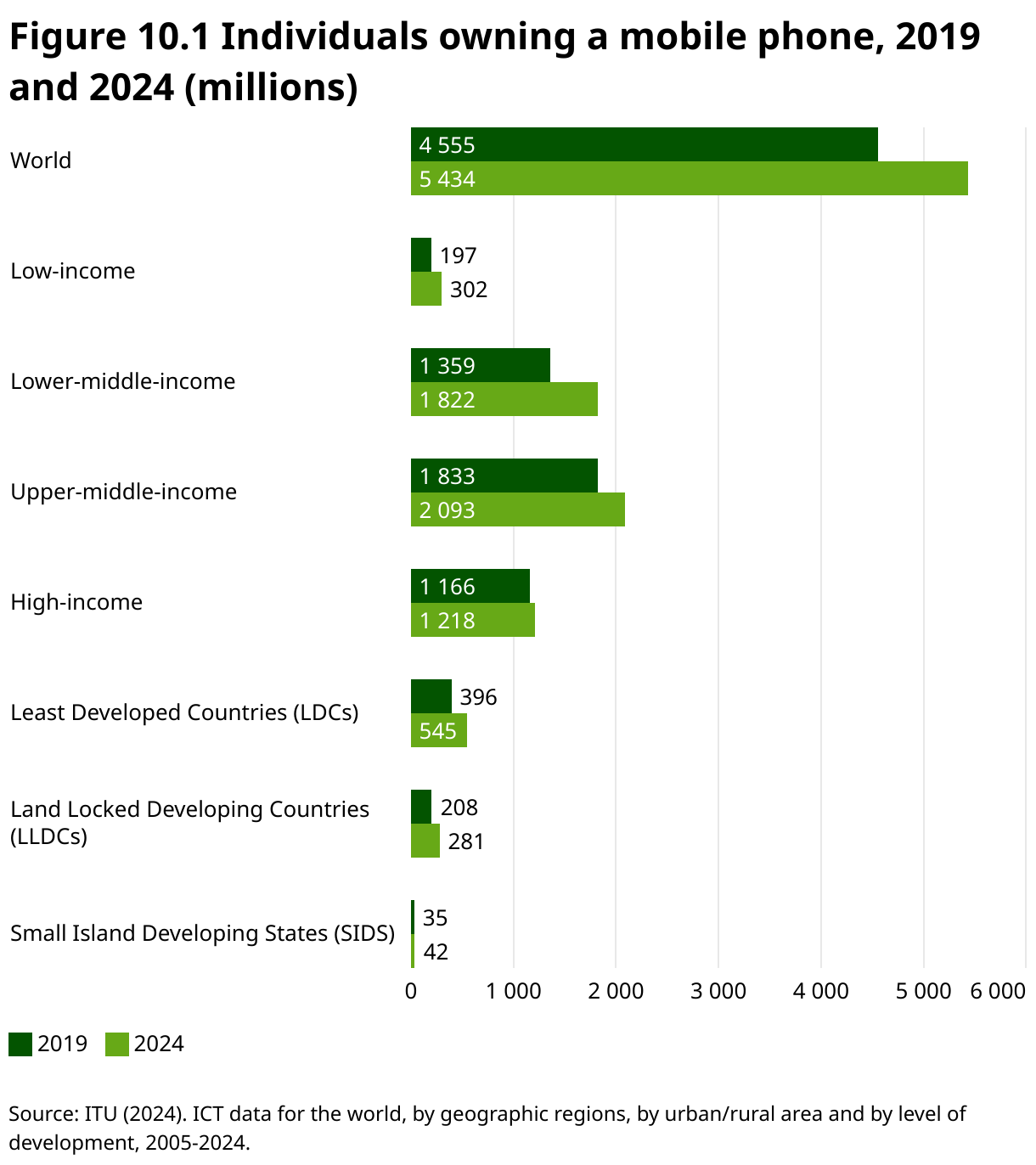
Mapping and tracking of mobile connectivity show global gains and regional gaps
The International Telecommunications Union (ITU) estimates that 97.9 percent of the world population is covered by a mobile network (
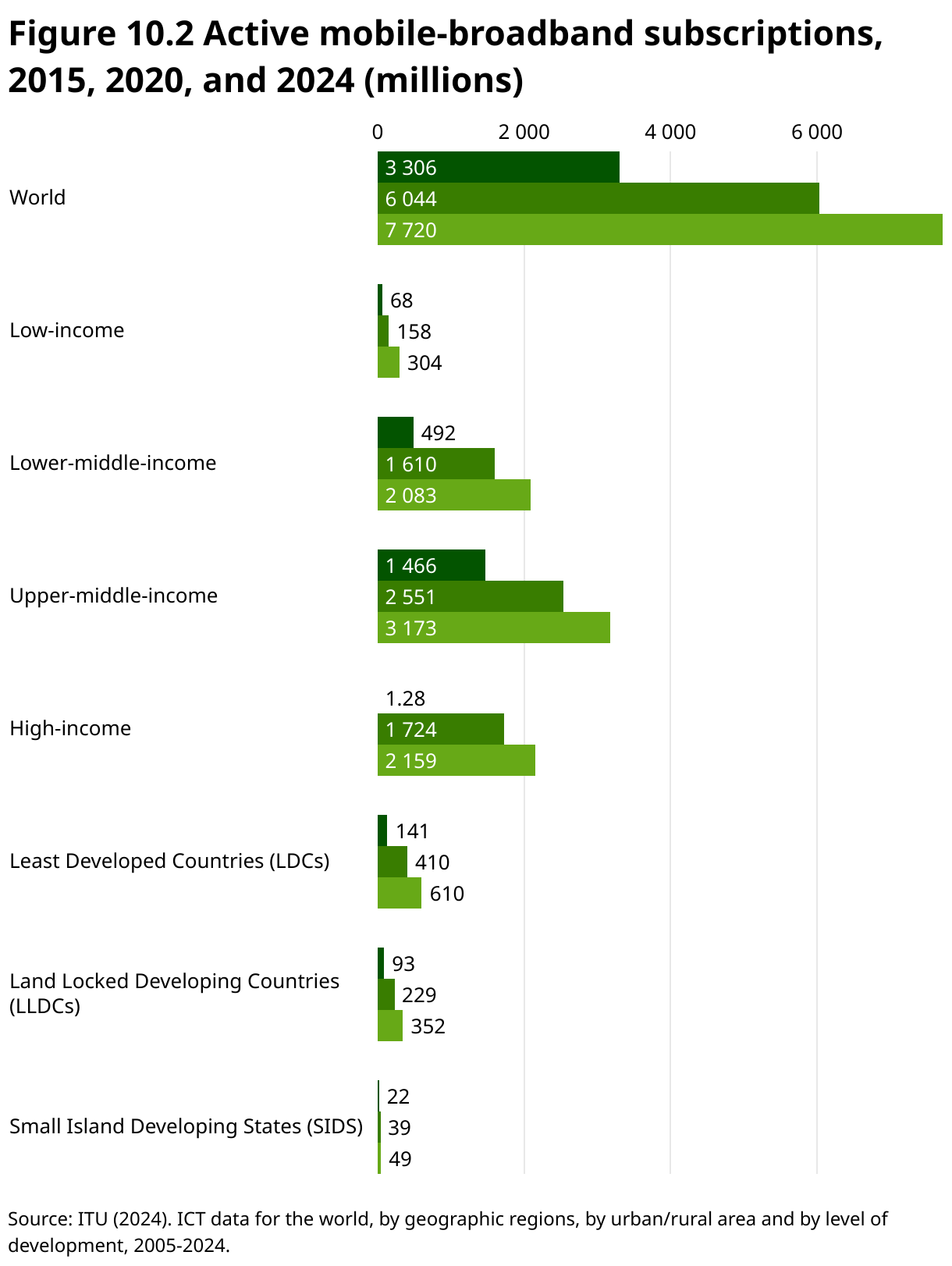
Figure 10.2 shows the rise in active mobile-broadband subscriptions, highlighting a growing reliance on mobile devices as the primary means of internet access (
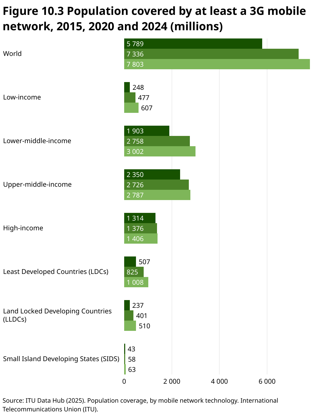
Figure 10.3 depicts the population covered by at least a 3G mobile network in 2015, 2020 and 2024. Global mobile network coverage has expanded significantly, reaching near-universal levels by 2024. This growth has successfully closed the coverage gap for most of the world’s population, including those in low-income countries and vulnerable groups like LDCs. However, the final few percentage points of the global population, often in the most remote and challenging environments, remain the hardest to connect.
Importantly, even basic mobile phones without internet access remain vital communication tools during a disaster (
Staying connected – core technologies enabling communications during disasters
Broadband and next-generation networks provide the backbone for disaster communications, enabling real-time data sharing, remote monitoring and prioritized emergency services.
Broadband remains crucial for effective disaster response, providing reliable communication in urban areas ... and bridging gaps in remote regions
Broadband internet, a high-speed, always-on internet connection that transmits data using a wide bandwidth, plays a vital role in disaster preparedness and response by enabling emergency services, first responders and authorities to share real-time updates, assess situations and make informed decisions. Broadband also supports remote monitoring, the use of devices, like surveillance cameras, environmental sensors and early warning systems, to observe and track conditions in disaster-prone areas without needing people on site.
However, using broadband in disaster situations presents challenges. Limited infrastructure in rural or remote areas can hinder connectivity, while network congestion from increased communication demand may cause delays. Power outages often disrupt broadband services, and accessibility issues can prevent some from using communication tools effectively. Despite these obstacles, broadband remains crucial for effective disaster response, providing reliable communication in urban areas through fiber optics and bridging gaps in remote regions through satellite and wireless technologies.
Next-generation networks (NGNs) are packet-based systems that break information – including voice, video or data – into small packets for efficient routing across shared infrastructure. Unlike older circuit-switched networks, NGNs separate the service layer (what users interact with) from the transport layer (the physical and routing infrastructure). This decoupling allows a wide range of services to run over the same network, regardless of the underlying access technology – whether it be fiber, mobile, satellite or Wi-Fi.
This flexibility is especially valuable in disaster response. If part of the infrastructure is damaged, services can continue using alternative connections. NGNs support dynamic rerouting and quality of service (QoS) mechanisms, meaning critical communications like emergency calls, real-time video or sensor data can be prioritized over less urgent traffic.
Because NGNs are based on internet protocol (IP) standards (the set of rules that governs how data packets are addressed, routed and delivered from one device to another over a network), they also enable better interoperability between agencies and systems. Using IP is crucial, because it allows the seamless integration of different devices, services and technologies across the same network, allowing emergency responders to communicate and access information regardless of the hardware or underlying technology in use.
Global system for mobile communications (originally groupe spécial mobile) (GSM) was first developed in the 1980s as a 2G (second-generation) mobile technology. The standard specifies protocols for the digital cellular networks used by mobile phones for voice calls, SMS and basic data services (
In disaster situations, GSM provides reliable communication when infrastructure remains intact and can be quickly restored using mobile base stations or satellite backhaul. GSM supports SMS-based emergency alerts and voice communication, ensuring affordable access for responders and affected populations. Although challenges like network congestion and damaged infrastructure can arise, GSM remains a critical tool.
When infrastructure fails – alternative and rapid deployment networks
When traditional communication infrastructure fails, resilient disaster communication relies on layering multiple delivery methods to maintain connectivity and coordination. Even for displacement shelters under disaster conditions, alternative and rapid deployment could mean using solar-powered radio transmitters as a fallback when mobile coverage drops, or hand-held loudhailers for rapid perimeter alerts. These layered methods – spanning satellite systems, radio communications and mesh networks – provide redundancy and adaptability for responders and affected communities in unpredictable environments.
The ability to set up a satellite-based network rapidly is a game-changer for first responders
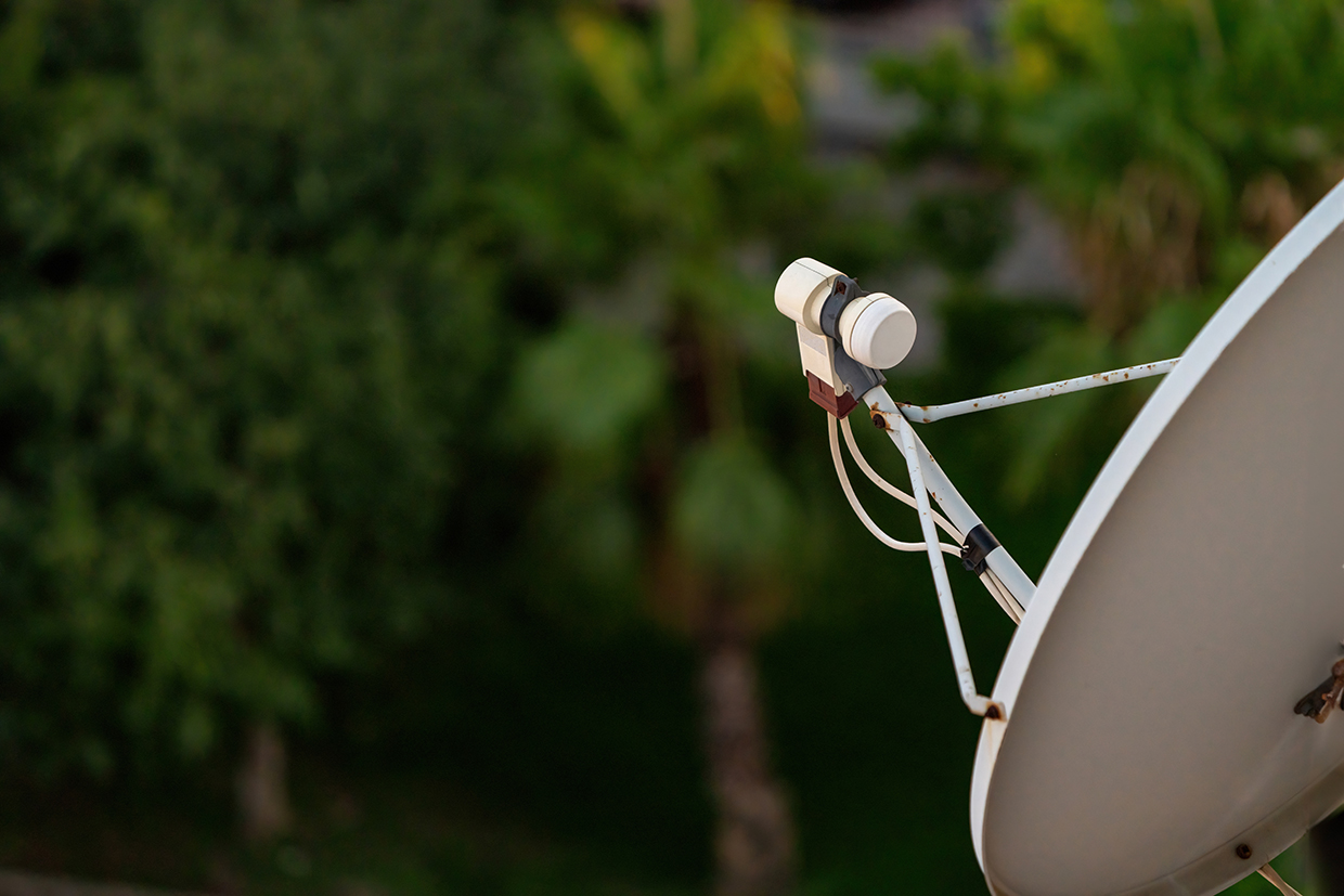
Satellite communication technology plays a crucial role in disaster response. Satellite phones and devices ensure that emergency responders, leaders and organizations can maintain communication even when landlines, mobile towers or fiber optics are down. While these systems are not designed for everyday citizens in the immediate aftermath of a disaster, satellite-enabled devices allow emergency coordination, rapid deployment of resources, and real-time information sharing. The ability to set up a satellite-based network rapidly is a game-changer for first responders.
Galileo’s emergency warning satellite service (EWSS), launching in 2025, adds a satellite-based layer to disaster communications by broadcasting predefined alerts directly to compatible receivers, including smartphones, handhelds and public displays. Operating independently of terrestrial networks, EWSS uses the common alerting protocol (CAP) (a standard format for sending emergency alerts so they can be automatically received and displayed across different devices and systems) to encode messages, which are then decoded locally on the device. Integrated into the Galileo GNSS under EU Regulation 2021/696, the service provides national civil protection authorities with rapid, reliable alert dissemination (
Radio communications. Very high frequency (VHF)/ultra high frequency (UHF) and high frequency (HF) radios are different types of radio networks that provide local and long-range communication and can function independently of broadband or mobile infrastructure. These technologies are used for short-range coordination among emergency responders. Public safety networks (like TETRA, P25 or LTE for Public Safety) are more advanced forms of radio networks designed for secure, prioritized communication between first responders during an emergency.
The Crisis Connectivity Charter (CCC) is a global partnership between technology companies, satellite operators, telecom providers and humanitarian organizations aimed at rapidly restoring internet and communications during a disaster. By pooling resources and deploying advanced technologies like satellite terminals and portable cell towers, the CCC ensures affected communities and responders stay connected when traditional networks fail. The Emergency Telecommunications Cluster (ETC), hosted operationally by WFP, coordinates these efforts on the ground, managing telecom infrastructure and activating CCC partners during emergencies. This collaboration facilitates disaster response for coordination, aid delivery and communication with vulnerable populations. Recently, the CCC was activated during the 2023 earthquake in Türkiye and Syria, where satellite connectivity was rapidly deployed to support rescue teams, and in the 2024 floods in Mozambique.
More specifically, the ETC is led by the United Nations Office for the Coordination of Humanitarian Affairs (OCHA), which brings together humanitarian organizations, UN agencies, governments and private sector partners to provide telecommunications services during disasters. The ETC sets up emergency communication infrastructure, such as satellite networks, mobile networks and telephony systems (technologies for voice communication, including traditional phone lines, mobile phones and internet-based services like Zoom or WhatsApp). It also restores local FM radio stations, a vital information source for many communities, especially where internet is limited. The ETC runs common feedback mechanisms (CFMs) – two-way systems that let people share concerns or feedback with aid providers – and supports user services like Wi-Fi access points, charging stations and IT help desks. For secure communication, it deploys security communications systems (SCS), which may include satellite phones, radio networks (VHF/UHF) or mobile phones. The ETC also coordinates the safe use of drones for tasks like delivering supplies, capturing aerial imagery or extending connectivity.
Mesh networks. A mesh network is a decentralized wireless network where devices (nodes) connect directly and dynamically to each other, allowing data to be routed through multiple paths for improved reliability and coverage. Nodes then act as both routers and hosts (
However, challenges include ensuring data security and privacy in an open, decentralized system and managing network scalability and performance as more nodes join. Setting up a mesh network typically involves wireless devices like smartphones or routers and specialized software with the proper configuration of network parameters.
Digital tools and coordination systems enable effective response across communities
Mobile apps, alert systems and feedback mechanisms play a vital role in disaster response by keeping communities informed and connected. Together with secure communication networks, such tools enable timely updates, two-way engagement, and reliable coordination between affected populations and responders.
Disaster response apps and websites have significantly improved our ability to stay connected during crises
Mobile-based warning dissemination: cell-broadcast and location-based SMS. Cell broadcast (CB) is a mobile network service that sends text-based warnings to all mobile devices within a defined geographical area, almost simultaneously. Unlike conventional short message service (SMS), which delivers messages one-to-one and can be delayed or blocked during high-traffic periods, CB leverages the cellular network’s broadcast capability to transmit a message to all phones connected to a cell tower within the target zone – in near real time. The message appears as a high-priority notification on the mobile screen, accompanied by a unique, loud alert tone and vibration – often overriding silent mode – to ensure it gets immediate attention. Crucially, CB does not require users to either subscribe, download apps or have internet access. Any compatible phone that is powered on within a given area will automatically receive an alert. This makes CB a highly inclusive and effective tool for reaching not only residents, but also visitors, travelers and individuals without a local mobile subscription (
Location-based SMS (LB-SMS), by contrast, uses the standard SMS channel, but targets only those devices currently connected to a cell tower within a defined geographical area. Once an area is selected, the mobile network filters active subscribers within that footprint and sends each one a conventional text message. While LB-SMS can be delivered to most mobile phones without requiring special handset compatibility, delivery is sequential rather than instantaneous, and can be subject to delays under high network load. Nonetheless, it remains a valuable alerting option in contexts where CB is unavailable, as it works on virtually all mobile devices and allows for longer, more detailed messages. LB-SMS is also useful for follow-up information after an initial CB alert, or for sending hazard-specific instructions to targeted locations (
Mobile apps and alert systems. Disaster response apps and websites have significantly improved our ability to stay connected during crises. For example, Facebook’s “Safety Check” feature, which allows users to mark themselves as safe during a local disaster, is an effective alert system that helps friends and family quickly confirm each other’s well-being. With real-time updates, these platforms help affected individuals access vital information quickly and securely, ensuring that people stay informed even amid the chaos of a disaster. ITU recommends that apps (which users need to download, register and learn how to use) be used mainly in a complementary fashion to the mobile alerting system (CB/LB-SMS), which requires no registration.
A chatbot is a computer program that understands text, voice or image inputs, and interacts with users. Its functions range from answering common questions without AI to using AI and machine learning to learn from conversations and better understand user intent. Chatbots can deliver vital information, support health and education, connect communities with responders, combat misinformation, and facilitate monitoring and evaluation. Their accessibility, multilingual support and simple interfaces make them poised to transform human–computer interaction (
Common feedback mechanisms. The common feedback mechanism (CFM) is designed to establish effective two-way communication systems between local communities and humanitarian assistance providers. The purpose is to ensure that affected populations can directly engage with and provide feedback on assistance programs. This feedback loop enhances accountability by enabling humanitarian organizations to make more informed decisions and ensuring that the voices of affected populations are heard. CFMs are a key part of accountability to affected populations (AAP), which is a core component of humanitarian response plans (HRPs). By improving collective accountability, CFMs help organizations coordinate and consolidate resources, avoiding duplication of efforts. CFM setup can vary depending on available technology, but often includes a short code (a four-digit number for easy access), customer relationship management (CRM) software (like WFP’s “SugarCRM” for managing interactions) and, potentially, a call center for direct communication.
Security communications systems (SCS) are a central part of the Emergency Telecommunications Cluster (ETC, see box 10.1) and provide secure, reliable communication for humanitarian responders and local authorities during an emergency, following United Nations Department of Safety and Security (UNDSS) guidelines. Its deployment varies according to three scenarios:
Scenario A: Uses public mobile networks when reliable, with satellite/radio backups.
Scenario B: Supports mobile networks with fallback VHF/UHF radios or satellite for emergencies.
Scenario C: Sets up primary VHF/UHF radio networks where mobile coverage is poor, backed by satellite communications.
ETC also establishes security operations centers (SOCs), provides equipment setup and training for staff, and offers technical support to authorities in deploying communication infrastructure. Additionally, the ETC supports the Telecommunications Emergency Support Services (TESS+) initiative, a United Nations (UN)-led service focused on setting telecommunications security standards for both UN and NGO staff safety in disaster zones.
Early warnings connect and protect communities – starting with everyday technologies
Early warning systems (EWS) – discussed in the storms and flooding chapter – are a critical communication tool for disaster response. They rely heavily on robust connectivity and communication to effectively disseminate timely warnings of an impending disaster. Effective EWS also depend on clear, consistent messaging across all channels and involve strategic communication tailored to specific communities. AI can support EWS in transmitting warnings and guiding responses, but careful planning is needed. Information and communication technologies (ICTs) are essential in single-hazard and multi-hazard early warning systems (MHEWS) for message management and delivery. A multi-channel approach that uses both traditional and modern technologies is crucial for reaching diverse populations. This includes using radio, television, social media, mobile phones and satellite communications. Messages should be clear, trusted and relevant, and can benefit from input from the target audience.
Effective EWS depend on clear, consistent messaging across all channels and involve strategic communication tailored to specific communities
Mobile networks are a powerful tool for issuing public warnings. Cell-broadcast or location-based SMS warnings can be sent to specific populations in at-risk areas. ITU has encouraged countries to consider implementing regulatory approaches that make the use of mobile networks mandatory for issuing public warnings. ITU underscores the point that aligning incentives with funding programs can speed up the rollout of mobile networks and bolster public safety (
Supply chain resilience for aid delivery – another critical component
Global humanitarian aid demand is rising sharply. Over 308 million people were estimated to have been in need in 2024, putting a strain on traditional supply chains (
To make matters worse, disasters can severely disrupt supply chains. Ports, warehouses and transportation infrastructure such as roads, railways and airports are all prone to damage from storm surges and flooding. Such disruptions can halt deliveries, delay goods movement and create significant operational challenges, as seen during Hurricane Harvey in the United States when major logistics networks in Houston and Louisiana were forced to suspend services.
To mitigate these risks, companies increasingly rely on technology such as Big Data analytics, which combines historical disaster data with supply chain information from enterprise resource planning (ERP) and warehouse management systems (WMS) to forecast potential disruption and model demand under various scenarios. Inventory management is more strategic with the use of WMS tools that provide visibility across all storage locations – enabling organizations to pre-position essential supplies near high-risk areas. Additionally, by linking hazard-specific forecasts, companies can bolster supply chain resilience. For example, cyclone forecasts issued 72 to 120 hours in advance can trigger phased deployment to secure international procurement orders within the first 24 hours, while flood forecasts predicting crest arrival 48 hours ahead can initiate relocation of stockpiles to higher ground and activation of amphibious transport for last-mile delivery.
Equally important is the ability to maintain constant communication in the field. Rugged mobile devices equipped with GPS, cameras and connectivity features empower responders to coordinate logistics more efficiently. Developing standardized supplier data and integrating information across systems allows organizations to identify vulnerabilities and plan contingencies ahead of time.
Technologies like blockchain, IoT and drones are beginning to improve aid delivery by making supply chains more transparent and efficient, and by empowering communities to manage their own supply chains. However, challenges, such as infrastructure gaps, local capacity and regulations, must be addressed (
Transparency continues to be a major challenge within humanitarian supply chains, and blockchain can provide tamper-proof, real-time tracking that improves visibility and accountability, as shown in pilots like the Pakistan-to-Dubai shipment pilot, which tested blockchain technology by tracking a shipment of 304 tents from Lahore, Pakistan, to Dubai. The shipment demonstrated successful real-time tracking and coordination among three separate organizations – DFID, the tent supplier, and the shipping company – using a single blockchain platform (
However, blockchain is not a universal solution. It can shift trust onto the technology itself, adding complexity and cost, so it must be carefully applied where it can genuinely add value to avoid creating new problems. Broad adoption of blockchain would require clear governance structures and system-wide rules (
Transparency continues to be a major challenge within humanitarian supply chains, and blockchain can provide tamper-proof, real-time tracking
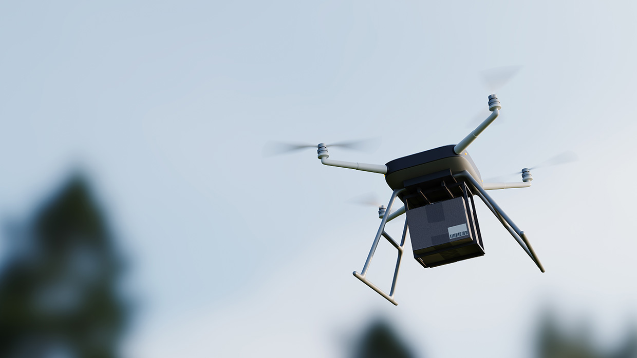
Poor infrastructure can present challenges in delivering aid to remote areas. But drones are overcoming these barriers by enabling faster, more reliable last-mile delivery. Drones used for communication can also act as temporary signal boosters or network relays, often supplementing existing mobile or broadband networks. They fall under the broader category of communication infrastructure, but with the added capability of mobility and on-demand deployment.
AI may improve disaster communications, but data and ethical challenges remain
In the humanitarian field, AI can accelerate anticipatory action for disasters by quickly analyzing complex data to identify needs, provide early warnings, plan responses and evaluate outcomes. Predictive analytics – a key AI tool – helps forecast sudden disasters, as well as long-term challenges. Integrated with technologies like mobile apps, drones and IoT, AI improves decision-making, supports health care insights, aids education and training, and streamlines administrative tasks, which frees up human resources for critical work (
Predictive analytics helps forecast sudden disasters, as well as long-term challenges.
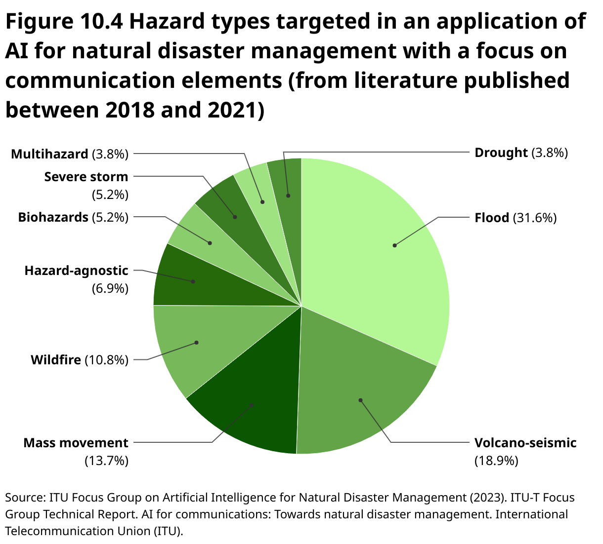
A technical report undertaken by the ITU/WMO/UNEP Focus Group on Artificial Intelligence for Natural Disaster Management for communication reviewed literature on recent research and applications in AI-based communications tools. The review revealed an active field of research and development on AI for communications during disasters (
However, challenges regarding AI remain a hurdle. AI and predictive analytics require large amounts of open, accurate and timely data, which can be hard to obtain due to limited connectivity, security issues and volatile conditions. Data quality, interoperability and standards are critical because errors or incomplete data can lead to flawed results. Data protection is a major concern, as AI may unintentionally reveal personal information or enable misuse by malicious actors. Bias in AI is a serious issue, often stemming from incomplete data and lack of diversity among developers, which can exacerbate inequalities. AI systems may also lack transparency, making decisions hard to explain or trust, and leading to accountability gaps (
Innovation examples
SKAI: AI-powered eyes-in-the-sky for disaster response

When disaster strikes, reliable ground information is often unavailable. Enter SKAI – the Satellite-based Kinesthetic Assessment and Intelligence tool – developed by WFP and Google Research – that aims to transform emergency response. Using advanced AI and satellite imagery, SKAI delivers near real-time damage assessments, pinpointing destruction across vast, hard-to-reach areas. It automatically maps building damage and supports situational awareness to enable smarter and faster decisions. In Pakistan, SKAI was deployed after severe floods devastated large swaths of the country. With roads submerged and communications cut off, SKAI’s AI algorithms scanned satellite images to identify damaged infrastructure and isolated communities. Within hours, WFP teams received information that helped them prioritize emergency food assistance and coordinate with local authorities. This context-agnostic analysis helped streamline logistics and target aid where it was most needed without waiting for ground reports. As an open-source, collaborative tool that combines machine learning with Earth observation data, SKAI supports governments, NGOs and first responders worldwide
NOAA expands multilingual weather alerts with AI technology
.jpg)
For 30 years, the National Oceanic and Atmospheric Administration (NOAA), a US governmental agency, had its National Weather Service (NWS) forecasts manually translated into Spanish, but is now using AI to improve accuracy, efficiency and inclusivity. Through pilot projects, the NWS has trained AI software with weather terminology in Spanish and simplified Chinese – two of the most common US languages after English – and plans to add Samoan, Vietnamese and more. Partnering with machine learning company Lilt, NWS has developed a specialized language model that drastically reduces translation time – from an hour to under 10 minutes for some products. Features include navigation, hazard maps, geo-location for local forecasts and alert banners. In the future, translations will be integrated into data transmission services (APIs), social media and alert systems, so as to expand reach. The project is improving community readiness and inclusion amid extreme weather caused by climate change (
Coping with recurring disasters in Cox’s Bazar, Bangladesh, through communications platforms and EWS
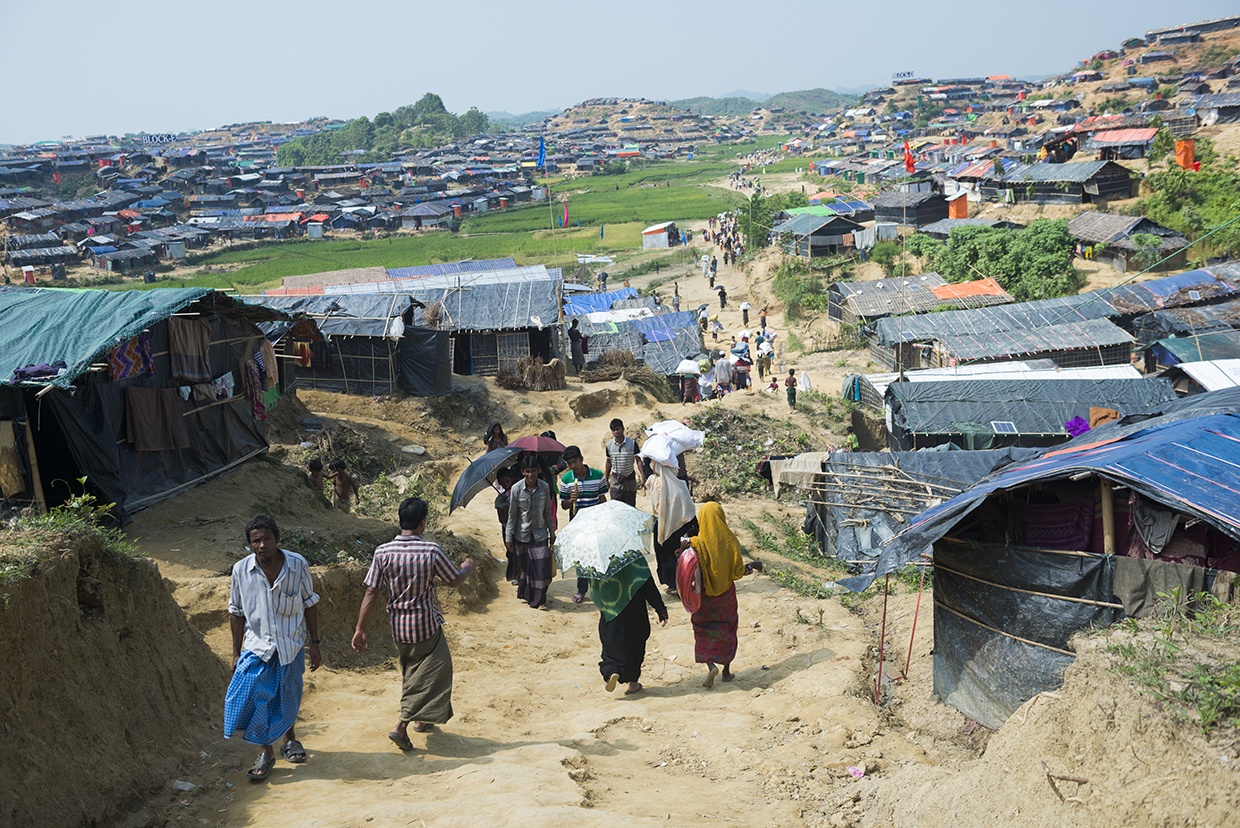
The humanitarian response in Bangladesh’s Cox’s Bazar – home to the world’s largest refugee camp – has increasingly employed technological advancements to enhance disaster preparedness and resilience for over 900,000 Rohingya refugees. Although Bangladesh is one of the most disaster-prone countries globally, it is recognized for its leadership in early warning and anticipatory action. Several forecast dissemination and coordination tools have been implemented. A key innovation has been the integration of technology-driven early warning systems across the 33 camps. This includes the expansion of the Cyclone Preparedness Programme (CPP) to include refugee populations, training over 3,300 Rohingya volunteers who disseminate localized warnings. Technological tools, such as automated SMS alert systems, simple weather gauges, and the INSTANT platform – a custom forecast portal developed by the United Nations Development Programme (UNDP) and the Regional Integrated Multi-Hazard Early Warning System for Africa and Asia (RIMES) – deliver 5-day forecasts, seasonal projections and hazard alerts directly to aid agencies. These efforts have embedded anticipatory actions across sectors using real-time forecasts and pre-alert protocols. They trigger coordinated responses including reinforcing shelters, pre-positioning food and medical supplies, and moving vulnerable individuals in advance of extreme weather. Additionally, integration with systems like the United Nations Food and Agriculture Organization’s Landslide Early Warning System (LEWS) and national flood forecasting services allows for rapid, data-informed response, thereby improving safety and readiness for vulnerable refugee populations (
KoboToolbox empowers the Kenya Red Cross with data-driven flood relief coordination
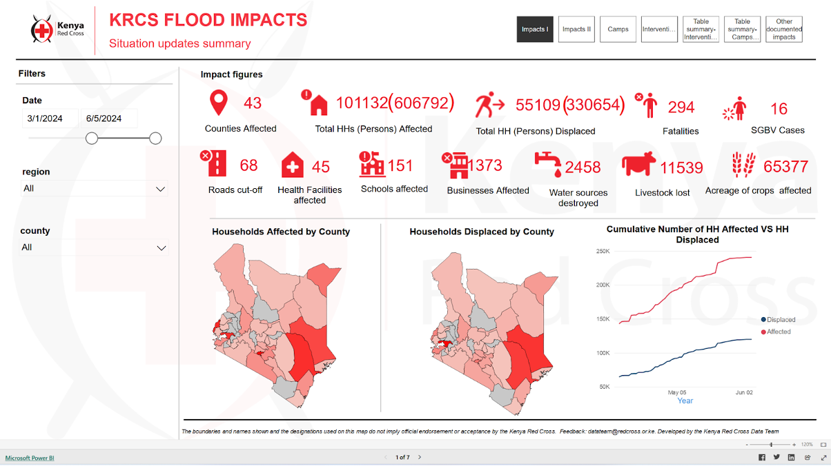
When Kenya faced severe flooding in 2024, impacting over 220,000 people, the Kenya Red Cross Society (KRCS) employed technology to enhance the disaster response. Using KoboToolbox, KRCS developed a customized Flood Situation Report (SitRep) Tool that collects data even from remote areas through offline capabilities. The tool gathers detailed information on affected populations and damage to critical infrastructure, helping coordinate aid delivery and aid emergency services like search and rescue. By centralizing and standardizing data collection with a smart survey design using features like cascading selects and skip logic, the tool improves accuracy and reduces survey fatigue. It also integrates with Power BI for dynamic data visualization, enabling daily updates to stakeholders. Since its initial deployment during the 2023 El Niño floods, the Flood SitRep Tool has transformed fragmented data collection into a unified, data-driven process, supporting efficient resource allocation across food distribution, health care, shelter and water sanitation efforts. With over 800 submissions from 43 communities, this technology-driven approach is critical in managing Kenya’s ongoing climate challenges, helping KRCS build community resilience (
Proven technology solutions
Communications: ethernet and PoE extenders
Enable-IT

Ethernet and power over ethernet (PoE) extenders allow the rapid deployment of communication, lighting and security systems in affected disaster areas. By using PoE, they eliminate the need for separate power lines, enabling faster setup of devices like surveillance cameras, LED lights and networking equipment. These extenders support both short- and long-term shelter strategies by providing reliable connectivity across larger distances, even in rugged environments. Ethernet connectivity is used in satellite ground stations, enabling reliable data transmission to end-user devices. Using PoE-powered satellite modems and access points streamlines deployment in disaster zones by removing the need for separate power supplies, allowing faster and more flexible setup in critical situations.
Technological maturity: Proven
Contracting type: For sale
Technology level: Medium
Place of origin: United States
Availability: Worldwide
Contact: WIPO GREEN Database
AI-enhanced communications: AI-powered disaster intelligence and risk assessment tool
Mayday.ai
Mayday.ai is an AI-powered platform that delivers real-time, full lifecycle (before, during, after) disaster event intelligence by integrating data from satellite and camera imagery, audio, and multilingual social media sentiment analysis. It provides early warning and two-way communication within a unified system, aiming to make critical event information widely accessible through AI automation at the national, regional, municipal, community and household level. The platform’s innovations have been recognized and supported by major organizations, including the European Space Agency, German Aerospace Center, NOAA, and various UN offices focused on disaster risk reduction and space affairs.
Technological maturity: Proven
Contracting type: For licensing and collaboration
Technology level: High
Place of origin: Germany
Availability: Worldwide
Contact: WIPO GREEN Database
Logistics: warehouse management system (for supply chain disruption)
Datex
The Footprint® Warehouse Management System (WMS) enables organizations to manage inventory across facilities, pre-position supplies, and respond to rapidly changing demands during natural disasters and other disruptions. Coupled with Datex Studio, a low-code visual interface, users can tailor their WMS with ease, configure workflows, and track changes with built-in testing and source control. Handheld mobile computers facilitate efficient communication, damage assessment and coordination, ensuring timely allocation of critical resources.
Technological maturity: Proven
Contracting type: For sale
Technology level: Medium
Place of origin: United States
Availability: Worldwide
Contact: WIPO GREEN Database
Logistics: mapping platform
OpenStreetMap
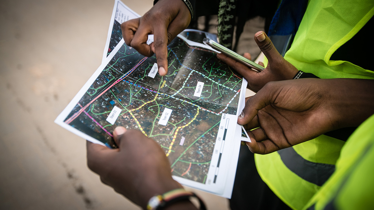
Humanitarian OpenStreetMap Team (HOT) is an international volunteer-driven organization that uses open mapping to support humanitarian aid, disaster response and sustainable development. When disasters strike, thousands of HOT volunteers rapidly create detailed, open-source maps of areas where data is limited, using platforms like OpenStreetMap. These maps help responders reach those in need quickly and effectively. HOT also supports communities, NGOs, governments and international organizations by providing training, tools and knowledge to support local mapping and data collection. They develop free, open-source apps and tools for collaborative mapping and geospatial data gathering, widely used by partners such as Red Cross, Médecins Sans Frontières, UN agencies and local groups.
Technological maturity: Proven
Contracting type: Open access
Technology level: Medium
Place of origin: United States
Availability: Worldwide
Contact: WIPO GREEN Database
Connectivity: satellite services
Télécoms Sans Frontières
Télécoms Sans Frontières (TSF) integrates cutting-edge satellite and digital technologies to ensure connectivity, education and information flow. The company provides the following solutions for disasters: Oxbird optimizes satellite bandwidth with enhanced quality of service (QoS), improving traffic management and services like VoIP (Voice over Internet Protocol – a technology that enables voice calls using an internet connection). Learning Kit provides portable, battery-powered digital education tools (tablets, server, Wi-Fi) for children. Humanitarian Information Display System uses remotely managed digital screens in refugee camps to share real-time, multilingual info via cloud connectivity. Mobile satellite services (MSS) deploy compact satellite terminals and phones, providing reliable internet and telephony where infrastructure is damaged. Finally, fixed satellite services (FSS) (very small aperture terminals) provide medium to long-term satellite internet access in remote or disaster-affected regions, supporting NGOs, health, coordination and free Wi-Fi within refugee camps.
Technological maturity: Proven
Contracting type: For service-based deployments and equipment loan/rental
Technology level: Medium
Place of origin: France
Availability: Worldwide
Contact: WIPO GREEN Database
Communications: disaster connectivity map
International Telecommunication Union (ITU), World Food Programme Emergency Telecommunications Cluster (ETC), GSMA
_(etc).jpg)
The Disaster Connectivity Map (DCM) provides near real-time data on communication network connectivity to governments, telecom operators and first responders, enabling faster, more targeted repairs and restoration after disruptions. It aggregates connectivity measurements from end-user devices, processes them, and displays both historical baselines and current status. Following a disaster, DCM can be activated in affected areas to pinpoint gaps and outages in real time, guiding response decisions. To date, it has been deployed in over 50 disasters worldwide, with a database of more than 200 million data points.
Technological maturity: Proven
Contracting type: Technical partnership/inter-agency coordination
Technology level: Medium
Place of origin: Switzerland
Availability: Worldwide (ITU Member States)
Contact: WIPO GREEN Database
Communications: ultra-portable GSM network
Vodafone

Vodafone Instant Network is a highly portable GSM network system designed for rapid deployment in disaster zones. Packaged into four cases weighing under 100 kg, it can be transported aboard commercial flights and set up within 40 minutes to provide secure 2G and 3G connectivity anywhere in the world. Instant Network Mini is an ultra-compact, 11 kg mobile network carried in a backpack and deployable in 10 minutes by non-technical staff. It supports up to five concurrent calls within a 100-meter radius and can send mass SMS alerts. Instant Charge is a modular phone charging station developed to support refugees and disaster survivors with smartphones. It can simultaneously charge up to 66 devices, is designed for outdoor use with minimal supervision, and helps prevent overcrowding in charging areas.
Technological maturity: Proven
Contracting type: Provided through partnerships, donations or special agreements
Technology level: Medium
Place of origin: United Kingdom
Availability: Worldwide
Contact: WIPO GREEN Database
Communications: portable and quickly deployable satellite communication
Thuraya
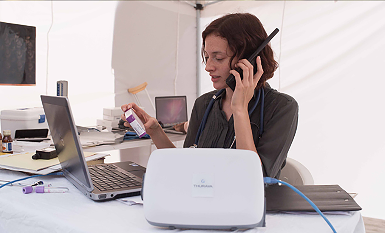
Thuraya offers quick-deploy satellite communication solutions essential for disaster response and relief operations. The satellite phones and data terminals provide high-speed mobile broadband within seconds, enabling first responders to access critical information like weather updates and mapping services rapidly. These tools support coordination among aid organizations, emergency services, and government or military agencies across different communication platforms. Thuraya’s systems also allow for the setup of solar-powered voice, fax, internet and SMS services, helping affected communities stay connected during ongoing relief efforts.
Technological maturity: Proven
Contracting type: For sale
Technology level: Medium
Place of origin: United Arab Emirates
Availability: Worldwide (except the Americas)
Contact: WIPO GREEN Database
Logistics: mobile information management platform for humanitarian service delivery
World Vision

World Vision’s Last Mile Mobile Solutions (LMMS) is a mobile information management platform designed to streamline humanitarian aid delivery at the critical "last mile" stage. It digitizes beneficiary registration, verification, distribution planning, monitoring and reporting. LMMS integrates software with custom hardware, including mobile devices, servers, printers and ID cards. Used in over 40 countries by more than 20 agencies, LMMS supports cash, food, shelter and health programs, registering over five million beneficiaries annually and facilitating over $100 million in aid distribution. It operates standalone without the need for either the internet or electricity, and is ideal for remote settings. LMMS tracks work, generates payment instructions and provides near real-time distribution reporting. It supports integration with tools like KoboToolbox and Power BI, linking every transaction to individual users for accountability.
Technological maturity: Proven
Contracting type: For partnerships, licensing agreements or collaboration
Technology level: Medium
Place of origin: United Kingdom
Availability: Worldwide
Contact: WIPO GREEN Database
Communications: voice and high-speed data emergency response communications systems
Viasat

Viasat offers a range of emergency communication systems providing global voice and high-speed data connectivity on land, sea and air. Quickly deployable terminals – including BGAN, FleetBroadband, and SwiftBroadband – support first responders with seamless communications. The Global Xpress high-speed satellite service provides higher data capacity rates for demanding operations. BGAN PTT delivers push-to-talk voice communications for vehicles, maintaining situational awareness when local networks fail. For beyond line-of-sight radio communication without modifying existing UHF/VHF radios, Viasat’s L-TAC service uses satellites as repeaters, reducing reliance on scarce tactical satellite resources. Additionally, the IsatPhone 2 handheld satellite phone offers dependable voice connectivity worldwide.
Technological maturity: Proven
Contracting type: For sale
Technology level: Medium
Place of origin: United States
Availability: Worldwide
Contact: WIPO GREEN Database
Frontier technology solutions
Communications: mesh network
Meshmerize

Meshmerize supports disaster response by enabling the rapid deployment of resilient mesh networks and the use of synchronized drone swarms for site inspection, disaster localization, search and rescue, and active team monitoring. This technology enhances information sharing among responders and prioritizes actions in the most affected areas. Meshmerize is also involved in the 6G Life project, advancing 6G communications focused on sustainability, security, resilience and human–machine collaboration.
Technological maturity: Frontier
Contracting type: For licensing
Technology level: Medium
Place of origin: Germany
Availability: Worldwide
Contact: WIPO GREEN Database
Communications: emergency broadband internet
Tekniam
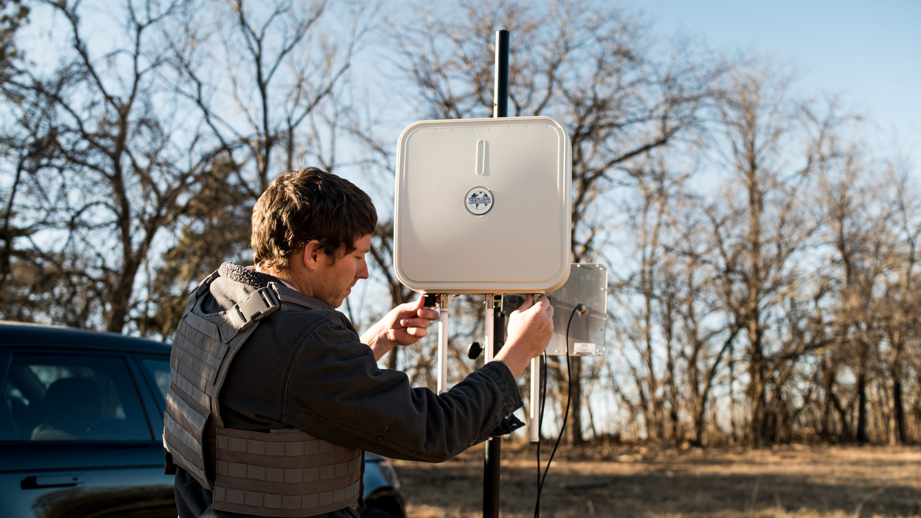
Tekniam’s Remote Universal Communication System (RUCS) is a compact, rapidly deployable wireless broadband network designed for emergency responders and rural areas with limited connectivity. It creates a local Wi-Fi internet signal covering a 305+ meter radius and can be extended up to 55 kilometers using daisy-chained units. Weighing just 2.3 kg, RUCS requires minimal power (from a car battery to a small power pack) and connects to any internet source – satellite, fiber or cellular. RUCS is easy to transport and set up in minutes, and provides an affordable, energy-efficient alternative to traditional bulky emergency communication setups.
Technological maturity: Frontier
Contracting type: For sale
Technology level: Medium
Place of origin: United States
Availability: Worldwide
Contact: WIPO GREEN Database
Communications: “pop-up” connectivity (LEO)
Eutelsat Oneweb

Eutelsat OneWeb is a global satellite internet provider using a constellation of low Earth orbit (LEO) satellites to deliver affordable, low-latency broadband worldwide. By combining OneWeb’s LEO technology with Eutelsat’s geostationary satellite expertise, they provide a comprehensive connectivity solution. Key features include global high-speed internet with low latency via hundreds of LEO satellites, rapidly deployable “pop-up” connectivity; redundant and reliable backup links that ensure continuous operations for businesses during critical events; flexible service plans with cloud-based management; and easy integration via apps and application programming interfaces (APIs).
Technological maturity: Frontier
Contracting type: For sale
Technology level: Medium
Place of origin: France
Availability: Worldwide
Contact: WIPO GREEN Database
Communications: digital self-registration platform for communities in crisis
World Food Programme
WFP is actively overcoming the complex challenge of registering displaced and vulnerable populations during crises by embracing innovative, cost-effective solutions. Traditional in-person registration methods are often slow, costly and resource-intensive – barriers that are especially critical to address as humanitarian funding becomes increasingly scarce. To meet this need, WFP has introduced the People Portal, a self-registration web platform that enables people in crisis to register themselves directly, significantly reducing the need for labor-intensive field operations. Communities may access the platform via WFP partners, field teams, or posters once the WFP initiates operations in the area. The People Portal reduced the cost of registering from US$12 to US$0.50 per person. If scaled to WFP’s target of 10 million registrations over the next two years, the People Portal could cut costs from US$120 million to just US$5 million, unlocking an estimated US$115 million in savings and accelerating the delivery of life-saving assistance.
Technological maturity: Frontier
Contracting type: Open access via WFP partners, field teams, or posters
Technology level: Medium
Place of origin: Italy
Availability: Worldwide
Contact: WIPO GREEN Database
Communications: food security modeling platform
World Food Programme
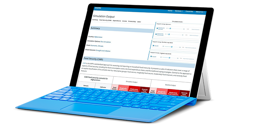
SHAPES (Shock and Assistance Platform for Economic Simulations) is WFP’s advanced modeling platform that uses simulations to evaluate the effects of shocks and assistance on food security. It integrates data from surveys, market prices and satellite sources to predict how households respond to economic, climate, or political crises. By simulating different aid strategies, transfer values, and targeting methods, SHAPES helps optimize humanitarian interventions. The platform has reduced emergency assessment times from six months to three and reduced setup costs for new country operations significantly. It continuously adapts to emerging challenges—such as forecasting displacement trends and evolving crisis dynamics—to enhance response effectiveness. SHAPES aims to expand to all large-scale WFP operations in 120 countries and territories across the world.
Technological maturity: Frontier
Contracting type: For collaboration
Technology level: Medium
Place of origin: Italy
Availability: Worldwide
Contact: WIPO GREEN Database
AI-enhanced communications: user-friendly geospatial vulnerability profiling and targeting tool
World Food Programme

GeoTar is WFP’s AI-powered geospatial tool that enhances emergency and anticipatory decision-making by automating vulnerability assessments. It integrates climate, food security and socio-economic data to deliver granular, real-time insights at the community level. As a backend system, GeoTar complements existing platforms and enables faster, more targeted humanitarian responses. GeoTar boosts geographic targeting accuracy by up to 30 percent and can save countries up to USD 100,000 by cutting the need for extra assessments. In 2024, it helped target six million people in Afghanistan and Chad, saving USD 90,000. GeoTar is now being evaluated for wider use in seven additional WFP country offices.
Technological maturity: Frontier
Contracting type: For collaboration
Technology level: Medium
Place of origin: Italy
Availability: Worldwide
Contact: WIPO GREEN Database
Logistics: disaster logistics platform
Aeronext
Following the January 2024 Noto Peninsula earthquake in Japan, NEXT DELIVERY, a part of Aeronet, used drones to deliver medical supplies to isolated areas. From this experience, Aeronext developed the SkyHub® Emergency Package, a phase-free (always ready and operational) disaster logistics solution that integrates drone delivery into everyday local logistics. The system creates a smart regional logistics platform, supporting local residents both during normal times and disasters. Challenges that were identified during the 2024 earthquake included disrupted roads, limited knowledge about the status of evacuation sites, and a lack of information on supply stockpiles. By digitizing everyday logistics operations with respect to the location of evacuation centers and prior hazard mapping, the platform enables rapid support during disasters. The everyday logistics services also ensure that residents become accustomed to using these collection points for drone deliveries in daily life, making the transition to emergency drone transport seamless.
Technological maturity: Frontier
Contracting type: For license
Technology level: High
Place of origin: Japan
Availability: Japan
Contact: WIPO GREEN Database
Horizon technology solutions
Communications: optical power supply technology
NTT Group and Kitami Institute of Technology (KIT)
.jpg)
Researchers have developed a way of transmitting 1 watt of electrical power alongside high-speed 10 Gbps bidirectional data through a single multi-core optical fiber (MCF) over distances greater than 10 kilometers. Using separate cores within the same fiber, the system sends power and data independently without interference, enabling disaster-affected areas to maintain communications even during power outages. This technology, demonstrated by NTT and partners, overcomes previous limits on power delivery distance through optical fibers and achieves a world record in optical power-distance product and self-powered data transmission performance. It can integrate with existing optical networks. Future applications will include optical communications in challenging environments – such as rivers, mountainous regions, and areas where electrification is difficult due to strong electric fields or corrosion – as well as the development of sensing networks connected to various IoT devices.
Technological maturity: Horizon
Contracting type: For sale
Technology level: Medium
Place of origin: Japan
Availability: Worldwide
Contact: WIPO GREEN Database
Communications: LEO satellite network
Telesat
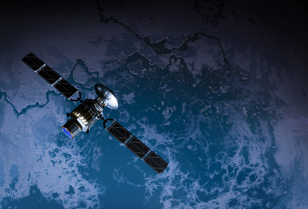
Telesat Lightspeed is a low Earth orbit (LEO) satellite network providing ultra-fast connectivity for first responders worldwide. It aims to extend public safety networks during disasters by delivering fiber-like speeds, multiple Gbps bandwidth and continuous global coverage with agile beam technology (the ability of satellite antennas to dynamically steer and shape radio signals or beams in real time, so they can be precisely focused on specific locations – concentrating capacity where demand is highest and adjusting coverage areas based on changing conditions). The first satellite launches are scheduled for mid-2026, with global service expected to commence in 2027.
Technological maturity: Horizon
Contracting type: Under development
Technology level: High
Place of origin: Canada
Availability: N/A
Contact: WIPO GREEN Database
AI-enhanced communications: piloting AI on Early Warning Connectivity Map (EWCM)
International Telecommunication Union (ITU), Microsoft AI for Good Lab, Planet, Institute for Health Metrics and Evaluation (IHME)
2_microsoft_etc.jpg)
The Early Warning Connectivity Map (EWCM) combines AI and satellite imagery to map population density at high resolution and overlay it with mobile network coverage data. EWCM highlights areas where people are vulnerable to natural hazards due to limited access to emergency notifications. It enables authorities to plan alternative alerting methods – such as sirens, radio or community messengers – before disasters strike and make targeted infrastructure investments to enhance resilience. The results will guide data-driven decisions on warning dissemination strategies and mobile infrastructure investment to ensure no one is left behind. As part of the United Nations Early Warnings for All initiative, EWCM supports countries for targeted, inclusive early warning delivery. Pilot deployments are underway with national disaster agencies to refine methodologies, validate data accuracy and integrate results into multi-hazard early warning platforms.
Technological maturity: Horizon
Contracting type: Currently pilot projects
Technology level: High
Place of origin: Switzerland
Availability: Pilot countries
Contact: WIPO GREEN Database