
The cryosphere is Earth’s frozen water, including glaciers, ice sheets, snow, permafrost, seasonally frozen ground, lake and river ice, ice shelves, icebergs and sea ice. It plays a vital role in regulating climate, storing freshwater, impacting sea level and shaping landscapes. Mountain and polar regions are among the most climate-sensitive components of the Earth system. They are especially delicate: even small changes in temperature can trigger rapid melting, permafrost thaw and shifts in snow cover.
These changes ripple through ecosystems and human societies, altering river flows, water availability and the risk of hazards such as floods, landslides and glacial lake outburst events. Because glaciers and the wider cryosphere are closely linked to the hydrological system, understanding their dynamics is critical for predicting climate impacts, managing water resources and protecting the ecosystems that depend upon them
5.1 Sea ice and glacial melting
Glaciers and sea ice are among Earth’s most ancient and dynamic reservoirs of frozen water, yet today they are retreating at unprecedented rates, reshaping landscapes, ecosystems and the global water cycle. Sea ice forms in the ocean, while glaciers are formed on land. Roughly 10 percent of Earth’s land area is covered by ice, of which almost 90 percent is in Antarctica with the remaining 10 percent in the Greenland ice sheet
Glaciers and sea ice are among Earth’s most ancient and dynamic reservoirs of frozen water, yet today they are retreating at unprecedented rates
Arctic sea ice is also declining rapidly as rising air and ocean temperatures accelerate summer melt and reduce winter recovery. Unlike glaciers, sea ice already floats on the ocean and therefore does not directly contribute to sea-level rise when it melts. However, its loss has major implications for the global climate system. Sea ice has a high albedo, which is the ability of a surface to reflect incoming solar radiation back into space. Bright ice reflects much of the sun’s energy, helping to keep the Arctic cool. As sea ice disappears, darker ocean waters absorb more solar heat, creating a self-reinforcing ice–albedo feedback that accelerates regional warming

Both glaciers and sea ice are critical components of the cryosphere. Glaciers can range from several hundred to several thousand years of age. The majority of the world’s glaciers are melting at an accelerated rate due to climate change, which is reducing snow accumulation as well as snow cover duration. Glacial retreat has been rapid since the 20thcentury with precipitous acceleration in recent decades. According to the Intergovernmental Panel on Climate Change (IPCC) in its Working Group I contribution to the Sixth Assessment Report, the widespread retreat of glaciers since 1950 is unmatched in at least the past 2,000 years
Recent research shows that glaciers are losing their natural self-cooling ability, which has historically acted like an “environmental air conditioner” in mountain regions. Katabatic winds that bring cold air down glacier slopes have previously slowed warming near glacier surfaces by roughly 0.83°C for every 1°C increase in ambient air temperature
Some alarming examples illustrate these points. Extreme melting events on the Greenland ice sheet are becoming more frequent, intense and widespread. Since the 1990s, these events have driven 30–40 percent of Greenland’s total ice melt and contributed about 3.5 mm to sea-level rise between 2005 and 2017. This is roughly comparable to the contribution from all glaciers worldwide
Extreme melting events on the Greenland ice sheet are becoming more frequent, intense and widespread
The Antarctic ice sheet shows similarly alarming trends, though its dynamics and tipping points differ from those in Greenland. Even in the absence of additional warming, West Antarctica could lose up to 40 percent of its ice, leading globally to a 2.1 meter sea-level rise
To add another layer of complexity, mountain regions are increasingly exposed to emissions from wildfires and dust storms. These, alongside other human activities, deposit black carbon and particulate matter on glaciers and snowpack, darkening surfaces and lowering the albedo, which accelerates melt rates
And in other regions, such as Asia, the picture is no less dire. The Asia-Pacific region contains the world’s highest mountains and largest glacier systems. The Third Pole, including the Tibetan Plateau and surrounding ranges, spans about 5 million km² with 100,000 km² of glaciers. Known as the “Water Tower of Asia,” it feeds over 10 major rivers and sustains nearly 2 billion people across the region
The Hindu Kush Himalayan region, shared by eight countries, holds the largest volume of ice outside the poles and supplies 10 major rivers, supporting water, agriculture, energy and industry for 1.3 billion people.
In Central Asia, the Pamir, Tien Shan and Karakoram ranges provide critical freshwater for hydropower, agriculture and domestic use.
The Mekong River, sourced from Tibetan glaciers, currently supports regional water supplies, but accelerated melt threatens long-term water availability and ecosystem stability.
Not a silver bullet: the role and limits of technology in glacier loss
Given these trends and the critical role of glaciers for human and ecological systems, a range of technological approaches has been developed to monitor, slow or adapt to ice loss. Current technological approaches largely fall into three interconnected categories. First, high-precision monitoring through satellites, unmanned aerial vehicles (UAVs), synthetic aperture radar (SAR), light detection and ranging (LiDAR) and sensor networks provides near-real-time data on ice mass, melt rates and surface dynamics, supporting climate research and early-warning systems. Second, localized anti-melt interventions, including reflective geotextiles, radiative cooling films and other passive materials, aim to decrease surface ice loss in more targeted areas. Third, adaptation-focused strategies preserve downstream water availability and the ecosystem services formerly provided by glaciers. While these technologies cannot restore glaciers at scale, they improve understanding, enable localized mitigation and support ecosystem resilience in high-alpine and cryosphere regions.
Accepting glacier loss as an inevitable outcome of global warming is necessary in some regions, with a shift away from saving glaciers and instead preserving the ecosystem services they provide. Therefore, the focus in these places has shifted to maintenance of downstream water availability using technologies such as artificial ice reservoirs (for example ice stupas) and seasonal water storage that mimics glacier function.
Effective cryosphere monitoring requires an international framework to coordinate observations, measurement standards, best practices, metadata and data exchange
In the end, it would be unrealistic to expect any current technology to truly reverse glacier loss at scale. However, technology can improve our understanding at higher resolutions and provide additional local protection and adaptation strategies. In addition to advances in technology, effective cryosphere monitoring requires an international framework to coordinate observations, measurement standards, best practices, metadata and data exchange across all cryosphere components. The World Meteorological Organization (WMO) Global Cryosphere Watch (GCW) provides this framework and plays a central role in improving our understanding of the cryosphere and monitoring its changes. Through the WMO Integrated Global Observing System, WMO Information System and WMO Integrated Processing and Prediction System, the GCW supports interoperable observations and operational services for weather, water, climate and hazard applications.
Hyper-precision monitoring and risk intelligence
Continuous and automated sensing through the fusion of UAVs, satellites, LiDAR, Global Navigation Satellite System (GNSS), SAR and internet of things (IoT) sensors is replacing manual fieldwork. Autonomous and extreme-environment robotics are facilitating autonomous data collection in remote landscapes. Multi-sensor drones are becoming the standard link between field sensors and satellites, due to their ability to conduct high-resolution mapping, thermal sensing and detect meltwater and temperature gradients as well as, of course, their capacity for rapid deployment.
This integrated monitoring approach is already being deployed operationally. In Qinghai Province, China, glacier monitoring combines GF-7 stereo satellite imagery, UAV photogrammetry, field validation and long-term remote sensing observations to generate high-resolution three-dimensional glacier models. The resulting digital surface models (DSMs) and digital orthophoto maps (DOMs) support continuous monitoring of glacier dynamics and hazard-prone areas, providing scientific evidence for glacier disaster prevention and water resource management
Artificial intelligence (AI), as seen in other sectors, is being increasingly used to process massive data sets, therefore improving change detection. Thus, real-time glacier mass balance and movement tracking is rapidly improving, as is the detection of micro-scale changes (ablations and more subtle deformations). As a consequence, monitoring of secondary risks, such as glacier lakes, meltwater flows and avalanches, is also quickly improving. As seen in other chapters of this edition and in the Green Technology Book Climate disaster edition, this has enabled a shift from more siloed data sets to interoperable global monitoring networks. The growth of coordinated global monitoring systems, like the World Glacier Monitoring Service, alongside the integration of regional systems in the Arctic and major mountain ranges is enabling a transition toward standardized measurement protocols. Through its GCW, the WMO provides the international framework for coordinating cryosphere observations, developing measurement standards and best practices
Real-time glacier mass balance and movement tracking is rapidly improving, as is the detection of micro-scale changes
Specifically, the integration of AI with satellite monitoring of glacier-fed lakes is improving early warning systems for glacial lake outburst floods (GLOFs) and ice collapse events. This enables the development of more robust disaster risk management systems as well. Overall, the combination of more precise and continuous monitoring via sensors, trackers and cameras, combined with satellite and drone use and topped off with AI analytics, has driven a powerful combination that is enhancing predictive intelligence.
From blankets to gravity-powered snow: localized cooling and snow experiments
Localized cooling experiments and glacier protection techniques do not stop glacier retreat but can help delay melting and preserve ice in targeted areas. These use reflective fabrics or geotextiles to cover glacier surfaces and reduce absorbed solar energy (the albedo effect). Passive cooling and reflective surface technologies follow two main pathways. The first uses reflective covers for glaciers, such as geotextiles and synthetic sheets to increase albedo and reduce surface heating. Nanomaterials and radiative cooling films may offer advantages over traditional blankets by reflecting solar radiation while emitting heat into space, although their large-scale effectiveness remains unproven.
Switzerland has used reflective geotextile blankets composed of plastic and fleece since the 1990s (Box 5.1). Studies have demonstrated that covered areas can reduce melting by 30–70 percent in localized trials, such as on the Morteratsch and Rhone glaciers
The challenge is that it is only economically feasible to cover small areas. Large-scale application on entire glaciers or ice sheets is impractical and expensive. Covering several glaciers would cost roughly USD1.5 billion per year in Switzerland alone
Localized cooling experiments and glacier protection techniques do not stop glacier retreat, but can help delay melting and preserve ice in targeted areas
Artificial snow and snow management are commonly utilized in ski resorts. Snowmaking can increase snow cover and bolster surface reflectivity, and potentially delay melt locally by 10–20 percent, but cannot completely counter warming trends
To slow glacial melt, some researchers and ski resorts are experimenting with reflective geotextile blankets. In the Swiss Alps and on Italy’s Presena Glacier, more than 300 sheets covering 110,000 cubic metres of ice are deployed each summer. The operation is logistically complex: a small team of workers with snowcats may take six weeks or more to place the tarps. Studies show that these white geotextiles can boost ice reflectivity by over 50 percent. Despite local success, scaling the approach is economically and practically unfeasible. Covering the world’s 250,000 km² of glaciers would be prohibitively expensive, and the benefits are perceived as limited to areas with financial or touristic value. Still, local interventions provide mitigation in key locations, helping to preserve glaciers that act as critical freshwater reservoirs
A new approach – gravity-powered snowmaking – uses water from higher elevations and leverages the elevation drop as water is fed from a point 200 meters or more above the target area. Thus, no electricity is needed – the water’s potential energy is converted into pressure naturally, generating about 20 bars (290 psi), which is sufficient to spray snow. Towers are spaced across the glacier area with cables strung between them. Snow guns are mounted on the cables and the pressurized water is sprayed as fine droplets that freeze into snow on the glacier surface. A pilot project operated by GlaciersAlive from ETH Zurich at Diavolezza pass in Switzerland (which overlooks and connects to the Morteratsch Glacier) has proven feasibility and can slow glacier retreat at a cost of USD2.15 million. Models indicate that covering about 1 km² of the Morteratsch Glacier consistently for 30 years could slow or reverse the glacier’s retreat, preserving roughly 0.5 km of glacier length by 2100. However, at a larger scale, it would require major infrastructure, including a concrete dam and reservoir alongside tunnels and cables across the glacier. The Diavolezza project estimates the cost at USD163 million, which critics argue could be better spent on reducing CO2 emissions globally
Large-scale engineering involving space-based sunshades (orbital shades) designed to reduce incoming solar radiation and massive structures to shade ice shelves or redirect warm water are considered to be potential geoengineering methods. These concepts remain largely theoretical, very expensive and are the subject of scientific, political and ethical debate.
When glacial lakes break: monitoring and managing glacial lake outburst floods
GLOFs can be catastrophic to human lives and infrastructure. These occur when water suddenly escapes from a glacial lake, often due to natural dam failure, ice collapse or overflow. They can destroy villages and roads, hydropower plants and farmland. Historically, human safety and infrastructure protection have dominated the focus for the monitoring and mitigation of GLOFs. However, there are growing ecological concerns to address as well. Sudden floods can wash out riverbeds, alter sediment flows, strip vegetation and destroy aquatic habitats. They can influence the biodiversity of fish populations and modify nutrient distribution. Controlled mitigation, such as gradual lake drainage, can limit sediment deposition and maintain ecological function.
Reliably detecting high-mountain glacial lakes remains challenging due to complex terrain and harsh conditions. Key technologies include satellite-based remote sensing, machine learning, sensors and engineering interventions, such as artificial drainage channels. Satellite-based sensors – both optical and SAR – are used to monitor lake levels and map lake boundaries. SAR is discussed in detail in the Green Technology Book Climate disaster edition. Increasingly, AI-based image analysis tools are being used to automatically identify glacial lakes in satellite imagery and track changes in their size over time, improving flood risk assessment and reducing the need for manual interpretation. Two deep learning models commonly used for this purpose are U-Net and DeepLab, which process multi-spectral Lansat-8 satellite imagery to detect and extract glacial lake boundaries
GLOF early warning systems (EWS) combine real-time sensors, data integration and predictive modeling to detect instability in glacial lakes. They collect data on weather, lake levels, snow conditions and ground stability using water level sensors, weather stations and deformation monitors. The Glacier Lake Outburst Floods in Central Asia project (GLOFCA) has developed EWS tailored to the unique conditions of each area. Unlike conventional hydro-meteorological forecasting systems, which provide warnings days in advance, GLOFCA’s systems must detect and respond to hazards within minutes. They integrate advanced technologies with public awareness, institutional coordination and community drills
Beyond supporting national and regional early warning systems, the WMO is strengthening global coordination of GLOF monitoring and forecasting through the Early Warnings for All (EW4All) initiative. The WMO is promoting the integration of cryosphere observations, hydrometeorological forecasting and impact-based warning services, while facilitating the transition of research capabilities into operations through the WMO Integrated Processing and Prediction System (WIPPS). Current WIPPS pilot activities are exploring standardized approaches for integrating global flood prediction products and advancing multi-hazard forecasting capabilities that can support GLOF early warning services and improve the delivery of timely warnings to vulnerable communities.
GLOF early warning systems (EWS) combine real-time sensors, data integration and predictive modeling to detect instability in glacial lakes
Artificial drainage channels for GLOF mitigation are not standardized technologies but are typically designed and implemented on a site-specific basis by specialized engineering consultancies and public–private project consortia.
Mirroring the mountains: moving beyond EWS with digital twins for glaciers
Existing EWS have been limited by delayed data integration, low levels of automation and inadequate real-time modeling. Digital twin platforms address some of these limitations by creating virtual replicas of cryosphere systems that are continuously updated with incoming data. These systems can use remote sensing, real-time observations, seismo-acoustic data and numerical simulations. Importantly, they enable multi-source data integration and automated updates using machine learning, physics-based modeling and interactive visualization
The SvalbardDT digital twin is one of many Earth Observation Digital Twin Components (EO DTCs) being developed under the European Space Agency’s (ESA) Digital Twin Earth program, which itself feeds into the larger Destination Earth (DestinE) initiative led by the European Commission. These digital twin projects are intended to become pre-operational components that could be integrated into DestinE in the future. The SvalbardDT digital twin aims to create a digital twin of Svalbard’s cryosphere using satellite Earth Observation data and physics-based models. It will capture snow cover, glacier mass balance and sea ice dynamics in 3D across the 21stcentury, feeding into a self-learning spatio-temporal AI model. The system will integrate Svalbard’s extensive observational record for validation and improved environmental modeling. Two main use cases are planned:
analyzing extreme weather impacts on glaciers, snow and sea ice, including Rain on Snow and Ice (ROSI) events; and
supporting terrestrial and marine navigation by providing stakeholders, such as local authorities, logistics and tourism operators, with precise snow and ice condition forecasts.
ESA issued a Call for Expressions of Interest in 2023 to gather proposals for EO DTCs, and nearly 80 submissions nationwide demonstrate strong community support (
Democratizing glacier monitoring with citizen science and low-cost technologies
Citizen science and low-cost ground-based sensing are rapidly transforming glacier monitoring by bridging spatial and temporal gaps left by satellites and high-tech UAVs. These grassroots approaches, which often use open-source technology, provide continuous, real-time data in remote environments. They lower barriers to participation so that local observers, smaller institutions and communities can contribute to global glacier monitoring efforts, complementing global data sets like the World Glacier Monitoring Service.
Glacier Digital Twins are emerging tools that create dynamic, interactive simulations of glaciers and mountain environments
Crowdsourced mountain observations are collected using platforms like MountaiNow, which let visitors use smartphones to upload geo-tagged observations of glaciers and permafrost. These observations create a living map that helps scientific groups like GLAMOS and OMERIS in the Alps to fill in gaps
Raspberry Pi is a small computing platform that can run a full operating system and conduct general computing tasks. Research groups have tested inexpensive Raspberry Pi-based camera arrays for structure-from-motion monitoring of glacial fronts. These systems produce 3D models of glacier movement and calving events (the process where chunks of ice break off from the edge of a glacier – typically where it meets a body of water) at a lower cost than professional photogrammetry. This provides a way for community groups or smaller research teams to contribute observational data
Whereas ice-penetrating radar is specialized, high-performance and research-grade – often expensive and requiring training for operation and data interpretation – emerging technologies are being designed for wider accessibility and collaboration. For example, Stanford researchers have developed an open source modular radar ecosystem for studying glaciers. They started with ORCA, a flexible framework for building inexpensive software-defined ice-penetrating radar systems. Using ORCA as a foundation, they created platforms such as Peregrine (a UAV-based system) and MAPPERR (a ground-based system). Together, these innovations expand access to glacier monitoring by providing researchers with flexible tools, enabling them to collect and share glacier data. This approach democratizes the study of ice sheets, which previously relied on highly specialized radar systems accessible to only a small number of expert teams. However, ensuring the quality of the data remains an essential factor. Standardized observation protocols, calibration against reference instruments, metadata documentation and quality-control procedures are needed to ensure that citizen science and low-cost observations can be integrated confidently with established monitoring networks.
Innovation examples
SAR satellites track Himalayan glaciers in real time
University of Leeds and Capella Space
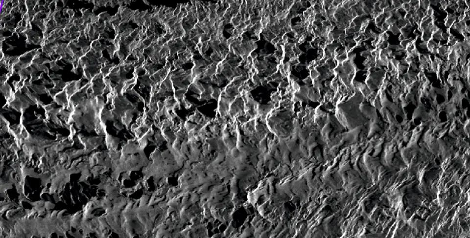
The University of Leeds is collaborating with Capella Space to monitor Himalayan glaciers using high-resolution SAR imagery. This technology allows researchers to see through persistent cloud cover and snow and capture year-round changes in glacier surfaces that optical imagery cannot. By tracking features like seasonal pond filling, glacier flow rates and debris covers, researchers can assess meltwater dynamics, surface melt rates and unusual glacier behaviors. This SAR-based monitoring is particularly important for the Karakoram and Himalayan glaciers, which supply critical water to rivers like the Indus and support hydropower, agriculture and drinking water. Capella’s sensors detect fine-scale surface streams and pond dynamics, helping to create data sets that inform numerical models and predict climate-driven changes. This collaboration enables a rapid analysis of glacial response to warming and provides a baseline for comparisons and improved understanding of glacier-induced flooding risks
Mapping Arctic ice with satellites and drones
UiT The Arctic University of Norway, Norwegian Polar Institute and FRAM – High North Research Center for Climate and Environment
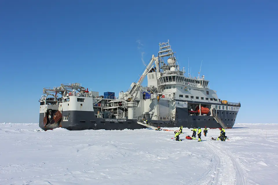
In April and May 2022, Norway launched its first Arctic expedition focused on validating satellite-based observations of sea ice and icebergs. Aboard the research vesselKronprins Haakon, scientists from UiT The Arctic University of Norway and the Norwegian Polar Institute collected ground-truth data in the western Fram Strait and East Greenland waters to improve the accuracy of satellite remote sensing products. The team combined traditional fieldwork with innovative tools. Drones equipped with optical, infrared, thermal and radar sensors captured high-resolution images of sea ice, icebergs and open water, while tomographic (image processing by sections or slices) ground-based radar provided calibration data at the same frequencies as those used by satellites. Snow pits and ice cores measured thickness, density, temperature and salinity, while red laser profilers mapped ice surface roughness, which is critical for interpreting radar backscatter in satellite imagery. These observations were cross-referenced with data from SAR satellites such as ESA Sentinel-1 and RADARSAT2. Together, the collected data feed into an “innovative toolbox” that integrates satellite products, models and in-situ measurements
China tests nanomaterials to slow glacier melt
Chinese Academy of Sciences (CAS)
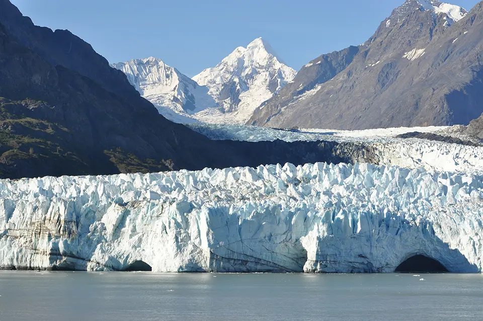
China is experimenting with innovative technologies to slow glacial melt. Researchers at the Key Laboratory of Cryospheric Science and Frozen Soil Engineering have deployed thermal blankets, nanomaterial “glacier covers” and artificial snow systems on glaciers including Ürümqi Glacier No. 1 and Dagu Glacier. Standard geotextile blankets increase surface reflectivity, reducing heat absorption and lowering melt rates. On Dagu Glacier, a 500-square-metre blanket reduced melting by roughly 34 percent between August 2020 and October 2021. More advanced nanofiber materials on Ürümqi Glacier No. 1 showed even greater promise, lowering summer melt rates by up to 70 percent through enhanced optical and thermal properties. Artificial snowmaking supplements glacier mass and increases albedo. Operations on the Bailanghe Glacier basin using smoke generators, rockets and aircraft contributed to a 5.9 percent gain in glacier mass over a few days, while helping to clean away heat-absorbing dust and black carbon. Despite local successes, these techniques are limited in scale, costly and carry environmental risks. Researchers emphasize that large-scale glacier preservation also requires global greenhouse gas (GHG) reduction. Nonetheless, combining high-tech glacier coverings, artificial snow, drones and real-time monitoring offers a multifaceted approach to slow melting
The following collection of technologies is divided into three groups: Proven technologies have been on the market for some time and hence are well tested, Frontier technologies are available but relatively new, while Horizon technologies are close to being available but still under development.
Proven technology solutions
Ice motion trackers
Greenland Guidance
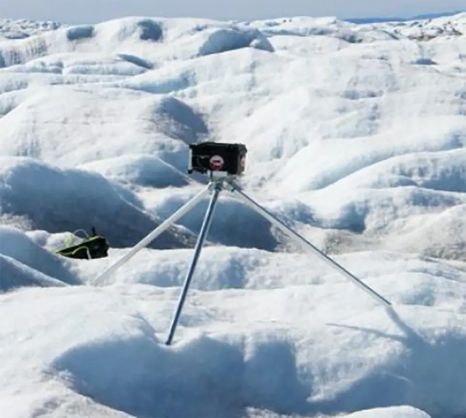
Greenland Guidance designs and builds customized, rugged instruments for polar and glaciated environments. Its ice motion tracker is a solar-powered GNSS unit that monitors surface movement on sea ice or glaciers and transmits location data in near real time. The draw wire ice ablation tracker measures up to 14 meters of ice melt and can include additional sensors, while the surface mass balance tracker combines ablation measurements with snow height and air temperature monitoring. A glacier weather station records key meteorological variables and can be configured to measure accumulation and melt. The polar time-lapse camera captures long-term visual changes such as calving or meltwater flow in extreme conditions. Thermistor strings measure subsurface temperatures in ice, snow or soil. In partnership, robotic platforms are available for autonomous data collection in hazardous or inaccessible terrain.
Technological maturity: Proven
Contracting type: For sale
Technology level: High
Place of origin: Kingdom of the Netherlands
Availability: Worldwide
Contact: WIPO GREEN Database
Timelapse camera stations for glacier and ice-melt observation
Enlaps
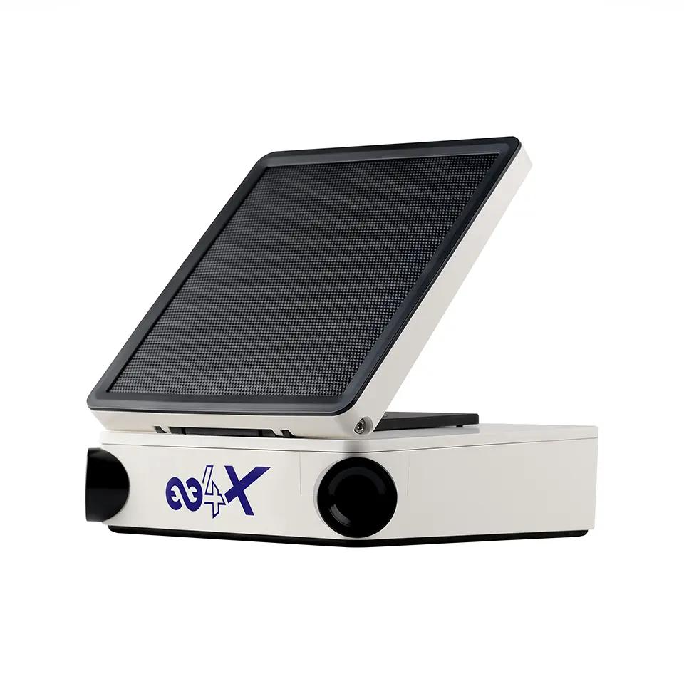
Enlaps’ Tikee systems are autonomous, solar-powered timelapse camera stations designed for long-term outdoor environmental monitoring, including glacier and ice-melt observation. The Tikee 4X and Tikee Mini+ capture high-resolution wide-angle images (up to 6K panoramic) at programmable intervals, allowing continuous visual tracking of glacier terminus retreat, surface lowering, seasonal snow cover change and proglacial lake development. Built for remote deployment, the units feature integrated solar panels, long-life batteries, 4G/LTE or Wi-Fi connectivity, Global Positioning System (GPS) tagging and weather-resistant enclosures suitable for harsh alpine conditions. Images are automatically transmitted to the myTikee cloud platform, which enables remote configuration, data storage, timelapse generation and project dashboards for longitudinal analysis and reporting. While not direct mass-balance sensors, Tikee systems provide high-frequency visual data sets that support glacier change documentation, communication and complementary scientific monitoring efforts in remote cryosphere environments.
Technological maturity: Proven
Contracting type: For sale
Technology level: High
Place of origin: France
Availability: Worldwide
Contact: WIPO GREEN Database
Ablation stake system
A2 Photonic Sensors
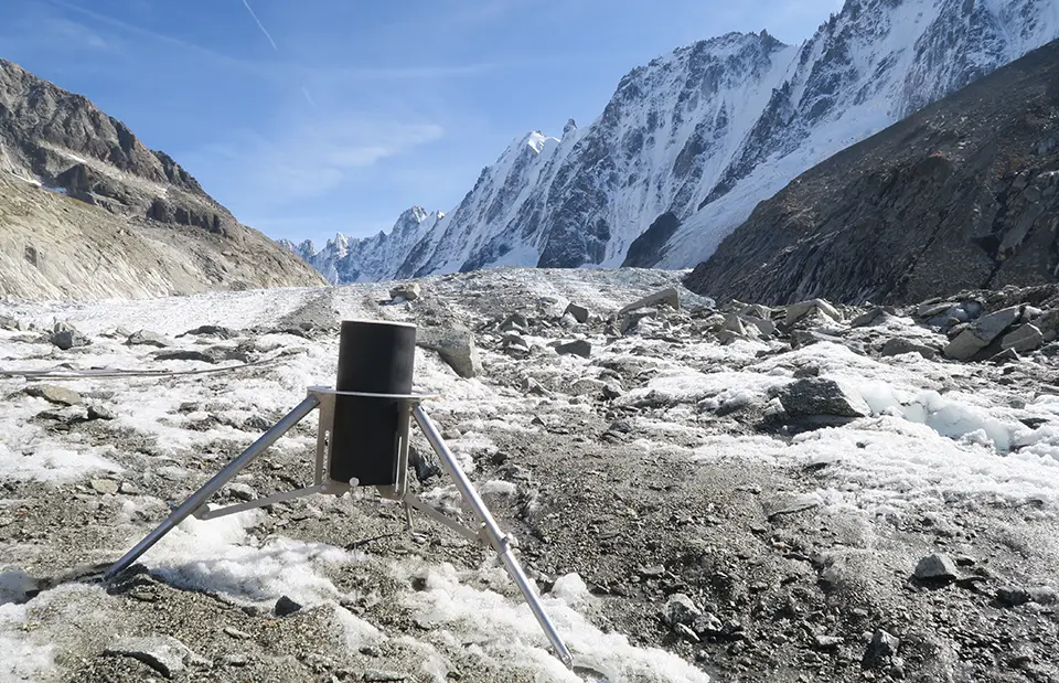
The SmartStake station is an automated instrument designed to monitor glacier ice ablation over extended periods. It serves as an alternative to traditional ablation stakes, providing more frequent and precise measurements. The system records up to four measurements per hour, with a resolution of 1 mm, and can track cumulative ablation of up to 7 meters. Data are stored on an internal SD card and can be transmitted wirelessly via satellite. The station also integrates additional sensors, including GPS, a snowfall detector, and a temperature sensor, to support broad environmental monitoring. The instrument has been developed in collaboration with the Institut des Géosciences de l'Environnement (IGE, France) and is supported by the World Glacier Monitoring Service (WGMS) as part of glacier observation initiatives.
Technological maturity: Proven
Contracting type: For sale
Technology level: High
Place of origin: France
Availability: Worldwide
Contact: WIPO GREEN Database
Collaborative monitoring network
World Glacier Monitoring Service (WGMS)
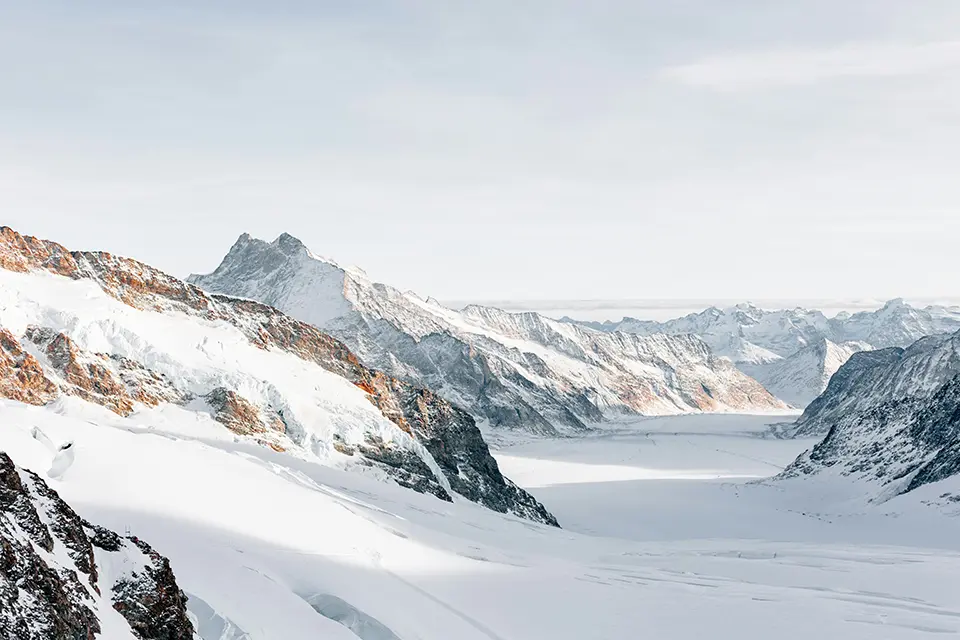
WGMS operates within the Global Terrestrial Network for Glaciers (GTN-G), contributing to standardized global glacier observation. Its work combines in-situ measurements (e.g., mass balance stakes, GPS surveying and photogrammetry) with remote sensing technologies, including satellite imagery from the Landsat program and Sentinel satellites. WGMS curates and harmonizes these data sets using geospatial databases and interoperable standards for long-term climate analysis. GTN-G is jointly managed by WGMS, the US National Snow and Ice Data Center (NSIDC) and the Global Land Ice Measurements from Space (GLIMS) initiative, with a steering committee established in 2009 to coordinate activities. WGMS is based in Zurich, Switzerland, while NSIDC and GLIMS are coordinated from Boulder, Colorado, USA.
Technological maturity: Proven
Contracting type: Open access
Technology level: High
Place of origin: Switzerland
Availability: Worldwide
Contact: WIPO GREEN Database
Integrated global cryosphere monitoring platform
World Meteorological Organization (WMO) Global Cryosphere Watch (GCW)
The WMO, through its GCW, provides the international framework for coordinating cryosphere observations, developing measurement standards and best practices and promoting interoperable metadata and data exchange. WMO’s Unified Data Policy supports the free and unrestricted international exchange of Earth system data, including cryosphere observations where available, to improve weather, climate, water and related environmental services. At present, snow depth observations, which are critical for glacier monitoring, are exchanged operationally through the WMO Information System 2.0 (WIS2), while work is underway to extend to other cryosphere components. The WMO also supports the operational use of cryosphere information through its Integrated Processing and Prediction System (WIPPS) and the development of regional service capabilities, including Regional Climate Centers (RCCs) for the Arctic, Antarctic and the Third Pole, to improve the delivery of cryosphere information for climate monitoring, prediction and early warning services.
Technological maturity: Proven
Contracting type: Open access
Technology level: High
Place of origin: Switzerland
Availability: Worldwide
Contact: WMO Global Cryosphere Watch
Ice stupas
Nilus
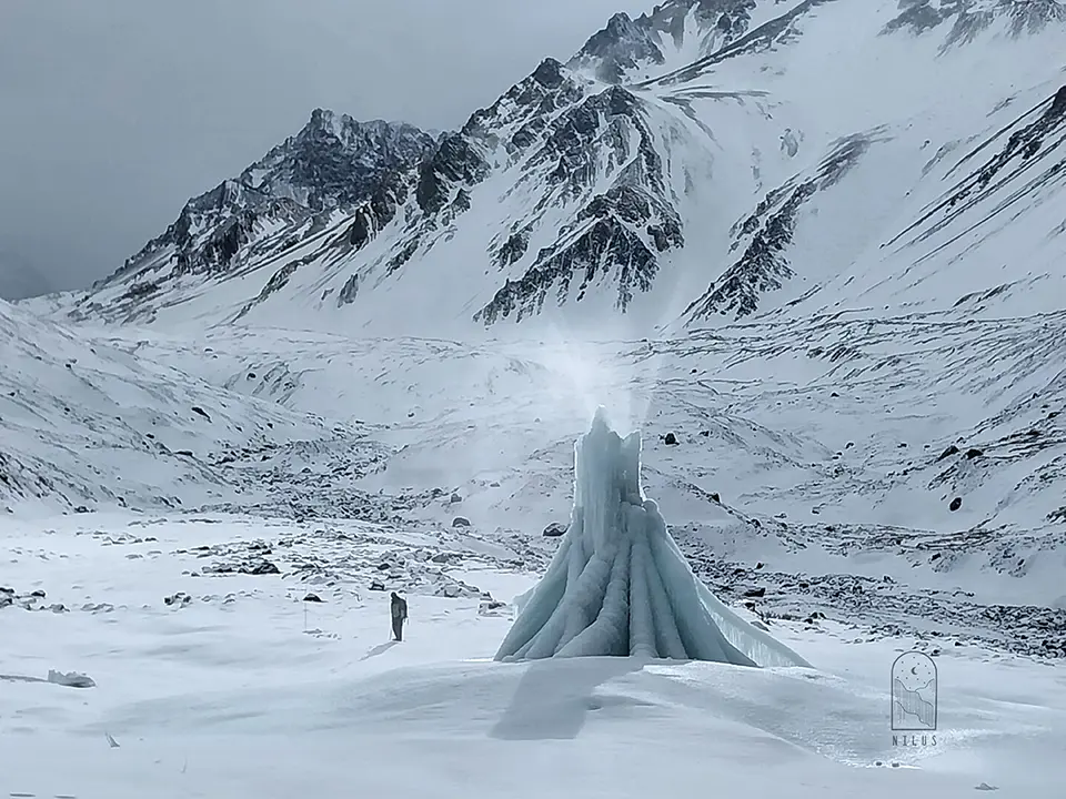
Ice stupas, or artificial ice reservoirs, are conical structures designed to store meltwater in cold, high-altitude regions and release it gradually during warmer months. Inspired by Himalayan techniques, they are built by channeling water from nearby glaciers or streams through elevated pipes, then spraying it into sub-zero air where it freezes almost instantly into layered ice cones. The conical shape minimizes sun exposure, slowing melting and maximizing water retention. In Chile’s Andes, Nilus has deployed ice stupas up to 33 feet high, capturing thousands of cubic meters of water, which can provide irrigation and drinking water well into dry seasons. While they do not increase the total glacier mass, they serve as seasonal water reservoirs, helping communities manage shortages caused by glacial retreat and drought. Ice stupas are relatively low-tech, sustainable and scalable, offering a practical adaptation strategy for water security in alpine regions facing climate-driven glacier loss.
Technological maturity: Proven
Contracting type: Project-based
Technology level: Low
Place of origin: Chile
Availability: Worldwide
Contact: WIPO GREEN Database
GLOF early warning system
MicroStep-MIS
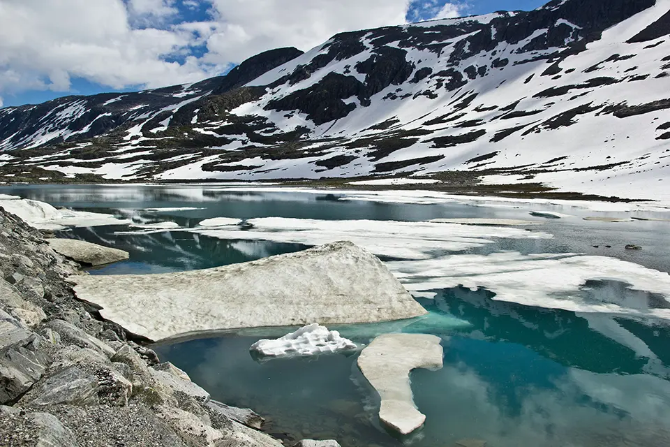
The MicroStep-MIS GLOF Monitoring and Early Warning System is an integrated platform designed to detect and manage the risk of GLOFs. It combines real-time data collection from weather stations, water level sensors and ground stability instruments with remote sensing and forecasting models. These inputs are processed in a centralized system that analyzes lake conditions, predicts inflows and potential flood scenarios, and assesses overall stability. A built-in decision support system provides operators with actionable insights, while automated alerts are triggered when risk thresholds are exceeded. Warnings can then be rapidly communicated to authorities and downstream communities via multiple channels, such as SMS, sirens and radio. Rather than preventing GLOFs, the system focuses on early detection, forecasting and coordinated response, helping reduce loss of life, infrastructure damage and environmental impacts in vulnerable mountain regions.
Technological maturity: Proven
Contracting type: For sale
Technology level: High
Place of origin: Slovakia
Availability: Worldwide
Contact: WIPO GREEN Database
Frontier technology solutions
UAV-based glacier mapping-monitoring
FlyPix AI
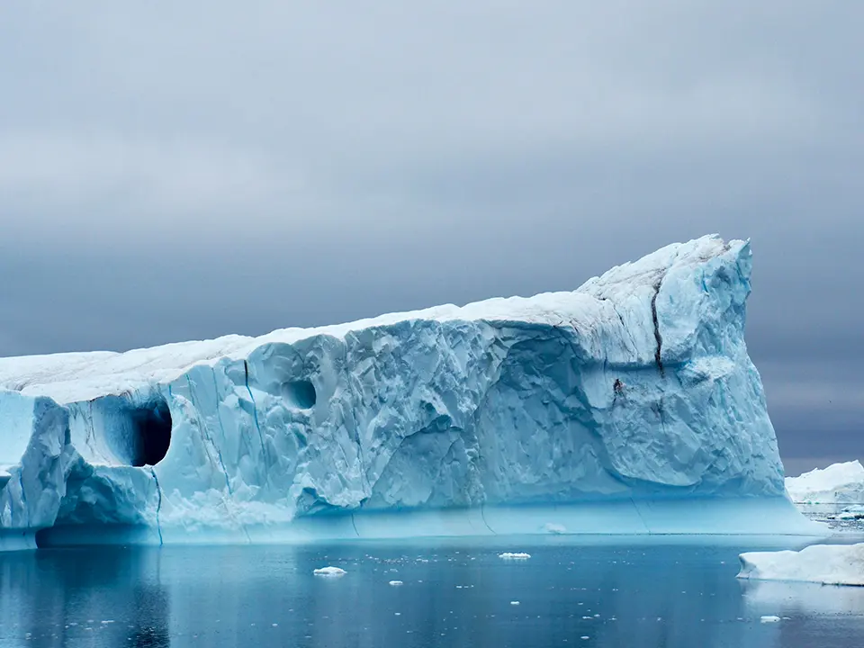
FlyPix AI uses AI-powered analysis of UAV, satellite and LiDAR data to transform glacier monitoring and environmental assessment. Its platform provides fast, precise insights on ice mass, glacier retreat, surface deformation and seasonal changes, supporting climate research and conservation efforts. The intuitive, no-code interface allows users to conduct complex geospatial analyses without technical expertise, automating tasks like ice classification, surface movement tracking and environmental risk assessment. FlyPix AI integrates with geographic information systems (GIS) and environmental management systems, enabling scalable and customizable monitoring workflows for both small- and large-scale projects.
Technological maturity: Frontier
Contracting type: For sale
Technology level: High
Place of origin: Germany
Availability: Worldwide
Contact: WIPO GREEN Database
Advanced geosynthetics to slow ice melt
Naue
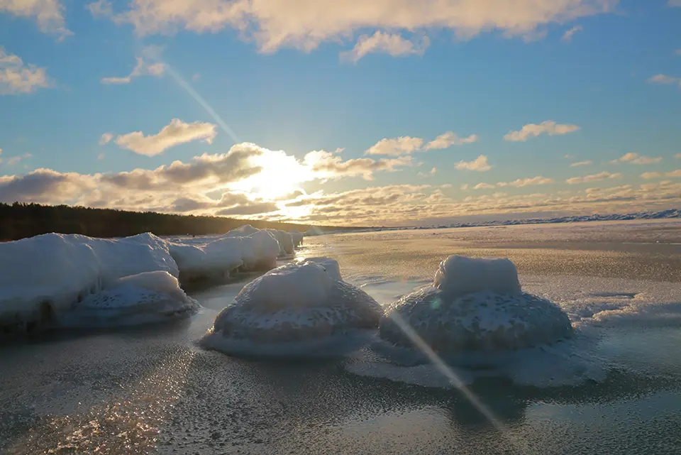
GlacierProtect is a biodegradable geotextile designed to slow glacier melt. Made from eco-friendly fibers, it reflects sunlight to reduce surface temperatures, stabilizes glacier surfaces and helps prevent erosion. Lightweight and durable, the material can be easily transported and deployed in remote, extreme environments, withstanding harsh weather conditions. By lowering ice melt rates, GlacierProtect contributes to preserving water reserves and stabilizing ecosystems. Its fully biodegradable composition ensures no harmful residues are left in sensitive glacier environments. Combining practicality, high reflectivity and long-term durability, GlacierProtect provides a scalable and sustainable approach to mitigating glacier loss and its associated climate impacts.
Technological maturity: Frontier
Contracting type: For sale
Technology level: High
Place of origin: Germany
Availability: Worldwide
Contact: WIPO GREEN Database
Compact and intelligent multi-sensor flagship drone series for enterprise industries
DJI
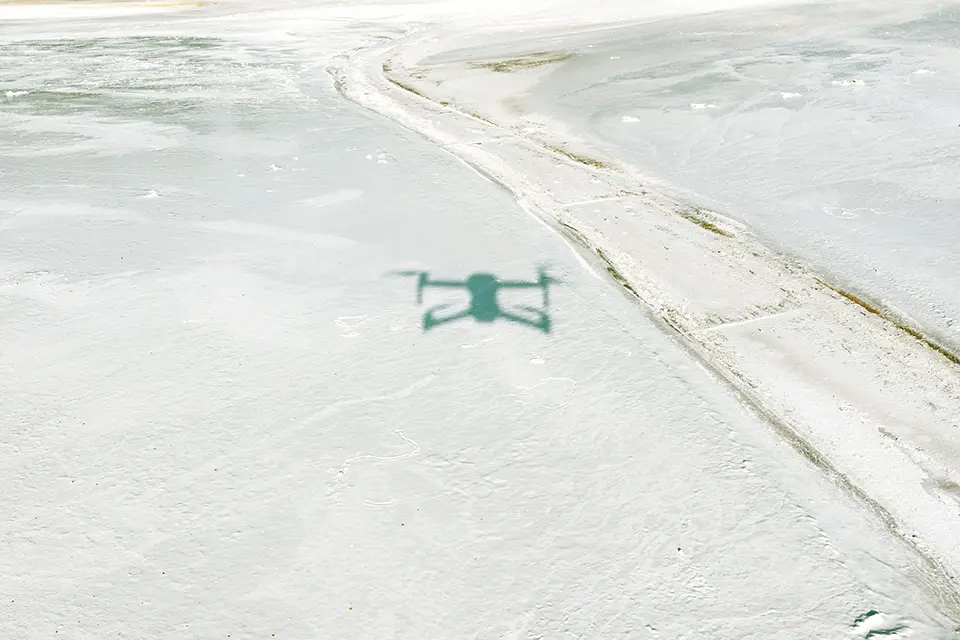
The DJI Matrice 4 Series consists of advanced enterprise drones (Matrice 4T and 4E) built for intelligent aerial operations with multi-sensor imaging, AI-assisted detection and precise measurement tools, such as a long-range laser rangefinder and high-resolution cameras. The 4E model excels at rapid, high-accuracy mapping and surveying with orthophoto and oblique capture, fast frame intervals and Smart 3D Capture for detailed terrain models, while the 4T adds thermal and near-infrared (NIR) imaging, useful for detecting temperature contrasts (e.g., meltwater flows or crevasse boundaries). Both models benefit from robust low-light capability and GNSS/real-time kinematic (RTK) positioning for reliable data capture in challenging environments. These features make the series applicable for ice and glacier monitoring, as they enable detailed topographic surveys, change detection and environmental assessment over dynamic cryospheric landscapes.
Technological maturity: Frontier
Contracting type: For sale
Technology level: High
Place of origin: China
Availability: Worldwide
Contact: WIPO GREEN Database
Anti-ice propeller for drone
DJI
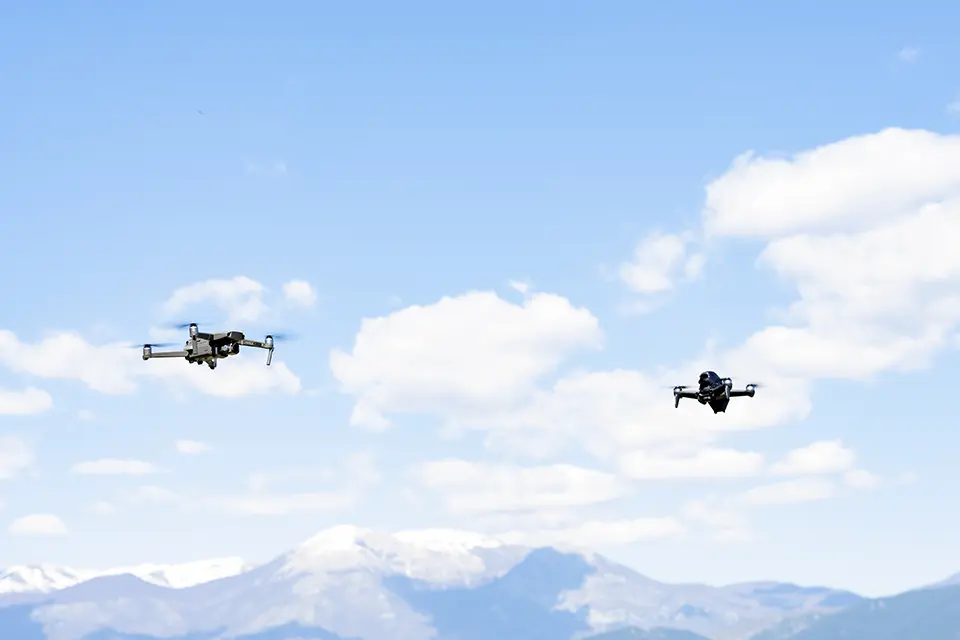
The anti-ice propellers (made for the DJI Matrice 4D Series) are specialized rotor blades designed to improve flight reliability and stability in cold, wet and challenging weather conditions. They feature an anti-ice coating that helps reduce the build-up of ice on the propeller surfaces, maintaining aerodynamic performance and consistent lift even in freezing rain or high humidity environments. The blades are aerodynamically optimized and dynamically balanced, which not only enhances flight stability but also reduces noise and vibration during operation. These qualities make them especially useful for professional aerial tasks, such as mapping, monitoring or search and rescue, where cold-weather performance and quiet, stable flight are critical.
Technological maturity: Frontier
Contracting type: For sale
Technology level: High
Place of origin: China
Availability: Worldwide
Contact: WIPO GREEN Database
Horizon technology solutions
Nano-thin radiative cooling material to stop glacial melt
Nanjing University
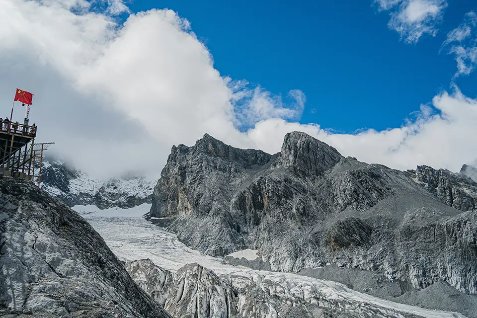
Professor Zhu Bin and his team at Nanjing University have developed a nano-thin, eco-friendly radiative cooling material made from cellulose acetate (CA) to reduce glacier melting. The material reflects over 92 percent of sunlight while radiating heat from the glacier into space, significantly lowering ice temperatures under direct sunlight. Pilot tests on Dagu Glacier (5,000 m above sea level) showed up to an 80 percent reduction in melting, suggesting potential for net glacier volume growth over three to five years. The porous, roll-to-roll electrospun film promotes passive cooling without external energy and is biodegradable. The internet company Tencent sponsored the project and provided support through its Carbon Neutrality Laboratory under a sustainability initiative. The technology is still in field-testing phases with controlled experiments and scaled deployments underway, representing a promising approach to passive glacier conservation and climate mitigation in high-altitude environments.
Technological maturity: Horizon
Contracting type: Under development
Technology level: High
Place of origin: China
Availability: Under development
Contact: WIPO GREEN Database
Glacier digital twin
University of Bristol, European Space Agency, University of Zurich, University of Innsbruck, enveo, Earthwave, University of Edinburgh
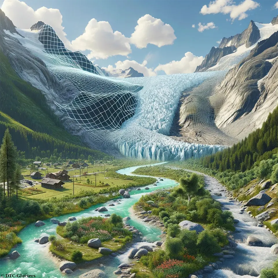
The Digital Twin Component for Glaciers (DTC Glaciers) project, developed under ESA’s Digital Twin Earth initiative, creates a dynamic “digital twin” of mountain glaciers. It integrates satellite (Earth observation) data, in-situ measurements and advanced models (including AI) into a single, interactive platform that continuously updates as new data comes in. This system allows users to monitor glacier changes, such as mass balance, volume and runoff, on a near-real-time basis and to simulate future scenarios, like melt rates or water availability. Accessible through dashboards and cloud-based tools, the platform supports scientists, hydrologists and policymakers in analyzing glacier behavior, predicting impacts and managing water and climate risks. It functions as a live data-driven simulation of glaciers, enabling better forecasting and decision-making in rapidly changing cryosphere environments. Its first phase (prototype stage) was completed in January 2026.
Technological maturity: Horizon
Contracting type: Under development
Technology level: High
Place of origin: United Kingdom
Availability: Under development
Contact: WIPO GREEN Database
Digital twin for complex mountain environments
Eurac Research
The EnvironTwin technology uses advanced digital twins to replicate complex mountain environments including forests, pastures, rocky glaciers, and agrivoltaic systems, providing detailed computer representations of these landscapes. Unlike traditional digital twins that track single objects, EnvironTwin models entire environmental systems influenced by climate change and human activity. The models integrate sensor networks, LiDAR, cloud computing, and sophisticated data modeling to monitor and predict landscape evolution, risks, and management strategies. Four alpine case studies, supported by Eurac Research’s Sensor System Technology Lab and Environmental Data Platform (EDP), will enhance research infrastructure and provide practical tools. Funded by the ERDF 2021–2027, the project aims to improve understanding and management of complex mountain systems by combining high-resolution monitoring with predictive modeling.
Technological maturity: Horizon
Contracting type: Under development
Technology level: High
Place of origin: Italy
Availability: Under development
Contact: WIPO GREEN Database
Open source software to support the development of ice-penetrating radar
Stanford University

Open Radar Code Architecture (ORCA) is an open-source, modular architecture for building ice-penetrating radar systems used to study glaciers and ice sheets. It combines software-defined radio with standardized hardware components, allowing researchers to construct low-cost, customizable radar instruments capable of mapping ice thickness, internal layering and subglacial terrain. By dramatically reducing cost and complexity compared to traditional radar systems, ORCA enables wider access to cryosphere monitoring tools and promotes data standardization across research groups. Its flexible design supports integration with multiple platforms, including ground-based systems, aircraft and drones. ORCA represents a shift toward collaborative sensing infrastructure for understanding glacier dynamics and improving projections of sea-level rise.
Technological maturity: Horizon
Contracting type: Under development
Technology level: High
Place of origin: United States
Availability: Under development
Contact: WIPO GREEN Database
UAV-based radar platform
Stanford University
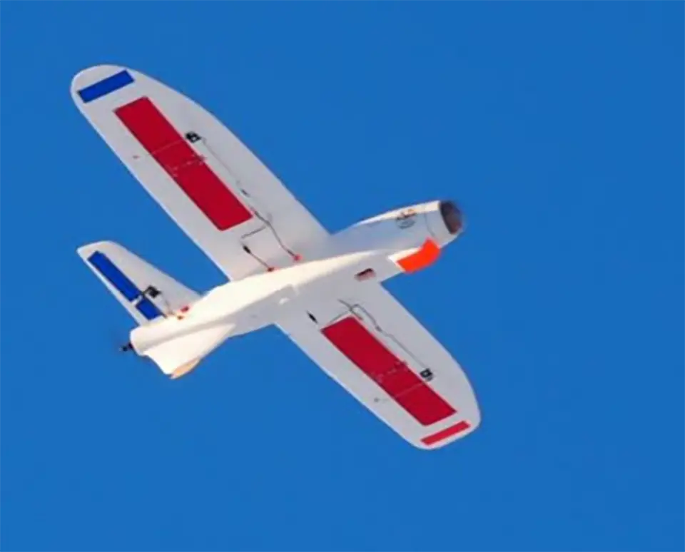
Peregrine is a lightweight UAV system designed to carry miniaturized ice-penetrating radar instruments built using the ORCA architecture. As a field-portable fixed-wing UAV equipped with a miniaturized ice-penetrating radar, it enables high-resolution mapping of glaciers and ice sheets in remote or hazardous regions where traditional survey methods are difficult or expensive. By combining drone mobility with compact radar payloads, Peregrine allows researchers to collect detailed subsurface data with greater flexibility and lower operational cost. The platform is particularly valuable for targeted surveys, repeat measurements and accessing previously unreachable terrain. Peregrine demonstrates how modular sensing technologies like ORCA can be deployed in field systems to expand the scale and frequency of cryosphere observations.
Technological maturity: Horizon
Contracting type: Under development
Technology level: High
Place of origin: United States
Availability: Under development
Contact: WIPO GREEN Database
5.2 Permafrost
Permafrost underlies much of the Northern Hemisphere, storing vast amounts of carbon accumulated over millennia. It is ground (rock, soil or sediment) that remains continuously frozen for at least two years, formed under persistently low surface temperatures and often lasting for thousands to hundreds of thousands of years
Permafrost distribution is commonly classified into four types: continuous, discontinuous, sporadic and isolated. Continuous permafrost underlies more than 90 percent of the land area and occurs in the coldest regions, such as parts of Siberia. Discontinuous permafrost underlies 50–90 percent of the surface area and is found in Canada. Sporadic permafrost extends beneath 10–50 percent of the ground, while isolated permafrost occurs where it underlies less than 10 percent of the surface
The Arctic is warming four times faster than the global average and permafrost regions now emit more carbon than they absorb
Permafrost is overlain by the active layer, a near-surface layer of soil and sediment that thaws and refreezes seasonally, regulating the exchange of heat between the atmosphere and the underlying frozen ground. This layer acts as an interface, transferring heat to and from the underlying permafrost. Within the frozen organic matter of permafrost lies roughly twice the amount of carbon found in the atmosphere
Older IPCC models assumed that permafrost thaw would be a small contributor to climate change this century, but new research suggests this is an underestimation. Long-term observations show that permafrost is warming at a global scale, with particularly strong warming documented in European mountain regions during the early 21stcentury (
Indicators and proxies track permafrost conditions
There are several direct and indirect metrics used to track permafrost conditions and health. No single metric suffices; instead, measurement relies on combining direct observations with indirect proxies to capture permafrost dynamics.
Snow and surface conditionsare the most obvious indicators. Snow has a complex influence on permafrost. During winter, a thicker snowpack insulates the ground, reducing heat loss to the atmosphere and often resulting in warmer ground temperatures. However, if snow persists into spring and summer, it can delay ground warming and thaw, thereby helping to preserve permafrost
Ground temperature metrics are critical. Borehole ground temperature (BGT) is used extensively to measure temperature at depth. Active layer thickness (ALT), the depth of seasonal thaw above the permafrost, is also used as a proxy for ground temperature. Borehole temperature monitoring systems are specialized systems that measure subsurface temperatures with thermistor strings installed along the length of boreholes that are typically 20–100 meters deep to provide high-accuracy data (±0.1°C) on the thermal state of permafrost and ALT, typically recording automatically over time
Surface movement and deformationare assessed through the measurements of surface subsidence (where the ground sinks due to ice melt – also called thermokarst). Interferometric synthetic aperture radar (InSAR) and high-precision GPS measurements can detect millimeter-scale ground movement over time
Hydrological proxiesinclude river discharge and timing; runoff that is early or greater than usual in volume can indicate thaw. Changes in groundwater flow, as well as the release of ions, carbon and heavy metals from thawing soils, are also used as indicators.
Carbon and ecosystem signalsinclude changes in vegetation type and productivity, GHG fluxes indicating decomposition of frozen organic matter and shifts in soil microbial activity as frozen ground becomes active.
Geophysical methods, including electrical resistivity tomography (ERT) and seismic surveys, are also employed. ERT is a method that sends small electrical currents through the ground to measure how easily the subsurface conducts electricity. Since ice and frozen soil conduct electricity poorly compared with water or thawed soil, ERT can create a 3D image showing which areas are frozen or contain liquid
Rock glaciersalso serve as indicators. They are downslope-moving landforms composed of rock debris and interstitial ice, whose flows have a distinct tongue shape that can be as big as a kilometer wide and several kilometers long. Their movement, ranging from centimeters to meters per year, responds to thermal conditions; increasing velocity is often associated with warming permafrost. They can also contribute to landscape instability and natural hazards, such as debris flows (
Technologies for monitoring, managing and protecting permafrost
Building on these indicators, monitoring systems have become increasingly integrated and technologically advanced. Permafrost monitoring has evolved into a well-established field driven by the need to maintain infrastructure in cold regions. Unlike in the “Sea ice and glacial melting” section above, on sea ice and glacial melting, for which technologies are mostly geared toward observation and experimental intervention, the permafrost is already a mature engineering problem, because infrastructure is reliant upon it.
Multi-layer monitoring systems both above and below ground are the new normal as a shift is underway from single-variable monitoring to multi-physics sensing that combines thermal, hydrological and mechanical stability data.
IoT-enabled monitoring and real-time alerting systems are increasingly deployed, using low-power sensors with data transmission via satellite and cellular technology and integration into decision-making platforms. These systems improve early warning capabilities for thaw and ground instability. In parallel, machine learning is being used to analyze complex data sets, with tools increasingly designed for use by non-experts.
Multi-layer monitoring systems both above and below ground are the new normal
Advancements in subsurface imaging are also critical. Techniques such as electrical resistivity and induced polarization, which detects how subsurface materials temporarily store and release electrical charge, now enable 2D, 3D and time-lapse (4D) mapping of frozen and thawed ground, allowing researchers to track thaw progression over time. This marks a shift from point-based measurements toward full 3D visualization of permafrost systems.
At the same time, advanced simulation tools can model heat transfer, groundwater movement and freeze–thaw cycles. Climate-driven advanced simulations integrate soil properties, infrastructure characteristics and future climate scenarios to support research and engineering decision-making.
Unlike glacier-focused interventions, permafrost technologies have been widely implemented in practice. Passive and active cooling systems are used to stabilize ground conditions in vulnerable areas. Thermosyphons – passive heat-transfer devices that require no external power – have been used since the 1970s to maintain frozen ground beneath infrastructure such as buildings and pipelines. They consist of sealed pipes filled with a refrigerant that evaporates underground as it absorbs heat and condenses above ground in colder air, passively transferring heat out of the soil and helping to preserve permafrost. For example, the Trans-Alaska Pipeline incorporates approximately 120,000 thermosyphons to stabilize its length and delay thaw.
Active cooling methods, including refrigeration systems and buried cooling pipes, are also used in industrial settings, such as tailings ponds. These systems could theoretically be extended across wild and remote permafrost regions, combined with vertical boreholes or vertical heat exchangers to extend cooling deeper into the ground, or enhanced with active refrigeration systems that circulate chilled fluids to maintain sub-zero temperatures However, there is limited research on their long-term effectiveness, costs, scalability and environmental impacts, and it is likely that large-scale deployment would be expensive and disruptive.
Thermosyphons – passive heat-transfer devices that require no external power – have been used since the 1970s to maintain frozen ground beneath infrastructure
While thermosyphons remain the dominant solution, hybrid systems that combine passive and active cooling are becoming more common
Infrastructure needs are driving engineering advances in permafrost areas
Infrastructure needs and requirements in Arctic and high-altitude areas have driven the development of engineering solutions such as specialized pile foundations, load-distributing structures and reduced ground disturbance construction. These advances are helping infrastructure to tolerate thaw and minimize heat input into the ground, and adapt to instability.
Hydrology has become critical to understand internal water movement and to monitor pore-water pressure inside the permafrost
While many of these engineering solutions are technologically mature, it is worth noting that the goal is to stabilize critical areas where failure is unacceptable, rather than endeavoring to save the global permafrost.
Interventions and stabilization technologies
Nanorefrigerants are being researched to significantly improve the cooling efficiency of thermosyphons, which are passive heat-transfer devices used to keep permafrost frozen and stabilize infrastructure such as roads, railways and pipelines. Adding nanoparticles to conventional refrigerants creates “nanorefrigerants,” which improve how the fluid conducts and transfers heat (particles such as aluminum oxide, copper oxide or carbon nanotubes carry heat more efficiently, speeding up heat movement by 50–60 percent). This also boosts system efficiency (meaning that more heat is removed from permafrost with the same energy input) (
Artificial ground freezing (AGF) is a geotechnical technique used for ground stabilization, seepage control and infrastructure development, and is used in tunneling, mining, urban metro construction and permafrost preservation. It was first patented in the mid-19thcentury in Germany for sinking shafts in waterlogged soils and gained traction in Europe and North America by the early 20thcentury, including in the Paris Métro. AGF was introduced in China in the 1950s for mining and used in urban metro trials in Beijing and Shanghai in the 1970s–1980s. The dawn of computational modeling in the 1970s enabled precise thermal and mechanical predictions. Since the 2000s, China has pioneered local horizontal freezing and energy-efficient systems, applying AGF at a larger scale for urban expansion and permafrost engineering.
While AGF is a mature engineering method, most traditional applications to date have been for short-term soil stabilization in construction and tunneling
Snow compaction. Fresh snow is light and full of air pockets, making it a good insulator that can trap heat in the ground during winter. Compaction increases snow density, reduces air pockets and raises thermal conductivity, allowing heat to escape more easily and lowering ground temperatures. Small-scale experiments suggest that compaction can reduce permafrost thaw, but scaling up requires personnel, equipment, suitable terrain and sufficient snowfall. Repeated compaction may harm ecosystems, damage soil and produce carbon emissions; it is also potentially costly and environmentally disruptive. Therefore, its effectiveness in remote areas and for timely mitigation of thaw remains uncertain.
Thawing permafrost – a methane time bomb
Methane (CH4) is the second most significant anthropogenic greenhouse gas after CO2, accounting for approximately one-third of current global warming. Due to its relatively short atmospheric lifetime of about a decade, it represents a critical target for near-term climate mitigation. In recognition of this, more than 155 countries have committed to the Global Methane Pledge, aiming to reduce global methane emissions by 30 percent by 2030 compared to 2020 levels
As warming thaws permafrost, CO2 and methane are released, which further speeds warming. Arctic methane emissions have increased rapidly. Polar and high-altitude regions are warming at least three times faster than the global average, and permafrost temperatures increased roughly 0.3°C between 2007 and 2016

Methane monitoring technologies
Monitoring platforms and networks for permafrost are maturing, integrating long-term data sets with standardized methods for climate research and infrastructure planning. Within this broader monitoring landscape, high-frequency methane flux measurements are becoming more standard, using both airborne and ground-based systems. This shift reflects the growing recognition of permafrost as a significant risk, making robust methane monitoring essential for both climate modeling and emissions accounting.
Eddy covariance flux systems with methane analyzers. Eddy covariance measures vertical turbulent transport of gases between the surface and the atmosphere. A 3D sonic anemometer measures wind velocity fluctuations at high frequency (10–20+ Hz) and a methane analyzer (open-path or closed-path) measures CH4concentration simultaneously at the same frequency. The covariance between vertical wind speed and methane concentration gives a direct landscape-scale flux, expressed as mass per area per time. It is currently the standard for ecosystem emissions research
Open-path methane analyzers measure methane concentrations in the atmosphere using infrared laser absorption across an open air path. When combined with high-frequency wind measurements from a sonic anemometer, these systems can estimate landscape-scale methane fluxes using the eddy covariance method. They are commonly used at permafrost and wetland sites to monitor real-time methane emissions from thawing soils, thermokarst features and other landscape sources
Closed-path cavity ring-down spectroscopy (CRDS) analyzers. Closed-path CRDS systems draw a continuous stream of air through a sampling tube into a temperature- and pressure-controlled optical cavity. A laser pulse enters the cavity and the system measures how quickly the light decays (“ring-down”) due to absorption by methane molecules. Because the path length effectively becomes extremely long inside the cavity, even tiny methane concentration changes (parts-per-billion level) are detectable with high stability
High-frequency methane flux measurements are becoming more standard, using both airborne and ground-based systems
UAV-mounted compact CRDS and laser sensors. UAVs equipped with lightweight CRDS or laser absorption sensors can fly predetermined grid patterns or transects over thaw features. These sensors measure methane concentration in the air below the UAV and, when combined with precise GPS data, they can map where methane emissions are occurring and how large they are. This approach is ideal for inaccessible terrain and captures the spatial heterogeneity of methane emissions
Portable chamber flux systems with integrated gas analyzers. A closed chamber is placed over soil, water or vegetation surfaces. As gases accumulate inside the chamber headspace, a portable methane analyzer (infrared or CRDS) measures the concentration increase over time, allowing calculation of methane flux from the surface
Long-term fixed sensor arrays (point observations). Stationary instruments installed near or within permafrost landscapes continuously log methane concentrations at fixed heights and locations. These may be single-channel infrared analyzers or multi-gas CRDS sensors. They are useful for baseline monitoring and long-term trends, and are often integrated into research stations or meteorological towers
Satellite-based methane and atmospheric trace gas monitoring systems
Monitoring methane and other atmospheric pollutants from space is critical for tracking emissions and guiding mitigation efforts. There is a growing suite of satellite missions, ranging from global instruments to platforms that detect large-scale trends and localized emission sources.
Monitoring methane and other atmospheric pollutants from space is critical for tracking emissions and guiding mitigation efforts
Global satellite systems
TROPOMI (Sentinel-5P, 2017). European satellite providing daily global coverage of methane and other trace gases at ~5.5 × 3.5 km resolution. Operates in the shortwave infrared to detect point sources and regional hotspots. Supports Copernicus Atmosphere Monitoring Service (CAMS) and research communities
(ESA, 2026e)ESA (2026e). TROPOMI. European Space Agency (ESA). Available at:https://www.tropomi.eu[accessed July 22, 2026]. .Sentinel-4 and Sentinel-5 (Copernicus) are follow-up missions to Sentinel-5P/TROPOMI. Sentinel-4 is geostationary, monitoring Europe’s air quality. Sentinel-5 provides broader global trace gas coverage, similar to TROPOMI
(ESA, 2026c)ESA (2026c). Sentinel-4, -5 and -5P. European Space Agency (ESA). Available at:https://www.esa.int/Applications/Observing_the_Earth/Copernicus/Sentinel-4_-5_and_-5P[accessed July 3, 2026]. .MethaneSAT (2024). American–New Zealand mission designed for high-resolution monitoring of methane from oil and gas and major sources (~130 × 400 meters, oversampled to ~45 meters). Contact was lost in early 2025, probably rendering the satellite unrecoverable
(EDF, 2025)EDF (2025). Slow global warming fast with MethaneSAT. Environmental Defense Fund (EDF). Available at:https://www.edf.org/methanesat[accessed July 3, 2026]. .GHGSat. Private Canadian satellites with high-resolution monitoring (~50 meters) of methane emissions from individual facilities worldwide. It is focused on oil and gas, mining and other industrial sources
(GHGSat, 2024)GHGSat (2024). Greenhouse gas emissions monitoring. GHGSat. Available at:https://www.ghgsat.com/en[accessed July 3, 2026]. .Atmospheric Infrared Sounder (AIRS) on NASA’s Aqua satellite. Global monitoring of GHGs including methane, CO2 and water vapor. It has coarser resolution and is used more for climate trend analysis than for pinpointing point sources
(NASA JPL, 2026)NASA JPL (2026). Atmospheric Infrared Sounder (AIRS). NASA Jet Propulsion Laboratory (JPL). Available at:https://airs.jpl.nasa.gov[accessed July 3, 2026]. .Greenhouse Gases Observing Satellite, Japan (GOSAT). Since 2009, it has recorded global CO2 and methane observations with a focus on regional and global fluxes rather than facility-level detection
(NIES Japan, 2026)NIES Japan (2026). Greenhouse gases observing satellite (GOSAT). National Institute for Environmental Studies (NIES), Japan. Available at:https://www.gosat.nies.go.jp/en[accessed July 3, 2026]. .
Regional or high-resolution systems
Copernicus Regional Air Quality Services use data from Sentinel satellites to provide air quality monitoring for Europe
(CAMS, 2023)CAMS (2023). CAMS – Air quality data for all seasons. Copernicus Atmosphere Monitoring Service (CAMS). Available at:https://atmosphere.copernicus.eu/cams-air-quality-data-all-seasons[accessed July 3, 2026]. .NASA OCO-2 and OCO-3 are primarily CO2-focused but data can help to model methane emissions indirectly via carbon cycle interactions
(NASA ESSP, 2025)NASA ESSP (2025). Orbiting Carbon Observatory-2 (OCO-2). NASA Earth System Science Pathfinder (ESSP). Available at:https://essp.nasa.gov/earth-pathfinder-quests/projects/orbiting-carbon-observatory-2-oco-2[accessed July 3, 2026]. .
Box 5.3 describes the ExtremeThaw project, which is examining the impacts of rapid permafrost thaw in the Swiss Alps.
The ExtremeThaw project at the Swiss Federal Institute for Forest, Snow and Landscape Research (WSL) investigates the impacts of rapid permafrost thaw in the Swiss Alps. Thawing permafrost releases carbon and pollutants, destabilizes slopes and may introduce ancient microbes into ecosystems and water systems. Despite its importance, alpine permafrost has been poorly monitored compared with Arctic regions. ExtremeThaw aims to fill this gap by quantifying carbon stocks and assessing the risks and impacts of permafrost thaw on ecosystem functions and services. The project focuses on four areas: GHG emissions from thawing soils, pollutant release into water systems, potential hazards from dormant microbes and opportunities for new carbon sinks as unfrozen ground supports new vegetation and microbial communities.
Researchers use over 100 existing Intercantonal Measurement and Information System (IMIS) climate stations to monitor vegetation growth, species composition and biomass as indicators of ecosystem response. Soil carbon and stability are assessed through soil profile surveys, including the study of ancient buried soils. Microbial diversity is analyzed to understand below-ground biological responses to thaw. The project also leverages the WSL permafrost and ground-ice map and long-term climate data to contextualize findings.
By combining field measurements with lab analyses, ExtremeThaw evaluates how thawing permafrost affects carbon cycling, pollutant release and potential new carbon sinks. The results aim to inform policy, improve GHG reporting and support management of alpine landscapes threatened by climate-driven permafrost degradation.
Source:
Nature- and ecosystem-based solutions to stop permafrost thaw
Rewilding of permafrost areas is a proposed strategy that would reintroduce large herbivores to recreate ecosystems like those that existed during the Pleistocene. Early experiments have been conducted in Pleistocene Park in Siberia. While potentially scalable, and reversible in the case of failure, rewilding faces challenges that include ethical concerns around species introduction, ecological uncertainty and the need for indigenous and local support
Nonetheless, research has revealed the possibility of using hoofed herbivores to protect permafrost. Increasing populations of animals such as horses, bison and reindeer can help by reducing shrub cover and compacting snow. As mentioned earlier, this reduces the snow’s insulating effect, allowing colder air to enter the ground and keep soils frozen
Wildfire both accelerates permafrost thaw and is intensified by it, thus creating a feedback loop that increases GHG emissions and ecosystem damage. Improved fire management through prescribed burns, early suppression and land management can help reduce risks
Solar geoengineering approaches require caution
Large-scale “geoengineering” climate interventions aim to reduce the amount of solar energy reaching the Earth – for example, through space-based sunshades or atmospheric aerosol injection. These approaches operate at continental or global scales with potential impacts across entire regions or hemispheres. They would require continuous, long-term operation, as stopping them could lead to termination shock (rapid temperature rebound)
The main approaches differ in where they intervene in the climate system. Stratospheric aerosol injection proposes releasing reflective particles, such as sulfur dioxide, into the stratosphere to scatter incoming sunlight, mimicking volcanic eruptions. Cloud-based methods seek to alter cloud properties to either reflect more solar radiation or release more heat. A third approach, space-based solar radiation management, would place reflective infrastructure in orbit to reduce the amount of sunlight reaching the Earth. All remain largely conceptual with significant scientific, technical and governance uncertainties
Innovation examples
Sensing the thaw: how pore-water pressure technology reveals permafrost instability
KELLER
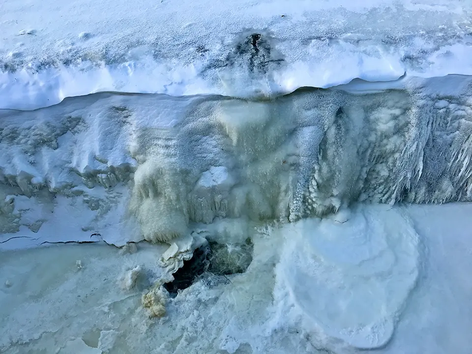
KELLER Pressure’s pore-water pressure monitoring technology plays a crucial role in understanding how ice-rich permafrost landscapes are responding to climate change, especially in alpine regions where permafrost degradation is accelerating. Warming temperatures increase water content in ice-rich ground, such as rock glaciers, which in turn can change internal hydrological conditions and destabilize slopes, increasing the risk of debris flows and other mass movements. Traditional monitoring techniques, such as monitoring ground temperature alone, do not fully capture subsurface water dynamics, but pressure sensors (piezometers) provide direct measurements of pore-water pressure within permafrost – data that are vital for characterizing internal conditions and how they evolve over time. This technology gives scientists and engineers insight into the hydrological processes driving permafrost movement and water availability within rock glaciers and frozen ground, helping to improve hazard assessment and climate models. By contributing high-resolution pore-water pressure data, these sensors enhance understanding of how thaw-induced changes in water content affect stability and can inform infrastructure planning and natural hazard mitigation in mountainous permafrost regions affected by warming
Keeping permafrost cold with solar-powered thermosyphons
U.S. Army Engineer Research and Development Center’s Cold Regions Research and Engineering Laboratory (ERDC-CRREL)
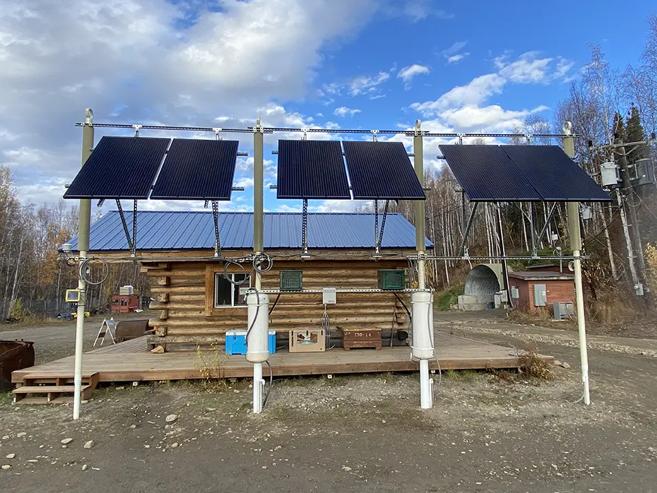
The U.S. Army ERDC‑CRREL evaluated whether solar energy could power active thermosyphons to cool and maintain frozen ground where traditional passive thermosyphons are limited by warmer air temperatures. Passive thermosyphons extract heat from soil only when the air is colder than the ground. Hybrid thermosyphons are fitted with an internal heat exchanger that can be cooled by an active refrigeration system when air temperatures are above ground temperatures. So, as Arctic air temperatures rise, the operating season for a passive system shortens. The project tested a hybrid system near Fairbanks, Alaska, by combining a solar array, battery storage and a refrigeration unit connected to a hybrid thermosyphon from Arctic Foundations Inc. The solar array supplied electricity to an active air-cooled condensing unit during warm periods, allowing the thermosyphon to cool subsurface soil even when ambient temperatures were above freezing. Monitoring confirmed that the system could extend ground cooling periods, improving upon the use of passive thermosyphons alone. The study also indicated the need for greater efficiency and economic viability. Future work should explore lower‑power refrigeration units and configurations that could support multiple thermosyphons
The following collection of technologies is divided into three groups: Proven technologies have been on the market for some time and hence are well tested, Frontier technologies are available but relatively new, while Horizon technologies are close to being available but still under development.
Proven technology solutions
Software package for simulation of permafrost thermal regimes
Simmakers
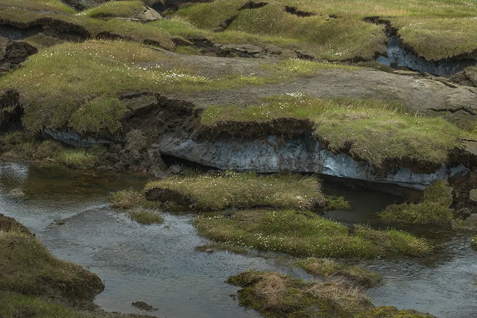
Simmakers’ Frost 3D Universal is a specialized thermal simulation tool for modeling heat transfer and phase changes in ground and permafrost environments. It allows engineers to build a 3D computational domain that includes surface topography, soil layers, pipelines, foundations, boreholes and structures, and define material thermal and hydrological properties. The software generates a computational mesh and simulates temperature, unfrozen water content and groundwater flow over time, accounting for heat exchange with climatic conditions like air temperature, snow depth and solar radiation. A built-in library of thermophysical soil and construction data supports realistic modeling. Frost 3D Universal uses advanced numerical methods, parallelized algorithms and can leverage multi-core central processing units (CPUs) and graphics processing units (GPUs) for faster problem solving. It visualizes results in 3D and sectional views for analysis. Typical applications include permafrost thaw prediction, thermal impact of pipelines and infrastructure, and ground freezing stability assessment.
Technological maturity: Proven
Contracting type: For licensing
Technology level: High
Place of origin: Russian Federation
Availability: Worldwide
Contact: WIPO GREEN Database
Permafrost monitoring system
PERMOS (Swiss Permafrost Monitoring Network)
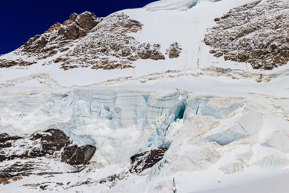
PERMOS is a long-standing scientific monitoring program that documents the state of and changes in mountain permafrost in the Swiss Alps. Managed by a dedicated office and supported by six academic partners along with funding from MeteoSwiss, the Federal Office for the Environment and the Swiss Academy of Sciences, PERMOS collects and openly shares field data as part of Switzerland’s climate monitoring efforts. It observes conditions at 27 high-mountain sites (2,200–3,500 meters above sea level), measuring ground temperatures in boreholes and at the surface, relative ground ice content and rock glacier velocities across typical permafrost landscapes, such as rock glaciers and steep slopes.
Technological maturity: Proven
Contracting type: Open source
Technology level: High
Place of origin: Switzerland
Availability: Switzerland
Contact: WIPO GREEN Database
Two-phase thermosyphon
Arctic Foundations of Canada
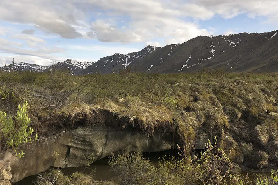
Two-phase thermosyphons are passive (and optionally hybrid active–passive) refrigeration devices that transfer heat from the ground to the air using a sealed vessel containing a two-phase working fluid. In winter, cold air condenses the fluid above ground, which then flows downward; below ground, the fluid warms, vaporizes and rises, creating a continuous heat-transfer cycle. Hybrid systems add powered condensers to operate even when ambient air is too warm. Thermosyphons are widely used in Arctic and cold-climate applications to maintain frozen ground, preventing permafrost thaw and protecting infrastructure such as roads, pipelines and foundations. This technology has been applied in over 900 installations since the 1960s, making it a mature and reliable solution. Arctic Foundations Inc. (AFI) has continuously developed and deployed thermosyphons since the 1970s with ongoing improvements in installation and efficiency.
Technological maturity: Proven
Contracting type: For sale/contract
Technology level: High
Place of origin: Canada
Availability: Worldwide
Contact: WIPO GREEN Database
GNSS receiver
Trimble
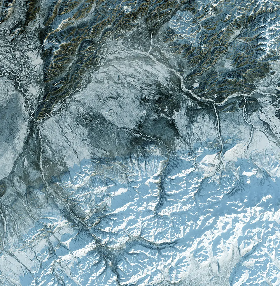
The Trimble Inc. R10 Model 2 GNSS System is an advanced global navigation satellite receiver that helps land surveyors collect fast, accurate field positioning data. It uses a high-performance GNSS chipset with 672 channels to track all major satellite constellations (GPS, Global Navigation Satellite System (GLONASS), BeiDou, Galileo, etc.) for reliable location fixes even in challenging environments. The system improves battery life by around 33 percent, increases internal memory for long-term data storage, and resists signal interference and spoofing. It builds on core technologies like HD-GNSS processing for precise measurements, tilt compensation for easier data capture, and xFill to maintain centimeter-level positioning when correction signals are temporarily unavailable. It integrates with handheld controllers and mobile devices running Android or iOS to streamline data collection and boost productivity across surveying, construction, mapping and GIS workflows.
Technological maturity: Proven
Contracting type: For sale
Technology level: High
Place of origin: United States
Availability: Worldwide
Contact: WIPO GREEN Database
Measurement and control data logger
Campbell Scientific

The CR1000Xe is a rugged, low-power measurement and control data logger used to collect, process, store and transmit sensor data in remote and harsh environments, such as weather stations, hydrology networks, soil monitoring and infrastructure projects. It connects to a wide range of analog and digital sensors, logs data in non-volatile memory and supports flexible communication options including USB, ethernet, cellular and satellite links. The device runs on a built-in programmable language, enabling custom data collection and automation routines tailored to specific applications. It operates reliably from –55°C to +85°C, can power external devices, supports expanded memory via microSD and integrates with cloud data systems like CampbellCloud for remote IoT connectivity. Designed for long-term field deployments, the CR1000Xe is widely used in environmental monitoring, research and engineering projects where high-resolution data logging is essential.
Technological maturity: Proven
Contracting type: For sale
Technology level: High
Place of origin: United States
Availability: Worldwide
Contact: WIPO GREEN Database
Borehole temperature profiler
Campbell Scientific
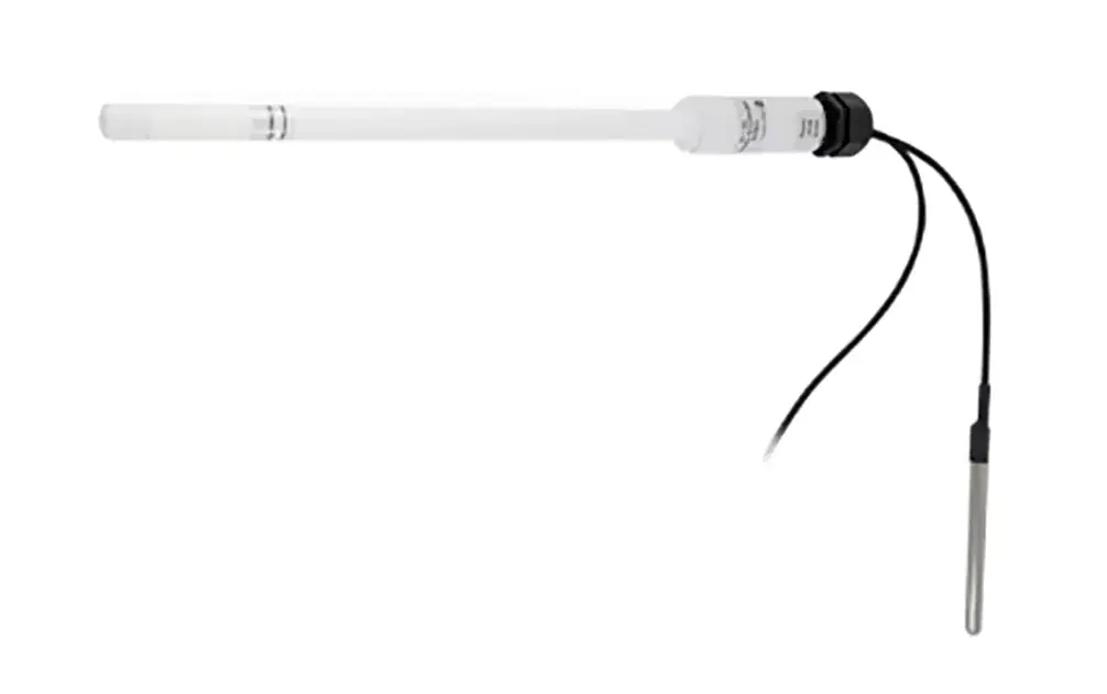
The CS231 is a rugged SDI-12 digital temperature profiler designed for precise long-term measurement of temperature profiles in soil, water, snow, ice and boreholes. It features a slim probe assembly with up to four optional external temperature sensors that maintain exact measurement depths and protect sensors in harsh environments. Digital SDI-12 communications reduce electrical noise and eliminate analog inaccuracies, while continuous readings (about one per second averaged over 10 seconds) deliver high-resolution temperature data across multiple depths. Its sealed design makes it suitable for frost and permafrost monitoring, soil and snowpack temperature profiling, and infrastructure applications. The CS231 operates in extreme temperatures (-55°C to +85°C) and integrates easily with Campbell Scientific data loggers for remote logging and analysis.
Technological maturity: Proven
Contracting type: For sale
Technology level: High
Place of origin: United States
Availability: Worldwide
Contact: WIPO GREEN Database
Electrical resistivity and induced polarization (IP) data acquisition system
ABEM
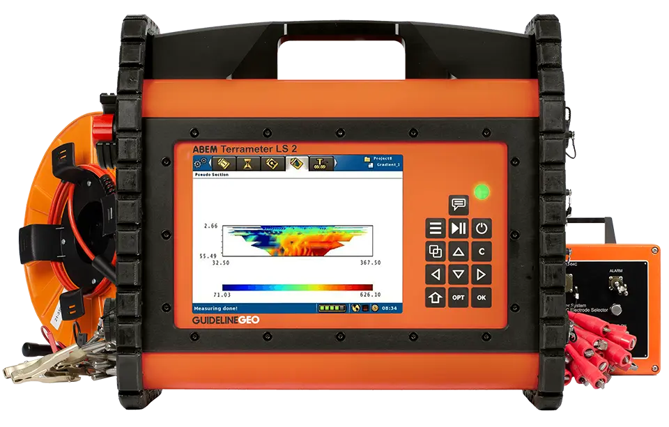
The ABEM Terrameter LS 2 enables non-invasive monitoring of permafrost by mapping subsurface resistivity to distinguish frozen from thawed ground, allowing detection of ice-rich layers, thaw progression and potential ground instability. It is a rugged, scalable electrical resistivity and IP data acquisition system used to image the subsurface by measuring how electrical currents flow through soil and rock. It supports 1D–4D resistivity/IP surveys for groundwater prospecting, geological mapping, environmental and engineering studies, and mineral exploration. Up to 12 measurement channels and built-in electrode switching allow high-resolution surveys and deep investigations, and external selectors can expand to over 16,000 electrodes for large area or 3D surveys. The system includes an integrated field computer with USB, ethernet, Wi-Fi and mobile connectivity, internal GPS/GLONASS positioning and expandable storage. Its rugged casing operates in harsh field conditions and a hardware licensing system lets users tailor and upgrade capabilities. The Terrameter also integrates accessories for borehole logging and complex layouts. It can be combined with borehole sensors for long-term, high-resolution permafrost monitoring.
Technological maturity: Proven
Contracting type: For sale
Technology level: High
Place of origin: Sweden
Availability: Worldwide
Contact: WIPO GREEN Database
All-in-one multi-node resistivity and IP imaging system
Iris Instruments
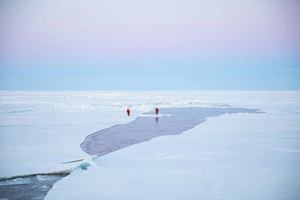
The Syscal Pro Switch is a robust electrical resistivity and IP system for subsurface imaging. It integrates a transmitter, receiver and multi-electrode switch, supporting up to 10 measurement channels and 24–120 electrodes for 1D–4D surveys. The system automatically adjusts current and voltage for precise resistivity and IP measurements, even in harsh field conditions, and records resistivity, self-potential and chargeability. It is widely used in environmental, geotechnical and hydrogeological studies. For permafrost monitoring, the Syscal Pro Switch maps frozen versus thawed ground, because ice-rich permafrost is highly resistive compared to unfrozen soils. By repeating surveys over time, it tracks active layer changes, thaw progression and ground stability. Data are processed and inverted via PC software to generate high-resolution subsurface images.
Technological maturity: Proven
Contracting type: For sale
Technology level: High
Place of origin: France
Availability: Worldwide
Contact: WIPO GREEN Database
Methane sensor
Li-COR
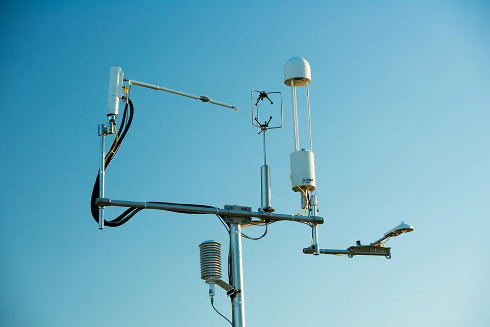
The LI-7700 Open Path CH4Analyzer is a rugged, low-power methane sensor designed for eddy covariance flux measurements in field environments. It uses wavelength modulation spectroscopy with an open optical path to measure ambient methane concentrations at high speed(up to 40 Hz), making it suitable for ecosystem and landscape‑scale emission studies. The instrument integrates with sonic anemometers and other high-speed gas analyzers to compute real‑time methane fluxes alongside momentum, heat, CO₂ and water vapor. Its low nominal power draw (≈4.5 W) and heated optics allow long‑term operation in remote locations, including solar‑powered deployments. Heated mirror and self‑cleaning features help maintain data quality in humid or variable conditions. The LI‑7700 synchronizes measurements with a precision timing protocol (PTP) for accurate flux calculations.
Technological maturity: Proven
Contracting type: For sale
Technology level: High
Place of origin: United States
Availability: Worldwide
Contact: WIPO GREEN Database
Thermistor strings (multi-sensor cables)
Geosense
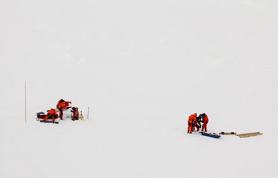
Geosense thermistor strings are multi-sensor cables used for long-term, high-precision temperature monitoring in harsh geotechnical environments. Each string consists of multiple negative temperature coefficient (NTC) thermistor sensors mounted along a multi-core cable, providing a temperature profile over depth. Sensor number, spacing and cable length can be customized to meet specific project requirements. NTC thermistors decrease in resistance as temperature rises, with high sensitivity (>4 percent per °C) that allows detection of very small temperature changes. Temperature is derived using the Steinhart–Hart equation, converting measured resistance into degrees Celsius. Readings can be collected manually with an ohmmeter or display units like the VW2106 or MP12, or automated through a data acquisition system. Thermistor strings are widely used in permafrost, slope and embankment monitoring, where they capture subsurface thermal dynamics essential for understanding thaw, stability and hydrological processes.
Technological maturity: Proven
Contracting type: For sale
Technology level: High
Place of origin: United Kingdom
Availability: Worldwide
Contact: WIPO GREEN Database
Pile foundation technology
PND
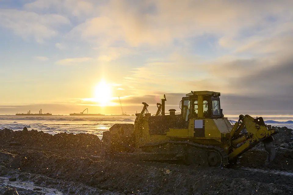
SPIN FIN piles are an innovative pile foundation technology with angled fins that increase capacity and stability, allowing shorter, stronger piles that perform well even in challenging soils and variable ground conditions, like those found in permafrost terrains. This foundation approach helps support structures without extensive deep excavation or disturbance to the ground, which can help minimize environmental impact in sensitive alpine or cryosphere settings by reducing soil disruption and preserving stability. They are designed to improve load capacity and resilience of foundations, especially in soft or unstable soils, which is useful where permafrost thaw and uneven ground conditions might pose risks.
Technological maturity: Proven
Contracting type: For sale
Technology level: High
Place of origin: United States
Availability: Worldwide
Contact: WIPO GREEN Database
Frontier technology solutions
Permafrost monitoring system
wanwave
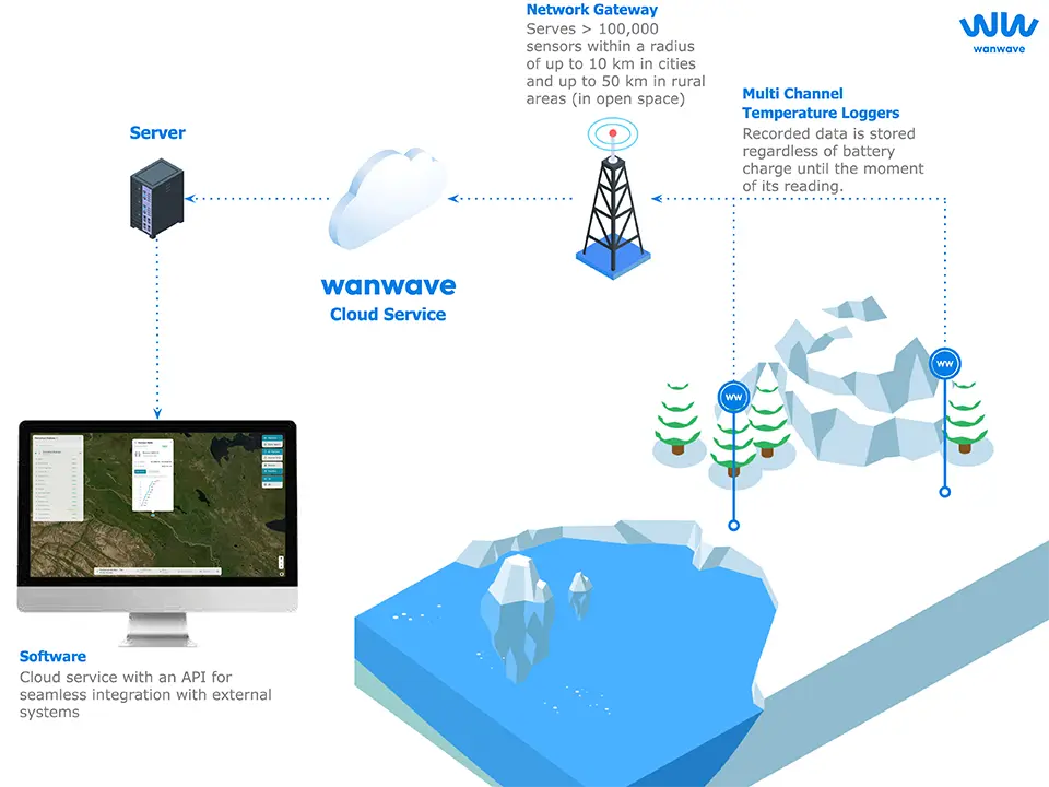
wanwave’s permafrost monitoring system continuously tracks ground temperature, active layer thickness and permafrost stability to detect thaw and assess ground conditions in real time. Its autonomous sensors, powered by long-life batteries, can transmit up to 50,000 messages over five years. Data are sent via network gateways, such as the Network Gateway WNG-20 and M15-2, which manage communication between sensors and the wanwave server. Key hardware also includes multichannel temperature recorders for precise thermal monitoring. The system helps protect infrastructure like roads, buildings and pipelines by identifying permafrost degradation and ground subsidence. It integrates via application programming interfaces (APIs) with environmental monitoring networks, climate models and decision-support systems, enabling centralized analysis and trend forecasting. Overall, the platform combines autonomous sensing, reliable data transmission and analytical integration to improve understanding of permafrost dynamics and enhance infrastructure resilience.
Technological maturity: Frontier
Contracting type: For sale
Technology level: High
Place of origin: United Kingdom
Availability: Worldwide
Contact: WIPO GREEN Database
Remote permafrost sensing sensor and software using machine learning
Kryotek Arctic Innovation Inc.
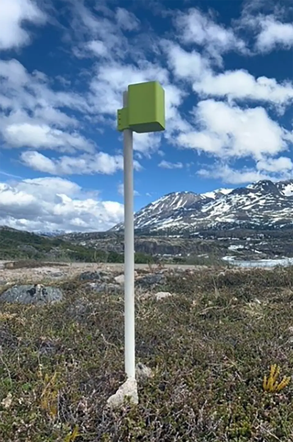
FrostLink is a permafrost monitoring system that determines whether the ground is thawed or frozen without relying on temperature measurements. Using machine learning, it predicts and measures permafrost thaw, sending automatic alerts to users if excessive thaw occurs. Its proprietary technology delivers simple, clear outputs – “thawed” or “frozen” – requiring no scientific interpretation or complex data management. The system is designed for easy deployment, with sensors installed in minutes using basic tools, and batteries and data loggers lasting up to 10 years. FrostLink serves multiple sectors, including mining, construction, climate research and shipping, enabling monitoring of infrastructure, seasonal frost, ice roads, snow roads and river crossings. By combining predictive analytics with straightforward alerts, it allows industries and researchers to respond quickly to permafrost changes.
Technological maturity: Frontier
Contracting type: For sale via procurement agreements and project-based contracts
Technology level: High
Place of origin: Canada
Availability: Worldwide
Contact: WIPO GREEN Database
Ground-cooling technology
Stabilice Frozen Foundation Systems
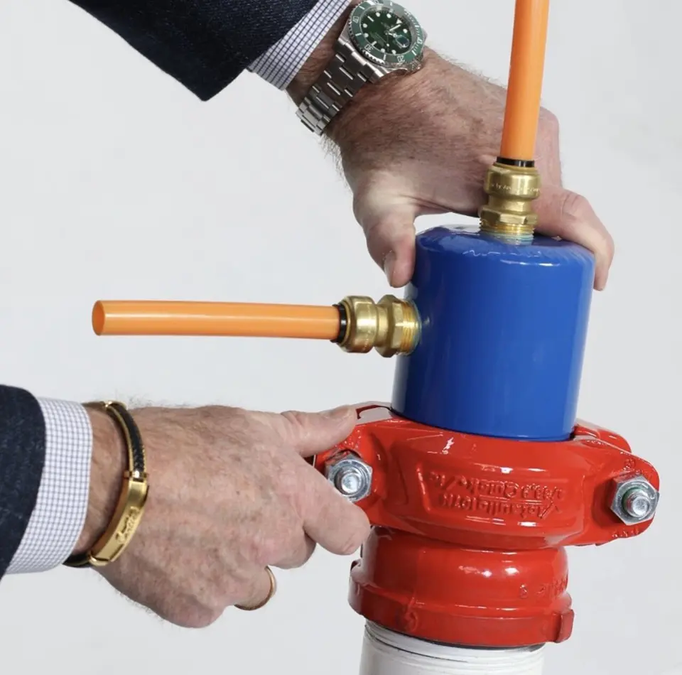
Stabilice™ is a ground-cooling foundation technology designed for infrastructure built on permafrost or frozen soils. It actively controls soil temperature beneath structures to prevent thawing caused by climate change, which can lead to instability, settlement and structural damage. By maintaining a stable freeze–thaw boundary, the system preserves soil strength and reduces risks such as uneven foundations or water accumulation. Unlike traditional passive methods, Stabilice uses adaptive cooling to respond to changing environmental conditions. This approach can significantly lower construction and maintenance costs for Arctic and sub-Arctic infrastructure. Overall, it provides a practical engineering solution to extend the lifespan and safety of buildings in regions where warming temperatures threaten ground stability.
Technological maturity: Frontier
Contracting type: For sale
Technology level: High
Place of origin: United States
Availability: Worldwide
Contact: WIPO GREEN Database
Gas concentration analyzer (with CRDS)
Picarro
Picarro G2307 gas concentration analyzer is a high-precision CRDS instrument that continuously measures methane (CH4), formaldehyde (H2CO) and water vapor (H2O) with real-time data and parts-per-billion sensitivity. It uses coated internal pathways to minimize adsorption and improve response time, and offers field-deployable stability with minimal calibration needs, supporting research on GHGs and emissions in both laboratory and remote settings.
Technological maturity: Frontier
Contracting type: For sale
Technology level: High
Place of origin: United States
Availability: Worldwide
Contact: WIPO GREEN Database
Photoacoustic GHG analyzer
Gasera
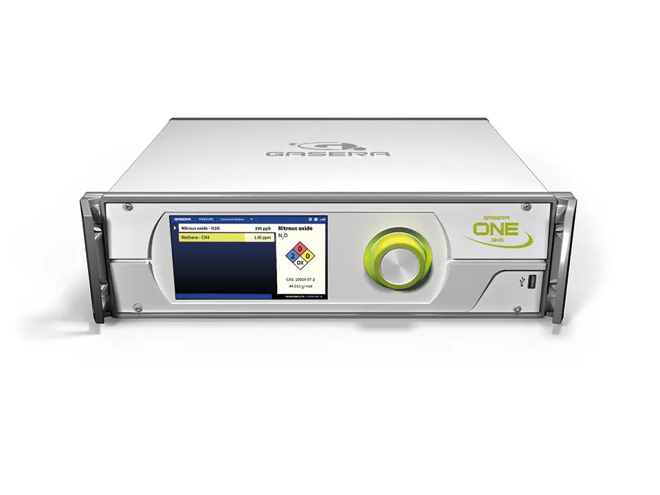
The Gasera ONE GHG analyzer is a high-sensitivity instrument designed to measure ambient methane (CH4) and nitrous oxide (N2O) using cantilever-enhanced photoacoustic spectroscopy combined with a mid-infrared quantum cascade laser (a highly sensitive technique that shines a special laser on a gas and detects tiny responses to measure trace amounts of GHGs). This method produces low-parts-per-billion detection limits, stable operation and a recommended 12-month recalibration interval, supporting continuous field and laboratory monitoring of GHG concentrations. The Gasera ONE GHG detects methane and other GHGs at very low concentrations, making it ideal for subtle permafrost emissions. Its compact design allows deployment in cold, remote environments, including stationary, mobile or UAV-mounted setups. Continuous, real-time measurements capture seasonal and spatial variability, supporting permafrost carbon-cycle research and monitoring thaw-driven gas release.
Technological maturity: Frontier
Contracting type: For sale
Technology level: High
Place of origin: Finland
Availability: Worldwide
Contact: WIPO GREEN Database
UAV-mounted laser methane sensor
Shenzhen BLV Technology Co., Ltd.
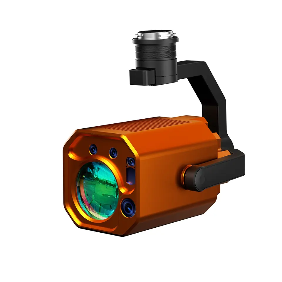
The BLV BL‑CH4 400 is a lightweight UAV‑mounted laser methane sensor that uses Tunable Diode Laser Absorption Spectroscopy (TDLAS) to detect methane and methane‑containing gases from substantial distances without contact. It integrates a laser emitter, receiver, indicator, RGB camera and rangefinder on a stabilized 3-axis gimbal, enabling real‑time, non‑contact scanning from up to ~300 m with sensitivity around 1 ppm·m and rapid response (~5 ms). The unit records methane (CH₄) concentrations and locations with GPS/coordinate support, suitable for aerial surveys, oil & gas inspection, environmental monitoring, and emissions hotspot detection in remote or hazardous areas where ground access is difficult. Compatible platforms include DJI Matrice 350/400 drone series, and cloud platform/app software supports data visualization and mission planning.
Technological maturity: Frontier
Contracting type: For sale
Technology level: High
Place of origin: China
Availability: Worldwide
Contact: WIPO GREEN Database
Portable, handheld multi-gas analyzer (used with a chamber)
Cubic Instruments
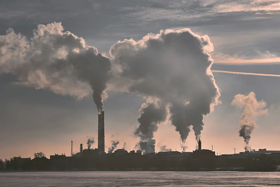
Cubic Instruments’ Gasboard-3800GHG Portable Greenhouse Gas Emission Analyzer is a handheld multi-gas instrument that uses micro-flow non-dispersive infrared (NDIR) dual-chamber sensor technology to continuously measure GHGs, including methane (CH4), carbon dioxide (CO2) and nitrous oxide (N2O), along with carbon monoxide (CO) and oxygen (O2), with ranges down to ~200 parts per million and accuracy up to ~±1 percent full scale range (relative to the sensor’s maximum calibrated range). It features an integrated heated sampling probe and portable pretreatment system, with digital/analog outputs and good resistance to cross-interference and moisture drift, making it suitable for field measurements of emissions flux in soils or localized sources.
Technological maturity: Frontier
Contracting type: For sale
Technology level: High
Place of origin: China
Availability: Worldwide
Contact: WIPO GREEN Database
Horizon technology solutions
Experimental permafrost wind turbine cooling device
Guangxi University and Guangxi Minzu University (Qin et al., 2023)
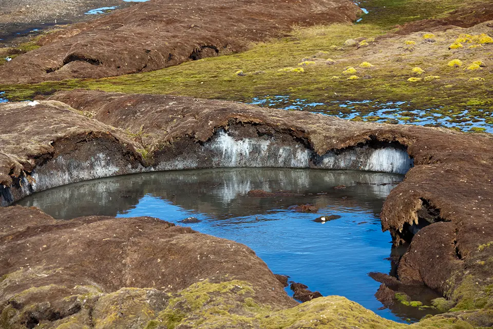
A new experimental permafrost cooling device uses a wind turbine to circulate a liquid coolant between the cold air and the ground, actively removing heat from the subsurface. Field trials on the Tibetan Plateau showed it cooled underlying frozen soil by about 0.6–1.0°C over two years. A phase-change-material (PCM) clutch automatically controls operation: it engages in cold conditions to enable cooling and disengages in warm periods to prevent heat gain. Field data show seasonal and daily cycling; the system is most active in winter (especially January–February), while in summer it enters “hibernation” with minimal circulation. Temperature differences between inner and outer tubes confirm when heat is actively extracted from the soil. The system is still in the experimental phase but demonstrates how renewable energy can directly influence permafrost thermal regimes.
Technological maturity: Horizon
Contracting type: Under development
Technology level: High
Place of origin: China
Availability: Under development
Contact: WIPO GREEN Database
Solar-powered thermal stabilization systems
Environmental Engineering Institute (IIE), Laboratory of Cryospheric Sciences (CRYOS), Ecole Polytechnique Fédérale de Lausanne (EPFL) (Sharaborova, 2025)Sharaborova, Elizaveta (2025). Stabilizing permafrost with solar-powered cooling systems. Nature Reviews Earth & Environment, 6(2), 85.
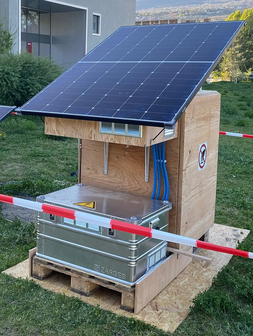
Researchers are developing solar-powered cooling systems designed to stabilize permafrost beneath infrastructure. The concept combines solar energy generation (photovoltaics) with active or hybrid cooling methods (e.g., heat pumps, thermosyphons or fluid circulation) to extract heat from the ground and maintain frozen conditions. Unlike purely passive systems, these approaches can operate even when natural temperature gradients are insufficient, improving reliability under warming climates. The systems are typically integrated into infrastructure such as roads, railways and foundations, where permafrost thaw threatens structural stability. This technology remains largely at the experimental or early deployment stage.
Technological maturity: Horizon
Contracting type: Under development
Technology level: High
Place of origin: Switzerland
Availability: Under development
Contact: WIPO GREEN Database