
The ocean is not a simply victim of climate change – it is the planet’s strongest defense system. It has protected humanity from the brunt of global warming by absorbing more than 90 percent of the excess heat trapped by greenhouse gases (GHGs) and roughly a quarter of the carbon dioxide (CO2) emitted by human activity. Since the early 1990s, ocean temperatures and heat content have steadily increased. And the pace of warming has nearly doubled over the past two decades, making it a clear indicator of accelerating global warming (
The ocean is not simply a victim of climate change – it is the planet’s strongest defense system
This chapter examines these interconnected pressures and the technologies emerging to better understand and respond to them. New tools are linking environmental monitoring, machine learning and automated systems in support of more adaptive approaches to ocean management. Sensor networks, satellites and autonomous vehicles are able to collect continuous data concerning ocean conditions, which feed digital twins and AI-based models capable of forecasting events such as marine heatwaves, coral bleaching or oxygen depletion weeks to months in advance. These forecasts can help guide restoration and create a continuous cycle between monitoring, prediction and action. Beyond monitoring and prediction, technologies are increasingly enabling large-scale ecosystem restoration. Robotics, AI and advanced materials are making coral propagation and habitat reconstruction more precise, scalable and data driven. Automated reef deployment systems, AI-guided site selection and engineered reef structures are helping restore degraded habitats, while improving survival rates and long-term ecosystem stability.
3.1 Ocean warming
Slowing global warming, but heating and stressing the seas
The ocean helps stabilize Earth’s climate by absorbing heat from the atmosphere, thereby moderating global temperatures. To grasp the sheer scale of heat stored in the ocean, consider this: between 1993 and 2022 the ocean absorbed more than 800 times the total amount of energy represented by all the electricity used in the United States in 2022 alone (

Heat absorption in the ocean is driven by two physical phenomena – albedo and specific heat capacity (
As ocean waters warm, they suffer various detrimental effects. First, warming reduces the amount of dissolved oxygen in seawater. This process is called deoxygenation and leads to the expansion of low-oxygen regions harmful to marine ecosystems. Rising temperatures also increase ocean stratification, meaning that the difference in temperature between surface and deeper waters differs more markedly. This “layering” effect limits vertical mixing, preventing nutrients trapped in deeper waters from circulating upward and supporting marine ecosystems (
Ocean on fire: marine and super marine heatwaves
A marine heatwave (MHW) is an extended period of unusually high ocean temperatures relative to the local climate. It is akin to a “heatwave in the ocean,” a sustained, abnormally warm event that lasts more than five consecutive days with temperatures above the 90thpercentile of the historical baseline (1 to 2 degrees Celsius higher than the seasonal average) (
Sea surface temperature (SST) refers to the warmth of the ocean’s upper layer, usually the top few meters. It is measured through satellite imagery, as well as direct observations taken from ships, drifting and moored buoys, and autonomous surface vehicles. Scientists have found that global average sea surface temperatures reached unprecedented highs in 2023, breaking historical records. The extreme and unusually persistent MHWs in 2023 were so powerful that researchers introduced the term “super-marine heatwaves” to describe sea surface temperatures in excess of the highest values recorded between 1982 and 2022 (
Extreme and unusually persistent marine heatwaves in 2023 were so powerful that researchers introduced the term “super-marine heatwaves”
Super-marine heatwaves were detected in many regions, including tropical and polar waters. The underlying causes for these record temperature levels are linked to long-term GHG warming, a shift to the warm phase of a Pacific–Atlantic–Arctic climate mode, and a transition from long-lasting La Niña conditions to a strong El Niño. Such extreme MHWs can stress ocean ecosystems and fisheries, coral reefs and marine life, while also influencing weather events such as storms.
Marine heat waves are a fast evolving area of research. At the National Oceanic and Atmospheric Administration (NOAA) Physical Sciences Laboratory, scientists are characterizing MHWs and learning how they form and dissipate in order to predict them better (
However, more research is necessary if we are to develop a better assessment of predictability – and understand the large-scale drivers both regionally and during different seasons. One key question is whether the climate models currently in use are able to simulate MHW mechanisms. Some researchers argue that a greater focus is needed on developing higher resolution global and regional models (
Underwater heat stress – coral, fish and ecosystems at risk
Ocean warming is the primary cause of coral bleaching, a phenomenon whereby corals expel symbiotic microscopic algae ( zooxanthellae) due to thermal stress and turn white (
In 2024, the International Coral Reef Initiative (ICRI) declared the fourth global coral bleaching event, and bleaching continues to intensify worldwide. Between January 2023 and March 2025, severe heat stress causing bleaching affected 84 percent of the world’s coral reefs. To put this into perspective, 21 percent of reefs were affected in 1998, 37 percent in 2010, and 68 percent between 2014 and 2017 (
Between January 2023 and March 2025, severe heat stress causing bleaching affected 84 percent of the world’s coral reefs
Warmer water alters organism metabolism by increasing oxygen demand (
Marine heatwaves render ecosystems more vulnerable to additional stressors, including the spread of non-native species. A decline in native species creates ecological gaps that can be quickly occupied by newcomers, and these species can become invasive when they take over available niches (
Ocean warming is a major driver of deoxygenation, because warmer water contains less dissolved oxygen. This is worsened by increased stratification, which limits mixing between surface and deeper waters and reduces nutrient exchange, disturbing marine food webs starting with phytoplankton and cascading up through higher trophic levels. In coastal areas, deoxygenation is also driven by eutrophication caused by excess nitrogen and phosphorus from agriculture, together with sewage and runoff, stimulating algal blooms. As the algae die and decompose, microbes consume oxygen, creating hypoxic (low-oxygen) and anoxic (no oxygen) zones that can be deadly for many species (
These changes do not just affect marine life; they influence global fisheries, weather patterns and carbon cycles, with real consequences felt by human communities and economies.
Building ocean resilience with robotics, AI and digital twins
Three clear trends are emerging across those technologies that address ocean warming, namely: automation, biological acceleration and predictive intelligence. First, automation and robotics are scaling reef monitoring and restoration. Autonomous underwater vehicles (AUVs), surface drones, AI-guided deployment systems and 3D scanning tools are replacing diver-based surveys and manual coral planting. These systems collect high-resolution data, plant corals precisely and monitor growth consistently, which speeds restoration and renders it more scalable.
Second, many solutions are focusing on actively rebuilding reef ecosystems rather than just observing decline. Techniques like coral gardening, micro-fragmentation, larval seeding, artificial reef substrates, electrified reef structures and modular reef systems are designed to accelerate coral growth, improve survival, stabilize damaged sea beds and enhance resilience to both warming and acidification. Some approaches even experiment with assisted evolution – or breeding new varieties, including gene editing designed to condition corals to tolerate higher temperatures.
There is a shift away from reactive conservation toward data-driven ocean restoration combining robotics, AI, predictive modeling and ecological engineering
Third, there is a clear shift toward early warning. As with disaster response (see the Green Technology Book Climate disaster response edition), there is a shift away from reactive conservation toward data-driven ocean restoration combining robotics, AI, predictive modeling and ecological engineering in support of marine ecosystems. These tools predict heat stress months in advance, detect biodiversity changes at the molecular level, and help guide where intervention will be most effective. High-resolution satellite monitoring, MHW forecasting, AI-based bleaching prediction, digital twin ocean models, acoustic monitoring and environmental DNA (eDNA, see Box 3.1 for explanation) sampling are enabling the near-real-time tracking of ocean conditions.
Digital twins of the ocean are virtual representations of marine systems that integrate satellite observations, sensor networks, AI, and ocean models to create a near-real-time simulation of the entire ocean. Emerging digital twin platforms incorporate autonomous sensing and advanced analytics to produce detailed 3D maps. Collaborative initiatives, such as the European Union (EU) Iliad project, aim to establish interoperable, data-intensive and cost-effective Digital Twins of the Ocean (DTOs). The Iliad DTOs combine a large volume of data to enable simultaneous communication with real world models, and integrate all existing EU Earth observing and modeling digital infrastructure and facilities to promote additional applications to be accessed at the Iliad Marketplace. They include plug-ins interfaces, raw data, citizen science data, and synthesized information. It is anticipated that Iliad DTOs will contribute to the achievement of the UN Ocean Decade (
Likewise, Fujitsu’s advanced digital twin system uses AUVs equipped with LiDAR, cameras and sensors to scan coral reefs and seaweed beds. Drones are able to collect data even in a strong current, which are then processed through AI models to identify organisms, map structures and estimate specific properties like carbon absorption (
Systems such as NOAA’s Coral Reef Watch use satellite data and physical climate models to calculate indicators such as HotSpot and Degree Heating Weeks in order to estimate bleaching risk (
The Allen Coral Atlas, managed by Arizona State University, illustrates how AI and satellite monitoring are together transforming coral reef conservation. Using machine learning and high-resolution satellite imagery, it has produced the first comprehensive map of benthic habitats and reef geomorphology, enabling managers to monitor reef condition at unprecedented scale (
Scaling ecosystem restoration and ecological engineering
Environmental DNA refers to genetic material shed by organisms into water, sediment or air. Sampling eDNA allows scientists to detect species presence, track biodiversity changes and monitor ecosystem health without the need to capture organisms directly. These analyses are therefore a quick and cost-effective way of detecting the presence of species and assessing wildlife communities and biodiversity (
Innovations are shifting coral restoration from small-scale conservation toward scalable, industrialized systems combining coastal engineering, robotics, AI, evolutionary biology and advanced materials
Automation and AI are transforming coral husbandry. The CHARM system automates coral care, with autonomous underwater robots feeding and monitoring farmed corals, and AI-guided vessels ensuring precise seeding and long-term tracking. Biological acceleration techniques, including microfragmentation, assisted evolution and coral paint (larval hydrogel combined with modular reef mesh), can speed coral growth and settlement. Complementary interventions, such as low-voltage electrified reef structures (Biorock) and mesh structures (e.g., Kajima Corporation), improve coral survival, promote natural recruitment and increase bleaching resistance.
Biorock works by passing a low-voltage electrical current through a submerged structure, thereby stimulating the deposition of limestone-like minerals from seawater and creating favorable conditions for coral attachment and skeletal growth. By facilitating calcium carbonate formation, proponents argue that corals can devote less energy to calcification and more to growth and recovery. Coral and other reef organisms on powered Biorock structures can grow 2–10 times faster than under natural conditions (
The Greeen Technology Book Adaptation edition features several innovative technologies for coral restoration. Reef balls, for example, are hollow concrete structures that reduce wave energy and create marine habitat. Archireef, working alongside researchers at the University of Hong Kong, is developing modular, 3D-printed terracotta reef tiles that mimic natural reef chemistry. See also the Green Technology Book Climate disaster response edition for more artificial reef technologies. A smaller technological frontier intervenes more directly using technologies, such as localized reef cooling pod system (oPod), or techniques to counter deoxygenation, such as experimental ocean reoxygenation using industrial by-products (see Innovation examples), though they remain at an early stage.
Environmental DNA (eDNA) refers to genetic material shed by organisms in the environment. Sampling eDNA allows scientists to rapidly detect species presence and monitor biodiversity. Applied Genomics (see Proven technology solutions) conducted a study to evaluate whether eDNA sampling could more effectively monitor biodiversity and detect ecosystem change compared to traditional scientific trawling methods (
Speculative ocean intervention: reoxygenation and upwelling
Artificial ocean reoxygenation is an emerging ocean intervention aimed at mitigating hypoxia and dead zones. It involves the intentional addition of oxygen to low-oxygen (hypoxic) or oxygen-depleted (anoxic) seawater, typically in areas where warming, nutrient pollution or stratification is reducing dissolved oxygen. While it has potential benefits – such as maintaining viable habitats for fish, plankton and benthic organisms, reducing harmful algal blooms and mitigating dead zones – it requires careful monitoring, deployment and long-term environmental assessment. Technologies include oxygen injection – often using oxygen co-produced from offshore hydrogen electrolysis – and mechanical or bubble-based oxygenation systems. Challenges include overcoming stratification to ensure oxygen reaches a necessary depth without causing harmful circulation effects. A key limitation is scale: although reoxygenation can be applied in localized hypoxic areas, the vast volumes of water involved make broader deployment across large marine ecosystems technically challenging and energy intensive. That the process is energy-intensive means it can also have unintended chemical impacts, for example, altered nitrogen, iron and sulfur cycles.
Artificial upwelling and downwelling are experimental ocean engineering approaches that bring deep, cold, nutrient-rich water to the surface (upwelling) or transport warm surface water to deeper layers (downwelling) in order to influence local temperature, nutrient availability and ocean circulation. Upwelling may enhance biological productivity and carbon uptake, while downwelling is being explored as a way of reducing local heat stress and delivering oxygen-rich surface water to deeper waters. However, these approaches remain at an early research stage, with effectiveness, scalability and the potential ecological side-effects uncertain.
Tracking marine wildlife in a warming ocean
Ocean warming is affecting marine life in three major ways: first, by shifting species distribution; second, by altering performance and survival; and third, by changing food webs and ecosystem interactions.
Ocean warming is reshaping species distribution, migration patterns and ecosystem interactions
Salmon is cold-water fish that spends part of its life in rivers and part in the ocean. It is widely regarded as a sentinel species – an early indicator of broader ecosystem change and climate impacts – because it depends on not only on freshwater, but also coastal and open-ocean ecosystems throughout its life cycle (
Large whales are also indicators of climate impacts on marine ecosystems, because migration is closely tied to the distribution of prey and broader oceanographic conditions (
Similar climate-related changes have been observed in humpback whales. Long-term climate tracking reveals that warming ocean temperatures, MHWs and disappearing polar sea ice are directly degrading humpback whale habitats (
Tuna are highly sensitive to ocean temperature and oxygen conditions, making them particularly responsive to ocean warming and MHWs. With suitable habitats shifting, tuna distribution, migration routes and fishing grounds are changing across many ocean regions. Warming oceans are also driving a poleward shift in tuna distribution and altering the location of productive fishing grounds, with implications for national fisheries, coastal economies and international fisheries governance.
These examples illustrate how ocean warming is reshaping species distribution, migration patterns and ecosystem interactions. In response, a growing suite of technologies is being developed to monitor temperature, animal movements, behavior, health and ecosystem change. Increasingly, marine animals themselves are becoming part of ocean observing systems through electronic tags to record movement, depth, temperature and habitat use, turning animals into mobile ocean sensors. Autonomous vehicles and smart sensors are enabling the continuous near-real-time monitoring of marine ecosystems. AI is transforming marine monitoring by automating the identification of species, analyzing acoustic recordings and imagery, detecting animals in satellite observations, and forecasting ecosystem change at a large scale. Modern monitoring platforms combine satellite observations, underwater acoustics, environmental DNA, oceanographic sensors and AI analytics into integrated systems.
Increasingly, marine animals themselves are becoming part of ocean observing systems through electronic tags that record movement, depth, temperature and habitat use, turning animals into mobile ocean sensors
Whales, dolphins and other marine mammals communicate acoustically. New marine mammal acoustic monitoring systems use hydrophones, AI-powered sound recognition and real-time species detection to identify whale presence, migration changes and behavioral responses to warming and shipping noise (Box 3.2). Acoustic telemetry tracks fish movements through acoustic tags attached to fish such as salmon, tuna, cod and shark. Networks of underwater receivers are then able to track migration routes and monitor changes in spawning behavior.
Unmanned aerial vehicles and remotely operated vehicles (ROVs) – already used for ocean monitoring – also collect valuable data on marine life. This enables monitoring in remote areas, while reducing the disturbance associated with diver-based surveys. Increasingly, cameras rather than people are monitoring marine life, contributing to fish counting, species identification, health monitoring and stress detection, and migration analysis. Commercial platforms such as Ocean Infinity use autonomous robotic vessels to collect large-scale ocean and habitat data.
These tools are complemented by whale-specific detection and warning systems to reduce vessel strikes and other human–wildlife conflicts. For tuna, researchers and fisheries managers use AI-enabled distribution models and dynamic ocean management systems to track movement and plan conservation efforts. They also use satellite-linked echo-sounder buoys, a fishing technology originally designed to help fishing fleets locate tuna. These buoys are now being repurposed into low-cost real-time ocean biodiversity monitoring systems (
The MRI Whale Unit is a leading African cetacean research program based at the University of Pretoria. Since 2021, the Unit has deployed satellite-linked telemetry tags on southern right whales to track migration routes, feeding areas and responses to climate-driven changes in the Southern Ocean. Each tag can transmit location data for up to a year, providing insights into whale movements across ocean regions. More recently, the program has deployed CTD (conductivity–temperature–depth) tags, transforming whales into mobile ocean-observing platforms. In addition to tracking whale movements, these tags collect data on water temperature, salinity and diving depth, generating oceanographic observations from remote regions that are difficult and costly to monitor using ships or fixed instruments. The project combines satellite telemetry, animal-borne sensors, GIS mapping and oceanographic monitoring to improve understanding of whale ecology and climate impacts. It is conducted through international collaboration involving NOAA, the University of Washington, MarEcoTel and other research partners.
Source:
Reforesting the ocean: kelp under climate stress
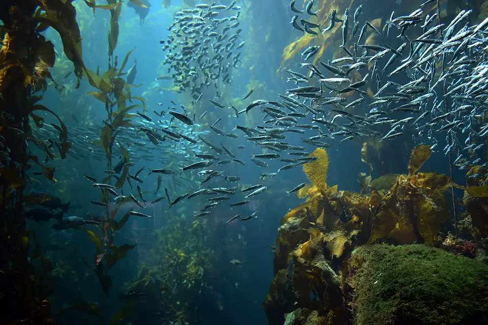
Kelp forests occur along approximately 25 percent of the Earth's coastline, providing habitat, food and ecosystem services that support a wide range of marine species (
Warming reduces the quantity of cold and nutrient-rich water on which kelp depends. Rising ocean temperatures and MHWs reduce growth, cause tissue degradation and incur large-scale loss. Ocean warming has already led to local extinction and range contraction in many kelp species, particularly at lower latitudes where kelp populations are most vulnerable to thermal stress. Indirect effects include increased sea urchin grazing, competition from turf algae and invasive species, altered nutrient availability and changes in disease and ecological interaction, further accelerating decline (
Kelp forest restoration is consequently a rapidly growing global field with a history spanning more than 300 years and projects in at least 16 countries (
Māra Moana, a kelp restoration initiative in Whakaraupō (Lyttelton Harbour), New Zealand, aims to respond to the marine heatwaves that have been the cause of a widespread loss of native kelp forests. The project combines ecological restoration, Indigenous stewardship and climate adaptation by reseeding native giant kelp ( rimurimu), removing invasive species and developing climate-resilient kelp strains better able to withstand warming oceans. Led by researchers at the University of Otago in partnership with Ngāi Tahu communities, the project is also creating practical restoration toolkits for local communities to support the long-term recovery of kelp ecosystems and the biodiversity, fisheries habitat and ecosystem services they provide.
Scaling seagrass recovery
Like kelp forests, seagrass meadows are foundation ecosystems that support biodiversity, fisheries and coastal protection. They are also among the planet's most important blue-carbon ecosystems, capable of sequestering carbon at rates that exceed those of many terrestrial forests and storing it in sediments for centuries to millennia (
Unlike some marine ecosystems that may experience localized gains and losses, a 2023 global modeling study found a net decline in seagrass abundance and diversity across all climate scenarios examined, indicating that warming oceans pose a serious threat to seagrass ecosystems globally (
Seagrass meadows are among the world's most important blue-carbon ecosystems, capable of sequestering carbon at rates that exceed those of many terrestrial forests and storing it in sediments for centuries to millennia
Restoration efforts such as seagrass transplantation, water-quality improvement, marine protected areas and community-based monitoring have demonstrated that degraded meadows can recover once key stressors are reduced. Unlike kelp restoration, which focuses on rocky reefs and open water out planting, seagrass technologies are engineered to handle soft, muddy or sandy sediment and meet the challenges of harvesting underwater flowering grass seeds. Manually picking reproductive shoots underwater is tiring, which limits large-scale restoration. New technologies automate the first step in this process. Towed seabed harvesters glide along the seafloor on skids, cutting seed-bearing shoots and transporting them to the surface using a gentle suction system, potentially increasing seed collection rates by up to 100-fold compared with manual diver collection.
Recent innovation is increasingly focused on mechanizing the entire restoration process from seed collection and processing to storage, planting and site stabilization (
Technologies that restore former ecological conditions rather than plant seagrass directly are also gaining traction. They include sand capping to stabilize sediments, biodegradable matting to reduce erosion and improve seedling establishment, and hydrodynamic shields that reduce the wave and current stress on restoration sites (
Innovation examples
Forecasting bleaching before it begins in Florida
University of Miami, Florida
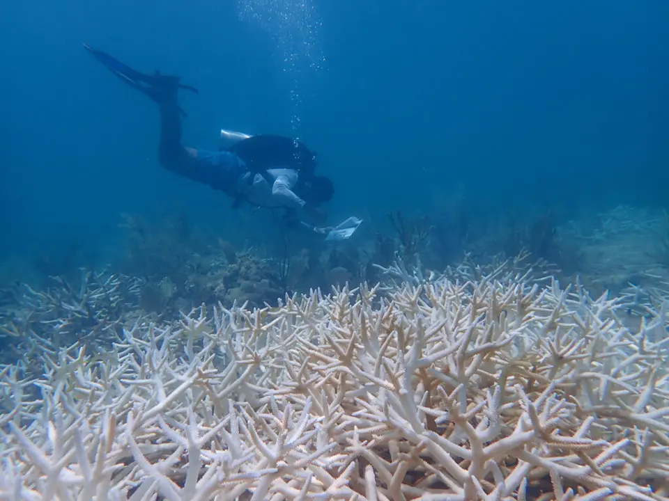
Florida and Caribbean reefs are undergoing increasingly frequent heat-stress events. These are causing coral bleaching, prompting an urgent need for early warning tools. Scientists at the University of Miami have developed an AI model for forecasting moderate heat stress along Florida’s Coral Reef up to six weeks in advance, with predictions generally accurate within one week. The machine learning model, XGBoost, was employed at three reef sites using environmental data from 1985–2024, including sea surface temperature anomalies, accumulated heat metrics, air temperature, wind, solar radiation and larger oceanic indicators like the Loop Current and El Niño conditions. Researchers also used explainable AI methods, which identify the factors most influencing model predictions, to determine which environmental variables most strongly influenced each prediction, allowing them to analyze how the drivers of heat stress vary according to reef location and forecast lead times. Surface air temperature consistently emerged as one of the most influential predictors in the model. The researchers emphasize that while this tool will not replace large, operational systems like NOAA’s Coral Reef Watch it complements them by providing local guidance to reef managers and restoration practitioners in planning and response efforts (
Reviving coastal waters with hydrogen byproducts
Lhyfe, Flexens, Department of Ecology, Environment and Plant Sciences (DEEP) at Stockholm University
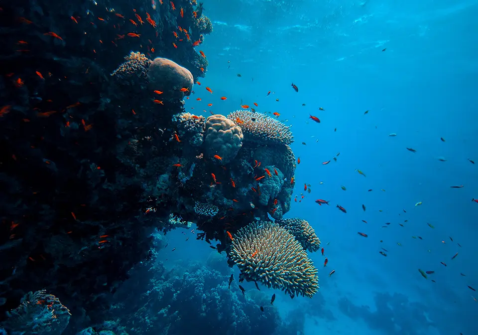
Oceans have been losing oxygen in recent decades due to warming and water pollution. Nutrients in coastal runoff cause excessive algae growth. Bacteria breaking down these algae consume oxygen, creating hypoxic conditions associated with eutrophication. With low oxygen, bacteria release phosphorus stored in sediments, promoting new algae growth and continuing the cycle. Reintroducing oxygen into these dead regions is being explored in the Baltic Sea Oxygenation and Super Green Hydrogen Economy (BOxHy) project launched by Lhyfe, Flexens and Stockholm University in 2023. As a green hydrogen producer, Lhyfe plans to produce hydrogen alongside offshore wind farms, using water electrolysis. During water electrolysis, water molecules are split to produce hydrogen and oxygen, the latter of which can be injected into hypoxic waters to restore dissolved oxygen and support marine life. A pilot assessed 19 coastal sites in the Baltic Sea for suitability. A follow-on pilot, BOxIn (Baltic Sea Pilot for Pure Oxygen Injection), is planned for a duration of six years, including baseline monitoring, multi-year oxygen injection, and post-project observation. Backed by the UN Ocean Decade, the project fosters collaboration between industry and academia and engages European marine enrichment initiatives. BOxHy/BOxIn represents one of the first structured attempts to adapt industrial oxygen co-production and strategic site selection for long-term marine ecosystem restoration (
Repurposing fisheries technology ocean and community resilience
Satlink
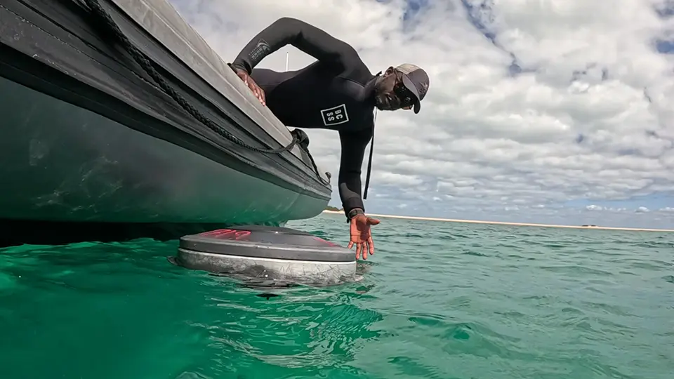
Satlink’s ReCon (Recovering and Connecting Habitats) initiative demonstrates how existing technology can be repurposed to support marine conservation and restoration. Satlink’s smart echosounder buoys were originally developed for the tuna fishing industry. They use acoustic sensors to estimate fish biomass underneath fish aggregating devices. Through ReCon, recovered devices are reconditioned and adapted to new environmental, scientific and social applications. Active across 25 countries and territories and covering more than 75,000 km of coastline, the project works with local partners to adapt the buoys to the needs of each region. Some of these applications are particularly relevant to ocean warming. In Mozambique, Project ReCon partnered with the Bazaruto Center for Scientific Studies (BCSS) to integrate the buoys into its Ocean Observatory, supporting long-term monitoring of ocean temperature, seawater chemistry, ocean acidification and marine biomass. In Pacific Island communities, the same technology can be deployed on anchored fish aggregating devices used by artisanal fishers. As warming waters and changing ocean conditions affect the distribution of tuna and other pelagic species, the buoys can provide information on fish biomass, position and oceanographic conditions, helping fishing communities adapt while also contributing valuable ocean observations(
China and Mauritius are working together to protect coral reefs through real-time monitoring
Huawei (Mauritius) Technology Co., Ltd; EcoMode Society
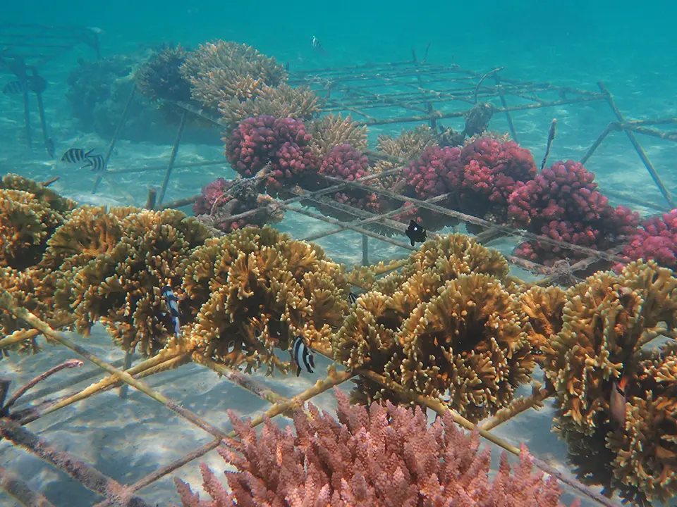
As part of Huawei's TECH4ALL initiative, Chinese and Mauritian partners have implemented a digitally connected coral restoration system enabling the continuous, real-time monitoring of underwater coral nurseries. Developed with digital technologies provided by Huawei (Mauritius) Technology Co., Ltd., the system integrates underwater cameras and environmental sensors to monitor coral growth, water quality, surrounding environmental conditions, marine biodiversity and potential threats such as coral predators. Solar-powered offshore platforms enable the continuous operation of monitoring equipment deployed at multiple depths. Images and sensor data are transmitted via 4G/5G connectivity to a cloud platform, where they are processed and analyzed in near real-time, allowing restoration teams to remotely observe coral health and intervene rapidly without the need for frequent diving inspections. By reducing underwater fieldwork while improved response speed, the system increases the efficiency of coral cultivation and transplantation. Since the project began in 2020, more than 25,000 coral fragments have been propagated and then transplanted onto degraded reefs at Pointe-aux-Feuilles, helping restore one of Mauritius's most biodiverse reef systems. Monitoring data are also shared with researchers to improve the understanding of coral bleaching, ecosystem dynamics and marine biodiversity (
The following collection of technologies is divided into three groups: Proven technologies have been on the market for some time and hence are well tested, Frontier technologies are available but relatively new, while Horizon technologies are close to being available but still under development.
Proven technology solutions
eDNA-based marine ecosystem monitoring
Applied Genomics
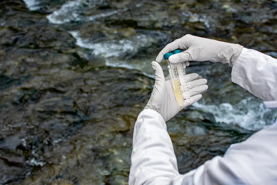
Applied Genomics develops environmental DNA (eDNA) technologies enabling non-invasive biodiversity monitoring and ecological assessment in terrestrial, freshwater and marine environments. The company develops proprietary eDNA sampling kits and large-volume water filtration systems designed to capture genetic material shed by organisms into the environment (e.g., seawater). Samples are then analyzed in a lab using genomics and bioinformatics to detect species presence, community composition and changes in biodiversity with high molecular precision. This approach is especially powerful in marine settings, where eDNA can reveal fish, invertebrate and mammal diversity more comprehensively and efficiently than traditional methods like trawling or visual surveys. Applied Genomics’ technology also supports long-term time-series monitoring, invasive species surveillance, marine protected area assessment and other applications informing conservation, sustainability reporting and environmental management.
Technological maturity: Proven
Contracting type: For service
Technology level: High
Place of origin: United Kingdom
Availability: Worldwide
Contact: WIPO GREEN Database
High-resolution model
National Oceanic and Atmospheric Administration (NOAA)
Coral Reef Watch (CRW) is a program run by NOAA providing near-real-time monitoring and forecasting of sea surface temperatures and coral bleaching risk worldwide. Its satellite-based system tracks ocean temperatures, heat stress and the anomalies that can trigger coral bleaching events. CRW uses satellite remote sensing and ocean models to generate high-resolution maps of thermal stress over coral reef areas. It produces Degree Heating Weeks (DHW) metrics that quantify cumulative heat stress and predict the likelihood of bleaching. Data is accessible online, allowing reef managers, scientists and policymakers to take timely decisions such as restricting human activity or prioritizing restoration interventions.
Technological maturity: Proven
Contracting type: Open access
Technology level: High
Place of origin: United States
Availability: Worldwide
Contact: WIPO GREEN Database
Coral seeding and CRIBs
Secore international
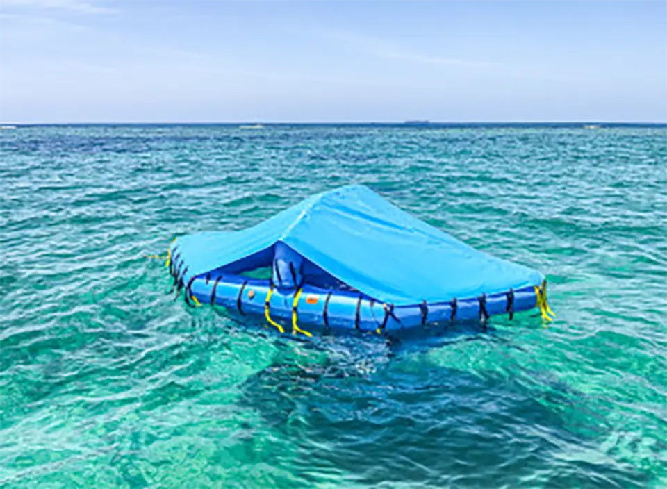
SECORE International develops innovative coral reef restoration technologies that accelerate reef recovery. Its flagship approach, Coral Seeding, collects coral spawn during natural mass spawning events, fertilizes eggs and sperm, and rears larvae under controlled conditions. Larvae are then settled onto specialized substrates, such as tiles or self-stabilizing units, before being out planted onto degraded reefs. To reduce costs and increase scalability, SECORE pioneered Coral Rearing In-Situ Basins (CRIBs) that allow coral larvae to grow and settle directly in the ocean, minimizing reliance on land-based nurseries. Supporting tools, including Coral Trees and custom settlement substrates, improve survival rates and simplify large-scale deployment. By combining methods, SECORE is able to restore coral genetic diversity and resilience. The technology is shared globally with partners, making coral restoration more efficient, scalable and scientifically grounded.
Technological maturity: Proven
Contracting type: For collaboration and partnership
Technology level: Medium
Place of origin: United States
Availability: Worldwide
Contact: WIPO GREEN Database
Passive acoustic monitoring system
Jasco
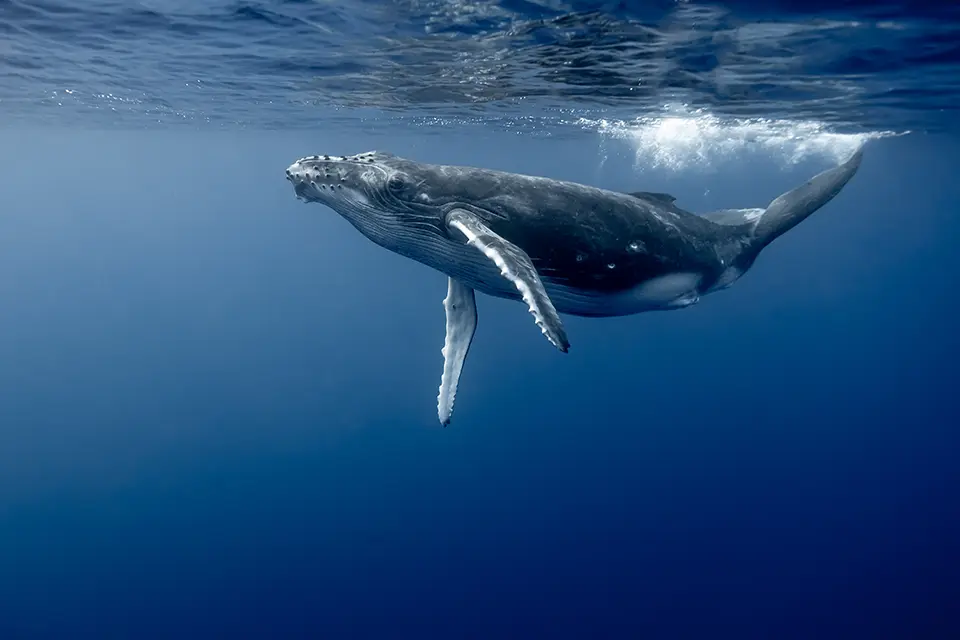
OceanObserver is a real-time passive acoustic monitoring system developed to detect and monitor marine mammals, including whales, using underwater sound. The system combines hydrophones with onboard processing software that analyzes acoustic data directly on autonomous vehicles, buoys and other ocean platforms. By detecting whale vocalizations as they occur, OceanObserver can provide near-real-time information on whale presence and movement (even in remote areas), at night or during poor weather when visual surveys are difficult. The technology supports marine conservation by helping researchers understand habitat use and migration patterns, while also enabling shipping, offshore energy and other marine activities to reduce the potential impact on whales.
Technological maturity: Proven
Contracting type: For sale
Technology level: High
Place of origin: Canada
Availability: Worldwide
Contact: WIPO GREEN Database
Marine robotics and autonomous ocean monitoring platform
Ocean Infinity
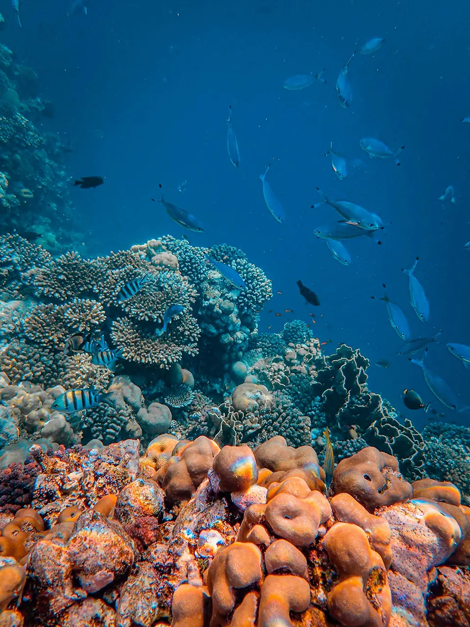
Ocean Infinity is a marine robotics company that develops and operates fleets of autonomous and remotely operated ocean vehicles for large-scale marine data collection. Its technology ecosystem combines uncrewed surface vessels (USVs), AUVs, ROVs, advanced sensors, AI-enabled data processing and shore-based command centers. Through its Armada fleet, robotic vessels can be operated remotely and deploy underwater robots to collect geophysical, environmental, hydrographic and oceanographic data in deep and remote ocean regions. Ocean Infinity's purpose-built software enables the real-time command and control of robotic systems from onshore operations centers, reducing the need for large crews at sea, while extending monitoring coverage and endurance. The platform supports applications ranging from seabed mapping and ocean exploration to environmental monitoring and marine ecosystem assessment.
Technological maturity: Proven
Contracting type: For service
Technology level: Medium
Place of origin: United Kingdom
Availability: Worldwide
Contact: WIPO GREEN Database
Drone-based whale health monitoring system
Ocean Alliance
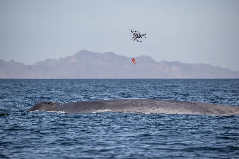
SnotBot is a drone-based whale health monitoring system. The technology uses modified consumer drones equipped with sterile collection plates that fly through a whale's exhaled blow (or "spout") to collect respiratory samples without disturbing the animal. Samples contain valuable biological information, including DNA, hormones, microbiomes and other indicators of health, stress, reproduction and exposure to environmental pressures. In addition to sample collection, SnotBot drones can be used for photogrammetry, body-condition assessment, tagging and disentanglement operations. By replacing more invasive methods, such as tissue biopsies, the system enables the safer and more frequent monitoring of whale populations at a lower cost.
Technological maturity: Proven
Contracting type: For service
Technology level: Medium
Place of origin: United States
Availability: Worldwide
Contact: WIPO GREEN Database
Large-scale kelp restoration system
SeaForester
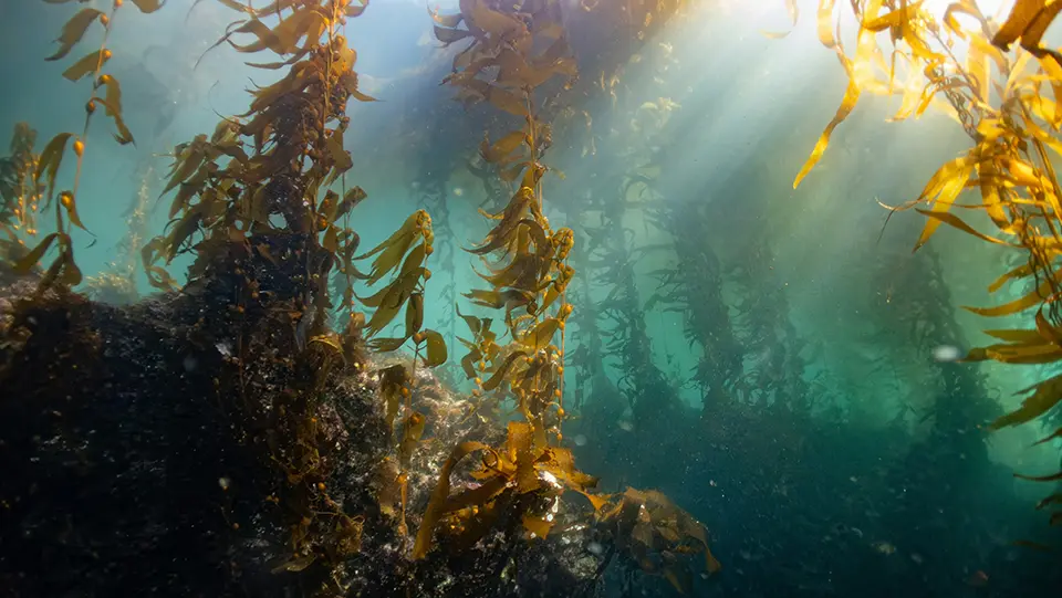
SeaForester is a large-scale kelp restoration approach combining seaweed nurseries with “seaforestation” techniques to re-establish degraded kelp forests. The system works by cultivating kelp spores on small stones (“green gravel”) under controlled conditions and then deploying them onto degraded reefs, where the kelp continues to grow, reproduce and gradually rebuild underwater forests. SeaForester complements restoration with monitoring and community-based implementation, aiming to restore biodiversity, strengthen fisheries, improve water quality, enhance carbon sequestration and increase ecosystem resilience. The approach is designed to be low-cost, scalable and adaptable to different regions through mobile seaweed nurseries and climate-resilient kelp strains.
Technological maturity: Proven
Contracting type: For service
Technology level: Medium
Place of origin: Portugal
Availability: Portugal, Norway
Contact: WIPO GREEN Database
Biorock (electrified reef) technology
Gili Eco Trust
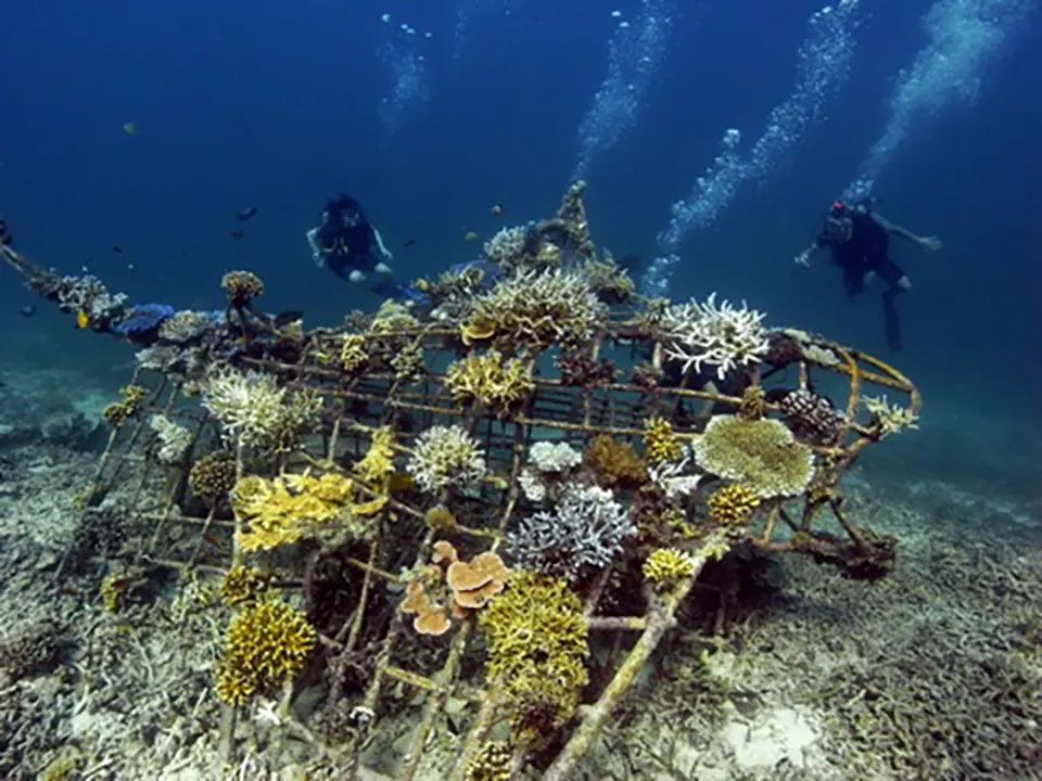
Gili Eco Trust employs Biorock® technology, a reef restoration method that uses low-voltage electrical currents passed through underwater steel structures to accelerate coral growth and ecosystem recovery. Originally developed by Prof. Wolf Hilbertz and Dr. Thomas J. Goreau, the process relies on electrolysis in seawater, which causes dissolved minerals like calcium carbonate to precipitate and coat a metal framework, creating a limestone-like substrate ideal for coral attachment and growth. Coral fragments are then attached to these structures, where they grow up to 2–8 times faster than on a natural reef surface and have a much higher survival rate, even during thermal stress and bleaching events. Biorock reefs also provide habitat for fish, sponges and other marine life, and can help protect shorelines by dissipating wave energy. The technology is powered safely using low electricity, increasingly sourced from renewable energy like marine turbines, making it sustainable and replicable in remote coastal locations.
Technological maturity: Proven
Contracting type: For collaboration and partnership
Technology level: Medium
Place of origin: Indonesia
Availability: Worldwide
Contact: WIPO GREEN Database
Smart enhanced reefs (SERs)
Underwater Gardens International
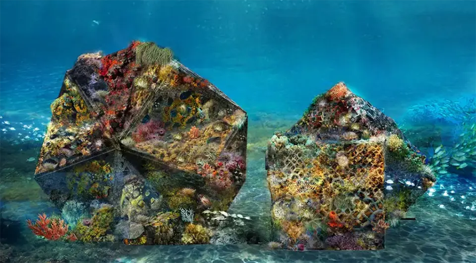
Underwater Gardens International develops ocean regenerative solutions designed to restore damaged marine ecosystems and boost biodiversity in support of climate resilience. Its core innovation is the Smart Enhanced Reef (SER®), a modular artificial reef system designed using ecological data and proprietary reefhopper® software. Rather than using a standard reef structure, SER® installations are tailored to local environmental conditions and restoration goals. The structures provide complex habitat for corals, fish, algae and other marine organisms, creating surfaces suitable for settlement and encouraging natural recruitment and ecosystem recovery. SER® systems can be deployed in shallow, mesophotic or deep-water environments and are intended to support long-term reef growth through natural biological processes. Underwater Gardens combines its SER® technology with digital monitoring, citizen science initiatives and socioeconomic programs, while its Blue Innovation Hub promotes marine education and climate awareness.
Technological maturity: Proven
Contracting type: For collaboration and partnership
Technology level: High
Place of origin: Spain
Availability: Worldwide
Contact: WIPO GREEN Database
Underwater acoustic digital twin system
blueOASIS
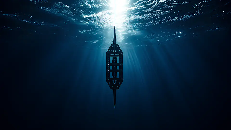
Hydrotwin is an AI-powered underwater acoustic intelligence platform that creates a dynamic digital twin of the marine soundscape. By combining artificial intelligence, IoT, edge computing, and cloud-based analytics, the platform transforms underwater acoustic data into actionable environmental and operational intelligence. Designed as a platform-agnostic solution, Hydrotwin seamlessly integrates with a wide range of hydrophones, autonomous monitoring buoys (from Sofar), unmanned surface and underwater vehicles, fixed observatories, and third-party sensing infrastructures, enabling flexible deployment across diverse marine environments. The platform continuously acquires underwater acoustic data and processes it at the edge to enable real-time detection, classification, localization, and tracking of both natural and anthropogenic sound sources, including vessels, underwater vehicles, dolphins, whales, and other marine species. At the core of Hydrotwin are advanced AI and machine learning models that automatically identify sound patterns, classify species and vessels, detect anomalies, and generate predictive insights. The platform supports interoperability through open APIs and standardized data interfaces, allowing integration with oceanographic monitoring systems, meteorological services, AIS vessel tracking, satellite observations, GIS platforms, environmental databases, and enterprise management systems.
Technological maturity: Proven
Contracting type: For collaboration and partnership
Technology level: High
Place of origin: Portugal
Availability: Worldwide
Contact: WIPO GREEN Database
Frontier technology solutions
Coral net
Kajima Corporation
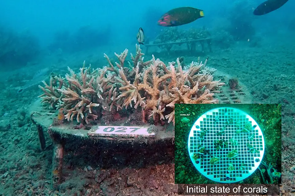
CORAL NET is a mesh-based coral restoration structure designed to reduce sedimentation, improve water circulation and create favorable conditions for coral settlement and growth. The mesh structure placed at a certain height from the seafloor provides adequate water-flow and light, as well as some shade area on its bottom surface for larval settlement and a nursery. Two types are available depending on environmental conditions: one is durable (made from stainless metal) for harsh wave conditions, while the other is biodegradable for calmer environments.
Technological maturity: Frontier
Contracting type: For collaboration and partnership
Technology level: Medium
Place of origin: Japan
Availability: Worldwide
Contact: WIPO GREEN Database
Acoustic telemetry system
Innovasea
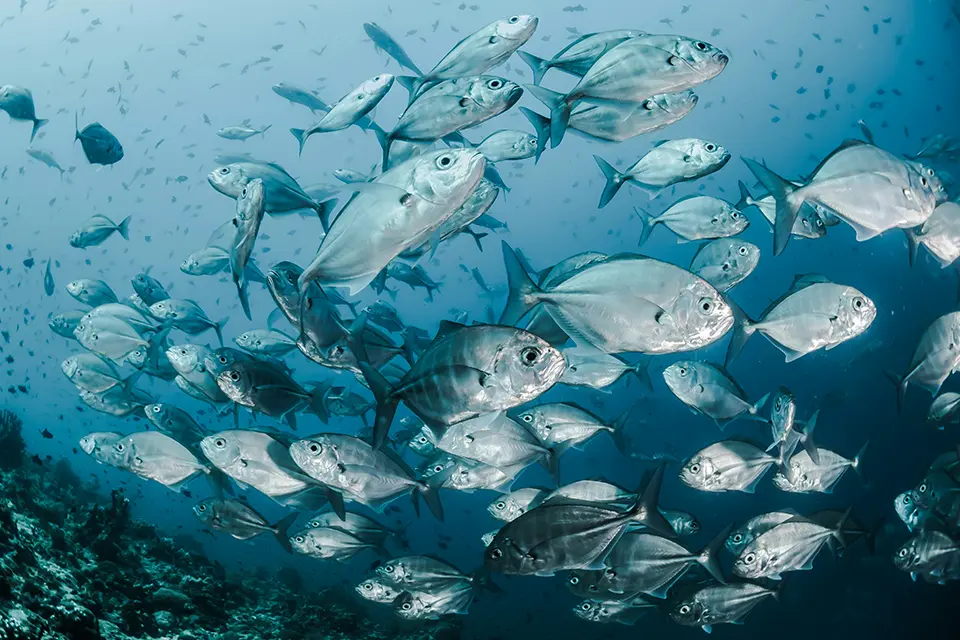
NexTrak is an advanced acoustic telemetry system that tracks the movements and behavior of aquatic animals across rivers, lakes and oceans. The system combines acoustic tags attached to fish or other marine species with underwater receivers that detect and record the unique sound signals emitted by the tags. NexTrak improves upon previous generations by increasing detection range by up to 40 percent and doubling detection rates, enabling researchers to monitor animals over larger areas with fewer receivers. A feature called increased residency (IR) programming reduces signal interference when many tagged animals are present, allowing up to 10 times more detections in high-density study areas. The system also possesses remote retrieval capabilities and includes cloud-based data management software. By providing more accurate and extensive movement data, NexTrak helps scientists understand migration patterns, habitat use and ecosystem connectivity.
Technological maturity: Frontier
Contracting type: For sale
Technology level: Medium
Place of origin: United States/Canada
Availability: Worldwide
Contact: WIPO GREEN Database
AI-powered marine biodiversity platform
Monterey Bay Aquarium Research Institute (MBARI)
FathomNet is an open-source marine biodiversity platform using AI, computer vision and a global database of annotated underwater imagery to automate the identification and monitoring of marine life. Developed by the Monterey Bay Aquarium Research Institute (MBARI) and partners, it aggregates millions of labeled images and video observations from research organizations worldwide to train AI models capable of recognizing marine organisms and habitats. Through tools, such as the FathomNet Database, FathomNet Portal and the citizen science app FathomVerse, the platform accelerates the analysis of underwater imagery collected by ROVs, autonomous vehicles, cameras and other observing systems. By enabling the rapid detection of species distribution, biodiversity change and ecosystem conditions, FathomNet supports marine conservation, ecosystem restoration and the long-term monitoring of climate impacts on ocean ecosystems.
Technological maturity: Frontier
Contracting type: Open access platform
Technology level: High
Place of origin: United States
Availability: Worldwide
Contact: WIPO GREEN Database
Kelp restoration technique
Green Gravel Action Group
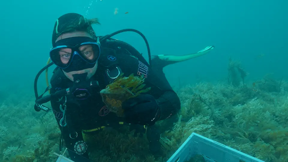
Green Gravel is a low-cost, scalable kelp restoration technique that involves seeding variety of substrates like lines, rocks, small stones or gravel with kelp spores in a laboratory or nursery, allowing juvenile kelp to grow under controlled conditions before they are dispersed onto degraded reefs. Once deployed, the kelp continues growing from the substrate and eventually attaches to the surrounding reef, helping re-establish kelp forests. In case of small sized substrates like seeded gravel, they can simply be dropped from boats, the approach avoids the need for extensive diving operations and can be applied over large areas.. Green Gravel has also been proposed as a way to introduce more heat-tolerant kelp genotypes into vulnerable ecosystems, improving resilience to ocean warming and marine heatwaves.
Technological maturity: Frontier
Contracting type: Open access
Technology level: Low
Place of origin: Australia
Availability: Worldwide
Contact: WIPO GREEN Database
Commercial kelp cultivation and ocean restoration platform
Kelp Blue
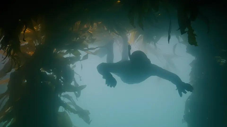
Kelp Blue is a large-scale ocean restoration and sustainable aquaculture initiative that cultivates giant kelp ( Macrocystis pyrifera) on offshore structures to restore marine ecosystems, enhance biodiversity and sequester carbon. The cultivated kelp is harvested sustainably, with only the upper canopy removed to allow continued growth and carbon storage, and is processed into products such as agricultural biostimulants, animal feed ingredients and other bio-based materials. By combining kelp cultivation with ecosystem restoration, Kelp Blue aims to create a commercially viable model in support of climate mitigation, ocean health and sustainable economic development.
Technological maturity: Frontier
Contracting type: For service
Technology level: Medium
Place of origin: Kingdom of the Netherlands/Namibia
Availability: Worldwide
Contact: WIPO GREEN Database
Seagrass and coral planting robot
Reefgen
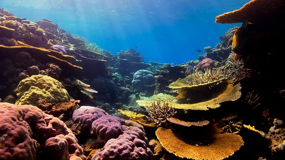
Reefgen uses underwater robotics to scale the restoration of seagrass meadows and coral reefs. Its flagship technology, the Grasshopper robot, automates the planting of seagrass seeds and shoots on the seafloor, reducing the cost, risk and labor associated with diver-based restoration. Operating under a robotics-as-a-service (RaaS) model, Reefgen provides restoration practitioners, governments and conservation organizations with robotic planting services instead of selling the robots themselves. The system combines robotic deployment, monitoring and data collection to enable large-scale ecosystem restoration in coastal environments. By mechanizing restoration, Reefgen aims to accelerate seagrass and coral recovery, enhance biodiversity, improve coastal protection and increase blue-carbon sequestration.
Technological maturity: Frontier
Contracting type: For service
Technology level: High
Place of origin: United States
Availability: Worldwide
Contact: WIPO GREEN Database
AI-powered whale detection platform
Whale Seeker
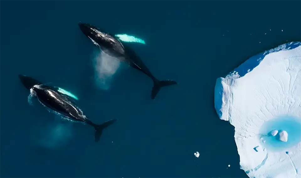
Cetus is an AI-powered whale detection platform that uses very-high-resolution satellite imagery to identify and monitor whales across large ocean areas. The system applies computer vision and machine-learning algorithms to the analysis of satellite images and automatically detects whales located at the ocean surface. By processing imagery at scale, Cetus can survey remote and expansive marine regions that are difficult or costly to monitor using ships or aircraft. The platform generates geospatial data on whale distribution, abundance and habitat use, supporting conservation planning, marine spatial management and the assessment of climate-driven shifts in migration and feeding areas. Because it relies on satellite observations, Cetus enables repeat monitoring over broad geographic areas and can complement traditional aerial surveys, vessel-based observations and acoustic monitoring programs. Its combination of Earth observation and AI represents a new approach to large-scale marine mammal monitoring.
Technological maturity: Frontier
Contracting type: For service
Technology level: High
Place of origin: Canada
Availability: Worldwide
Contact: WIPO GREEN Database
Ocean temperature long-range forecasts
Fisheries Research and Development Corporation (FRDC), the Commonwealth Scientific and Industrial Research Organisation (CSIRO), and the Australian Bureau of Meteorology (BoM)
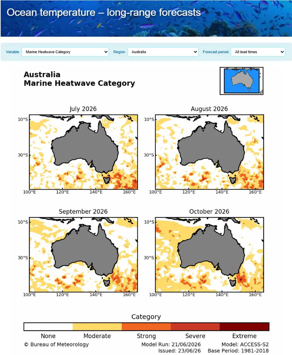
The long-range ocean temperature forecast provides information on the likelihood, location, and predicted severity of marine heatwaves across the Australian region up to four months ahead. The forecasts were developed in partnership by the Australian Bureau of Meteorology (BOM) and CSIRO, and funded by the Department of Climate Change, Energy, the Environment and Water (DCCEEW), the Fisheries Research and Development Corporation (FRDC), and CSIRO. The forecast uses sea surface temperature forecast data from the BOM's Australian Community Climate Earth-System Simulator – Seasonal V2 (ACCESS–S2) model. The tool is updated three times a week and shows regional maps indicating the likelihood and category (moderate to extreme) of a marine heatwave. Views are available by state and across all Australian waters. Marine heatwaves pose a significant threat to the long-term health and resilience of coral reef and other marine ecosystems. Long-range marine heatwave and ocean temperature forecasts support decision-making across marine management, aquaculture, fisheries, conservation and ocean research by providing early warning to help users plan and prepare for ecological and industry impacts.
Technological maturity: Frontier
Contracting type: Open access
Technology level: High
Place of origin: Australia
Availability: Australia
Contact: WIPO GREEN Database
Ultra large scale coral reef restoration method using autonomous underwater vehicles and coral tissue embedded in hydrogel
CORAlliance
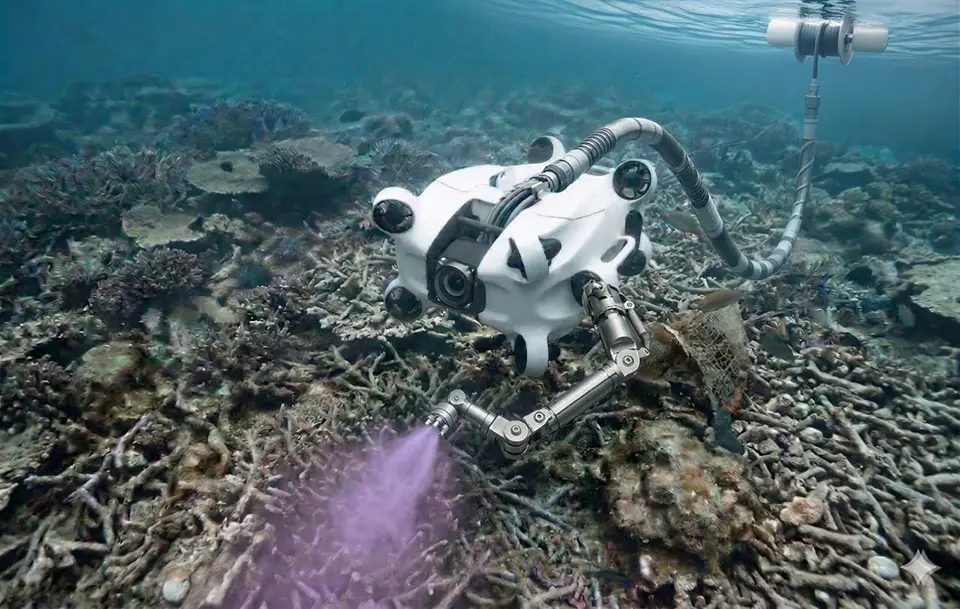
CORAlliance (Coastal & Ocean Regeneration Alliance) offers a patented, scalable system for large‑scale coral reef restoration that moves beyond traditional small‑scale outplanting. At the heart of its approach is the Coral Paint, a bio‑based hydrogel infused with crustose coralline algae, coral polyps, and coral larvae that primes degraded reef areas and promotes rapid settlement and growth, enabling restoration up to hundreds of times faster than manual transplantation. Supporting this is the Modular Living Coral Mesh, large metal grids coated with Coral Paint that stabilize rubble fields and facilitate reef recovery. On‑site rearing facilities (containerized wet labs and floating sea tanks) ensure ecological fit and reduce transport impacts. CORAlliance also uses advanced delivery tools – from diver‑held spray lances to autonomous underwater vehicles -- to apply materials precisely, and an AI‑driven monitoring platform tracks biodiversity, coral cover, and growth.
Technological maturity: Frontier
Contracting type: For collaboration and partnership
Technology level: High
Place of origin: Switzerland
Availability: Maldives, Palau and Seychelles
Contact: WIPO GREEN Database
oPod for reef cooling
Blue Carbon
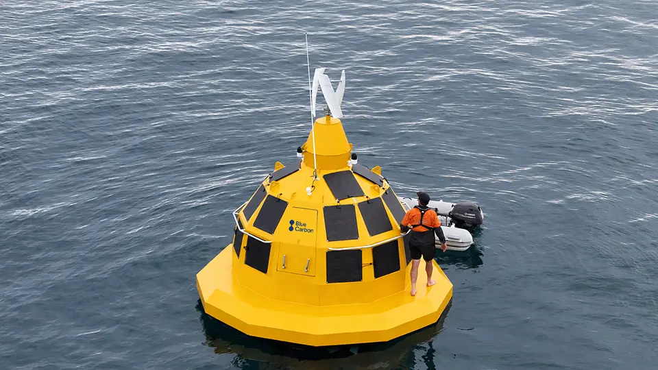
Blue Carbon's oPod™ technology is a wave- and solar-powered system designed to support coral reef restoration, monitoring, and environmental management. By circulating seawater and, where appropriate, drawing cooler water from deeper depths, the system can help reduce localized heat stress around coral restoration sites and create more favorable conditions for coral survival and growth. The technology has undergone trials and pilot deployment, and early commercial use began in 2025–2026. While the oPod™ system is now entering the market, it is still very new, with broader commercial availability just starting.
Technological maturity: Frontier
Contracting type: For collaboration and partnership
Technology level: High
Place of origin: Australia
Availability: Australia
Contact: WIPO GREEN Database
Horizon technology solutions
AI-assisted marine robotics system
Australian Institute of Marine Science (AIMS)
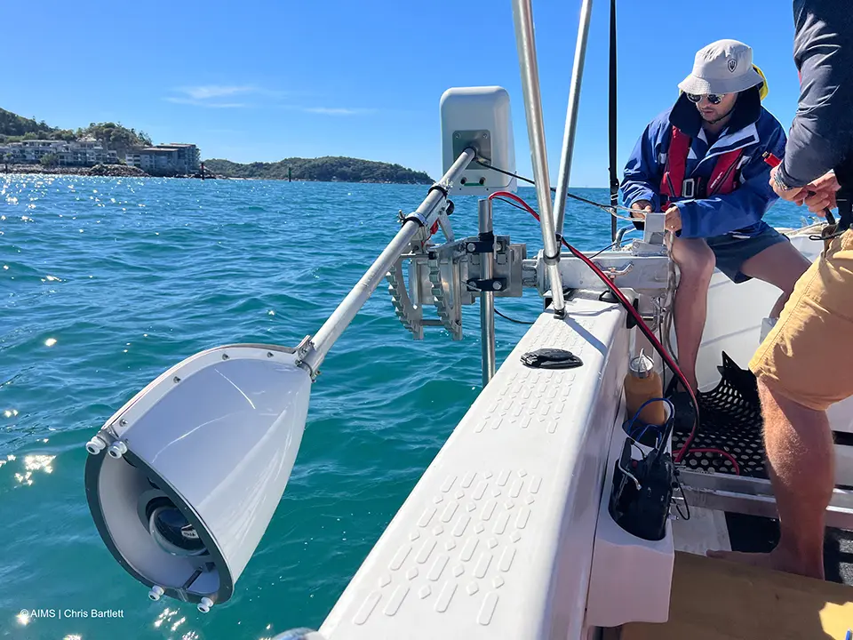
The Australian Institute of Marine Science (AIMS), in conjunction with other organisations, is developing AI-assisted marine robotics systems supporting the development of at-scale up coral reef restoration, particularly on the Great Barrier Reef. The system, called the Deployment Guidance System (DGS), is currently in the research and field testing stage. It combines robotics, GPS guidance, cameras, and AI to plan, deploy, and monitor coral seeding devices holding juvenile corals. AI models analyze reef data to identify optimal deployment sites, while the robotic system ensures precise placement. Each deployment is recorded with GPS so scientists can revisit and monitor coral growth. By automating planning, positioning, and tracking, the system allows reef restoration efforts to cover larger areas more consistently and safely than manual methods.
Technological maturity: Horizon
Contracting type: Under development
Technology level: High
Place of origin: Australia
Availability: Under development
Contact: WIPO GREEN Database
Sea simulator for coral seeding
Australian Institute of Marine Science (AIMS)
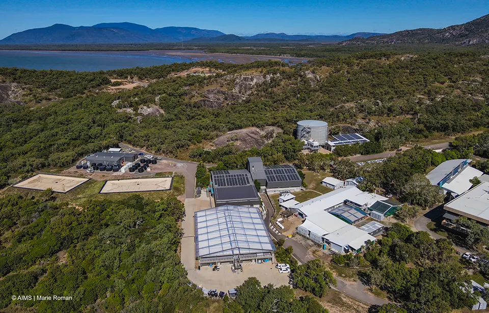
The National Sea Simulator (SeaSim) is a large-scale marine research infrastructure that supports the development and evaluation of coral seeding technologies through the replication of both present-day and future ocean conditions in controlled experimental seawater systems. This capability enables rigorous investigation of coral reproduction, settlement, growth and survival, as well as broader coral reef ecosystem responses under a range of environmental scenarios. SeaSim’s advanced industrial process automation platform also provides a foundation for the development of scalable coral production workflows, including the integration of image analysis, process control and robotics. Within this framework, coral colonies collected prior to spawning can be induced to spawn, fertilised, reared through larval stages, and settled onto substrates for subsequent attachment to seeding devices designed to improve survival and support targeted, cost-effective deployment to reefs. Early trials have demonstrated promising survival outcomes for coral recruits established on these devices. These capabilities position SeaSim as a unique platform for advancing coral seeding from experimental development toward scalable application.
Technological maturity: Horizon
Contracting type: Under development
Technology level: High
Place of origin: Australia
Availability: Under development
Contact: WIPO GREEN Database
Underwater seagrass seed harvester
Tandem Ventures
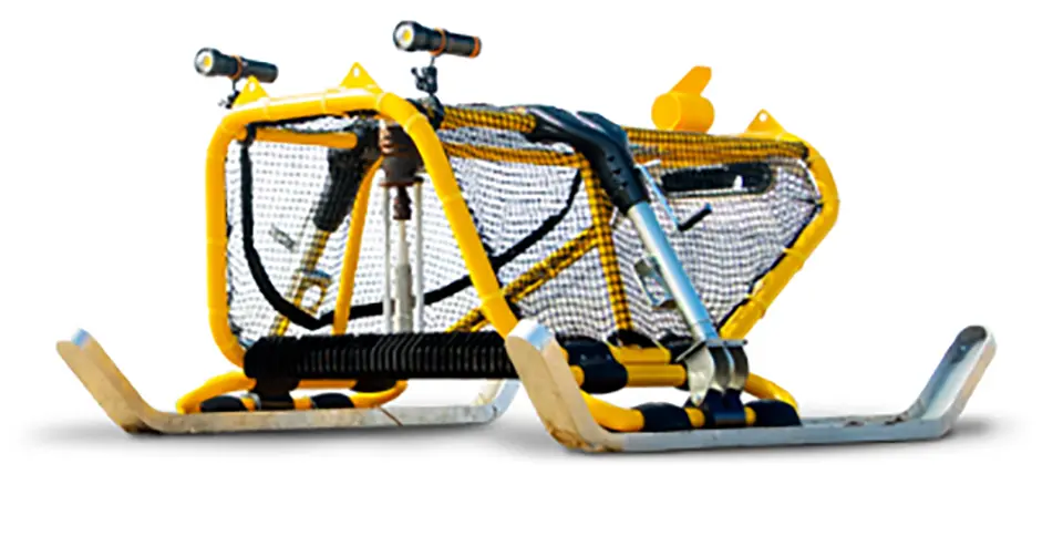
The Seagrass Harvester, developed by Tandem Ventures in collaboration with Project Seagrass and Swansea University, is a boat-towed mechanical harvesting system designed to automate the collection of seagrass seeds for restoration projects. Traditionally, divers collect seed-bearing shoots by hand using scissors, a slow and labor-intensive process that limits restoration scale. The Harvester moves over the seabed on skids, cutting the upper portions of seagrass shoots that contain mature seeds and transporting them to the surface through a suction and filtration system for collection. Developers estimate the technology could be up to 100 times faster than manual harvesting, potentially enabling restoration at much larger scales. The design is intended to be open source, allowing researchers and restoration organizations worldwide to adapt and replicate the technology for local conditions.
Technological maturity: Horizon
Contracting type: Under development
Technology level: High
Place of origin: United Kingdom
Availability: Under development
Contact: WIPO GREEN Database
Autonomous seagrass restoration robot
Ulysses Ecosystems Engineering
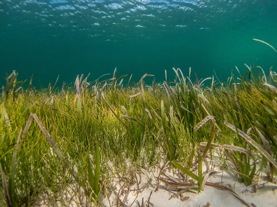
MAKO is an autonomous underwater restoration system developed by Ulysses Ecosystem Engineering combining robotics, AI, computer vision and precision deployment technologies to restore seagrass meadows at scale. The robot navigates across the seabed, identifies suitable habitat conditions, and plants either seagrass propagules or seeds with high spatial accuracy. By automating tasks that traditionally require a large team of divers, MAKO aims to accelerate restoration, reduce costs and improve consistency across large restoration sites. The system also collects environmental and habitat data during operations, supporting monitoring and adaptive management.
Technological maturity: Horizon
Contracting type: Under development
Technology level: High
Place of origin: United States
Availability: Under development
Contact: WIPO GREEN Database
Robotic system for coral reef mapping and monitoring
Arizona State University
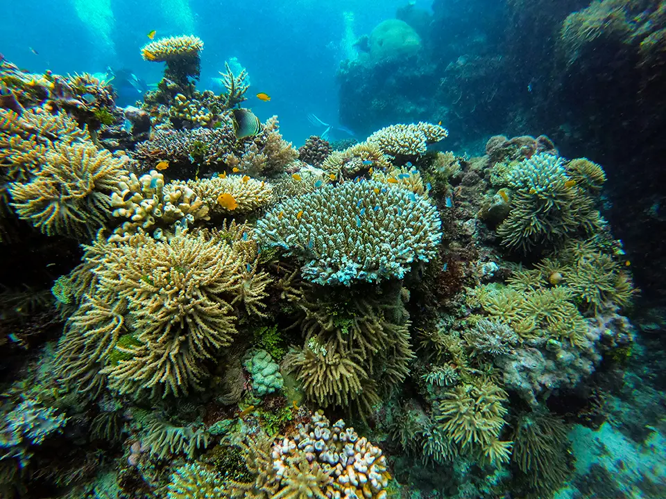
The Coral Collaborative Robotic Aquatic Laboratory (CoRAL) is an advanced robotic system for better monitoring, mapping and sampling of coral reefs. It combines multiple robotic components – such as an autonomous surface vessel, an underwater drone and multi-spectral imagers – to collect high-resolution visual data and environmental samples more safely, frequently and at a larger scale than traditional diver-based surveys. The system is also capable of supporting intervention tasks like collecting water samples, planting new corals or aiding artificial reef structures. It aims to reduce cost and risk ,while improving the scientific understanding of reef health.
Technological maturity: Horizon
Contracting type: Under development
Technology level: High
Place of origin: United States
Availability: Under development
Contact: WIPO GREEN Database
AI-driven marine heatwave forecasting system
NIWA; Earth Sciences New Zealand
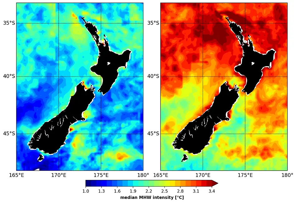
The marine heatwave forecasting system is an AI-driven early warning tool designed to predict extreme ocean temperature events – known as marine heatwaves – well in advance. It aims to generate publicly accessible forecasts spanning several months for New Zealand’s surrounding oceans by combining historical models, fine-scale ocean and atmospheric data, and machine-learning approaches. The project adapts an ocean “emulator” model originally developed by the University of California, Santa Cruz, to infer future conditions such as sea surface temperature and heat extremes on scales of a few kilometers. These forecasts are intended to help marine businesses, iwi (Māori communities) and regulators prepare for impacts like ecosystem stress, fishery disruptions and aquaculture risk, enabling climate-resilient planning decisions to be made. The system represents a cost-effective alternative to traditional numerical ensemble forecasting systems.
Technological maturity: Horizon
Contracting type: Under development
Technology level: High
Place of origin: New Zealand
Availability: Under development
Contact: WIPO GREEN Database
AI-enabled marine ecosystem digital twin
Fujitsu
Fujitsu has developed a technology that uses AUVs, LiDAR sensors and AI to create high-resolution 3D digital twins of underwater ecosystems. The drones scan marine environments, such as coral reefs, seaweed beds and offshore infrastructure, capturing centimeter-scale data even in murky water or strong currents. AI-based image enhancement restores color and sharpens contours in underwater images, allowing the accurate identification and measurement of organisms and structures before converting the data into detailed 3D models. These models form an ocean digital twin, enabling researchers to analyze ecosystems, simulate environmental changes and test conservation strategies. Initial field trials near Ishigaki Island, Japan, successfully mapped coral reefs in real time. Fujitsu plans to expand the system to model seaweed ecosystems and estimate blue carbon storage.
Technological maturity: Horizon
Contracting type: Under development
Technology level: High
Place of origin: Japan
Availability: Under development
Contact: WIPO GREEN Database
3.2 Ocean acidification
The emissions driving climate change are not just warming the air and the ocean – they are altering ocean chemistry by increasing acidification, with serious consequences for marine ecosystems.
From air to acid: the ocean in peril (or “the second deadly pressure”)
At least a quarter of the CO2 released into the atmosphere dissolves in the ocean. Since the start of the industrial era, the ocean has absorbed roughly 525 billion tonnes of CO2, currently amounting to about 22 million tonnes each day (
Figure 3.2 shows ocean pH having decreased by about 0.1 units since 1985. Since pH is measured on a logarithmic scale, a small unit decrease in pH represents a large increase in acidity. Between 1985 and 2024 alone, ocean acidity increased by 17.5 percent (

When CO2 is absorbed by seawater a series of chemical reactions is triggered that increases hydrogen ion concentration. This lowers the pH, making the water more acidic and reducing the relative abundance of carbonate ions. Carbonate ions are a key component of calcification, the biological process of building calcium carbonate structures such as shells, skeletons and other hard parts. A decline in carbonate ions makes it harder for calcifying organisms – including oysters, clams, sea urchins, shallow and deep-water corals – and calcareous plankton to build and maintain such structures (
Scientists once assumed rivers supplied enough minerals to keep the world’s ocean pH stable through a process called buffering. But CO2 is now entering the ocean so quickly that natural buffering is unable to keep up – and marine life has had scant time to adjust. The shells of some organisms are already dissolving, although a few species living in naturally variable estuarine environments appear to be developing a greater tolerance to lower pH conditions (
Since the start of the industrial era, the ocean has become 30 percent more acidic – a rate of change faster than anything known in ocean chemistry over the past 50 million years
The effects of rising CO2 on marine ecosystems are expected to be severe, especially for tropical coral reefs, as well as high-latitude marine invertebrates such as snails, crabs, starfish and so on (
Impact of acidification on fish populations and marine life
Shellfish hatcheries – especially oyster, clam and mussel hatcheries – draw in seawater from coastal areas. When that seawater turns corrosive, larvae experience a high rate of mortality. This is common in parts of Europe, the Pacific Northwest United States, and parts of Australia. Beyond aquaculture, ocean acidification also affects coastal communities whose economies depend on reef-based tourism, Globally, acidification has been estimated to incur annual economic losses of USD97–301 billion (in 2014) (
Hatchery buffering systems are localized adaptation technologies applied in marine and estuarine aquaculture facilities. Systems such as the Burke-o-Lator developed by Burke Hales for Pacific shellfish hatcheries (and used in the United States and Canada) provide real-time carbonate chemistry data to help optimize buffering and water conditions in order to improve larval survival under more acidic conditions. Burke-o-Lators measure ocean pH, the quantity of CO2dissolved, non-organic carbon from non-organic sources, and aragonite concentration (
The Central and Northern California Ocean Observing System uses Burke-o-Lators to track seawater chemistry in real time. Observations show coastal pH often falls below 7.75, a level at which the aragonite saturation state (Ωₐᵣₐg) approaches 1. When Ωₐᵣₐg is around or below 1, seawater becomes chemically corrosive to calcium carbonate minerals (
Technologies and tools for ocean acidification action
The International Alliance to Combat Ocean Acidification (OA Alliance) is a global coalition of governments and organizations that has more than 120 members. In its submission to the UNFCCC Ocean and Climate Change Dialogue (2022) titled “Advancing Ocean & Coastal Adaptation” (
remediation and amelioration of coastal acidification through aquatic ecosystems such as mangroves, seagrass beds, salt marshes and kelp forest;
improving water quality, limiting coastal erosion and providing protection from extreme events;
facilitating the movement and protection of species (refugia);
supporting adaptive management and promoting resilience strategies for highly vulnerable species; and
reducing those land-based/terrestrial sources of pollution that exacerbate local OA conditions.
In a proposed Toolkit, the OA Alliance outlined six actionable areas together with the associated technologies or methods. Table 3.1 lists the various technologies in support of these actionable areas. Note that action area 1 is to reduce atmospheric CO2 emissions, which lies outside the scope of this edition of the Green Technology Book, as technologies featured here are intended to restore ecosystems and not to mitigate climate change writ large. However, this area is included in order to highlight the indirect benefits that blue carbon ecosystems can have in reducing ocean acidification.

Within the respective actionable areas, strategies that build adaptation and resilience are particularly relevant for ecosystem restoration. One such approach is the use of Marine Protected Areas (MPAs) to reduce local stressors, such as overfishing and pollution, and create conditions that help marine ecosystems better withstand ocean acidification. While not itself a technology, an MPA functions as an adaptive management tool able to enhance ecosystem resilience. The OA Alliance recommends identifying existing MPAs or locally-managed marine areas for potential locations for expanding ocean acidification monitoring and research, as these sites are often suitable for long-term ecological observation (
Aeration and circulation systems: tools to reduce CO2 and acid stress in aquaculture
Seawater aeration and water circulation systems are important technologies for managing OA in localized environments such as marine laboratories, coral restoration sites and aquaculture facilities. By increasing gas exchange and water movement, they can reduce localized CO2 accumulation and improve the saturation state of calcium carbonate (
Water circulation can improve mixing between water layers and help prevent the localized buildup of high CO2-rich water (
Autonomous systems, smart sensors and data platforms transforming ocean acidification monitoring
The measurement and tracking of carbonate system variables is crucial for monitoring the progression of ocean acidification and understanding the ocean’s role as a carbon sink. Effective ocean acidification monitoring requires continuous, long-term time series obtained from moorings and autonomous sensors sustained over many years. Acidification trends unfold gradually, but short-term variability can be rapid and intense, therefore both must be captured in order to understand ecosystem exposure.
Box 3.4 discusses how high-frequency sampling, such as measurements being taken every few hours rather than a monthly average, can significantly alter estimates of carbon flux, shift the classification of a region as being either a CO2 source or a sink, and better reflect the chemical conditions experienced by organisms. Because marine life responds to sudden shifts, and not just long-term trends, integrated monitoring systems are essential. These must combine carbonate chemistry measurements (pH, pCO2, total alkalinity), temperature and salinity, and physical drivers like wind and upwelling, since ocean chemistry and physics are interconnected. Automated monitoring platforms are particularly valuable for collecting such data over time and space. Box 3.5 provides an explanation of the main four parameters usually monitored when tracking ocean acidification.
Recent research using two NOAA moorings off Southern California (CCE1 offshore and CCE2 nearshore) challenges the traditional view of the ocean as a stable carbon sink. Open ocean waters are typically a CO2sink, while nearshore upwelling sites are usually a CO2 source. During the 2015–2016 marine heatwave, this pattern reversed: the offshore site became a CO2 source, while the nearshore site became a sink when warm surface waters suppressed upwelling (
High-frequency observations (every three hours) revealed short-lived events that were invisible in monthly averages. Strong winds and upwelling raised surface pCO2– the partial pressure of CO2 in seawater that determines whether CO2 moves between ocean and atmosphere – triggering rapid CO2 outgassing. These findings suggest that conclusions based on monthly data may be misleading: the California Coastal Upwelling System may function as a net CO2 source rather than a sink (
This research underscores the need for sustained high-resolution monitoring. The ocean carbon sink is dynamic, and short-term variability can strongly affect carbon budgets and climate projections. Upwelling regions are particularly prone to acidification, because they bring deep, CO2-rich water to the surface, enhancing local acidification and air–sea CO2 release. Ocean acidification is therefore a regional and event-driven phenomenon that renders marine organisms and ecosystems especially vulnerable to rapid environmental changes.

Autonomous platforms can operate continuously for months or years at a time collecting physical and chemical data across a wide area without relying assistance. Examples include AUVs, profiling floats and instruments that drift through the water column or with the current. Slocum gliders, RAFOS and deep Argo floats (see Proven technology solutions) allow the monitoring of temperature, salinity, pressure, current and water mass movement, while also observing long-term changes linked to acidification and circulation.
In recent years, the development of compact sensors that directly measure carbonate chemistry in the ocean has progressed. Whereas traditional ocean acidification measurement required laboratory analysis of collected water samples, new miniature sensors enable in situ measurements in the ocean, and can also be placed on autonomous platforms. One such recent innovation is a total alkalinity sensor developed by the National Oceanography Centre in the United Kingdom. This autonomous sensor can measure deep-ocean total alkalinity, pH and carbonate chemistry parameters. By providing multiple co-located measurements in real time, the sensor reduces uncertainty, supports the calculation of key carbonate system variables, like saturation state and pCO2, and enables the near-real-time integration with observation networks and ocean carbon models.
Autonomous platforms can operate continuously for months or years at a time collecting physical and chemical data across a wide area without assistance
CTD (conductivity, temperature, depth) sensors measure the fundamental water properties determining density and circulation, which in turn influence the movement of acidified waters. These instruments are often deployed on autonomous platforms alongside chemical sensors to provide a comprehensive view of carbon system dynamics and the impact of ocean circulation on acidification (
Importantly, monitoring increasingly relies on software platforms that integrate large environmental datasets. These combine oceanographic measurements, satellite data, watershed data and ecosystem maps. GIS platforms, such as QGIS, allow researchers to map acidification hotspots and analyze interactions between runoff and coastal chemistry. Likewise, decision support platforms and portals – such as the Coastal Aquaculture Planning Portal developed by NOAA (see Proven technology solutions) – support the assessment of water quality and ecosystem risks, as well as the planning for aquaculture locations.
Marine carbon dioxide removal: emerging approaches and challenges
High-resolution monitoring reveals where and when ocean acidification is most severe, pointing to opportunities for intervention. Ocean carbon dioxide removal (mCDR) technologies are being explored, not only to lower atmospheric CO2 and mitigate climate change, but also to reduce ocean acidity and buffer carbonate chemistry. These methods are typically grouped into three main categories: chemical, mineral and biological.
First, chemical approaches such as ocean alkalinity enhancement (OAE) aim to accelerate the ocean’s natural capacity to absorb CO2 by increasing seawater alkalinity. This involves adding alkaline materials, such as finely ground silicate rocks (e.g., olivine), limestone or manufactured hydroxide minerals, either directly into the open ocean or within coastal zones to promote carbonation reactions that convert dissolved CO2 into stable bicarbonate ions. These ions remain in the ocean for millennia, enabling long-term carbon sequestration (>20,000 years). Although ocean alkalinity processes occur naturally over geological timescales, human-driven enhancement remains largely theoretical and at an intermediate technology readiness level (TRL ~6). Risks and uncertainties include possible ecological disruption and trace metal release, as well as the complexity of large-scale monitoring, which is technically challenging.
Mineralization approaches more broadly accelerate natural geochemical reactions, converting CO2 into stable carbonate and bicarbonate minerals. These approaches can be applied to seawater, through enhanced weathering in coastal zones, or on land. While slower than some electrochemical methods, mineralization provides durable carbon storage and can also buffer ocean pH over time. However, it faces several technological and economic challenges. Mining, grinding, transporting and dispersing large quantities of alkaline rock, such as olivine, is both energy and cost intensive. Other challenges include establishing reliable monitoring, reporting and verification systems to confirm actual CO2 removal (
High-resolution monitoring reveals where and when ocean acidification is most severe, pointing to opportunities for intervention
Direct CO 2 extraction from seawater. Light-driven or electrochemical processes alter the carbonate equilibrium, resulting in the release of dissolved CO2 as a gas that can be captured and stored. By removing CO2 from seawater, these systems can indirectly draw additional CO2out of the atmosphere, creating a feedback loop that reduces acidity and contributes to climate mitigation. Electrochemical carbon dioxide removal (eCDR) uses electrically-driven reactions to capture CO2directly from seawater and stabilize it in a long-lived form. Seawater naturally contains dissolved inorganic carbon, and by locally altering pH through electrochemical processes, eCDR shifts chemical equilibria to increase CO2 uptake from the atmosphere and convert it into stable bicarbonate, carbonate minerals or other forms suitable for long-term sequestration. Approaches range from applying voltage across electrodes to drive pH changes to extracting acid/base streams for engineered carbonation, sometimes co-producing hydrogen or mineral byproducts to improve economic feasibility. Scaling these systems would likely require large coastal or offshore facilities capable of processing large volumes of seawater using low-carbon electricity, potentially integrated with desalination plants, ports or renewable energy infrastructure. Technology readiness ranges from laboratory validation to early pilot demonstrations.
eCDR can buffer ocean acidification by raising local pH and carbonate ion concentration. However, benefits depend on using low-carbon electricity, carefully controlling local chemistry to avoid harmful pH fluctuations, and monitoring ecological impacts. Energy use, electrode durability and system integration remain key challenges, and large-scale deployment requires full environmental and lifecycle assessment.
Blue carbon, coastal restoration and seaweed cultivation: some promise, several questions
Biological and nature-based carbon dioxide removal (CDR) approaches use marine ecosystems to capture CO2 through photosynthesis, while supporting ecosystem recovery. Examples include blue carbon restoration (mangroves, seagrasses, and salt marshes) and macro- or microalgae cultivation, which can provide habitat, improve water quality and in some cases offer localized buffering against ocean acidification.
Coastal vegetated ecosystems (mangroves, salt marshes and seagrass beds) naturally sequester carbon in plant biomass and soil, removing CO2 from the atmosphere and contributing to localized acidification buffering. Restoration of these systems is the primary pathway for blue carbon CDR, and they can also deliver co-benefits such as coastal protection, habitat support and fisheries enhancement. Challenges include landscape changes (e.g., coastal development or erosion), climate impacts (e.g., sea level rise, storms), underinvestment in monitoring, and limited data on sequestration. To help address these challenges, carbon accounting, modeling and monitoring technologies – including sensors, remote sensing and GIS mapping – are being increasingly used to assess ecosystem growth, health and resilience.
Coastal vegetated ecosystems naturally sequester carbon in plant biomass and soil, removing CO2 from the atmosphere and contributing to localized acidification buffering
Macroalgae (seaweed) and microalgae capture CO2 through photosynthesis and can provide some localized buffering in coastal areas, aquaculture systems and farmed stands. They provide benefits, such as habitat creation, improved water quality, nutrient remediation and support for fisheries, while also producing biomass that could be stored long-term in biochar, bioproducts or ocean sinks. However, effectiveness is largely localized and context dependent. A large-scale mitigation of ocean acidification is unrealistic. Challenges include energy and nutrient requirements, scalability and potential environmental impacts such as deep-sea disturbance, altered light and nutrient dynamics, and conflict with existing ocean usage.
Experimental physical methods to mitigate ocean acidification
As discussed above under ocean warming, some CDR approaches, such as artificial upwelling (nutrient-driven), can stimulate biological carbon uptake and indirectly reduce acidification through photosynthesis. However, such methods remain highly experimental. Effects on pH are complex and regionally variable. Deep water brought to the surface is often low in pH, meaning upwelling can temporarily worsen local acidification rather than buffer it. Any potential application would require the careful monitoring of chemical, biological and ecological responses, and large-scale effectiveness remains unproven.
More broadly, some mCDR techniques are controversial. This is because they directly alter marine chemistry and/or ecosystems at scale, raising concerns about potential ecological impacts, governance and long-term effectiveness. Ocean alkalinity enhancement, artificial upwelling and large-scale algae cultivation may change local pH, nutrient dynamics or oxygen levels, and potentially affect sensitive species, food webs and sediment chemistry. While these approaches show promise for climate mitigation, most remain under active research and debate.
Innovation examples
Harnessing sailboat sensors to strengthen ocean acidification monitoring
Max Planck Institute for Meteorology, University of Hamburg, GEOMAR Helmholtz Centre for Ocean Research Kiel, and the Flanders Marine Institute
Researchers have shown that high-quality CO2 measurements collected aboard sailing vessels can significantly strengthen global ocean carbon chemistry monitoring, a foundation for understanding and responding to ocean acidification. Surface ocean partial pressure of CO2 (pCO2) is essential for quantifying air–sea carbon exchange and tracking changes in seawater acidity. Yet large regions of the ocean remain under-sampled. Scientists from several collaborating research centers assessed the impact of integrating sailboat-collected data, including observations gathered during global voyages by Team Malizia. When incorporated into the Surface Ocean CO2Atlas, these additional measurements reduced uncertainties in air–sea CO2 flux estimates and improved representation of under-monitored regions. By tapping into existing maritime activity as an observation platform, this approach provides a scalable, cost-effective way to expand acidification monitoring networks and improve regional carbonate chemistry modeling (
Kelp farms turn the tide on acidification
Bangs Island Mussels; Bigelow Laboratory for Ocean Sciences
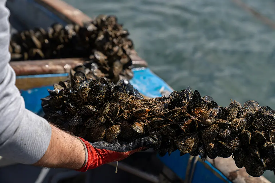
Bangs Island Mussels, a sea farm in Maine, produces hundreds of thousands of pounds of shellfish and seaweed each year. However, it sits within the Gulf of Maine, which is warming three times faster than the global average and particularly vulnerable to ocean acidification. This threatens shell development in clams, mussels, oysters and lobster, jeopardizing an industry generating USD 85–100 million annually. To help buffer these effects, the farm cultivates kelp, which consumes CO₂ and thrives in high-CO₂ environments. In partnership with Bigelow Laboratory for Ocean Sciences and Colby College, the team began testing water in 2015 to compare chemistry inside the kelp beds with surrounding waters, finding that mussels growing within the kelp had thicker shells. The farm now grows kelp alongside mussels using integrated multi-trophic aquaculture, which farms an ecosystem rather than a single species, and sells the seaweed to local processors for fermented foods and other products. Monitoring of seaweed farms has expanded from Alaska to Norway, and authors from Bigelow Laboratory published a 2025 article in Nature Climate Change on the potential of seaweed farming to capture carbon on the seafloor (
Citizen science using a low cost pH sensor
Woods Hole Oceanographic Institution (WHOI); Ocean and Climate Innovation Accelerator (OCIA)
Researchers at WHOI, supported by the OCIA, are developing a low-cost, autonomous pH sensor designed for widespread use along coasts and by fishermen to improve ocean acidification monitoring. The goal is to create a pH instrument that is accurate, scalable and affordable, capable of continuous in situ measurements up to 300 meters deep and easy enough for fishermen or other ocean users to deploy on existing gear. Data from these sensors will be uploaded wirelessly to build high-resolution maps of coastal pH, helping scientists track acidification trends and inform mitigation strategies. Using advanced semiconductor chips and optical sensing technology, the prototype aims to be a fraction of the cost of current ocean pH instruments (potentially a tenth as much), while requiring minimal training to operate (
The following collection of technologies is divided into three groups: Proven technologies have been on the market for some time and hence are well tested., Frontier technologies are available but relatively new, while Horizon technologies are close to being available but still under development.
Proven technology solutions
Marine permaculture
Climate Foundation
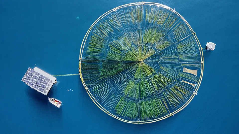
Marine Permaculture is a nature-based climate and ecosystem solution that uses renewable energy (wave, solar, wind) to drive deep water upwelling and irrigation for large-scale offshore seaweed cultivation. The system creates substrate and nutrient delivery that enables kelp and other macroalgae to grow in open ocean conditions, helping restore marine ecosystems, rebuild fish populations and sequester CO2 by exporting carbon-rich organic matter to the deep ocean. It also supports sustainable food and feed production. The Climate Foundation is a US-headquartered nonprofit organization with activities and pilot deployments in locations such as the Philippines, Hawaii, Tasmania and other subtropical waters.
Technological maturity: Proven
Contracting type: For partnership or collaboration
Technology level: Medium
Place of origin: United States
Availability: Worldwide
Contact: WIPO GREEN Database
Slocum glider
Teledyne Marine
The Slocum Glider is a long-endurance AUV that uses changes in buoyancy to move through the water in a sawtooth pattern, enabling efficient, months-long ocean observation missions without heavy power use. It is designed to collect high-resolution oceanographic data – such as temperature, salinity, currents and other environmental parameters – while traveling hundreds to thousands of kilometers on pre-programmed routes. Slocum Gliders operate at depths down to about 1,000 meters and regularly surface to transmit data and receive instructions via satellite, allowing remote mission control. The modular design supports a wide range of scientific sensors for physical, chemical and biological measurements. Because they are buoyancy-driven and require minimal support, the Gilders can be deployed from small vessels and withstand rough weather conditions, making them valuable for the persistent monitoring of ocean environments, climate research and large-scale circulation studies.
Technological maturity: Proven
Contracting type: For sale
Technology level: High
Place of origin: United States
Availability: Worldwide
Contact: WIPO GREEN Database
Deep-ocean profiling boat
MRV Systems
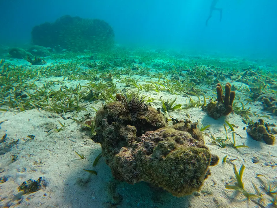
The DeepSOLO™ is a deep-ocean profiling float built by MRV Systems under license from the Scripps Institution of Oceanography specifically for the Deep Argo program. It autonomously cycles from the surface down to a depth of 6,000 meters, measuring pressure, temperature and conductivity using high-precision CTD sensors and transmitting data via Iridium satellite. A passive bottom detector helps it approach the seafloor safely before surfacing to send data. DeepSOLO is designed for long endurance – typically capable of ~250 profiles over several years – making it useful for full-depth ocean monitoring and global circulation studies.
Technological maturity: Proven
Contracting type: For partnership or collaboration
Technology level: High
Place of origin: United States
Availability: Worldwide
Contact: WIPO GREEN Database
RAFOS float
Seascan Inc.
The RAFOS float is an autonomous, submersible oceanographic instrument that passively drifts on water currents, while acoustically listening to fixed sound sources to determine its position over time. Deployed for months to years at a time, it provides high-resolution Lagrangian (moving with the flow) trajectories reflecting water movement below the surface. Although RAFOS itself does not measure carbonate chemistry directly, its ability to map where and how water parcels move – across space and through time – makes it a powerful platform for contextualizing alkalinity and other carbonate parameters. When fitted with sensors for temperature, salinity, pressure and optional biogeochemical variables, RAFOS floats can be integrated into observational networks able to capture the water mass dynamics affecting total alkalinity, dissolved inorganic carbon and pH. By linking physical transport pathways with the underlying chemistry, researchers are better placed to resolve the spatiotemporal patterns driving ocean acidification and ecosystem exposure.
Technological maturity: Proven
Contracting type: For partnership or collaboration
Technology level: High
Place of origin: United States
Availability: Worldwide
Contact: WIPO GREEN Database
Marine mapping software/hydrographic data processing system
Teledyne CARIS
The CARIS HIPS & SIPS is a hydrographic data processing system that converts raw sonar and survey measurements into high-resolution maps of the seafloor and the coastal environment. While it does not measure pH directly, it provides the spatial context essential for ocean acidification research. By detailing bathymetry, underwater features and upwelling zones, it helps scientists identify areas where acidification may be intensified or mitigated. Integrated with real-time survey data and cloud-based sharing, HIPS & SIPS supports habitat assessments, vulnerability modeling and strategic monitoring. Its ability to merge diverse datasets ensures that acidification studies are informed by accurate, comprehensive spatial information.
Technological maturity: Proven
Contracting type: For sale
Technology level: High
Place of origin: Canada
Availability: Worldwide
Contact: WIPO GREEN Database
Open-source GIS platform
QGIS
QGIS (Quantum GIS) is an open-source geographic information system (GIS) used worldwide for spatial data analysis, mapping and visualization. It allows users to import, manipulate and analyze geospatial datasets obtained from a wide variety of sources, including satellite imagery, digital elevation models, watershed boundaries, river discharge and nutrient load data, as well as coastal water quality measurements. In the context of ocean acidification, QGIS can be used to identify and map land-based nutrient runoff hotspots (e.g., agricultural catchments, urban stormwater outfalls), visualize connections between watersheds and coastal zones, and overlay environmental layers such as pH, temperature and dissolved oxygen from monitoring networks. Its analytical tools enable the calculation of runoff pathways and contaminant flow directions, and make spatial correlations between terrestrial and coastal environmental stressors. QGIS also supports custom modeling by allowing plugins, making it a flexible platform for stakeholders wanting to integrate diverse datasets and inform adaptive strategies addressing nutrient pollution and acidification risks.
Technological maturity: Proven
Contracting type: Open source
Technology level: High
Place of origin: Switzerland
Availability: Worldwide
Contact: WIPO GREEN Database
Coastal aquaculture planning portal (CAPP)
NOAA National Centers for Coastal Ocean Science (NCCOS)
The Coastal Aquaculture Planning Portal (CAPP) developed by NOAA is a web-based decision-support platform for sustainable coastal and marine aquaculture. It integrates spatial mapping tools, datasets and analytics to help planners, regulators and industry assess environmental, socioeconomic and regulatory factors relating to aquaculture siting. CAPP features interactive tools like OceanReports for customized spatial reports and National AquaMapper for the layered visualization of wave height, bathymetry, wind speed, habitats, protected species and water quality. By aggregating complex coastal data in one interface, the portal supports informed siting decisions, environmental impact assessments and permitting. Beyond aquaculture, tools within CAPP support mapping and analytical capabilities that can help track nutrient runoff, water quality trends, and ecosystem vulnerabilities, offering valuable insight for addressing ocean acidification and coastal ecosystem health.
Technological maturity: Proven
Contracting type: Open source
Technology level: High
Place of origin: United States
Availability: Worldwide
Contact: WIPO GREEN Database
Frontier technology solutions
Compact conductivity–temperature–depth sensor for autonomous ocean observation and profiling
RBR
The RBRbrevio³ C.T.D is a compact, high-accuracy conductivity–temperature–depth sensor designed for autonomous ocean observation and profiling applications. It measures salinity indirectly by combining conductivity and temperature with pressure (depth) data, key physical properties used to calculate water density, which in turn influences ocean circulation and overturning strength. Its short, lightweight housing is ideal for integration with gliders, AUVs, floats, moorings or towed vehicles, and it supports high sampling rates (up to ~32 Hz) through real-time communication and on-board data logging. An inductive conductivity cell and fast thermistor help reduce salinity spikes and improve accuracy at varying depths, while its rugged construction supports long-term deployment at up to 6,000 meters depth, making it useful for deep ocean observing programs.
Technological maturity: Frontier
Contracting type: For sale
Technology level: High
Place of origin: Canada
Availability: Worldwide
Contact: WIPO GREEN Database
Offshore kelp forest cultivation for carbon sequestration and ecosystem enhancement
Kelp Blue
Kelp Blue grows offshore forests of giant kelp ( Macrocystis pyrifera) on submerged structures to capture CO2 and support marine ecosystems. Giant kelp naturally absorbs carbon via photosynthesis, locking CO2 into its tissue and releasing oxygen. Detached fragments and dissolved organic carbon drift offshore and can sink to the deep ocean floor, where carbon may remain sequestered for over 100 years, contributing to long-term carbon storage and helping counter ocean acidification by reducing dissolved CO2 in seawater. Beyond climate mitigation, Kelp Blue’s kelp forests enhance marine biodiversity, provide habitat and nursery grounds for fish and invertebrates, and improve nutrient cycling and water quality. The company sustainably harvests only the kelp canopy to produce biostimulants, bio-materials and other products.
Technological maturity: Frontier
Contracting type: For collaboration and partnership
Technology level: High
Place of origin: Kingdom of the Netherlands
Availability: Namibia
Contact: WIPO GREEN Database
Water-based carbon capture and stabilization system
Vycarb
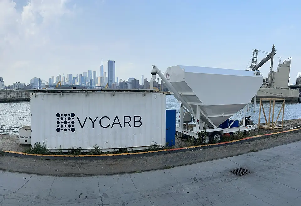
Vycarb’s technology captures CO2 using a water-based process that converts dissolved CO2 into stable bicarbonate, enabling long-term carbon storage. The system is designed to integrate with industrial or environmental water flows, where it removes CO2 efficiently, while producing an alkaline byproduct that can help balance water chemistry. Because it reduces dissolved CO2 rather than simply storing compressed gas, the approach is particularly relevant to ocean acidification. An integrated hardware–software sensor system continuously measures dissolved CO2, bicarbonate and carbonate levels, enabling fully monitored and auditable carbon storage, while ensuring the treated water chemistry remains safe for release. By storing CO2 as bicarbonate with alkalinity in natural waters, it can help stabilize pH levels and reduce the chemical drivers of acidification harmful to corals, shellfish and other marine organisms.
Technological maturity: Frontier
Contracting type: For collaboration and partnership
Technology level: High
Place of origin: United States
Availability: United States
Contact: WIPO GREEN Database
Marine anoxic carbon storage (MACS) and marine sediment carbon storage (SCS)
Rewind
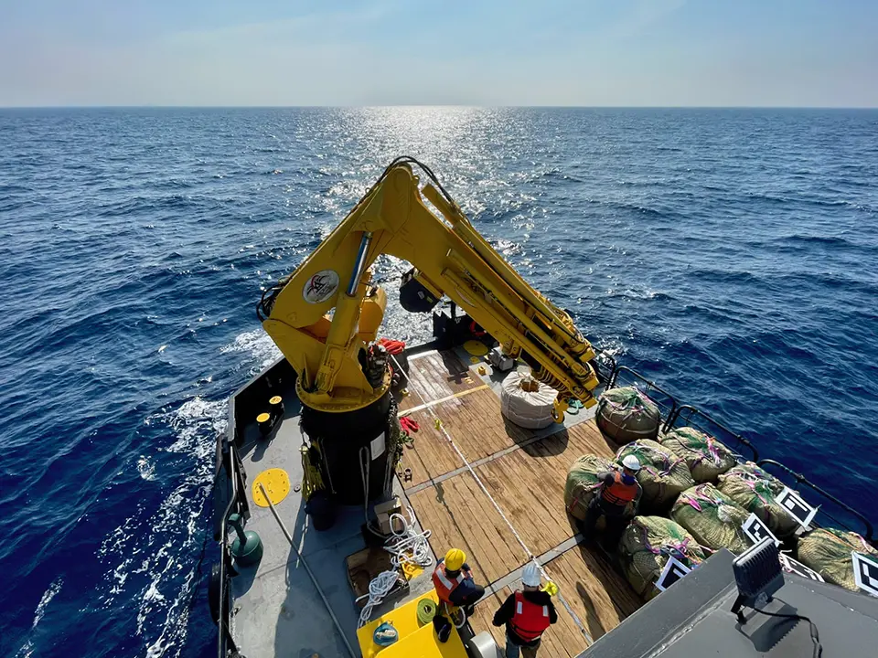
Rewind’s ocean approach is focused on storing sustainably sourced plant biomass within naturally oxygen-free marine environments where low oxygen levels significantly slow microbial decomposition. In anoxic basins and sediments, organic material can remain preserved for long periods, reducing the likelihood that the carbon will return to the atmosphere as CO2. The company has also developed sediment carbon storage (SCS), a method that involves placing biomass within low-oxygen seabed sediment, often in areas associated with dredging, where natural burial processes limit decomposition. By targeting anoxic or low-impact sediment sites, the approach aims to minimize disruption to productive oxygenated ecosystems and avoid altering nutrient balances. The method is designed to provide long-term carbon storage, while supporting broader efforts to reduce atmospheric CO2 linked to ocean warming and acidification.
Technological maturity: Frontier
Contracting type: For collaboration and partnership
Technology level: High
Place of origin: Israel
Availability: Georgia, Israel, Romania
Contact: WIPO GREEN Database
Wave-powered pump for upwelling/downwelling
Sea-Up
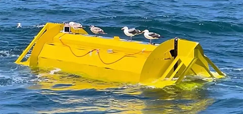
Sea-Up develops wave-powered upwelling systems that use the vertical motion of ocean waves to pump deeper, colder, nutrient-rich water toward the sunlit surface where natural biological productivity can be stimulated. By increasing nutrient availability in surface waters, the system aims to enhance phytoplankton growth, which may support carbon uptake through natural ocean processes. Sea-Up operates a subscription-based funding model called “Sea-Share,” through which individuals or organizations finance specific pumps and associated estimated carbon removal outcomes.
Technological maturity: Frontier
Contracting type: For collaboration and partnership
Technology level: High
Place of origin: United States
Availability: Bermuda
Contact: WIPO GREEN Database
Sargassum management/seaweed valorisation
Seafields
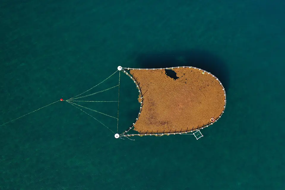
Seafields provides a nearshore solution that intercepts Sargassum before it reaches the coast, using floating barriers and in-water paddocks to keep the seaweed alive and create a reliable, year-round biomass supply. The harvested Sargassum is processed into sustainable industrial feedstocks for products such as biostimulants, biochar and biomaterials. By managing Sargassum in nearshore waters before it washes ashore and decomposes, the system can also help avoid associated methane emissions, protect coastal and marine ecosystems, and support a circular blue economy.
Technological maturity: Frontier
Contracting type: For collaboration and partnership
Technology level: High
Place of origin: United Kingdom
Availability: Caribbean, Mexico, United Kingdom, North Atlantic
Contact: WIPO GREEN Database
Horizon technology solutions
Total alkalinity sensor
National Oceanography Centre
The National Oceanography Centre has developed a miniaturized total alkalinit (TA) sensor based on microfluidic lab-on-chip (LOC) technology. The system enables high resolution in situ measurements to be taken throughout the water column at sampling intervals of approximately 10 minutes. It operates using an open-cell design combined with spectrophotometric pH determination. The sensor features an adjustable measurement range (default 2,000–2,600 µmol kg⁻¹). First-generation units have been successfully deployed on fixed pontoons, seabed landers, shipboard underway systems, AUVs and ROVs.
Technological maturity: Horizon
Contracting type: N/A
Technology level: High
Place of origin: United Kingdom
Availability: Under development
Contact: WIPO GREEN Database
Direct Ocean Capture (DOC) system using electrochemical CO2 extraction
SeaO2
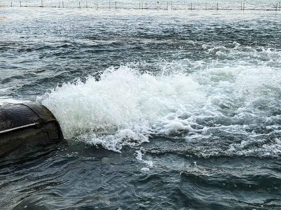
SeaO2develops DOC to remove CO2 from seawater using an electrochemical process driven by renewable electricity and seawater alone. The system alters the carbonate equilibrium within seawater, allowing dissolved inorganic carbon to be released as gaseous CO2, which is then captured for permanent storage in geological formations or converted into useful products like mineralized concrete, green fuels or chemicals. After treatment, decarbonized water is returned to the ocean’s surface where it naturally reabsorbs CO2 from the atmosphere, creating a continuous carbon removal cycle and helping offset ongoing emissions. Because dissolved CO2 contributes to ocean acidification, removing it locally can buffer acidity and support marine ecosystem health as water returns with a lower carbon content. SeaO2’s modular, scalable design is intended for integration with existing infrastructure, and pilot plants (e.g., in the Dutch North Sea region) are scaling from prototype to facilities with a multi-hundred tonne annual CO2 removal capacity.
Technological maturity: Horizon
Contracting type: N/A
Technology level: High
Place of origin: Kingdom of the Netherlands
Availability: Under development
Contact: WIPO GREEN Database
Electrochemical ocean alkalinity enhancement (OAE) carbon removal technology
Ebb Carbon
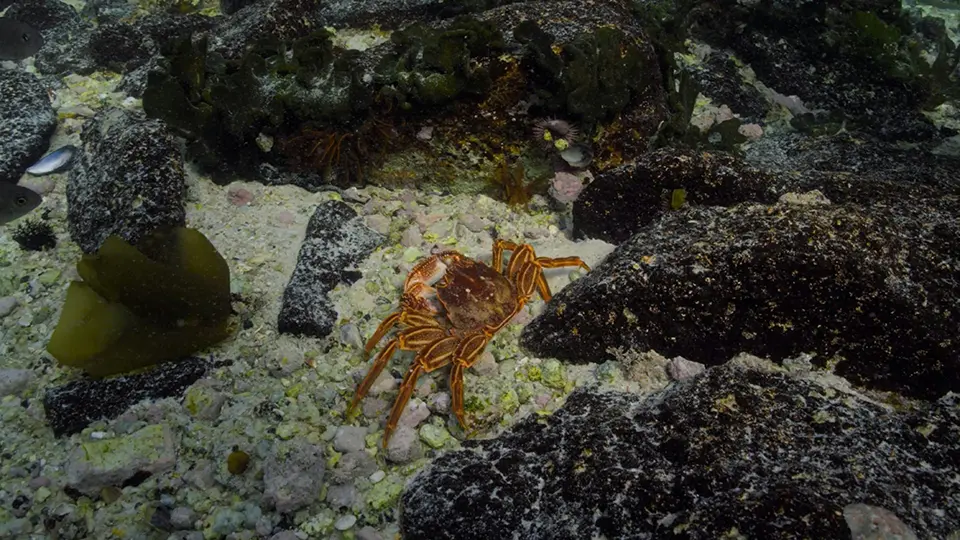
Ebb Carbon uses an electrochemical ocean alkalinity enhancement system to remove CO2 from the atmosphere by increasing the ocean’s capacity to absorb and store it. Seawater or brine flows through a modular electrochemical unit where electric current and ion-selective membranes separate it into three streams: a filtered brine stream, an acidic stream and an alkaline stream. The acidic stream can be repurposed for industrial uses, while the alkaline stream is safely returned to the ocean. Mixing with surrounding seawater, this alkaline water raises local pH and carbonate levels, promoting additional CO2 uptake from the atmosphere and converting it into stable bicarbonate ions that remain in the ocean for thousands of years. By enhancing alkalinity, the system also helps counter ocean acidification, protecting sensitive marine organisms like corals and shellfish. The technology is modular, compatible with existing seawater or desalination infrastructure, and continuously monitored to ensure pH changes stay within natural variability.
Technological maturity: Horizon
Contracting type: N/A
Technology level: High
Place of origin: United States
Availability: Under development
Contact: WIPO GREEN Database
Seawater electrolysis
Equatic
Equatic uses a proprietary seawater electrolysis process to accelerate the ocean’s natural ability to remove and store CO2. Seawater is pumped into an on-shore facility and electrolyzed using renewable electricity, splitting it into hydrogen, oxygen, an alkaline stream and an acid stream. The alkaline stream promotes CO2 removal by drawing atmospheric carbon into the water where it is converted into stable bicarbonate ions and solid carbonates that can remain stored for tens of thousands of years. The acid stream is neutralized with rock before discharge to maintain safe marine chemistry, and the treated seawater is returned to the ocean without causing a harmful imbalance. This approach benefits the ocean by enabling increased carbon uptake and long-term storage, which helps mitigate ocean acidification and supports overall ocean health. Additionally, the process produces carbon-negative hydrogen, offering clean energy to reduce fossil fuel use. Equatic uniquely operates within contained plants, allowing the accurate measurement and verification of the CO2 removed.
Technological maturity: Horizon
Contracting type: N/A
Technology level: High
Place of origin: United States
Availability: Under development
Contact: WIPO GREEN Database
3.3 Atlantic meridional overturning circulation (AMOC) and ocean current disruption
The Atlantic meridional overturning circulation (AMOC) is a major Atlantic Ocean current that is part of a “global conveyor belt” moving warm water from the Southern Ocean to the Arctic, while returning cold, dense water to the south (
AMOC: a potential tipping point in ocean circulation
The AMOC influences weather and climate across the Atlantic region and transports heat around the globe. It is a critical element of the climate system, having weakened or collapsed during past glacial periods and thereby contributed to abrupt climate changes. Past climate records show how disruptive such changes can be. At the end of the last ice age, large amounts of freshwater entering the North Atlantic triggered a major weakening or shutdown of circulation, leading to a sudden cooling in the Northern and a warming in the Southern Hemisphere. Evidence suggests it is once again weakening owing to a combination of ocean warming, increased rainfall and melting sea ice (
Direct measurement of the AMOC has been limited, but available data suggest it may have slowed by roughly 15 percent since the 1950s. Even a modest weakening can serve to cool Europe and alter precipitation patterns in South America and Africa, shift the Indian monsoon and move the tropical rain belt, potentially causing drought in the African Sahel. Some projections suggest a potential collapse could occur as early as mid-century under current emissions trajectories (
Increasing GHG emissions could raise the risk of crossing a tipping threshold. AMOC collapse would severely impact the North Atlantic climate and could have lasting effects: higher seas, stronger storms, Amazon rainfall changes and big north–south climate swings.
In situ, autonomous and satellite approaches to AMOC monitoring
Monitoring ocean currents and large-scale circulation patterns, such as the AMOC, relies on a combination of in situ sensors, autonomous vehicles, moored instruments and satellite observation. These systems aim to capture the velocity, direction and vertical structure of currents, as well as associated physical parameters like temperature, salinity and ocean mass. This is essential for understanding climate dynamics, heat transport and long-term variability. Some techniques are controversial. This is because they involve the active manipulation of deployment areas or rely on complex models, raising questions about accuracy, coverage gaps and interpretation in poorly observed regions.
AMOC collapse could have lasting effects: higher seas, stronger storms, Amazon rainfall changes and big north–south climate swings
A major class of instruments uses surface vehicles and AUVs. Gliders and AUVs drift or navigate through the water column, measuring temperature, salinity and currents, while transmitting data via satellite. Long-endurance gliders operate for months at a time, traversing hundreds to thousands of kilometers, while ultra-deep AUVs, capable of reaching a depth of 6,000 meters, provide high-resolution mapping of deep-ocean currents and water masses. Remotely operated vehicles complement these autonomous systems by enabling precise, localized surveys and sensor deployment in GPS-denied or complex underwater environments. Key innovations include GNSS-aided inertial navigation systems, which improve georeferencing and motion compensation on compact platforms (correcting measurements for the movement of the platform carrying the instrument), ensuring accurate oceanographic data even when far away from a support vessel. Box 3.6 provides a brief overview of the differences between ocean monitoring platforms.
Ocean observing platforms differ in how they move through the marine environment, determining the types of measurements they are able to collect and the scale at which they operate.
Profiling floats move up and down by adjusting buoyancy and drifting with ocean currents, making them ideal for long-term climate monitoring.
Gliders likewise utilize buoyancy changes, but have added wings that allow them to glide forward, enabling slow and energy-efficient route-based surveys to be made.
Autonomous underwater vehicles (AUVs) use propellers for active navigation, allowing them to follow precise paths and conduct high-resolution seabed mapping and targeted missions.
Fixed and moored instruments remain stationary and provide continuous long-term measurements at a specific location.
Fixed and moored instruments are critical for long-term monitoring. An acoustic Doppler current profiler (ADCP) measures velocity profiles across depth cells and can be deployed on the seabed, attached to a buoy or on an autonomous platform. A passive acoustic monitoring (PAM) buoy tracks underwater sound and environmental conditions over a long duration, providing supplemental data on water mass movement and ecosystem dynamics. Deep-ocean profiling floats, such as those used in the Deep Argo program, autonomously cycle between the surface and the seabed, measuring pressure, temperature and conductivity, providing full-depth circulation information. Total alkalinity sensors now allow the high-resolution in situ measurement of those chemical properties influencing density-driven currents and ocean acidification.
Ultra-deep AUVs, capable of reaching a depth of 6,000 meters, provide high-resolution mapping of deep-ocean currents and water masses
Satellite and remote-sensing technologies provide global coverage that complements in situ networks. Satellite altimetry missions measure sea surface height and ocean mass variations, while gravimetry missions like the Gravity Recovery and Climate Experiment (GRACE) and the Gravity field and steady-state Ocean Circulation Explorer (GOCE) track temporal and static variations in Earth’s gravity field, informing estimates of large-scale current transport and ocean circulation trends. See Box 3.7 for an overview of these two missions.
Scatterometry is used to measure surface wind stress and air–sea interaction, while satellite-derived coastal bathymetry and shoreline change data support the modeling of regional circulation and coastal dynamics. High-resolution, long-term datasets obtained from these platforms are critical for ocean reanalysis systems, which integrate observations into numerical models to estimate circulation patterns and improve the understanding of large-scale ocean processes, including AMOC variability.
The Gravity Recovery and Climate Experiment (GRACE) and its successor GRACE Follow-On measure tiny variations in Earth’s gravity field using twin satellites that track changes in the distance between them as they orbit the planet. These measurements reveal shifts in the distribution of mass, especially water in oceans, ice sheets and land hydrology. In oceanography, GRACE data are used to estimate ocean bottom pressure, allowing scientists to infer large-scale deep ocean currents and their variability, which improves understanding of global circulation patterns.
Meanwhile, the Gravity field and steady-state Ocean Circulation Explorer (GOCE) mission from the European Space Agency maps the Earth’s gravity field with very high precision to produce an accurate model of the geoid, the theoretical ocean surface shaped only by gravity. When combined with satellite measurements of actual sea-surface height, this geoid allows scientists to determine the speed and direction of surface ocean currents.
Together, these satellite gravity missions provide global measurements of ocean mass distribution, pressure gradients and sea-surface structure, complementing in situ observations and improving the monitoring of large-scale circulation systems such as the AMOC and the role they play in terms of the climate.
Source:
Together, these approaches represent a multi-scale, integrated monitoring network. Autonomous and moored instruments capture local and deep-water current structure, gliders and AUVs provide mobility and coverage in poorly observed regions, while satellites and reanalysis systems supply basin- and global-scale context. Innovations, such as compact GNSS-aided inertial navigation systems, ultra-deep AUVs with hovering capability and high-resolution lab-on-chip alkalinity sensors, are enhancing measurement precision and endurance, and enabling the long-term, scalable monitoring of ocean circulation.
Major monitoring systems tracking AMOC and large-scale ocean circulation
Monitoring the AMOC and ocean currents at large scale relies on a combination of observational networks and modeling systems to track large-scale ocean circulation and variability. Complementing autonomous and moored instruments, these systems provide additional precision and bring a global perspective to the understanding of this important circulation.
There are several global ocean reanalysis systems, including the HYCOM Consortium (a multinational effort to operate the Hybrid Coordinate Ocean Model (HYCOM) ocean reanalysis and prediction system supported by US institutions), Copernicus Marin (operates the Global Ocean Reanalysis System (GLORYS) based on the Nucleus for European Modelling of the Ocean (NEMO) model and incorporating in situ and satellite data) and the Estimating the Circulation and Climate of the Ocean (ECCO) consortium (a collaboration between Massachusetts Institute of Technology (MIT), National Oceanic and Atmospheric Administration (NOAA), Jet Propulsion Laboratory (JPL) and others) that produces estimates of ocean parameters for research. These models integrate satellites, moorings, float- and ship-based observations to produce a consistent estimate of ocean circulation inclusive of temperature, salinity and velocity. Reanalysis outputs allow researchers to quantify AMOC strength, track variability over time and project future changes under different climate scenarios.
Scatterometers – mentioned above – measure surface wind speed and direction across the ocean, the wind stress driving ocean currents, and upwelling/downwelling processes. Observations are assimilated into reanalysis and ocean circulation models to improve estimates of surface-driven AMOC variability. They are operated by NASA via its QuikSCAT SeaWinds instrument whose measurements of surface winds feed into global reanalysis research; the European Organisation for the Exploitation of Meteorological Satellites (EUMETSAT), which operates an advanced scatterometer (ASCAT) on the MetOp satellite series providing marine wind observations; and by the China National Space Administration (CNSA), which operates the HY-2A scatterometer that contributes wind observations for surface stress and circulation forcing.
Acoustic tomography uses the traveling times of sound between moorings to map ocean temperature and current distribution. Variations in sound speed provide a direct, basin-scale (overall behavior of an entire ocean basin) measure of AMOC variability over time. This is primarily a research technique pioneered by the Scripps Institution of Oceanography and the Woods Hole Oceanographic Institution. There are no large commercial providers offering basin-scale acoustic tomography systems.
Seafloor pressure and deep ocean circulation
Deep ocean circulation is monitored using precise measurements of pressure on the seafloor. Bottom pressure recorders (BPRs) measure very small changes in seafloor pressure, which reveal how deep ocean waters are moving. Often these changes amount to only a few centimeters over a single year. These measurements are critical for detecting trends, seasonal cycles and abrupt shifts in overturning circulation, which is driven by pressure gradients in the deep ocean.
Bottom pressure recorders (BPRs) measure very small changes in seafloor pressure, which reveal how deep ocean waters are moving
The RAPID-MOC is a long-term ocean observing system jointly operated by the National Oceanography Centre (United Kingdom); the University of Miami Rosenstiel School of Marine, Atmospheric, and Earth Science; and NOAA, with support from the United Kingdom and US research funding agencies. RAPID originally stood for “Rapid Climate Change Programme,” a UK research initiative launched in the early 2000s to investigate abrupt climate change risks. The observing array established under that program became known as RAPID-MOC, referring to the AMOC. It measures the strength and variability of the AMOC at 26.5°N across the Atlantic Ocean. It uses a network of moored instruments including current meters, temperature and salinity sensors, and BPRs, to track how much warm surface water flows northward and how much cold deep water returns southward.
In setups like the RAPID array at 26.5°N, BPRs provide continuous estimates. They are placed along the continental slopes on both sides of the Atlantic and help calculate the depth-independent (barotropic) transport of the ocean, which is combined with temperature and salinity measurements to determine total AMOC strength. Modern systems use very precise sensors (better than 0.01 dbar). To address the challenge of long-term sensor drift, one-year overlap periods are used between successive two-year mooring deployments and then compared with GRACE satellite data (see Box 3.7). Observations reveal that the AMOC varies significantly on a weekly-to-monthly timescale, and that it weakened measurably between 2004 and 2016 (
Innovation examples
Next-generation gravity mission for monitoring ocean circulation
ESA
The European Space Agency (ESA) is planning a new mission called the Next Generation Gravity Mission (NGGM). While building on the gravity measurements pioneered by GRACE and GOCE, this mission is specifically designed to improve the detection of changes in large-scale ocean circulation, including the weakening of the ocean conveyor system. It will include two satellites flying together as part of the MAGIC satellite constellation, alongside a companion pair from the GRACE-C mission developed by NASA and the German Aerospace Center. These satellites will use satellite gravimetry to measure tiny variations in Earth’s gravity. Ocean circulation slightly changes gravity, because moving masses of water alter how mass is distributed across the planet. The satellites detect these changes by measuring the distance between them with extreme precision. When they pass over an area with slightly stronger gravity caused by greater water mass below, the leading satellite accelerates slightly before the trailing one. This allows scientists to map whereabouts mass is moving on Earth. The satellites can also detect pressure changes on the ocean floor. By measuring pressure differences between upper and lower continental slopes, scientists are able to estimate AMOC strength. Unlike the RAPID array, which is expensive and limited to one location, satellites can monitor the entire ocean basin continuously and potentially detect early warning signs of AMOC weakening or collapse (
Argo meets AI: a new way to measure the AMOC
GEOMAR Helmholtz Centre for Ocean Research Kiel; Christian-Albrechts University of Kiel
Researchers from GEOMAR Helmholtz Centre for Ocean Research Kiel and Christian-Albrechts University of Kiel have developed a machine-learning method of estimating the strength of large-scale Atlantic Ocean currents (AMOC) using data obtained from Argo floats. Because direct moored observations are expensive and require high maintenance, the study tested whether widely available Argo float data (specifically temperature and salinity profiles) could be used to estimate deep ocean currents. Using a high-resolution ocean model (VIKING20X) and simulated Argo floats, they trained a machine learning model to convert scattered float measurements into estimates of large-scale ocean flow. The results were promising: the model explained up to 80 percent of the variation in ocean transport and had an average error of less than one Sverdrup (Sv), a unit used to measure ocean currents (equal to one million cubic meters of water per second). This is a strong result, because the AMOC itself only varies by a few Sverdrups over the course of years to decades. Finally, the researchers used explainable AI methods to understand how the model worked. They found that Argo data becomes especially useful over longer timescales, suggesting that machine learning applied to Argo float observations could help complement, or partially replace, moored estimates of the deep AMOC component in future monitoring systems (
The following collection of technologies is divided into three groups: Proven technologies have been on the market for some time and hence are well tested, Frontier technologies are available but relatively new, while Horizon technologies are close to being available but still under development.
Proven technology solutions
Inertial navigation system (INS) with GNSS for compact autonomous vehicles
SBG Systems
The Ellipse-N is a compact global navigation satellite system (GNSS)-aided inertial navigation system (measures motion using internal accelerometers and gyroscopes) optimized for smaller autonomous platforms such as gliders, medium-sized AUVs or unmanned surface vehicles (USVs). It combines a micro-electro-mechanical system (MEMS)-based inertial sensors (tiny sensors and mechanical components built on a microchip) with GNSS corrections to provide accurate orientation, position and velocity measurements, ensuring reliable motion compensation for onboard scientific instruments. Its lightweight, low-power design allows deployment on long-endurance missions, gathering temperature, salinity and current profiles critical for ocean circulation research. The Ellipse-N improves georeferencing and data quality on autonomous platforms operating far from a support vessel. When integrated into oceanographic missions, it supports climate monitoring, environmental studies and deep-ocean research. Its modular and compact form make it versatile for deployment on platforms where space and power are limited, while maintaining the accuracy required for scientific applications.
Technological maturity: Proven
Contracting type: For sale
Technology level: High
Place of origin: France
Availability: Worldwide
Contact: WIPO GREEN Database
Inertial navigation system (INS) with GNSS for high-precision navigation
SBG Systems
The Ekinox-D is a high-performance inertial navigation system (INS) designed for demanding marine applications requiring precision and reliability. It integrates dual-antenna GNSS with high-grade inertial sensors to deliver accurate measurements of position, heading, pitch, roll and heave, even in rough sea conditions. Its performance ensures precise motion compensation for oceanographic sensors mounted on ships, autonomous surface vehicles or AUV support platforms. Such accuracy is essential when collecting temperature, salinity and current data for large-scale ocean circulation studies, for example, monitoring the AMOC. By improving the geospatial reliability of sensor data, Ekinox-D allows scientists to detect subtle variations in ocean currents and water mass transport, enhancing climate models, navigation accuracy and integration with satellite or other in situ observations.
Technological maturity: Proven
Contracting type: For sale
Technology level: High
Place of origin: France
Availability: Worldwide
Contact: WIPO GREEN Database
Autonomous underwater vehicle (AUV)
Kongsberg
The HUGIN AUV is a free-swimming robotic system designed for long-range, untethered underwater survey and data collection. Operating at depths of up to 6,000 meters, HUGIN combines a hydrodynamic body with advanced navigation and a flexible array of sensors – such as synthetic aperture sonar, multibeam echo sounders, sub-bottom profilers, cameras and environmental instruments – to gather high-resolution geophysical and oceanographic data in a single mission. Since its development in the 1990s, it has become one of the most widely deployed commercial AUVs globally, used for seabed mapping, environmental monitoring and infrastructure inspection. Modern variants like the HUGIN Endurance enable long missions (up to 15 days and exceeding 2,000 km) with minimal human intervention, supported by sophisticated onboard navigation and mission planning systems.
Technological maturity: Proven
Contracting type: For sale
Technology level: High
Place of origin: Norway
Availability: Worldwide
Contact: WIPO GREEN Database
Remotely operated underwater vehicle (ROV)
Deep Trekker
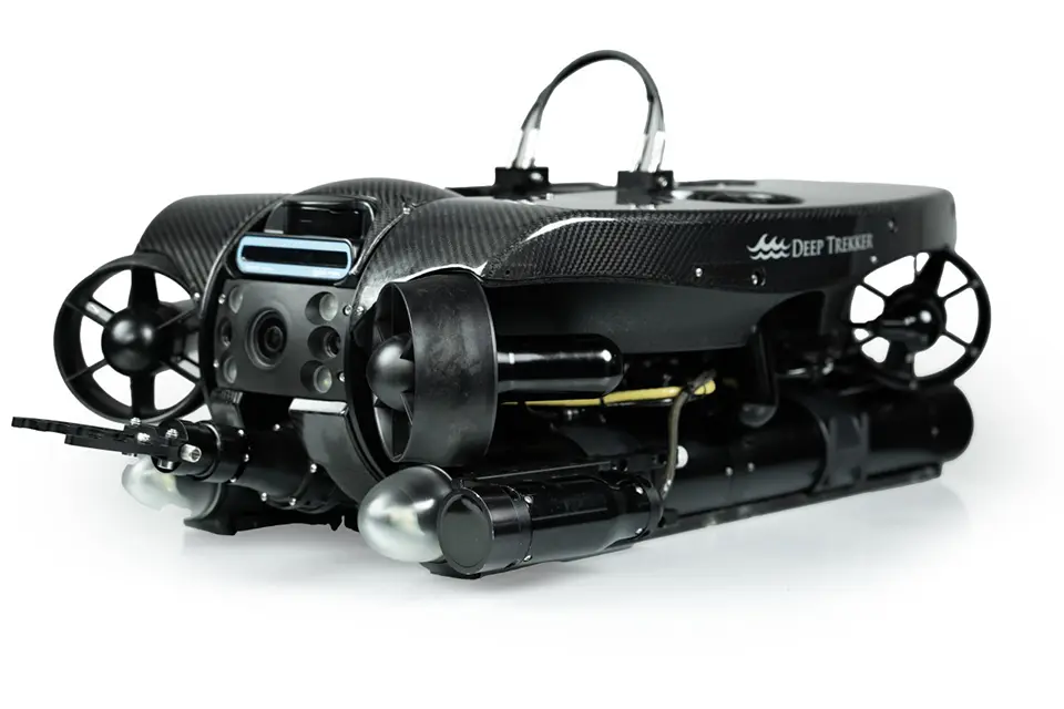
The Deep Trekker REVOLUTION ROV is a remotely operated underwater vehicle designed for flexible subsea operations. It offers advanced stabilization, autonomous waypoint navigation and a modular design that supports a range of modular sensor systems for environmental data collection, imaging and mapping. With flexible power options and a rotating head, the REVOLUTION can integrate high-resolution cameras, sonar systems and other survey tools needed for scientific missions. Its control software (BRIDGE Technology) allows data collection, autonomous path planning and operations in GPS-denied environments, making it adaptable for challenging water conditions. While not a dedicated scientific platform like a deep-ocean float or a mooring, the REVOLUTION ROV is effective for undertaking localized subsea surveys, habitat mapping and targeted deep-sea measurements that provide supplemental observational data in support of broader ocean circulation and climate monitoring efforts.
Technological maturity: Proven
Contracting type: For sale
Technology level: High
Place of origin: Canada
Availability: Worldwide
Contact: WIPO GREEN Database
Solar-powered autonomous surface buoy equipped with an acoustic Doppler current profiler (ADCP)
Obscape
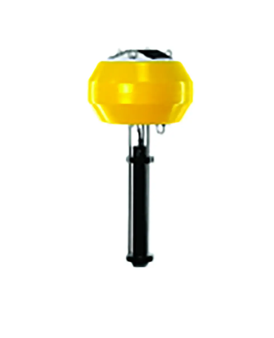
The Obscape ADCP Buoy is a solar-powered autonomous surface buoy equipped with an ADCP, typically supplied by manufacturers such as Nortek. It measures current speed and direction throughout the upper water column (up to ~90 meters depth depending on configuration) and transmits data in near-real-time via cellular or satellite communications. Designed for offshore and coastal deployment, the system enables the long-duration, low-maintenance monitoring of ocean currents without requiring continuous vessel support. For large-scale ocean observing systems, instruments like the ADCP Buoy provide localized, high-resolution velocity profiles that complement deep-water moorings, gliders and ship-based ADCP surveys. While not a full-basin AMOC monitoring solution on its own, it can contribute to larger networks that track ocean currents and circulation changes.
Technological maturity: Proven
Contracting type: For sale
Technology level: High
Place of origin: Kingdom of the Netherlands
Availability: Worldwide
Contact: WIPO GREEN Database
High-performance acoustic doppler current profiler (ADCP) designed for detailed water-column velocity measurements
Nortek
The Signature1000 is a high-performance ADCP designed for detailed water-column velocity measurement. Operating at 1 MHz, it provides high-resolution current profiling suitable for coastal, shelf and upper-ocean deployment. Using broadband Doppler technology and multiple acoustic beams, the instrument measures current speed and direction across vertical depth cells, generating precise velocity profiles over time. The Signature1000 supports moored, seabed or autonomous platform installation and is engineered for long-term deployment in demanding marine environments. Its high sampling flexibility and integrated wave measurement capability allow the simultaneous monitoring of currents, turbulence and surface wave conditions. For large-scale circulation studies, instruments like the Signature1000 contribute localized, but highly detailed velocity data that can be integrated into broader observing networks, complementing deep-water ADCPs, gliders, satellite gravimetry and CTD systems used to monitor ocean transport variability and climate-relevant circulation changes.
Technological maturity: Proven
Contracting type: For sale
Technology level: High
Place of origin: Norway
Availability: Worldwide
Contact: WIPO GREEN Database
Deep sea profiling float
Tsurumi-Seiki
Deep NINJA is a deep-ocean profiling float developed jointly by Tsurumi-Seiki Co., Ltd. and the Japan Agency for Marine-Earth Science and Technology (JAMSTEC). It is designed to autonomously sink, drift and resurface, while measuring temperature, salinity and pressure to depths of up to 4,000 meters (deeper than a standard Argo float). The float uses a buoyancy engine (a device that changes a float’s density so it can move up and down in the ocean of its own accord), GPS for positioning at the surface and Iridium satellite communication to transmit data back to land. Deep NINJA has been used in scientific deployments in the Southern Ocean and Antarctic waters, contributing to Deep Argo efforts.
Technological maturity: Proven
Contracting type: For collaboration
Technology level: High
Place of origin: Japan
Availability: Worldwide
Contact: WIPO GREEN Database
SeaSonde
Codar Ocean Sensors
The SeaSonde® high-frequency (HF) radar continuously maps surface ocean currents and waves over large coastal areas using shore-based antennas. It emits high-frequency radio signals that scatter off the moving sea surface. By measuring Doppler shifts and using patented direction-finding algorithms, the system derives 2D surface current velocity fields and key wave parameters in near real-time. The SeaSonde is a non-contact, low-power, remotely accessed and can support modeling, search-and-rescue and coastal management. It has been widely deployed globally, with systems providing decades of operational data and even capturing tsunami-related signatures.
Technological maturity: Proven
Contracting type: For collaboration
Technology level: High
Place of origin: United States
Availability: Worldwide
Contact: WIPO GREEN Database
iSVP (Surface Velocity Program) drifting buoy
MetOcean Telematics
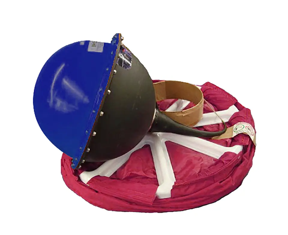
The iSVP (Surface Velocity Program) drifting buoy is a Lagrangian (moving with the flow) surface current drifter that measures ocean currents by physically moving with the water. It consists of a surface float equipped with GPS and satellite telemetry, connected via a tether to a subsurface drogue (a fabric “holey-sock” sea anchor) centered at a depth of about 15 meters. This drogue ensures the buoy follows the water mass rather than being pushed by wind or waves. As the buoy drifts, it periodically records its position and transmits data via Argos or Iridium satellites, allowing scientists to calculate current velocity and direction from successive positions. The standard SVP is equipped with a sea surface temperature sensor, and buoys can also be equipped with an optional barometric pressure sensor. The standard SVP is equipped with a sea surface temperature sensor, and buoys can also be equipped with an optional barometric pressure sensor.
Technological maturity: Proven
Contracting type: For sale
Technology level: High
Place of origin: Canada
Availability: Worldwide
Contact: WIPO GREEN Database
Frontier technology solutions
Ultra-deep autonomous underwater vehicle
Exail
The Exail A6K is an ultra-deep AUV designed for demanding deep-sea missions. It can operate at depths of up to 6,000 meters and supports long-endurance missions (up to about 30 hours, depending on payload), and has unique hovering capabilities for stable, low-altitude surveying. The A6K combines dual-mode survey and inspection functions and can carry a wide array of sensors – such as synthetic aperture sonar, multibeam echo sounders, high-resolution cameras, sub-bottom profilers, environmental sensors, lasers and magnetometers – tailored to mission needs. Its autonomy allows it to interrupt pre-planned routes for detailed investigation based on real-time data. It is flexible and easy to maintain, making it useful for science, ocean mapping, underwater inspections and rescue missions.
Technological maturity: Frontier
Contracting type: For sale
Technology level: High
Place of origin: France
Availability: Worldwide
Contact: WIPO GREEN Database
Deep water acoustic Doppler current profiler (ADCP)
Sonardyne
.jpg)
The Origin 65 is a deep-water ADCP engineered for the long-range profiling of underwater currents, waves and turbulence. It combines advanced low-frequency acoustics with a robust “satellite-dish” transducer design and on-board Edge processing to produce high-resolution velocity profiles up to ~800 meters above the seabed, while operating at depths of between ~4,100 and 4,500 meters. An integrated acoustic modem allows remote configuration and data access without recovery, and an internal Pressure Inverted Echo Sounder (PIES) provides precise sound velocity and time-of-flight measurements that are fused with current data. These capabilities make the Origin 65 suitable for sustained deployment in challenging environments, where it can collect detailed current data for scientific missions. It has been used in long-duration ocean current programs (e.g., Loop Current studies in the Gulf of Mexico), showing its potential for deep-ocean circulation monitoring.
Technological maturity: Frontier
Contracting type: For sale
Technology level: High
Place of origin: United Kingdom
Availability: Worldwide
Contact: WIPO GREEN Database
Coastal defense and stochastic surge model
Ocean Ledger
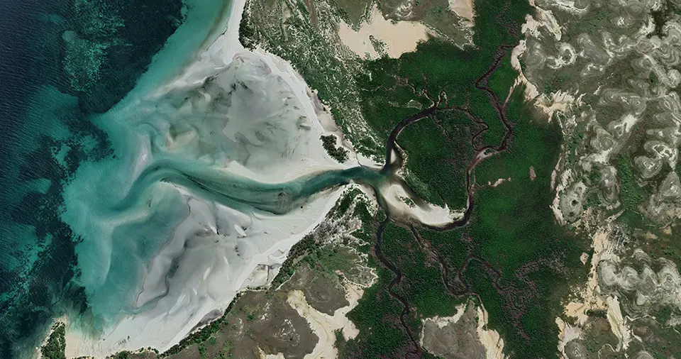
Ocean Ledger provides insights into local coastal physical risks using satellite-derived data products and analytical methods to identify trends over time. The model uses satellite-derived bathymetry to map water depth in remote areas using multispectral satellite imagery. It generates spatially detailed shoreline positions and calculates erosion and accretion rates, as well as volume changes, at 100-meter intervals or finer along the coastline. High-resolution (15-meter) maps can then be produced detailing storm surge risk that accounts for erosion and other key factors, including estimates of surge damage frequency and severity. They can also measure historical gains and losses in ecosystem extent to support nature-based solutions and incorporate the value of natural flood defenses into catastrophe risk pricing and management. Ocean Ledger’s data can be accessed directly through an application programming interface (API) for seamless integration into existing systems; or through a web-based portal, where users can request new sites and view data alongside maps and additional visualizations.
Technological maturity: Frontier
Contracting type: For service
Technology level: High
Place of origin: United Kingdom
Availability: Worldwide
Contact: WIPO GREEN Database
Mooring: passive acoustic monitoring (PAM) buoy
Cyprus Subsea Consulting & Services
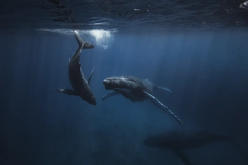
The PAM Smart Buoy is a moored observing platform integrating a self-powered buoy with a high-sensitivity digital hydrophone and environmental sensors. Once deployed, it sits anchored at a fixed location, continuously capturing underwater sound and environmental conditions. The system’s broadband hydrophone records acoustic signals across a wide frequency with low noise, and data are transmitted in near-real-time via GSM or satellite links for analysis and event detection. Such a moored system is ideal for monitoring ambient ocean noise, marine life vocalizations or human-generated sounds over a long duration. Some oceanographic processes, such as internal waves, turbulence, deep mixing, generate sound and acoustic data can help in the studying of these processes. Acoustic data can complement physical measurements within integrated climate observing networks.
Technological maturity: Frontier
Contracting type: For sale
Technology level: High
Place of origin: Cyprus
Availability: Worldwide
Contact: WIPO GREEN Database
Bottom pressure sensor (BPR)
Sonardyne
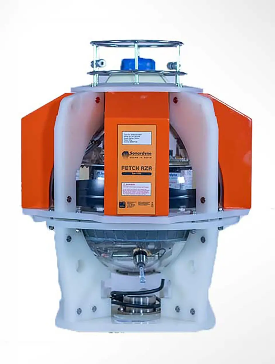
The Fetch AZA is a self-calibrating bottom pressure recorder designed for long-term deep ocean monitoring. Deployed on the seafloor at depths of up to 3,000–6,000 meters, it measures the extremely small pressure changes that reveal shifts in water mass movement or vertical seabed displacement. Its key innovation is the Ambient-Zero-Ambient (AZA) calibration system, which periodically compares the main pressure sensor with a protected reference sensor to automatically correct measurement drift – one of the main limitations of conventional sensors. This allows the instrument to maintain highly accurate readings during deployments lasting up to 10 years. The system can log additional environmental data (such as temperature and sound velocity) and transmit information acoustically to vessels or uncrewed surface vehicles (USVs). These capabilities enable the long-term, high-precision monitoring of ocean circulation, seabed deformation and climate-relevant processes.
Technological maturity: Frontier
Contracting type: For sale
Technology level: High
Place of origin: United Kingdom
Availability: Worldwide
Contact: WIPO GREEN Database
Horizon technology solutions
Digital twin of the ocean
EDITO
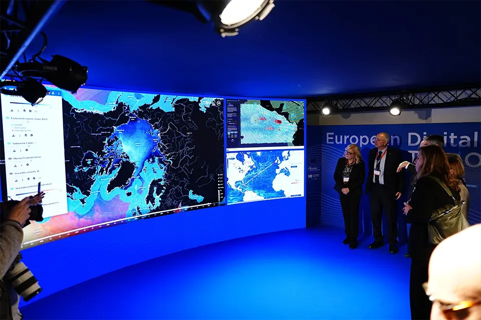
The European Digital Twin of the Ocean is a high-resolution virtual replica of the ocean, integrating real-time observations and advanced models to simulate large-scale circulation patterns like the AMOC. It allows researchers to monitor shifts, forecast changes and test climate scenarios to better understand ocean dynamics and their global impact. It continuously integrates real-time data obtained from satellites and sensors, advanced ocean models, AI and high-performance computing to mirror and forecast ocean behavior. This open, interactive platform lets governments, researchers, industries and citizens monitor ocean conditions, simulate future scenarios (like climate impacts or pollution) and test “what-if” decisions to protect marine ecosystems, strengthen ocean governance and support sustainable blue economy planning. After an initial inception phase via the Horizon Europe “EDITO-Infra” and “EDITO Model Lab” projects, (2022-2025), EDITO continues developing in the framework of the Horizon Europe “EDITO 2” project (2025-2028), which is implemented by Mercator Ocean International, and the Flanders Marine Institute, with the support of Seascape Belgium on behalf of the EMODnet Secretariat. Beyond 2028, EDITO is intended to evolve into a long-term, sustained European infrastructure that extends beyond the lifetime of these projects. By 2030, EDITO envisions a fully operational European Digital Twin Ocean platform, serving as a global benchmark for digital ocean solutions and democratised access to ocean knowledge.
Technological maturity: Horizon
Contracting type: Under development
Technology level: High
Place of origin: France
Availability: Under development
Contact: WIPO GREEN Database