
Although emerging technologies cannot replace essentials like food, shelter and medical care, they are proving indispensable in organizing and accelerating relief efforts (
Emergency infrastructure and rapid deployment
Climate-driven disasters are displacing millions, overwhelming traditional response systems. Innovations like 3D-printed shelters, rescue drones, and mobile solar grids enable faster, adaptive responses. Resilient shelter designs, amphibious aid vehicles, and decentralized logistics tackle challenges while cutting costs and environmental impact.
Technological developments and trends
The Internal Displacement Monitoring Centre (IDMC) reports that almost 449 million displacements were triggered by disasters across more than 120 countries between 2008 and 2024 (
Figure 9.1 indicates that the number of disaster displacements in 2024 was nearly double the annual average for the period 2008-2023, reaching 45 million. Strikingly, 2024 broke several records, with 29 countries and territories reporting the highest disaster displacement figures on record. The number of countries reporting displacement caused by both conflict and disasters has tripled since 2009 (
Almost 449 million displacements were triggered by disasters across more than 120 countries between 2008 and 2024
Displacement due to disasters is not only a humanitarian challenge, but also an operational test of early warning systems. Forecast- and impact-based early warnings can significantly reduce the logistical strain caused by sudden mass movements.


Given the unprecedented scale and frequency of displacement caused by climate-driven disasters, traditional response methods are increasingly stretched thin. Early warning systems play a critical role in ensuring that emergency infrastructure and support services are in place before disaster impacts occur. Accurate hazard forecasts, such as cyclone track projections, flood crest timing or wildfire spread modeling, provide the lead time to logistics activation. Response agencies can synchronize procurement, customs clearance and transport operations with the anticipated onset. However, turning that lead time into effective action depends on having rapid and adaptable response technologies ready to deploy. Emergency infrastructure and rapid deployment capabilities have therefore emerged as critical components in meeting these challenges, enabling swift operational capacity and a more effective disaster response.
Emergency infrastructure and rapid deployment technologies encompass flexible and adaptable, mobile and resilient solutions designed to establish immediate operational capacity in crisis zones. Advanced construction technologies and materials enable fast, low-cost rebuilding and are being used in temporary shelters for displaced people. Mobile medical units and rapidly deployable shelters provide hygiene, health care and safety, while autonomous and robotic systems, such as water and multi-terrain rescue robots and foldable drones, are game changers for search-and-rescue operations. Likewise, logistical supply chain innovations are essential for the delivery of aid to inaccessible areas. Energy and water infrastructure resilience is also crucial for remote and off-grid areas enduring disasters.
Technologies involved in emergency infrastructure prioritize AI and automation, energy independence and localized manufacturing. Many solutions, such as drones and 3D printing, combine hardware with AI. By integrating physical and digital systems, innovative solutions can bring immediate relief alongside long-term recovery. Military-grade technology is often repurposed for use in civilian disaster response efforts. The military’s expertise in rapid deployment and robust infrastructure can play a role in enhancing response capabilities. Fortunately, renewable energy and circular design principles are increasingly becoming standard, reducing the environmental impact of these technologies.
From plastic sheeting to 3D printing: evolving shelter technologies
Disasters can cause severe destruction, leaving communities in urgent need of protection – including reliable shelters. In emergency situations, effective shelters prioritize simplicity, safety and the use of locally available, sustainable materials, only resorting to imported materials when necessary. Plastic sheeting is widely used because of its low cost and versatility. However, shelters should offer not only physical protection, but also support the dignity, safety and psychological well-being of displaced people (
Improving how shelters are designed and managed is often one of the most practical ways of reducing disaster impact
Temporary shelters can be classified into four types: emergency shelters, which provide immediate and life-saving protection for the very short-term; temporary shelters like tents so that individuals or groups can bridge the gap between emergency and a more stable means of shelter; temporary housing, which is typically more durable and better equipped than shelters; and, lastly, permanent housing, which despite being labeled as “permanent” can sometimes be deployed quickly and cost-effectively in urgent situations. While the choice depends on the nature of the disaster and available resources, emergency and temporary shelters often end up serving as long-term housing for affected people (
Improving how shelters are designed and managed is often one of the most practical ways of reducing disaster impact. While exact cost–benefit data for humanitarian contexts is limited, evidence from non-humanitarian settings shows that every USD 1 spent on risk mitigation saves between USD 7 and USD 15 in post-disaster damage and recovery costs (
To reduce disaster impacts on shelters and settlements, practitioners use various techniques tailored to local hazards (
Strengthening structural connections: in Indonesia, after earthquakes in 2018 and 2020, the use of light steel framing with diagonal bracing improved shelter resilience against earthquakes, cyclones and high winds.
Raising foundations and deep posts: in Syria, following floods in 2022 and an earthquake in 2023, the Global Shelter Cluster recommended installing plinths at wall bases. Similarly, after 2022 cyclones in Madagascar, posts were sunk at least 75 cm deep, so as to better withstand floods and storms.
Creating defensible spaces (for fire risk): after fires in Palestine in 2018, clearing dry vegetation, waste and debris around shelters in camps helped reduce fire risks.
Additional measures include spacing tents in order to create firebreaks, digging drainage channels to manage water flow, and planting vegetation to prevent erosion. Such strategies vary according to context, but collectively help make shelters more disaster-resilient.
The UNHCR provides minimum standards for floor space in emergency shelters for both warm and cold climates, while also providing a table of the pros and cons associated with different shelter solutions, as shown in table 9.2.

Efforts to promote disaster-resilient shelter solutions often encounter policy limitations, as some host countries prioritize temporary shelter approaches for displaced populations, reflecting the prevailing view of displacement as a short-term situation. This can entail restrictions on the use of durable materials, permanent foundations or long-term infrastructure, which may limit the building of shelters resilient to climate-related hazards. Many mitigation measures, such as framing or installing drainage systems and strengthening walls, are seen as permanent and banned in camps. Innovative and contextually appropriate approaches are needed – for instance, Catholic Relief Services and Caritas International label their durable shelter upgrades for Rohingya refugees in Bangladesh as “mid-term shelters” to comply with government restrictions, despite the work being essentially permanent (
The Sphere Handbook (
3D printing enabling rapid, on-demand construction using local materials
Traditional construction methods are often slow, expensive and logistically complex. In contrast, 3D printing presents a promising alternative by enabling faster, more adaptable and cost-efficient solutions for disaster recovery and rebuilding. Historically, societies have responded to disasters with rapid, adaptive architecture – for example, Otto Bartning’s modular churches built from wartime rubble in post-World War II Germany or China’s prefabricated Fangcang hospitals during the COVID-19 pandemic – each aiming to provide shelter quickly during an emergency (
3D-printed housing employs large robotic arms guided by digital blueprints (CAD files) to lay down layers of material – like concrete or clay – directly onto a building site. The printer follows a programmed path, creating walls and structural elements layer by layer, leaving gaps for doors and windows.
One of the key advantages of 3D printing is its ability to deploy quickly. Mobile 3D printers can be transported directly to disaster-affected areas, where they can produce essential supplies and structures on-site, operating both night and day to maximize output. This approach eliminates long supply chains and reduces delays. Because 3D printing allows for customization, it can address the specific needs of each disaster scenario, and its scalability ensures it can be adapted to varying levels of impact and the available resources.
Cost effectiveness is another benefit. 3D printing minimizes material waste by building objects layer by layer to conserve resources. Homes can be printed in 24 hours for under USD 4,000 by companies like Icon, compared to 40× the cost using conventional methods (
3D printing within disaster settings offers quick, customized production in small batches, but is not suitable for mass manufacturing
Beyond constructing immediate shelter, 3D printing can be used to repair infrastructure, such as roads, bridges and utility systems, by rapidly producing replacement parts and structural components. In health care, it supports the production of urgent medical supplies, including prosthetics, surgical tools and personal protective equipment, as well as spare parts for medical machines. It also helps restore the supply of basic needs by printing components for water filtration systems and food production setups. 3D printing may also support education and skills development when used to produce educational materials and training models, and to set up local workshops that teach additive manufacturing skills.
3D printing within disaster settings offers quick, customized production in small batches, but is not suitable for mass manufacturing owing to its current limited speed. In addition, not all components (e.g., doors, windows, roofs) are currently printable. While most high-tech 3D printed construction projects are built in high-income countries, there are emerging pilot projects in low-income, fragile and post-disaster contexts. However, several key challenges continue to limit broader adoption. They include technical skill requirements, regulatory hurdles, equipment fragility, sensitivity to weather, possible high costs, and the need for reliable power – all of which can be difficult to guarantee within disaster-affected settings (
Rapid-deploy and mobile units provide shelter, health care, power and logistics
Inflatable emergency response shelters are quick-deploying self-erecting structures used for protection, as well as triage stations, field hospitals, command centers and temporary housing. Some can be inflated in under 6 minutes. Inflatable air tents are ready for rapid setup in an emergency and can help maintain a stable interior temperature.
Portable cabins are versatile, modular and more durable disaster relief solutions that serve multiple functions beyond providing basic shelter. They provide secure emergency housing, can be converted into mobile health centers or hospitals, act as command and control centers for coordination, serve as warehouses for essential supplies, and function as temporary classrooms.
Shipping containers can serve as secure storage and mobile command centers in disaster relief
Medical containers are portable, modular units – often modified shipping containers – equipped with medical facilities for either an emergency or remote health care provide clean ventilated spaces and ensure accessibility to health care. Technology providers like Proseven produce adhesive pads that can secure equipment inside these containers, ensuring they remain stable during transportation and easy to reorganize on-site. Shipping containers can serve as secure storage and mobile command centers in disaster relief, and can be modified with the addition of eco-friendly features such as solar panels and rainwater harvesting.
Sesame Solar Nanogrids deliver rapid, off-grid renewable power within 15 minutes to support pop-up shelters, medical centers and emergency operations. Providers like Rubb have developed easily deployable, air-transportable emergency shelters and storage structures that can be assembled quickly. High-durability rescue boats support the response to water-related disasters.
Innovations deliver emergency food and water supplies
In the immediate aftermath of a disaster, access to safe drinking water and food is a critical lifeline for affected communities. Innovative technologies help ensure their timely delivery and safety. From emergency water filters that protect against bacteria, parasites and emerging contaminants like PFAS (per- and polyfluoroalkyl substances that break down very slowly) to durable and hygienic drinking water buckets designed for rapid local deployment, advancements in water and sanitation technology are saving lives. Solutions like smart water ATMs enable controlled, contactless access to clean water. At the cutting edge of food delivery, robotics and drones are transforming the transportation of food to disaster areas through projects like RoboFood, which is pioneering edible robots capable of delivering lifesaving nutrients in disaster zones (they are made in part from edible materials). Logistics drones, such as Aeronext’s AirTruck, help to deliver critical supplies in a challenging terrain. Together, these integrated technologies address the complex demands of emergency food and water provision during a disaster. However, the use of drones in active conflict regions or in areas beyond state control might not be possible or advisable.
To cut the costs incurred using helicopters and airplanes, the World Food Programme (WFP) has developed SHERP, an amphibious all-terrain vehicle, in Ukraine. It delivers humanitarian aid to remote locations. By replacing airlifts for food delivery, it has significantly reduced transportation expenses, with some operations achieving up to a 75 percent cost reduction (
As described in box 9.2, WFP has developed an extensive disaster logistics framework and operation, complete with coordination and information-sharing platforms, logistics and stockpiling hubs for supplies; its own air service; and an ever-expanding drone coordination model for a wide range of services and operations.
Food delivery is obviously vital. The increasing frequency of climate-related disasters has spurred demand for emergency meal services. For example, Hurricane Ian in 2022 required the feeding of 30,000 displaced residents in Florida in the United States. Similarly, in 2019, Cyclone Idai devastated Mozambique, displacing over 1.85 million people and creating urgent food supply challenges in fragile and hard-to-reach areas. Such impacts are often larger in scale and more profound in fragile or conflict-affected areas due to their greater vulnerability. Some governments are responding by increasing funding for food logistics, for example, the United States USD 3.5 billion allocation to FEMA in 2023, which boosts partnerships with catering providers (
In 2023, the World Food Programme (WFP) supported 58 countries in strengthening their emergency preparedness and response systems, reaching 103 million people with assistance during disasters and crises. WFP’s approach integrates advanced technologies and innovative logistics that optimize operational efficiency.
WFP employs data-driven early warning systems and geographic information systems (GIS) for real-time risk assessment and disaster impact mapping. WFP’s United Nations Humanitarian Response Depot (UNHRD) network maintains strategic stocks at five global hubs, enabling the dispatch of relief items within 48 hours of notification. This system supports over 100 partners with rapid procurement, storage and transport. The organization’s global supply chain managed the delivery of an estimated 3.7 million metric tons (MT) of food in 2023, supported by its Logistics Cluster and the Logistics Cluster Information Exchange (LogIE). LogIE’s multi-layered, map-based data integration platform supports coordination and information sharing to ensure that aid reaches its destination efficiently. The UN Humanitarian Air Service (UNHAS) – operated by WFP – transported over 388,000 passengers and 4,800 MT of cargo in 2023 to more than 389 destinations using a fleet of 144 aircraft. The Operations Centre (OPSCEN) facilitates 24/7 crisis communication and inter-agency coordination.
Since 2017, WFP has been advancing the use of drones to enhance its emergency preparedness and response to disasters. Supported by partners like Belgium, the United Kingdom’s Foreign, Commonwealth & Development Office (FCDO) and the European Union, WFP has developed a global drone coordination model, pre-positioned equipment in five regions, and conducted over 25 capacity-building activities benefiting 600+ participants in 2022. Drones are used for rapid damage assessment and flood modeling; agricultural crop health monitoring using multispectral imaging; and search and rescue missions using infrared technology. They also support emergency connectivity by delivering mobile and internet coverage and facilitate precise site surveying for communication network setup.
Innovation examples
Mobile technology for water and sanitation disaster resilience in the Pacific
 Source: Field Ready
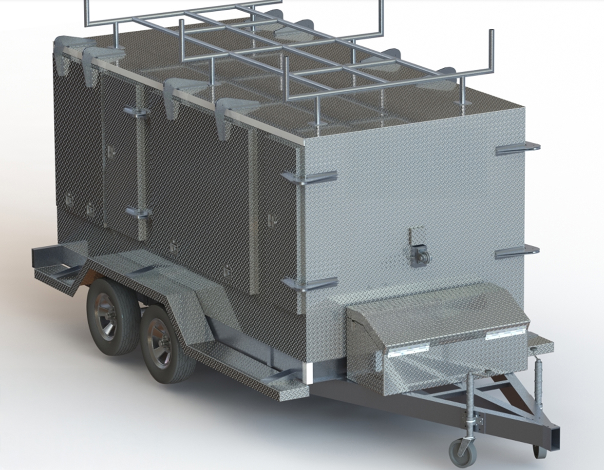
Field Ready is a humanitarian organization dedicated to building local capacity and delivering practical solutions for disaster response. In the Pacific region, Field Ready has developed a Mobile Makerspace – a portable workshop equipped with tools and technology – to support rapid repairs, particularly focused on water, sanitation and hygiene (WASH) needs in remote island communities. The Pacific’s diverse water sources and climate challenges require innovative approaches to water management. Field Ready emphasizes rainwater harvesting as a sustainable, community-driven solution to water scarcity. Deploying the Mobile Makerspace, teams have supported villages in Fiji in assessing and repairing critical WASH infrastructure, including rainwater systems, sanitation shelters and water tanks. A key piece of equipment, the portable Guttering Machine, enables the on-site production of gutters, allowing communities to maintain and expand their rainwater harvesting systems. The Mobile Makerspace’s successful deployment across islands demonstrates its mobility and adaptability. Field Ready plans to expand this approach throughout the Pacific, including Vanuatu, Samoa and the Solomon Islands, to improve disaster response capabilities regionally (
Flying lifelines: how Zipline’s drones transform medical supply delivery in Rwanda
 Source: Zipline
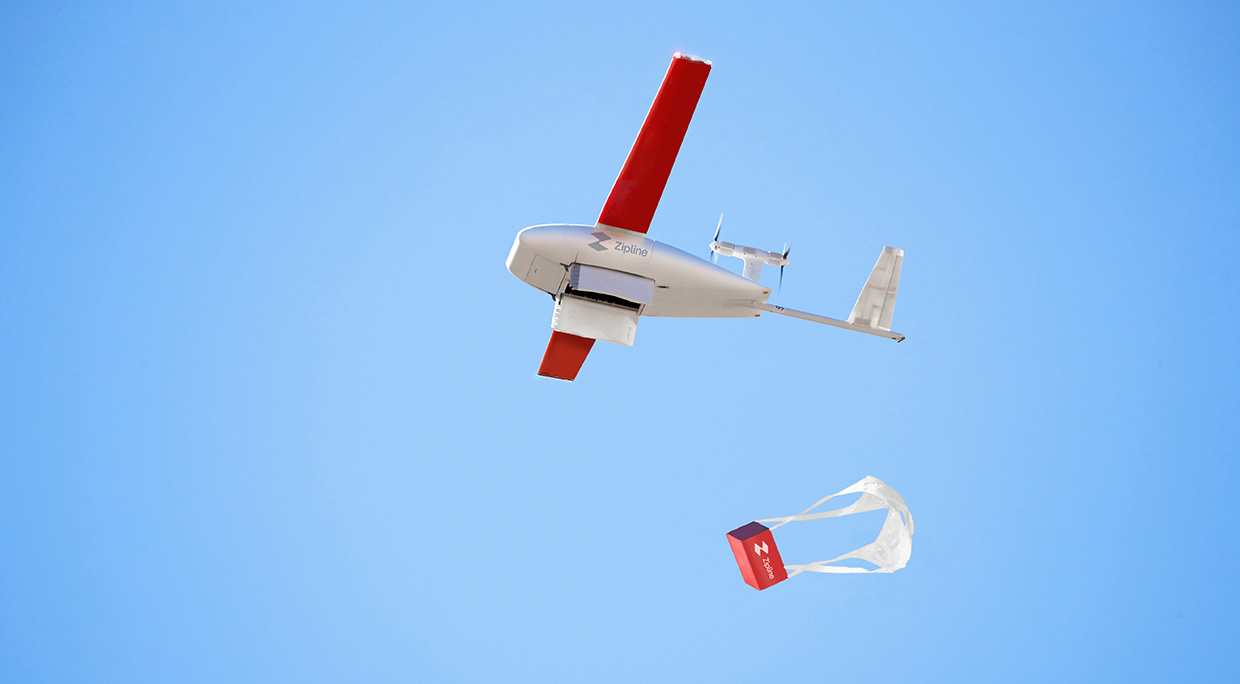
Rwanda’s mountainous terrain and poor road infrastructure make transporting medical supplies to rural areas unreliable, causing 25–40 percent of temperature-sensitive products like blood to spoil before reaching a clinic. Zipline – a US-based drone company – addresses these challenges by using drones to deliver blood and emergency medical supplies quickly and efficiently. Operating from two distribution centers, Zipline receives blood collected by the National Centre for Blood Transfusion in Kigali and flies it directly to district hospitals and rural clinics, bypassing difficult terrain and unreliable roads. Health workers order supplies via SMS or phone, and drones fly at speeds up to 160 km/h, delivering packages by parachute within minutes. By early 2020, Zipline was delivering over 75 percent of Rwanda’s blood supply outside the capital, reducing delivery times from hours to minutes. Zipline operates through strong partnerships with Rwanda’s Ministry of Health, its Civil Aviation Authority and donors like the Global Alliance for Vaccines (GAVI). Zipline’s success also highlights the potential of drone delivery to enhance health care access in remote areas through public–private collaboration (
Sustainable, low-cost timber–cardboard shelters for post-disaster relief in Australia
 Source: Southern Cross University
After the 2019/20 bushfires and 2022 floods in Northern Rivers, Australia, researchers from Southern Cross University and the University of Queensland developed an innovative, low-cost disaster-resistant housing system using hybrid timber–cardboard materials. The key technology is a “sandwich panel” construction, where recycled cardboard “studs” are bonded between plywood layers made from radiata pine, hoop pine, particleboard and medium-density fiberboard. Structural elements also incorporate low-diameter roundwood and pulpwood residues sourced from local forest thinnings, maximizing use of forestry by-products. This approach significantly reduces material costs and embodied carbon emissions by utilizing waste and residue materials, while creating lightweight panels for framing and cladding. The design simplifies fabrication and assembly and supports easy disassembly for reuse or recycling, which is ideal for rapid deployment in flood or bushfire disasters. Backed by New South Wales’ Department of Primary Industries and industry partners, the system aims to provide affordable, sustainable temporary shelters that can be built for around $12,000. This hybrid timber–cardboard technology offers a new class of structural composite material, representing a promising model for scalable post-disaster housing solutions that address urgent shelter shortages in vulnerable communities (
Proven technology solutions
Shelters: shipping containers for disaster relief
VS&B Containers Group
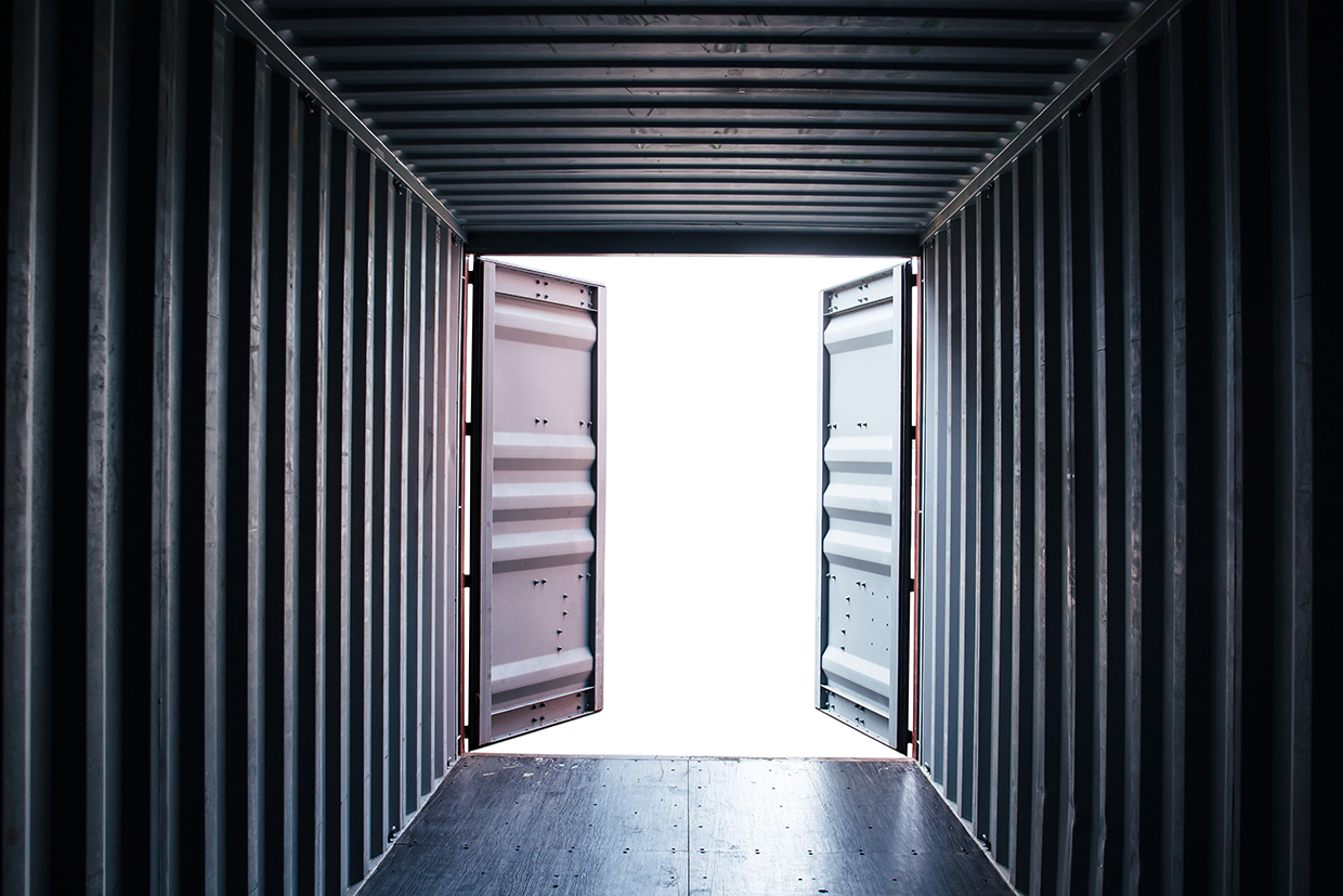
Shipping containers, originally designed for global trade, are revolutionizing disaster relief logistics. A sturdy steel construction protects supplies from harsh conditions and theft, while a standardized size allows rapid transport via ships, trucks and trains to ensure aid reaches affected areas quickly. Beyond transportation, containers can be transformed into temporary shelters, mobile clinics, storage units and command centers. They are often reusable and adaptable with eco-friendly technologies like solar panels and rainwater systems. VS&B provides both standard and custom-built containers from a fleet of over 30,000 containers available across Europe and Asia.
Technological maturity: Proven
Contracting type: For sale
Technology level: Low
Place of origin: India
Availability: Asia, Australia, Europe, United States
Contact: WIPO GREEN Database
Shelters: emergency shelter buildings
Pontarolo Engineering
Pontarolo’s emergency shelter building solutions enable the rapid construction of durable and energy efficient temporary or permanent housing. Central to this system is the Climablock formwork, an insulated concrete form (ICF) made of expanded polystyrene (EPS) that combines structure and insulation in a single step. The system also includes Kaldo and Spyrogrip panels for floors and ceilings, which provide additional thermal and acoustic insulation. For foundations, IsolCupolex Rialto is a multi-patented system that creates an aerated and insulated slab, and which serves as a stay-in-place forming system for the casting of the pavement slab. This slab can bear heavy loads, while still providing a ventilated crawl space that improves moisture control and structural stability. With no thermal bridges (areas in a building where heat flows more easily due to a break or weakness in the insulation, such as at junctions where walls meet floors or roofs, structural elements, and window/door frames), the constructions support passive or nearly zero-energy building schemes.
Technological maturity: Proven
Contracting type: For sale
Technology level: Medium
Place of origin: Italy
Availability: Europe, North America, Oceania, South Africa
Contact: WIPO GREEN Database
Shelters: portable emergency tents for people, supplies and vehicles
Rubb Building Systems
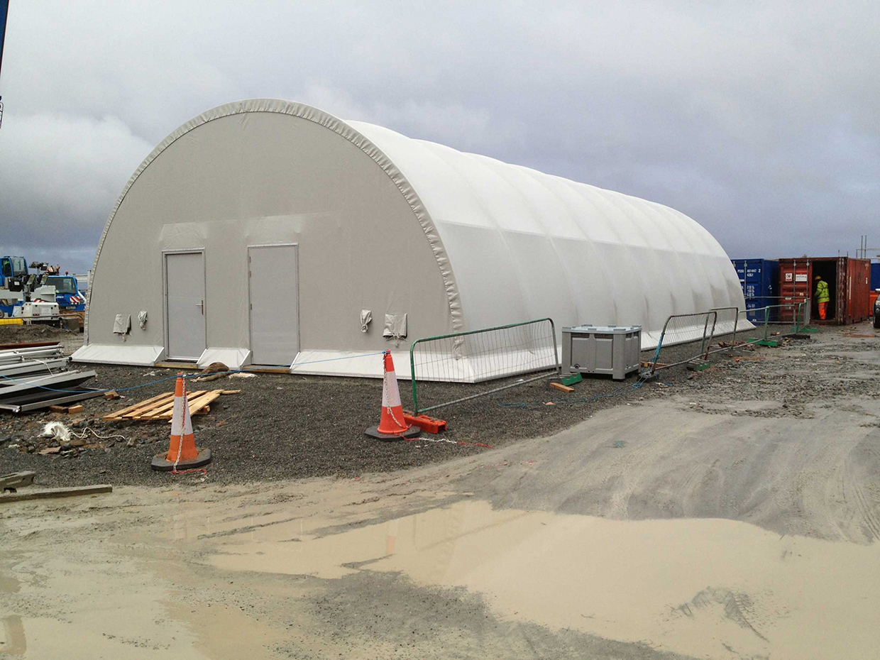
Rubb’s emergency shelter technology offers quickly deployable solutions for disaster relief. Its portable tents can be assembled in just a few hours using basic tools and local labor. Shelters are easily dismantled, stored and redeployed as needed. Larger soft-skin prefabricated structures provide emergency accommodation, secure storage and protection for vehicles, equipment and aircraft from extreme weather. Designed for global field missions, all shelters fit into standard ISO containers and are fully air transportable. The aluminum-framed buildings are especially suited for air freight, enabling rapid deployment worldwide.
Technological maturity: Proven
Contracting type: For sale
Technology level: Medium
Place of origin: Norway
Availability: Worldwide
Contact: WIPO GREEN Database
Shelters: inflatable emergency response shelter
Giant Inflatables Industrial

Inflatable emergency response shelters are essential in disaster situations, humanitarian missions and military operations, serving as field hospitals, command centers and temporary housing. The X-beam Advanced (XBA) shelter is a rapidly deployable, self-erecting inflatable structure that sets up in under 6 minutes using high-strength inflatable beams. It is both lightweight and durable, and provides strong protection against harsh weather. Usable interior space is maximized using vertical walls, and openings on all four sides create a modular system where multiple units connect to create flexible and expandable shelter configurations.
Technological maturity: Proven
Contracting type: For sale
Technology level: Medium
Place of origin: Australia
Availability: Worldwide
Contact: WIPO GREEN Database
Robotics and drones: drones for diverse disaster operations
WeRobotics
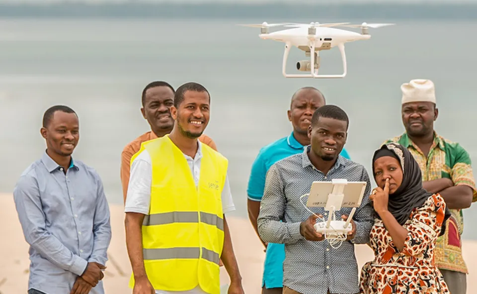
WeRobotics is a Swiss-American nonprofit organization founded in 2015 that partners with local experts to deploy drone, data and AI solutions for disaster response in over 40 countries. Its Flying Labs initiative – a global network of locally-led innovation hubs – trains communities to use drone technology for social good. In emergencies, drones provide high-resolution imagery for rapid damage assessment, create detailed maps and 3D models to guide resource deployment, and monitor hazardous areas without endangering responders. They also support search and rescue by covering large areas, detecting heat signatures and delivering real-time data to teams. Beyond response, drones assist in risk reduction by mapping vulnerable zones like floodplains and wildfire-prone regions.
Technological maturity: Proven
Contracting type: For sale
Technology level: Medium
Place of origin: United States
Availability: Worldwide
Contact: WIPO GREEN Database
Water and sanitation: emergency water filters
LifeStraw
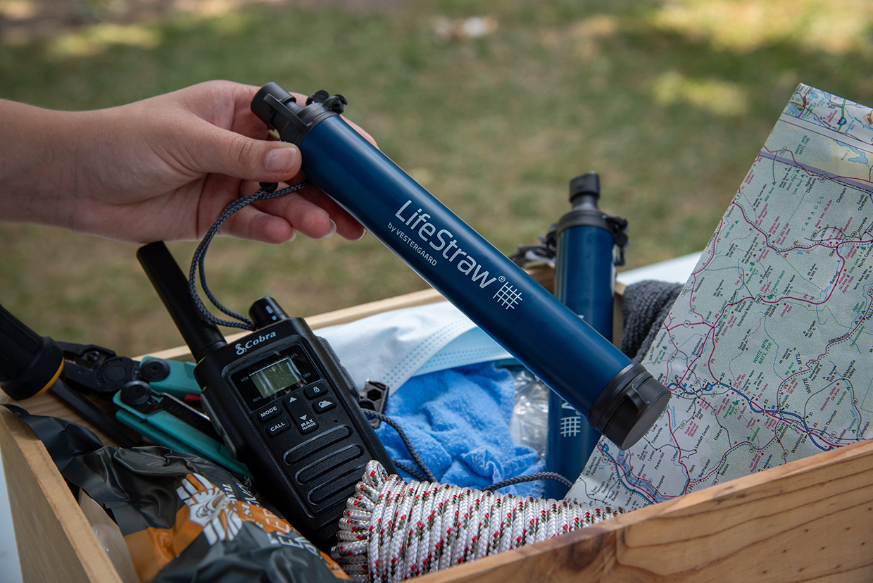
LifeStraw facilitates access to clean drinking water during emergencies and in homes, addressing contaminants ranging from bacteria and parasites to chemicals like lead and PFAS. Their products utilize an advanced hollow fiber membrane technology, which consists of tiny straw-like fibers with microscopic holes that block bacteria, parasites, dirt and microplastics similar to a super-fine strainer. The company offers product lines tailored to the specific needs of emergencies, outdoor activities, or home use, where the filter is supplemented with additional filtration methods to handle viruses, lead, chemicals, and/or improve taste. LifeStraw is a Climate Neutral Certified B Corp and actively responds to water-related emergencies around the globe.
Technological maturity: Proven
Contracting type: For sale
Technology level: Medium
Place of origin: Switzerland
Availability: Worldwide
Contact: WIPO GREEN Database
Water and sanitation: smart water ATM control panel and water vending machine
AALROOT
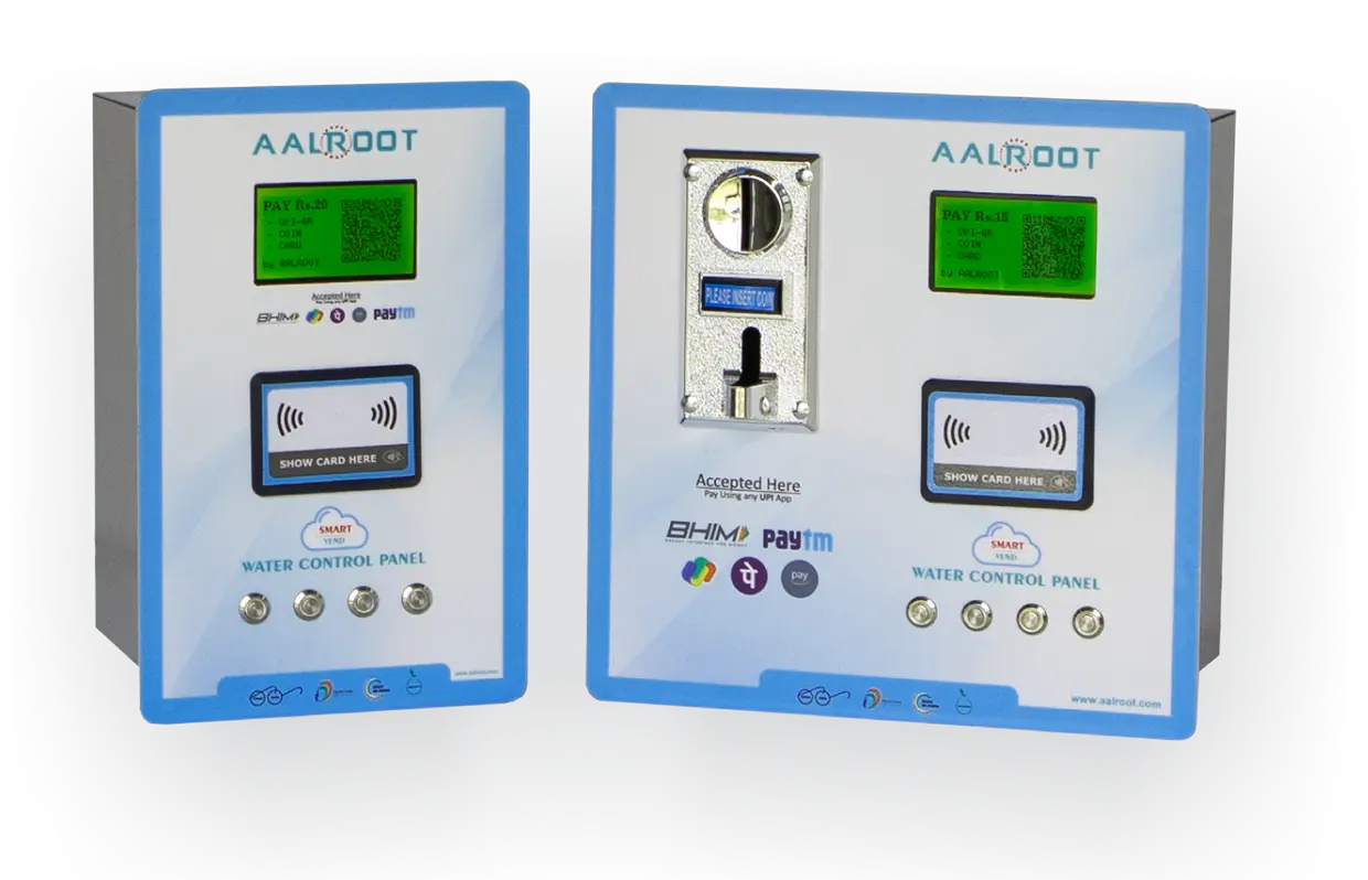
The AALROOT Smart Water ATM Control Panel is an electronically-operated system designed to facilitate efficient and secure water dispensing in public places. It integrates multiple payment methods, including UPI-QR, eCard and coin, and provides dynamic QR generation based on volume selection. The system uses a flow sensor and solenoid valve (electromechanically operated) to regulate water output based on user selection, providing precise control over dispensed quantities. It is Wi-Fi enabled for remote monitoring and management via a dedicated mobile application. There is an auto-refund feature if water is not dispensed, as well as a low water level switch and emergency stop. Real-time transaction tracking provides information on dispensed water and revenue collection.
Technological maturity: Proven
Contracting type: For sale
Technology level: Medium
Place of origin: India
Availability: India
Contact: WIPO GREEN Database
Water and sanitation: drinking water bucket
Field Ready

Field Ready’s “Better Buckets,” originally designed by Oxfam, an international development NGO, have been locally manufactured in the Pacific since 2019, improving delivery speed and reducing shipping costs in the wake of disasters. The 14-liter buckets are made from new, high-quality polyethylene and have been drop-tested to withstand a fall from a height of 2 meters without springing a leak. They feature a clip-on cap for easy cleaning and filling, with an optional tap for water dispensing. Designed for hygiene, the buckets have curved interiors to limit bacterial growth, sealable lids to prevent contamination, and a rim-lock system for a tight fit. They are stackable, easy to carry and safe to transport carried on the head. Custom branding options are available, including embossed logos and a choice of color.
Technological maturity: Proven
Contracting type: For sale
Technology level: Medium
Place of origin: United States
Availability: Worldwide
Contact: WIPO GREEN Database
Frontier technology solutions
Shelters: 3D printers and 3D printed structure with Lavacrete/CarbonX
ICON
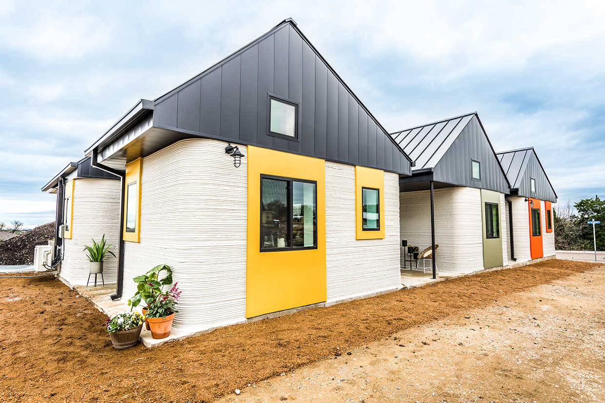
ICON develops robotic and AI-based construction technologies. Their Lavacrete building material is a cementitious mix that prints quickly and produces walls capable of withstanding hurricane-force winds with a two-hour fire rating. The company also offers CarbonX, a low-carbon building material that reduces emissions by 24% compared to the Lavacrete mix. ICON’s 3D printers include Vulcan, a gantry-style system capable of printing a 2,000-sqft. single-story house in about seven days with continuous operation. It has to date printed more than 200 structures and homes across social housing, disaster-relief housing, market-rate residential housing and commercial projects. In 2024, ICON also unveiled a new robotic printer enabling multi-story construction. For fine-tuning mixes and ensuring that it maintains the right consistency, curing time and strength, ICON created Magma, a portable mixing system that optimizes their material mixing by automatically adjusting the proportions of additives and water based on construction site temperature and humidity.
Technological maturity: Frontier
Contracting type: For sale
Technology level: High
Place of origin: United States
Availability: Mexico, United States
Contact: WIPO GREEN Database
Shelters: 3D printing architecture
World’s Advanced Saving Project (WASP)
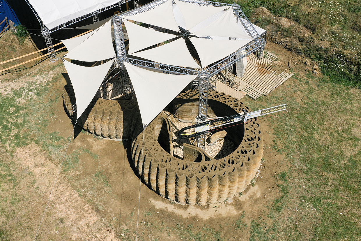
WASP’s 3D printing technology focuses on sustainable architecture using locally sourced materials. Its Crane WASP system is a large-scale, collaborative 3D printer designed specifically for building houses. It emphasizes the use of on-site materials to minimize costs and environmental impact, thereby embodying the concept of “Km 0” or zero-distance sourcing. Included in its Maker Economy Starter Kit, Crane WASP aims to make affordable, eco-friendly housing accessible by using innovative printing methods and locally available resources, inspired by the “vasaia” wasp as a symbol of efficient construction.
Technological maturity: Frontier
Contracting type: For sale
Technology level: High
Place of origin: Italy
Availability: Worldwide
Contact: WIPO GREEN Database
Shelters: mobile medical facility
Mobile Medical Container Promotion Council (MMCPC)

The MMCPC provides medical containers and prefabricated flat pack units that can be rapidly deployed to create “Micro Hospitals” for emergencies or remote locations. Built in Japan and shipped pre-assembled, they can be installed in less than 30 days and configured as treatment rooms, operating rooms, wards, or laboratories. Equipment such as oxygen concentrators, water units, power generators, and even advanced imaging devices like CT or MRI can be included. Flat pack units offer flexibility, long service life, and can connect to form larger facilities. In Japan, MMCPC containers have been deployed after disasters such as the Noto Peninsula earthquake, where a medical container and portable equipment like oxygen units and monitors were sent to maintain care. The MMCPC oversees the development, transport, and installation of these systems, working with government agencies and offering telemedicine support from specialists in Japan.
Technological maturity: Frontier
Contracting type: For sale
Technology level: Medium
Place of origin: Japan
Availability: Worldwide
Contact: WIPO GREEN Database
Shelters: nanogrids/rapid deployment pop-up shelters with renewable energy
Sesame Solar

Sesame Solar Nanogrids are ready-to-use, rapidly deployable mobile power systems designed for emergency response, medical centers and military operations. They combine pop-up shelters with renewable energy, providing heated and cooled shelter alongside clean water and device charging. Using patented retractable solar arrays, green hydrogen and battery storage, the nanogrids deliver continuous, 100 percent renewable power within 15 minutes. No onsite expertise is needed and they are operable by a single person. Designed for long-term use of up to 20 years, Sesame’s Nanogrids can also be clustered to create larger mini-grids, making them versatile solutions for powering temporary or transitional communities during a disaster or disruption.
Technological maturity: Frontier
Contracting type: For sale
Technology level: Medium
Place of origin: United States
Availability: Worldwide
Contact: WIPO GREEN Database
Robotics and drones: search and rescue robot equipped with sonar – river and flood rescue model
Hydronalix

Hydronalix’s EMILY is a remote-controlled rescue robot designed to speed up water rescues. Propelled like a jet ski, EMILY can be dropped from the air and remotely driven to collect stranded people at speeds up to 25 mph. It is heat-resistant, durable in water and can carry up to five adults simultaneously. Equipped with speakers, EMILY allows rescuers to communicate calmly with victims during emergencies. The developers are advancing the technology through features like automation, thermal imaging, slowing mechanisms within the proximity of stranded people, and real-time voice translation. Additionally, EMILY incorporates sonar technology for precise underwater navigation and victim detection, thereby enhancing its ability to locate and assist people in distress quickly and safely.
Technological maturity: Frontier
Contracting type: For sale
Technology level: High
Place of origin: United States
Availability: Worldwide
Contact: WIPO GREEN Database
Robotics and drones: dedicated logistics drone
Aeronext
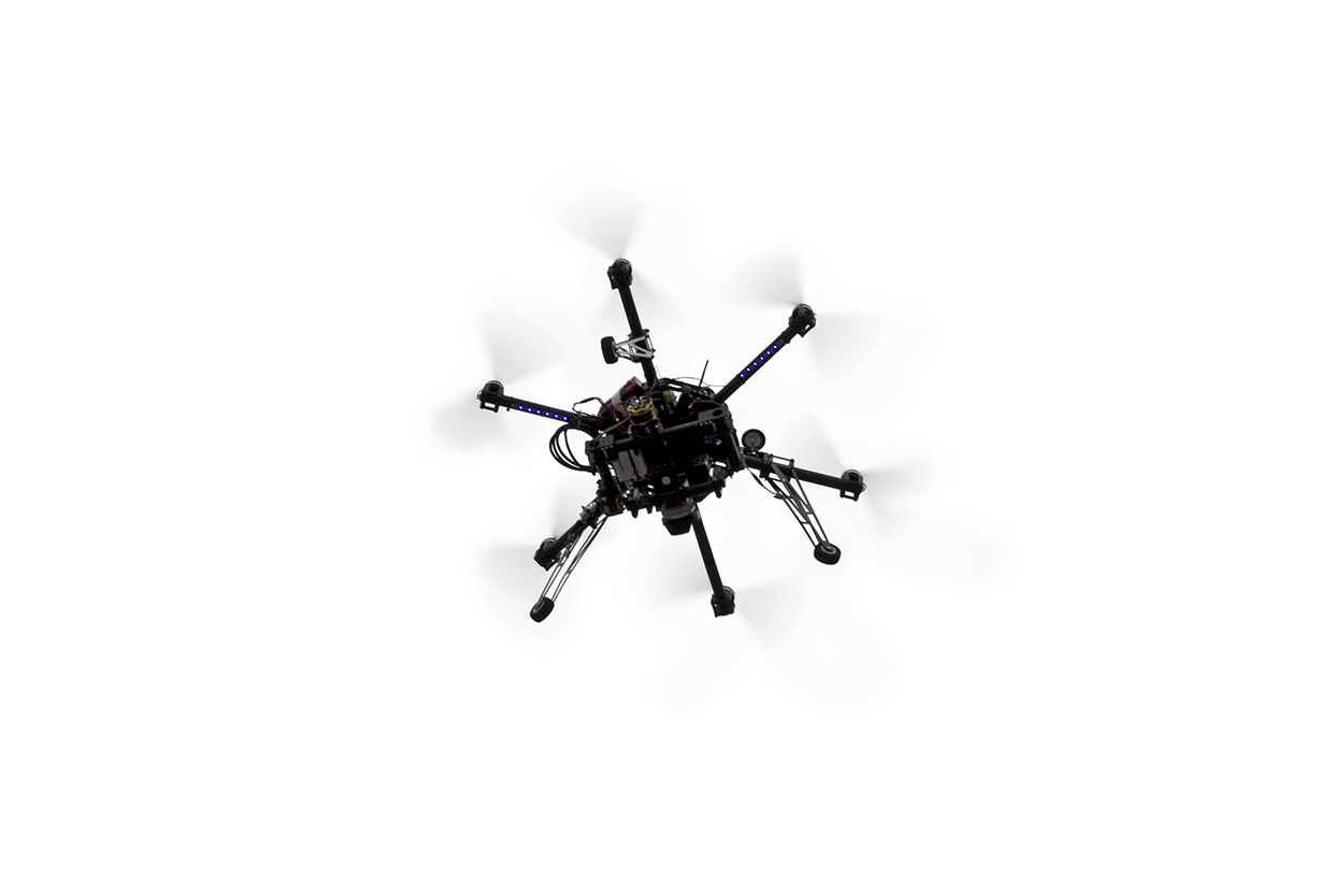
Aeronext’s AirTruck is Japan’s first mass-produced logistics drone featuring advanced 4D GRAVITY® technology. Developed in collaboration with ACSL, a licensed user of 4D GRAVITY®, AirTruck has been tested extensively across Japan. The SkyHub® smart logistics system manages drones for delivery networks and integrates flight operations into a unified system. The AirTruck has demonstrated the ability to fly in challenging conditions, including in Mongolia at 1,300 meters altitude and a temperature of –15°Celsius.
Technological maturity: Frontier
Contracting type: For sale
Technology level: High
Place of origin: Japan
Availability: Worldwide
Contact: WIPO GREEN Databasehttps://wipogreen.wipo.int/wipogreen-database/articles/176736
Robotics and drones: drone operations and emergency response platform
DroneControl
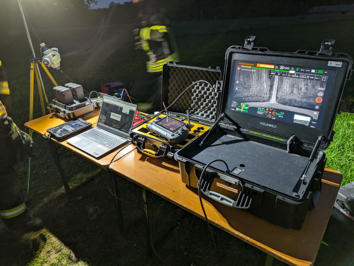 Source: DroneControl
The DroneControl Ecosystem streamlines public safety drone operations through a centralized dashboard with role-based customization, real-time access to flight logs, equipment status, and key organizational and local airspace updates for ensuring informed decision-making. It enables teams to manage pilots, equipment, workflows, and mission data in one secure space. The DroneControl FirstResponder application is purpose-built for emergency deployment, replacing native drone software with an independent interface for secure, ultra-low latency (<200ms) peer-to-peer video streaming and remote drone control. Live feeds can be viewed simultaneously from multiple drones alongside map overlays showing flight tracks, camera orientation, and precise geolocation. Integrated two-way audio enables direct communication between remote operators viewing the same mission feed. Operators can remotely switch cameras, zoom, adjust camera angles, and share views instantly. Upcoming features include tools for simplified flight planning, automated risk assessments and pre-flight checklists, and geofence alerts.
Technological maturity: Frontier
Contracting type: For license
Technology level: High
Place of origin: Switzerland
Availability: Europe
Contact: WIPO GREEN Database
Horizon technology solutions
Robotics and drones: drone equipped with microphone arrays
Fraunhofer
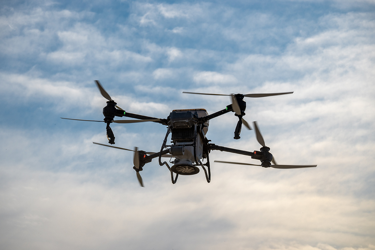
LUCY is an advanced acoustic detection system that mimics human hearing using an array of 48 microphones (soon expanding to 256) to precisely locate sound sources. It works like ears and a brain: microphones pick up sounds, and a signal processing unit analyzes in which direction they came from. Using AI and adaptive filters, LUCY filters out background noise – from wind, rescue equipment, birds and drone rotors – and detects specific sound patterns such as the shouting, banging or clapping that people use to call for help. The system processes signals in real time, providing accurate location data to rescue teams via tablets for efficient victim identification. Its compact, lightweight design allows deployment on various drones and vehicles or on the ground. Researchers continue improving LUCY, so as to enhance its capabilities for emergency response.
Technological maturity: Horizon
Contracting type: Under development
Technology level: High
Place of origin: Germany
Availability: N/A
Contact: WIPO GREEN Database
Robotics and drones: edible robots
RoboFood
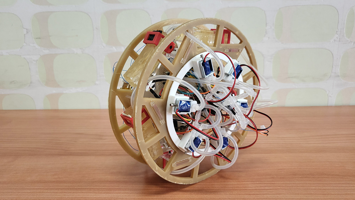
The RoboFood project aims to create edible robots and robotic foods by merging food science with robotics to open new possibilities beyond food delivery drones. These edible robots could provide lifesaving nutrition in emergencies, deliver vaccines to endangered animals, and even monitor their own freshness and safety. By using soft robotics and advanced food processing, RoboFood seeks to develop smart, edible materials and components like sensors, actuators and energy sources. The project focuses on five goals: building a library of smart edible materials; developing manufacturing and preservation techniques; creating complete edible robotic parts; integrating systems and packaging; and demonstrating proof-of-concept models. One of the key applications is edible rescue drones for disaster aid.
Technological maturity: Horizon
Contracting type: Under development
Technology level: High
Place of origin: Switzerland
Availability: N/A
Contact: WIPO GREEN Database
Robotics and drones: emergency medical rescue and transport robot
CSSC Haishen Company and DEEP Robotics

China has introduced its first emergency rescue and transport robot, developed by CSSC Haishen and DEEP Robotics, designed for extreme temperatures (from –20°C to 55°C) and complex environments like disasters. The robot features three mobility modes – quadrupedal, wheeled and tracked – allowing it to walk, run, climb stairs, avoid obstacles and navigate difficult terrain. During demonstrations, it performed medical functions such as monitoring, infusion, defibrillation, CPR and oxygen supply, while evacuating injured people with real-time treatment. The robot uses advanced smart navigation with two modes: map-based for open areas and video-based for confined spaces, enabling autonomous path planning and obstacle avoidance. Future upgrades aim to incorporate cutting-edge technologies like 6G, quantum tech and embodied intelligence.
Technological maturity: Horizon
Contracting type: Under development
Technology level: High
Place of origin: China
Availability: N/A
Contact: WIPO GREEN Database
Supply chain logistics: early warnings of stockouts of emergency supplies
Arribada
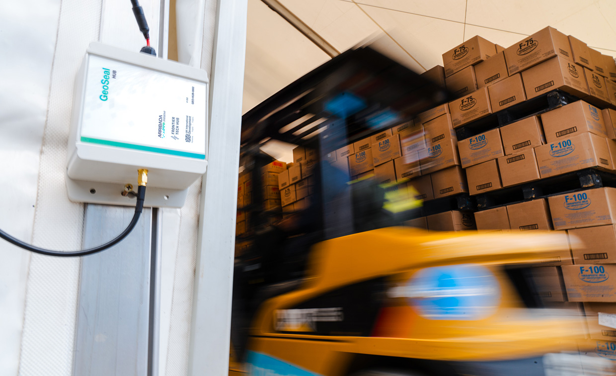
Arribada partnered with the UK Foreign, Commonwealth & Development Office and the Frontier Tech Hub to develop GeoSeals, a low-cost, open-source supply tracking tool designed to meet the low-connectivity and scaling challenges of humanitarian logistics. The system has two main components: GeoHubs and GeoSeals. GeoHubs are solar-powered IoT devices installed at building entrances at each point in a humanitarian supply chain, while GeoSeals are low-cost, adhesive, passive Radio Frequency Identification (RFID) tags affixed to individual aid items such as boxes of ready-to-use therapeutic food. As GeoSeals-tagged items travel through the network, their arrival at each supply chain point is automatically detected by the GeoHubs. To minimize power consumption, the hubs use infrared sensors to activate only when triggered by movement, prompting the RFID reader to scan. When items are detected, the hub records the unique ID of each one and generates time-stamped geolocation data showing where and when it was scanned. This data is transmitted to the cloud, providing insights into supply levels, stockout risks, and potential bottlenecks.
Technological maturity: Horizon
Contracting type: Under development
Technology level: Medium
P of origin: United Kingdom
Availability: Ethiopia
Contact: WIPO GREEN Database
Communications and digital coordination
Digital connectivity is now a lifeline in disaster response. When traditional networks fail, satellite systems, mesh networks, and emergency radios keep responders connected. Mobile apps, AI-driven chatbots, and community feedback tools enable real-time alerts and coordination. Meanwhile, blockchain and IoT are streamlining aid supply chains, while drones bridge last-mile delivery gaps.
Technological developments and trends
Over the past decade, there has been a growing recognition that “information is aid,” while its absence can have deadly consequences (
Mapping and tracking of mobile connectivity show global gains and regional gaps
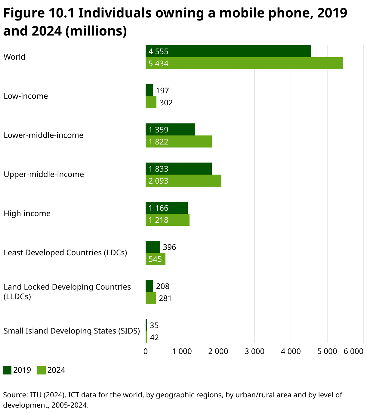
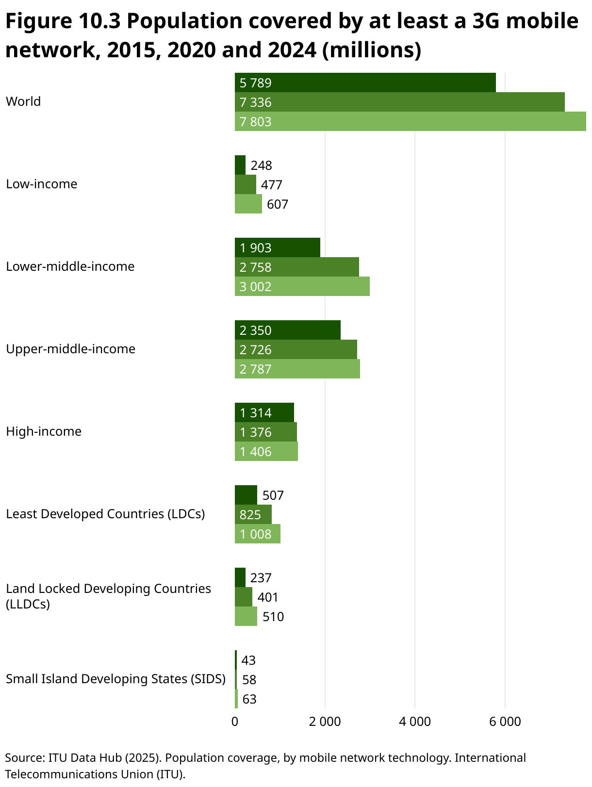
The International Telecommunications Union (ITU) estimates that 97.9 percent of the world population is covered by a mobile network (
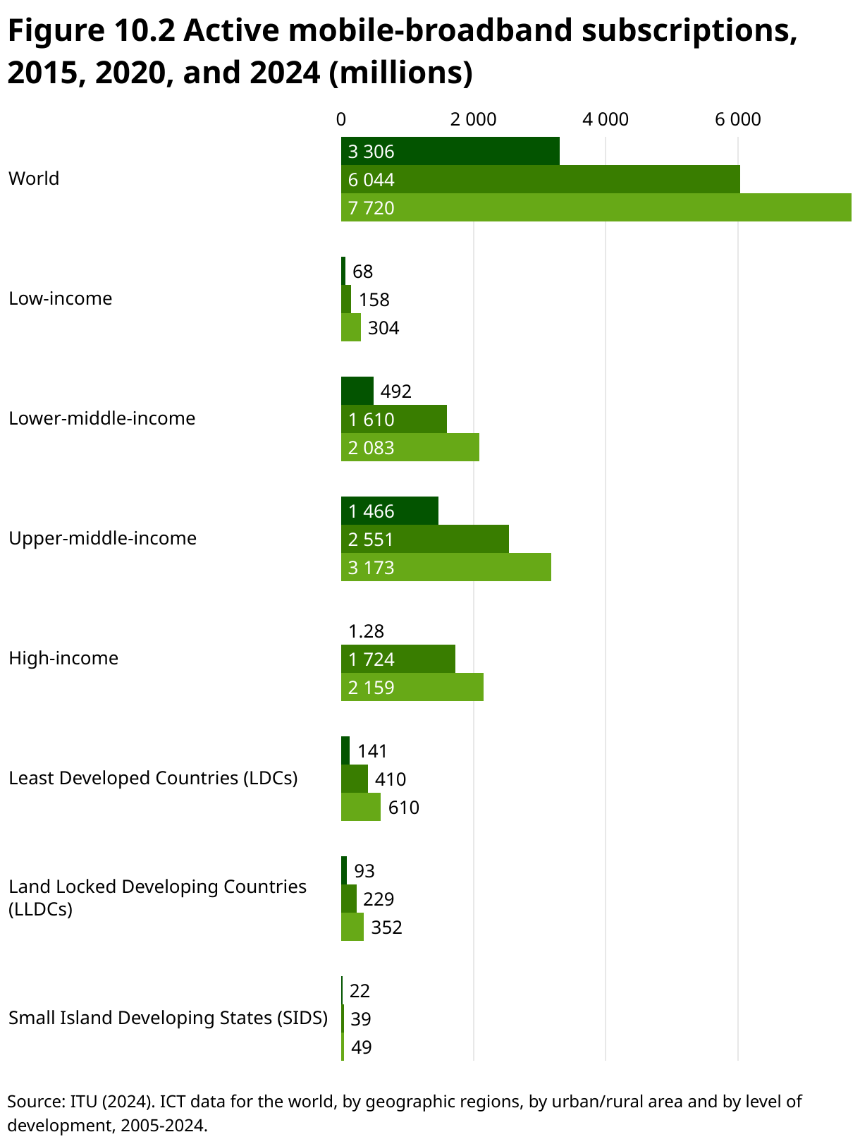
Figure 10.2 shows the rise in active mobile-broadband subscriptions, highlighting a growing reliance on mobile devices as the primary means of internet access (
Figure 10.3 depicts the population covered by at least a 3G mobile network in 2015, 2020 and 2024. Global mobile network coverage has expanded significantly, reaching near-universal levels by 2024. This growth has successfully closed the coverage gap for most of the world’s population, including those in low-income countries and vulnerable groups like LDCs. However, the final few percentage points of the global population, often in the most remote and challenging environments, remain the hardest to connect.
Importantly, even basic mobile phones without internet access remain vital communication tools during a disaster (
Staying connected – core technologies enabling communications during disasters
Broadband and next-generation networks provide the backbone for disaster communications, enabling real-time data sharing, remote monitoring and prioritized emergency services.
Broadband remains crucial for effective disaster response, providing reliable communication in urban areas ... and bridging gaps in remote regions
Broadband internet, a high-speed, always-on internet connection that transmits data using a wide bandwidth, plays a vital role in disaster preparedness and response by enabling emergency services, first responders and authorities to share real-time updates, assess situations and make informed decisions. Broadband also supports remote monitoring, the use of devices, like surveillance cameras, environmental sensors and early warning systems, to observe and track conditions in disaster-prone areas without needing people on site.
However, using broadband in disaster situations presents challenges. Limited infrastructure in rural or remote areas can hinder connectivity, while network congestion from increased communication demand may cause delays. Power outages often disrupt broadband services, and accessibility issues can prevent some from using communication tools effectively. Despite these obstacles, broadband remains crucial for effective disaster response, providing reliable communication in urban areas through fiber optics and bridging gaps in remote regions through satellite and wireless technologies.
Next-generation networks (NGNs) are packet-based systems that break information – including voice, video or data – into small packets for efficient routing across shared infrastructure. Unlike older circuit-switched networks, NGNs separate the service layer (what users interact with) from the transport layer (the physical and routing infrastructure). This decoupling allows a wide range of services to run over the same network, regardless of the underlying access technology – whether it be fiber, mobile, satellite or Wi-Fi.
This flexibility is especially valuable in disaster response. If part of the infrastructure is damaged, services can continue using alternative connections. NGNs support dynamic rerouting and quality of service (QoS) mechanisms, meaning critical communications like emergency calls, real-time video or sensor data can be prioritized over less urgent traffic.
Because NGNs are based on internet protocol (IP) standards (the set of rules that governs how data packets are addressed, routed and delivered from one device to another over a network), they also enable better interoperability between agencies and systems. Using IP is crucial, because it allows the seamless integration of different devices, services and technologies across the same network, allowing emergency responders to communicate and access information regardless of the hardware or underlying technology in use.
Global system for mobile communications (originally groupe spécial mobile) (GSM) was first developed in the 1980s as a 2G (second-generation) mobile technology. The standard specifies protocols for the digital cellular networks used by mobile phones for voice calls, SMS and basic data services (
In disaster situations, GSM provides reliable communication when infrastructure remains intact and can be quickly restored using mobile base stations or satellite backhaul. GSM supports SMS-based emergency alerts and voice communication, ensuring affordable access for responders and affected populations. Although challenges like network congestion and damaged infrastructure can arise, GSM remains a critical tool.
When infrastructure fails – alternative and rapid deployment networks
When traditional communication infrastructure fails, resilient disaster communication relies on layering multiple delivery methods to maintain connectivity and coordination. Even for displacement shelters under disaster conditions, alternative and rapid deployment could mean using solar-powered radio transmitters as a fallback when mobile coverage drops, or hand-held loudhailers for rapid perimeter alerts. These layered methods – spanning satellite systems, radio communications and mesh networks – provide redundancy and adaptability for responders and affected communities in unpredictable environments.
The ability to set up a satellite-based network rapidly is a game-changer for first responders
Satellite communication technology plays a crucial role in disaster response. Satellite phones and devices ensure that emergency responders, leaders and organizations can maintain communication even when landlines, mobile towers or fiber optics are down. While these systems are not designed for everyday citizens in the immediate aftermath of a disaster, satellite-enabled devices allow emergency coordination, rapid deployment of resources, and real-time information sharing. The ability to set up a satellite-based network rapidly is a game-changer for first responders.
Galileo’s emergency warning satellite service (EWSS), launching in 2025, adds a satellite-based layer to disaster communications by broadcasting predefined alerts directly to compatible receivers, including smartphones, handhelds and public displays. Operating independently of terrestrial networks, EWSS uses the common alerting protocol (CAP) (a standard format for sending emergency alerts so they can be automatically received and displayed across different devices and systems) to encode messages, which are then decoded locally on the device. Integrated into the Galileo GNSS under EU Regulation 2021/696, the service provides national civil protection authorities with rapid, reliable alert dissemination (
Radio communications. Very high frequency (VHF)/ultra high frequency (UHF) and high frequency (HF) radios are different types of radio networks that provide local and long-range communication and can function independently of broadband or mobile infrastructure. These technologies are used for short-range coordination among emergency responders. Public safety networks (like TETRA, P25 or LTE for Public Safety) are more advanced forms of radio networks designed for secure, prioritized communication between first responders during an emergency.
The Crisis Connectivity Charter (CCC) is a global partnership between technology companies, satellite operators, telecom providers and humanitarian organizations aimed at rapidly restoring internet and communications during a disaster. By pooling resources and deploying advanced technologies like satellite terminals and portable cell towers, the CCC ensures affected communities and responders stay connected when traditional networks fail. The Emergency Telecommunications Cluster (ETC), hosted operationally by WFP, coordinates these efforts on the ground, managing telecom infrastructure and activating CCC partners during emergencies. This collaboration facilitates disaster response for coordination, aid delivery and communication with vulnerable populations. Recently, the CCC was activated during the 2023 earthquake in Türkiye and Syria, where satellite connectivity was rapidly deployed to support rescue teams, and in the 2024 floods in Mozambique.
More specifically, the ETC is led by the United Nations Office for the Coordination of Humanitarian Affairs (OCHA), which brings together humanitarian organizations, UN agencies, governments and private sector partners to provide telecommunications services during disasters. The ETC sets up emergency communication infrastructure, such as satellite networks, mobile networks and telephony systems (technologies for voice communication, including traditional phone lines, mobile phones and internet-based services like Zoom or WhatsApp). It also restores local FM radio stations, a vital information source for many communities, especially where internet is limited. The ETC runs common feedback mechanisms (CFMs) – two-way systems that let people share concerns or feedback with aid providers – and supports user services like Wi-Fi access points, charging stations and IT help desks. For secure communication, it deploys security communications systems (SCS), which may include satellite phones, radio networks (VHF/UHF) or mobile phones. The ETC also coordinates the safe use of drones for tasks like delivering supplies, capturing aerial imagery or extending connectivity.
Mesh networks. A mesh network is a decentralized wireless network where devices (nodes) connect directly and dynamically to each other, allowing data to be routed through multiple paths for improved reliability and coverage. Nodes then act as both routers and hosts (
However, challenges include ensuring data security and privacy in an open, decentralized system and managing network scalability and performance as more nodes join. Setting up a mesh network typically involves wireless devices like smartphones or routers and specialized software with the proper configuration of network parameters.
Digital tools and coordination systems enable effective response across communities
Mobile apps, alert systems and feedback mechanisms play a vital role in disaster response by keeping communities informed and connected. Together with secure communication networks, such tools enable timely updates, two-way engagement, and reliable coordination between affected populations and responders.
Disaster response apps and websites have significantly improved our ability to stay connected during crises
Mobile-based warning dissemination: cell-broadcast and location-based SMS. Cell broadcast (CB) is a mobile network service that sends text-based warnings to all mobile devices within a defined geographical area, almost simultaneously. Unlike conventional short message service (SMS), which delivers messages one-to-one and can be delayed or blocked during high-traffic periods, CB leverages the cellular network’s broadcast capability to transmit a message to all phones connected to a cell tower within the target zone – in near real time. The message appears as a high-priority notification on the mobile screen, accompanied by a unique, loud alert tone and vibration – often overriding silent mode – to ensure it gets immediate attention. Crucially, CB does not require users to either subscribe, download apps or have internet access. Any compatible phone that is powered on within a given area will automatically receive an alert. This makes CB a highly inclusive and effective tool for reaching not only residents, but also visitors, travelers and individuals without a local mobile subscription (
Location-based SMS (LB-SMS), by contrast, uses the standard SMS channel, but targets only those devices currently connected to a cell tower within a defined geographical area. Once an area is selected, the mobile network filters active subscribers within that footprint and sends each one a conventional text message. While LB-SMS can be delivered to most mobile phones without requiring special handset compatibility, delivery is sequential rather than instantaneous, and can be subject to delays under high network load. Nonetheless, it remains a valuable alerting option in contexts where CB is unavailable, as it works on virtually all mobile devices and allows for longer, more detailed messages. LB-SMS is also useful for follow-up information after an initial CB alert, or for sending hazard-specific instructions to targeted locations (
Mobile apps and alert systems. Disaster response apps and websites have significantly improved our ability to stay connected during crises. For example, Facebook’s “Safety Check” feature, which allows users to mark themselves as safe during a local disaster, is an effective alert system that helps friends and family quickly confirm each other’s well-being. With real-time updates, these platforms help affected individuals access vital information quickly and securely, ensuring that people stay informed even amid the chaos of a disaster. ITU recommends that apps (which users need to download, register and learn how to use) be used mainly in a complementary fashion to the mobile alerting system (CB/LB-SMS), which requires no registration.
A chatbot is a computer program that understands text, voice or image inputs, and interacts with users. Its functions range from answering common questions without AI to using AI and machine learning to learn from conversations and better understand user intent. Chatbots can deliver vital information, support health and education, connect communities with responders, combat misinformation, and facilitate monitoring and evaluation. Their accessibility, multilingual support and simple interfaces make them poised to transform human–computer interaction (
Common feedback mechanisms. The common feedback mechanism (CFM) is designed to establish effective two-way communication systems between local communities and humanitarian assistance providers. The purpose is to ensure that affected populations can directly engage with and provide feedback on assistance programs. This feedback loop enhances accountability by enabling humanitarian organizations to make more informed decisions and ensuring that the voices of affected populations are heard. CFMs are a key part of accountability to affected populations (AAP), which is a core component of humanitarian response plans (HRPs). By improving collective accountability, CFMs help organizations coordinate and consolidate resources, avoiding duplication of efforts. CFM setup can vary depending on available technology, but often includes a short code (a four-digit number for easy access), customer relationship management (CRM) software (like WFP’s “SugarCRM” for managing interactions) and, potentially, a call center for direct communication.
Security communications systems (SCS) are a central part of the Emergency Telecommunications Cluster (ETC, see box 10.1) and provide secure, reliable communication for humanitarian responders and local authorities during an emergency, following United Nations Department of Safety and Security (UNDSS) guidelines. Its deployment varies according to three scenarios:
Scenario A: Uses public mobile networks when reliable, with satellite/radio backups.
Scenario B: Supports mobile networks with fallback VHF/UHF radios or satellite for emergencies.
Scenario C: Sets up primary VHF/UHF radio networks where mobile coverage is poor, backed by satellite communications.
ETC also establishes security operations centers (SOCs), provides equipment setup and training for staff, and offers technical support to authorities in deploying communication infrastructure. Additionally, the ETC supports the Telecommunications Emergency Support Services (TESS+) initiative, a United Nations (UN)-led service focused on setting telecommunications security standards for both UN and NGO staff safety in disaster zones.
Early warnings connect and protect communities – starting with everyday technologies
Early warning systems (EWS) – discussed in the storms and flooding chapter – are a critical communication tool for disaster response. They rely heavily on robust connectivity and communication to effectively disseminate timely warnings of an impending disaster. Effective EWS also depend on clear, consistent messaging across all channels and involve strategic communication tailored to specific communities. AI can support EWS in transmitting warnings and guiding responses, but careful planning is needed. Information and communication technologies (ICTs) are essential in single-hazard and multi-hazard early warning systems (MHEWS) for message management and delivery. A multi-channel approach that uses both traditional and modern technologies is crucial for reaching diverse populations. This includes using radio, television, social media, mobile phones and satellite communications. Messages should be clear, trusted and relevant, and can benefit from input from the target audience.
Effective EWS depend on clear, consistent messaging across all channels and involve strategic communication tailored to specific communities
Mobile networks are a powerful tool for issuing public warnings. Cell-broadcast or location-based SMS warnings can be sent to specific populations in at-risk areas. ITU has encouraged countries to consider implementing regulatory approaches that make the use of mobile networks mandatory for issuing public warnings. ITU underscores the point that aligning incentives with funding programs can speed up the rollout of mobile networks and bolster public safety (
Supply chain resilience for aid delivery – another critical component
Global humanitarian aid demand is rising sharply. Over 308 million people were estimated to have been in need in 2024, putting a strain on traditional supply chains (
To make matters worse, disasters can severely disrupt supply chains. Ports, warehouses and transportation infrastructure such as roads, railways and airports are all prone to damage from storm surges and flooding. Such disruptions can halt deliveries, delay goods movement and create significant operational challenges, as seen during Hurricane Harvey in the United States when major logistics networks in Houston and Louisiana were forced to suspend services.
To mitigate these risks, companies increasingly rely on technology such as Big Data analytics, which combines historical disaster data with supply chain information from enterprise resource planning (ERP) and warehouse management systems (WMS) to forecast potential disruption and model demand under various scenarios. Inventory management is more strategic with the use of WMS tools that provide visibility across all storage locations – enabling organizations to pre-position essential supplies near high-risk areas. Additionally, by linking hazard-specific forecasts, companies can bolster supply chain resilience. For example, cyclone forecasts issued 72 to 120 hours in advance can trigger phased deployment to secure international procurement orders within the first 24 hours, while flood forecasts predicting crest arrival 48 hours ahead can initiate relocation of stockpiles to higher ground and activation of amphibious transport for last-mile delivery.
Equally important is the ability to maintain constant communication in the field. Rugged mobile devices equipped with GPS, cameras and connectivity features empower responders to coordinate logistics more efficiently. Developing standardized supplier data and integrating information across systems allows organizations to identify vulnerabilities and plan contingencies ahead of time.
Technologies like blockchain, IoT and drones are beginning to improve aid delivery by making supply chains more transparent and efficient, and by empowering communities to manage their own supply chains. However, challenges, such as infrastructure gaps, local capacity and regulations, must be addressed (
Transparency continues to be a major challenge within humanitarian supply chains, and blockchain can provide tamper-proof, real-time tracking that improves visibility and accountability, as shown in pilots like the Pakistan-to-Dubai shipment pilot, which tested blockchain technology by tracking a shipment of 304 tents from Lahore, Pakistan, to Dubai. The shipment demonstrated successful real-time tracking and coordination among three separate organizations – DFID, the tent supplier, and the shipping company – using a single blockchain platform (
However, blockchain is not a universal solution. It can shift trust onto the technology itself, adding complexity and cost, so it must be carefully applied where it can genuinely add value to avoid creating new problems. Broad adoption of blockchain would require clear governance structures and system-wide rules (
Transparency continues to be a major challenge within humanitarian supply chains, and blockchain can provide tamper-proof, real-time tracking
Poor infrastructure can present challenges in delivering aid to remote areas. But drones are overcoming these barriers by enabling faster, more reliable last-mile delivery. Drones used for communication can also act as temporary signal boosters or network relays, often supplementing existing mobile or broadband networks. They fall under the broader category of communication infrastructure, but with the added capability of mobility and on-demand deployment.
AI may improve disaster communications, but data and ethical challenges remain
In the humanitarian field, AI can accelerate anticipatory action for disasters by quickly analyzing complex data to identify needs, provide early warnings, plan responses and evaluate outcomes. Predictive analytics – a key AI tool – helps forecast sudden disasters, as well as long-term challenges. Integrated with technologies like mobile apps, drones and IoT, AI improves decision-making, supports health care insights, aids education and training, and streamlines administrative tasks, which frees up human resources for critical work (
Predictive analytics helps forecast sudden disasters, as well as long-term challenges.
A technical report undertaken by the ITU/WMO/UNEP Focus Group on Artificial Intelligence for Natural Disaster Management for communication reviewed literature on recent research and applications in AI-based communications tools. The review revealed an active field of research and development on AI for communications during disasters (
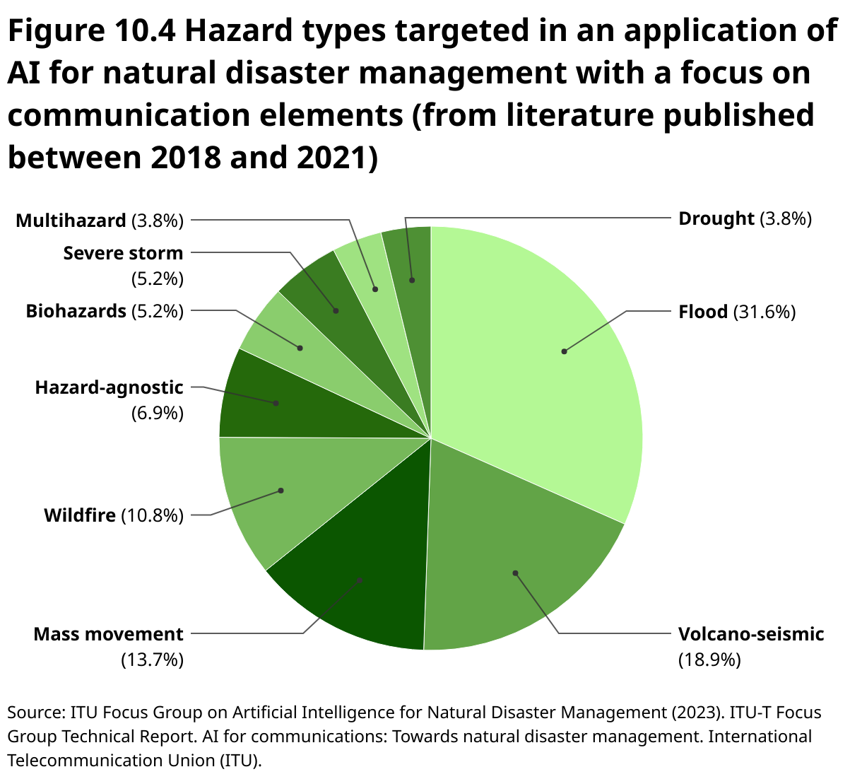
However, challenges regarding AI remain a hurdle. AI and predictive analytics require large amounts of open, accurate and timely data, which can be hard to obtain due to limited connectivity, security issues and volatile conditions. Data quality, interoperability and standards are critical because errors or incomplete data can lead to flawed results. Data protection is a major concern, as AI may unintentionally reveal personal information or enable misuse by malicious actors. Bias in AI is a serious issue, often stemming from incomplete data and lack of diversity among developers, which can exacerbate inequalities. AI systems may also lack transparency, making decisions hard to explain or trust, and leading to accountability gaps (
Innovation examples
SKAI: AI-powered eyes-in-the-sky for disaster response
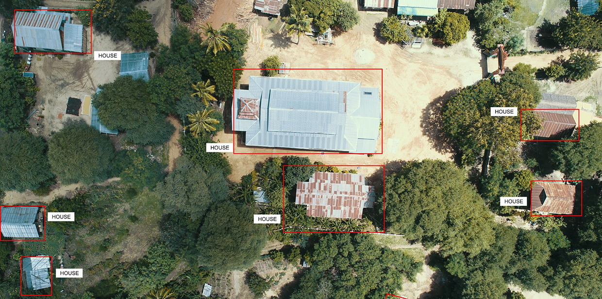
When disaster strikes, reliable ground information is often unavailable. Enter SKAI – the Satellite-based Kinesthetic Assessment and Intelligence tool – developed by WFP and Google Research – that aims to transform emergency response. Using advanced AI and satellite imagery, SKAI delivers near real-time damage assessments, pinpointing destruction across vast, hard-to-reach areas. It automatically maps building damage and supports situational awareness to enable smarter and faster decisions. In Pakistan, SKAI was deployed after severe floods devastated large swaths of the country. With roads submerged and communications cut off, SKAI’s AI algorithms scanned satellite images to identify damaged infrastructure and isolated communities. Within hours, WFP teams received information that helped them prioritize emergency food assistance and coordinate with local authorities. This context-agnostic analysis helped streamline logistics and target aid where it was most needed without waiting for ground reports. As an open-source, collaborative tool that combines machine learning with Earth observation data, SKAI supports governments, NGOs and first responders worldwide
NOAA expands multilingual weather alerts with AI technology

For 30 years, the National Oceanic and Atmospheric Administration (NOAA), a US governmental agency, had its National Weather Service (NWS) forecasts manually translated into Spanish, but is now using AI to improve accuracy, efficiency and inclusivity. Through pilot projects, the NWS has trained AI software with weather terminology in Spanish and simplified Chinese – two of the most common US languages after English – and plans to add Samoan, Vietnamese and more. Partnering with machine learning company Lilt, NWS has developed a specialized language model that drastically reduces translation time – from an hour to under 10 minutes for some products. Features include navigation, hazard maps, geo-location for local forecasts and alert banners. In the future, translations will be integrated into data transmission services (APIs), social media and alert systems, so as to expand reach. The project is improving community readiness and inclusion amid extreme weather caused by climate change (
Coping with recurring disasters in Cox’s Bazar, Bangladesh, through communications platforms and EWS
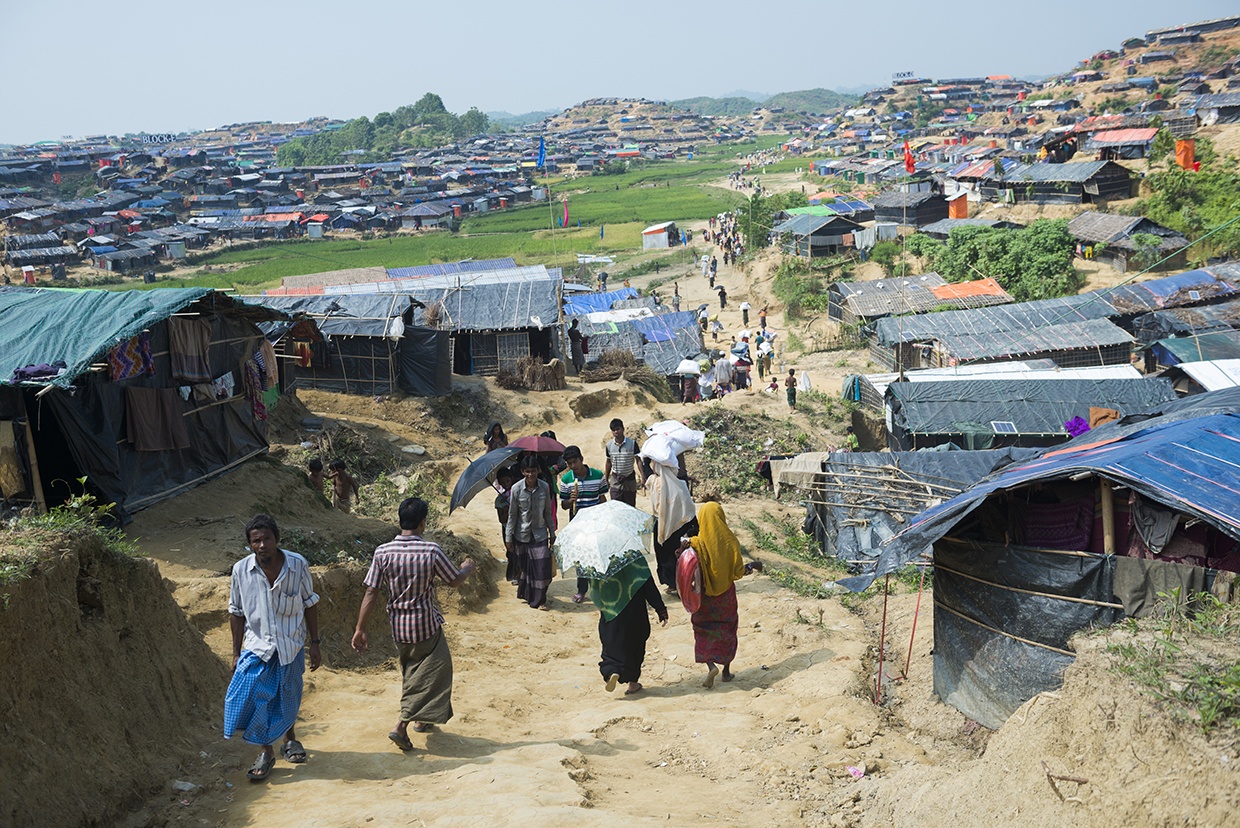
The humanitarian response in Bangladesh’s Cox’s Bazar – home to the world’s largest refugee camp – has increasingly employed technological advancements to enhance disaster preparedness and resilience for over 900,000 Rohingya refugees. Although Bangladesh is one of the most disaster-prone countries globally, it is recognized for its leadership in early warning and anticipatory action. Several forecast dissemination and coordination tools have been implemented. A key innovation has been the integration of technology-driven early warning systems across the 33 camps. This includes the expansion of the Cyclone Preparedness Programme (CPP) to include refugee populations, training over 3,300 Rohingya volunteers who disseminate localized warnings. Technological tools, such as automated SMS alert systems, simple weather gauges, and the INSTANT platform – a custom forecast portal developed by the United Nations Development Programme (UNDP) and the Regional Integrated Multi-Hazard Early Warning System for Africa and Asia (RIMES) – deliver 5-day forecasts, seasonal projections and hazard alerts directly to aid agencies. These efforts have embedded anticipatory actions across sectors using real-time forecasts and pre-alert protocols. They trigger coordinated responses including reinforcing shelters, pre-positioning food and medical supplies, and moving vulnerable individuals in advance of extreme weather. Additionally, integration with systems like the United Nations Food and Agriculture Organization’s Landslide Early Warning System (LEWS) and national flood forecasting services allows for rapid, data-informed response, thereby improving safety and readiness for vulnerable refugee populations (
KoboToolbox empowers the Kenya Red Cross with data-driven flood relief coordination

When Kenya faced severe flooding in 2024, impacting over 220,000 people, the Kenya Red Cross Society (KRCS) employed technology to enhance the disaster response. Using KoboToolbox, KRCS developed a customized Flood Situation Report (SitRep) Tool that collects data even from remote areas through offline capabilities. The tool gathers detailed information on affected populations and damage to critical infrastructure, helping coordinate aid delivery and aid emergency services like search and rescue. By centralizing and standardizing data collection with a smart survey design using features like cascading selects and skip logic, the tool improves accuracy and reduces survey fatigue. It also integrates with Power BI for dynamic data visualization, enabling daily updates to stakeholders. Since its initial deployment during the 2023 El Niño floods, the Flood SitRep Tool has transformed fragmented data collection into a unified, data-driven process, supporting efficient resource allocation across food distribution, health care, shelter and water sanitation efforts. With over 800 submissions from 43 communities, this technology-driven approach is critical in managing Kenya’s ongoing climate challenges, helping KRCS build community resilience (
Proven technology solutions
Communications: ethernet and PoE extenders
Enable-IT
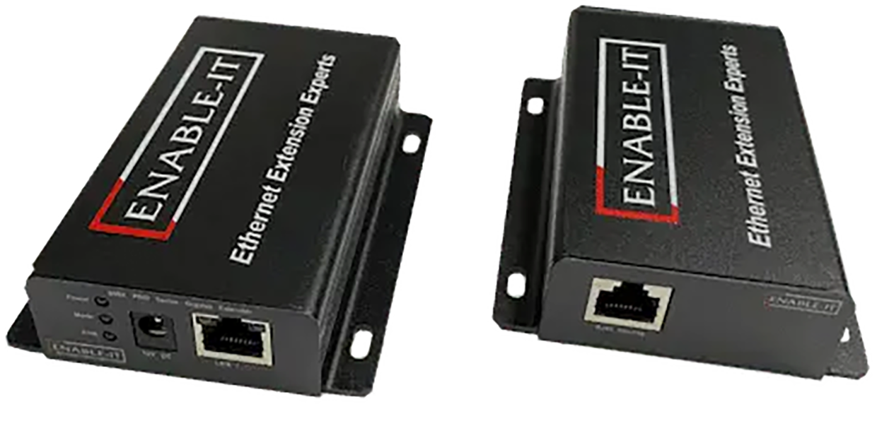
Ethernet and power over ethernet (PoE) extenders allow the rapid deployment of communication, lighting and security systems in affected disaster areas. By using PoE, they eliminate the need for separate power lines, enabling faster setup of devices like surveillance cameras, LED lights and networking equipment. These extenders support both short- and long-term shelter strategies by providing reliable connectivity across larger distances, even in rugged environments. Ethernet connectivity is used in satellite ground stations, enabling reliable data transmission to end-user devices. Using PoE-powered satellite modems and access points streamlines deployment in disaster zones by removing the need for separate power supplies, allowing faster and more flexible setup in critical situations.
Technological maturity: Proven
Contracting type: For sale
Technology level: Medium
Place of origin: United States
Availability: Worldwide
Contact: WIPO GREEN Database
AI-enhanced communications: AI-powered disaster intelligence and risk assessment tool
Mayday.ai
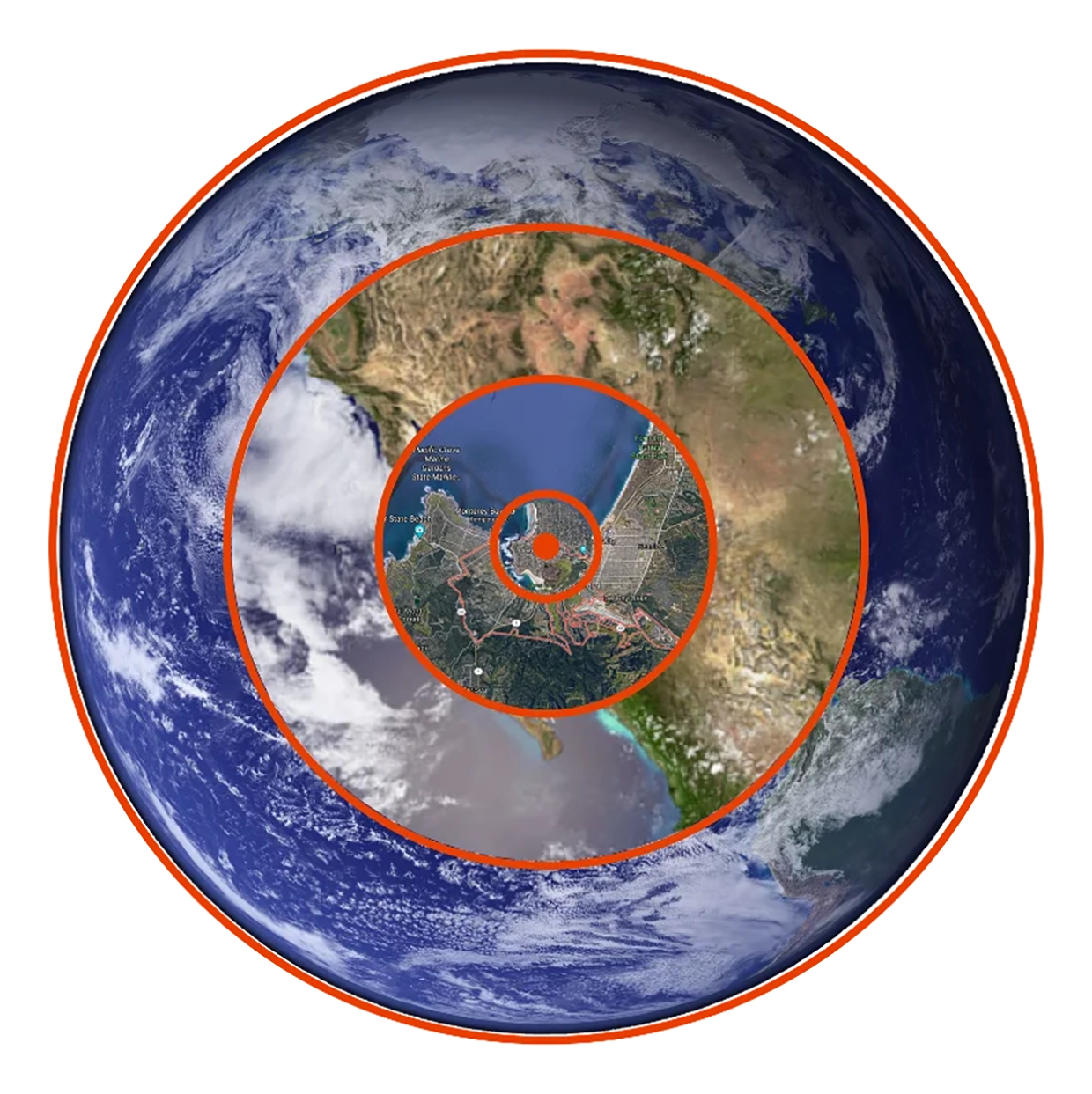
Mayday.ai is an AI-powered platform that delivers real-time, full lifecycle (before, during, after) disaster event intelligence by integrating data from satellite and camera imagery, audio, and multilingual social media sentiment analysis. It provides early warning and two-way communication within a unified system, aiming to make critical event information widely accessible through AI automation at the national, regional, municipal, community and household level. The platform’s innovations have been recognized and supported by major organizations, including the European Space Agency, German Aerospace Center, NOAA, and various UN offices focused on disaster risk reduction and space affairs.
Technological maturity: Proven
Contracting type: For licensing and collaboration
Technology level: High
Place of origin: Germany
Availability: Worldwide
Contact: WIPO GREEN Database
Logistics: warehouse management system (for supply chain disruption)
Datex
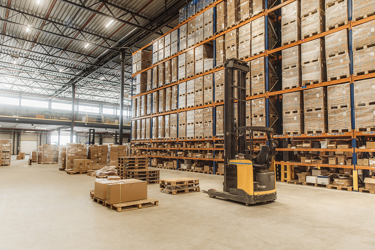
The Footprint® Warehouse Management System (WMS) enables organizations to manage inventory across facilities, pre-position supplies, and respond to rapidly changing demands during natural disasters and other disruptions. Coupled with Datex Studio, a low-code visual interface, users can tailor their WMS with ease, configure workflows, and track changes with built-in testing and source control. Handheld mobile computers facilitate efficient communication, damage assessment and coordination, ensuring timely allocation of critical resources.
Technological maturity: Proven
Contracting type: For sale
Technology level: Medium
Place of origin: United States
Availability: Worldwide
Contact: WIPO GREEN Database
Logistics: mapping platform
OpenStreetMap
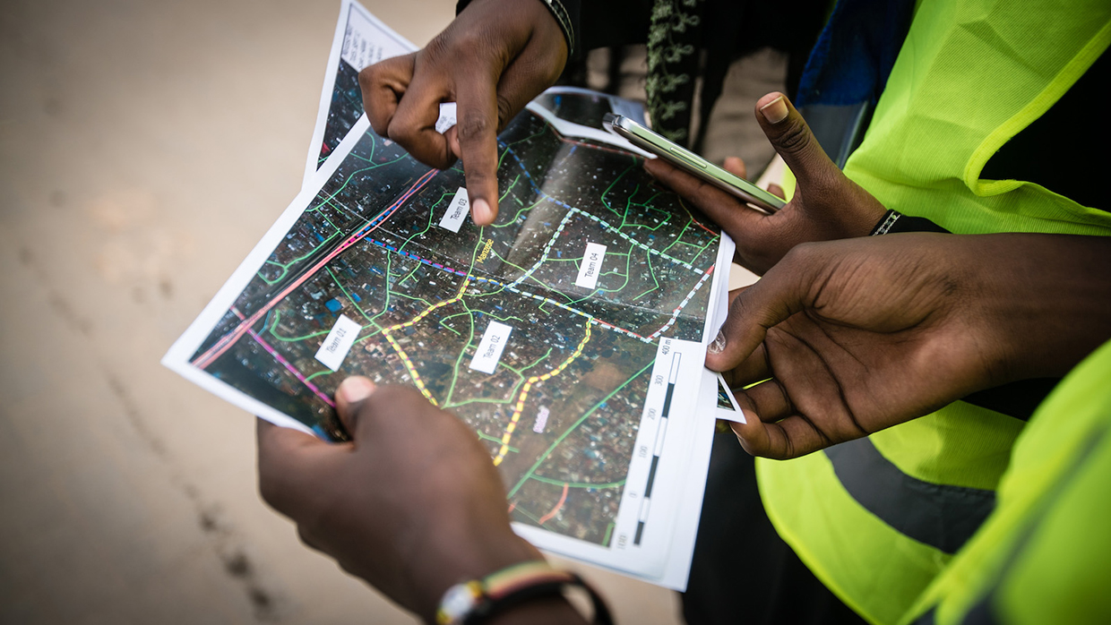
Humanitarian OpenStreetMap Team (HOT) is an international volunteer-driven organization that uses open mapping to support humanitarian aid, disaster response and sustainable development. When disasters strike, thousands of HOT volunteers rapidly create detailed, open-source maps of areas where data is limited, using platforms like OpenStreetMap. These maps help responders reach those in need quickly and effectively. HOT also supports communities, NGOs, governments and international organizations by providing training, tools and knowledge to support local mapping and data collection. They develop free, open-source apps and tools for collaborative mapping and geospatial data gathering, widely used by partners such as Red Cross, Médecins Sans Frontières, UN agencies and local groups.
Technological maturity: Proven
Contracting type: Open access
Technology level: Medium
Place of origin: United States
Availability: Worldwide
Contact: WIPO GREEN Database
Connectivity: satellite services
Télécoms Sans Frontières
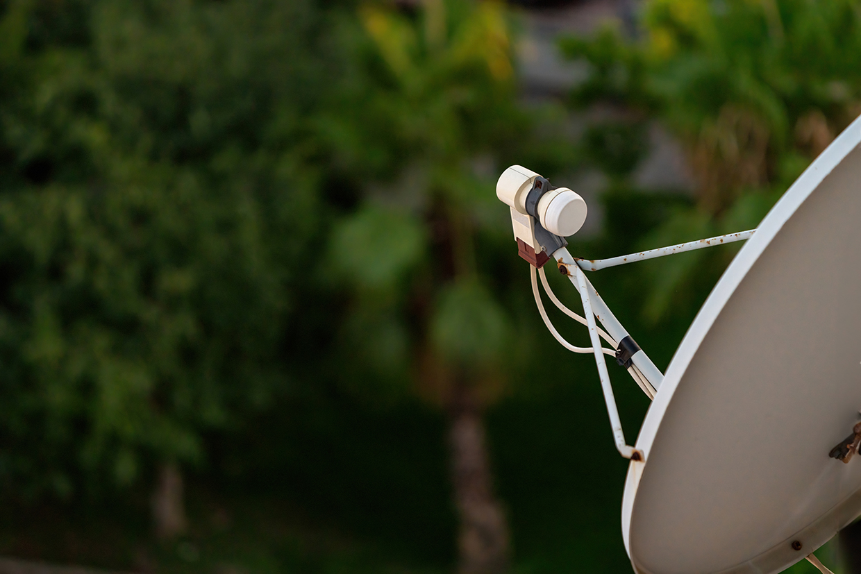
Télécoms Sans Frontières (TSF) integrates cutting-edge satellite and digital technologies to ensure connectivity, education and information flow. The company provides the following solutions for disasters: Oxbird optimizes satellite bandwidth with enhanced quality of service (QoS), improving traffic management and services like VoIP (Voice over Internet Protocol – a technology that enables voice calls using an internet connection). Learning Kit provides portable, battery-powered digital education tools (tablets, server, Wi-Fi) for children. Humanitarian Information Display System uses remotely managed digital screens in refugee camps to share real-time, multilingual info via cloud connectivity. Mobile satellite services (MSS) deploy compact satellite terminals and phones, providing reliable internet and telephony where infrastructure is damaged. Finally, fixed satellite services (FSS) (very small aperture terminals) provide medium to long-term satellite internet access in remote or disaster-affected regions, supporting NGOs, health, coordination and free Wi-Fi within refugee camps.
Technological maturity: Proven
Contracting type: For service-based deployments and equipment loan/rental
Technology level: Medium
Place of origin: France
Availability: Worldwide
Contact: WIPO GREEN Database
Communications: disaster connectivity map
International Telecommunication Union (ITU), World Food Programme Emergency Telecommunications Cluster (ETC), GSMA

The Disaster Connectivity Map (DCM) provides near real-time data on communication network connectivity to governments, telecom operators and first responders, enabling faster, more targeted repairs and restoration after disruptions. It aggregates connectivity measurements from end-user devices, processes them, and displays both historical baselines and current status. Following a disaster, DCM can be activated in affected areas to pinpoint gaps and outages in real time, guiding response decisions. To date, it has been deployed in over 50 disasters worldwide, with a database of more than 200 million data points.
Technological maturity: Proven
Contracting type: Technical partnership/inter-agency coordination
Technology level: Medium
Place of origin: Switzerland
Availability: Worldwide (ITU Member States)
Contact: WIPO GREEN Database
Communications: ultra-portable GSM network
Vodafone

Vodafone Instant Network is a highly portable GSM network system designed for rapid deployment in disaster zones. Packaged into four cases weighing under 100 kg, it can be transported aboard commercial flights and set up within 40 minutes to provide secure 2G and 3G connectivity anywhere in the world. Instant Network Mini is an ultra-compact, 11 kg mobile network carried in a backpack and deployable in 10 minutes by non-technical staff. It supports up to five concurrent calls within a 100-meter radius and can send mass SMS alerts. Instant Charge is a modular phone charging station developed to support refugees and disaster survivors with smartphones. It can simultaneously charge up to 66 devices, is designed for outdoor use with minimal supervision, and helps prevent overcrowding in charging areas.
Technological maturity: Proven
Contracting type: Provided through partnerships, donations or special agreements
Technology level: Medium
Place of origin: United Kingdom
Availability: Worldwide
Contact: WIPO GREEN Database
Communications: portable and quickly deployable satellite communication
Thuraya
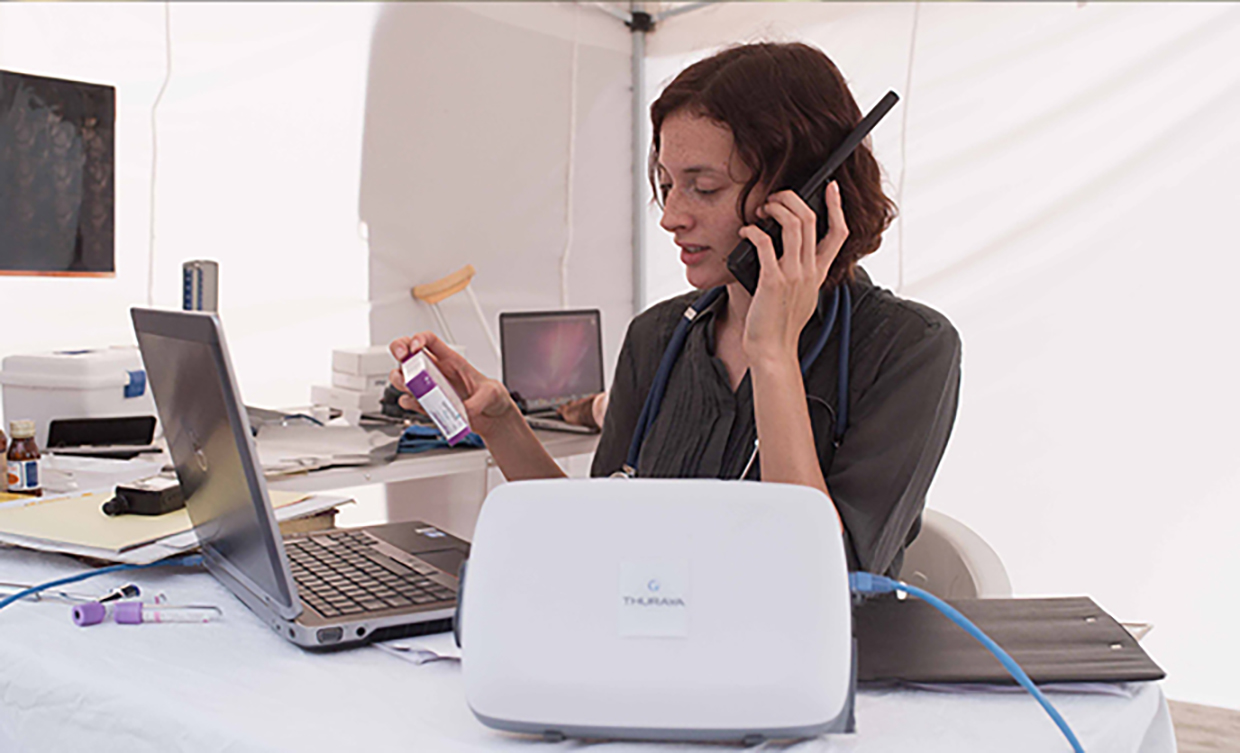
Thuraya offers quick-deploy satellite communication solutions essential for disaster response and relief operations. The satellite phones and data terminals provide high-speed mobile broadband within seconds, enabling first responders to access critical information like weather updates and mapping services rapidly. These tools support coordination among aid organizations, emergency services, and government or military agencies across different communication platforms. Thuraya’s systems also allow for the setup of solar-powered voice, fax, internet and SMS services, helping affected communities stay connected during ongoing relief efforts.
Technological maturity: Proven
Contracting type: For sale
Technology level: Medium
Place of origin: United Arab Emirates
Availability: Worldwide (except the Americas)
Contact: WIPO GREEN Database
Logistics: mobile information management platform for humanitarian service delivery
World Vision
World Vision’s Last Mile Mobile Solutions (LMMS) is a mobile information management platform designed to streamline humanitarian aid delivery at the critical "last mile" stage. It digitizes beneficiary registration, verification, distribution planning, monitoring and reporting. LMMS integrates software with custom hardware, including mobile devices, servers, printers and ID cards. Used in over 40 countries by more than 20 agencies, LMMS supports cash, food, shelter and health programs, registering over five million beneficiaries annually and facilitating over $100 million in aid distribution. It operates standalone without the need for either the internet or electricity, and is ideal for remote settings. LMMS tracks work, generates payment instructions and provides near real-time distribution reporting. It supports integration with tools like KoboToolbox and Power BI, linking every transaction to individual users for accountability.
Technological maturity: Proven
Contracting type: For partnerships, licensing agreements or collaboration
Technology level: Medium
Place of origin: United Kingdom
Availability: Worldwide
Contact: WIPO GREEN Database
Communications: voice and high-speed data emergency response communications systems
Viasat
Viasat offers a range of emergency communication systems providing global voice and high-speed data connectivity on land, sea and air. Quickly deployable terminals – including BGAN, FleetBroadband, and SwiftBroadband – support first responders with seamless communications. The Global Xpress high-speed satellite service provides higher data capacity rates for demanding operations. BGAN PTT delivers push-to-talk voice communications for vehicles, maintaining situational awareness when local networks fail. For beyond line-of-sight radio communication without modifying existing UHF/VHF radios, Viasat’s L-TAC service uses satellites as repeaters, reducing reliance on scarce tactical satellite resources. Additionally, the IsatPhone 2 handheld satellite phone offers dependable voice connectivity worldwide.
Technological maturity: Proven
Contracting type: For sale
Technology level: Medium
Place of origin: United States
Availability: Worldwide
Contact: WIPO GREEN Database
Frontier technology solutions
Communications: mesh network
Meshmerize
Meshmerize supports disaster response by enabling the rapid deployment of resilient mesh networks and the use of synchronized drone swarms for site inspection, disaster localization, search and rescue, and active team monitoring. This technology enhances information sharing among responders and prioritizes actions in the most affected areas. Meshmerize is also involved in the 6G Life project, advancing 6G communications focused on sustainability, security, resilience and human–machine collaboration.
Technological maturity: Frontier
Contracting type: For licensing
Technology level: Medium
Place of origin: Germany
Availability: Worldwide
Contact: WIPO GREEN Database
Communications: emergency broadband internet
Tekniam

Tekniam’s Remote Universal Communication System (RUCS) is a compact, rapidly deployable wireless broadband network designed for emergency responders and rural areas with limited connectivity. It creates a local Wi-Fi internet signal covering a 305+ meter radius and can be extended up to 55 kilometers using daisy-chained units. Weighing just 2.3 kg, RUCS requires minimal power (from a car battery to a small power pack) and connects to any internet source – satellite, fiber or cellular. RUCS is easy to transport and set up in minutes, and provides an affordable, energy-efficient alternative to traditional bulky emergency communication setups.
Technological maturity: Frontier
Contracting type: For sale
Technology level: Medium
Place of origin: United States
Availability: Worldwide
Contact: WIPO GREEN Database
Communications: “pop-up” connectivity (LEO)
Eutelsat Oneweb
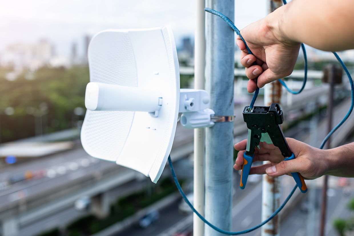
Eutelsat OneWeb is a global satellite internet provider using a constellation of low Earth orbit (LEO) satellites to deliver affordable, low-latency broadband worldwide. By combining OneWeb’s LEO technology with Eutelsat’s geostationary satellite expertise, they provide a comprehensive connectivity solution. Key features include global high-speed internet with low latency via hundreds of LEO satellites, rapidly deployable “pop-up” connectivity; redundant and reliable backup links that ensure continuous operations for businesses during critical events; flexible service plans with cloud-based management; and easy integration via apps and application programming interfaces (APIs).
Technological maturity: Frontier
Contracting type: For sale
Technology level: Medium
Place of origin: France
Availability: Worldwide
Contact: WIPO GREEN Database
Communications: digital self-registration platform for communities in crisis
World Food Programme
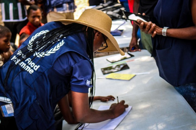
WFP is actively overcoming the complex challenge of registering displaced and vulnerable populations during crises by embracing innovative, cost-effective solutions. Traditional in-person registration methods are often slow, costly and resource-intensive – barriers that are especially critical to address as humanitarian funding becomes increasingly scarce. To meet this need, WFP has introduced the People Portal, a self-registration web platform that enables people in crisis to register themselves directly, significantly reducing the need for labor-intensive field operations. Communities may access the platform via WFP partners, field teams, or posters once the WFP initiates operations in the area. The People Portal reduced the cost of registering from US$12 to US$0.50 per person. If scaled to WFP’s target of 10 million registrations over the next two years, the People Portal could cut costs from US$120 million to just US$5 million, unlocking an estimated US$115 million in savings and accelerating the delivery of life-saving assistance.
Technological maturity: Frontier
Contracting type: Open access via WFP partners, field teams, or posters
Technology level: Medium
Place of origin: Italy
Availability: Worldwide
Contact: WIPO GREEN Database
Communications: food security modeling platform
World Food Programme
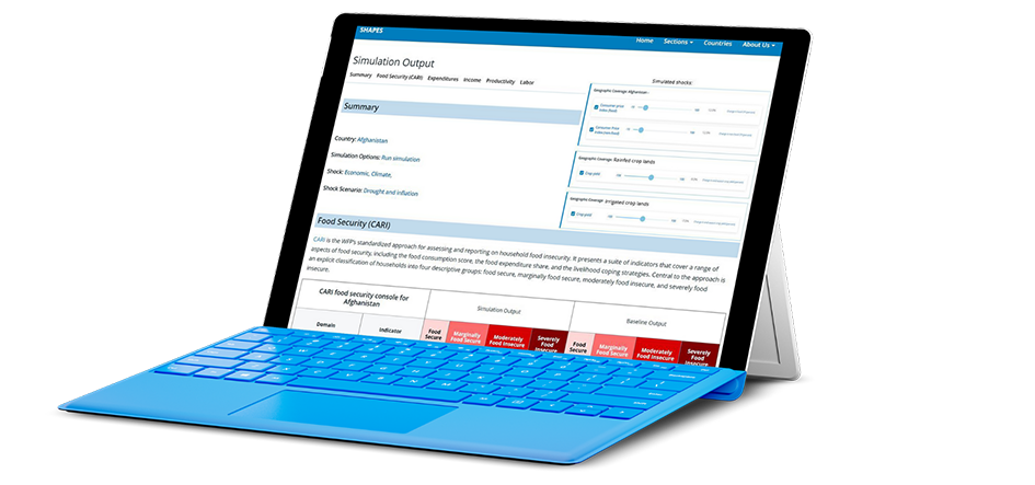
SHAPES (Shock and Assistance Platform for Economic Simulations) is WFP’s advanced modeling platform that uses simulations to evaluate the effects of shocks and assistance on food security. It integrates data from surveys, market prices and satellite sources to predict how households respond to economic, climate, or political crises. By simulating different aid strategies, transfer values, and targeting methods, SHAPES helps optimize humanitarian interventions. The platform has reduced emergency assessment times from six months to three and reduced setup costs for new country operations significantly. It continuously adapts to emerging challenges—such as forecasting displacement trends and evolving crisis dynamics—to enhance response effectiveness. SHAPES aims to expand to all large-scale WFP operations in 120 countries and territories across the world.
Technological maturity: Frontier
Contracting type: For collaboration
Technology level: Medium
Place of origin: Italy
Availability: Worldwide
Contact: WIPO GREEN Database
AI-enhanced communications: user-friendly geospatial vulnerability profiling and targeting tool
World Food Programme
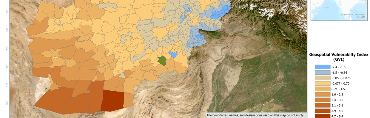
GeoTar is WFP’s AI-powered geospatial tool that enhances emergency and anticipatory decision-making by automating vulnerability assessments. It integrates climate, food security and socio-economic data to deliver granular, real-time insights at the community level. As a backend system, GeoTar complements existing platforms and enables faster, more targeted humanitarian responses. GeoTar boosts geographic targeting accuracy by up to 30 percent and can save countries up to USD 100,000 by cutting the need for extra assessments. In 2024, it helped target six million people in Afghanistan and Chad, saving USD 90,000. GeoTar is now being evaluated for wider use in seven additional WFP country offices.
Technological maturity: Frontier
Contracting type: For collaboration
Technology level: Medium
Place of origin: Italy
Availability: Worldwide
Contact: WIPO GREEN Database
Logistics: disaster logistics platform
Aeronext
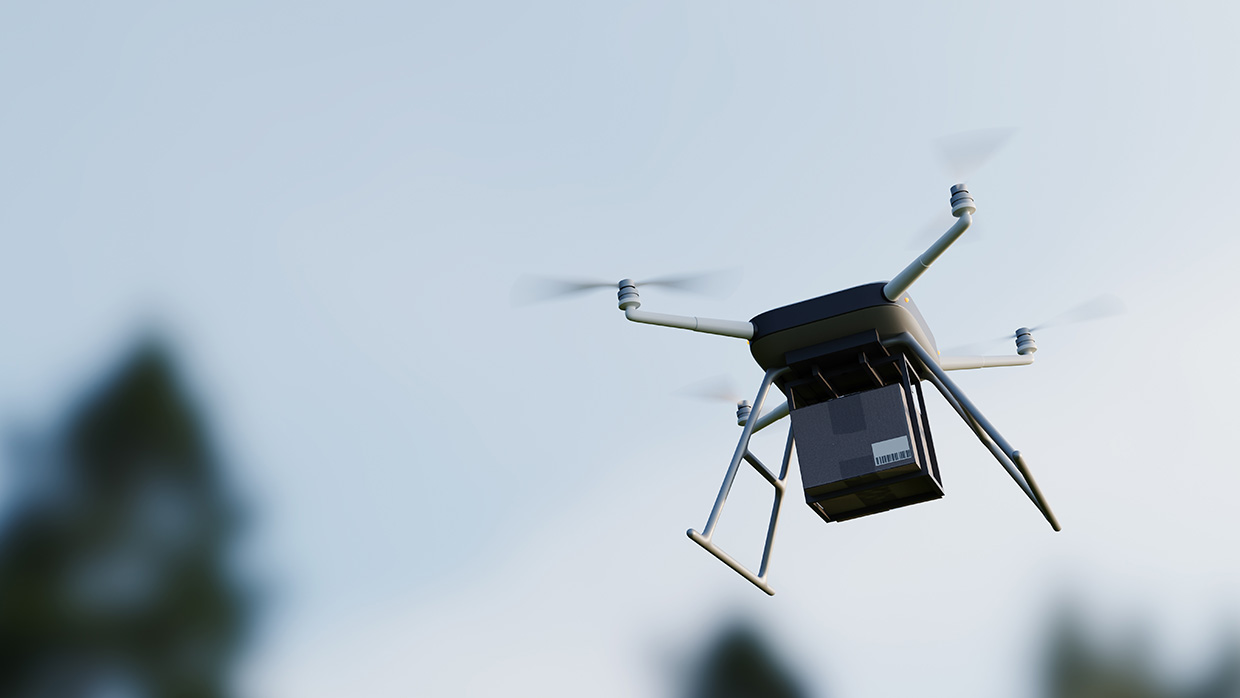
Following the January 2024 Noto Peninsula earthquake in Japan, NEXT DELIVERY, a part of Aeronet, used drones to deliver medical supplies to isolated areas. From this experience, Aeronext developed the SkyHub® Emergency Package, a phase-free (always ready and operational) disaster logistics solution that integrates drone delivery into everyday local logistics. The system creates a smart regional logistics platform, supporting local residents both during normal times and disasters. Challenges that were identified during the 2024 earthquake included disrupted roads, limited knowledge about the status of evacuation sites, and a lack of information on supply stockpiles. By digitizing everyday logistics operations with respect to the location of evacuation centers and prior hazard mapping, the platform enables rapid support during disasters. The everyday logistics services also ensure that residents become accustomed to using these collection points for drone deliveries in daily life, making the transition to emergency drone transport seamless.
Technological maturity: Frontier
Contracting type: For license
Technology level: High
Place of origin: Japan
Availability: Japan
Contact: WIPO GREEN Database
Horizon technology solutions
Communications: optical power supply technology
NTT Group and Kitami Institute of Technology (KIT)

Researchers have developed a way of transmitting 1 watt of electrical power alongside high-speed 10 Gbps bidirectional data through a single multi-core optical fiber (MCF) over distances greater than 10 kilometers. Using separate cores within the same fiber, the system sends power and data independently without interference, enabling disaster-affected areas to maintain communications even during power outages. This technology, demonstrated by NTT and partners, overcomes previous limits on power delivery distance through optical fibers and achieves a world record in optical power-distance product and self-powered data transmission performance. It can integrate with existing optical networks. Future applications will include optical communications in challenging environments – such as rivers, mountainous regions, and areas where electrification is difficult due to strong electric fields or corrosion – as well as the development of sensing networks connected to various IoT devices.
Technological maturity: Horizon
Contracting type: For sale
Technology level: Medium
Place of origin: Japan
Availability: Worldwide
Contact: WIPO GREEN Database
Communications: LEO satellite network
Telesat
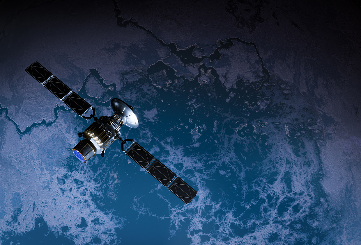
Telesat Lightspeed is a low Earth orbit (LEO) satellite network providing ultra-fast connectivity for first responders worldwide. It aims to extend public safety networks during disasters by delivering fiber-like speeds, multiple Gbps bandwidth and continuous global coverage with agile beam technology (the ability of satellite antennas to dynamically steer and shape radio signals or beams in real time, so they can be precisely focused on specific locations – concentrating capacity where demand is highest and adjusting coverage areas based on changing conditions). The first satellite launches are scheduled for mid-2026, with global service expected to commence in 2027.
Technological maturity: Horizon
Contracting type: Under development
Technology level: High
Place of origin: Canada
Availability: N/A
Contact: WIPO GREEN Database
AI-enhanced communications: piloting AI on Early Warning Connectivity Map (EWCM)
International Telecommunication Union (ITU), Microsoft AI for Good Lab, Planet, Institute for Health Metrics and Evaluation (IHME)

The Early Warning Connectivity Map (EWCM) combines AI and satellite imagery to map population density at high resolution and overlay it with mobile network coverage data. EWCM highlights areas where people are vulnerable to natural hazards due to limited access to emergency notifications. It enables authorities to plan alternative alerting methods – such as sirens, radio or community messengers – before disasters strike and make targeted infrastructure investments to enhance resilience. The results will guide data-driven decisions on warning dissemination strategies and mobile infrastructure investment to ensure no one is left behind. As part of the United Nations Early Warnings for All initiative, EWCM supports countries for targeted, inclusive early warning delivery. Pilot deployments are underway with national disaster agencies to refine methodologies, validate data accuracy and integrate results into multi-hazard early warning platforms.
Technological maturity: Horizon
Contracting type: Currently pilot projects
Technology level: High
Place of origin: Switzerland
Availability: Pilot countries
Contact: WIPO GREEN Database
Financial resilience, risk transfer and insurance technologies
Innovative financial technologies are transforming disaster risk response: parametric insurance triggers automatic payouts, while index-based insurance protects smallholder farmers using weather or yield benchmarks. AI-enhanced catastrophe bonds attract private capital, and mobile money platforms deliver anticipatory cash transfers before disasters strike. Biometric systems and blockchain streamline aid distribution while combating fraud.
Technological developments and trends
The economic toll of disasters has risen sharply over the past century. Low-income countries have borne the heaviest relative burden, averaging losses exceeding 2 percent of GDP annually in recent decades – over twice the share of GDP compared to wealthy nations. As shown in figure 11.1, high-income countries that face absolute economic losses generally sustain lower relative damages that are typically below 0.5 percent of GDP (
High-income countries face the highest relative losses due to wildfires, most likely due to suburban sprawl
When considering economic damages by disaster type, the differences come into sharper relief. For example, figure 11.2 shows economic damage from drought, depicting low-income countries as impacted the most profoundly. Figure 11.3, on the other hand, shows economic damage from wildfire events (


As climate change intensifies hazards, the need for robust and tailored risk transfer mechanisms becomes critical for the mitigation of financial shocks. This is especially true for low-income countries, since traditional insurance often fails to reach the most vulnerable. Financial and insurance technologies are revolutionizing risk management, while bolstering resilience for both disaster victims and even the insurance companies themselves (
Mobile money platforms enable direct cash transfers to be made to vulnerable populations, while cryptocurrency donations bypass traditional banking barriers for cross-border aid. Indexed-based insurances using satellite data and catastrophe bonds use big data and AI to protect farmers and governments from climate shocks. Digital cash and voucher assistance (CVA) programs now integrate biometrics and blockchain to reduce fraud. The World Bank and private insurers are adopting AI-powered risk models to streamline catastrophe bond issuance, attracting capital markets to disaster recovery. Yet challenges remain, such as ensuring equitable access, safeguarding data privacy in biometric verification systems, and protecting the three billion people still underserved by microinsurance (
Digital cash can make disaster aid smarter, faster and safer
Cash and voucher assistance (CVA) is a humanitarian aid approach whereby those affected by crises receive cash or vouchers instead of direct goods or services. Cash assistance means giving beneficiaries money (physical or digital) that they can spend as needed. Voucher assistance provides beneficiaries with coupons or electronic vouchers that can be exchanged for specific goods or services from approved vendors. As humanitarian aid shifts from in-kind to cash-based assistance, digital cash is replacing traditional cash delivery due to its agility, transparency and cost-effectiveness. It empowers recipients with greater choice, supports local markets, improves speed and flexibility, enhances accountability, promotes financial inclusion, and reduces personal risks associated with carrying physical cash or in-person transactions.
Financial and insurance technologies are revolutionizing risk management, while bolstering resilience for both disaster victims and even insurance companies
Mobile money solutions like M-Pesa (Kenya), bKash (Bangladesh) and GCash (Philippines) are essential tools for disaster relief. This is especially the case in areas with limited banking infrastructure, enabling the direct transfer of funds to individuals via their mobile phones. bKash, for example, operates through SMS and unstructured supplementary service data (USSD) codes, enabling users without smartphones or internet access to perform transactions. With strong security protocols and integration with mobile and agent networks, these platforms ensure reliable access to financial services, especially in emergency situations.
Using predictive analytics, preemptive cash transfers can be issued in advance of disasters, while mobile money systems enable instant aid disbursement, even in low-connectivity areas. Meanwhile, blockchain and biometrics are streamlining CVA to reduce fraud. Blockchain technology can support disaster response by providing secure, transparent and decentralized methods for managing identities and aid distribution. In emergency situations where displaced individuals often lose physical documents, blockchain enables fast and verifiable ID management (
Biometric technology (also discussed below), including fingerprints, iris scans and facial recognition, is used alongside mobile and blockchain technologies in CVAs. It is seen as a tool to enhance accountability, prevent fraud and ensure aid reaches the intended individuals. However, the political context of each country and the unequal implementation of biometric-based CVAs can create challenges, hindering efforts to promote independence and dignity, especially when biometric data is either not recognized or restricted (
Forecast-based/anticipatory cash assistance. Ahead of Cyclone Remal’s expected landfall in Bangladesh’s southern coastal regions in 2024, the WFP promptly distributed cash assistance of USD 43 (BDT 5,000) to 30,000 vulnerable families across five districts, helping them prepare for and recover from the storm (
Insurance solutions that bridge gaps in climate risk coverage gaining traction
Insurance plays a vital role in mitigating climate risks by transferring financial burdens from vulnerable individuals and communities to broader markets (
Disaster insurance faces significant adoption challenges, especially in low-income countries. Market failures stem from high risk, limited financial capacity, poor risk data, as well as behavioral factors like “charity hazard” (reliance on post-disaster aid) (
Collaboration, especially public–private partnerships, is key to improving disaster insurance by addressing market gaps, tailoring products to local needs, and boosting resilience using innovative schemes. Understanding risk impacts on the willingness to pay for insurance alongside specific risk characteristics also helps inform better insurance strategies. In addition, policy and governance are key to disaster insurance uptake, but many developing countries have reactive, weak frameworks. Success requires political will, strong laws, stakeholder coordination and government/donor support in data, legal setup and capacity-building (
Insurtech (insurance technology) refers to the use of innovative technologies to improve and transform the insurance industry. In relation to disasters, insurtech involves tools like AI-driven risk modeling, satellite imagery, IoT sensors and digital platforms that help insurers better predict, assess and manage disaster risks. For example, insurtech solutions can provide faster and more accurate damage assessments after a hurricane or wildfire, automate claims processing and enable parametric insurance products that trigger instant payouts based on predefined weather events.
Fintech (financial technology) broadly encompasses technology-driven innovations that improve financial services. When applied to disaster and catastrophe risk management, fintech includes financial instruments and platforms that facilitate the transfer and management of catastrophe risks. Catastrophe bonds, for instance, are fintech innovations that allow insurers to transfer disaster risks to the capital markets, raising funds for disaster recovery. Blockchain technology enhances transparency and automation in disaster risk finance by enabling secure, tamper-proof contracts and faster claims payouts.
Microinsurance (insurance products specifically designed for low-income populations offering low premiums, limited coverage and simple terms) and inclusive insurance (which aims to ensure access to affordable insurance for all underserved populations, including informal workers, rural communities, migrants, refugees and other marginalized groups) are an increasingly used tool for building financial resilience into low-income and vulnerable populations, but there is still a significant coverage gap. While coverage has grown by 70 percent in 37 countries over the past three years, only 12 percent of the three billion people who could benefit are currently covered (
Parametric insurance pays out a predetermined amount based on the occurrence of a specific event or condition, rather than on the actual loss incurred. It is based on a trigger, such as wind speed, and requires no inspections or loss adjustment, thus enabling a fast payout – which is useful for disasters, agriculture, drought, and climate-related risks. Take, for example, a coastal business that purchases parametric insurance paying out USD 100,000 if a Category 4+ hurricane passes within 50 miles. If such an event occurs, the company receives the money, regardless of the actual damage incurred.
Whereas parametric insurance pays out a predetermined amount based on the occurrence of a specific event or condition rather than on the actual loss incurred, index-based insurance is a specific type of parametric insurance whose trigger is based on an index, such as rainfall amount, temperature or crop yield average. This index is determined by measured data from a third party, such as weather stations or satellites. For example, a farmer buys rainfall index insurance. If rainfall drops below 50 mm during the growing season (based on satellite data), the farmer will then receive a payout without the need for a time-consuming in-situ assessment. This type of insurance is commonly used in agriculture within developing countries. Importantly, it helps to avoid issues like disputed claims or fraud, and is gaining traction in markets where traditional insurance is too expensive or complex to implement. A further subset of parametric insurance is satellite-indexed insurance. This specifically uses satellite imagery and remote sensing technologies to assess and validate disaster-related claims in areas where ground-based assessments are either difficult or costly, or both. These particular products can trigger payouts based on a predefined threshold, for example, rainfall level, vegetation health measured by the normalized difference vegetation index (NDVI) or soil moisture and drought indicators.
Insurance industry challenges and parametric reinsurance. Reinsurers provide catastrophe policies covering extremely rare events – those that might happen only once every 100, 250 or even 500 years. Consequently, major firms develop models considered adequate for reinsurers to underwrite these catastrophe risks. However, issues emerge when models designed for such rare events are applied to more frequent events occurring every five to 10 years (
The insurance industry is facing an affordability crisis
The insurance industry is facing an affordability crisis, especially with secondary perils like severe convective storms causing rising losses to outpace premiums, thus straining primary insurers. Reinsurers, wary due to past losses and modeling challenges for frequent, less extreme events, are reluctant to increase exposure to such risks. To address this gap, companies such as Demex (see Frontier technologies) are promoting parametric reinsurance to improve protection for insurers. This innovative approach aims to balance risk between insurers and reinsurers, helping stabilize the market without reinsurers withdrawing from secondary peril coverage (
Catastrophe bonds, while fundamentally financial instruments, are intertwined with advanced technology, making them a key innovation in the insurtech and fintech spaces. Their creation and management rely heavily on sophisticated catastrophe modeling that uses AI, satellite data, climate simulations, and other cutting-edge analytics to predict the likelihood and impact of disasters. This modeling informs the design of bond triggers and payout structures by accurately quantifying risk exposure. Additionally, the issuance and trading of “cat” bonds often occurs on digital platforms that use blockchain technology and smart contracts to automate trigger events and payouts, which can contribute to transparency and security. Cat bonds integrate real-time data feeds and early warning systems to connect insurers, reinsurers and capital markets, ultimately bolstering the broader risk management ecosystem.
AI-enhanced catastrophe modeling. The World Bank is exploring the use of AI to enhance catastrophe risk modeling and streamline catastrophe bond transactions. AI can analyze huge datasets to identify patterns and correlations that traditional methods might miss. This approach allows for the more accurate assessment of vulnerabilities and potential economic losses. By improving modeling reliability, AI could facilitate more transactions being made within the catastrophe bond market, potentially increasing investor confidence and participation (
Broadly speaking, AI is increasingly being used within the insurance industry. It can help insurers improve claims processing and make insurance more affordable by lowering transaction costs. As discussed in other chapters in this year’s Green Technology Book, it is being applied for weather prediction, damage assessment and improving resilience in disaster-prone regions. However, the effectiveness of AI depends on the quality of data it uses. Additionally, industry-wide collaboration between different stakeholders is necessary to enable it to reach its full potential for insurance and other disaster response technologies (
Biometrics technologies support disaster relief and fraud prevention – but data concerns remain
Digital ID systems usually consist of multiple technologies working together to enable identification. Because of such complexity, there is no single agreed-upon definition. A digital ID can be a digital version of an identity document, a collection of personal attributes used in a transaction, or a network of digital identifiers that uniquely identify someone (
Fingerprint recognition. In disaster-affected areas, fingerprint biometric systems are used by humanitarian organizations to register individuals, ensuring each person can claim relief without the risk of duplicate or multiple claims being made under different identities. It can be deployed in refugee camps, temporary shelters or at remote field offices.
Facial recognition for aid distribution. In high-traffic disaster response areas, facial recognition technology is used to verify identities at aid distribution points by using pre-recorded images (such as those taken at registration centers).
Iris scans are increasingly used in disaster-prone regions for identification, since the iris is a unique, unchangeable feature. Some organizations like the Indian Red Cross have tested iris-scanning technology to ensure that aid reaches the correct individuals, while reducing administrative overheads and delays.
In regions where infrastructure is damaged, mobile biometric kits allow field officers to register people using a smartphone or portable device. The data collected, including fingerprints, facial or iris scans, can be stored and processed in the cloud, allowing for real-time verification of claims.
Behavioral biometrics for ongoing claim verification. After an initial registration, behavioral biometrics – such as typing patterns, walking gait, and even smartphone usage patterns – can be used to track a claimant’s identity continuously. While still experimental within disaster settings, this kind of behavioral biometric system can potentially be applied more frequently in the future to track aid recipients via digital platforms or cash transfers.
Blockchain with biometric verification. Blockchain technology combined with biometric systems can be used to securely store identity data for disaster victims. Blockchain ensures that once a person’s identity is verified using biometrics, their data cannot be altered. WFP has tested a blockchain-based system using biometric verification for food assistance in refugee camps.
Voice biometrics for remote verification. In areas with limited access to physical biometric devices, voice biometrics can be used over mobile phones. People register their voice patterns, and during subsequent interactions their identity can be verified through their unique voice features. In some developing countries, microinsurance companies are exploring voice biometric systems for verifying claims via mobile phone (
FasterCapital, 2025FasterCapital (2025). Innovations in microfinance. FasterCapital. Available at: https://fastercapital.com/topics/innovations-in-microfinance.html/1 [accessed June 16 2025]. ). In Bangladesh, where mobile money systems like bKash are widespread, voice biometrics are being explored to verify identities before funds are released to individuals who have registered for disaster relief (Bharadwaj et al., 2023Bharadwaj, R, T Mitchell, N Karthikeyan, N Raj, S Chaliha, R Abhilashi, K Chinnaswamy, B Raghini, I Deulgaonkar, D and Chakravarti and T McCabe (2023). Delivering anticipatory social protection: Country readiness assessment. London: International Institute for Environment and Development (IIED). Available at: https://www.preventionweb.net/media/91089/download?startDownload=20250623. ).Biometrics for medical assistance. Disasters often overwhelm health care systems with a surge of patients. In such a situation, biometric technology can play a role in improving medical care by recording the unique physical characteristics of an individual, thereby streamlining patient identification.
UNHCR employs its Biometric Identity Management System (BIMS), which uses fingerprint scanning, iris images and facial photos to create unique biometric records for refugees. This system ensures accurate identification, prevents fraud and enables the efficient delivery of services like food, shelter and cash assistance. BIMS provides a centralized database that is accessible across locations, supports mobile and offline use, and integrates with other systems to streamline operations. To enhance data sharing and coordination, UNHCR uses the PRIMES Interoperability Gateway (PING), a secure platform that allows the safe exchange of biometric and biographical data with partners including WFP. This collaboration has improved food distribution for refugees in Tanzania by enabling WFP to access verified identity data via PING and synch it with WFP’s cloud-based SCOPE platform. SCOPE is used for registering and tracking beneficiaries, deduplicating personal data, managing beneficiary lists, and monitoring assistance delivery (both cash and in-kind). It also supports beneficiary authentication, transfer value management and operational data storage.
The partnership between UNHCR and WFP through their interoperable technologies boosts data transfer speed and adds biometric security to reduce fraud, ensuring aid reaches the correct people efficiently.
Source: (
Biometric vending machines are innovative tools used during a disaster response to provide essential supplies like food, water and emergency items quickly and securely. In Japan, disaster-response vending machines have been used since 2007, having first been developed by the Institute of Disaster Mitigation and Coca-Cola West. They automatically dispense resources during emergencies, providing water, electricity and information, while using biometric authentication to control access. In India, the GrainATM (Annapurti) is a biometric-enabled automated grain dispenser that provides subsidized grains 24/7 to beneficiaries under the Public Distribution System. Launched in Odisha and supported by WFP, it allows ration card holders to quickly access up to 50 kg of grains with biometric verification, cutting waiting times by 70 percent (WFP, 2024c).
Significant biometric data technology challenges remain. In camps like Dadaab in Kenya, refugees have faced challenges such as biometric data not being recognized, delays in aid distribution and restrictions on the types of food or services they can purchase. Cash assistance is often restricted to specific vendors, which limits choice. Additionally, some refugees feel trapped by the need for biometric verification to maintain access to assistance, which can limit their mobility and economic freedom (
Innovation examples
AI-driven cash relief before and after disasters strike
In response to Hurricanes Helene and Milton, disaster aid delivery has been transformed using AI. The nonprofit organization GiveDirectly is pioneering a direct cash assistance program, having provided $1,000 payments to nearly 1,000 households in North Carolina and Florida. This approach aims to rush relief to those most affected by leveraging Google’s machine learning tools to identify high-need households in disaster zones. Using AI to analyze satellite imagery and poverty data, GiveDirectly targets communities with significant damage and economic vulnerability. Eligible recipients are invited to enroll via the Propel app, where funds are deposited directly onto debit cards, reducing delays and documentation burdens typical of traditional aid programs. Direct cash assistance offers recipients flexibility in addressing diverse needs such as food, clothing, childcare and bill payments. While the model has proven effective, limitations include the requirement for smartphone access and internet connectivity, which exclude some vulnerable populations. GiveDirectly plans to expand its reach through hybrid remote and in-person assistance. Additionally, Google is using AI to predict severe floods up to a week in advance, enabling the International Rescue Committee and GiveDirectly to send cash transfers before disasters strike. This anticipatory aid, piloted in Nigeria and Mozambique, uses satellite data, government information and mobile money platforms to identify at-risk populations and deliver funds quickly (
African Risk Capacity (ARC) Group parametric insurance payouts power rapid climate crisis relief in Zimbabwe and Somalia
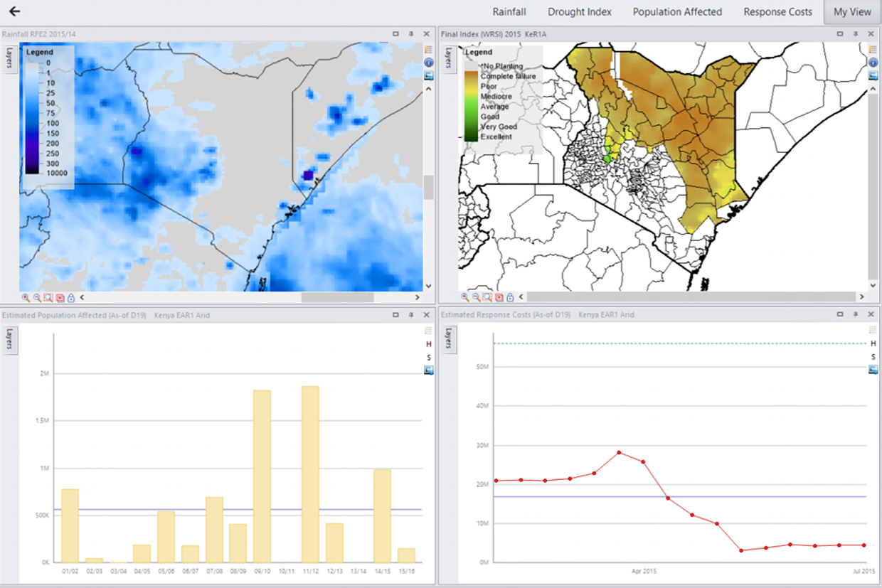
The African Risk Capacity (ARC) Group pioneers parametric disaster insurance solutions across Africa, providing rapid financial support to countries facing climate-induced crises. In 2024, Zimbabwe received a historic payout of USD 16.8 million to aid drought-affected populations amid severe food insecurity caused by El Niño. This payout was triggered by ARC’s Africa RiskView software, an early warning system that automatically releases funds based on predefined drought severity metrics impacting over 4.7 million people. Through the ARC Replica program, humanitarian organizations can purchase insurance policies that complement governments’ insurance coverage, thereby increasing protection for populations against climate risks. Humanitarian partners World Food Programme (WFP) and Start Network have received USD 6.1 million and USD 8.9 million, respectively, enabling humanitarian organizations to deliver timely or early assistance to vulnerable populations following a shock. Premiums are supported by donors including the Swiss Agency for Development and Cooperation and KfW, a German development bank, ensuring predictable emergency funding. Somalia also secured USD 1.46 million from ARC’s sovereign drought insurance pool for the 2024/25 season, with Start Network receiving $728,000 via Replica to provide cash transfers to over 45,000 drought-impacted households. These efforts represent a shift from reactive aid to prearranged risk financing, showcasing how ARC’s parametric insurance and Replica program use technology-driven risk monitoring and prearranged financing to strengthen disaster resilience across Africa (
Blockchain-based index insurance protects Southeast Asia’s coffee farmers from climate risk
Insurtech company Igloo has expanded its blockchain-based parametric Weather Index Insurance to coffee farmers in Southeast Asia, building on the success of its program for rice farmers. Launched in Vietnam’s Central Highlands, the program covers five provinces and insures plots as small as 0.1 hectares at a cost starting around USD 42 per hectare, with coverage up to USD 1,700. The insurance uses rainfall data and pre-assigned loss values to automate claims, eliminating the need for on-site damage assessment and ensuring fast, transparent payouts. Smart contracts hosted on a public blockchain guarantee consistency and trust in the payout process. Igloo partners with local insurers, meteorological agencies and international reinsurers to implement the program. This is crucial, as climate change increasingly threatens coffee crops across the region with drought, erratic rainfall and suboptimal temperatures that jeopardize farmer livelihoods, as well as global supply chains. By using big data, real-time risk assessment and automated claims management, Igloo’s model counters the high cost, delays and inefficiencies of traditional agricultural insurance and helps small-scale farmers protect their income, while adapting to growing climate volatility (
Proven technology solutions
Insurance and risk transfer: agriculture disaster insurance
ACRE Africa
ACRE Africa is an agricultural and climate risk enterprise offering innovative insurance solutions to smallholder farmers across Africa. Its approach includes providing weather index-based insurance products, such as Bima Pima, which allow farmers to pay premiums in small, affordable installments via mobile money platforms like M-Pesa. These products are designed to trigger automatic payouts based on weather data, eliminating the need for on-site inspection and reducing administrative costs. ACRE Africa collaborates with local partners, including mobile network operators and agro-dealers, to distribute insurance products and build trust within farming communities. Its use of technology, including satellite data and blockchain for smart contract automation, enhances the efficiency and scalability of services. Since its inception, ACRE Africa has expanded its reach to over 3.1 million farmers across multiple African countries.
Technological maturity: Proven
Contracting type: For sale
Technology level: Medium
Place of origin: Kenya
Availability: Sub-Saharan Africa
Contact: WIPO Green Database
Insurance and risk transfer: bespoke parametric insurance
Descartes Underwriting
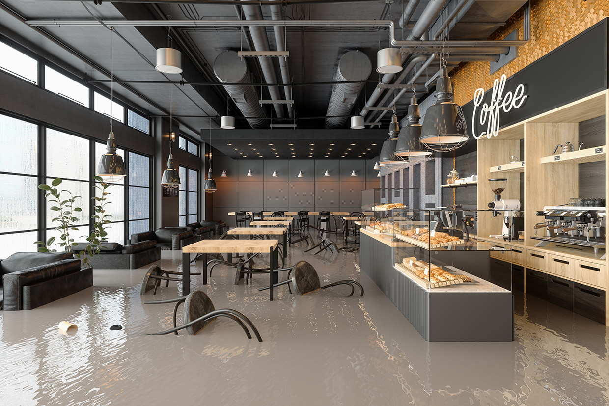
Descartes Underwriting delivers advanced parametric insurance using AI, satellite imagery and real-time data analytics to protect businesses from disasters like hurricanes, earthquakes, floods and extreme weather. Policies trigger automatic payouts when specific conditions – such as wind speeds or seismic activity – are met, so as to enable fast claims-free financial relief. By integrating machine learning and sensor data, Descartes builds precise, dynamic risk models that capture climate trends and local hazards. Focused on large corporate clients, its offers scalable solutions covering extensive geographical areas worldwide. Descartes issues policies on A-rated paper (referring to insurance policies or contracts that are backed by insurers with an “A” (Excellent) rating from independent rating agencies like A.M. Best, Standard & Poor’s, and Moody’s), and is supported by leading reinsurers.
Technological maturity: Proven
Contracting type: For sale
Technology level: Medium
Place of origin: France
Availability: Worldwide
Contact: WIPO Green Database
Cash transfers and financial inclusion platforms: mobile money platform
bKash
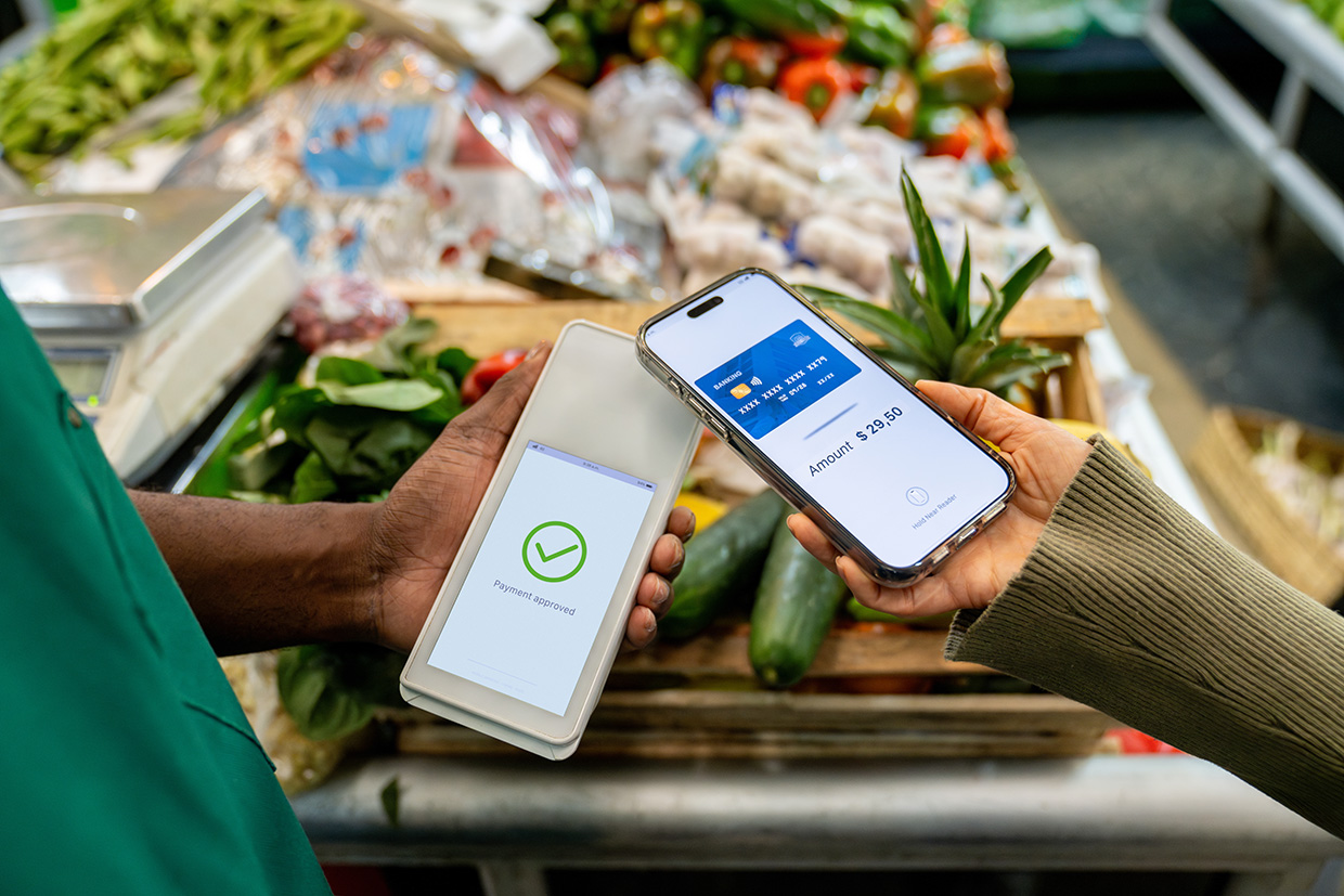
bKash operates as a mobile-based digital payment platform that leverages USSD and smartphone apps to provide secure, easy-to-use financial services. It enables users to send money, pay bills, recharge mobile phones and access banking services without the need for a traditional bank account. USSD works over the GSM network and allows users to access financial services by dialing codes on basic feature phones. The platform integrates with Bangladesh’s banking infrastructure and uses robust encryption and authentication methods to ensure transaction security. Its technology supports real-time transactions, interoperability with other financial institutions, and scalability to serve millions of users, making digital finance accessible even in remote or underserved areas.
Technological maturity: Proven
Contracting type: Subscription or usage-based services
Technology level: Medium
Place of origin: Bangladesh
Availability: Bangladesh
Contact: WIPO Green Database
Cash transfers and financial inclusion platforms: mobile money platform
M-Pesa
M-Pesa is Africa’s leading mobile money service and the continent’s largest fintech platform. It offers a safe, convenient way for both banked and unbanked people to make payments and access financial services. Launched in 2007 by Safaricom, Vodafone’s Kenyan partner, M-Pesa now serves over 60 million customers across eight African countries. M-Pesa uses SMS and USSD technology to enable financial transactions on basic mobile phones without internet. It links mobile numbers to digital wallets for sending money, paying bills and more. The system operates on a secure, centralized platform that processes transactions instantly and integrates with banks and agents for cash services. Robust encryption and authentication ensure user security. In 2020, Vodacom and Safaricom acquired the M-Pesa brand from Vodafone Group through a joint venture, giving them full control over product development and support.
Technological maturity: Proven
Contracting type: Subscription or usage-based services
Technology level: Medium
Place of origin: Kenya
Availability: Democratic Republic of Congo, Egypt, Ethiopia, Ghana, Kenya, Lesotho, Mozambique, South Africa and Tanzania
Contact: WIPO Green Database
Insurance and risk transfer: crop and weather monitor with built-in index viewer
Swiss Re
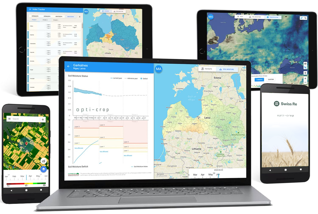
Swiss Re, a large Swiss reinsurance company, is expanding its parametric agricultural insurance to help smallholder farmers and public sector clients manage climate risks like droughts, floods and heatwaves. Using predefined triggers such as rainfall, soil moisture, temperature and vegetation indices, payouts are made automatically and faster without the need for traditional claims processing. The company’s Opti-Crop platform leverages near real-time satellite and weather data to enhance transparency and reduce delays. Swiss Re supports insurers and governments in product design and data integration, aiming to better align payouts with actual losses. Active in South America, Central Asia, Africa, and Southeast Asia, Swiss Re offers standardized indices that include soil moisture, rainfall, temperature, normalized difference vegetation index (NDVI) (vegetation density) and area yield to track environmental conditions and improve insurance access.
Technological maturity: Proven
Contracting type: For sale
Technology level: Medium
Place of origin: Switzerland
Availability: Worldwide
Contact: WIPO Green Database
Insurance and risk transfer solutions: index-based livestock and yield index insurance
Pula
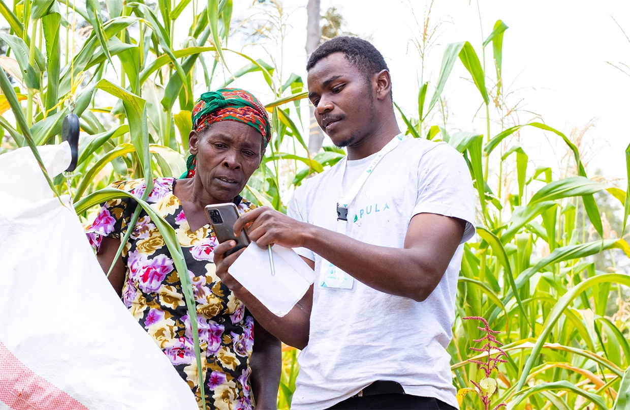
Pula’s insurance products use satellite technology and data analytics to protect farmers and pastoralists. Its Index-Based Livestock Insurance (IBLI) uses satellite-derived NDVI data to monitor pasture health and detect grazing shortages caused by drought or delayed rains. This enables timely payouts to support livestock care during critical periods. For crops, Pula’s Yield Index Insurance (YII) divides regions into agro-ecological zones using historical climate and yield data. Satellite and ground data help measure actual yields at season’s end, triggering compensation if yields fall below set thresholds. A hybrid insurance combines Weather Index Insurance (WII) and YII, using weather data and yield measurements to deliver fast payouts for weather-related losses and broader coverage for drought, floods, pests and diseases. This enables efficient risk assessment and rapid financial support without the need for individual loss verification.
Technological maturity: Proven
Contracting type: For sale
Technology level: Medium
Place of origin: Switzerland
Availability: Ethiopia, Kenya, Nepal and Nigeria
Contact: WIPO Green Database
Cash transfers and financial inclusion platforms: blockchain-based decentralized donation platform
Giveth

Giveth is a blockchain-based donation platform that uses Ethereum smart contracts to ensure transparency and accountability in funding social impact projects, allowing donors to track exactly how and where their contributions are used in real time. Giveth uses decentralized technology to reduce reliance on traditional intermediaries, creating a direct and auditable link between donors and projects. The platform supports recurrent donations, milestone-based funding, and integrates with Web3 wallets – digital wallets that allow users to interact with decentralized applications (dApps) and blockchain networks, especially those built on platforms like Ethereum. Unlike traditional wallets used for storing fiat currency, Web3 wallets manage cryptographic keys – enabling users to store, send and receive cryptocurrencies and digital assets, and to authenticate themselves on decentralized platforms without needing a username or password. Giveth is open source, enabling global participation in supporting charitable causes through cryptocurrency.
Technological maturity: Proven
Contracting type: Open source
Technology level: Medium
Place of origin: Switzerland
Availability: Worldwide
Contact: WIPO Green Database
Cash transfers and financial inclusion platforms: blockchain-based platform for impact projects
Alice SI
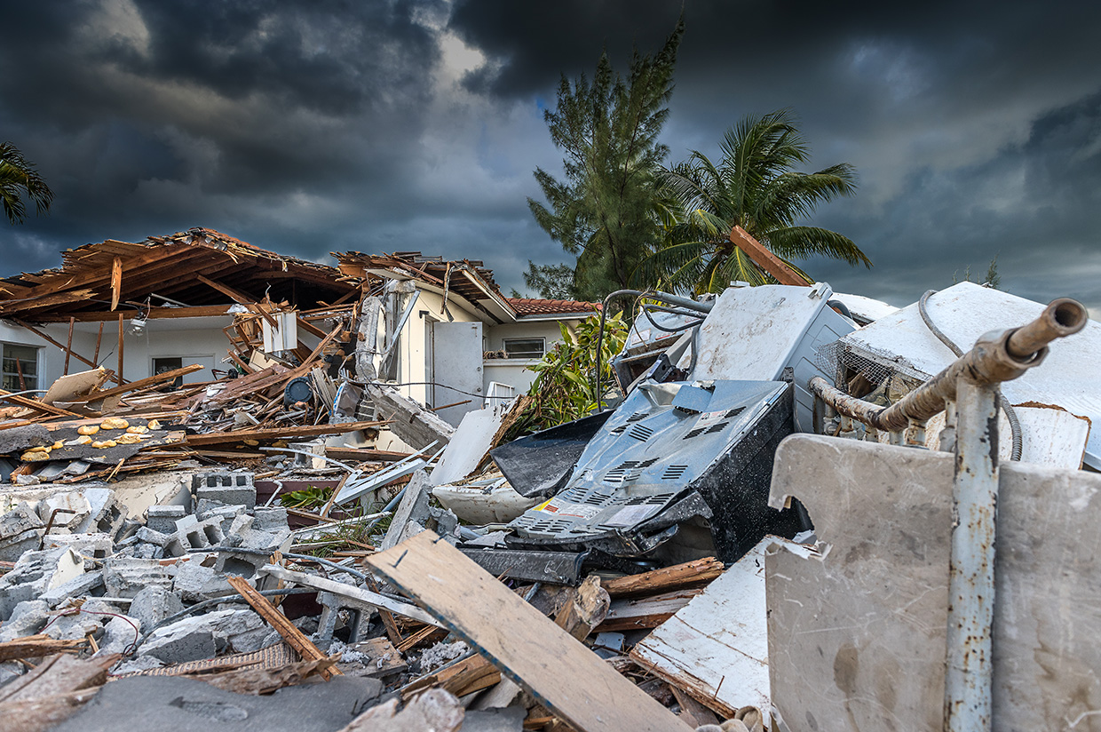
Alice SI is a blockchain-based platform designed to bring transparency and accountability to charitable donations. It uses Ethereum smart contracts to ensure that funds are only released when verified outcomes are achieved, helping build trust between donors and organizations. The platform integrates technologies like Etheroscope, which visualizes smart contract data in real time, and Sensor TRX, which uses IoT and APIs to automate impact validation – the platform connects to devices and software systems to automatically track whether specific outcomes have been achieved without requiring manual checking. In areas with limited connectivity, Alice also offers Tappy, a contactless wallet that allows beneficiaries to validate impact and access funds. By combining blockchain with real-time data and verification tools, Alice SI ensures that donations are traceable in order to increase donor confidence and facilitate more effective social impact funding.
Technological maturity: Proven
Contracting type: Open source
Technology level: Medium
Place of origin: United Kingdom
Availability: Worldwide
Contact: WIPO Green Database
Insurance and risk transfer solutions: catastrophe bonds
World Bank

The World Bank’s Capital at Risk (CAR) Notes program helps transfer disaster-related financial risk from countries to global investors by issuing catastrophe and pandemic bonds. These bonds may risk investors’ principal and are issued under the World Bank’s Global Debt Issuance Facility, benefiting from tax and securities law exemptions, but often without a credit rating. Unlike traditional catastrophe bonds that use a special purpose vehicle (SPV) to issue bonds and hold collateral, the World Bank issues bonds directly and manages contracts, investments and payments. In this setup, the sponsor (a country or client) enters into an insurance or derivative contract with the World Bank. The bonds pay out when predefined disaster events – for example, when an earthquake or storm meets parametric criteria – occur. For example, in Mexico, payouts triggered by such events are routed through intermediaries like Swiss Re and Agroasemex. If no disaster happens, investors receive their principal back at maturity. This program helps countries manage risks from disasters by tapping global capital markets efficiently.
Technological maturity: Proven
Contracting type: Risk transfer agreement/structured finance product
Technology level: Medium
Place of origin: United States
Availability: Worldwide
Contact: WIPO Green Database
Insurance and risk transfer solutions: climate risk insurance as a part of a comprehensive risk management package
World Food Programme
Over the past decade, the World Food Programme (WFP) has expanded access to climate risk insurance, reaching over 10.5 million people through a portfolio of products, including weather index, area yield, hybrid index, livestock index and business interruption insurance. These products protect vulnerable groups that include smallholder farmers, pastoralists and micro, small and medium enterprises (MSMEs) from climate-related perils such as drought, excessive rainfall and pests. In 2024 alone, WFP facilitated access to insurance for three million people across 15 countries with over USD 41 million in payouts benefiting more than 1.5 million people. WFP embeds insurance into broader financial services and resilience-building strategies by linking premium subsidies to disaster risk reduction and climate adaptation efforts, integrating insurance with savings, loans and market access, and promoting crop-agnostic coverage to support livelihood diversification. It also develops Forecast Index Insurance to unlock pre-disaster financing for Anticipatory Action. These integrated models enhance risk protection and incentivize adaptive practices and investment.
Technological maturity: Proven
Contracting type: For collaboration
Technology level: Medium
Place of origin: Ethiopia
Availability: Bangladesh, Burkina Faso, Cộte d’Ivoire, Cuba, Ethiopia, the Gambia, Guatemala, Haiti, Iraq, Kenya, Kyrgyz, Madagascar, Malawi, Mozambique and Senegal
Contact: WIPO Green Database
Frontier technology solutions
Risk assessment and modeling tools: climate risk models and insurance mapping tool
SkyFi

SkyFi delivers advanced geospatial analytics specifically designed for the insurance sector to improve risk assessment, claims management and disaster response. Using high-resolution satellite imagery and remote sensing, SkyFi helps insurers evaluate environmental risks, such as flood likelihood, soil moisture and terrain changes over time, thereby enabling precise underwriting and risk modeling. After disasters, like a flood or fire, insurers can quickly assess structural damage remotely, speeding up claims prioritization and processing. Real-time geospatial data also supports emergency response by mapping impact severity and optimizing service routes. Additionally, SkyFi offers continuous monitoring of insured assets to detect early signs of damage or wear, helping reduce claim frequency by enabling proactive maintenance. This data-driven approach allows insurance companies to improve accuracy, reduce costs and enhance customer service by responding faster and more effectively to risks and claims. Overall, SkyFi empowers insurers with actionable insights through satellite technology to manage risks and optimize operations efficiently.
Technological maturity: Frontier
Contracting type: For sale
Technology level: Medium
Place of origin: United States
Availability: Worldwide
Contact: WIPO Green Database
Risk assessment and modeling tools: parametric wildfire and hurricane insurance
Kettle
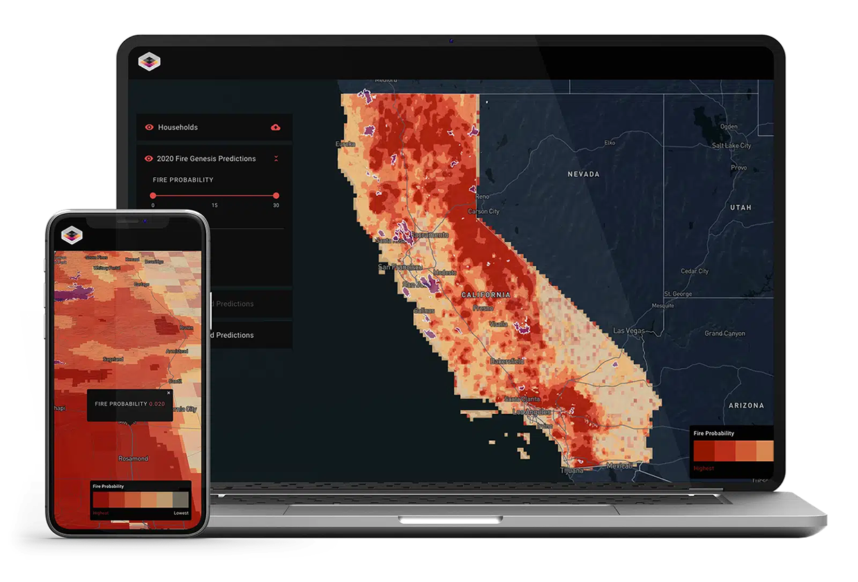
Kettle uses proprietary machine learning algorithms that analyze billions of data points from sources like NASA, NOAA, and the European Space Agency. This technology processes vast raw data through an ETL (referring to “extract, transform, load,” a data processing method used to collect data from multiple sources (extract), clean and organize it into a usable format (transform), and then load it into a database or system where it can be analyzed or used (load) pipeline to train deep neural networks, generating over two million high-resolution wildfire footprints at 100-meter scale. Kettle’s suite of models – including Ignition, Contagion, Building Vulnerability, Fire Edge Downscaling, and Parcel Risk Assessment – predict wildfire risks by simulating ignition and spread patterns across millions of grid cells. Kettle’s Genesis Model divides areas into micro-grids, analyzing factors driving wildfire ignitions monthly. Using deep long short-term memory convolutional neural networks, Kettle accurately captures the temporal and spatial dynamics of wildfire spread.
Technological maturity: Frontier
Contracting type: For partnership and collaboration
Technology level: Medium
Place of origin: United States
Availability: Worldwide
Contact: WIPO Green Database
Cash transfers and financial inclusion platforms: instant disbursements via digital identity
AID:Tech
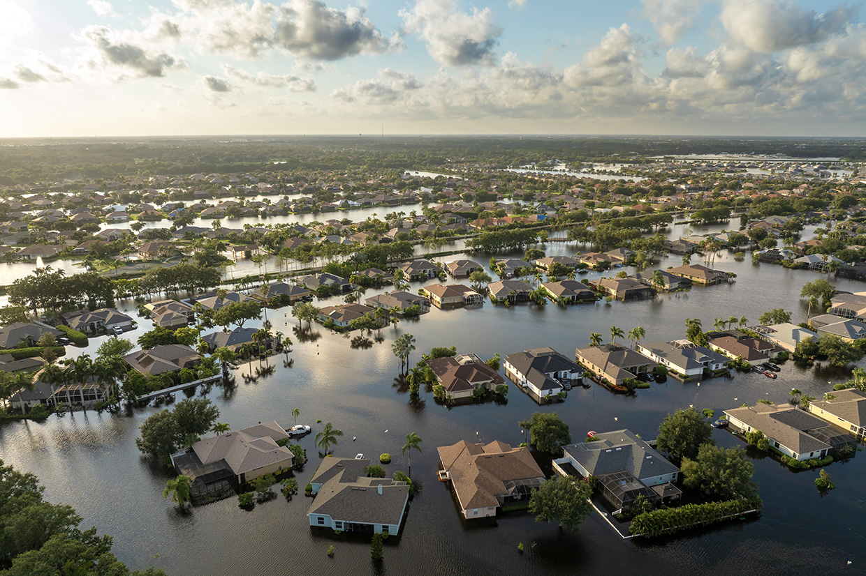
AID: Tech’s Kare platform is a digital aid distribution system designed to improve disaster relief by using blockchain and digital identity verification. Funds are sent directly to recipients inside digital wallets accessible via mobile apps. Users can spend these funds using virtual Visa debit cards, which work with Apple Pay and Google Pay. The platform allows customizable disbursement controls, such as restricting purchases of alcohol or tobacco. Kare offers real-time tracking of aid distribution and resource usage, ensuring transparency. Additionally, it partners with Amazon to deliver physical goods directly to those in need.
Technological maturity: Frontier
Contracting type: For licensing
Technology level: Medium
Place of origin: Ireland
Availability: Worldwide
Contact: WIPO Green Database
Cash transfers and financial inclusion platforms: blockchain payment solution for digital cash distribution
Stellar
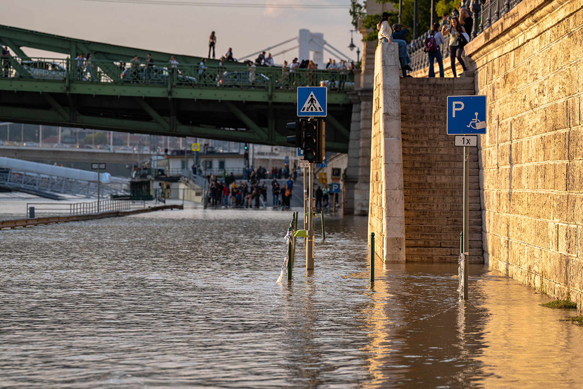
UNHCR, in partnership with the Stellar Development Foundation (SDF), has launched a pioneering blockchain-based payment solution using the Stellar network to deliver cash assistance to internally displaced persons (IDPs) and war-affected people within Ukraine. The pilot distributes funds in USD Coin (USDC), a stablecoin, directly into recipients’ digital wallets accessible via smartphones. This allows beneficiaries to use or withdraw money globally at MoneyGram locations. The solution ensures full traceability and accountability. Initially piloted in the cities of Kyiv, Lviv and Vinnytsia, the platform aims to expand globally. This initiative complements UNHCR’s long-standing commitment to cash-based interventions, which have delivered nearly USD 5 billion to over 35 million people worldwide.
Technological maturity: Frontier
Contracting type: Collaborative humanitarian solution
Technology level: Medium
Place of origin: Ukraine
Availability: Ukraine (with plans to expand)
Contact: WIPO Green Database
Cash transfers and financial inclusion platforms: rescue card/Zinli
World Food Programme
When emergencies occur, WFP’s cash-based assistance can take up to six months to set up without existing payment arrangements. Many unbanked individuals are excluded due to strict Know Your Customer (KYC) requirements (a set of rules financial institutions and organizations follow to verify the identity of their clients. The goal is to prevent fraud, money laundering and terrorist financing). The Rescue Card, a prepaid, reloadable card linked to WFP’s digital wallet, offers immediate aid within 72 hours, with flexible KYC to include marginalized groups. As of 2025, it has helped over 88,000 people across eight countries. Rescue Card has cut costs by 70–85 percent and reduced delivery times by up to two years. In 2024, most assistance—56 percent to 68 percent—went directly to women, with 80 percent spent on food. To boost preparedness, 5,000 cards were prepositioned in Barbados ahead of Hurricane Beryl. Nowadays, Rescue Card is prepositioned in eight countries to support emergency operations and anticipatory action.
Technological maturity: Frontier
Contracting type: For collaboration
Technology level: Medium
Place of origin: Panama
Availability: Barbados, Bolivia (Plurinational State of), Cuba, Dominican Republic, Guatemala, Haiti , Honduras, Peru
Contact: WIPO Green Database
Risk assessment and modeling tools: AI solution for assessing damage caused by disasters
Tractable
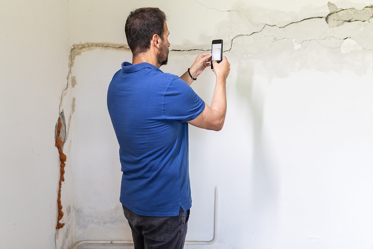
Tractable’s AI Property solution uses AI to rapidly assess external building damage due to wind, hail and hurricanes, cutting damage evaluation time from months to a single day. Homeowners simply upload photos via a mobile web app, and AI processes them in order to estimate damage and submit a report to insurers. This technology is currently being used by Japan’s MS&AD Insurance Group, as it was during Typhoon Mindulle in 2021, helping expedite claims and recovery. The AI focuses on external damage, such as to fences and walls, and there are plans to include indoor damage such as from water leaks and smoke. Initially, human experts verify AI assessments, but the system is designed to learn and move toward full automation. AI Property is also available in North America, aiming to help insurers respond faster to disasters and improve customer support during crises.
Technological maturity: Frontier
Contracting type: For licensing
Technology level: Medium
Place of origin: United Kingdom
Availability: Japan, North America
Contact: WIPO Green Database
Insurance and risk transfer solutions: bespoke index-based insurance
IBISA
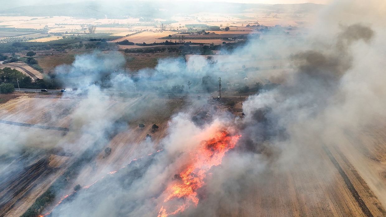
IBISA is a climate InsurTech specializing in parametric insurance solutions that protect against weather-related risks, mainly within agriculture. Its index-based policies trigger automatic payouts when predefined weather conditions – such as extreme rainfall, cyclones or temperature anomalies – are met, thereby eliminating lengthy claims processes and providing fast financial aid. Recently, IBISA raised EUR 2.8 million from investors, including The Acumen Resilient Agriculture Fund, Equator, and the Asian Development Bank Ventures, to expand into emerging markets in Asia and Africa. IBISA’s approach involves analyzing local weather data to define tailored triggers relevant to each region. Once a weather event exceeds these thresholds, satellite data is reviewed and claims processed within 10 days.
Technological maturity: Frontier
Contracting type: For sale
Technology level: Medium
Place of origin: Luxembourg
Availability: Africa, Asia
Contact: WIPO Green Database
Risk assessment and modeling tools: multi-peril data solution for catastrophes related to natural hazards
ICEYE
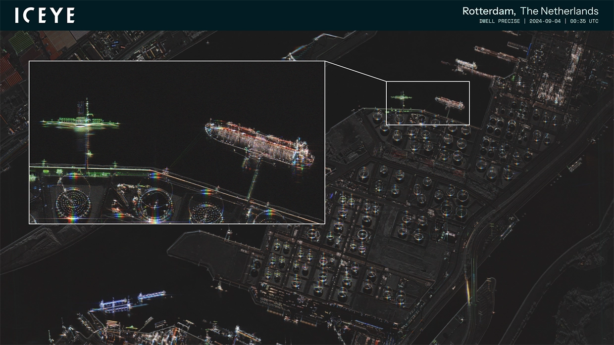
ICEYE operates the world’s largest synthetic aperture radar (SAR) satellite constellation, with 50+ satellites launched to date, to deliver near real-time observation data on natural catastrophes such as floods, hurricanes, earthquakes, and wildfires. Unlike optical sensors, SAR technology functions continuously—day or night, through cloud, smoke, and ash—ensuring reliable information in all conditions. ICEYE’s Multi-Peril Data Solution integrates these observations into GIS-ready hazard and damage layers, enabling insurers to obtain comprehensive situational awareness within hours of an event. By replacing model-based projections with observed evidence, the technology accelerates loss assessment, improves claims prioritization, and enhances the precision of underwriting and pricing. Through timely, observation-based catastrophe intelligence, ICEYE strengthens financial resilience and supports climate adaptation within the insurance sector.
Technological maturity: Frontier
Contracting type: For licensing
Technology level: Medium
Place of origin: Finland
Availability: Worldwide
Contact: WIPO Green Database
Horizon technology solutions
Insurance and risk transfer solutions: enhanced parametric insurance pilot
Mercy Corps Ventures and MiCRO
Mercy Corps Ventures and MiCRO have launched a pilot in Guatemala to reduce basis risk in parametric insurance for smallholder farmers. The initiative establishes a Basis Risk Fund that compensates farmers when qualifying climate-related losses occur but do not trigger payouts under existing parametric policies. To improve accuracy and affordability, the project will test technology-led methods to verify field losses, including the use of drones to assess crop damage, and compare their cost-effectiveness against traditional, in-person verification. Data and insights from the pilot will be used to refine the parametric insurance model, improve event identification and evaluate the long-term sustainability of the fund. Developed in partnership with Guatemala’s Ministry of Agriculture, the pilot aims to strengthen farmers’ trust in insurance products, enhance climate resilience and identify scalable ways to deliver faster, fairer compensation for farmers affected by extreme weather.
Technological maturity: Horizon
Contracting type: N/A
Technology level: Medium
Place of origin: Guatemala
Availability: Guatemala
Contact: WIPO Green Database
Insurance and risk transfer solutions: blockchain-integrated carbon credit-backed insurance
Ryskex/Arx Veritas
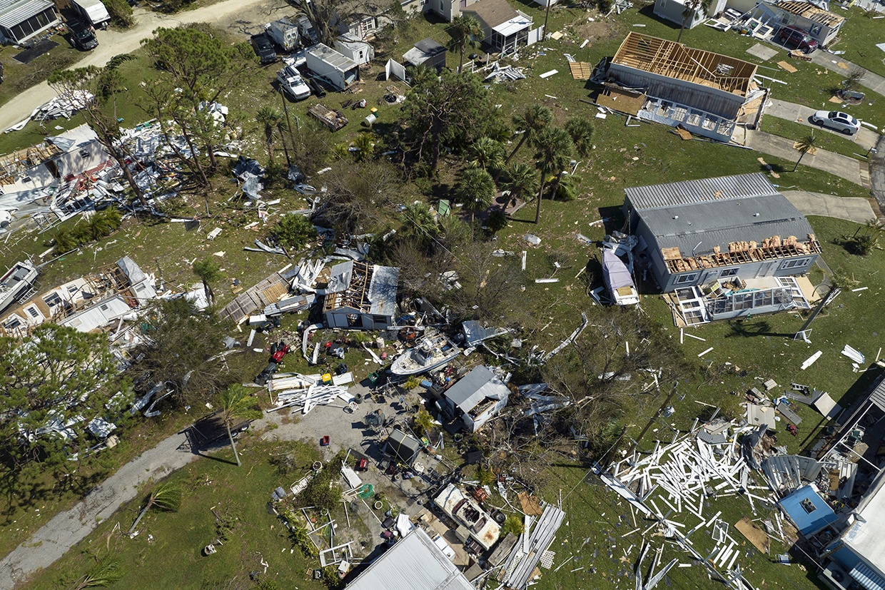
The Arx Veritas Parametrics Cell, developed by Ryskex and Arx Veritas, uses blockchain and AI to transform climate risk into investable assets using 10 million emission reduction units (ERUs). The cell, within the Veritas Ex Machina platform, turns carbon credits (10 million emission reduction units valued at $73 each) into investable, auditable assets. The initiative integrates blockchain (via Redbelly Network) and AI-driven underwriting to create a fraud-proof framework for climate-related risk transfer. Launched in April 2025, it uses Token “X” (a blockchain-based token or digital asset that represents a stakeholder’s ownership or investment – letting investors share in financial outcomes linked to carbon credit-backed insurance) to enable secure participation by institutional investors. The cell applies parametric principles relying on data-driven triggers similar to disaster risk models to facilitate payouts.
Technological maturity: Horizon
Contracting type: Under development
Technology level: Medium
Place of origin: United Kingdom
Availability: N/A
Contact: WIPO Green Database
Insurance and risk transfer solutions: parametric heat insurance for women workers
Climate Resilience for All

Source: CRA/Rameshwar Bhatt
Starting in April 2024, Climate Resilience for All launched the one year-long Women’s Climate Shock Insurance and Livelihood Initiative (WCSI). The program combined parametric microinsurance, direct cash assistance, and early warning systems to support women facing income and health risks from extreme heat while working in the informal sector. Implemented with the Self-Employed Women’s Association in India and underwritten by Swiss Re Public Sector Solutions, the pilot covered 50,000 women across 23 districts in Gujarat, Maharashtra, and Rajasthan. Direct cash assistance equivalent to about two day’s wages was provided when temperatures reached 40°C for two consecutive days, while the insurance issued larger one-time payouts at higher thresholds between 42–43.5°C. Premiums averaged six dollars annually, shared between participants and philanthropic contributions. The model integrates historical climate data for threshold design and aims to advance toward forecast-based financing. WCSI is planned for expansion to Thailand, Pakistan, and Sierra Leone, and coverage for floods and cyclones is being examined.
Technological maturity: Horizon
Contracting type: For collaboration
Technology level: Medium
Place of origin: South Africa
Availability: India
Contact: WIPO GREEN Database
Insurance and risk transfer solutions: parametric climate derivatives platform
mistEO
Source: mistEO
In 2024, mistEO launched IndraWeather, a weather intelligence platform delivering hyper-local, real-time weather data and forecasting. It utilizes sources including the proprietary "Indra Numerical Weather Prediction Model", satellite imagery, radar systems, and in situ automated weather stations. The processed data feeds into mistEO's suite of Climate Decision Intelligence platforms, providing, for instance, livestock farmers with tools for informed decision-making, including weather-related alerts and actionable insights on topics ranging from heat stress in cattle to preparing farms for inclement weather. IndraWeather data also supports parametric insurance solutions across agriculture, renewable energy, mobility, and marine industries, and mistEO is now developing a weather parametric derivatives platform for broader applications across these verticals. This platform will consist of financial tools enabling businesses to hedge against weather-related risks, such as logistics disruptions from the sudden onset of heavy snow, and will be offered to banking and insurance companies designing bespoke financial products.
Technological maturity: Horizon
Contracting type: For collaboration
Technology level: High
Place of origin: India
Availability: N/A
Contact: WIPO GREEN Database