
The growing threat of water-related disasters can be particularly devastating in vulnerable regions where infrastructure and early warning systems may be inadequate. Yet, also in wealthier nations, the increasing frequency and intensity of storms is straining infrastructure and stretching emergency services.
Coastal erosion and landslides are additional critical consequences of extreme weather events. As storm surges and intense rainfall erode coastlines and destabilize slopes, they threaten infrastructure, ecosystems and communities. This not only exacerbates flood risks, but also creates long-term environmental challenges demanding urgent attention and innovative solutions.
Storms and flooding
As floods and storms grow fiercer, technology is building dynamic defenses. Advanced satellite networks provide real-time tracking, while minisondes gather hyperlocal storm data. Cities fortify defenses with self-healing concrete, impact-resistant roofs and automated flood barriers that activate at the first sign of water. AI early warnings and digital twin models reduce damage and strengthen resilience.
Technological developments and trends
The aftermath of a storm can often be just as destructive as the storm itself. The most common consequence of a storm – flooding – can destroy homes, disrupt livelihoods and contaminate water supplies, leading to long-term health and economic challenges. Floods were the most common disaster on Earth in 2023 (

Riverine and inland flooding have long been a major concern, exacerbated by heavy rainfall and poor infrastructure, leading to widespread devastation in many parts of the world. In 2022, Pakistan experienced record monsoon rains that caused severe riverine flooding, affecting one-third of the country, 33 million people, and causing over 1,700 deaths. In 2023, catastrophic inland flooding in Libya resulting from Storm Daniel resulted in more than 4,000 deaths and widespread destruction. And in 2024, severe flooding affected parts of Spain, leading to widespread infrastructure damage, evacuations, and at least 232 fatalities.
This chapter explores the wide range of simple to advanced technologies that help predict and respond to such events, and the innovative solutions being developed to bolster resilience to their impact. From advanced satellite and remote sensing technologies and early warning systems to flood-resistant architecture and infrastructure, this chapter delves into how humanity can more efficiently and effectively respond to a world where too much water is becoming an ever-greater threat.
Riverine and inland flooding have long been a major concern, exacerbated by heavy rainfall and poor infrastructure, leading to widespread devastation in many parts of the world
What are tropical cyclones?
Tropical cyclones are rapidly rotating storms that form over warm tropical oceans, also known as hurricanes or typhoons, depending on location (
Climate change is increasing storm frequency and severity, and altering trajectories
Storms are intensifying. Over the period between 1979 and 2017, the number of major hurricanes increased, whereas smaller hurricanes decreased (
Warmer temperatures due to climate change intensify storms by increasing atmospheric moisture, leading to heavier precipitation. Climate change increases the intensity of storms, while at the same time decreasing the speed at which they travel. The reason for this is still debated. A prominent theory is that Arctic warming is contributing to the slowdown (
Impacts of tropical storms are often severe and long-lasting
Over the last 50 years, 1,945 disasters have been attributable to tropical cyclones, resulting in nearly 800,000 deaths and USD 1.4 trillion in economic losses. During this period, tropical cyclones have accounted for 17 percent of all weather, climate and water-related disasters, and were responsible for 38 percent of total deaths and 38 percent of total economic losses from such events (
Longer-term impacts can persist for up to several years as communities struggle to recover from damage and often displacement. For example, some neighborhoods in New Orleans in the United States are still rebuilding almost 20 years after Hurricane Katrina struck, with a similar situation in communities affected by Hurricane Maria in Puerto Rico and the Caribbean, and Typhoon Haiyan in the Philippines.
Flooding: the disaster after the storm
Flooding typically occurs when heavy or persistent rainfall exceeds the soil’s ability to absorb water and the capacity of rivers, streams and coastal regions to cope with the flow. Flooding is triggered by events such as heavy rainfall, thunderstorms, tornadoes, tropical cyclones, monsoons, melting snow and dam failures. Among the most common types of flooding are flash floods, snowmelt floods, coastal and river floods (
Glacier melt and thawing permafrost are exacerbating flooding. The loss of global glacier mass has accelerated, leading to the formation of more and larger glacial lakes. These lakes are potential sources of glacial lake outburst floods (known as GLOFs) and represent a significant risk to both people and infrastructure. In fact, more than 10 million people worldwide are at risk from GLOFs. In High Mountain Asia, the threat of such floods is expected to triple by 2100 (
Flood risk is rising while record floods wreak havoc
Between 2000 and 2015, the number of people living in flood-prone areas increased from 58 million to 86 million. This growth reflects both increased flooding hazards and expanded settlement in vulnerable zones. Today, 1.8 billion people (nearly one-quarter of the global population) face significant flood risk, 90 percent of whom live in low- and middle-income countries (
Today, 1.8 billion people (nearly one-quarter of the global population) face significant flood risk, 90 percent of whom live in low- and middle-income countries
Flooding causes structural damage – weakening or collapsing buildings, and damaging roofs, floors and walls. Furthermore, it erodes soil and causes landslides (discussed in the landslides chapter), damages electrical systems, contaminates drinking water and causes waterborne illnesses, damages businesses and disrupts local economies.
Growing urban communities are most vulnerable to flooding. In the 2023 edition of the United Nations Environment Programme (UNEP) Adaptation Gap Report 2024, 69 percent of the most common hazards reported by 536 cities across the globe were flood-related hazards (2,411 actions) and coastal hazards (978) (
While climate change and extreme weather events are key drivers of increasing flood risks, human activities, particularly land and infrastructure development, are crucial contributors. Urban sprawl into floodplains and coastal areas, combined with poor ecosystem management, has intensified flood vulnerability in many regions. Without consideration of natural flood defenses and more sustainable land-use policies, the risk of devastating floods will only grow. Integrating nature-based solutions and stronger regulations on land development could play a critical role in mitigating flood impacts.
In addressing flooding, the focus is primarily on solutions that respond to its impacts, rather than preventing inland or riverine flooding from occurring. Although we may not control the exact conditions that lead to these floods, the strategies for managing the aftermath — such as improving infrastructure, enhancing flood resilience, and providing early warning systems — are broadly similar across various flood types, whether coastal or inland. Both types of flooding can cause significant damage to homes, infrastructure, and the environment. Therefore, the technologies and approaches designed to respond to flooding, such as storm tracking, flood-resistant infrastructure, and real-time data gathering, are often adaptable to multiple contexts, helping communities prepare for and recover from water-related disasters more effectively.
Weather forecasting has improved significantly
Weather forecasting is challenging because of the many variables involved. However, it has come a long way in recent decades, primarily thanks to better data and technology. Scientists have developed sophisticated technologies, including advanced global climate models, an ever evolving and profound understanding of how storms develop, and an expanding record of past cyclone activity (
Additionally, the way in which forecasts are communicated has evolved, with minute-by-minute updates now available online. The United Kingdom (UK) meteorological office claims that its four-day forecasts are now as accurate as its one-day forecasts were 30 years ago (

Technology dives deeper into storms
Advanced storm tracking technologies, developed by organizations like the National Aeronautics and Space Administration (NASA), European Space Agency (ESA), Japan Aerospace Exploration Agency (JAXA), and other space agencies, use satellite-based systems to monitor and track storms in real time. These technologies employ a combination of radar, infrared, and visible light imaging to capture detailed data on storm development, movement and intensity.
For example, NASA’s Cyclone Global Navigation Satellite System (CYGNSS) uses a network of small satellites to measure wind speed in tropical cyclones. The ESA uses Sentinel satellites equipped with a synthetic aperture radar (SAR) to monitor storm surges, track rainfall and assess flood risk. SAR is a remote sensing technology that uses radar waves from satellites to generate images of the Earth’s surface even under cloud cover. It is particularly good at mapping surface water bodies and, under certain conditions, can help detect shallow subsurface moisture.
Advanced storm tracking technologies use satellite-based systems to monitor and track storms in real time
Box 2.1 provides a glimpse into a joint satellite mission to measure precipitation using a more comprehensive coverage and to enhance those global precipitation datasets that support improved storm and flood forecasting.
This is a joint satellite mission initiated by NASA and JAXA to advance the work begun under the earlier Tropical Rainfall Measuring Mission (TRMM), which measured heavy-to-moderate rainfall over tropical and subtropical oceans. The GPM system Core Observatory satellite uses the GPM Microwave Imager (GMI) and Dual-frequency Precipitation Radar (DPR) to measure precipitation from space, combining active and passive remote sensing techniques to enhance global precipitation datasets. NASA is responsible for managing the mission and overseeing operation of the GPM Core Obervatory, while JAXA provides the DPR, a core instrument on the satellite.
GPM covers both land and the ocean across 65ºN–65ºS, improving upon its predecessor, TRMM, by offering better coverage (including in medium-to-high latitudes), improved estimates of light rain and snowfall, and more frequent observations taken every 3 hours. GPM data benefits operational forecasters, climate prediction, water resource management, crop monitoring and disaster management, while also advancing the scientific understanding of Earth’s water and energy cycle. Global reinsurance companies also use GPM rainfall data to set rainfall thresholds for insurance payouts.
Dropsondes and minisondes: parachuting into storms
Dropsondes and minisondes are weather probes released from aircraft into storm systems to collect real-time data on the temperature, humidity, pressure and wind speed at different altitudes within a storm. Dropsondes are most commonly used to measure the vertifcal profiles of these parameters. They are dropped from P-3 aircraft operated by the National Oceanic and Atmospheric Administration (NOAA) from an altitude of 10,000 feet (roughly 3,000 meters) and descend to the surface using a small parachute. Data obtained are used by forecast models to predict storm track and intensity. Dropsondes have been used for decades, but NOAA is continuing to make them lighter and cheaper with the development of minisondes. Minisondes are a smaller version, and their lighter weight renders them better for high-altitude deployment. They can also be deployed in larger numbers for high-density measurement across storm systems, enabling a more complete data set over a larger area (
Drones gather data in areas otherwise difficult or dangerous to reach and are relatively cost-effective
State-of-the-art drones gather data from inside a storm
Drones are also at the cutting edge in storm research by providing real-time, high-resolution data from within storms. Equipped with sensors and cameras, advanced drones can fly into storm systems, capturing atmospheric conditions such as wind speed, temperature, humidity and pressure. They gather data in areas otherwise difficult or dangerous to reach, such as the storm’s eye, and are relatively cost-effective. The localized information they provide complements satellite and radar data, helping to improve the accuracy of storm prediction.
New drones, such as NOAA’s Altius-600 can fly very low, enabling better surface-level information-gathering where storms are actually impacting people (
Early warning systems crucial, yet still lagging in many vulnerable countries
As human-induced climate change drives more extreme weather events, the need for early warning systems has never been more critical. A multi-hazard early warning system (MHEWS) is an integrated system that enables predictions of hazardous weather or climate events, and informs how governments, communities and individuals on how act to minimize impacts. MHEWSs are built on partnerships within and across relevant sectors (
The information shared globally is first analyzed by advanced supercomputing modeling centers where models simulate the interaction between weather, hydrology, oceans and the cryosphere. Global data exchange and coordination is then facilitated by the World Meteorological Organization (WMO), with support from the UN Development Programme (UNDP), UN Educational, Scientific and Cultural Organization (UNESCO) and UN Environment Programme (UNEP).
Over the last few decades, early warning for storms and flooding has significantly improved, allowing for better preparedness and response. Yet, only half of countries worldwide have sufficient multi-hazard early warning systems in place (
Over the last few decades, early warning for storms and flooding has significantly improved, allowing for better preparedness and response
In 2022, the Early Warning for All (EW4All) initiative was launched by the United Nations Office for Disaster Risk Reduction (UNDRR) in partnership with the WMO and other key organizations. This initiative aims to ensure that everyone, everywhere – especially vulnerable populations – has access to early warning systems for disasters like floods, storms and other extreme weather events by the end of 2027. The initiative receives support from the International Telecommunication Union (ITU) and the International Federation of Red Cross and Red Crescent Societies (IFRC).
The 2024 Global Status of Multi-Hazard Early Warning Systems report analyzes the latest data on the initiative’s progress (

Doppler radar uses the Doppler effect to collect velocity data from particles being measured. In this way, Doppler radar sends out a signal that bounces off the raindrops within a storm, the radar’s receiver then detects the reflected signal and measures the frequency shift, which is directly related to the movement of the raindrops (
Developed in the 1980s, NEXRAD (Next-Generation Radar) is the weather radar used by the US National Weather Service. It measures precipitation, predicts flooding and hail, provides wind speed and direction, indicates the presence of wind shear and gust fronts, and predicts and tracks storms. NEXRAD represented an evolution from earlier radar systems when it became operational in the 1990s, as it incorporated Doppler radar capabilities in order to measure both precipitation intensity and storm particle movement (called radial velocity). NEXRAD also improved weather information by digitally processing radar data, making the data easier for non-meteorologists to interpret.
PAR (Phased Array Radar) technology then emerged as the next significant advancement in Doppler radar systems. PAR offers faster scanning capabilities, allowing the real-time tracking of storms and rapidly changing weather conditions. Unlike traditional NEXRAD systems, which require mechanical movement to scan, PAR uses electronically-controlled beams, thereby enabling continuous, high-resolution monitoring to enhance the precision and timeliness of weather forecasts, improving early warning systems.
Satellite systems. Satellites play a vital role in early warning systems by providing real-time data on weather patterns. Copernicus, operated by the ESA, offers a range of environmental monitoring tools through its Sentinel satellites. Sentinel-1 satellites are equipped with SAR, and monitor ground displacement and flood levels. The Sentinel-2 satellites offer high-resolution optical imagery, providing valuable information about land use, vegetation and disaster impacts. Sentinel satellites operate in sun-synchronous, low Earth polar orbits at an altitude of about 800 km.
Other satellite networks, such as NOAA’s Geostationary Operational Environmental Satellite (GOES) and the Japan Meteorological Agency’s Himawari 8 (launched in 2014) and Himawari 9 (launched in 2019), also enhance forecasting by providing imagery and atmospheric measurements, real-time mapping of lightning activity, and the monitoring of space weather. GOES and Himawari are both situated at approximately 36,000 km above the Equator in a geostationary orbit. This means they orbit Earth at the same rate as the planet, which allows them to remain fixed over one spot on the Earth’s surface for continuous monitoring.
AI can improve early warning, with some limitations
Early warning systems (EWS) have been shown to reduce flood-related fatalities by up to 40% and the integration of artificial intelligence and innovative detection methods has the potential to further enhance their accuracy and effectiveness (
Early warning systems (EWS) have been shown to reduce flood-related fatalities by up to 40%
AI-enabled multi-hazard monitoring systems can integrate diverse datasets to predict secondary disasters. These cross-domain models capture the interconnectedness of hazards – for example, storms can trigger floods and landslides. By synthesizing this information, AI provides a more comprehensive understanding of cascading disaster scenarios, helping emergency response teams better prepare for, or even mitigate, cascading impacts.
AI can also assist in calibrating non-contact video gauges (camera-based systems that remotely estimate water levels using computer vision) and guide forensic analysis in assessing flood risk and vulnerability. It can improve communication during emergencies by generating AI-based maps and photorealistic visualizations from digital elevation models, predicting inundation areas and damage (
However, while being a potentially highly efficient tool, AI models can be wrong and misinterpret vulnerability data, potentially leading to inappropriate emergency responses. Non-expert interpretation of AI outputs may therefore be problematic. Erroneous data and false alarms can undermine public trust, especially as AI models struggle with imprecise definitions of what is an “extreme” event (
The effectiveness of AI depends on the availability of data, and there may be different outcomes in data-rich versus data-scarce regions. Addressing the digital divide is therefore crucial, as biased data can lead to the underrepresentation of certain communities. This is particularly challenging in the Global South, where “one-size-fits-all” models may not address local needs. Tailored models with active involvement from affected communities offer a promising solution to reducing bias (
For more information on EWS technologies, see the Green Technology Book Adaptation edition.
Big data (vast, complex datasets from multiple sources) technology plays a crucial role in disaster prediction through integrating diverse data sources. Unlike traditional methods that rely on a single data source, big data combines inputs like rainfall, runoff and historical records to improve flood forecasts. Rapid processing supports timely evacuation planning for governments and communities.
Machine learning and deep learning models trained on historical data can predict events, such as hurricane paths, by analyzing long-term meteorological and oceanic data. Deep learning also improves precision by continuously analyzing satellite imagery for early signals like cloud patterns and surface temperature shifts. This real-time analysis enhances flood risk maps and resource allocation, as discussed in the emergency infrastructure and rapid response chapter.
Historically, applying machine learning to natural hazard prediction has proved challenging because of the rarity of events and limited data availability. This is especially true for hurricanes, where complex, high-dimensional meteorological data and small datasets hinder mode accuracy (
IoT and LiDAR drive real-time flood monitoring
Technologies for monitoring rainfall are critical for managing the impacts of storms and flooding. They can be quite simple, as seen in bucket rainfall sensors that tip when the bucket is full, sending a pulse signal. Other sensors use infrared light to detect raindrops as they scatter or reflect light. Sensor networks can provide comprehensive coverage. Internet of things (IoT)-based flood sensors monitor water levels in flood-prone areas and send real-time data that enable early warnings to be issued for communities, while IoT-enhanced river gauges provide continuous data to flood managers planning responses. The technologies feature wireless communication capabilities, allowing remote data transmission (via FTP, cloud platforms, SMS alerts, and so on), which ensures easy access from anywhere. Several solutions have been designed to integrate into other monitoring stations and data systems (data loggers, platforms, cloud environments) to provide a more holistic view of systems and environmental conditions. Finally, many solutions offer automated data collection and alerting features that notify users when a threshold, such as rainfall or water level, is exceeded, triggering prompt responses for disaster mitigation.
Flood risk mapping is essential for informing an emergency response, infrastructure planning and risk assessment
Flood risk mapping is essential for informing an emergency response, infrastructure planning and risk assessment, as it helps quantify potential impacts and supports awareness campaigns. There are some relatively simple flood risk mapping tools available based on digital elevation models (DEMs). However, sometimes this mapping relies on complex models and expertise, and requires costly data collection. And to effectively contribute to risk management, such maps must be integrated into broader strategies (
Technologies such as LiDAR, which stands for Light Detection and Ranging, further enhance flood assessment and response. LiDAR uses laser pulses to create accurate 3D maps that enable the identification of structural damage from water, depicting terrain changes and flood severity, while satellites offer near-real-time imagery that supports decision-making. Importantly, LiDAR can infiltrate hard-to-reach areas like basements and wall cavities to assess water intrusion and damage. Its accuracy helps calculate the volume of materials damaged by water, such as flooring, insulation and drywall, which is vital for planning drying, material removal and reconstruction.
Roofing technologies build top-down resilience
A multitude of roofing technologies and accessories enhance the strength and resilience of homes and buildings in regions prone to storms and extreme wind events.
Accessories to strengthen infrastructure. Simple, proven technologies can help fortify buildings against extreme winds. They include hurricane clips, hurricane straps, roof tie-downs, and storm braces – metal connectors and supports that secure roofs to walls and foundations.
Metal roofs perform well in storms. There are various types, including steel, aluminum and copper. They may, however, be more expensive than asphalt shingles – and noisier.
Clay roofs. Clay tiles provide storm resistance through their weight and interlocking design, which limits wind and water infiltration. Naturally water-resistant and hail-tolerant, they shed water efficiently and last 50–100 years with minimal upkeep.
Impact-resistant shingles are made of advanced polymer composites and can withstand hail and windborne debris, outperforming traditional asphalt or rubber materials in terms of durability.
Sensor-embedded roofs incorporate advanced monitoring systems that track weather conditions (temperature, humidity, wind speed), structural integrity (cracks, material fatigue) and moisture intrusion (early leak detection to prevent water damage). These sensors provide real-time alerts, enabling early leak detection and automated responses such as vent adjustment or closure of skylights.
Seamless roofing systems lack seams and joints, rendering them superior for waterproofing. They are made from liquid-applied membranes, such as silicone or polyurethane, and some offer reflective surfaces that reduce heat absorption as well.
Bituminous roofs are seamless solutions employing bituminous membranes, a type of waterproofing material used for flat or low-slope roofs. Membranes are reinforced with fiberglass or polyester and topped with gravel or foil for added protection, providing long-lasting waterproofing.
Siphonic roof drainage rapidly removes rainwater from flat roofs using negative pressure, often draining at over twice the speed of a gravity system – without requiring pumps.
Construction technologies to stormproof houses
Increasingly common in storm-prone regions like Florida in the United States, impact-resistant windows feature laminated glass that has a durable polymer interlayer and dual-pane construction. Even if shattered, such windows maintain integrity and protect against flying debris and glass shards.
Storm shutters. Roller shutters made of interlocking metal slats provide strong storm protection and can be rolled up when not in use. Motorized hurricane screens offer convenient, remote-controlled protection via smartphone or automatic activation.
Green bars. Stainless steel reinforcement bars are known for the high corrosion resistance they offer due to their chromium content. Epoxy-coated steel rebar, known as “green bars,” enhances corrosion resistance in reinforced concrete. It is a cost-effective alternative to stainless steel and helps prevent cracking in storm-exposed structures.
Fiber reinforcement polymers (FRPs), including fiberglass and carbon fiber, are emerging as green, low-carbon alternatives, offering improved corrosion resistance and improved tensile strength. Though carbon fiber is costly, using recycled waste materials in FRPs helps reduce carbon footprint.
Floating infrastructure is transitioning from a once far-fetched idea to a viable solution. First highlighted in the 2019 IPCC Special Report on Oceans and the Cryosphere in a Changing Climate (
Modern building materials are game changers for waterproofing
Traditional airbricks are ventilation openings in a building’s foundation that allow airflow. Smart airbricks integrate technology enabling them to actively respond to environmental changes, such as flooding. These advanced bricks can automatically seal to prevent water from entering through ventilation gaps. Some models come equipped with sensors that detect rising humidity or water levels and can connect to smart home systems, enabling automatic activation when needed for flood protection.
Self-healing concrete is an innovative material that can automatically repair cracks over time without human intervention. It incorporates healing agents like bacteria (commonly Bacillus species) or chemical capsules (with polyurethane or epoxy resins), which activate when cracks form and water or air enters, sealing the damage. Concrete admixtures, added during mixing, enhance concrete performance, including its strength and durability. For example, Sika’s watertight concrete system includes water-resisting admixtures, along with additional solutions like SikaSwell profiles and sealants that expand on contact with water to seal joints and penetrations.
Flood defenses reinvented
Next-generation flood defenses are transforming protection with lightweight materials and automated systems. Innovations – from self-deploying barriers to smart seals and rapid-drying tools – are delivering faster responses and more efficient protection and recovery for vulnerable properties.
Sandless sandbag solutions. Modern flood barriers have evolved beyond traditional sandbags, employing innovative materials that combine portability with rapid deployment. These water-activated systems use advanced absorption technologies to create instant barriers when needed. Some use superabsorbent polymers that rapidly expand upon contact with water to form a solid, stable barrier, while maintaining a lightweight design. Alternative solutions use hydraulic polymers or gel-based formulations that similarly absorb moisture and solidify, creating effective flood protection with significantly easier handling and placement compared to conventional sandbags. When exposed to water, such barriers activate within minutes – absorbing moisture, expanding in volume, and hardening into position.

Flood doors and barriers. Flood doors are sealed entryways that prevent water from entering a building. Hydrostatic barriers use water pressure to create a solid seal, often automatically deployed in doorways or windows. FloodGuard screw-in barriers can be screwed into place, while pivot barriers are hinged, swing-out barriers ideal for flash flooding, featuring quick opening and closing. Slot-in barriers slide into pre-installed frames to block floodwaters.
Innovations – from self-deploying barriers to smart seals and rapid-drying tools – are delivering faster responses for vulnerable properties.
Water-inflated dams are flexible barriers that use water to inflate and create a dam-like structure for temporary flood control. Water-gate barriers, on the other hand, inflate automatically when exposed to water, are deployed in smaller areas like doorways, gates or entrances, and use the pressure of rising floodwaters to inflate and create a watertight seal.
Air movers and dehumidifiers help dry out and restore water-damaged areas. These are powerful fans designed to circulate large volumes of air across wet surfaces, accelerating the evaporation process. Dehumidifiers work as heat pumps and remove moisture from the air by pulling in humid air, cooling it so as to condense the moisture, and then releasing dry air back into the environment.
See the Green Technology Book Adaptation edition for more information on flood control solutions.
From runoff to resilience – transforming cities with stormwater technology
As urban expansion and frequent flooding intensify, cities are investing in advanced stormwater management solutions. Impermeable surfaces like roads and buildings hinder natural water absorption, worsening runoff and flood risks. In response, governments are implementing underground drainage, retention basins and green infrastructure. The push for water conservation is also driving innovation, including underground detention systems and real-time monitoring technologies.
Modern stormwater technologies are smarter and more sustainable than ever before, incorporating IoT, AI and digital innovation to improve runoff management and flood resilience. Cities and industries now use real-time monitoring, automated drainage systems and digital twin simulations to optimize planning and response. Cloud-based solutions are further driving the digital transformation of stormwater management.
Nature-based solutions also play a critical role. They include:
Rain gardens and green roofs that absorb and filter water, while enhancing urban aesthetics.
Permeable pavements that reduce runoff and recharge groundwater.
Sponge cities, an urban design concept originating in China, integrate permeable surfaces, green infrastructure (parks, wetlands), rainwater harvesting and natural drainage systems to absorb, store and purify rainwater either for reuse or controlled release.
San Salvador, El Salvador, for example, is combating both floods and landslides washing away valuable topsoil and fertility through a forest and coffee farm restoration project known as CityAdapt. Led by city officials and local coffee farmers on the city’s surrounding hillsides, the project is reforesting 1,150 hectares in order to restore the land’s natural absorption capabilities, while protecting 115,000 residents from flooding (
Modern stormwater technologies incorporate IoT, AI and digital innovation to improve runoff management and flood resilience
Modular infiltration systems manage stormwater runoff by promoting rainwater absorption. Composed of interlocking modular units, they can be customized to fit site-specific needs, enhancing natural infiltration and replenishing groundwater supplies.
Active attenuation technologies. Unlike passive solutions, these systems dynamically control water flow to prevent flooding using sensors, automation or human intervention. Key features include:
Real-time adjustments via detention basins, pumps or gated channels that temporarily store and slowly release excess water.
Smart monitoring such as moisture sensors that detect water damage in buildings.
Automated systems like StormHarvester (see frontier technologies) that use predictive algorithms to adjust the water level in tanks based on rainfall forecasts. These “smart” tanks optimize storage, reduce costs by 50 percent and require less space than traditional systems.
See the Green Technology Book Adaptation edition for more information on these technologies.
Safe sanitation and hygiene
Rapid spreading of diseases is a common risk in relation to flooding when sanitation facilities and wastewater conduits are flooded and waste released. In flood-prone areas, effective sanitation and water purification rely on technologies designed for resilience, mobility and safety. Elevated or raised latrines such as Sky Latrines and urine diversion dry toilets prevent floodwater contamination by keeping waste above ground level. These systems often include sealed vaults or urine separation features that reduce pathogen risk and facilitate safe waste removal, even when the ground has become waterlogged. Container-based sanitation (CBS) is a flood-resilient, off-grid system that captures waste in sealed, removable containers that are serviced regularly and transported off-site for safe treatment, reuse or disposal. CBS is ideal for flood-prone areas, as it requires no digging. It also works in high groundwater zones, dense settlements or rocky terrain, providing a hygienic alternative where pit latrines or sewer systems are impractical. Floating treatment pods are also used in areas where ground-based toilets are infeasible, containing and processing waste in buoyant units (
For drinking water, manual and solar-powered ultrafiltration units use membranes to remove bacteria and viruses without the need for electricity, chemicals or spare parts. Mobile purification plants mounted on trailers or trucks provide rapid-response treatment at scale. These often include built-in power sources. All of these technologies emphasize portability, low maintenance and adaptability to unstable environments. See the chapters on drought and emergency infrastructure and response for more information on water purification within disaster settings.
Digital twins for flood protection – promising technologies for cities
Digital twins are transforming water management and hazard mitigation worldwide, enabling more efficient governance and decision-making (
Innovation examples
Autonomous saildrones investigate hurricane rapid intensification forecasting

The Saildrone Explorer is helping scientists improve hurricane prediction, particularly with respect to forecasting rapid intensification, when wind speeds can increase by more than 30 knots in just 24 hours. While NOAA has made progress in tracking hurricanes, understanding ocean processes during intensification remains a challenge. To tackle this, NOAA and Saildrone launched a multi-year mission in 2021 using uncrewed surface vehicles (USVs) in tropical storms and hurricanes. The goal is to collect data on near-surface atmospheric and ocean parameters to study energy and momentum exchange between the ocean and atmosphere. These USVs, equipped with special “hurricane wings” for extreme conditions, are deployed in high-risk areas like the Tropical Atlantic and Gulf of Mexico. They transmit real-time data such as air temperature, wind speed, water salinity and wave height. NOAA coordinates sampling using underwater gliders and aerial assets to measure the surface flux within a hurricane, especially around the eyewall. This helps create a complete picture of the atmospheric and water column. The data obtained from several 2021 and 2022 missions is available to the public (
Machine learning breaks the monsoon rainfall prediction barrier in South Asia

The South Asian monsoon sweeps in annually during cycles known as monsoon intraseasonal oscillations (MISOs), deluging the people of the region with heavy rains between June and September. The rainfall fluctuates widely, with some weeks seeing several inches, while other weeks remain mostly dry. Precise prediction of these wet and dry periods more than one or two days in advance is difficult. Current large-scale forecasts that predict up to 10 days in advance use numerical modeling based on computer simulations of the atmosphere. These simulations are derived from modeling the motion of fluids. By using a new machine-learning based forecast model, South Asian monsoonal rainfall prediction can be extended to 30 days with a 70 percent improvement in accuracy. This will be useful for both agriculture and urban planning, as well as deepening our understanding of how climate change is likely to affect the South Asian monsoon and other weather events. The research is a collaboration between Caltech, George Mason University, Portland State University, University of Maryland, UCLA, Imperial College London, and École Normale Supérieure in Paris, with funding from India’s Ministry of Earth Sciences, NASA, and the National Science Foundation (
Tiny bamboo homes bolster resilience against flooding in Bangladesh
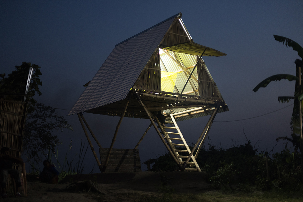
An award-winning architect in Bangladesh, Marina Tabassum, has developed an innovative housing solution to help people cope with the increasing threat of flooding caused by climate change. Her design, the “Khudi Bari” or “tiny house” is a two-floor home built on bamboo stilts, elevated to protect against rising floodwaters. During the annual monsoon floods, farmers no longer have to abandon their homes. Instead, they can simply climb a ladder to the second floor and wait for the floodwaters to recede. Unlike cyclone shelters, which are designed for short-term use during storms, Khudi Bari houses are built to withstand long-term flooding, offering both safety and mobility. Each Khudi Bari house costs around USD 450 to build, using locally-sourced materials like bamboo poles and metal sheeting. The houses are modular, meaning they can be assembled, disassembled and relocated easily. The design was inspired by traditional homes raised on stilts in central Bangladesh, but Tabassum’s innovation makes them more adaptable and practical for modern needs, allowing residents to stay safe during extended floods without losing valuable possessions (
Digital twin technology takes on flood management water scarcity in China
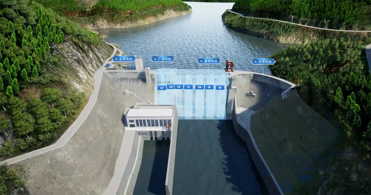
Urbanization and climate change have increased flood risks and water scarcity in China. To address these challenges, China has adopted digital twin technology for water management, enabling real-time monitoring and simulation of water systems to optimize flood control, drought relief and resource allocation. In 2022, the Ministry of Water Resources launched a nationwide digital twin system with 94 pilot programs in 48 locations. This system monitors all 5,186 small and medium-sized rivers at flood risk, collecting data from 53,000 precipitation stations, 25,000 hydrological stations, as well as meteorological satellites. A dynamic national water conservation map integrates data from 16 million water management projects, including reservoirs and river dikes. Key projects, such as the Xiaolangdi Water Conservancy Project on the Yellow River, enhance flood forecasting and early warning systems. In a simulated flood control drill at Xiaolangdi, digital twins applied 2021 flooding data and increased it by 10 percent to predict extreme water levels, helping develop response strategies. In 2025, China plans to digitalize key river basin components for real-time simulations, advancing flood prevention and water management across the country (
Proven technology solutions
Water and sanitation: modular sanitation unit
Wetlands Work!

The HandyPod by Wetlands Work! is a contained and flood-resistant sanitation system designed for floating, flood-prone or high groundwater communities. Installed directly beneath a home or schools, the HandyPod collects waste into the first of three sealed containment units, preventing contact with floodwaters and groundwater contamination. It uses a multi-stage, passive gravity flow process involving treatment by anaerobic digestion and microbial biofilm, often completed with filtering through a small, constructed wetland to reduce pathogens and organic matter. The treated effluent can be safely discharged into the environment or used for home garden irrigation, while solids are periodically removed. Requiring no electricity, no moving parts, minimal water, and low maintenance, the HandyPod is particularly suited to areas where pit latrines or sewer connections are infeasible, such as on lakes, floodplains, beaches and mangroves.
Technological maturity: Proven
Contracting type: For sale
Technology level: Medium
Place of origin: Cambodia, Myanmar
Availability: Worldwide
Contact: WIPO GREEN Database
Water and sanitation: container-based toilet and composting waste treatment
Sustainable Organic Integrated Livelihoods (SOIL)

SOIL provides full-cycle sanitation services, including container-based toilets and composting waste treatment services, in Haiti. Their EkoLakay toilets seal waste in containers, preventing exposure and reducing the risk of waterborne diseases during floods. Unlike traditional sanitation methods, such as pit latrines, the EkoLakay remains safe and operational even during floods or high water tables. SOIL staff regularly collect waste and transport it for treatment, generating nutrient-rich compost that supports local agriculture and depleted soils.
Technological maturity: Proven
Contracting type: For sale/service
Technology level: Medium
Place of origin: Haiti
Availability: Haiti
Contact: WIPO GREEN Database
Water and sanitation: community water filter
Grifaid
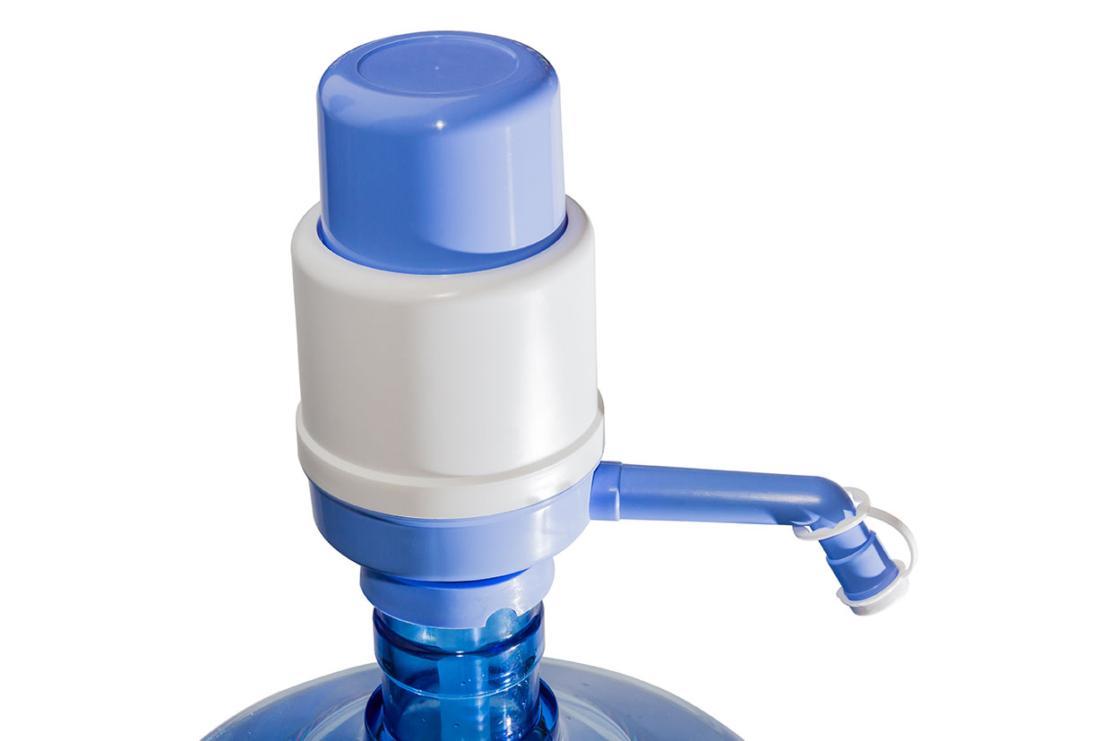
The Grifaid Community Filter is a manual, membrane-based water purifier designed for community or institutional use. Users can treat up to 300 liters per hour by simply placing an inlet pipe into a container of untreated water, and then hand-pumping it through the system. It uses ultrafiltration membranes to remove bacteria and viruses to WHO standards, delivering clear water without altering taste. It is an affordable solution requiring no electricity, chemicals, spare parts or consumables to function. Built-in self-cleaning and back-flush mechanisms prevent clogging and ensure long-term, trouble‑free use for up to 6 years.
Technological maturity: Proven
Contracting type: For sale
Technology level: Medium
Place of origin: United Kingdom
Availability: Worldwide
Contact: WIPO GREEN Database
Water and sanitation: compact mobile water purification system
Metawater
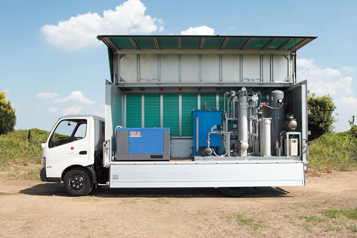
Metawater Co. Ltd has developed a mobile ceramic membrane filtration system mounted on a 4-ton truck to deliver safe drinking water during emergencies and in underserved areas. The unit uses a durable, high-performance ceramic membrane with a 0.1 μm pore size, effectively removing protozoa (e.g., Cryptosporidium), E. coli, and other bacteria, even from highly turbid or fluctuating raw water. All essential components including power generators are onboard, enabling it to operate in areas without electricity. The system is designed for quick deployment to disaster zones, like flooded regions, and for use in rural or remote communities where centralized treatment is impractical. Its simple configuration ensures easy operation and maintenance, and the ceramic elements allow long-term storage without chemicals or membrane degradation.
Technological maturity: Proven
Contracting type: For sale
Technology level: Medium
Place of origin: Japan
Availability: Worldwide
Contact: WIPO GREEN Database
Flood response: sandless sandbag
FloodSax
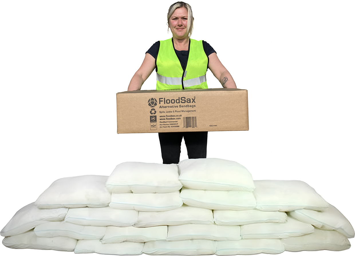
FloodSax sandless sandbags are quick and easy to deploy, being transformed within roughly 5 minutes into an effective flood barrier. FloodSax bags are designed with a semi-porous inner lining containing a gelling polymer and absorbent crystals. When activated, these crystals absorb water and expand, creating a taut, sandbag-like barrier that blocks floodwaters. Once activated (when submerged in water) they hold the water inside, preventing it from escaping. Each bag can absorb up to 20 liters of water. Before activation, they are lightweight, weighing just 370 grams. Once expanded, a standard 520 mm × 470 mm × 170 mm bag weighs 20 kg and is strong enough to withstand powerful floods. A row of FloodSax can hold back around 18 cm (7 inches) of water and they have proven to be reliable flood barriers worldwide.
Technological maturity: Proven
Contracting type: For sale
Technology level: Medium
Place of origin: United Kingdom
Availability: Worldwide
Contact: WIPO GREEN Database
Storm-resilient infrastructure: hurricane clips
MiTek South Africa

The eCo Hurricane Clip is a galvanized steel framing anchor for roofing used to connect structural timber members at right angles to each other, commonly in high-wind areas. These clips are often employed for truss-to-beam connections, providing additional strength and stability during extreme weather conditions. Hurricane Clips work by securing the roof or structural elements to the walls of a building, helping prevent roof uplift or structural separation during high winds. The Clip is installed using nails through pre-punched holes and must be used in pairs for optimal effectiveness. When fully nailed with Permfix nails, a pair of eCo Hurricane Clips can handle a design load of 1.6 kilonewtons.
Technological maturity: Proven
Contracting type: For sale
Technology level: Medium
Place of origin: South Africa
Availability: South Africa
Contact: WIPO GREEN Database
Storm-resilient infrastructure: green rebar (epoxy-coated)
Zeta Industry
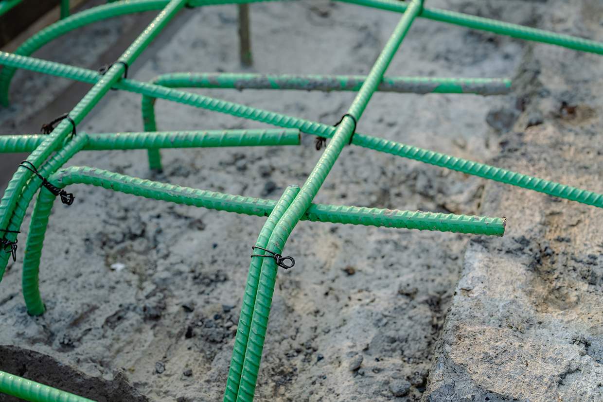
Epoxy-coated rebar is essential for reinforcing roads, bridges and industrial plants, providing protection against corrosion caused by rainwater and moisture. When either penetrate steel fittings inside concrete foundations, platforms, columns and beams, corrosion occurs, weakening load-bearing components. Corrosion also lowers the pH value, diminishing the durability of concrete and steel construction, leading to cracks, reduced mechanical strength and the need for costly repairs. The epoxy coating acts as a physical and electrochemical barrier, isolating the steel and preventing corrosion. Within the United States and Europe, using epoxy-coated rebar that meets American Society for Testing and Materials (ASTM) standards is a requirement for airports and highways. Extensive testing has shown epoxy-coated rebar to be more durable than regular rebar, offering long-term cost savings of up to 50 percent.
Technological maturity: Proven
Contracting type: For sale
Technology level: Low
Place of origin: Türkiye
Availability: Worldwide
Contact: WIPO GREEN Database
Storm-resilient infrastructure: fiber-reinforced polymer (FRP)/glass-reinforced plastic (GRP) composite rebar
Asia Composite
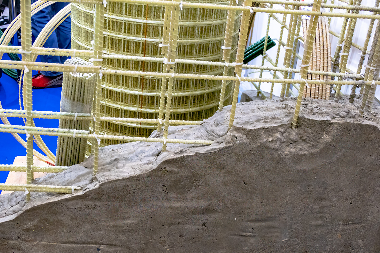
Steel rebar has been used in construction for over a century. But in corrosive environments, deterioration can be rapid and catastrophic. Composite rebar, known for its corrosion resistance, is being increasingly used in the retrofitting of tunnels, coastal structures and buildings exposed to a harsh environment. Made from polymers reinforced with glass fiber and resin, composite rebar is more durable. Its tensile strength and elasticity depend on factors such as fiber content, type of epoxy or polyester resin used and the orientation of the glass fibers, as well as quality control during manufacturing. This technology offers an alternative to traditional steel rebar, particularly in areas prone to corrosion, in building longer-lasting and more reliable structures.
Technological maturity: Proven
Contracting type: For sale
Technology level: Low
Place of origin: Islamic Republic of Iran
Availability: Islamic Republic of Iran
Contact: WIPO GREEN Database
Storm-resilient infrastructure: siphonic roof drainage systems
Pipelife
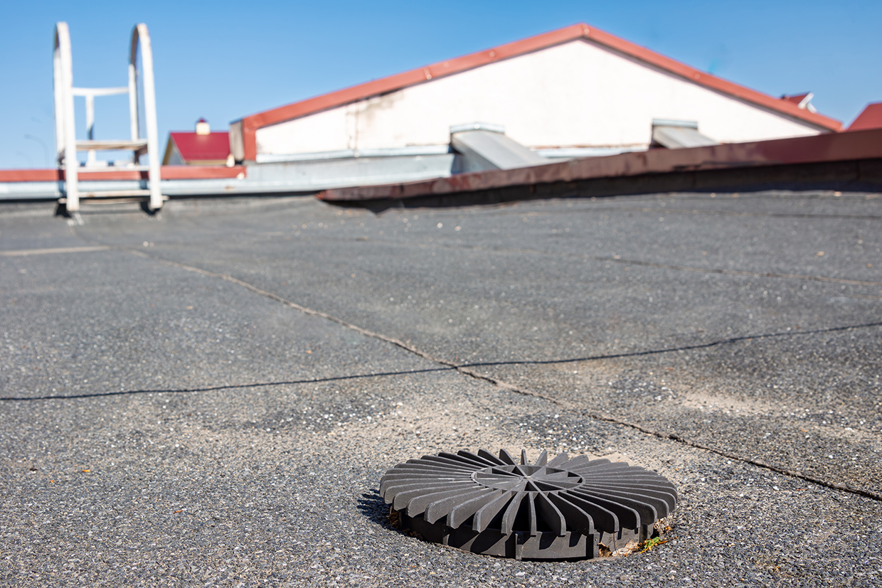
Effective rainwater drainage is crucial in maintaining the safety and integrity of flat or low-gradient roofs. Siphonic systems require fewer, smaller pipes compared to traditional gravity systems. Pipelife’s siphonic roof drainage system is designed to prevent overflows, leaks and structural damage. It contains pre-welded outlets and high-quality pipes made from durable, UV-resistant thermoplastics. Pipelife fittings are compatible with butt-welding and electrofusion connection technologies, providing strong, leak-free joints.
Technological maturity: Proven
Contracting type: For sale
Technology level: Medium
Place of origin: Austria
Availability: Worldwide
Contact: WIPO GREEN Database
Storm-resilient infrastructure: hurricane windows and doors
Neuffer
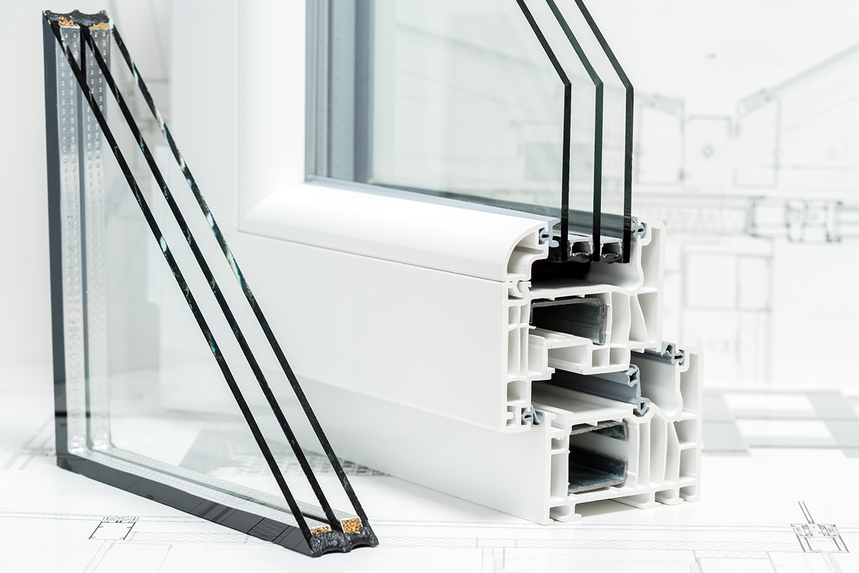
As climate change leads to more unpredictable storms and stricter building regulations, high-quality hurricane windows and doors with impact-resistant glass are essential for protection. Neuffer offers Miami-Dade-certified hurricane windows, such as the Reynaers CS 77 model, designed to withstand hurricane-strength winds and heavy rainfall. These windows feature laminated glass covered with a thick polymer film, which provides protection from flying debris and high wind pressure (up to 5,000 Pa). Unlike regular windows, Reynaers hurricane windows have five invisible layers of strong PVB polymer film and can be tempered for added flexibility upon impact. This technical design ensures that, if broken, the glass remains in place, providing excellent storm protection and injury prevention. Additionally, windows are encased in durable aluminum and uPVC frames that have a built-in drainage system to prevent water damage during storms.
Technological maturity: Proven
Contracting type: For sale
Technology level: Medium
Place of origin: Germany
Availability: Asia, Europe, North America
Contact: WIPO GREEN Database
Storm-resilient infrastructure: wind-resistant lightweight roofing systems
Onduline
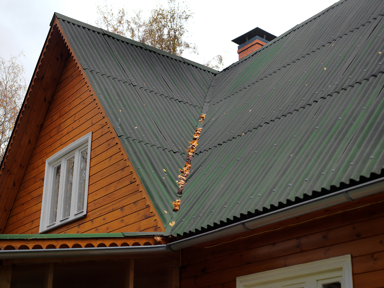
Onduline’s wind resistance is attributable to several key features that work together to enhance its durability in extreme conditions: a fixation system with washers of at least 16 mm; a minimum of 10 fixations per m² that ensures a strong connection to the structure; corrugated sheets that improve rigidity and stability; a flexibility and resilience that allows the sheets to absorb shocks and vibrations from gusty winds; and accessories designed to prevent wind from passing through the sheets. Onduline CLASSIC sheets can withstand winds up to 225 km/h on metal structures and up to 260 km/h on wooden purlins (horizontal structural components used in roofing systems to support the sheeting). The Onduvilla variant offers even greater resistance, handling winds of up to 315 km/h on metal structures and up to 290 km/h on wooden purlins.
Technological maturity: Proven
Contracting type: For sale
Technology level: Medium
Place of origin: France
Availability: Worldwide
Contact: WIPO GREEN Database
Frontier technology solutions
Water and sanitation: septic tank-like upgrade for pit latrines
International Development Enterprises (iDE), Cambodia, and Engineers Without Borders (EWB) Australia

Pour-flush pit latrines that direct waste into underground pits often face issues of rapid filling and overflowing in flood-prone areas, resulting in many latrine owners resorting to unsafe emptying practices. In response, iDE and EWB Australia developed the All Seasons Upgrade (ASU), a latrine pit upgrade providing year-round pit functionality (i.e., flushing) in high groundwater and low infiltration soils. The ASU attaches a gravel filter pit and leach field to an existing latrine pit. The filter pit is filled with gravel and offers an additional treatment reactor, while preventing the leach field from clogging. And the leach field offers increased surface area for infiltration at a depth above the groundwater table, but deep enough to prevent the upward flow of contamination. The solution minimizes households’ exposure to untreated fecal sludge, thereby improving latrine functionality and reducing environmental pollution. It is sold, manufactured, installed and delivered to rural households in Cambodia’s flood-prone areas through iDE-connected sanitation entrepreneurs.
Technological maturity: Proven
Contracting type: For collaboration
Technology level: Medium
Place of origin: United States
Availability: Cambodia
Contact: WIPO GREEN Database
Weather monitoring: Automatic Weather System (AWS), Automatic Rainfall Recorder (ARR) and Automatic Water Level Recorder (AWLR)
Mertani
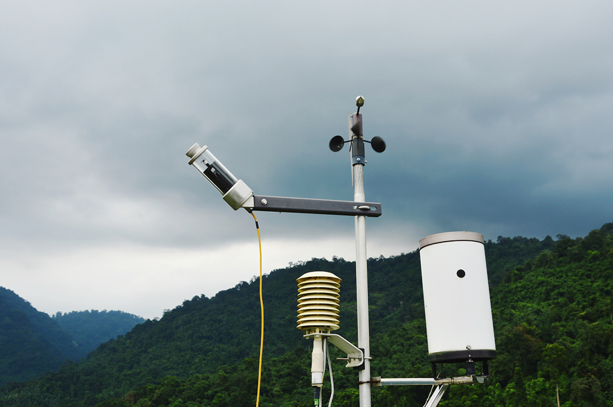
Mertani’s IoT systems collect precise monitoring data. The AWS provides real-time data on weather parameters like temperature, humidity, wind speed and solar radiation, aiding in weather forecasting and agricultural planning. The ARR accurately measures rainfall intensity and volume, crucial for flood prediction and water resource management. The AWLR monitors water levels in rivers, lakes and reservoirs, supporting flood warning systems and irrigation management. They are equipped with sensors, data loggers and cloud-based platforms for remote access and analysis useful for the hydrology, disaster management and agriculture industries.
Technological maturity: Frontier
Contracting type: For sale
Technology level: High
Place of origin: Indonesia
Availability: Indonesia
Contact: WIPO GREEN Database
Precipitation monitoring: hail monitoring system
KISTERS
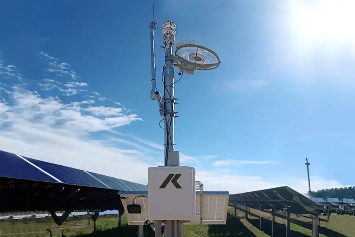
HailSens IoT is an advanced sensor for real-time hail monitoring, detecting hail impacts through kinetic energy measurement. It records key hailstone characteristics such as kinetic energy, diameter and timestamp of the impact in real-time. The receiver’s software allows for immediate assessment of the hail event and can trigger near-instant alerts based on the incoming data. The IoT allows for detailed measurements that are useful for meteorologists and insurance adjusters, as they can help optimize prediction models, manage insurance indices or even help protect solar panels by adjusting their position during hail events.
Technological maturity: Frontier
Contracting type: For sale
Technology level: Medium
Place of origin: Germany
Availability: Worldwide
Contact: WIPO GREEN Database
Stormwater management: smart tanks for active attenuation
StormHarvester
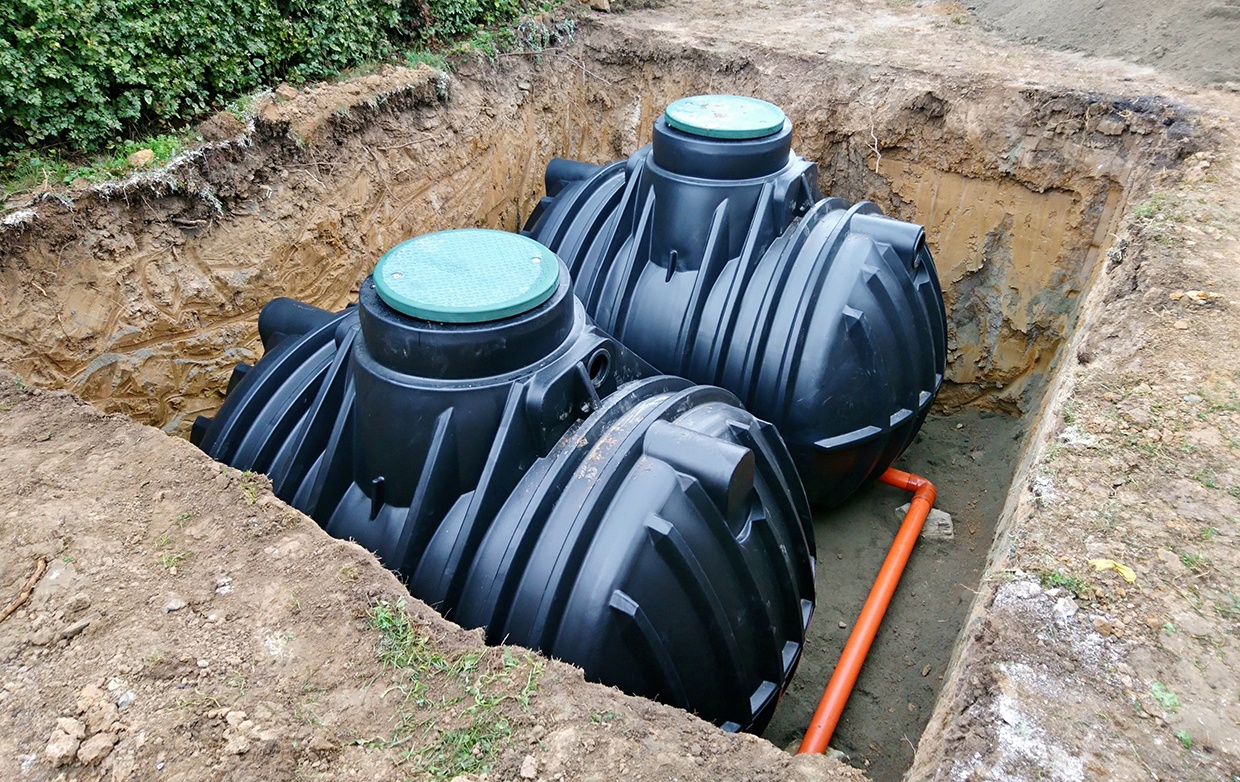
The StormHarvester Smart Tank combines flood prevention and rainwater harvesting within a single solution. It transforms an ordinary attenuation tank into a “smart” tank, allowing water to be stored and reused on-site. The system continuously monitors short- and medium-term rainfall forecasts and automatically adjusts water levels within the tank to create enough volume to manage stormwater runoff from upcoming rainfall. By connecting a valve or attenuation pump to a precise rainfall runoff prediction algorithm, StormHarvester optimizes water levels. It can reduce space requirements and lower the cost of a rainwater harvesting system by 50 percent.
Technological maturity: Frontier
Contracting type: For sale
Technology level: Medium
Place of origin: United Kingdom
Availability: Worldwide
Contact: WIPO GREEN Database
Flood barrier: easy movable dam
WaveSave
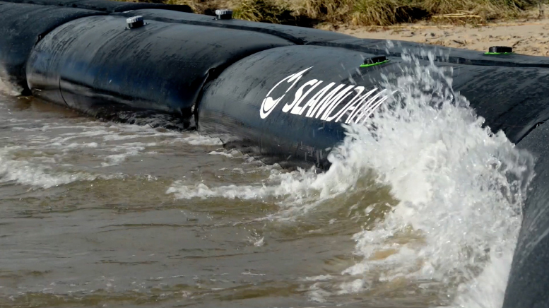
The SLAMDAM® is a patented, flexible modular flood barrier system designed to provide temporary or permanent protection against floodwaters. Its unique construction includes two tubes that must be filled simultaneously, with a specially developed intermediate membrane forming two interlocking compartments. When water pressure is applied, the stressed compartment rises slightly, while the opposing compartment slots in underneath to provide counterpressure. This design ensures that the SLAMDAM® remains firmly in place, even at high water levels. SLAMDAM® can adapt to any surface and withstand variations.
Technological maturity: Frontier
Contracting type: For sale
Technology level: Medium
Place of origin: Kingdom of the Netherlands
Availability: Worldwide
Contact: WIPO GREEN Database
Water damage response: dehumidifier
Lunor
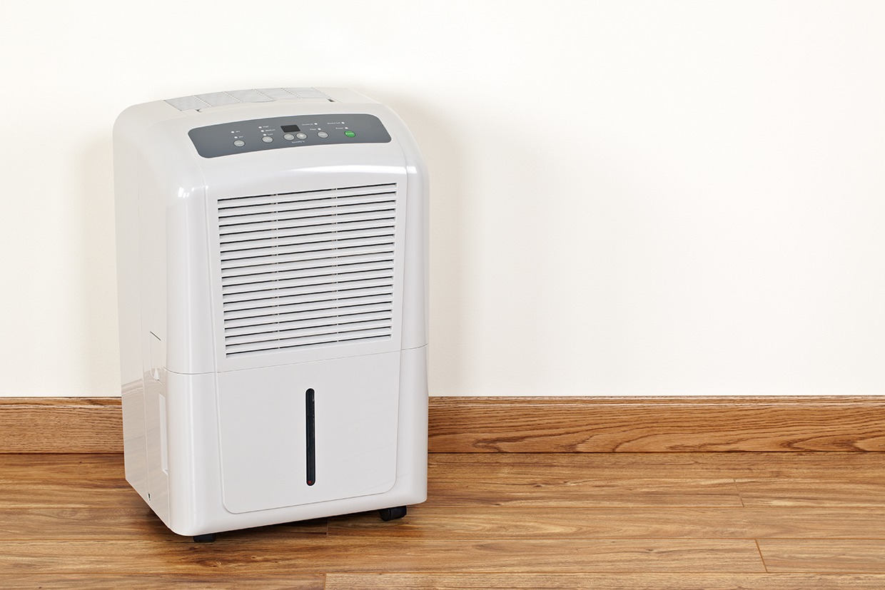
Lunor dehumidification systems are designed to save space and energy when drying. Featuring options like fresh air intake, sound insulation and climate monitoring, their key feature is the intelligent control system that automatically regulates the dehumidification process. These systems can be instaled on brackets up to 2.4 meters high, ensuring clear spaces and eliminating injury risk. Technicians also perform core drillings in concrete or brick, guide condensation water to drains via Geberit PE pipes or install condensation water pumps. A mobile version is available for garages, production areas, civil defense facilities and other locations. Units come with options like overflow protection or a prepared connection for drainage via a hose into a floor drain.
Technological maturity: Frontier
Contracting type: For sale
Technology level: Medium
Place of origin: Switzerland
Availability: Switzerland
Contact: WIPO GREEN Database
Storm-resilient infrastructure: anti-flood airbricks
Eco Coverage Technologies
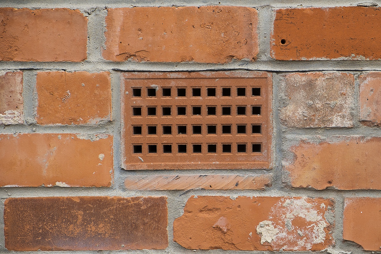
Traditionally, airbricks are used to allow air to flow under floors. But in flood-prone areas, they can also allow water to enter a building. Smart AirBricks work as a passive flood protection system designed to prevent water ingress into properties. They automatically activate to seal ventilation openings in buildings when floodwaters are detected, thereby preventing water ingress, while maintaining airflow during dry conditions. They operate without the need for an external power supply and are easy to clean after a flood.
Technological maturity: Frontier
Contracting type: For sale
Technology level: Medium
Place of origin: United Kingdom
Availability: United Kingdom
Contact: WIPO GREEN Database
Storm-resilient infrastructure: watertight concrete system
Sika Group
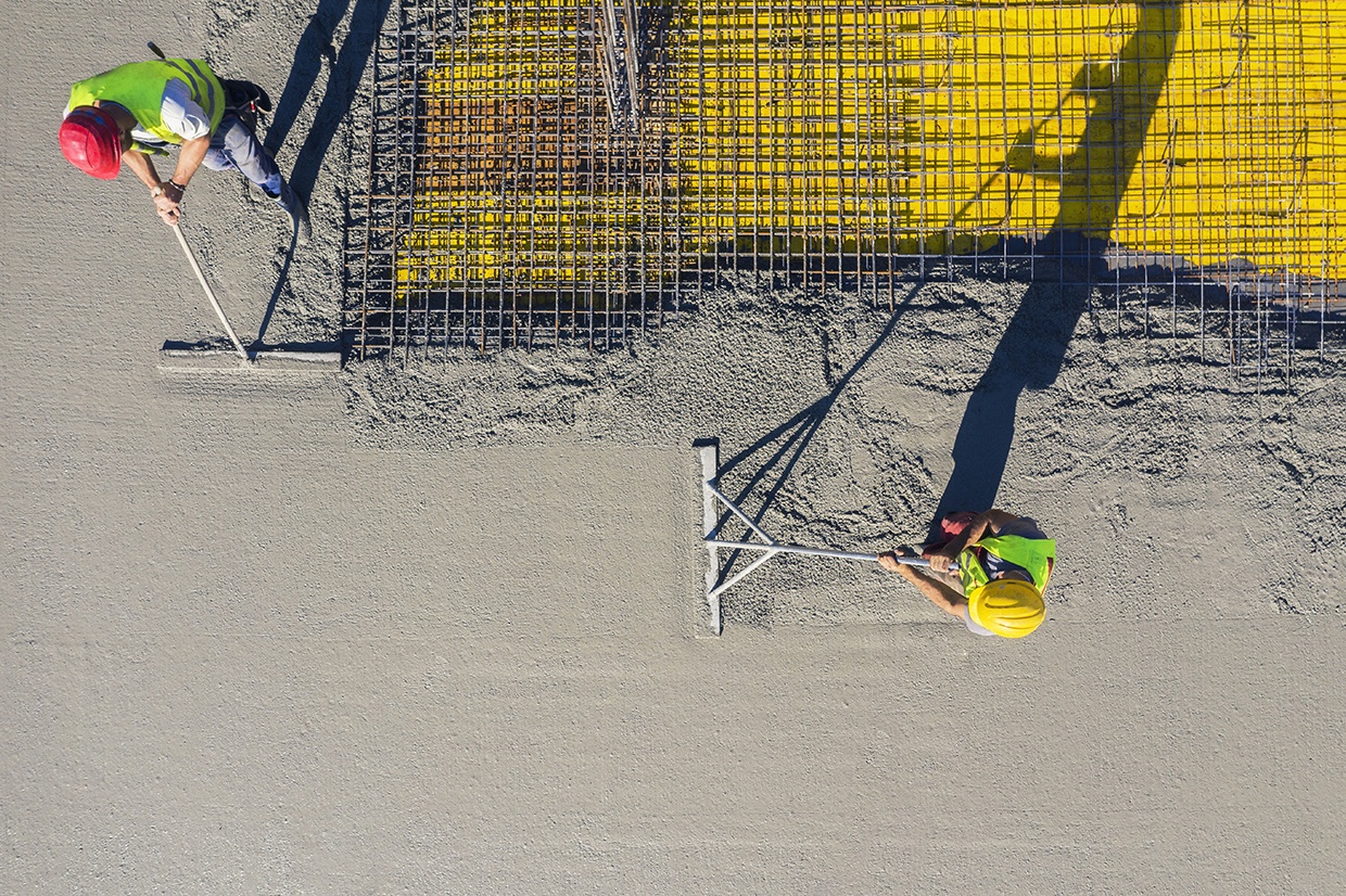
Sika Group’s watertight concrete system is designed to prevent water penetrating into concrete structures. It utilizes a combination of specialized products, including waterproofing additives, admixtures and surface treatments, to enhance the durability and resistance of concrete against water infiltration. The system works by incorporating hydrophobic agents and crystalline technology, which react with water to form a waterproof barrier within the concrete itself. This ensures long-lasting protection against water damage, reducing the risk of leaks and structural deterioration. Sika’s watertight concrete solutions are widely used in underground structures, basements, tunnels and water retention areas to prevent water ingress in concrete construction projects.
Technological maturity: Frontier
Contracting type: For sale
Technology level: Medium
Place of origin: Switzerland
Availability: Worldwide
Contact: WIPO GREEN Database
Storm-resilient infrastructure: self-healing concrete
Basilisk
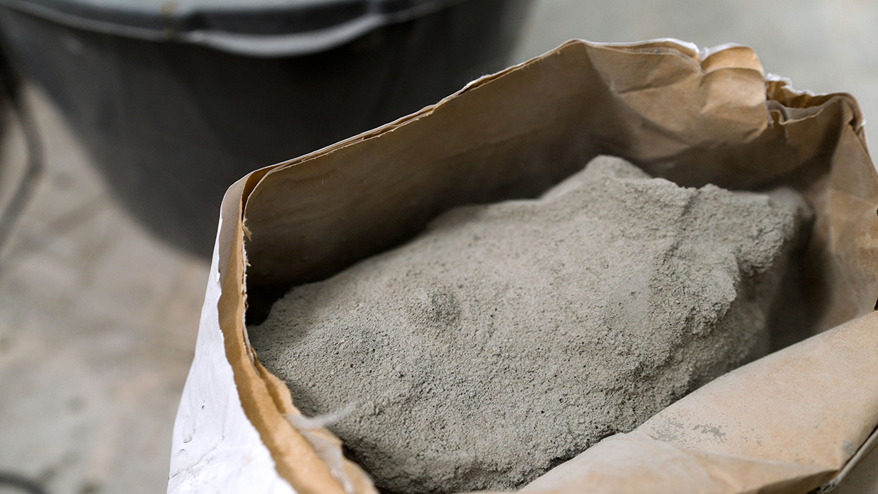
Basilisk Healing Agent is a bio-based granular additive that can convert any concrete mix into self-healing concrete. The technology uses microorganisms that produce limestone, allowing cracks in concrete structures to be repaired autonomously and enhancing durability. This self-healing system can be applied to both new and existing construction, and currently repairs cracks up to 1 mm, filling them with limestone and effectively waterproofing the concrete. Beyond waterproofing, self-healing concrete reduces the need for additional reinforcement in concrete structures to compensate for the shrinkage that occurs as concrete cures and hardens. It also creates a lower CO2 footprint and minimizes maintenance.
Technological maturity: Frontier
Contracting type: For sale
Technology level: Medium
Place of origin: Kingdom of the Netherlands
Availability: Worldwide
Contact: WIPO GREEN Database
Storm-resilient infrastructure: Alutech Smart Mobile for roller shutters
Alutech
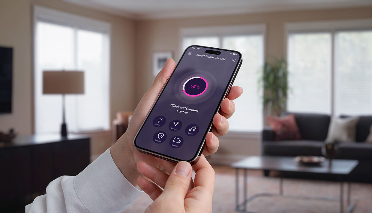
The ALUTECH Smart mobile app allows the remote control of roller shutters, allowing their opening or closing from anywhere and the setting of schedules based on weather conditions like temperature or wind. During extreme weather, the shutters can automatically close for added protection. Instead of Wi-Fi or radio, the system uses the Zigbee protocol, which creates a mesh network wherein devices communicate directly, even if out of range. It also reconnects devices if there is interference or failure. Additionally, it tracks device status and energy use, and updates automatically without needing an installer.
Technological maturity: Frontier
Contracting type: For sale
Technology level: High
Place of origin: Russian Federation
Availability: Russian Federation
Contact: WIPO GREEN Database
Storm tracking, research and prediction: lightweight weather sondes
Skyfora
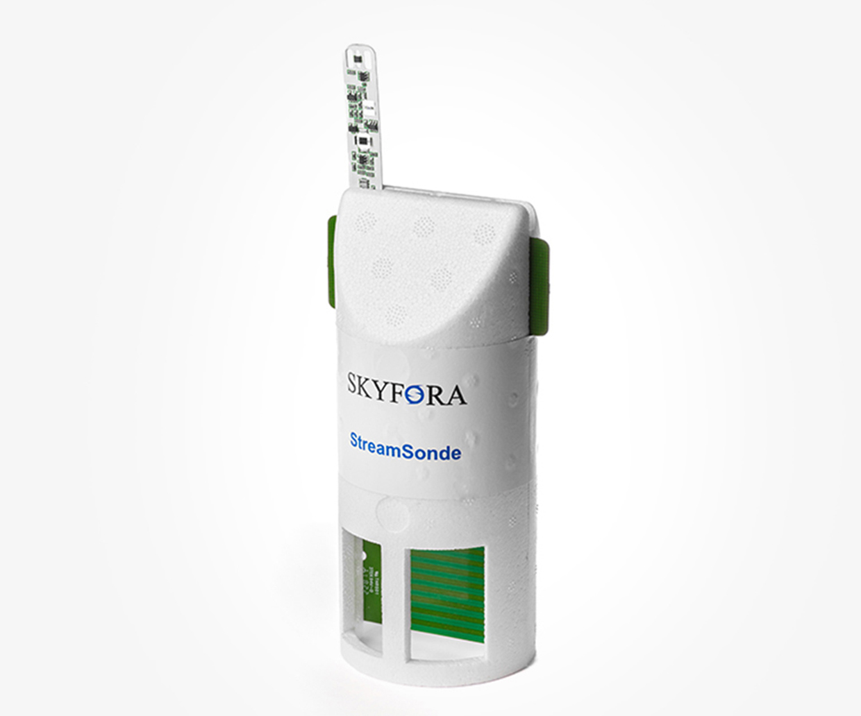
Skyfora’s StreamSonde technology is a highly accurate atmospheric data collection device that builds on prior weather sondes. StreamSondes are lightweight, small and parachute-free versions of dropsondes that can be deployed in large numbers. They are designed to stay in the air longer and gather more data, increasing the volume and accuracy of weather information collected. Deploying multiple StreamSondes simultaneously helps create detailed and high-resolution atmospheric profiles. With improved data collection capabilities, Skyfora’s technology supports more accurate weather monitoring and disaster prevention efforts, providing better insights for meteorologists and other professionals.
Technological maturity: Frontier
Contracting type: For (limited) sale
Technology level: High
Place of origin: Finland
Availability: Partnerships with government agencies, research institutions, and meteorological organizations
Contact: WIPO GREEN Database
Horizon technology solutions
Hurricane research: air-deployed unmanned aircraft system (UAS)
Black Swift Technology
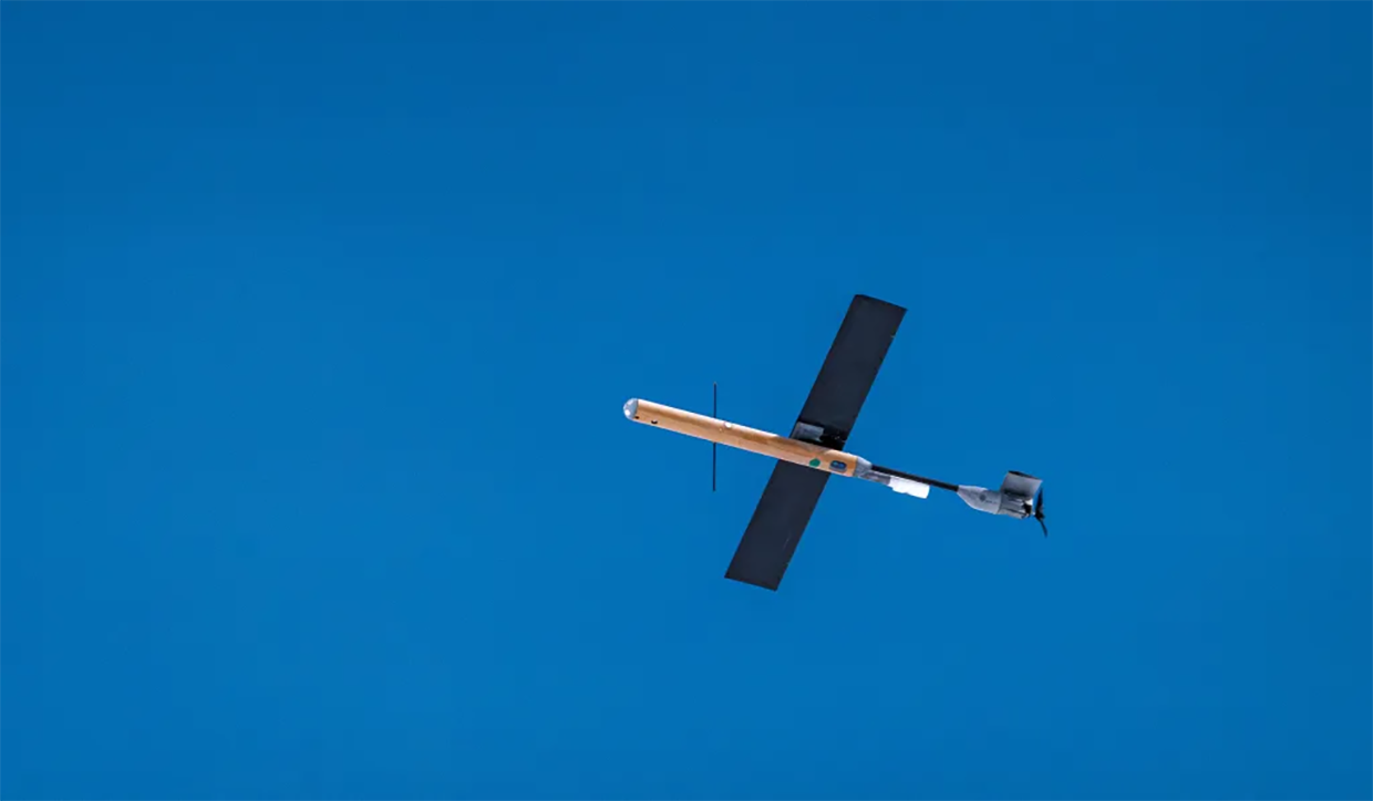
NOAA and the US Air Force sought a low-cost, air-deployed UAS to sample the lower boundary layer of a hurricane for atmospheric research. They selected Black Swift’s S0 Air Deployed UAS for the task, a lightweight and compact platform weighing just 1.2 kg, making it the lightest platform to successfully sample a tropical cyclone. The S0 can operate in dangerous parts of the storm, with the ability to transmit data within a 125 nautical mile range and fly for over 100 minutes. Its sensor suite captures 3D wind measurements, pressure, temperature, humidity and sea surface temperature – all critical for understanding tropical cyclones. The S0’s autonomous, “launch-and-forget” design aims to ensure reliable, low-cost missions for hurricane research.
Technological maturity: Horizon
Contracting type: Under development
Technology level: High
Place of origin: United States
Availability: Under development
Contact: WIPO GREEN Database
Flood protection and modeling: digital twin
TU Dresden
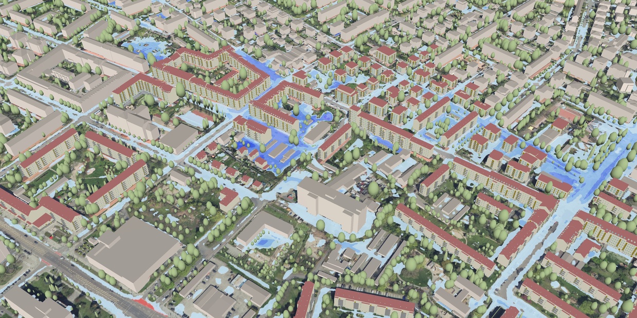
In 2024, the Institute of Hydraulic Engineering and Technical Hydromechanics (Institut für Wasserbau und Technische Hydromechanik, IWD) started developing an “Urban Digital Heavy Rain Twin.” It consists of a virtual model of the city, for which data can be visualized and accessed via a 3D web app on desktop and mobile devices. Then, users can conduct heavy rain simulations in urban areas and track the results in real time, ultimately assessing flood risk, even for specific individual buildings. The prototype offers fully automated creation of 2D simulation models based on free and open software, which can be complemented by precipitation forecasts from the German Weather Service. Flood simulations intersect with urban infrastructure features like roads to assess potential hazards and calculate potential damage of residential buildings. The platform will be publicly accessible at the end of 2025, while the full completion of the Urban Digital Heavy Rain Twin is scheduled for the end of 2026.
Technological maturity: Horizon
Contracting type: Under development
Technology level: High
Place of origin: Germany
Availability: Under development
Contact: WIPO GREEN Database
Flood protection and modeling: digital twin
Destination Earth

Destination Earth (DestinE) is an EU initiative to build a highly accurate digital twin (DT) of the Earth to simulate, monitor, and analyze natural and human-driven processes. It is implemented jointly by the European Space Agency (ESA), the European Centre for Medium-Range Weather Forecasts (ECMWF), and EUMETSAT under the Digital Europe Programme. DestinE builds upon three main components: the DestinE Platform, providing access to data, services, and applications; the Data Lake, harmonizing and enabling big data processing across sources such as ESA, ECMWF, EUMETSAT, and Copernicus; and the DT Engine, the software infrastructure that powers extreme-scale simulations. The first two operational digital twins are the Climate Change Adaptation DT, which produces multi-decadal, km-scale climate scenario simulations, and the Weather-Induced Extremes DT, which delivers high-resolution forecasts and interactive on-demand simulations of extreme weather. Both began demonstrations in 2024, with full-scale expansion of the system planned through 2030.
Technological maturity: Horizon
Contracting type: Under development
Technology level: High
Place of origin: United Kingdom
Availability: Under development
Contact: WIPO GREEN Database
Coastal erosion
The world's coasts are vanishing before our eyes, but a wave of innovation is fighting back. Hybrid defenses now merge engineering with nature: 3D-printed seawalls incorporate oyster habitats, while AI-guided drones map erosion in real time. From living breakwaters that tame storm surges to geotextiles that knit shorelines together, these solutions protect both communities and ecosystems and buy time for 600 million coastal residents on the climate frontline.
Technological developments and trends
Coastal erosion is an escalating threat to the 600 million people living in low-elevation coastal areas worldwide (
It is important to recognize the source-to-sea connections in coastal systems. Sediment management upstream, including dam operation, plays a key role in coastal erosion by disrupting the natural flow of sediments that replenishes beaches and shorelines. Without adequate sediment supply, beaches become depleted, accelerating erosion and weakening natural coastal defenses.
Human activities like coastal development, dam construction and ecosystem destruction contribute significantly to erosion
A recent global study using the Global Surface Water Explorer dataset estimates that from 1984 to 2015, around 28,000 km² of land was lost to erosion – the size of Haiti. Additionally, 24 percent of sandy beaches worldwide eroded at a rate of more than 0.5 meters per year during this same period, above what is typically considered normal for coastal erosion (
Coastal erosion threatens lives and livelihoods
As urban development expands, an increasing number of people living in low-lying cities are becoming exposed to erosion. By 2030, rising sea levels are projected to expose over 100 million people in sub-Saharan Africa to flooding, with that number growing to 135 million by 2050 (
Importantly, global port activities – crucial to international trade – are at considerable risk. Between 1980 and 2020, approximately 38 percent of global container port activity occurred in hurricane-prone areas, with damages estimated at USD 7.5 billion annually (
By 2030, rising sea levels are projected to expose over 100 million people in sub-Saharan Africa to flooding, growing to 135 million by 2050
Since 20 percent of the world’s population lives within 25 km of the coast, such populated areas tend to be more developed than other coastal locations, which contributes to greater coastal deterioration (
In addition to erosion, coastal subsidence – the sinking of coastal areas – compounds the challenges faced by low-lying coastal areas, making them even more vulnerable to the impacts of rising sea levels. Coastal subsidence is commonly overlooked in both coastal-management policies and longer-term urban planning (
Saltwater intrusion is another serious consequence of coastal erosion and rising sea levels. This occurs when saltwater infiltrates freshwater sources, such as rivers, aquifers and lakes, and is also caused by the over-pumping of groundwater. Such intrusion can render water undrinkable, reduce soil fertility and disrupt ecosystems by altering soil composition and aquatic habitats. It also threatens human activities, with freshwater scarcity affecting drinking water and agriculture. To address this issue, reverse osmosis (RO) water filters and other technologies have emerged to remove salt and impurities and provide safe water for consumption and irrigation. See the Green Technology Book Adaptation edition for more information on desalination technologies.
Coastal communities losing natural protection
The loss of coastal ecosystems, such as wetlands, mangroves and coral reefs, is further compounding risk. These ecosystems play a vital role in mitigating the impacts of tropical cyclones and storm surges by attenuating wind impacts, retaining water and acting as natural barriers. Coral reefs dissipate up to 97 percent of wave energy, offering both coastal protection and ecosystem services (
Over the last 30 years, the destruction of these ecosystems has contributed to the loss of natural protection for 1.4 million people
Over the last 30 years, the destruction of these ecosystems has contributed to the loss of natural protection for 1.4 million people (
Figure 3.1 depicts the global total population impacted annually by tropical cyclones and the degree of protection provided by natural ecosystems in the past and present and in a climate-altered future (

A diverse range of coastal protection methods for erosion
Coastal protection methods combat erosion, protect communities and preserve coastal ecosystems. They range from traditional infrastructure, such as seawalls and groynes, to innovative bioengineering solutions that enhance coastal resilience and support ecological restoration.
Traditional “hard engineering” methods: proven and reliable
Coastal structures like groynes, jetties and gabions have been used for decades to manage water flow and reduce erosion.
Groynes are structures extending from the shore into the sea. They are designed to reduce longshore drift and trap sediment, preventing beach erosion and maintaining beach width. Made of rock, wood, steel or concrete, they are often arranged in groyne fields, so as to work together in protecting the beach.
Gabions are wire mesh containers filled with rocks, commonly used in engineering projects to stabilize banks and prevent soil loss. They can also be used as levees, retaining walls or in drainage systems to reduce water pressure buildup. Gabions are durable and cost-effective, and can also support the growth of vegetation between the rocks.
Sea walls, especially concrete ones, are being reengineered to handle rising sea levels. Innovations like flap-gate seawalls, which automatically open and close in response to water level, help maintain natural water flow during fluctuations such as at high tide and during storm surges.
Breakwaters and revetments serve as barriers against wave energy. Whereas breakwaters reduce wave impact and protect vessels, revetments are sloped structures that absorb wave energy and blend more naturally into the landscape.
Hybrid solutions for coastal resilience: combining nature and engineering
Hybrid solutions combine human-engineered structures with natural processes to provide both coastal protection and ecological benefits.
Artificial reefs. Coastal defense strategies have traditionally relied on hard engineering structures like seawalls and breakwaters to mitigate erosion. While effective at reducing wave impact, these methods can be costly and ecologically disruptive, and can moreover worsen erosion elsewhere. Artificial reefs offshore mimic natural reefs by reducing wave energy, thereby protecting beaches from erosion and supporting marine life. For example, in 2020, the Sarawak government in Malaysia allocated RM 70 million to deploy 17,200 reef balls – artificial reef structures made of concrete designed to mimic natural coral reefs by providing habitat – along its coastline as part of the Sarawak Reef Ball Project. The initiative aimed to enhance marine resources, protect fishing grounds from illegal trawling, and improve local fishermen’s livelihoods (
Innovations such as the USD 67.6 million Reefense program (launched by the U.S. Department of Defense) are developing hybrid reefs that combine man-made structures with natural elements like oysters and corals, with the aim of protecting coastal areas from extreme weather events and rising sea levels (
Hybrid solutions combine human-engineered structures with natural processes to provide both coastal protection and ecological benefits
Sea wall innovations incorporate advanced designs such as the Smart Seawall wave diversion system, which diverts waves and supports the growth of aquatic habitats. 3D-printing technology is also being used to create custom seawall tiles and structures more efficiently, incorporating biomimicry and reducing environmental impact.
Geosynthetics, such as geogrids and nonwoven textiles, are increasingly used alongside other erosion control measures to stabilize shorelines and reinforce seawalls. These materials provide durability, allow water to flow and prevent sediment loss. Geogrids are typically made from polymers, while nonwoven textiles are made by bonding fibers either mechanically, thermally or chemically to create a porous and durable material that allows water to pass through, while retaining soil particles, thus preventing sediment loss.
Rebuilding coastal resilience with bioengineering, restoration and stabilization techniques
Bioengineering technologies use natural processes and materials to stabilize coastal areas, reduce erosion and promote ecological restoration. These techniques are environmentally friendly and help enhance biodiversity, while offering protection.
Hydroseeding and hydroblankets. Hydroseeding involves spraying a mixture of seeds, mulch and fertilizer to stabilize large areas. More affordable than sodding (laying down pre-grown grass) for large areas, hydroseeding provides for the uniform distribution of seeds and allows tailoring to specific site conditions. Hydroblankets add a protective biodegradable mat to enhance stabilization.
Erosion control mats, made from natural fibers like jute and coconut, help trap sediment and reduce wave impact when combined with vegetation planting for longer-term stabilization.
Mangrove restoration in tropical regions reduces wave energy, stabilizes sediments and improves water quality by filtering pollutants and trapping runoff.
Wetland restoration using plants such as sedges (Carex spp.), cattails (Typha spp.) and bulrushes (Schoenoplectus spp. or Scirpus spp.) helps control erosion by absorbing excess water and providing a natural barrier to water flow.
Seagrass restoration in shallow coastal waters reduces wave energy, stabilizes sediments and provides vital habitats for marine life.
Bioengineering technologies use natural processes and materials to stabilize coastal areas, reduce erosion and promote ecological restoration
Dune restoration focuses on rebuilding coastal sand dunes by removing invasive species, planting dune grasses and reducing beach grooming to facilitate natural sand processes. It differs from beach nourishment in that it builds vertically instead of horizontally. This is accomplished by dredging sand from offshore sources and transporting it through piping, or else sand can be placed and sculpted using heavy machinery. Other methods include the removal of the invasive species that often alter natural sand flow processes, planting dune grasses to stabilize the sand, installing fences around the dune and reducing beach grooming, that is, the use of tractors to grade the sand to smooth for beach recreation (
Beach nourishment involves adding sand to restore beach size and function, with periodic replenishment to counter ongoing erosion. Innovations in sand deposition technologies are advancing rapidly. A deeper understanding of coastal fluvial processes, along with improved hydrological modeling, is helping to optimize how and where sand is placed – maximizing effectiveness, while reducing environmental impact. This knowledge also supports the further development of nature-based solutions. Nourishment is typically carried out by pumping sand from shallow waters onto the beach or transporting it from further away on barges. The collection of source material may have negative impacts on marine life.
Combining beach nourishment with vegetation planting enhances stability and prevents further erosion. A variety of plants can be used in this process (
Beach Morning Glory (Ipomoea pes-caprae): a creeping, salt-tolerant vine found in tropical and subtropical regions.
Beachgrass (Ammophila spp.): salt-tolerant with a deep root system; often used for stabilizing sand dunes and preventing the intrusion of saltwater into the freshwater ecosystem.
Cordgrass (Spartina patens): a perennial grass that forms a dense mat, tolerates salt and stabilizes sandy soils.
Sea oats (Uniola paniculata): tall grasses with extensive root systems.
Seashore paspalum (Paspalum vaginatum): a perennial creeping grass common in tropical and subtropical coastal regions.
Coastal monitoring and mapping: drones, LiDAR and specialized software
Several techniques, such as direct measuring of distance and monitoring with cameras, lasers or aerial photography, are used to monitor coastal morphology dynamics (
LiDAR-equipped drones are revolutionizing coastal monitoring through their ability to quickly survey large areas and provide high-resolution imagery
LiDAR-equipped drones are revolutionizing coastal monitoring through their ability to quickly survey large areas and provide high-resolution imagery. LiDAR sensors help generate the digital elevation models (DEMs) useful for 3D representation of coastal landscapes and erosion patterns and tracking topographical changes over time. They are more economical and efficient compared to traditional methods like ground surveys. This is because they are able to rapidly survey large areas, and the data generated can be combined with ground surveys and satellite imaging to create models that help in understanding the spatial distribution of erosion. Software specifically designed for coastal monitoring, such as Pix4D, allows for the creation of detailed maps, 3D models and the time-lapse visualization of coastal changes, providing insights into how erosion is progressing and where damage has occurred.
Software tools have also been developed to support engineers in designing geotechnical and erosion control solutions. Maccaferri, for example, has developed a versatile suite of tools to help develop efficient drainage systems and design flexible pavement, road subgrade stabilization, reinforced soil slopes, retaining walls and hybrid structures.
Innovation examples
Dune restoration in Catalonia: simple sand traps and drone-assisted monitoring
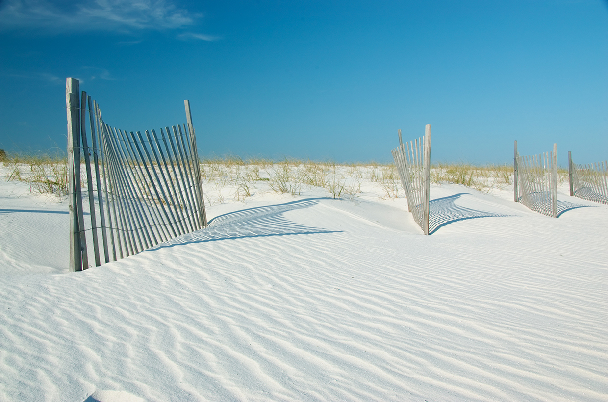
Along the Catalan coast in Spain, 50 meters of beach was lost between 1974 and 2024, partly due to the disruption of natural sediment flows caused by port and dam construction. Manually replenishing the beaches with transported sand proved to be costly and unsustainable. In response, the Government of Catalonia, the Natural Park of Costa Brava, and residents and businesses initiated a project to restore the beach’s dune system. Beginning in 2020, they installed cane fences – known as sand traps – to capture sand and increase dune height and volume. These sand traps act as filters, allowing wind to pass through, while at the same time trapping the sand. In 2021, researchers introduced drones equipped with advanced sensors and radars to monitor changes. The drones were used to create DEMs with centimeter-level accuracy. Measurements revealed a remarkable 40 percent increase in dune height over the course of three years, with an average 2-meter rise. Building on this success, project managers are now applying these same techniques in urban areas where natural dunes have been replaced by buildings and promenades. In Calafell, the city council has removed sections of the promenade to make way for natural sand deposits, using the same sand-capturing methods to reshape the beach and improve its storm resilience. The project highlights the lasting power of nature-based solutions as a sustainable and long-term approach to coastal resilience (
Multiple wins for living shorelines in Tampa Bay, Florida

Hurricanes are a major concern in Florida, making coastal protection a priority. In 2024, Tampa Bay Watch, an environmental nonprofit organization, built 500 feet of living shorelines along Tampa Bay. These shorelines help prevent erosion, storm surge and flooding using native plants, sand and natural materials. The project used concrete structures called reef balls, which were placed alongside mesh bags filled with oyster shells. These shells were collected through the Shells for Shorelines program, which gathers discarded oyster shells from local restaurants. The shell bags serve to replace eroded sediment and trap sand, while the reef balls provide a surface on which oysters can grow. It takes about 6 months for oysters to settle, and each oyster can filter up to 50 gallons of water daily. Over two years, a reef ball can support around 1,000 oysters, thereby helping stabilize the shoreline, attract marine life and support plant growth such as marsh grass. Oysters now cover 200 acres of Tampa Bay spread across 20 similar projects (
Proven technology solutions
Coastal erosion protection: gabion (groyne)
Maccaferri
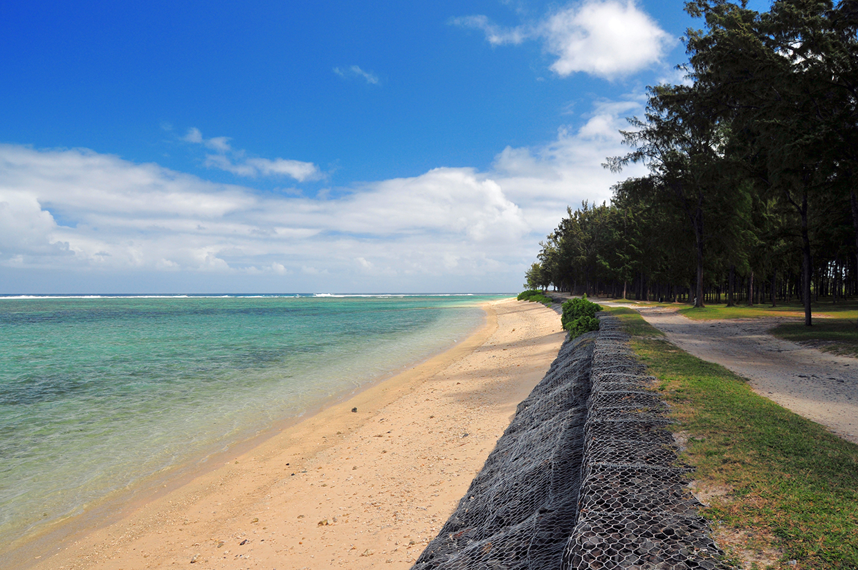
Maccaferri gabions are wire baskets made from double-twisted hexagonal steel mesh designed for erosion control, slope stabilization and retaining structures. They are filled with locally sourced stones and recycled materials. Gabions are highly permeable, allowing water to flow through, while preventing soil erosion, making them ideal for riverbank protection, coastal defenses and landslide mitigation. Maccaferri’s PoliMac® polymer coating is applied on gabions to enhance durability against chemicals and cold. Bio PoliMac, which is made from bio-naptha derived from sustainable raw materials and biobased feedstock, is also available.
Technological maturity: Proven
Contracting type: For sale
Technology level: Medium
Place of origin: Italy
Availability: Worldwide
Contact: WIPO GREEN Database
Coastal erosion protection: TECCO CELL
Geobrugg AG

TECCO® CELL is an engineered solution for coastal protection, built from marine grade high tensile stainless-steel mesh, geotextile, and locally sourced rock fill. Together, these components form a porous revetment that stabilizes slopes and mitigates erosion. The system responds to beach geometry, tidal variations, and wave dynamics, while its flexible structure accommodates changing shoreline levels over time. Compared to conventional rock armor, the open structure of TECCO® CELL offers higher wave energy dissipation and reduced wave run-up. Stability is ensured by the interlocked cell compartments, which create a monolithic system. The modular design of TECCO® CELL is suitable for both small- and large-scale coastal projects. Stainless-steel materials guarantee durability under continuous wave exposure, making it effective for both temporary and permanent applications. In addition, the system can be adapted to site-specific needs, including beach access and the integration of vegetation. All components are non-toxic and recyclable, and the company also offers variants for fully submarine applications.
Technological maturity: Proven
Contracting type: For sale
Technology level: Medium
Place of origin: Switzerland
Availability: Worldwide
Contact: WIPO GREEN Database
Coastal erosion protection: Triton marine mattresses
Tensar
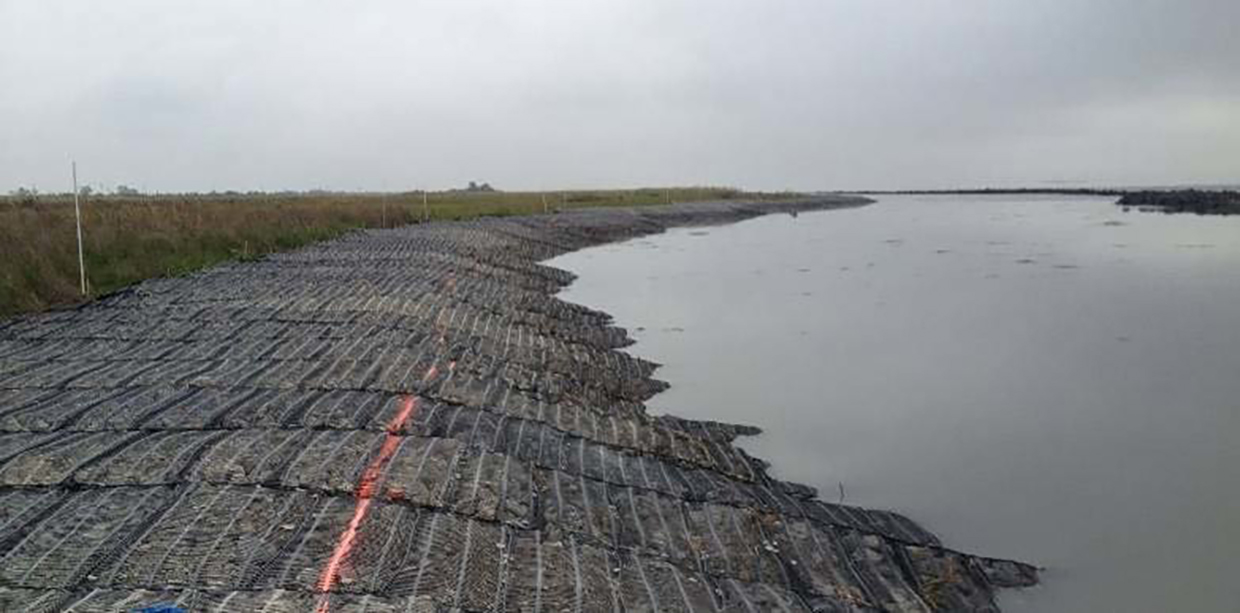
Tensar Triton marine mattresses are commonly used for revetment, scour protection and channel linings, especially in difficult conditions involving saltwater, soft soils or steep slopes. They come in different styles and thicknesses to meet various project needs. The mattresses are perfect for environments where erosion is high, such as areas with strong waves and fast-moving water, where geotextile fabric alone is unable to remain in place. The stones inside the mattresses provide ballast that helps the geotextile fabric remain secure. The mattresses serve two main functions: deploying geotextile in fast-moving water and protecting the foundations for armor stone riprap (a type of rock or other material that is placed along shorelines, riverbanks or on slopes to prevent erosion). Additionally, Triton mattresses are used in modular capping systems to treat contaminated sediment and can hold materials like sand or carbon for specific remediation needs.
Technological maturity: Proven
Contracting type: For sale
Technology level: Medium
Place of origin: United States
Availability: Worldwide
Contact: WIPO GREEN Database
Coastal erosion protection: Secumat Green mats
Naue
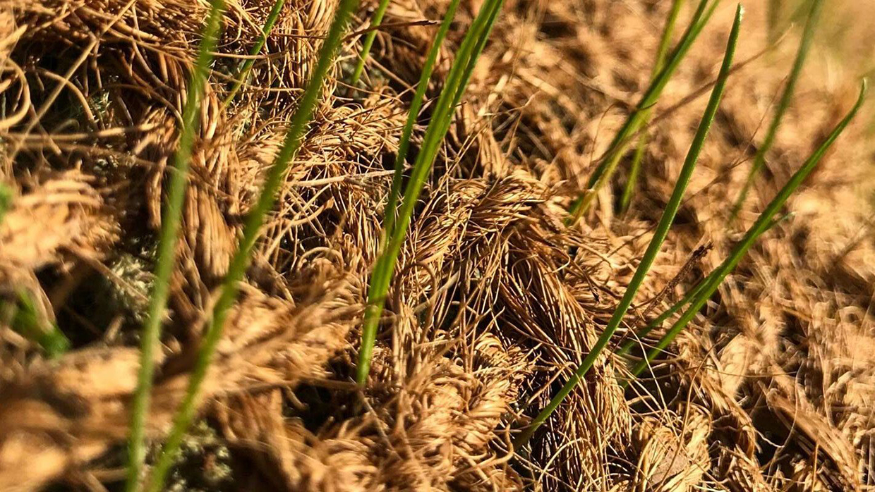
Secumat® Green mats, made from biodegradable materials like jute and coconut fibers, are designed to prevent surface erosion and enhance the stability of slopes and shoreline areas. They stabilize soil, preserve nutrients and promote vegetation growth, making them ideal for environmentally-sensitive areas. Easy to install, Secumat® Green decomposes naturally, leaving no ecological footprint, offering a sustainable solution for landscaping projects. Secumat® Green Jute N provides a temporary solution made from 100 percent untreated jute fibers. The mat is biodegradable and features a woven net. Secumat® Green Coco N is made from 100 percent untreated coir (coconut) fiber woven into a net. Secumat® Green PinW is a 30 cm wooden pin used for securing the mats, made from untreated, high-strength hardwood. Each variant offers a different tensile strength.
Technological maturity: Proven
Contracting type: For sale
Technology level: Medium
Place of origin: Germany
Availability: Worldwide
Contact: WIPO GREEN Database
Coastal erosion protection: split barge
Rohde Nielsen
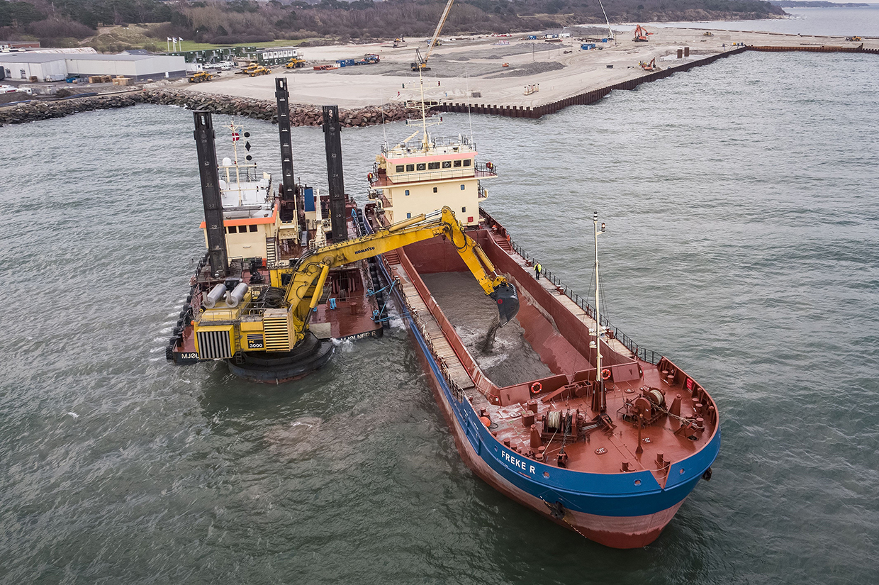
Most of Rohde Nielsen’s hopper barge vessels are self-propelled split hopper barges, built to transport materials like sand, silt and clay. Their split-hull design allows for rapid bottom discharge, unloading cargo within minutes and making them ideal for beach nourishment, land reclamation and offshore disposal. These barges provide continuous, reliable service to stationary dredgers, enhancing overall project efficiency. Additionally, polluting or sensitive materials can be safely managed using sealed tank barges, which ensures environmental protection during operations.
Technological maturity: Proven
Contracting type: For sale
Technology level: Medium
Place of origin: Denmark
Availability: Worldwide
Contact: WIPO GREEN Database
Slope stabilization/recovery: hydroseeding
GeoGrow
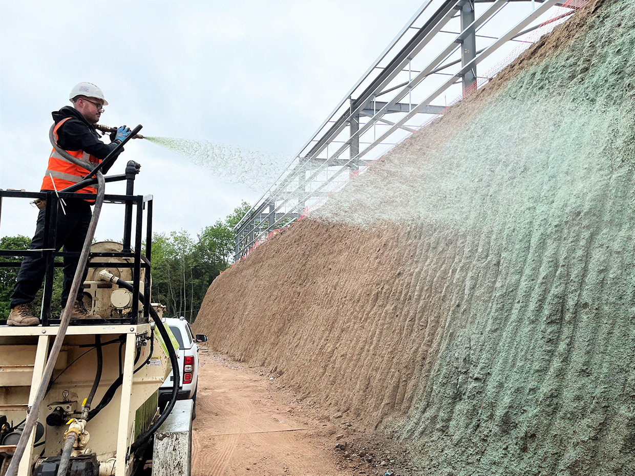
Hydroseeding is a process whereby a mixture of seeds, water, mulch and additives such as fertilizer or biostimulants are blended into a slurry and sprayed directly onto an area. This method combines high-performance, thermally-refined wood fiber, seeds, fertilizers and binding agents inside a hydroseeding machine to create a slurry that is then sprayed onto surfaces, so as to encourage rapid vegetation growth. Sometimes referred to as hydro-mulching, this technique ensures faster germination and establishment of plants by providing an ideal environment for seed growth. GeoGrow’s materials are 100 percent organic, biodegradable and non-toxic. Grass seed mixes that are appropriate for hydroseeding large open spaces and erosion control areas are available, including low-maintenance, shade and drought tolerant riverbank and wildflower mixes.
Technological maturity: Proven
Contracting type: For sale
Technology level: Medium
Place of origin: United Kingdom
Availability: Europe and United Kingdom
Contact: WIPO GREEN Database
Breakwater system: moveable flap gate-type breakwater system
Kanadevia
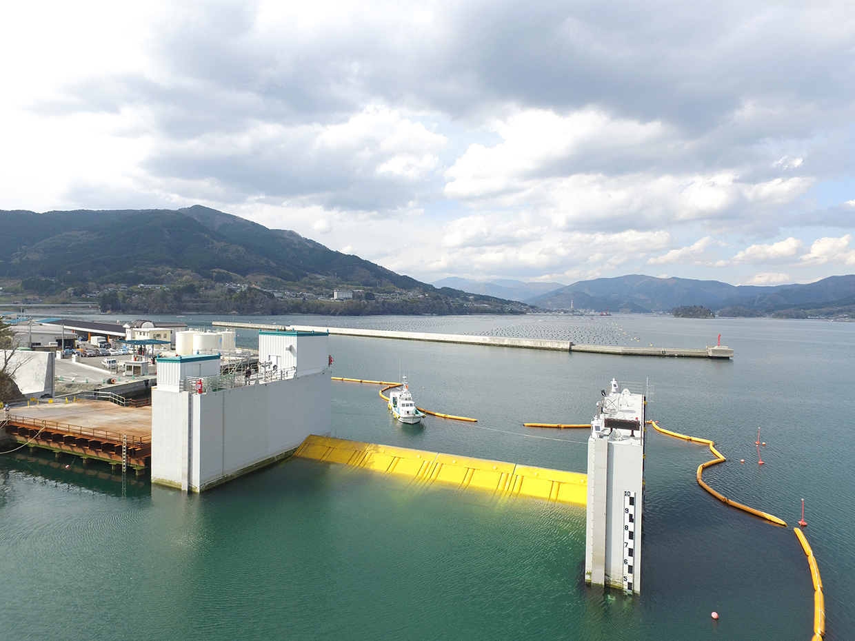
A movable flap-gate breakwater system is a dynamic coastal or harbor protection structure designed to reduce wave energy and protect shorelines, ports or harbors from wave impact. Unlike traditional fixed breakwaters, this system can be either adjusted or relocated to suit changing wave conditions. It can also be opened to allow ships to pass through or maintain natural tidal flows. The system is versatile and can be used on rivers, seabeds or as a land-based solution with the neo RiSe series. The series name, “neo RiSe®,” stands for “No Energy, No Operation, Rising Seawall,” a design that enables automatic gate closure during an emergency without the need for external power or human intervention, using buoyancy. The neo RiSe-A blends with building exteriors, while neo RiSe-L can be integrated into existing structures. The neo RiSe-SL Super Long Span Flap-gate Seawall offers continuous water retention over long distances.
Technological maturity: Proven
Contracting type: For sale
Technology level: High
Place of origin: Japan
Availability: Japan
Contact: WIPO GREEN Database
Frontier technology solutions
Coastal erosion mapping: topo-bathymetric laser scanning system with LiDAR
RIEGL
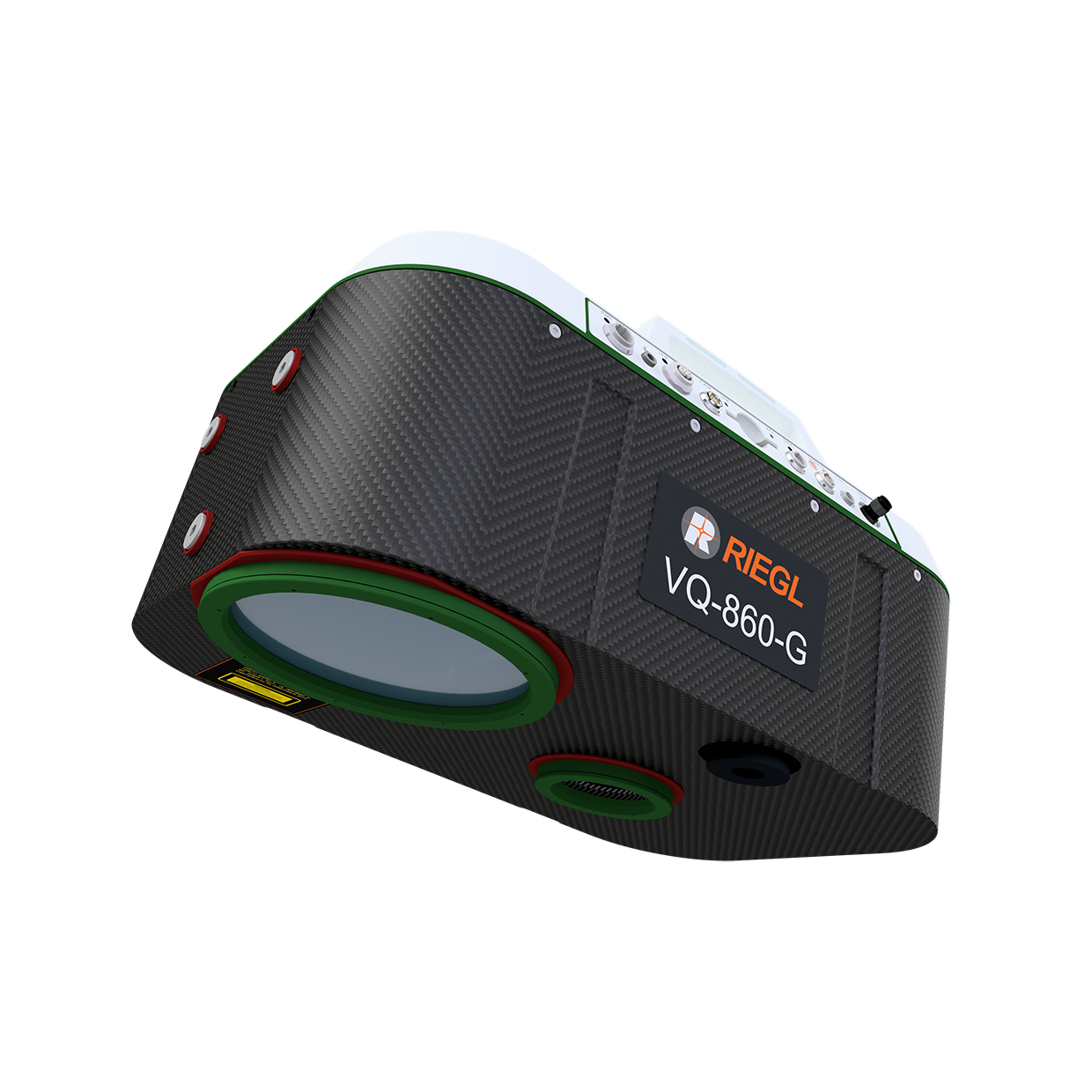
The RIEGL VQ-860-G is a lightweight topo-bathymetric laser scanning system designed for integration on crewed aircraft or drones. Providing up to 100 high-resolution scans per second at altitudes ranging from 75 to 300 meters, it maps both land and underwater topography for applications such as coastline cartography, river mapping, and detection of submerged and floating targets. The scanner can be optionally integrated with a factory-calibrated IMU/GNSS system and a digital camera to supplement the acquired data, and the system also features a reduced laser power mode for eye-safety during operation in sensitive areas. In addition to online echo waveform processing, the gathered data gets stored internally or on a removable storage card, enabling offline full waveform analysis.
Technological maturity: Frontier
Contracting type: For sale
Technology level: High
Place of origin: Germany
Availability: Worldwide
Contact: WIPO GREEN Database
Coastal erosion mapping: Mavic 3 Enterprise drone
DJI
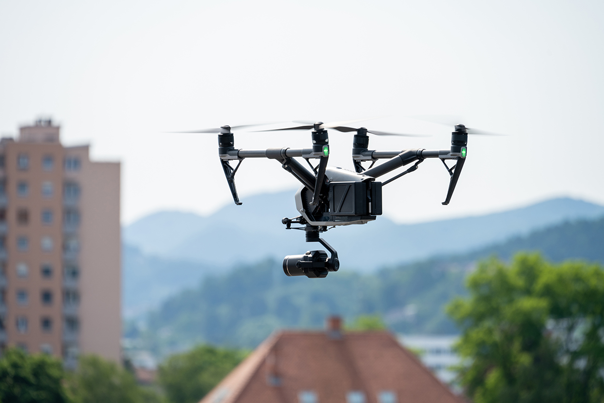
Mavic 3 Enterprise Series drones are optimized for detailed land and coastal zone mapping. They feature a mechanical shutter, a 56× zoom camera, and an real-time kinematic (RTK) module for precise centimeter-level accuracy. The Mavic 3E model is designed to enhance mapping and mission efficiency. A thermal version is also available, making it suitable for search and rescue, inspections and nighttime operation. The Mavic 3E is equipped with a 20MP, wide-angle 4/3 CMOS sensor and a mechanical shutter to prevent motion blur. It supports rapid 0.7-second interval shooting, making mapping missions faster without the need for Ground Control Points. Its wide camera, with large 3.3 μm pixels and intelligent low-light mode, performs well in low-light conditions. With a 45-minute flight time, the Mavic 3E can cover up to 2 square kilometers in one flight, maximizing survey efficiency.
Technological maturity: Frontier
Contracting type: For sale
Technology level: High
Place of origin: China
Availability: Worldwide
Contact: WIPO GREEN Database
Coastal erosion mapping: DJI Terra software
DJI

DJI Terra is 3D modeling software that uses photogrammetry to create precise 2D and 3D reconstructions from visible light imagery and data processed through DJI LiDAR. It is fully compatible with DJI Enterprise drones, offering comprehensive solutions for various industries like land surveying, power transmission, emergency services and construction. The software enables the rapid generation of realistic 3D models and point clouds from photographs, with AI technology that automatically optimizes water surfaces in the models. DJI Terra can also produce vegetation index maps (e.g., normalized difference vegetation index (NDVI) and normalized difference red edge index (NDRE)) to assess plant growth and health. It supports radiometric correction (the process of adjusting raw data from an image to account for atmospheric conditions and sensor inconsistencies) and generates reflectance maps, ensuring accurate data for remote sensing research.
Technological maturity: Frontier
Contracting type: For sale
Technology level: High
Place of origin: China
Availability: Worldwide
Contact: WIPO GREEN Database
Coastal erosion protection: 3D living seawalls, kind tiles and living shorelines
KindDesigns
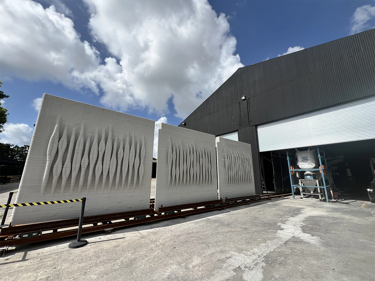
KindDesigns develops sustainable coastal infrastructure solutions using cutting-edge robotics and advanced materials. The technology includes high-resolution 3D concrete printers that enable on-site, custom designs to be printed 20 times faster than traditional construction methods. The materials used are marine-grade concrete and custom reinforcement, which are eco-friendly, non-toxic and pH-neutral, ensuring safety for marine ecosystems. KindDesigns offers over 1,000 custom 3D-printed designs to improve coastal infrastructure. Their Kind Tiles™ can be added to any existing seawall (concrete, steel or vinyl) to dissipate wave energy, promote species colonization and enhance water quality by supporting marine life attachment.
Technological maturity: Frontier
Contracting type: For sale
Technology level: Medium
Place of origin: United States
Availability: United States
Contact: WIPO GREEN Database
Coastal erosion protection: smart seawall aquatic and wave diversion models
Smart Seawall Technologies
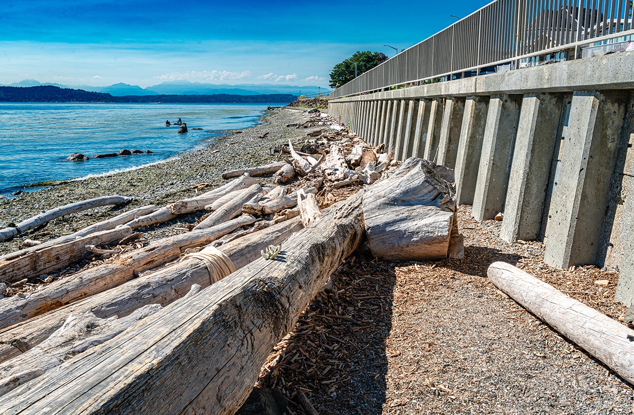
Smart Seawall’s patented wave diversion shoreline technology and solutions integrate utilities, enhance aquatic habitats and provide luxurious waterfront options for municipalities and residential areas. All Smart Seawall models are suitable for both intercoastal and coastal locations, and designed for private, commercial and governmental projects. The aquatic and wave diversion series incorporates aquatic features to support native marine life. The aquatic series is ideal for calmer waters, such as bays and canals, and provides a range of options such as full frontage seawalls, permanent dock systems, floating dock systems and single pylons for anchorage. The wave diversion series is designed for more turbulent areas with larger waves and uses proprietary technology to divert up to 70 percent of wave energy back into the water. The system is customizable and adaptable to any coastline.
Technological maturity: Frontier
Contracting type: For sale
Technology level: High
Place of origin: Germany
Availability: Worldwide
Contact: WIPO GREEN Database
Coastal erosion protection: software for erosion control planning
Maccaferri
Maccaferri’s software programs are designed to support engineering solutions and design processes. Newer tools, such as MAC.R.O. (Maccaferri Automatic Calculation of Rockfall) and Maccaferri Slope Stability Software, were developed to provide engineers with advanced, user-friendly platforms for analyzing and designing solutions for geotechnical, hydraulic and erosion control challenges. Several different downloadable design software programs are available, including MACFLOW Studio for the design of effective drainage solutions, MACREAD AASHTO for the design of flexible pavement layers, MACREAD Studio for the design of road subgrade stabilization solutions, MacStars 4.0 for the design of reinforced soil slopes, walls and complex hybrid structures, and GAWAC for the design of gabion retaining walls.
Technological maturity: Frontier
Contracting type: For sale
Technology level: High
Place of origin: Italy
Availability: Worldwide
Contact: WIPO GREEN Database
Coastal erosion protection: soil and water treatment
Planet Horizons Technologies SA
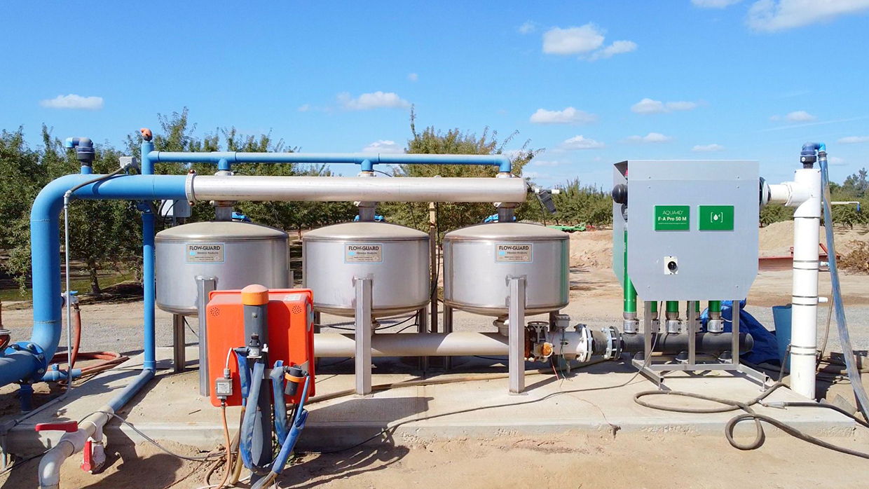
AQUA4D® is an advanced water treatment technology using resonance fields to alter the physical structure of water molecules. This process improves water’s interaction with soil by dissolving crystallized salts that block soil pores, addressing salinity issues common in agriculture. By opening these pores, AQUA4D® increases soil moisture retention, reduces the need for frequent irrigation, and enhances nutrient uptake and root development. The treatment also helps leach harmful salts away from plant roots, thereby regenerating soils and promoting healthier crop growth.
Technological maturity: Frontier
Contracting type: For sale
Technology level: Medium
Place of origin: Switzerland
Availability: Europe, North America, South America
Contact: WIPO GREEN Database
Coastal restoration: multidisciplinary program on restoration and regeneration
BESE and Blue Carbon Lab
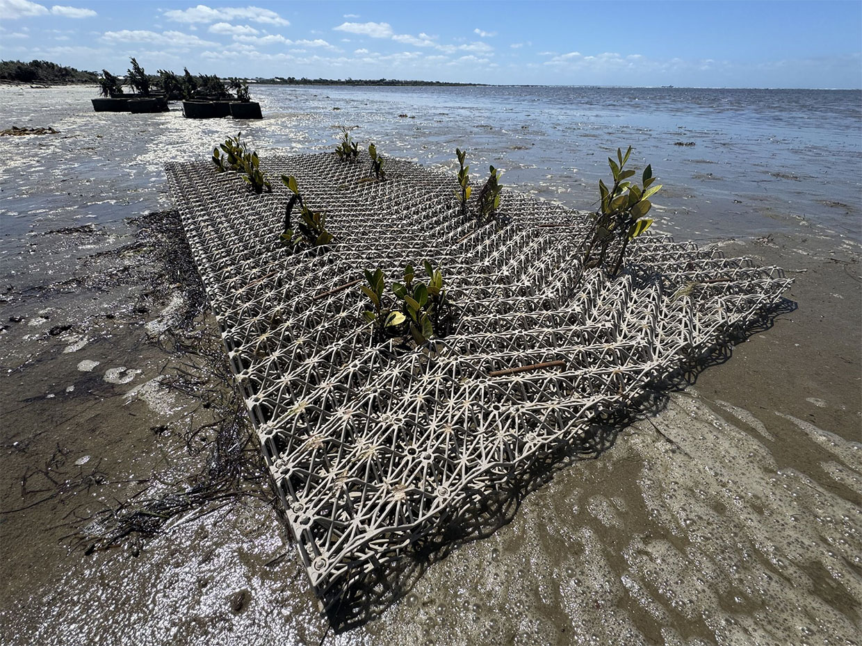
Regenerating Our Coasts is a program that tests biodegradable structures to help restore coastal areas and explore their potential across Australia. The program also aims to educate the public, stakeholders and industry on the benefits of such restoration techniques for local ecosystems. It has trialed direct seeding into BESE-elements® structures, which are 3D lattice forms made from biodegradable potato starch that degrade within 2–10 years. These structures mimic coastal soil conditions, slow down water movement and aid seeds in establishing roots. The program is now testing seagrass seed injection into such structures in order to restore intertidal seagrass in lost areas. It also uses wave sensors to monitor environmental factors, such as wave energy, sediment and elevation, which affect plant growth. Ongoing data collection helps compare plant and soil responses to different restoration methods.
Technological maturity: Frontier
Contracting type: For collaboration
Technology level: Medium
Place of origin: Kingdom of the Netherlands
Availability: Worldwide
Contact: WIPO GREEN Database
Artificial reefs: modular breakwater units
Reefy
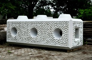
Reefy’s Reef Enhancing Breakwater (REB) is a modular artificial reef system built from large interlocking concrete ReefBlocks. The structure dissipates wave energy, providing erosion control and protecting shorelines and infrastructure such as dikes and seawalls. The blocks are assembled underwater, forming a stable breakwater that allows controlled return flow through the structure for sediment stabilization. The system was tested in wave flume experiments at Deltares, where it dissipated up to 90% of wave energy under hurricane conditions. In 2023, Reefy installed a REB system in Rotterdam as part of a pilot project. It was monitored for engineering and ecological performance and the findings validated the design. The next-generation ReefBlocks feature a fully textured surface and optimized hydrodynamics, with installations planned for late 2025 and early 2026.
Technological maturity: Frontier
Contracting type: For sale
Technology level: Medium
Place of origin: Kingdom of the Netherlands
Availability: Worldwide
Contact: WIPO GREEN Database
Horizon technology solutions
Artificial reefs: architected wave-breaking reefs
Massachusetts Institute of Technology (MIT)

A team from MIT is developing “architected” reefs – offshore structures designed to mimic the wave-buffering effects of natural reefs, while creating habitats for marine life. These reefs feature cylindrical cores surrounded by slats that break incoming waves into turbulent jets, thereby dissipating their energy. The new design could reduce wave energy as effectively as current artificial reefs using 10 times less material. The team plans to use sustainable cement molded into “voxel” patterns to create these cylinders, which can be easily assembled. The cylinders can form a semi-permeable wall about half a mile off the coast, offering pockets for fish and marine species to inhabit. Early lab-scale tests show that this reef could reduce wave energy by over 95 percent.
Technological maturity: Horizon
Contracting type: Under development
Technology level: High
Place of origin: United States
Availability: N/A
Contact: WIPO GREEN Database
Artificial reefs: carbon neutral artificial reef structures
Holcim

Xstone is Holcim’s modular concrete armor block designed to support coastal defense systems such as groynes and embankments. The blocks are porous and reduce the force of incoming waves, helping reduce scouring and erosion as water levels rise. Their shape and textured surface provide habitat and sheltered zones for marine organisms, allowing the Xstone to double as an artificial reef structure. In 2025, Holcim initiated a multi-year program piloting a new, carbon-neutral Xstone made using bioactive concrete and biochar. Around 400 Xstones were installed to establish an artificial reef at the Friedrichsort pier in Germany. The program will monitor the Xstones performance in terms of marine conservation and compare it with other material installed simultaneously at the same site.
Technological maturity: Horizon
Contracting type: For collaboration
Technology level: Medium
Place of origin: Germany
Availability: Germany
Contact: WIPO GREEN Database
Artificial reefs: breakwater structures made from local silt
NETICS
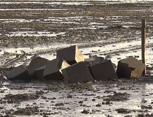
GEOWALL® Reef Blocks are made from locally sourced dredged sediment compressed to form solid units of substrate for marine life attachment. Each block consists of about 90% dredged material and is produced on-site using the electric GEOWALL® press, reducing the need for material transport and providing a low-carbon alternative to conventional concrete reef units. In 2021, NETICS initiated a five-year trial with the Royal Netherlands Institute for Sea Research and the University of Groningen, installing 400 GEOWALL® Reef Blocks made from local sediment along the coast between Delfzijl and Eemshaven in the Netherlands. The trial investigates how these blocks perform under tidal and saline conditions, and whether they provide suitable habitat for oysters, mussels, and other marine species. The project hopes to improve the water quality by supporting water-filtering fauna while simultaneously preventing sediment scouring with the blocks acting as breakwaters. The blocks were installed at different heights and compressed to varying hardness levels to compare durability and colonization rates.
Technological maturity: Horizon
Contracting type: For collaboration
Technology level: Medium
Place of origin: Kingdom of the Netherlands
Availability: Kingdom of the Netherlands
Contact: WIPO GREEN Database
Artificial reefs: 3D-printed reef structures made from invasive algae-based ceramic material
Thrasos 3D

Domosfera is a modular 3D-printed reef structure made from clay and converted sargassum waste, an invasive algae in the Caribbean Sea. The material is carbon-negative, removing 476 kilograms of CO₂e per square meter, and is produced through a low-energy sintering process. The structures provide surfaces for coral polyps to colonize and chemically attract coralline algae to settle, while dissipating up to 50 percent of wave energy and protecting coastal communities from erosion. The surface is algae-resistant, helping increase coral survival by up to 85 percent during bleaching events compared to concrete structures. The structures use a mussel-inspired, coral-safe adhesive that has kept coral fragments intact during seismic activity while giving the modules a natural appearance. In collaboration with the Cozumel Coral Reef Restoration Program and commercial partners - local dive shops, resort operators, and ceramic industry players - Thrasos 3D deployed pilot installations off the coast of Cozumel, Mexico.
Technological maturity: Horizon
Contracting type: For collaboration
Technology level: Medium
Place of origin: Mexico
Availability: Mexico
Contact: WIPO GREEN Database https://wipogreen.wipo.int/wipogreen-database/articles/177301
Coastal protection: coastal carbon capture with carbon-removing sand
Vesta

Vesta is developing "Coastal Carbon Capture", a solution that accelerates the natural weathering of olivine to remove carbon dioxide from the atmosphere and has the added benefit of counteracting coastal erosion. By placing olivine sand in coastal waters, the sand gradually dissolves over the course of years to decades, increasing ocean alkalinity, reducing seawater acidity, and permanently storing CO₂. Vesta has conducted field pilots in the United States, placing up to 7,000 cubic yards of olivine sand in intertidal and nearshore zones. The projects are monitored by independent research organizations, with data collected on water quality, sediment, marine organisms, and carbon removal efficiency.
Technological maturity: Horizon
Contracting type: For collaboration
Technology level: Medium
Place of origin: United States
Availability: United States
Contact: WIPO GREEN Database https://wipogreen.wipo.int/wipogreen-database/articles/177301
Landslides
As climate change intensifies rainfall and thawing permafrost triggers landslides, innovative safeguards are emerging. Models now forecast risk globally every 30 minutes, while AI analyzes real-time data from tiltmeters, InSAR satellites, and drone-mounted LiDAR. On unstable slopes, bioengineered biogrout strengthens soil, and smart barriers deploy automatically when sensors detect movement, protecting communities before rocks fall.
Technological developments and trends
Landslides – the sudden or slow downhill movement of rock, soil or debris – are powerful natural events that shape landscapes and threaten communities worldwide. They come in many forms, such as falls, topples, slides, spreads and flows (
Landslides can move rapidly, with debris flows reaching speeds of 60–80 km/h, or slowly at rates of millimeters to centimeters per year
When a landslide occurs there is not much that can be done to remedy the situation for those affected people or infrastructure. Most of the technologies discussed in this section are therefore related to prevention and early warning systems.
Landslides can move rapidly, with debris flows reaching speeds of 60–80 km/h, or slowly at rates of millimeters to centimeters per year (
Climate change is expected to trigger more landslides, particularly in mountainous regions, largely driven by an increase in extreme rainfall. Warming can also lead to permafrost melting and associated landslides in higher mountain ranges (European Climate and Health Observatory and ADAPT, 2025).
Innovative landslide monitoring technologies to detect and analyze landslide activity
Landslide monitoring technologies range from instrumental ground sensors and devices to global positioning systems (GPS), aerial photography, satellite images and LiDAR. Surface and subsurface monitoring technologies work together to provide a comprehensive understanding of both surface and subsurface conditions, which is critical to the evaluation and prevention of landslides (
Surface monitoring
Tiltmeters measure changes in slope angle or inclination in order to provide information on ground movement and are usually installed at multiple locations along a slope to detect potential landslide activity. These instruments are sensitive to ground movements at or near the surface, allowing early detection of shifts in slope stability.
Extensometers measure the change in distance (or elongation) between two fixed points on a material or structure, typically over larger distances. In the same way as for tiltmeters, observed changes may indicate movement as a precursor to a landslide event.
Subsurface monitoring
Inclinometers measure the angle of inclination or slope deflection below the ground surface. They are typically installed in boreholes or inclinometer casings to track subsurface movements and evaluate slope stability.
Strain gauges measure the strain or deformation within a structural element, such as a retaining wall, providing data on the mechanical behavior of materials and helping assess slope stability from within the ground or structure.
Piezometers or pore pressure sensors measure groundwater or pore water pressure within soil or rock formations, enabling the monitoring of groundwater levels and the identification of potential slope failure triggers.
Seismic sensors detect the seismic waves and ground vibrations generated by landslides and earthquakes, and play a role in providing early warnings.
Earth pressure cells monitor the pressure within earth-fill dams, embankments or at the interface between a structure and excavation walls. They consist of two welded stainless-steel plates with a vacuum-sealed gap filled with de-aired oil. A pressure pad connected to a transducer forms a closed hydraulic system, generating an electrical signal that can be read remotely. Vibrating wire technology is often used in these systems to measure strain, displacement or pressure. A wire attached to the sensor vibrates under stress, and the frequency change is converted into an electrical signal proportionate to the pressure. This signal is then sent to a readout unit or data logger for monitoring.
Revolutionizing landslide monitoring, modeling and risk mapping with satellites and remote sensing
In addition to ground-based monitoring, satellite-based or other platforms for remote sensing technologies have become crucial for detecting and tracking landslides. These technologies enable large-scale monitoring with minimal environmental disruption.
Global navigation satellite systems (GNSSs) help monitor ground movements and detect landslides. They use a network of satellites orbiting the Earth that send signals to receivers on the ground. A GNSS includes global coverage systems such as GPS (United States), Galileo (European Union), GLONASS (Russian Federation) and BeiDou (China). These technologies enable the precise measurement of ground movement and displacement by tracking changes in the position of receivers.
In addition to ground-based monitoring, satellite-based or other platforms for remote sensing technologies have become crucial for detecting and tracking landslides
Synthetic aperture radar (SAR) is a remote sensing technology that uses radar waves from satellites to capture images of the Earth’s surface, as defined in the chapter on storms and flooding. SAR uses microwave signals to capture high-resolution images of the Earth’s surface, enabling the detailed monitoring of landscapes, weather patterns and disasters, even through cloud cover. In dry conditions it can also reveal shallow subsurface features. SAR captures images of the Earth’s surface before and after a landslide event and tracks changes in surface elevation. If there is a shift in terrain due to a landslide, the phase difference in the SAR images can reveal the quantity of displacement and show the precise area affected. Repeated SAR scans can monitor stability over time. SAR can also help map an area and assess damage.
Interferometric synthetic aperture radar (InSAR) is a more advanced remote sensing technology that uses SAR satellites for monitoring and detecting ground deformation. InSAR enhances SAR by processing multiple SAR images taken at different times in order to detect subtle changes to the Earth’s surface such as land subsidence or movement related to landslides. It has millimeter precision, enabling the early detection of land movement, and the ability to cover large areas. It provides abundant archive data enabling time-series analyses of change (
From space to surface: high-tech tools for landslide tracking
NASA’s landslides team has developed the Landslide Hazard Assessment for Situational Awareness (LHASA) model, which provides timing and location information on potential landslide occurrences every 30 minutes. NASA has also developed the Landslide Susceptibility Map, a tool to identify and map regions at risk, and the Global Landslide Catalog, a global database that tracks and records landslides worldwide by compiling information from satellite data, ground observations and scientific reports to create a detailed record of landslide events. The landslide project is part of NASA’s Global Precipitation Measurement (GPM) mission (explained in the storms and flooding chap) utilizing satellite data and citizen science contributions in order to model and record landslides worldwide.
For decades, optical data has been the primary tool for landslide modeling. Optical satellites, including the Landsat series and Sentinel-2, have enabled large-scale assessments with increasingly higher temporal and spatial resolution analysis. The use of multiple spectral bands also allows for the analysis of higher-contrast data, including NDVI, a combination of spectral bands used to assess and monitor vegetation health and density. However, cloud cover poses a challenge to optical data from satellites (
Hyperspectral remote sensing – also called imaging spectroscopy – analyzes reflected radiation across many narrow spectral bands, allowing for more advanced analyses of spectral signatures of land and vegetation features, which helps determine bio- and geochemical information about an area (
The terrestrial laser scanner (TLS) is a specific type of LiDAR system designed to be used on the ground. TLS are used to create precise 3D maps of damage, monitor slope stability, plan debris removal and reconstruction, support search and rescue efforts, and analyze the causes and mechanics of a landslide. Whereas LiDAR is used in a variety of settings, including aerial or satellite-based scanning, TLS is typically stationary and placed at various points on the ground to obtain high-resolution scans of smaller, more localized areas such as landslides, steep slopes, damaged infrastructure and collapsed tunnels. TLS works by sending laser pulses that are reflected back from the first solid surface they encounter, such as soil, rock, vegetation or a man-made structure. This means it cannot penetrate the ground, unlike ground-penetrating radar, but can capture detailed surface geometry.
The growing availability, reliability and cost efficiency of remote-controlled drones has made it easier to access real-time aerial images in remote, unsafe or otherwise unreachable locations
Like with other extreme weather events, drones are useful in the aftermath of a landslide. Aerial photographs have long been a useful tool, and the growing availability, reliability and cost efficiency of remote-controlled drones has made it easier to access real-time aerial images in remote, unsafe or otherwise unreachable locations. This has significantly raised the importance of drones for conducting landslide assessments (
AI and big data: integrating multiple data sources for landslide monitoring
As is the case with flooding, advancements in big data and AI have improved landslide monitoring and prediction systems. The latest technologies use real-time data collection, advanced computation techniques and dynamic risk assessment to predict landslides with greater accuracy, issue early warnings and reduce loss of life and property.
The combination of big data and AI has improved data analysis, occurring alongside the increased use of drones, satellites, remote sensing and IoT sensors, ground sensor networks and meteorological data. Big data can help process this in real time. Additionally, AI algorithms analyze volumes of historical data to identify patterns. Importantly, AI models can dynamically adjust predictions based on feedback concerning changing conditions delivered by ground sensors (
Prepare for the future or recover from past landslides – soil stabilization
A variety of methods are employed to stabilize slopes and improve soil stability, ranging from traditional engineering techniques to innovative, eco-friendly solutions.
Retaining walls constructed out of concrete, steel or geosynthetic materials are commonly used to stabilize slopes, alongside gravity walls, which rely on their own weight to hold back soil. To enhance soil stability and address issues like erosion and foundation weaknesses, innovative methods such as biogrout, soil nailing and ground improvement techniques are gaining popularity. These techniques offer sustainable, efficient and cost-effective solutions compared to traditional methods.
Biogrout is an eco-friendly material that serves as an alternative to conventional chemical soil stabilization methods. Bacteria, such as Sporosarcina pasteurii, are inserted into the soil in order to produce calcium carbonate (limestone) which fills the soil pores and binds particles together, thereby improving soil stability and strength. Not only does this process strengthen weak soils, it also reduces water seepage in landfill and seals underground water channels. This process can augment the load-bearing capacity of foundations and provide improved structural support.
A variety of methods are employed to stabilize slopes and improve soil stability, ranging from traditional engineering techniques to innovative, eco-friendly solutions
Soil nailing is an engineering technique used to stabilize slopes and excavations by installing closely spaced steel bars in the soil, so as to stabilize either a natural slope or reinforce an over-steepened slope. It involves drilling or launching steel bars to a specified depth. Systems like the GeoStabilization Soil Nail Launcher™ use compressed air to drive nails at high speed for increased efficiency.
In addition, rock bolting involves inserting steel bolts into a rock face for stabilization. Shotcrete is a method of spraying concrete onto an unstable rock or soil surface using compressed air at high velocity to provide a protective layer.
Ground improvement techniques are methods used to compact the soil and increase its density and strength through the use of mechanical vibration (using vibratory rollers or vibrating plates), dynamic compaction (dropping a heavy weight, e.g., a large steel block or hammer, from a significant height onto the soil surface), vibroflotation (using a high-frequency vibrating probe, called a vibroflot, to compact granular soils) or the addition of cementitious materials. These techniques are often used in conjunction with soil stabilization methods like biogrout and soil nailing.
Geosynthetic clay liners (composed of a layer of bentonite (very absorbent) clay sandwiched between two layers of geosynthetic fabrics) can also be used in soil stabilization to prevent water seepage and improve the load-bearing capacity of soil. When applied in conjunction with biogrout or another stabilization method, they can reduce water flow and prevent erosion, thereby contributing to long-term slope stability.
As explained in the coastal erosion chapter, geogrids reinforce soil by adding tensile strength to the soil mass. They are often used either in conjunction with soil nailing or as part of a retaining wall system. Finally, planting deep-rooted plants and grasses can help stabilize soil naturally. Biodegradable erosion control mats protect soil during the establishment of vegetation, preventing erosion until the plants take root.
Dealing with debris and damage
In areas prone to rockfalls, protection nets and barriers can be installed to capture falling rocks before they impact roads or infrastructure. Typically made of high-tensile steel cables or mesh, these rockfall protection nets absorb the impact of falling rocks and safely direct them to the ground.
Debris flow barriers, slurry pumps and other technologies used for landslide debris cleanup are essential for managing and mitigating the aftermath of a landslide. Debris flow barriers block the flow of landslide debris, including mud, rocks and trees, before it can damage infrastructure. They can be passive (in the case of permanent structures) or active (meaning they can be adjusted to handle varying flow volumes) and are constructed from steel, concrete or mesh materials.
Slurry pumps are heavy-duty pumps designed to handle thick, viscous mixtures of water, mud, debris and sediment using a combination of high pressure and specialized impellers to move debris-laden liquids. They remove and transport mud and other loose materials to either safer locations or treatment facilities.
Additionally, excavators, bulldozers, vacuum trucks and hydraulic excavation using waterjets combined with excavation machinery can all be used in debris clean-up efforts. Sediment removal and screening using classifiers, screens and separators are also employed to remove large debris particles.
Innovation examples
Aerial mapping with drones in Tbilisi, Georgia
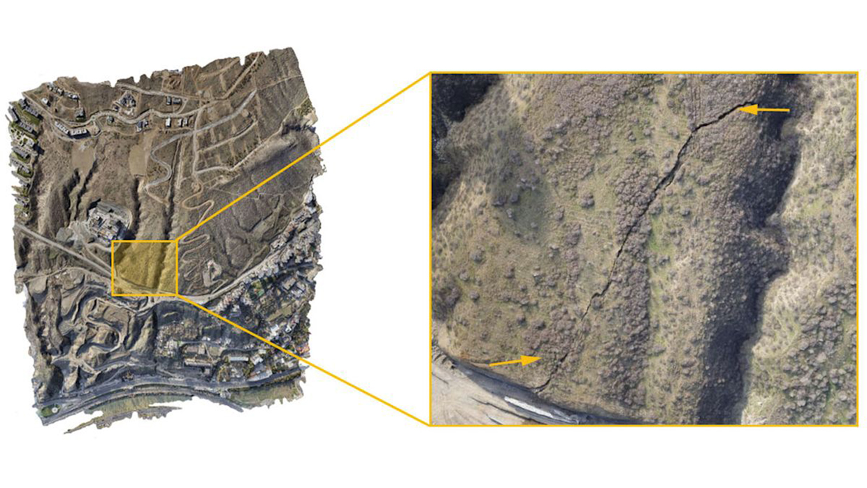
In 2021, a fissure opened on a hillside near two residential areas in Tbilisi, Georgia, prompting local authorities to assess the potential damage. To safely carry out this operation, the National Environmental Agency of Georgia turned to drones and the PIX4Dmapper. They selected the eBee X fixed-wing drone for its long flight time and battery efficiency (see also Green Technology Book Mitigation edition, agriculture section). Using photogrammetry, the eBee X captured data across various parameters, which were then analyzed with the help of PIX4D’s specialized mapping software. The PIX4Dmapper allowed the team to measure and quantify key features of the landmass, including volume and movement. Over two flights, they collected more than 800 images, creating a digital surface model (DSM) that provided an in-depth analysis of the fissure’s depth, volume, curvature, potential movement and flow accumulation. The fissure measured 14 meters in depth with a displaced volume of half a million cubic meters of land. Thanks to these advanced technologies, stabilization measures were quickly implemented to protect residents and their property (
Soil nailing and rock bolting stabilize active landslide zones in India
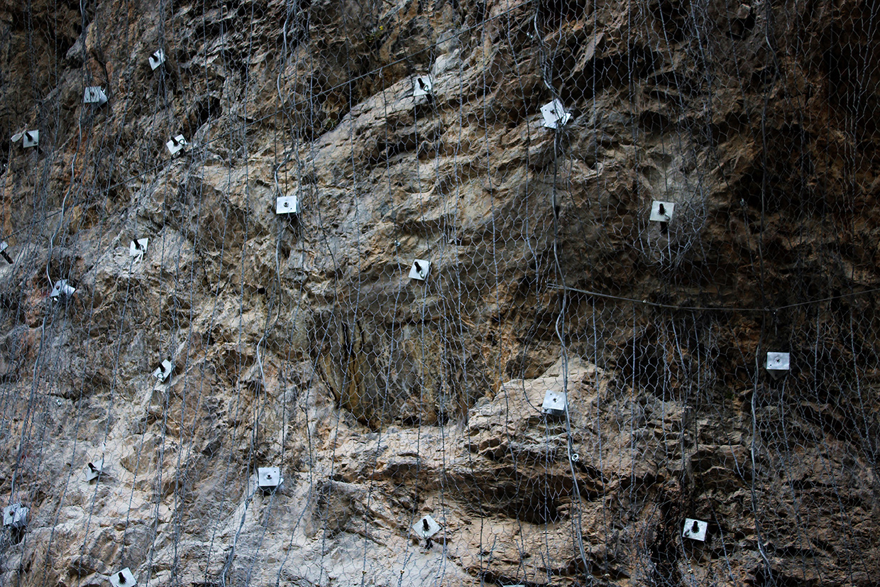
In Uttarakhand, landslides frequently disrupt roads, particularly during the monsoon season, presenting a major challenge for Char Dham pilgrims. To address this, the Border Roads Organisation (BRO) is employing Australian rock bolt technology to stabilize landslide-prone areas along the Gangotri and Yamunotri highways. This proven technology involves removing loose debris and reinforcing bedrock through soil nailing and rock bolting. Specialized drilling is used to secure fractured rocks by inserting bolts at critical fracture points, enhancing the stability of the formations. The technique has been shown to be 90 percent effective in preventing future landslides. According to BRO officials, using this method has significantly improved the safety of the roads in question for both pilgrims and tourists. After stabilizing the area, excavation tunnels were constructed, and treatments started in two additional landslide zones, with the goal of completing stabilization efforts by spring 2025. This initiative is part of a broader effort to improve road safety and resilience within Uttarakhand’s challenging mountainous landscape (
A drone in the dark: assessing a collapsed tunnel
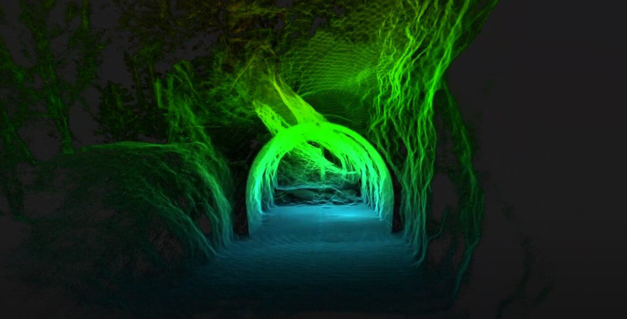
In 2024, several landslides collapsed a tunnel in Switzerland, cutting off access between villages and a ski resort. Safe entry was impossible, so the local authorities employed Flyability’s Elios 3 indoor drone to assess the collapsed tunnel. The drone collected data via LiDAR, photos and videos, and the point cloud datasets from the LiDAR scan provided a clear view of the damage. It also helped show how the tunnel’s design, specifically a small and unnecessary window, contributed to its vulnerability. Cold air flowing through the window since the tunnel was built in the 1960s had caused a type of freeze–thaw weathering effect (where water freezes and expands, causing cracks and faults over time) inside the tunnel. The surrounding rock had also developed faults due to weathering, traffic vibration and minor seismic events. The Elios 3 drone’s key features – its autonomous stabilization, protective cage, ability to survive colliding with walls, advanced processing, 4 K cameras for clear visualization in low light, thermal cameras to detect structural weaknesses and laser distance measurement – made it essential for investigating the accident. Thanks to these capabilities, the tunnel was reopened within months, demonstrating how drone technology can enhance emergency response and prevent future incidents (
Proven technology solutions
Slope stabilization: soil nail launcher
Geostabilization International
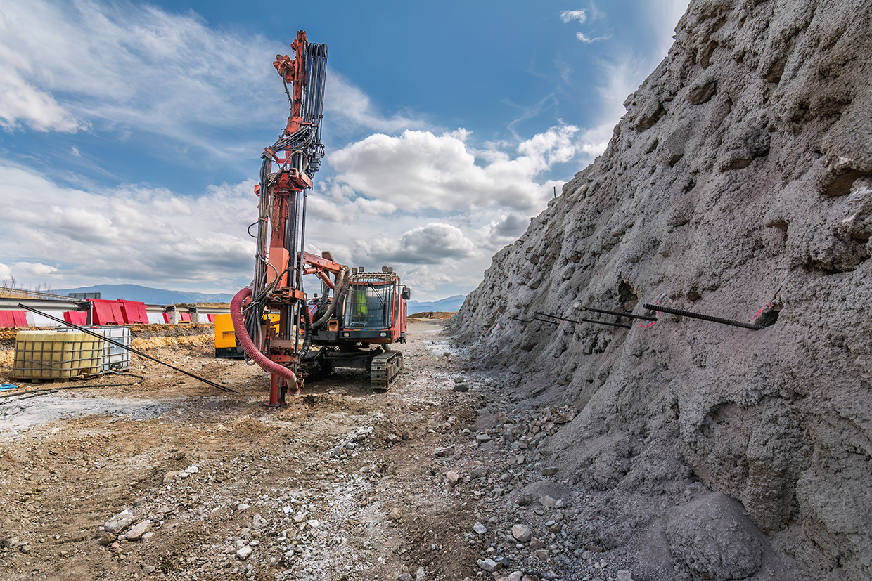
The Soil Nail Launcher™ was originally developed by the British military and is a compressed air cannon that shoots a 6-meter steel or fiberglass tube at speeds of up to 400 km/h. The high-speed launch creates tensile stresses that prevent the nail from buckling and helps it penetrate the ground efficiently. The shockwave at the tip displaces soil during installation, and the process stops when friction at the nail tip absorbs the cannon’s energy. Unlike traditional methods, this system minimizes wear and preserves the nails’ corrosion protection, leading to higher pullout capacities (the maximum force or resistance a soil nail can withstand before it starts to be pulled out or displaced from the ground). It also increases soil density in the nailed area, unlike open-hole drilling, which can weaken the connection between the soil nail and the surrounding soil.
Technological maturity: Proven
Contracting type: For sale
Technology level: Medium
Place of origin: United States
Availability: Canada, New Zealand, United States
Contact: WIPO GREEN Database
Slope stabilization: 2D-Geo system
GEOIZOL Project
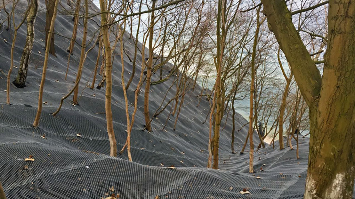
The 2D-Geo is a high-strength steel net with diamond-shaped meshes designed to stabilize slopes and prevent erosion. It is anchored to the ground using special plates and can be combined with anti-erosion fabric for added protection. Supplied in rolls and connected with steel spirals, the net can cover a large area. It is effective for stabilizing mudslides, rockfalls and landslides, as well as protecting against erosion. Key benefits include stabilizing slopes of up to 70–80 degrees, saving up to 40 percent compared to lower-strength nets. It also offers high tear strength, has minimal environmental impact and encourages grass seed germination by creating a fertile soil layer. Additionally, its large mesh size helps preserve the landscape’s aesthetic appearance.
Technological maturity: Proven
Contracting type: For sale
Technology level: Medium
Place of origin: Russian Federation
Availability: Russian Federation
Contact: WIPO GREEN Database
Landslide monitoring: wireless tilt sensor
Next Industries
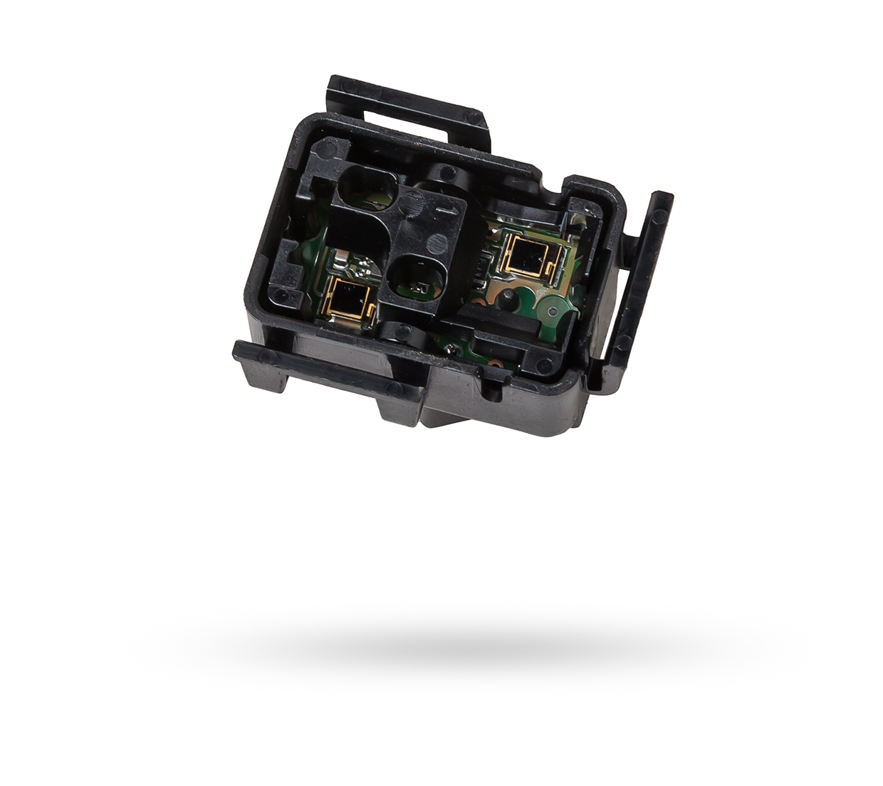
The NI310-TIL Wireless LoRa Tilt Sensor is a compact device that measures tilt angles in real time. It has a built-in micro-electromechanical systems (MEMS) accelerometer (to detect changes in movement or tilt by measuring the displacement of a mass suspended on a spring, which is then converted into an electrical signal) for accurate readings and can be set up quickly with customizable angle thresholds. The sensor is waterproof. Users can create up to 36 trigger rules, so the sensor sends an alarm when a certain tilt angle is reached. It is easy to install and can be wirelessly connected to other systems, allowing data to be transmitted to an IoT cloud platform for remote monitoring and analysis.
Technological maturity: Proven
Contracting type: For sale
Technology level: Medium
Place of origin: Italy
Availability: Worldwide
Contact: WIPO GREEN Database
Landslide monitoring: extensometers (clip-on, sensor arm, video and laser)
ZwickRoell
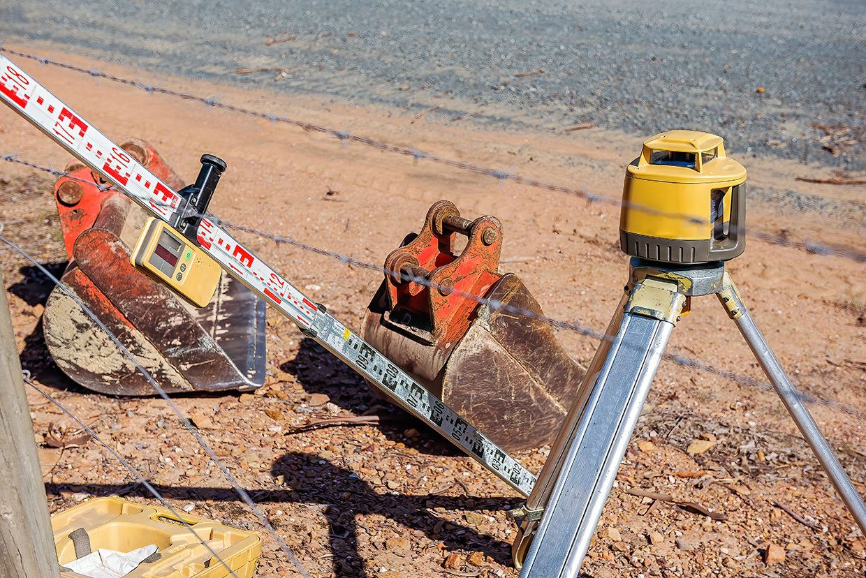
Extensometers are devices used to measure the displacement or strain of an object, and they come in various types. Sensor arm extensometers are mounted directly onto the object using knife edges attached to sensor arms, measuring strain by detecting changes in the arms’ angle or travel distance. They are modular and adaptable. Clip-on extensometers are also directly attached, offering high accuracy, but limited flexibility. Video and laser extensometers are contactless: laser extensometers use a laser beam directed at a target on the object to measure the distance, while video extensometers use high-resolution cameras to track the movement of markers placed on an object, with software analyzing the images to calculate the displacement.
Technological maturity: Proven
Contracting type: For sale
Technology level: Medium
Place of origin: Germany
Availability: Worldwide
Contact: WIPO GREEN Database
Landslide monitoring: earth pressure cell
Sisgeo
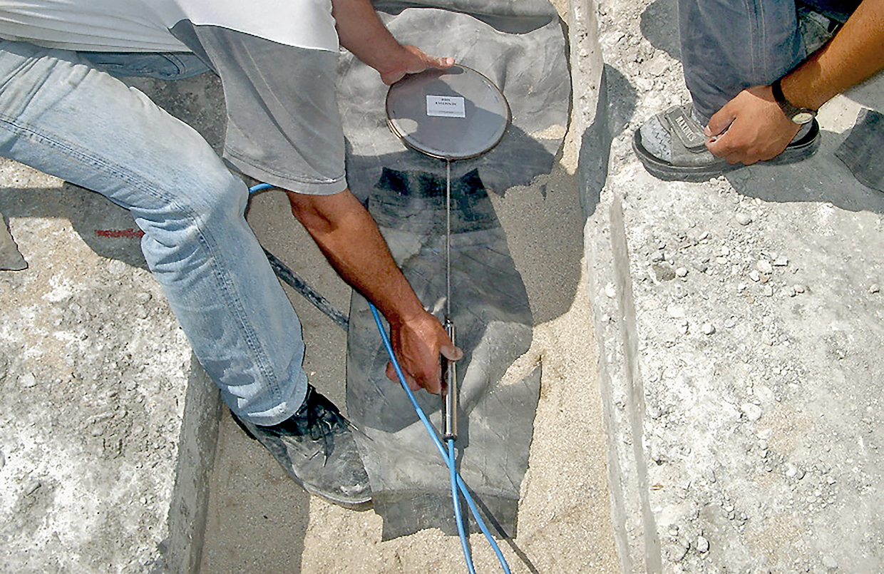
Earth pressure cells measure total pressure in embankments, retaining walls and diaphragm walls. They consist of two stainless steel plates welded together, filled with de-aired oil and connected to a transducer via a tube, forming a closed hydraulic system. Pressure applied to the cell generates an electrical signal that is readable remotely using portable units or data loggers. Vibrating wire technology – often integrated into these systems – measures strain, displacement or pressure by detecting changes in a wire’s vibration frequency under stress. This frequency shift is converted into an electrical signal. Vibrating wire systems – known for their accuracy and environmental resilience – are ideal for long-term geotechnical monitoring, providing reliable data for pressure monitoring applications.
Technological maturity: Proven
Contracting type: For sale
Technology level: Medium
Place of origin: Italy
Availability: Worldwide
Contact: WIPO GREEN Database
Landslide debris clean-up: mobile debris crushers
Metso
Metso crushers are designed to process debris generated in disasters or demolitions. Available in mobile and stationary configurations, they are effective for medium-hard and hard materials such as concrete, asphalt, and bricks. Mobile units are easy to relocate as work progresses and have been used in disaster recovery operations, where crushers helped manage rubble and produce aggregates for reuse in, for example, road bases, reclaimed asphalt, or erosion control.
Technological maturity: Proven
Contracting type: For sale
Technology level: Medium
Place of origin: Finland
Availability: Worldwide
Contact: WIPO GREEN Database
Landslide debris clean-up: grinding machine
Rotochopper
Rotochopper’s electric and diesel grinding machines are designed for the high-efficiency, high-volume processing of organic materials like wood, construction debris and green waste. They use a rotating drum with sharp, heavy-duty knives to shred and grind the material into a consistent, finely processed output. They are designed to feed logs, whole trees and brushy material into the powerfeed. The StopWatch Monitoring System can detect ungrindable objects and vibration in the rotor and stop and reverse the infeed. The electric-powered models provide a quieter, cleaner operation with less maintenance, whereas the diesel-powered models offer greater mobility for on-site operations, especially in rugged areas. Both systems have advanced features, such as adjustable screens to control particle size, and quick-change blades for minimal downtime.
Technological maturity: Proven
Contracting type: For sale
Technology level: High
Place of origin: United States
Availability: Worldwide
Contact: WIPO GREEN Database
Landslide damage assessment: 3D terrestrial laser scanner (TLS)
Leica Geosystems
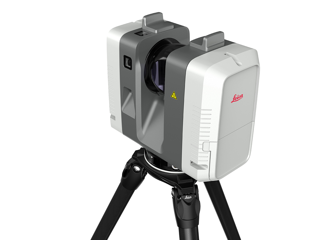
The RTC360 is a high-precision 3D laser scanner with quick scanning capabilities (up to 2 million points per second) that captures detailed 3D topographical data for precise mapping of the displacement of land to assess the extent of damage. It is compact and captures detailed terrain data in rugged areas, such as landslide-prone slopes, with high accuracy. It offers software integration for processing large datasets quickly. It is small and lightweight with a collapsible tripod and therefore can be taken anywhere. It has a one-button operation for simple scanning. The Cyclone FIELD 360 app is also part of the RTC360 solution, enabling the on-site automatic capturing, registration and examination of scan and image data. The app can also connect the 3D data acquired in the field with the laser scanner and data registration back at the office.
Technological maturity: Proven
Contracting type: For sale
Technology level: High
Place of origin: Switzerland
Availability: Worldwide
Contact: WIPO GREEN Database
Frontier technology solutions
Landslide monitoring: vibrating wire multi-level piezometer
Roctest
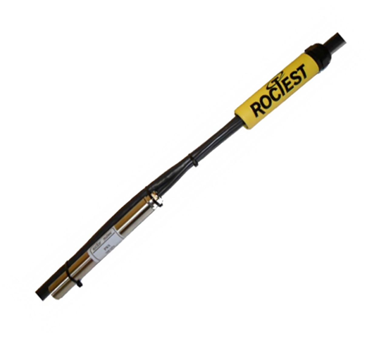
A multi-level piezometer is used to measure pore water pressure in the ground at different depths, so as to understand how water pressure changes. A wire inside vibrates at a specific frequency, and when water pressure changes, it affects the wire’s tension, which changes the vibration frequency. This change is then used to measure the pressure. The PW-ML multi-level piezometer features multiple piezometers connected to a single communication cable, which links to a data acquisition system (SENSLOG) or readout device (MB-3TL). The multi-level piezometer is installed using direct grouting with piezometer string and a grout injection tube. Once the grout hardens, the piezometers are sealed off from one another, allowing for accurate measurements of pore water pressure at different depths. This system lets the user customize sensor spacing along the cable, ensuring precise depth control based on site-specific needs. The connections between each piezometer and the main cable are reinforced with epoxy resin.
Technological maturity: Frontier
Contracting type: For sale
Technology level: High
Place of origin: Canada / Switzerland
Availability: Worldwide
Contact: WIPO GREEN Database
Landslide monitoring: land deformation monitoring services using satellite radar data (InSAR)
GeoKinesia
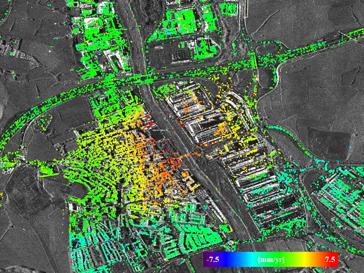
GeoKinesia is highly experienced in land deformation monitoring, specializing in SAR, InSAR, and other remote sensing techniques. InSAR (Interferometric Synthetic Aperture Radar) is a remote sensing method that detects land and structural displacement with millimeter precision by comparing satellite images taken at different times. GeoKinesia uses a proprietary Persistent Scatterer Interferometry (PSI) InSAR processing technique with a high level of automation and reliability. It helps estimate key factors like residual topographic error (the remaining discrepancies in height or elevation after accounting for topographic variations in data), which is crucial for accurate modeling. With this technique, GeoKinesia can create deformation velocity maps, cumulative deformation maps, time series, and analyze both horizontal and vertical movement.
Technological maturity: Frontier
Contracting type: For sale
Technology level: High
Place of origin: Spain
Availability: Worldwide
Contact: WIPO GREEN Database
Landslide monitoring: Landslide Hazard Assessment and Model for Situational Awareness (LHASA)
National Aeronautics and Space Administration (NASA)
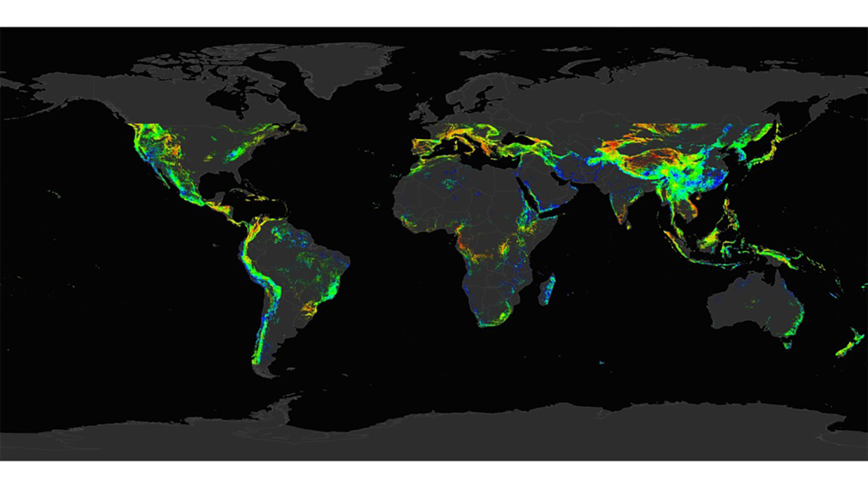
The Landslide Hazard Assessment and Model for Situational Awareness (LHASA) provides near real-time global landslide hazard forecasting to support disaster preparedness and response efforts. LHASA version 2.1 combines multiple data sources including satellite-based estimates of precipitation and soil moisture, terrain, and seismicity to predict where rainfall-triggered landslides are most likely to occur. The system uses XGBoost machine learning algorithms trained on historical landslide data to generate daily nowcasts that are publicly accessible through NASA’s Landslide Viewer. By integrating forecasts from NASA’s Goddard Earth Observing System (GEOS) Forward Processing system and incorporating new landslide inventory data, LHASA helps emergency managers, researchers, and communities worldwide better prepare for and respond to landslide hazard.
Technological maturity: Frontier
Contracting type: Open source (freely available)
Technology level: High
Place of origin: United States
Availability: Worldwide
Contact: WIPO GREEN Database
Landslide monitoring: 2D drone mapping software
Pix4D
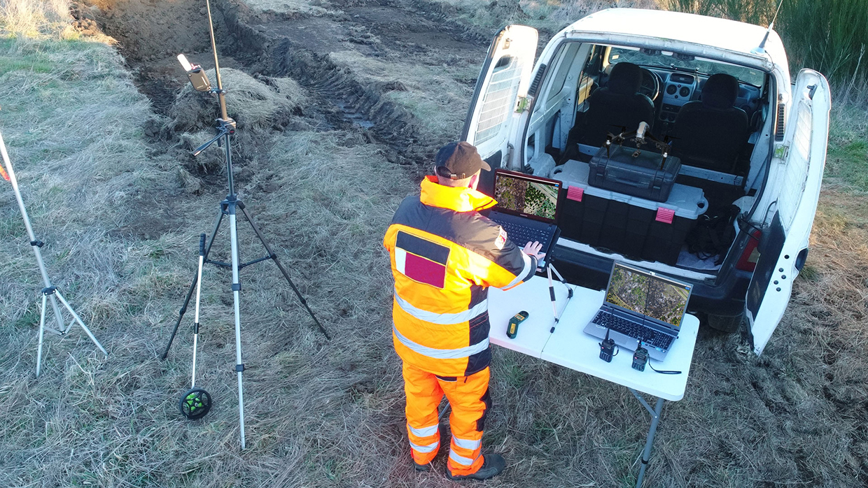
Pix4D develops end-to-end mapping solutions that transform images into survey-grade maps, 3D models, and actionable insights, using photogrammetry and machine learning. Developed for emergency response, PIX4Dreact enables the creation of 2D maps from aerial imagery within minutes and without relying on the internet or a cloud for processing. It contributes to rapid and accurate damage assessment and subsequent planning of resources. For landslide monitoring, PIX4Dmatic combines photogrammetry and LiDAR technology to process thousands of images while maintaining survey-grade accuracy, cutting the processing time in half. The result can be viewed online using PIX4Dcloud, enabling collaborative and user-friendly progress tracking and site documentation.
Technological maturity: Frontier
Contracting type: For sale
Technology level: High
Place of origin: Switzerland
Availability: Worldwide
Contact: WIPO GREEN Database
Landslide monitoring: drone capture automation, drone data processing and analysis
Skycatch
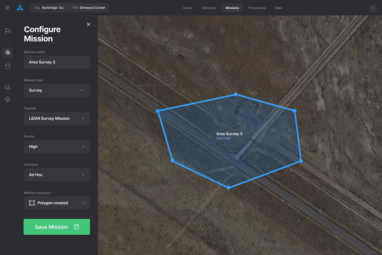
High-resolution aerial images captured by drones can be used to create detailed 3D terrain models. This data can be used for pre- and post-event comparison wherein drones can quickly map landslide areas to assess the extent of movement, erosion or deformation. Data can also be gathered from regular drone flights over landslide-prone areas to provide real-time updates on ground movement and help identify early signs of instability. Drones provide quick access to hard-to-reach areas, reducing the need for manual inspections and offering a safer, more efficient way to monitor dangerous or unstable terrain. Skycatch’s drone technology is valuable for monitoring landslides and other geohazards in real-time, providing crucial data for risk mitigation and decision-making. Skycatch works with a variety of drone hardware manufacturers, integrating its software with their drones to ensure seamless capture, data processing and analysis.
Technological maturity: Frontier
Contracting type: For sale
Technology level: High
Place of origin: United States
Availability: Worldwide
Contact: WIPO GREEN Database
Rockfall protection system: monitoring and alert system
Logistics and Supply Chain MultiTech R&D Centre (LSCM)
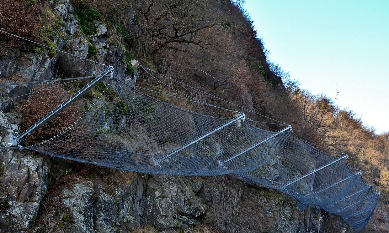
The Smart Barrier System by LSCM provides real-time monitoring of falling debris. It is a low-cost system that uses IoT sensors to first detect landslide impacts on barriers and then instantly notify authorities for follow-up actions via a web platform and mobile app. An integrated infrared camera transmits images, while an on-site warning message system (WMS) delivers landslide warnings. The system is designed to withstand extreme weather and has been used to enhance the effectiveness of remote barriers built by Hong Kong’s Civil Engineering and Development Department (CEDD).
Technological maturity: Frontier
Contracting type: For licensing
Technology level: High
Place of origin: Hong Kong, China
Availability: Hong Kong, China
Contact: WIPO GREEN Database
Rockfall protection system: monitoring and alert system
Maccaferri
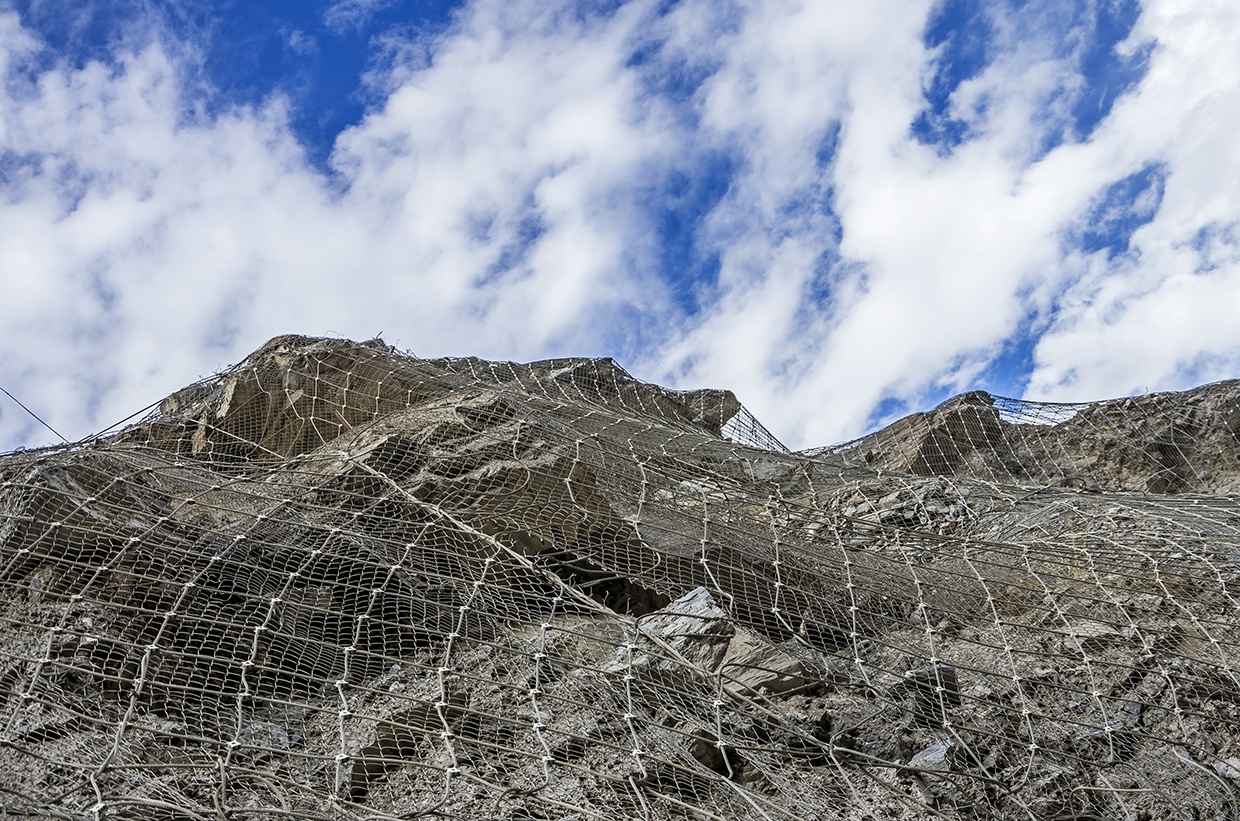
HELLOMAC is an advanced alert system designed to monitor rockfall protection systems, especially in remote areas. It detects boulder movement, stress and sagging, sending real-time notifications via mobile app, email and SMS for every section of the rock barrier. Built from durable metal alloys, its compact and robust structure is engineered to withstand harsh conditions and heavy loads. With continuous monitoring capability, it operates without external power sources, relying on batteries that last up to five years, and functions even in areas with no cell coverage.
Technological maturity: Frontier
Contracting type: For sale
Technology level: High
Place of origin: Italy
Availability: Worldwide
Contact: WIPO GREEN Database
Horizon technology solutions
Landslide research: benthic event detector (BED)
Monterey Bay Aquarium Research Institute

Underwater and terrestrial landslides share similar drivers, including gravity, soil composition and slope angle, and both involve the movement of sediments, rocks and debris. Studying underwater landslides helps researchers understand slope stability, which can inform landslide technology and engineering on land. A benthic event occurs near the ocean or lake floor, within the benthic zone, and benthic event detectors (BEDs) are designed to measure near-seafloor conditions in sediment gravity flows. Deployed by the Monterey Bay Aquarium Research Institute (MBARI), BEDs were used in the Coordinated Canyon Experiment to monitor sediment movement across 50 km of Monterey Canyon at depths of 200, 300 and 400 meters. These motion-sensing instruments rest on the seafloor, capturing data within the densest part of the sediment flow. Over 18 months, the BEDs recorded 10 sediment gravity flows, revealing that these flows can mobilize the top three meters of the seafloor. This research provided valuable insights into the dynamics of sediment flows. BED technology is still under development, but close to commercialization.
Technological maturity: Horizon
Contracting type: Under development
Technology level: High
Place of origin: United States
Availability: N/A
Contact: WIPO GREEN Database
Landslide research: meta-model and novel feature selection technique for understanding landslides
Leibniz Centre for Agricultural Landscape Research (ZALF)

Building upon six advanced machine learning models, researchers in Germany and India have developed a meta-model and framework to better understand and forecast landslides using data from West Bengal, India. The researchers converted spatialized features, such as geology, lithology, soil texture, land-use and land cover, into binary vectors, making them compatible with a machine learning algorithm. Then, an ensemble geospatial feature selection technique was employed, finding and including only the most influential causative aspects of landslides. The resulting meta-model stacks the predictions made by the six foundational models. It demonstrated superior accuracy as compared with the individual models due to its integration with the ensemble feature selection process. The findings have implications for both disaster management and land-use planning, and the methodology, which can be extended to other regions, is open access.
Technological maturity: Horizon
Contracting type: Under development/open access
Technology level: High
Place of origin: Germany/India
Availability: N/A
Contact: WIPO GREEN Databasehttps://wipogreen.wipo.int/wipogreen-database/articles/177267
Landslide monitoring: AI routing system for weather-affected unpaved roads
HeiGIT

The AI Logistic Awareness System (AILAS) is an AI-supported, weather-adaptive routing system designed for regions with unpaved roads. It is intended to assist planners in road development, maintenance, and humanitarian logistics, where uncertain road conditions can cause life-threatening delays. HeiGIT is currently developing and testing AILAS through a pilot project in Madagascar, where dashcams mounted on emergency vehicles capture street-level imagery to train a deep learning model. This imagery is combined with secondary weather and environmental data within a probabilistic framework to evaluate how weather conditions influence road passability. As the system evolves and sufficient imagery becomes available, AILAS will predict passability across the entire unpaved road network, including areas without direct image data. The predictions will be integrated into routing software or a web-based map tool, enabling reliable logistical planning based on both current and anticipated road conditions. HeiGIT is looking to scale the system to other regions and integrate extreme events, such as floodings or landslides.
Technological maturity: Horizon
Contracting type: Under development/for collaboration
Technology level: High
Place of origin: Germany
Availability: Madagascar
Contact: WIPO GREEN Databasehttps://wipogreen.wipo.int/wipogreen-database/articles/177281
Landslide monitoring: ground-penetrating radar and hyperlocal landslide nowcasting
Augsense Lab

Augsense Lab develops quantum and remote sensing technologies for subsurface and atmospheric monitoring related to landslide risk. The company is focused on developing two core systems: a ground-penetrating radar (GPR) and a GNSS-based atmospheric sensing platform. The GPR, an antenna-less radio-frequency receiver, detects low-frequency radio signals by leveraging the quantum properties of Rydberg atoms. It enables subsurface imaging through soil, rock, and debris without a conventional large antenna. Augsense Lab is currently focused on miniaturizing the system, with the aim of mounting it on drones for use in search-and-rescue operations. The company recently signed an iDEX contract with India’s Ministry of Defence to advance its work on next-generation quantum sensors and collaborates with Kerala-based mistEO on sensor miniaturization and AI-driven real-time forecasting. Meanwhile, the N-Sonde platform employs GNSS tomography and radio occultation to generate 3D refractivity profiles for hyper-local weather forecasting. This technology is part of a pilot project deployed by the Kerala State Disaster Management Authority, which will integrate N-Sonde data into a landslide prediction model developed by IIT Roorkee.
Technological maturity: Horizon
Contracting type: Under development
Technology level: High
Place of origin: India
Availability: N/A
Contact: WIPO GREEN Database