
The chapters in this section explore cutting-edge solutions, from firefighting robots and biodegradable retardants to CRISPR (clustered regularly interspaced short palixndromic repeats)-engineered crops and underground water mapping. These solutions enable us to confront the growing challenges of dry-weather extremes in a changing climate.
Wildfire
Cutting-edge technologies are transforming wildfire management. AI-powered satellites and thermal drones enable early detection, while digital twins improve fire modeling. Autonomous aircraft deploy retardants with precision, and fire-resistant materials protect homes. IoT sensors and mobile Doppler radar track fire weather. Robotics handle dangerous operations, and VR enhances training to detect, predict, and combat severe wildfires.
Technological developments and trends
Wildfires and climate change converge to form a vicious cycle: rising temperatures and shifting humidity and wind patterns fuel more severe fire seasons, while wildfires cause greenhouse gas (GHG) emissions and damage ecosystems, contributing further to global warming (
Wildfires: a growing global threat
A wildfire is any fire occurring in wildland areas, including forests, grasslands and other natural landscapes. Wildfires are different than structural fires, i.e., those occurring in buildings and urban areas (
Wildfires are rapidly becoming a global threat, profoundly impacting societies, ecosystems and economies. They cause increasing loss of life, displacement and evacuations each year. Besides carbon dioxide, wildfires also emit harmful pollutants such as black carbon, carbon monoxide, particulate matter, volatile organic compounds (VOCs) and nitrogen oxides, which pose serious health risks, including respiratory problems and higher premature mortality (
Wildfires are rapidly becoming a global threat, profoundly impacting societies, ecosystems and economies
Climate change is fueling wildfires
In recent decades, the combined effects of global warming and land-use changes have led to more frequent heatwaves, droughts and infestations of wood-eating insects. These factors have weakened ecosystems and increased wildfire risk. Heatwaves, often occurring alongside dry conditions, significantly increase the likelihood and intensity of wildfires. Heat dries out vegetation, creating perfect conditions for fires to ignite and spread. The rapid spread of many fires, in some cases driven by winds but also the rising availability of these dry fuels, often outpaces both evacuation efforts and firefighting responses, and heightens the direct threat to life and safety. Recent attribution studies found climate change made extreme events, such as Los Angeles’s catastrophic fires in January 2025, 30 percent more likely (
The combined effects of global warming and land-use changes have led to more frequent heatwaves, droughts and infestations of wood-eating insects
Burning the expanding WUI
Land-use changes have paradoxically reduced total burned area in grasslands due to agricultural expansion, even as forest fires intensify (
Nearly 12 million hectares burned globally in 2023, roughly corresponding to the land area of Bangladesh, surpassing the previous record by approximately 24 percent. Extreme wildfires in Canada were responsible for about two-thirds of the fire-related tree cover loss, contributing 27 percent of global tree cover loss (
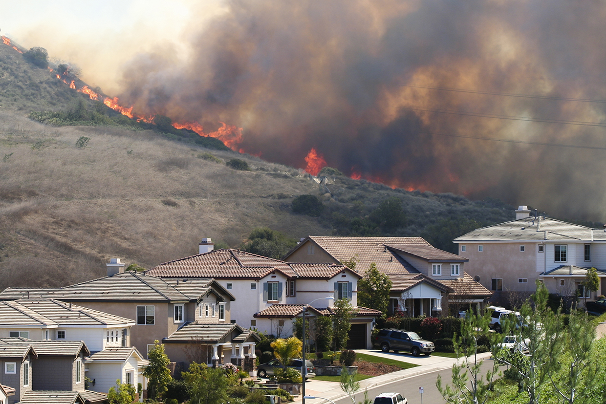
In the WUI, large flames are often mistakenly identified as the primary threat, when in fact wind-driven embers – which ignite structures far from the original fire – pose the greater danger. It is also common for houses to catch fire after the main fire has passed due to embers that have landed in vents. This turns wildfires into “urban disasters” (
Power grids and power lines – increasing fire hazards in an era of climate change
Wildfires can impact critical parts of the power grid, including transmission and distribution lines, and even power plants. Power lines, especially those that are older or in poor condition, can spark fires, and have become a significant concern in dry or windy places with high fire danger. Electricity can arc and ignite surrounding vegetation, while equipment such as transformers and electrical insulators can overheat, causing sparks. Grid failures can cause fires, and therefore wildfires and grid failures have begun to exacerbate each other (
Argentina, Australia, Chile and the western United States face these risks, and their governments are focused on hardening power grids, improving maintenance, and transitioning to using underground cables. In California, Pacific Gas and Electric (PG&E, a public utility company) equipment was linked to several fire starts, and in response the state imposed stricter regulations, including public safety power shut-offs during extreme weather events to prevent fires (
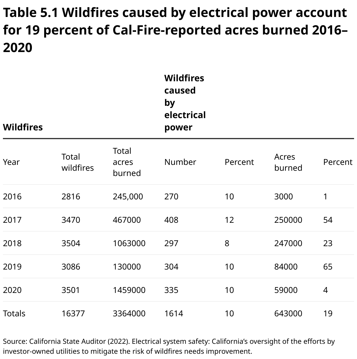
California utilities are now investing heavily in measures to reduce the risk of ignitions. However, this is a costly endeavor. Innovations such as GE Vernova’s SPEEDWORM robot, which tunnels 300 m in two hours, and Prysmian Group’s automated splicing machine (which reduces cable splicing failures that occur when two sections of cable are damaged at the point where they are spliced), aim to cut costs and boost grid safety. AI is helping analyze vegetation near lines, while Gridware’s sensors, deployed by PG&E, detect faults and fire risks in real time.
Innovation in firefighting has advanced rapidly in the last decade
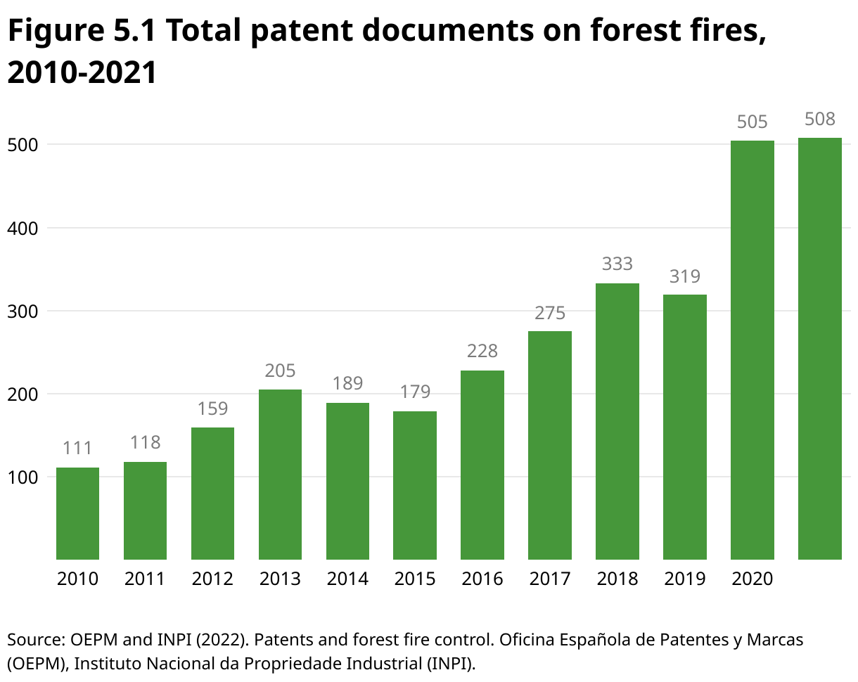
Since 2020, the number of patent applications related to forest fires has substantially increased globally. While Australia, the Russian Federation and Spain may not be the leading patent filing offices worldwide, they are notable for their contributions in the field of forest fire technologies, surpassing other offices such as Japan or the European Patent Office. Increasingly, innovations focus on the use of AI and drones in combating and managing forest fires. Portugal is actively involved in research and development projects aimed at fire prevention and detection, including aerial technologies, AI and sensors. The field of fire extinguishing technology leads in patent filings, surpassing detection and prevention or protective equipment. Post-fire restoration is the least patented sector, leaving significant opportunities for innovation (
Figure 5.1 shows total global patent documents on forest fires between 2010 and 2021, during which a total of 3,129 patent and utility model documents related to forest fires were published.
Early fire detection: catching fires before they spread
Early fire detection systems are critical for minimizing wildfire damage and danger to human life and the environment. Technologies such as satellite imaging, drones with infrared cameras, and AI-driven predictive analytics have drastically improved the speed and accuracy of detecting fires at their earliest stages. By using real-time monitoring systems, fire response teams can quickly assess new ignitions and respond with minimal delay, often before a fire spreads.
Key innovations in fire detection include real-time environmental monitoring through internet-of-things (IoT) sensors that track conditions such as temperature, humidity and smoke levels. These sensors, combined with AI algorithms, help forecast potential fire risks and send alerts to emergency managers when danger is imminent. Integrated communication networks such as mobile apps and crowdsourcing further enhance situational awareness, alerting both responders and the public about fire events as they unfold. A key example is Pano AI’s high-resolution, 360°Cameras on mountaintops and cell towers that use AI to detect smoke and fire around the clock. Other systems combine multispectral sensors with advanced geographical information system (GIS) models to monitor fire progression.
Thermal cameras provide real-time information even in darkness
Among the most critical tools in wildfire monitoring are thermal cameras. These systems provide real-time information about fire hotspots, even in low-visibility conditions such as smoke or darkness. Thermal cameras are particularly effective at detecting heat signatures, helping firefighters pinpoint smoldering areas that may reignite.
Thermal cameras are particularly effective at detecting heat signatures, helping firefighters pinpoint smoldering areas that may reignite
For instance, UC San Diego’s ALERT California program uses a network of over 1,000 wildfire-monitoring cameras paired with advanced sensors to provide real-time data on ongoing fires and other hazards (
Satellites for fire detection, mapping and post-fire recovery
Satellites have become a vital tool in wildfire monitoring and management. Equipped with advanced sensors, they provide information on fire behavior, intensity and the surrounding environment. Earth observation satellites have evolved dramatically over the last few decades via a mix of public programs and private entrepreneurs. Together, they offer a wide range of products for specialized tasks such as wildfire detection and monitoring, often at competitive prices.
MODIS (moderate resolution imaging spectroradiometer) is a sensor on the National Aeronautics and Space Administration’s (NASA) Terra and Aqua satellites that provides frequent global coverage (250 m–1 km resolution) and near real-time wildfire detection (1–3 hours), mapping fire intensity, progression, smoke plumes and atmospheric impacts. Landsat is a series of Earth-observing satellites operated by NASA and the United States (US) Geological Survey that provide high-resolution imagery (30 m) for detailed post-fire analysis, such as land-cover changes and ecosystem recovery. Sentinel satellites, operated by the European Space Agency (ESA), have high spatial resolution (up to 10 m). Sentinel-1 uses synthetic aperture radar (SAR) to detect fire damage through smoke and clouds, while Sentinel-2 provides optical imagery to assess fire effects on vegetation.
NASA’s Fire Information for Resource Management System (FIRMS) provides multiple sources of active fire detection data products and low-latency (available almost immediately) satellite imagery. FIRMS uses 15 satellites – 10 polar-orbiting and five geostationary. Polar orbiting satellites are low (<1000 km), sun-synchronous, collect one or two observations daily, and have relatively high spatial resolution. Geostationary satellite orbits are locked on a fixed point above the equator while Earth rotates, using a higher orbit (35,000 km). They collect multiple observations per hour but have lower spatial resolution. FIRMS uses 16 sensors implemented by five different space agencies: NASA, the National Oceanic and Atmospheric Administration (NOAA), ESA, the European Organisation for the Exploitation of Meteorological Satellites (EUMETSAT) and the Japan Aerospace Exploration Agency (JAXA), as no one satellite sensor meets all requirements (high spatial resolution, frequent observations, global coverage, consistency, accuracy, and reliability) (
Satellite surveillance enhanced by AI pattern recognition can quickly and accurately detect wildfires. German startup OroraTech uses mini satellites in low orbit to capture thermal images. OroraTech’s algorithms factor in vegetation and humidity, enabling firefighting agencies to prioritize resources and focus on fires with large growth potential.
SAR for wildfire detection
SAR is a remote sensing technology that also operates in conditions of cloud cover, haze and smoke, overcoming the limitations of traditional optical sensors as well as light detection and ranging (LIDAR)-based systems. SAR is further discussed in the storms and flooding chapter. Researchers at Ohio State University are experimenting with SAR for wildfire detection by integrating it into predictive models to improve early warning systems and wildfire management strategies (
Mobile Doppler radar systems – not just for storm tracking
Doppler radar systems provide critical information about atmospheric conditions that impact wildfire behavior and suppression efforts. Importantly, Doppler radar can detect and track fire-generated weather patterns. For example, wildfires sometimes generate pyrocumulonimbus clouds (fire-induced thunderstorms) that produce lightning and strong winds. Doppler can provide wind speed and direction data to help predict fire behavior, smoke plumes and ash clouds (especially if smoke reaches higher altitudes). Doppler can also be integrated with satellite imagery and ground-based sensors for better modeling of fire behavior.
Fire behavior models guide wildfire strategy worldwide
Fire behavior modeling is essential for understanding and predicting wildfire spread. Several advanced systems integrate satellite, weather and ground data to create accurate models. The Rothermel spread model (1972) remains the foundation for many systems, powering tools such as FARSITE – the US standard for tactical fire spread prediction, Canada’s Fire Behavior Prediction System, Australia’s PHOENIX RapidFire and FIRECAST, and Europe’s ELMFIRE for cross-border wildfire scenarios. These models predict fire spread by simulating how factors such as terrain, wind and fuel affect fire behavior, and are often combined with satellite data and AI-powered platforms.
Emerging models that integrate machine learning are improving our ability to predict fire risks and damage. Some models predict lightning-induced fire risk. AI-powered applications are also leveraging crowdsourcing through analysis of user-submitted photos documenting fire-prone areas. Platforms such as Google Earth Engine provide powerful geospatial analysis capabilities to track active fires and predict fire spread.
Models predict fire spread by simulating how factors such as terrain, wind and fuel affect fire behavior, and are often combined with satellite data and AI-powered platforms
When models fall short. Fire behavior models face limitations such as outdated fuel maps, computational bottlenecks, and difficulties predicting extreme fires (e.g., ember storms, crown fires) (
Digital twins for wildfires. Using AI and machine learning, digital twins) merge data from sensors located on the ground, in air, and in space to produce highly accurate global wildfire models. Unlike current models with spatial resolution of 10 km per pixel, NASA’s Wildfire Digital Twin project is developing models with a resolution of 10–30 m per pixel. These models can be generated in minutes, while current global models take hours. The NASA digital twin project aims to improve global wildfire forecasting and better understand the health impacts of wildfire smoke, particularly fine aerosols such as particulate matter 2.5.
Fighting fires from above – aerial innovations
Aerial firefighting technologies enable fire suppression in difficult-to-reach areas such as remote forests, rugged terrain, or areas with limited road access using aircraft that drop water, fire retardants, or other fire-suppressing agents such as foam, gel agents, powder or dry chemical agents onto the wildfire. They can also be used for monitoring, reconnaissance and coordination.
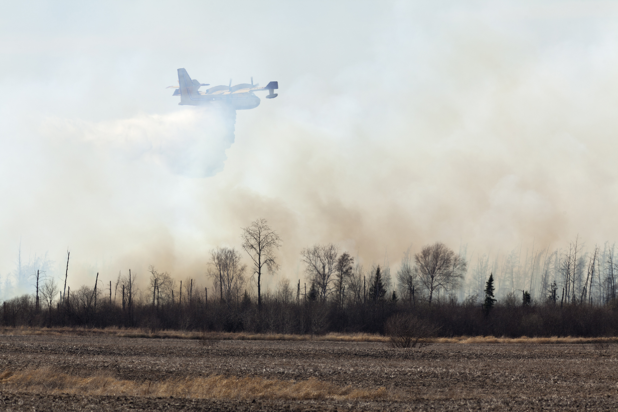
Fixed-wing aircraft are primarily used for large-scale aerial water or retardant drops. Aircraft such as the DC-10 or C-130 Hercules are modified for firefighting, carrying more than 37,000 liters of retardant and covering large areas. Fixed-wing aircraft also create firebreaks by dropping retardant ahead of the fire’s path to prevent it from spreading. Air tankers are specialized aircraft designed specifically for dropping water or fire retardant. They are large, high-performance aircraft converted for firefighting use. The Canadair CL-215 and CL-415 are iconic firefighters, now produced by De Havilland Canada with the model name DHC-515. Other examples include the Lockheed P-3 Orion, Boeing 737, and the Air Tractor AT-802. They typically carry between 3,785 and 11,350 liters of fire retardant or water.

Helicopters are more versatile than fixed-wing aircraft, primarily used for precision drops. The CH-47 Chinook or the Kaman K-MAX can carry large buckets (often referred to as “bambi buckets”) that scoop water from nearby water bodies and dump it directly on the fire. Helicopters can access areas that are difficult for fixed-wing aircraft to reach. Their flexibility allows them to make multiple precise drops, and they can hover in place to directly target hotspots.
Drones are becoming more prominent in wildfire management, equipped with thermal imaging, infrared and high-definition cameras, sensors and small fire suppression systems
UAVs or drones are becoming more prominent in wildfire management, equipped with thermal imaging, infrared and high-definition cameras, sensors and small fire suppression systems. They track fire movement, locate spot fires, assess fire behavior, coordinate firefighting efforts, and can ignite prescribed fires by dropping incendiary devices. Drones also support post-fire reforestation by dropping seeds in inaccessible areas. Advanced drones provide real-time aerial footage and live feeds. High-capacity industrial models, such as those developed by Drone Hopper, operate at night to create firebreaks or tackle small fires. Emerging systems combine manned and unmanned aircraft for autonomous nighttime firefighting with automated return after retardant drops.
Fire retardants. Water has been the most used fire suppressant due to its ability to cool, suffocate and interrupt the combustion process. Inorganic compounds such as phosphorus and nitrogen salts are used as flame retardants. However, these salts can contribute to pollution if they enter water sources. Another common retardant is foam, which enhances water’s ability to penetrate and cling to surfaces. However, foam is still a short-term solution since it relies on water, and its effect ends once the water evaporates (
Innovations are focused on improving aqueous solutions that are more effective than water, such as mixtures of surfactants (trisiloxane–polyether) and salts, along with biodegradable and low-toxicity options such as organic components, nitrification inhibitors or gelling agents (
Fighting fire with fire
“Fighting fire with fire” is a containment tactic to eliminate some or all of the fuel – such as dry grasses or woodland – ahead of a spreading fire in a targeted way. This is a frequent component of fire suppression efforts by fire crews on the ground.
Prescribed fires are carefully planned to ensure that the fire stays contained and achieves the desired ecological benefits without threatening nearby communities
Prescribed or controlled fires are conducted separately from fire suppression activities. They are intentionally ignited under carefully managed conditions to reduce the risk of uncontrolled wildfires and improve ecosystem health. These fires help clear dead vegetation, excess fuel, and underbrush, which can otherwise contribute to larger, more dangerous wildfires. They also promote the regeneration of certain plant species that rely on fire for regeneration, such as sequoia trees, longleaf and jack pines, Kowhai trees and Banksia species. Conducted by trained professionals, prescribed fires are carefully planned to ensure that the fire stays contained and achieves the desired ecological benefits without threatening nearby communities.
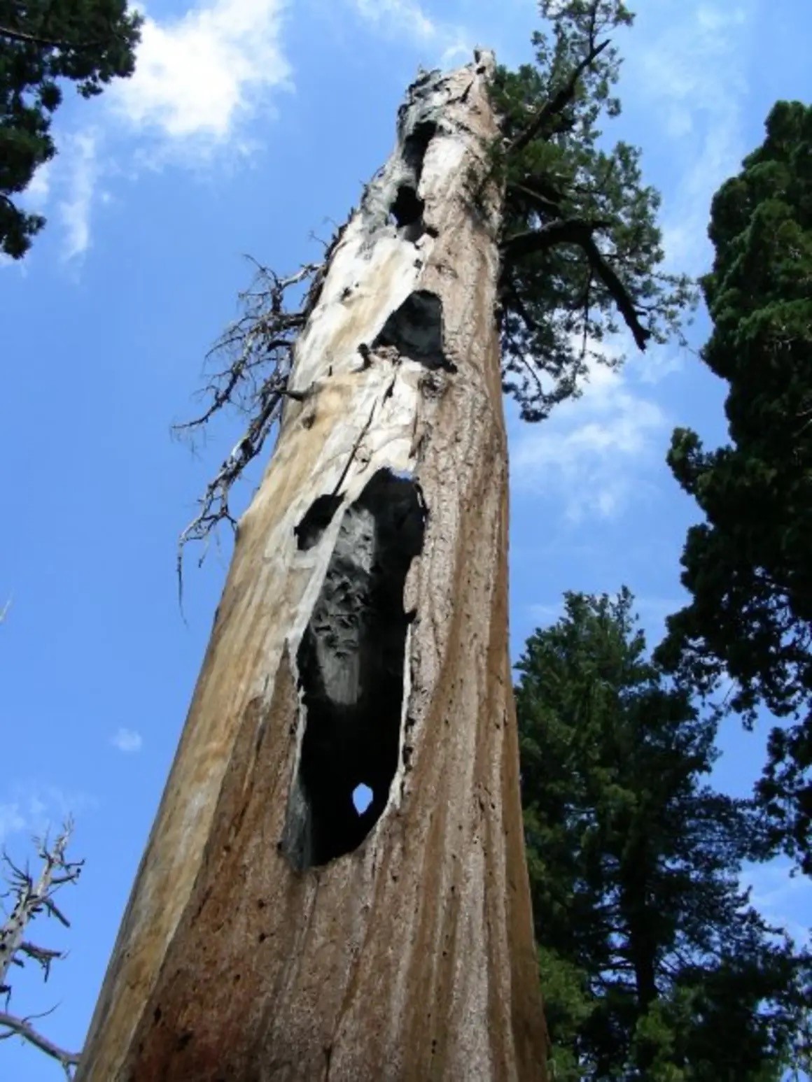
In addition to prescribed fires, mechanical thinning is another important method for reducing fuel loads. This technique involves removing trees, shrubs and underbrush to lower fire intensity, create defensible spaces and improve forest health.
Fuel breaks are cleared areas that reduce flammable vegetation to slow or stop wildfire spread. Placed strategically around communities and infrastructure, they interrupt continuous fuel, protecting against fire damage. Fuel breaks create safer zones for firefighters, improve fire control and buy response time. They are made using heavy machinery such as bulldozers or chainsaws, and also by grazing, manual clearing, controlled burns, or sometimes chemical treatments in hard-to-manage areas.
Safer, more efficient firefighting on the ground
As technology continues to evolve, innovative solutions are being developed not only to improve the effectiveness of firefighting but also to prioritize the safety and efficiency of responders.
Robots are increasingly being used in firefighting, equipped with heat-sensing cameras and fire retardants to fight fires in dangerous areas. While many are controlled remotely, advancements in AI are allowing robots to make independent firefighting decisions by using thermal and infrared cameras, either on the ground or in the air. Robots can also carry equipment and evacuate people, ensuring firefighter safety. However, their high cost remains a major barrier to widespread adoption.
Virtual reality (VR) is being explored to improve firefighter training since it helps firefighters practice various skills, such as rescue techniques, in a controlled environment. The addition of haptic technology – systems that use tactile feedback to simulate the sense of touch, involving sensations of vibration, force or motion that can be felt by users through devices such as wearable suits, gloves or handheld controllers – enhances the experience. Some companies, such as FLAIM Systems, combine VR with real-world heat simulations for more realistic training.
Firefighting gear reinvented
Innovations in personal protective equipment (PPE) and firefighting gear are revolutionizing firefighter safety and convenience, and making gear lighter, more durable, and better at protecting against extreme heat, toxic smoke and physical hazards.
Fire-resistant fabrics made with poly(p-phenylene-2,6-benzobisoxazole) (PBO) provide exceptional heat resistance and durability. Recent innovations in “smart PPE” feature wearable physiological monitoring devices that measure temperature, relative humidity and heat index, and assess safety and send alerts. Some monitor carbon monoxide, nitrogen dioxide, temperature, humidity, firefighter heart rate and smoke density. Kestrel weather devices enable firefighters to gather critical on-site weather observations. New generation fire shelters are now used across the globe. Box 5.1 provides a brief history of the wildfire shelter.
Emergency wildfire shelters are lightweight, heat-reflective tents that firefighters carry and deploy as a last resort to protect themselves if trapped by wildfire. They were first developed in 1959 by the U.S. Forest Service, with the first documented use in 1964, saving 36 lives. By 1967, shelters were mass-produced with an A-frame design using aluminum foil, fiberglass and kraft paper. In 2002, the U.S. Forest Service introduced the New Generation Fire Shelter, which incorporated woven silica and fiberglass for better protection, though it still wasn’t sufficient for extreme conditions.
The Fire Shelter Project Review began in 2014, with NASA Langley Research Center developing the Convective Heating Improvement for Emergency Fire Shelters (CHIEFS) project to test over 300 material combinations for better heat resistance without adding bulk. By 2015, full-scale tests showed promising results. However, shelters haven’t changed significantly since the 2002 design, as the CHIEFS prototype has not yet been widely adopted. Key challenges remain: no material can withstand extreme fire temperatures without becoming too bulky or fragile, and the materials are too expensive for field use. Until a breakthrough material is found, the 2002 design will likely remain in use.
Fireproofing homes – materials that withstand heat
First, creating a defensible space by clearing vegetation around the home helps reduce the risk of direct flame contact. Addressing the threat of embers and radiant heat is also essential for safeguarding homes (
Concrete is highly fire-resistant, providing strong heat protection and a thick barrier against flames. Insulated concrete forms, combining reinforced concrete with foam panels, enhance thermal insulation. Other common fire-resistant materials include bricks, clay, fire-resistant and tempered glass (including wired glass), and stucco, which offers a one-hour fire rating at 2.5 cm thickness (i.e., can resist fire for one hour at this thickness) (
Creating a defensible space by clearing vegetation around the home helps reduce the risk of direct flame contact
Stainless steel rebar and fire-resistant coatings provide durability, while glass-fiber-reinforced polymer combined with lightweight concrete is ideal for fire-prone areas due to its rust resistance, non-conductivity and high strength-to-weight ratio (
Innovation examples
NASA FireSense deploys drone technologies on a prescribed fire, Alabama, USA

A team from NASA’s Armstrong Flight Research Center demonstrated drone technology during a prescribed burn in Geneva State Forest, Alabama, as part of its FireSense project. The team installed two instruments from NASA’s Langley Research Center on the Alta X drone: a 3D wind sensor and a radiosonde to measure temperature, pressure and humidity. The collected data helped predict smoke dispersion and mixing height (the extent or depth to which smoke will be dispersed), which can be difficult to forecast for prescribed burns. The Alta X drone’s vertical flight path and autonomous data collection allowed the team to monitor fire behavior from 3,000 feet (0.91 km), while NASA Armstrong’s B200 King Air flew over actively burning fires at 6,500 feet (1.98 km) with sensors gathering data at varying altitudes during and after the fire. This mission not only aimed to showcase the technology as an improved method of monitoring the variables for a prescribed burn, but also to refine burn forecast models. In August 2024, similar drone technology was tested in Missoula, Montana, for further refinement of fire forecasting (
Watch Duty: an app for the ages
When Southern California’s wildfires erupted in January 2025, Los Angeles County’s alert system failed, prompting residents to turn to the nonprofit app Watch Duty. The app provides real-time updates on fire perimeters, wind direction, and evacuation routes. It quickly gained over 2 million new users in its first week alone, and the city’s emergency operations center began using its live map to track developments. Watch Duty works by collecting real-time data from various sources, including radio broadcasts from emergency responders and other official channels, but also inputs from citizens. It was founded in 2021 by John Mills, a tech entrepreneur, after experiencing his own difficulty finding information during a wildfire. His development team includes former firefighters, which has helped the app gain trust among both citizens and professionals. Watch Duty is now available in 22 North American states, and a paid version has been launched with additional features such as data on electric and gas lines and land ownership. In Los Angeles County, home to nearly 10 million people, Watch Duty has become a vital tool, providing faster, more reliable updates than the county’s buggy alert system. It is supported by a team of 200 volunteers and 15 employees. Next, Watch Duty plans to launch a flood-warning system (
FireAId’s AI-supported maps predict wildfires with 80 percent accuracy in Türkiye
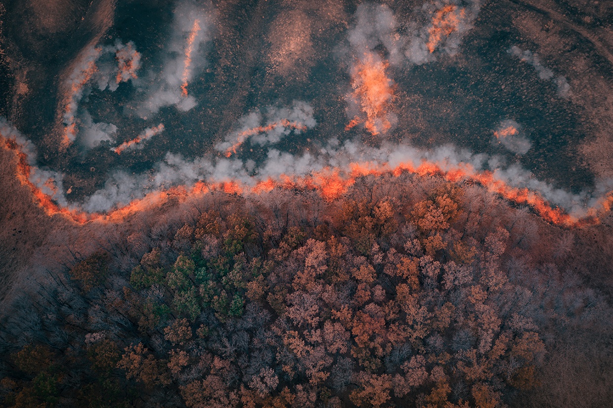
The FireAId initiative, launched in January 2022, is aimed at reducing wildfire risks in Türkiye through a global collaboration involving tech giants such as Microsoft, Google, NASA and other key organizations. In response to the rising frequency of wildfires, the World Economic Forum Centre for the Fourth Industrial Revolution, Koç Holding, the Turkish Ministry for Agriculture and Forestry, and Deloitte spearheaded this initiative, using AI to enhance wildfire prediction and prevention. The pilot program has successfully created an interactive wildfire risk map utilizing AI and machine-learning algorithms. The map integrated more than 400 variables from 14 different data sets, including historical, meteorological and geographical data, to optimize resource allocation and predict wildfire starts. After its implementation in Türkiye, the system achieved an impressive 80 percent accuracy rate in forecasting wildfires 24 hours in advance. The FireAId initiative’s success in Türkiye has inspired other countries such as Portugal and South Africa to join the effort, promoting global knowledge exchange and the integration of emerging technologies into wildfire prevention and response (
AI model helps predict and prevent peatland fires in Indonesia
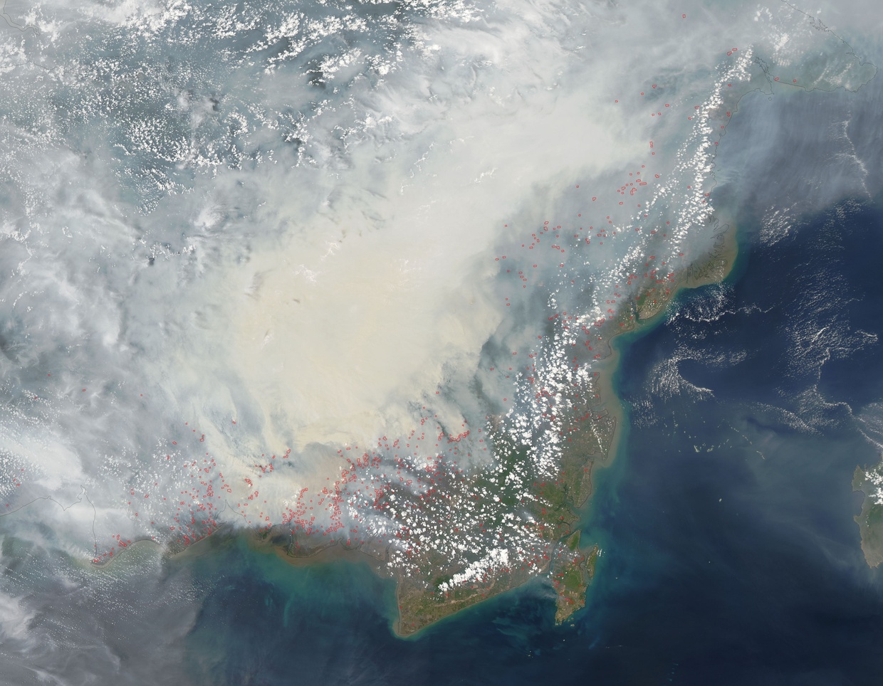
Peatlands, often drained for agriculture and urban expansion, are highly vulnerable to recurring fires, which not only endanger lives and livelihoods but also release significant carbon dioxide. Researchers from Aalto University have developed a neural network model to predict the occurrence of these fires in Central Kalimantan, Indonesia, an area severely impacted by peatland fires. The model uses measurements taken before each fire season in 2002–2019 to predict the distribution of peatland fires, and a neural network analyzes 31 variables including land cover, vegetation and drought indices to predict fire likelihood. While the model’s predictions were accurate 80–95 percent of the time, it still missed many isolated fires, showing the need for further refinement. Researchers simulated various fire management strategies and discovered that converting scrubland to swamp forests could reduce fires by 50 percent, and blocking drainage canals could reduce it by 70 percent. However, these strategies could disrupt the local economy, which relies on stable cultivation. Alternative strategies, such as establishing plantations, could reduce fire risks but often lead to forest loss and minimal local economic benefits. Ultimately, the study provides valuable insights for policymakers to balance fire prevention with economic and environmental considerations (
Proven technology solutions
Detection: multispectral sensors for fire detection and early-stage fire suppression
IQ Technologies for Earth and Space
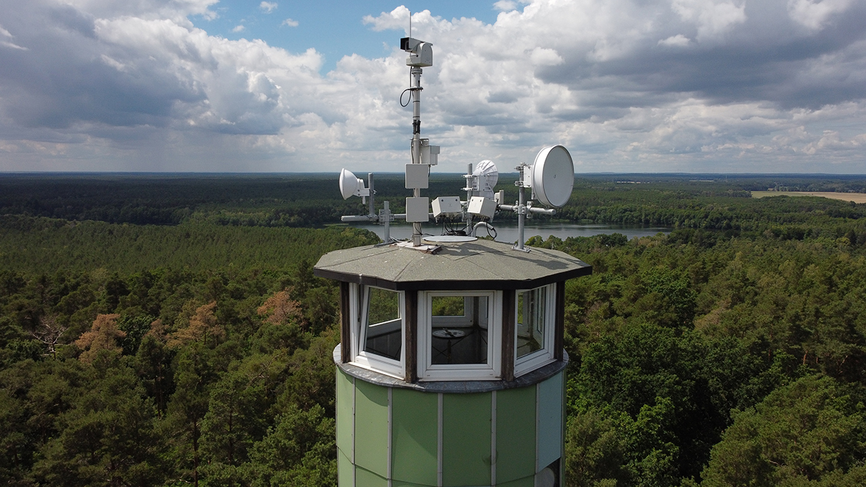
IQ FireWatch is an advanced wildfire detection system that combines multiple sensors and AI to outperform traditional methods such as closed-circuit television (CCTV), spectroscopy and thermal infrared. It uses a multispectral sensor suite, including monochrome, near-infrared, red–green–blue and optional thermal infrared sensors, to detect fires across all conditions and regions. With a large spectral range, it captures more light than standard color cameras, enhancing information. The system integrates classic feature-based detection with AI, reducing false alarms and increasing detection speed. Real-time raw data processing ensures optimal performance without loss of information, even in poor weather. Unlike compressed image formats used by conventional cameras, IQ FireWatch delivers clearer, more detailed data, enabling faster and more accurate wildfire detection.
Technological maturity: Proven
Contracting type: For sale
Technology level: High
Place of origin: Germany
Availability: Worldwide
Contact: WIPO GREEN Database
Firefighting PPE: fire-resistant fabric made with PBO
TAIWAN K.K. CORP

KANOX PBO Pioneer is an advanced, inherently fire-resistant material designed for firefighter protection. PBO is a high-performance synthetic fiber, offering heat resistance up to 650 degrees Celsius (°C) and surpassing materials such as Nomex and Kevlar. It is lightweight (PBO is twice as strong as Kevlar at the same weight) and made with a durable twill weave, offering exceptional tensile strength and tear resistance, enabling firefighters to work in extreme conditions.
Technological maturity: Proven
Contracting type: For sale
Technology level: Medium
Place of origin: Taiwan
Availability: Worldwide
Contact: WIPO GREEN Database
Firefighting equipment: weather devices for firefighters
Kestrel
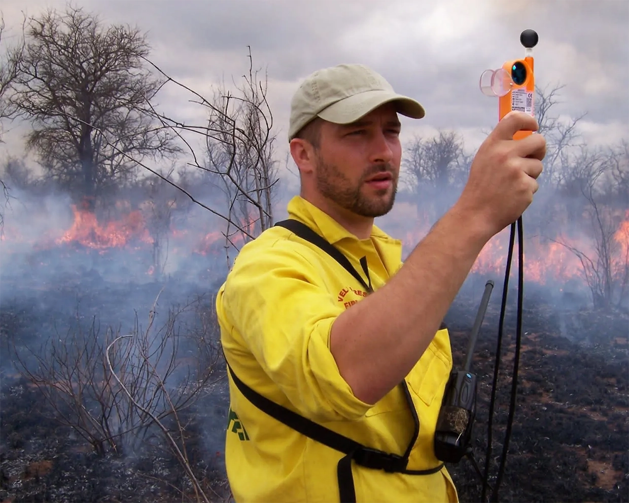
Kestrel weather meters are essential tools for firefighters, providing accurate, real-time weather data that are critical for fire behavior analysis and safety. Meters measure key variables such as wind speed, temperature, humidity and pressure, with advanced models featuring built-in calculations of probability of ignition and fine dead fuel moisture. The Kestrel PRO line includes wireless data transfer via the Kestrel LiNK app, making it easier to share real-time conditions. The meters also track environmental trends and provide instant access to critical fire behavior data, eliminating the need for paper lookup tables. Additionally, Kestrel’s Fire Weather Meters help predict heat stress and prevent injuries during training and operations by measuring wet bulb globe temperature (WBGT). The Kestrel DROP D3FW loggers allow for continuous monitoring of temperature and humidity, which is useful for prescribed burns.
Technological maturity: Proven
Contracting type: For sale
Technology level: Medium
Place of origin: United States
Availability: Worldwide
Contact: WIPO GREEN Database
Firefighting equipment: thermal camera
SeekThermal
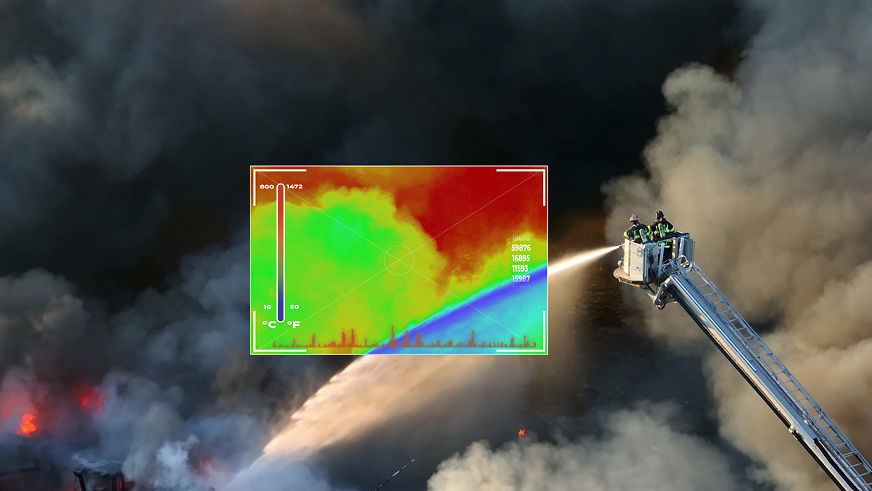
The FirePRO Series provides cost-effective, lightweight thermal cameras that enhance firefighter safety and efficiency. The FirePRO 300 features a 320 × 240 resolution sensor, while the FirePRO 200 offers 200 × 150 resolution. Both models use Seek’s Mixed Gain Mode, allowing firefighters to observe both hot and cool areas in a single image, making thermal imaging more intuitive. The cameras are useful in low-visibility conditions, detecting heat signatures through smoke, darkness or haze to locate hotspots and people, and monitor fire progression. Thermal cameras also support coordination with aerial units such as drones, improving firefighting efficiency, and can help in post-fire assessments to identify remaining heat sources and prevent reignition.
Technological maturity: Proven
Contracting type: For sale
Technology level: Medium
Place of origin: United States
Availability: Worldwide
Contact: WIPO GREEN Database
Firefighting equipment: thermal camera
Exosens

Exosens designs advanced thermal imaging systems for firefighting and critical infrastructure, including handheld and wearable (helmet/jacket-mounted) cameras. These tools provide real-time visibility in smoke-filled environments, aiding in victim rescue, hotspot detection and structural integrity assessment. Equipped with Photonis’ shutterless infrared cores, they maintain image clarity amid rapid temperature changes. While primarily tactical, their high-resolution thermal data also support wildfire research – such as prescribed burn monitoring – improving fire behavior models over time.
Technological maturity: Proven
Contracting type: For sale
Technology level: High
Place of origin: France
Availability: Worldwide
Contact: WIPO GREEN Database
Firefighting equipment: firefighting turbine
EmiControls
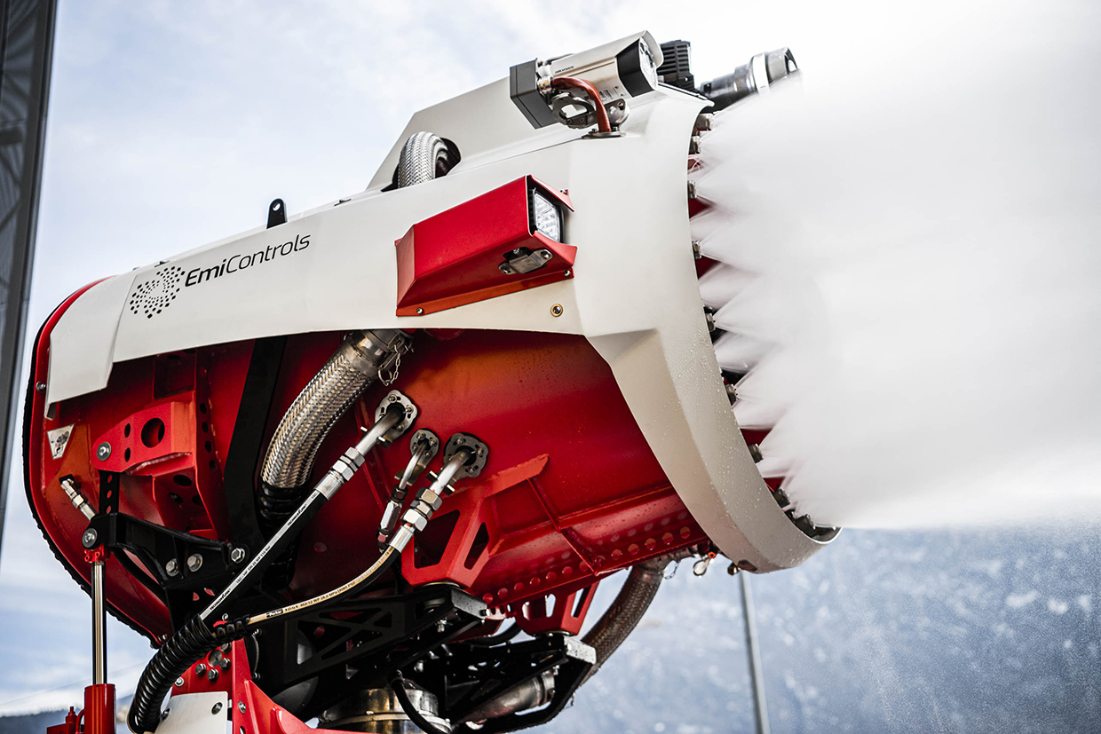
A firefighting turbine uses highly efficient fire safety technology that atomizes water, foam or a mixture of the two into fine droplets, creating a large surface area for enhanced heat absorption. This mist envelops objects and reaches hidden fire sources, making it more effective than conventional water jets. The technology offers high cooling capacity with low water consumption and can deliver water mist with pinpoint accuracy at low pressures. Available in both stationary and mobile set-ups, the turbines can integrate with any fire detection system for fully automatic deployment, or be incorporated into a firefighting robot or fire truck. They can also be remotely controlled at distances up to 300 m.
Technological maturity: Proven
Contracting type: For sale
Technology level: Medium
Place of origin: Italy
Availability: Worldwide
Contact: WIPO GREEN Database
Aerial firefighting: helicopter firefighting bucket with refill pump
Kawak Aviation Technologies
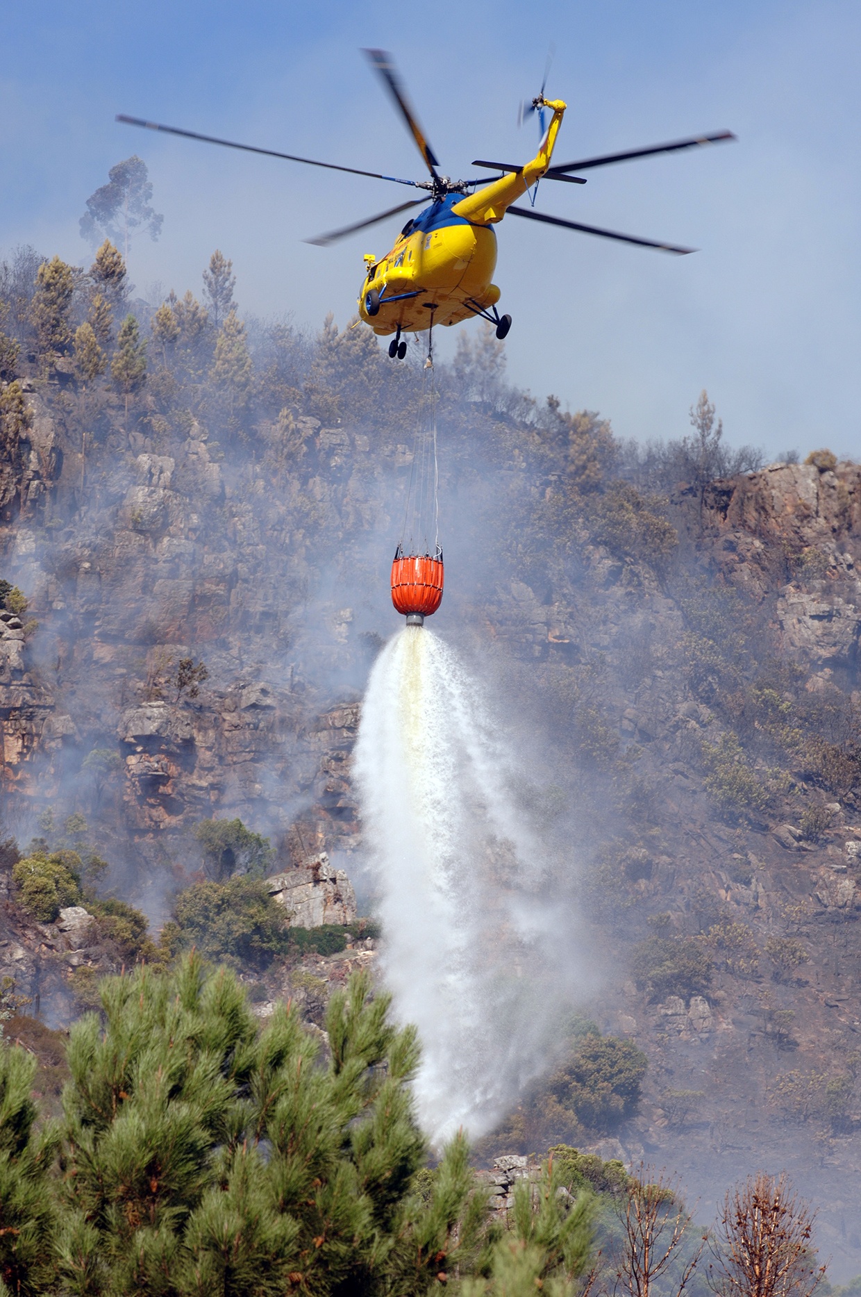
The Cascade helicopter firefighting bucket is designed for efficient aerial firefighting. The bucket’s rapid dip-fill capability reduces turnaround time. Its compact, collapsible design allows for easy storage, transport and deployment. The KJet series helicopter bucket refill system offers simplified faster filling. Designed for bottom-filling buckets, it can fill from shallow streams, ponds and tanks, reducing cycle times and increasing flexibility in dip sites. Its corrosion-resistant construction ensures durability in harsh environments with minimal maintenance.
Technological maturity: Proven
Contracting type: For sale
Technology level: Medium
Place of origin: United States
Availability: Worldwide
Contact: WIPO GREEN Database
Aerial firefighting: amphibious aircraft
Beriev Aircraft Company (part of PJSC UAC of Rostec State Corporation)

The Be-200ES is the world’s only amphibious jet aircraft. It can drop up to 270 metric tonnes in a single refueling, making it highly effective for large-scale firefighting operations. The Be-200ES has garnered international attention, with its first foreign contract in 2020 receiving positive feedback. Manufactured by the Beriev Aircraft Company (part of PJSC UAC), this aircraft has proven its effectiveness in combating fires in the Russian Federation and is expanding its presence in global markets for firefighting services.
Technological maturity: Proven
Contracting type: For sale
Technology level: Medium
Place of origin: Russian Federation
Availability: Worldwide
Contact: WIPO GREEN Database
Fire monitoring: provision of real-time data on wildfire activity
NASA

NASA’s Fire Information for Resource Management System (FIRMS) provides near real-time satellite-based global wildfire detection and monitoring tools. Originally developed in 2007 by the University of Maryland with NASA and UN support, FIRMS delivers fire location, extent and intensity data using MODIS and VIIRS satellite sensors. In 2021, NASA and the US Forest Service launched FIRMS US/Canada, a modernized platform combining data from NASA, NOAA and other agencies to support wildfire response and decision-making. New features include the static thermal anomalies mask, helping distinguish fire types. The system aids fire managers and the public by visualizing active fires and hotspots. Users can access FIRMS through its Fire Map Viewer, an interactive tool for visualizing active fire locations globally. Data downloads are available in shapefiles, keyhole markup language or text files. FIRMS also offers web map service capabilities for integrating fire data into other applications.
Technological maturity: Proven
Contracting type: Data is open access
Technology level: High
Place of origin: United States
Availability: Worldwide
Contact: WIPO GREEN Database
Fire retardant: Instant Foam for Fighting Forest Fires (I4F)
R-Fire and TFEX Engineering Ltd
Unlike traditional water or foam-based methods, I4F uses a unique foam technology that stays on the branches of trees, preventing fire from spreading. This foam can be carried in smaller volumes, reducing the risk to pilots by minimizing the need to fly directly over the fire. The technology provides up to three times the extinguishing capacity of water, with a cooling effect that can last up to 60 minutes, compared to conventional foams that last only 25 minutes. I4F foam is also more cost-effective than long-term retardants, reduces water waste, lowers carbon dioxide (CO2) emissions, protects flora and fauna, and helps safeguard human lives in WUIs.
Technological maturity: Proven
Contracting type: For sale
Technology level: Medium
Place of origin: Hungary
Availability: Worldwide
Contact: WIPO GREEN Database
Fire-resistant building materials: bio-based composite
Duplicor

Duplicor® resin is a 100 percent bio-based composite material made from crop residues. When combined with natural fibers such as flax, jute or hemp, it forms an eco-friendly, fire-resistant material. Duplicor® is extremely fire-resistant, achieving Euro fire class B without requiring additional fire retardants. It emits minimal smoke and does not release hazardous particles. Beyond fire resistance, it offers a sustainable alternative for the construction industry, significantly reducing CO2 emissions compared to traditional materials.
Technological maturity: Proven
Contracting type: For sale
Technology level: Medium
Place of origin: Kingdom of the Netherlands
Availability: Europe
Contact: WIPO GREEN Database
Frontier technology solutions
Power-line fire mitigation: AI-driven platform for vegetation management
Overstory
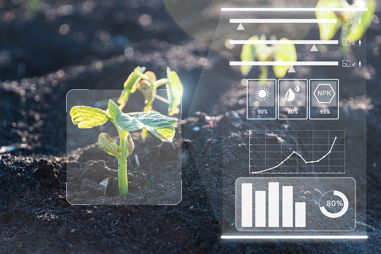
Overstory’s AI-driven platform helps utility companies manage vegetation near power lines to reduce wildfire risks. By processing satellite images, it extracts detailed data on tree and shrub health, height and species. The system then generates risk assessments to pinpoint which vegetation poses a fire threat, recommending pruning or removal for mitigation. With actionable insights and optimization guidelines, Overstory enables utilities to proactively manage fire hazards, integrating smoothly with their existing systems for effective, real-time risk management.
Technological maturity: Frontier
Contracting type: For sale
Technology level: High
Place of origin: Germany
Availability: Brazil, Canada, Europe, United States
Contact: WIPO GREEN Database
Power line fire mitigation: sensor system for real-time grid monitoring
Gridware
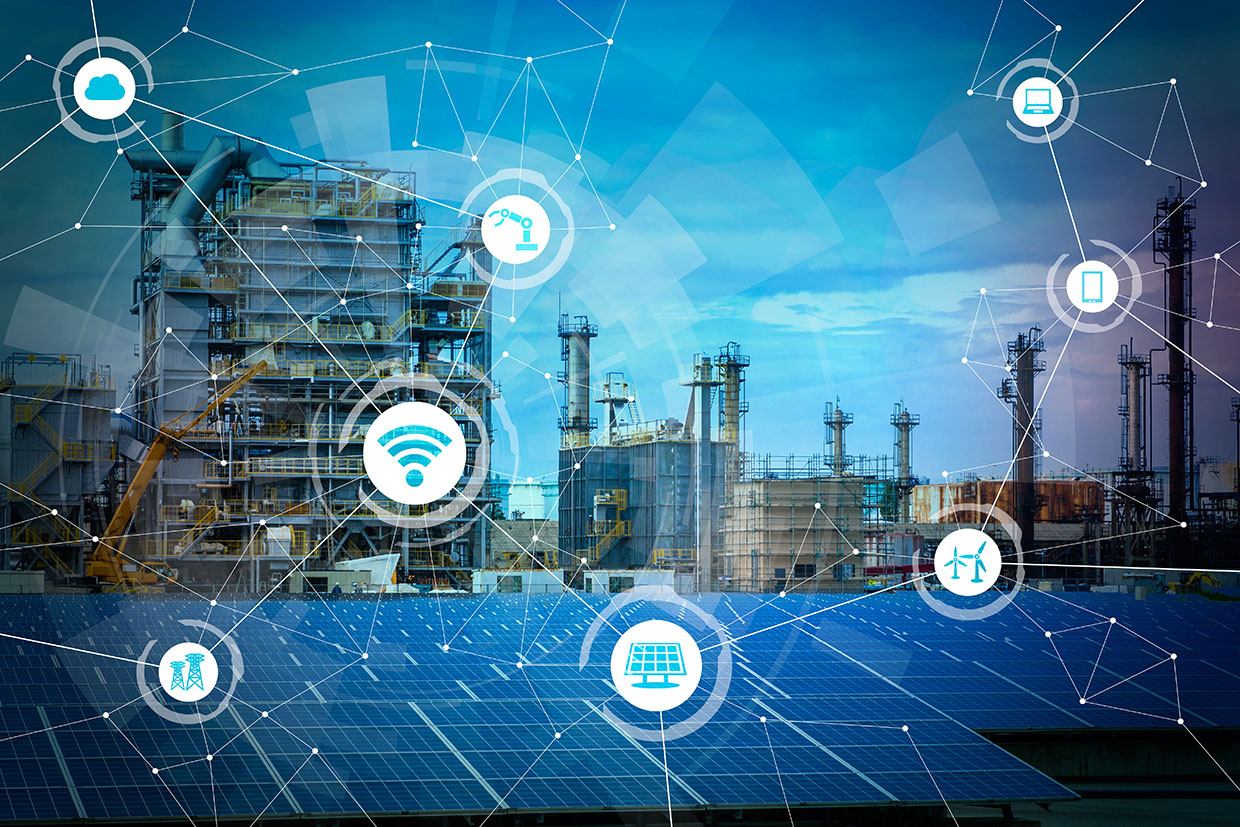
Gridware uses advanced sensors placed on power poles to continuously monitor grid infrastructure, alerting operators in real time to hazards and faults. The sensors detect wildfire threats, such as equipment failures, downed lines, or contact with vegetation, enabling rapid response and repairs. Since the devices run on solar power, they remain operational during power outages. In 2023, the Californian power utility company PG&E deployed 1,875 sensors, and planned to expand to 10,000 in 2024, monitoring thousands of kilometers of power lines.
Technological maturity: Frontier
Contracting type: For sale
Technology level: High
Place of origin: United States
Availability: United States
Contact: WIPO GREEN Database
Detection: intelligent platform for fire detection
Pano AI

Pano Rapid Detect is an advanced platform designed to help fire professionals detect and respond to wildfires faster and more accurately. Utilizing 360° ultra-high-definition cameras and AI-driven analysis, Pano stations are deployed on high vantage points to scan landscapes and spot wildfire activity within a 16 km radius. The platform integrates satellite data, emergency alerts and communication tools, ensuring real-time information sharing with responders, while using deep learning to automatically detect, verify and classify fire events in real time. Once a fire is detected, Pano sends rapid alerts to fire-monitoring teams.
Technological maturity: Frontier
Contracting type: For sale
Technology level: High
Place of origin: United States
Availability: Worldwide
Contact: WIPO GREEN Database
Fire modeling: satellite-based mapping and monitoring of fire damage
OroraTech
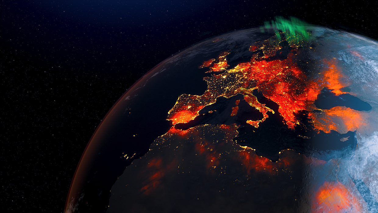
The Burnt Area solution provides burnt area mapping and fire progression tracking using satellite data. It provides detailed insights into fire damage globally, supporting decision-making and recovery efforts in the aftermath of wildfires. Its high-resolution fire data have 20 m precision and can provide fire damage data within 2–3 days of a fire event. The system maps burnt areas and assesses damage severity more quickly than aerial mapping. It can provide continuous updates on fire movement and impacts and is scalable and adaptable for both small fires and large-scale fire events.
Technological maturity: Frontier
Contracting type: For sale
Technology level: High
Place of origin: Germany
Availability: Worldwide
Contact: WIPO GREEN Database
Fire retardant: non-toxic fire retardant and pump proportioner
FireRein
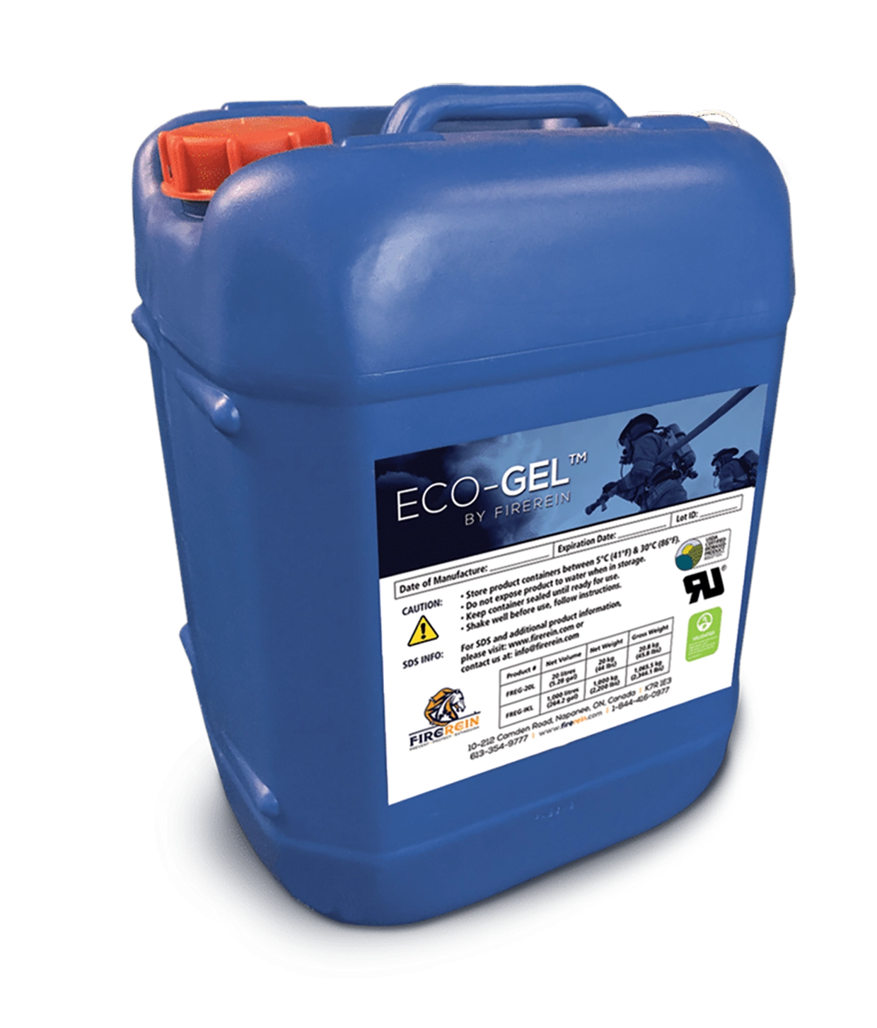
Eco-Gel™ is a non-toxic and biodegradable plant-based firefighting water additive. It is the first firefighting gel to be Underwriters Laboratories listed for both Class A (ordinary combustibles – wood, paper, vegetation) and Class B (flammable liquids – gasoline, oil, chemicals) fires, making it effective for a wide range of fire scenarios. When mixed with water, Eco-Gel™ creates a hydrogel that clings to surfaces – vertical, horizontal, and overhead – providing protection for firefighters and preventing fire re-ignition. Its food-grade ingredients make it exceptionally safe, and it has been certified by the United States Department of Agriculture’s BioPreferred Program. FireRein also offers the FireRein TPP™ (Through Pump Proportioner) system, which enables users to introduce Eco-Gel™ into a firefighting water stream, adjusting its viscosity as needed. The product has a shelf life of five years.
Technological maturity: Frontier
Contracting type: For sale
Technology level: Medium
Place of origin: Canada
Availability: North America (limited availability in Australia, EU, Middle East)
Contact: WIPO GREEN Database
Firefighting UAV: drone for nocturnal operations
Drone Hopper
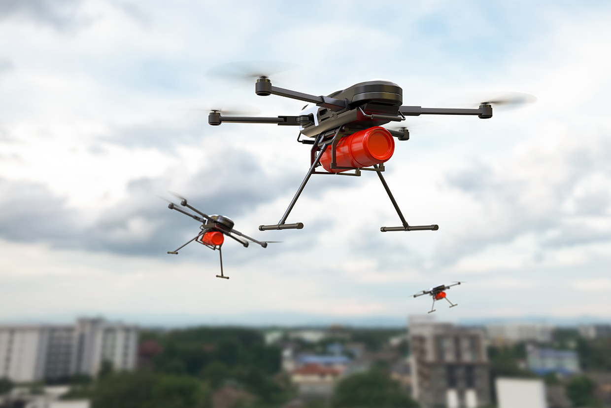
Drone Hopper specializes in manufacturing high-load capacity industrial drones with thermal engines. Their product line includes both heavy-duty drones with high autonomy and lighter drones with industrial features. The company’s WILD HOPPER project focuses on creating drones specifically for firefighting applications, aiming to complement existing aerial resources. Drone Hopper’s drones are particularly useful in areas where conventional piloted aircrafts cannot operate. The drones are employed in indirect attack methods (e.g., creating firebreaks) and direct interventions to combat smaller fires or provide quick response.
Technological maturity: Frontier
Contracting type: For sale
Technology level: High
Place of origin: Spain
Availability: Spain
Contact: WIPO GREEN Database
Firefighting robot: forest mulcher
Vallfirest
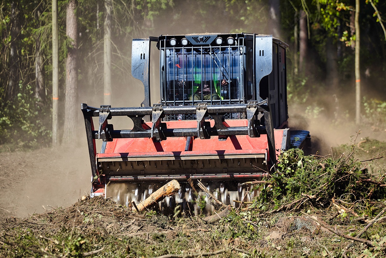
Dronster is a remote-controlled emergency robot designed to improve safety and efficiency in wildland firefighting, structural fires and rescue operations. The Dronster can operate multiple attachments such as trenchers, snowplows and extinguishing monitors, allowing it to adapt to various emergency scenarios. Remotely controlled from up to 150 m, it enables firefighters to handle dangerous tasks from a safe distance. It can navigate difficult terrain, including slopes of over 30° and dense vegetation. Weighing about 850 kg, the Dronster can be transported by pickup trucks, vans, or helicopters, ensuring quick deployment to emergency sites.
Technological maturity: Frontier
Contracting type: For sale
Technology level: High
Place of origin: Spain
Availability: Worldwide
Contact: WIPO GREEN Database
Firefighting equipment: smart personal protective equipment
SlateSafety
The BEACON V2 is an advanced environmental monitoring system designed to measure real-time temperature, relative humidity, heat index and effective WBGT. It serves as a hyperlocal monitor for heat tracking and can also be integrated with the BAND V2 wearable device, creating a comprehensive safety system for teams in physically demanding roles. The BAND V2 is a safety wearable that continuously monitors physiological data and sends real-time alerts to ensure worker safety. The data collected from both devices are processed and stored securely in the cloud. Additionally, BEACON V2 provides coarse real-time location system capabilities.
Technological maturity: Frontier
Contracting type: For sale
Technology level: High
Place of origin: United States
Availability: Worldwide
Contact: WIPO GREEN Database
Fire prevention: user-driven app for assessing potential bushfire fuel loads
NOBURN
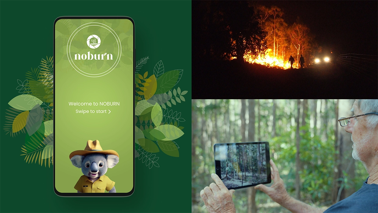
The NOBURN app, developed by researchers at the Universities of Adelaide and the Sunshine Coast, uses AI and computer vision to analyze user-submitted photos of fire-prone areas. It assesses bushfire fuel loads and predicts potential bushfire severity and spread. The app aims to raise awareness about the role AI can play in preventing devastating bushfire losses and in providing situational awareness for bushfire commanders. By enabling thousands of citizens to contribute data through photos, the app facilitates a broader approach to bushfire prevention. The app has the potential to expand into real-time resource deployment tracking and even AI-assisted communication with firefighters.
Technological maturity: Frontier
Contracting type: Open access
Technology level: High
Place of origin: Australia
Availability: Australia
Contact: WIPO GREEN Database
Fire-resistant building materials: fire protection coating
Flame Security International

FIRECOAT Interior is a water-based, fire-resistant coating tested to Bushfire Attack Level (BAL-29) under Australian Standard AS 3959. Designed for homes and commercial interiors, it reacts to heat by forming an insulating char layer, delaying ignition and flame spread while reducing smoke. Ideal for ceilings, kitchens and areas with electrical equipment, it provides critical evacuation time. Applied via brush, roller or spray (2–3 coats required), it meets stringent safety standards for radiant heat and ember exposure. Exterior and structural fireproofing require FIRECOAT’s specialized variants.
Technological maturity: Frontier
Contracting type: For sale
Technology level: High
Place of origin: Australia
Availability: Australia, Sweden, United States
Contact: WIPO GREEN Database
Fire-resistant building materials: bio-based alternative for ecological construction
Nordtreat

NORFLAM® is a flame-retardant treatment for wood-based products offering fire protection and unlimited color selections in one. Applied either industrially or manually on-site, NORFLAM® provides fire protection ranging from Euroclass standards B-s1, d0, to D-s1, d0, making it suitable for various applications in construction. The solution is commonly used for materials such as solid wood cladding, thermally modified timber, interior paneling and wood-based panels. Over 95 percent of the raw materials used in NORFLAM® are non-fossil, and more than 40 percent are bio-based. This helps the product meet certifications such as LEED, M1 and A+ emission ratings.
Technological maturity: Frontier
Contracting type: For sale
Technology level: Medium
Place of origin: Finland
Availability: Europe
Contact: WIPO GREEN Database
VR: firefighter training system
FLAIM
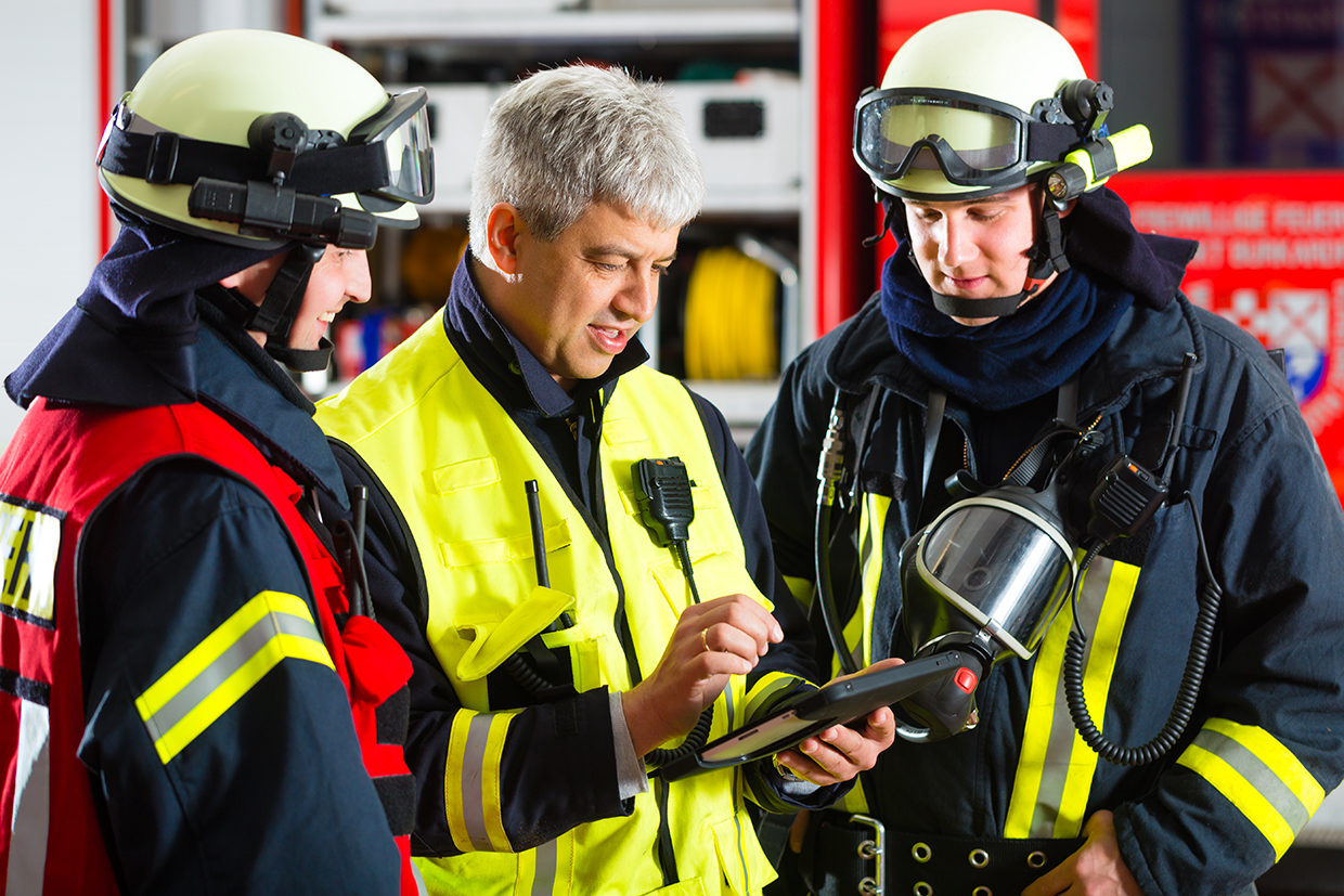
FLAIM technology provides advanced VR firefighter training solutions, designed to deliver immersive, high-fidelity fire scenarios that simulate real-world emergencies. Their platform includes FLAIM Trainer, which combines VR fire simulations with firefighting equipment to create realistic training experiences. This helps firefighters develop crucial skills, such as situational awareness and quick decision-making, all while maintaining safety during training. FLAIM also integrates with Capture, a web-based learning and analytics platform that securely tracks and reports on performance and competency during training sessions. The platform records key data, which are then used to evaluate and improve training strategies and outcomes.
Technological maturity: Frontier
Contracting type: For sale
Technology level: High
Place of origin: Australia
Availability: Worldwide
Contact: WIPO GREEN Database
Horizon technology solutions
Place-of-origin detection and response: autonomous drones for ultra-early wildfire response
Dryad
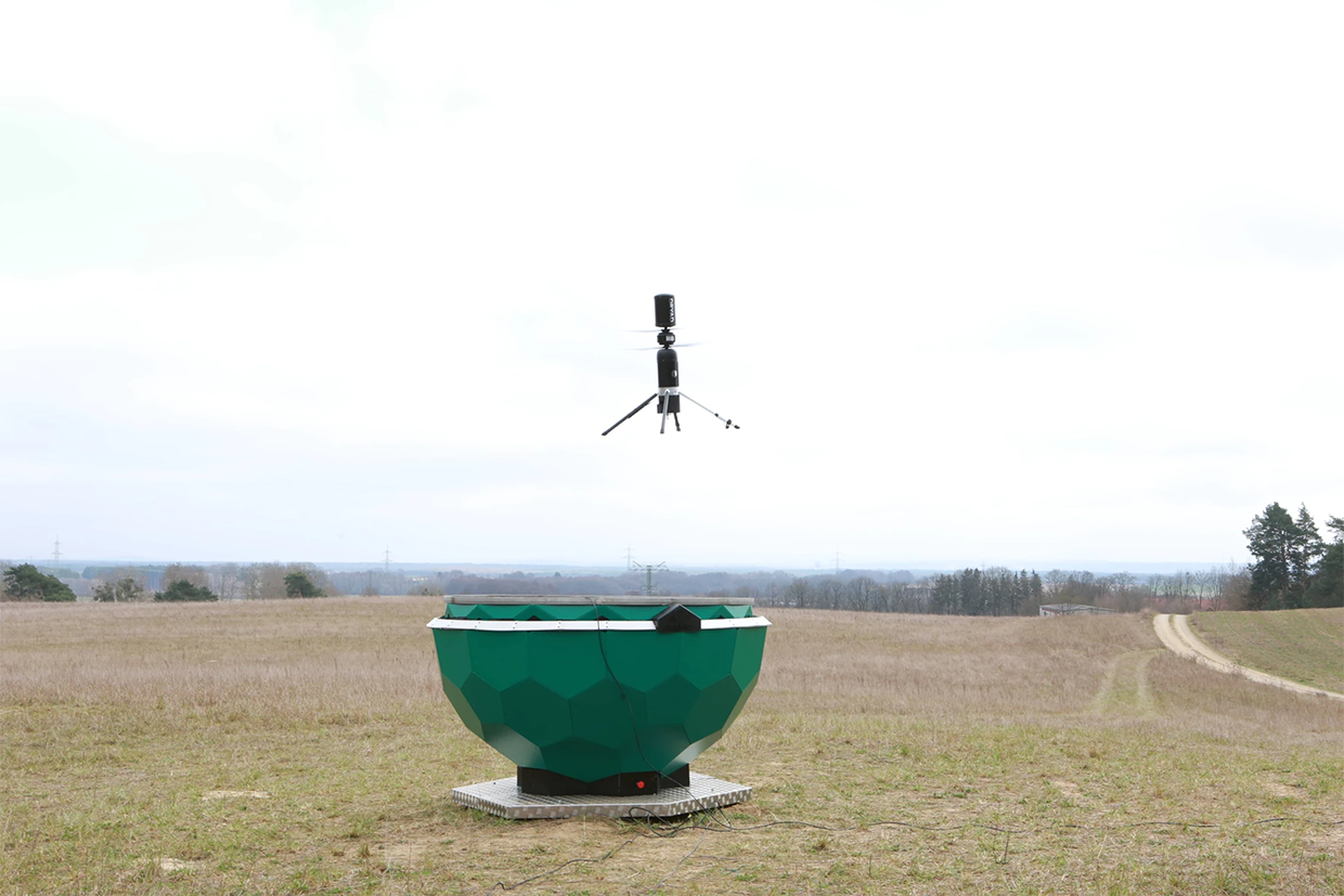
The Silvaguard drone system integrates with Dryad’s Silvanet ultra-early fire detection system, using solar-powered gas sensors to detect wildfires at the smoldering stage. Upon detection, Silvaguard drones autonomously deploy, providing real-time aerial observation and pinpointing fire location and size. In the future, Silvaguard drones will use suppression technologies, such as acoustic waves (a novel suppression method whereby high-intensity sound waves vibrate air molecules and separate oxygen from fuel vapors), to extinguish fires in their early stages. As of 2025, the system is a fully functional prototype and is undergoing testing to enhance suppression capabilities and refine drone autonomy. The Silvaguard system represents a significant step toward automated, real-time wildfire detection and suppression, with the long-term vision of deploying fleets of drones for widespread wildfire management.
Technological maturity: Horizon
Contracting type: Under development
Technology level: High
Place of origin: Germany
Availability: N/A
Contact: WIPO GREEN Database
Detection: CubeSat AI model
University of South Australia (UniSA)

Researchers from UniSA, Swinburne University of Technology and Geoscience Australia have developed an energy-efficient AI model for detecting bushfire smoke using onboard image processing in cube satellites (standardized and miniaturized, lightweight, low-cost satellites). Part of the broader Kanyini CubeSat mission managed by SmartSat CRC, the project addresses the challenge of processing large volumes of data within the strict power, storage and transmission capabilities of small satellites. By processing imagery in orbit rather than after downlink, the system reduces data volumes by 84 percent while consuming 69 percent less energy. In one simulated event, it took 14 minutes for the onboard AI to detect smoke and send the data to the ground station. This approach enables fire smoke detection at rates up to 500 times faster than that of conventional on-ground processing. Once operational, the technology could be commercialized and used in a CubeSat constellation.
Technological maturity: Horizon
Contracting type: Under development
Technology level: High
Place of origin: Australia
Availability: N/A
Contact: WIPO GREEN Database
Detection and response: autonomous vase/vessel fire protection system
Hephaesnus

The Sallus® Guard is an autonomous fire protection system designed to detect and suppress fires around properties. The system independently identifies flames from up to 10 m away and releases a retardant to cover approximately 30 m². It operates without electrical, water or other external connections. Beyond fire protection, the Sallus® Guard serves as a decorative element, featuring optional enhancements such as CCTV systems and device-charging capabilities.
Technological maturity: Horizon
Contracting type: Available for pre-order
Technology level: High
Place of origin: Portugal
Availability: N/A
Contact: WIPO GREEN Database
Aerial firefighting: autonomous aircraft for wildfire response
Rain
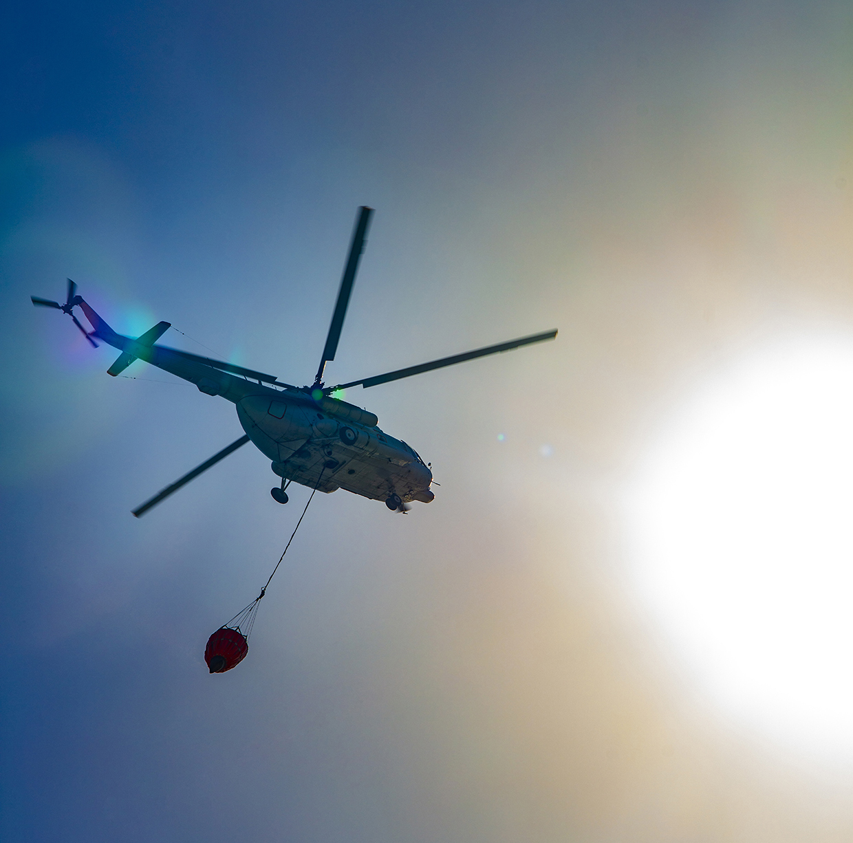
Rain has developed a wildfire mission autonomy system that enables uncrewed and optionally piloted aircraft to autonomously detect and suppress wildfires. The system integrates onboard sensors, infrared and visual cameras, global positioning system (GPS) and inertial navigation systems with software for wildfire mission management, path planning, fire perception, suppression strategy and suppressant targeting. It enables autonomous mapping of fire size and behavior, and uses the data to design a suppression strategy. A handheld control interface, the Rain tablet, allows operators to command tasks such as area searches, water drops, and bucket refills. In partnership with Sikorsky, Rain demonstrated the technology in California, where a tablet-controlled Black Hawk helicopter performed autonomous fire suppression, including drops in high winds and real-time path adjustments.
Technological maturity: Horizon
Contracting type: Under development
Technology level: High
Place of origin: United States
Availability: N/A
Contact: WIPO GREEN Database
Fire modeling: AI-enabled lightning strike prediction model
Bar-Ilan University
Researchers from Bar-Ilan University are developing a machine-learning model that predicts lightning-induced wildfire risk globally. Unlike previous models, it uses seven years of high-resolution satellite data, considering factors such as lightning strikes, vegetation, weather and topography. The AI model was tested on 2021 wildfire data, achieving over 90 percent accuracy. Testing also revealed that lightning-induced wildfires behave differently from those caused by humans, highlighting the need for specialized prediction models. The model shows that climate change is increasing lightning fire risks, driven by more frequent extreme weather. While not yet implemented in real-time forecasting systems, this AI model demonstrates how big data and AI can improve wildfire management.
Technological maturity: Horizon
Contracting type: Under development
Technology level: High
Place of origin: Israel
Availability: N/A
Contact: WIPO GREEN Database
Drought
As droughts grow longer and more severe, a wave of innovation is reshaping how we manage water. AI-powered forecasting and satellite-based monitoring to smart irrigation and atmospheric water harvesters are enabling more efficient use. Emerging solutions like fog nets, hydrogel-enhanced soils, wastewater recycling, desalination, and leak detection sensors are helping communities capture and conserve water in arid environments.
Technological developments and trends
Droughts are prolonged dry periods in the natural climate cycle caused by a lack of rainfall. Although they are historically part of the natural climate cycle, human-driven climate change is now making them longer, more severe and less predictable (
Droughts are not just disasters – they are slow-burning crises that destabilize food, energy and health systems. This means they disrupt the water–energy–food nexus, a framework that highlights the critical interdependence between these sectors, showing how pressure on one (such as water) can ripple across the others (such as food production and energy supply) (
As droughts typically unfold over extended periods, much of the discussion and solutions in this section focus on prevention and preparedness rather than immediate emergency response. In acute drought situations, emergency measures typically involve transporting water to affected areas and populations, conserving the sparse water resources available, or organizing evacuations. Prevention measures to optimize water use, along with surveying, recycling and managing water resources efficiently, are numerous and increasingly critical in a “new normal” marked by more frequent and severe climate-induced droughts.
Droughts are not just disasters – they are slow-burning crises that destabilize food, energy and health systems
Economically, one study estimated that up to 5 percent of global GDP will be exposed to severe droughts over the next 50 years, with losses rising from USD 4.7 billion in the 2030s to USD 10 billion by the 2050s (in 2005 prices). Despite these growing risks, droughts have received less attention than other disasters, and response efforts remain insufficient.
Sanitation and hygiene worsened by drought
As of 2022, 2.2 billion people lacked safe drinking water, while 3.5 billion lacked safe sanitation. Drought reduces water availability, hindering safe water management, especially in areas affected by conflict or unequal access. People may resort to unsafe water, increasing the risk of waterborne diseases. Limited water can also lead to poor hygiene, contributing to illnesses such as diarrhea and skin infections (
Droughts also lower groundwater levels and strain water infrastructure, increasing reliance on untreated sources that may contain naturally occurring toxins such as arsenic (
To address these risks, portable testing labs and rapid detection methods (e.g., membrane filtration) can help identify contamination, Purification tools such as solar-powered filters, ultraviolet (UV) disinfection with advanced oxidation processes (AOP) and reverse osmosis can treat high-risk water. AOP, for instance, combines UV light and oxidants (usually hydrogen peroxide) to form powerful hydroxyl radicals that break down difficult-to-remove contaminants, such as micropollutants, that are often resistant to traditional water treatment methods.
Drought conditions also further degrade water quality by concentrating pollutants such as heavy metals and overwhelming wastewater systems. They may also shift the distribution of disease vectors such as mosquitoes, raising the risk of disease infections such as Malaria, West Nile and Dengue virus, as they gather around limited or stored water sources often more prevalent in populated areas during water stress situations.
From sky to soil – predicting and monitoring drought with data
As droughts become more frequent and severe, early warning and monitoring systems are increasingly vital. Key drought indices, such as the Standardized Precipitation Index, which tracks precipitation deficits, and the Standardized Evapotranspiration Precipitation Index, which accounts for both precipitation and evapotranspiration, help assess drought risk (
Feeding the world in a drier future
Agriculture was the largest consumer of freshwater globally in 2024, accounting for approximately 70 percent of all water withdrawals (
Among the four main global crops – wheat, maize, rice, and soybeans – wheat is the most sensitive to drought, followed by soybean and maize
The impact of drought on crop yields is complex. Drought degrades soils by reducing moisture levels, diminishing fertility, causing erosion and lowering soil quality. Reduced water availability often leads to smaller, lower-quality harvests. Crop type and variety, location, irrigation, plant phenology, and drought severity and evolution all influence how agricultural systems respond to water stress (
Among the four main global crops – wheat, maize, rice, and soybeans – wheat is the most sensitive to drought, followed by soybean and maize. Rice appears to have been less affected by changes in drought severity over the past decade (
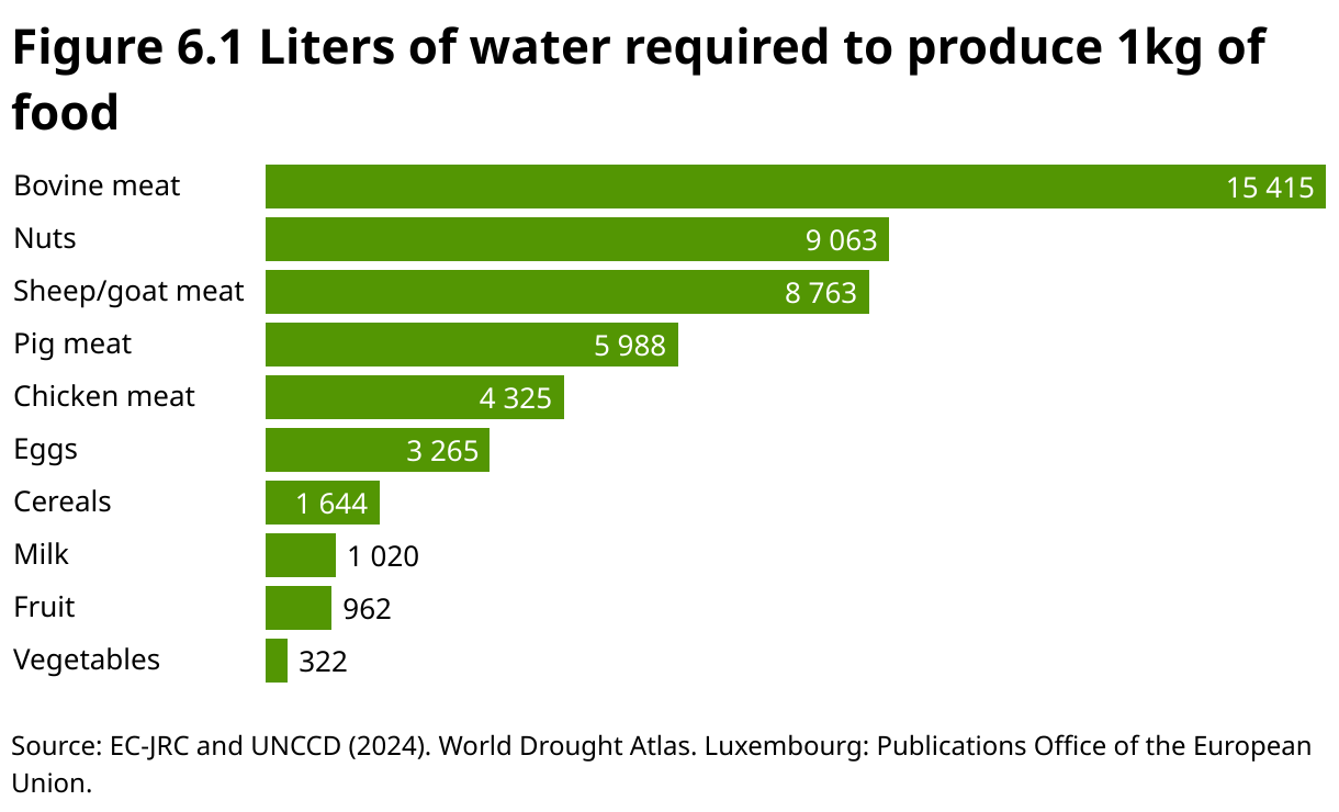
Water use varies dramatically with different food products. Figure 6.1 shows the water required to produce 1 kg of various agricultural products.
Genetic innovation in crops: CRISPR/Cas9 and GM
Drought tolerance is a complex trait influenced by multiple genes, making it one of the most difficult characteristics to study and categorize (
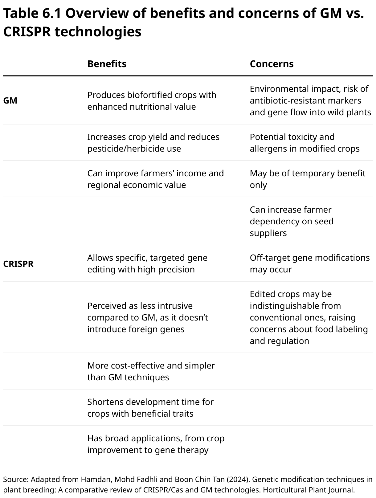
The development of recombinant technology in the late 20th century led to the development of genetically modified (GM) crops, offering potential benefits in nutrition, yield and stress resilience. Despite ongoing controversy, GM crops are now grown on 190 million hectares by 17 million farmers across 29 countries, marking a 112-fold increase since 1996 (
Gene editing (via CRISPR/CRISPR-associated protein 9 (Cas9)) allows precise modifications to specific genes related to drought tolerance, such as those controlling water use efficiency and stomatal regulation (
The CRISPR/Cas9 system has thus gained attention for its ability to edit plant genomes by creating precise DNA breaks. Unlike GM, CRISPR doesn’t always require foreign DNA insertion, and thus presents a more efficient and accurate method than traditional breeding. Supporters view CRISPR/Cas9 as a powerful tool for developing crops with better resilience, higher yields and improved nutrition. It has been used to enhance nearly 120 crops (
Marker-assisted selection and genome-wide association studies help breeders identify plants with drought-tolerant traits, such as deep roots and efficient water use, speeding up breeding cycles by selecting for these traits without waiting for plants to express them in the field (
Techniques such as somaclonal variation and tissue culture can discover new drought-tolerant plants or rapidly propagate those with desirable traits (
Specific crops leading the fight against drought
The global drought-resistant crops market is expected to grow at a 6.9 percent compound annual growth rate until 2032. Key segments such as oilseeds, pulses and conventional breeding methods will play a significant role in fostering market growth, with Europe slated to lead in research and development efforts (
Certain crops help farmers mitigate risks from changing weather patterns. Chilies and millets are drought-resistant alternatives to traditional corn farming. Chilies thrive in harsh conditions, while millet is praised for its resilience in dry, poor soils (
HB4 wheat, a genetically modified wheat variety developed by Bioceres, an Argentinian crop productivity solutions company, is designed to address water shortages. By incorporating the HaHB4 gene from sunflowers, it helps plants survive dry spells through the production of antioxidants and osmoprotectants (small molecules that help plants retain water and protect cells during drought). Approved in Argentina in 2020, HB4 wheat has produced up to 38 percent higher yields in drought conditions and 23 percent more in optimal conditions (
Crop wild relatives are wild plants related to domesticated crops, providing genetic diversity for breeding programs
Cutting-edge innovations are on the horizon. Australia’s Grains Research and Development Corporation, led by the Commonwealth Scientific and Industrial Research Organization (CSIRO), Australia’s national science agency, is investing USD 12.7 million in a project to integrate long coleoptile wheat, which can be sown deeper, improving yield by up to 20 percent by better utilizing soil moisture (
Crop wild relatives (CWRs) are wild plants related to domesticated crops, providing genetic diversity for breeding programs. The Dissemination of Interspecific International Center for Agricultural Research in the Dry Areas (ICARDA) Varieties and Elites through Participatory Research (DIIVA-PR) initiative enhances food security and resilience for wheat and barley farmers by evaluating CWR-derived lines in Ethiopia, Morocco and Tunisia, assessing landraces, and integrating the best germplasm into breeding. The project has released six drought-tolerant varieties and conducted trials in 23 countries (
Livestock vulnerability to drought
Drought reduces the availability of pasture and water, leading to malnutrition, dehydration and, in recurring cases, starvation and death for livestock – threatening the livelihoods of pastoralists (
Practical strategies for livestock feed include extending grazing seasons through managed grazing and planting drought-tolerant forages such as sorghum, millet and brassicas. Drought-tolerant grains (which endure drought stress and survive despite water shortage) such as sorghum and millet are well-suited to arid climates, requiring much less water than crops such as corn. Crop residues, such as corn stover and soybean residue, can supplement feed. Cottonseed hulls (in parts of Africa, and in Australia and India), alfalfa pellets and cactus pads (Africa, Mexico and the Middle East) are region-specific alternatives that provide water-efficient feed in dry areas (
Enhancing drought resilience through water efficiency and climate-smart agriculture (CSA)
Drought is not merely a climatic event, but also a consequence of unsustainable land use. Its impacts are disproportionately borne by women and marginalized communities who often rely on degraded land for subsistence farming and lack access to early warnings or adaptive technologies. Deforestation, overgrazing and soil degradation amplify water scarcity and vulnerability. Transitioning to CSA, precision farming and improved breeding techniques can improve drought resilience, reduce environmental impacts, bolster food security and restore landscapes. Improved irrigation methods and precision agriculture have been covered in other editions of the Green Technology Book, including Adaptation, Mitigation, Energy and special EXPO editions.
Precision agriculture (PA), which is rapidly gaining popularity worldwide, is a farming approach that uses GPS, sensors and IoT devices to improve resource efficiency by applying site-specific inputs. The global market for PA is projected to grow from USD 9.8 billion in 2024 to USD 22.5 billion by 2034, reflecting a compound annual growth rate of 8.6 percent, driven by advancements in IoT, AI and data analytics (
In regions such as the United States, large-scale farms are leading the adoption of precision agriculture technologies. In 2023, 70 percent of large-scale crop-producing farms employed guidance autosteering systems, a significant increase from the single-digit adoption rates seen in the early 2000s (
Agricultural drones are rapidly expanding worldwide, with China already using them to spray one-third of its farmland. These drones enable targeted irrigation, reducing overwatering and conserving water. So far, their efficient spraying and no-till operations have saved 210 million tonnes of water globally (
Drones with multispectral or thermal cameras can detect early signs of water stress in plants and assess soil moisture variations across fields
Conservation agriculture is a farming technique aimed at resource-efficient agriculture. It is based on minimal soil disturbance (e.g., zero or reduced tillage), permanent soil cover (e.g., crop residues or cover crops) and crop rotation or diversification. Zero or low-tillage systems help build drought resilience by improving soil health, conserving moisture and reducing erosion. CSA, as defined by the Food and Agriculture Organization of the United Nations (FAO), expands on conservation agriculture with a broader framework to address the triple challenge of sustainably increasing agricultural productivity and incomes; adapting and building resilience to climate change; and reducing or removing GHG emissions where possible (
The UNCCD’s (United Nations Convention to Combat Desertification) proactive drought management approach is built on three key pillars: monitoring and early warning systems, vulnerability and impact assessments, and risk mitigation through sustainable land management. This approach is used by governments, agencies and communities to anticipate and reduce drought impacts before emergencies arise. The first pillar focuses on continuously monitoring climate, hydrology and water-supply conditions to provide timely information that helps anticipate drought events. The second pillar involves assessing the vulnerability of communities and ecosystems to drought, ensuring that interventions target those most at risk. The third pillar emphasizes risk reduction by promoting sustainable practices such as conservation agriculture, which improve soil health, retain moisture and reduce erosion. Together, these tools form a comprehensive drought toolbox designed to enhance preparedness, reduce impacts and build resilience against increasingly frequent and severe droughts.
Source:
Protecting the world’s disappearing groundwater
Groundwater levels are influenced by increasing water demand and climate change. Rapid declines in groundwater levels (greater than 0.5 m per year) have been widespread in the 21st century, particularly in dry regions with large agricultural areas. Alarmingly, groundwater depletion has accelerated in 30 percent of the world’s regional aquifers over the past 40 years (
Groundwater monitoring is challenging due to the complexity of underground systems. Varying soil conditions, irregular flow of aquifers and the long timescales required for data to reflect significant changes complicate accurate assessment. However, technologies such as remote sensing, hydrological modeling, geophysical surveys and real-time data sensors are enhancing monitoring capabilities.
Ground penetrating radar (GPR) is an innovative, non-invasive technology used to monitor groundwater resources and detect contamination of migration pathways. By emitting high-frequency electromagnetic pulses into the ground, GPR creates cross-sectional images of subsurface structures, revealing potential contaminant zones, voids and migration pathways. It is useful for mapping water tables and aquifer characteristics.
Groundwater depletion has accelerated in 30 percent of the world’s regional aquifers over the past 40 years
NASA’s unmanned aerial vehicle synthetic aperture radar (UAVSAR) technology uses advanced radar to track underground water movement, detecting surface elevation changes caused by snowmelt recharging groundwater and helping to identify and quantify aquifer replenishment. Satellite-based InSAR and airborne electromagnetic systems (such as the one described in the innovation examples) work together to map underground water pathways to identify recharge locations. The Gravity Recovery and Climate Experiment (GRACE), a joint mission between NASA and the German Aerospace Center (DLR), also works alongside the UAVSAR data to provide tools for monitoring water storage, recharge hotspots, and groundwater movement on both regional and global scales.
Airborne electromagnetic (AEM) surveys are another important geophysical tool for mapping groundwater. This method works by flying an aircraft equipped with a large wire coil that generates a controlled electromagnetic field. This field penetrates the ground and interacts with subsurface materials, inducing secondary electrical currents whose strength depends on the conductivity of the underlying geology. Sensors on the aircraft measure these returning signals, which are then processed to map groundwater depth, salinity and aquifer structure without drilling.
To manage water scarcity, various storage techniques are being utilized, from rainwater harvesting to large reservoirs and nature-based solutions such as wetlands, which store water and replenish groundwater.
Managed aquifer recharge is a method that boosts and sustains natural groundwater recharge through various techniques such as spreading, recharge or injection. These approaches optimize water storage, enhance water security, restore aquifers, prevent seawater intrusion in coastal areas, stop land subsidence, improve water quality, and support ecosystems reliant on groundwater (
Efficient water management in cities and at home
A wide array of technologies for efficient water management across communities and households is available. Smart water meters are advanced devices that measure water usage in real-time and transmit data digitally. Cutting-edge innovations feature remote monitoring, IoT integration and predictive analytics, which enable proactive leak detection, dynamic pricing and more precise water management. Household appliances include low-flow toilets, faucets and laundry machines. Water management technologies are addressed in both the Green Technology Book Adaptation and Energy editions.
Making every drop count – turning wastewater into water wealth
Recycling wastewater offers a promising solution to combat drought by providing a sustainable, alternative water source for agricultural, industrial and domestic use. Modern water treatment and wastewater reclamation have evolved significantly, improving water extraction, management and treatment for various uses such as drinking, irrigation and industrial processes. The global market for wastewater recovery systems was valued at approximately USD 37.3 billion in 2022 and is projected to reach USD 88.5 billion by 2032, growing at a compound annual growth rate of 9.1 percent (
Zero liquid discharge (ZLD) is an advanced wastewater treatment approach that enables industrial facilities to recover and reuse most water – often over 95 percent – while converting the remaining contaminants into solid waste. Although ZLD significantly reduces freshwater intake and eliminates liquid effluent discharge, it still requires some make-up water and is energy- and cost-intensive, making it most practical in water-scarce regions or where strict environmental regulations apply.
Harvesting water from the air
Around 2 billion people experience daily water stress, with 1.1 billion – mainly in urban slums or remote arid regions – having access to just 5 liters per day (
Passive fog harvesting systems use vertical fences of nanoscopic woven mesh to capture microscopic water droplets from fog. These systems yield between 5.3 and 13.4 liters/m² mesh per day, depending on factors such as fog moisture content, droplet size, mesh properties, wind speed and the season (
Fog harvesting provides a sustainable supplementary water source for communities facing chronic or seasonal water scarcity
To address contamination from pollutants in the water from fog collectors, researchers have developed polymer coatings with photocatalytically active nanoparticles such as titanium dioxide that break down contaminants when exposed to sunlight. Recent advancements allow the coatings to remain reactive even in cloudy conditions, enabling passive purification.
Metal–organic frameworks (MOFs) are highly efficient in capturing water vapor from the air, even in low humidity, due to their porous structures that provide an exceptionally high surface area. MOFs, such as those used in AirJoule® (described in frontier technology solutions), enable atmospheric water harvesting with minimal energy input and reduce reliance on traditional dehumidification methods, which consume more energy and may use climate-harmful refrigerants.
Hydropower in hot water
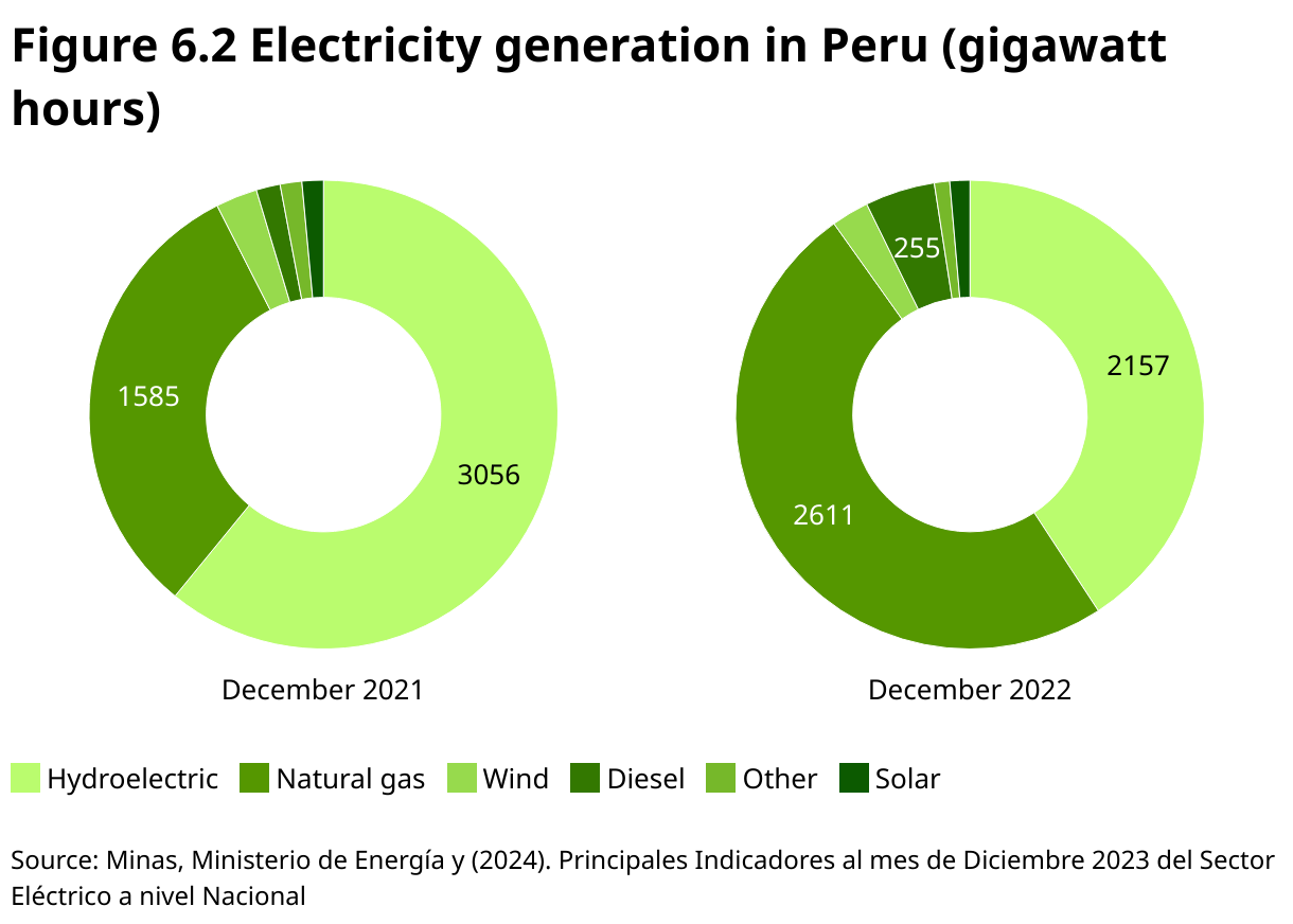
Droughts reduce water flow and reservoir levels, significantly limiting hydropower generation and sometimes causing shutdowns. This forces increased reliance on costly and carbon-intensive fossil fuels, leading to power disruptions and economic strain in agricultural and industrial operations, and across communities (
Regions such as Brazil, Ghana, Peru, Uganda and the western United States have all faced power shortages due to drought-induced hydropower declines, resulting in higher fossil fuel use and emissions (
Advances in hydropower technology, such as more efficient turbines and floating solar panels on reservoirs (that reduce evaporation losses), can maximize energy generation even with reduced water (
Keeping power flowing when water runs low
Beyond hydropower, droughts also challenge thermal power plants that rely on water for cooling, forcing reduced output or shutdowns to avoid overheating. Reduced water availability lowers their cooling efficiency, which can lead to a decrease in their overall electricity generation. Underground water storage can help maintain cooling supplies during droughts, supporting continued plant operation.
Mitigating these impacts requires diversifying energy sources and modernizing the grid. Incorporating renewable energy technologies (e.g., solar, wind) reduces dependence on hydropower and fossil fuels, bolstering resilience. Pumped storage hydropower, a form of energy storage that uses stored water rather than continuous river flows, improves grid stability by storing excess energy for later use (
Smart grids, demand response and energy storage (e.g. batteries) help balance electricity supply and demand during drought-induced stresses. Advanced cooling methods such as closed-loop systems and air-cooled condensers reduce water use in thermal plants (
Innovation examples
Satellite-powered forecasting system tackles drought in Saint Kitts and Nevis

Saint Kitts and Nevis, a twin-island Caribbean nation, is becoming more vulnerable to climate change impacts, including drought. With rainfall being the only source of potable water, decreasing precipitation has led to regular water outages affecting 80 percent of the population. This is a recent challenge for Saint Kitts and Nevis, with the first occurrence in 2015. To address this, the United Nations Climate Technology Centre and Network (CTCN), in collaboration with HR Wallingford and the Department of Environment, developed a system that uses satellite and remote monitoring data to forecast droughts and predict groundwater availability. This system generates drought risk maps and provides forecasts to farmers via WhatsApp through the island’s Met Office. Extension officers then visit farmers to advise them on optimal planting and harvesting times. This timely information helps farmers better manage water resources and adapt to changing conditions, especially as tourism and housing continue to increase water demand. This technology could also be adapted for use in other regions facing similar climate challenges. While small island nations need over USD 5 billion annually for climate adaptation, scalable tools such as this offer a cost-effective way to build resilience (
Unlocking hidden water: aerial mapping transforms groundwater recharge in California

Tulare County, a heavily agricultural region in California’s Central Valley, faces severe groundwater depletion due to prolonged over pumping. Declining water tables, dry wells and land subsidence have threatened both farms and communities. Under California’s Sustainable Groundwater Management Act, local agencies must achieve aquifer sustainability by 2040 – therefore requiring smarter water storage solutions. AEM, a new underground mapping technology, is helping identify the best locations for storing surplus water. Helicopters equipped with electromagnetic sensors map underground geology, identifying paleo valleys – ancient riverbeds of porous gravel and sand ideal for rapid water recharge. These high-resolution 3D maps allow agencies such as the Tulare Irrigation District to target floodwater capture and groundwater banking precisely. AEM mapping is also being used in Denmark and other countries, where it has helped identify areas with significant water storage potential. In California, the Department of Water Resources has surveyed over 11,000 miles (17,703 km). AEM revealed unexpected aquifer depths and recharge potential in Tulare’s Kaweah Subbasin, which shifted pumping limits and guided new recharge projects. However, challenges persist in securing land, funding infrastructure and navigating water rights (
Recharging the land: the promise of sand dams in Kenya

In southeastern Kenya, sand dams are transforming water access in arid regions, especially in villages such as Kasengela. These concrete barriers built across seasonal rivers trap water and sand, creating artificial aquifers that store water during the rainy season, recharge groundwater and minimize evaporation. With only 5 percent of Makueni County’s households having access to clean piped water, sand dams have significantly improved water availability. This sustainable solution has also alleviated the long, dangerous water collection journeys once faced by locals. The community-led construction of these dams, supported by organizations such as the Africa Sand Dam Foundation, has resulted in the creation of 680 dams since 2010. The dams also support the environment by revitalizing vegetation and replenishing groundwater, which can lead to the formation of springs and boreholes. The success of each dam, however, depends on factors such as rainfall patterns, soil composition and geological characteristics. The success of these sand dams, while reliant on careful site selection, has caught the attention of the international community as a model of sustainable water management that can be replicated in other drought-prone regions (
Smart farming in Cabo Verde: harnessing IoT and AI to tackle drought
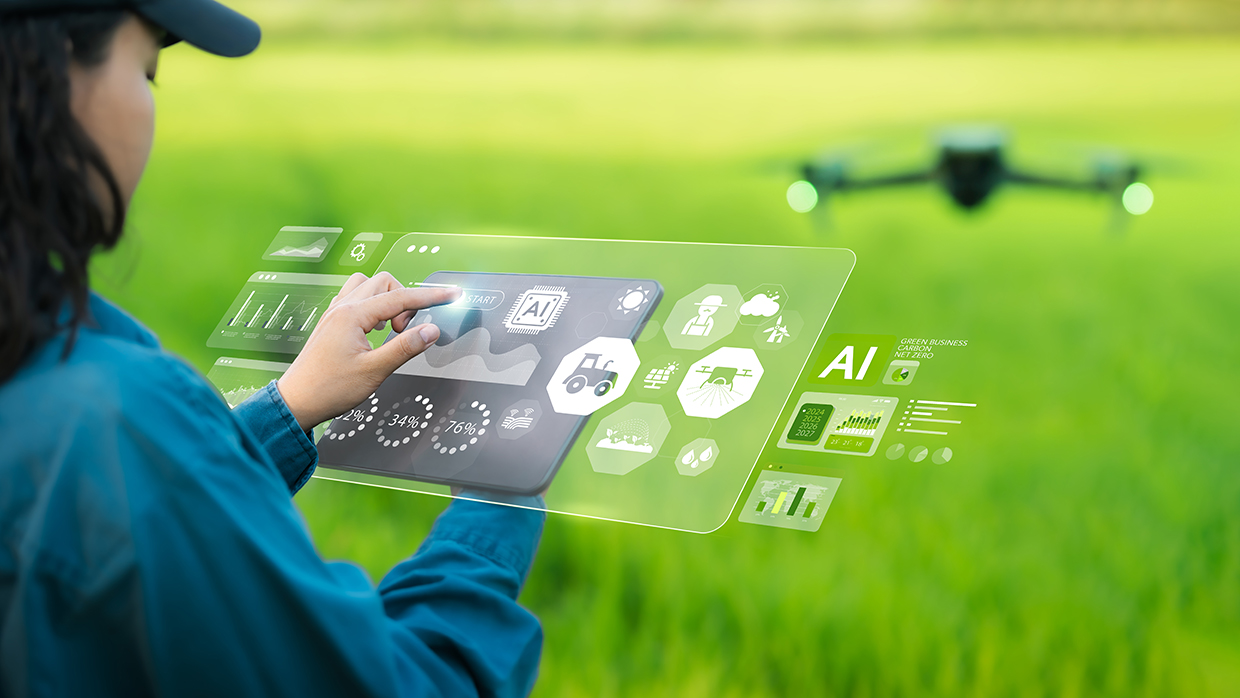
Cabo Verde is adopting emerging technologies such as IoT and AI to address the agricultural challenges caused by recurring droughts. Traditional farming methods in the country, such as rainfed agriculture and terracing, have been limited by arid conditions. To combat this, smart agriculture techniques are being introduced, including wireless sensor networks for soil, weather, and water monitoring, as well as drones for crop growth tracking. These technologies enable farmers to make more informed decisions about irrigation and crop management. A pilot project, led by researcher Sónia Semedo and supported by Primebotics and the Ribeira de São Filipe Producers Association, aims to test these technologies’ viability. The project focuses on optimizing agricultural production through smart irrigation systems and AI-driven strategies. It also emphasizes training, with farmers learning to operate drones and utilize the smart irrigation system. Notably, the project has involved female farmers to ensure that solutions meet the needs of all agricultural workers. With initial successes, including a working prototype and training for local farmers, the project is now exploring scalability and future expansion, potentially revolutionizing farming practices in the region (
Proven technology solutions
Laundry water saving: NuTek Ozone Laundry Support System (OLSS)
NuTek International
NuTek’s OLSS technology provides water and energy savings as well as sanitation. By using ozone in both wash and rinse cycles, it effectively eliminates 99.99 percent of harmful microorganisms, including antibiotic-resistant bacteria in cold water. Unlike traditional systems that rely on hot water and multiple rinse cycles, OLSS reduces water consumption by using fewer cycles and lower temperatures. Additionally, the system enhances chemical efficiency, lowering chemical usage. The reduced water saturation also results in shorter drying times, further conserving energy. With proven results from third-party tests, NuTek’s OLSS provides solutions for healthcare, hospitality, and commercial laundry operations.
Technological maturity: Proven
Contracting type: For sale
Technology level: Medium
Place of origin: United States
Availability: Worldwide
Contact: WIPO GREEN Database
Water quality: automated microbial measurement system
Vienna Water Monitoring Solutions

The ColiMinder® CMI-02 is a device designed for continuous, automated monitoring of microbiological water quality in various applications. Available in three versions – the industrial standard, the low-energy, and the portable Emergency Response Unit – it measures microbiological contamination within 15 minutes using enzymatic activity and operates with fully automated sampling, measurement, cleaning and calibration. The system can perform up to 54 measurements per day. The ColiMinder® provides real-time data transfer and visualization and users can receive notifications via email or SMS. It supports up to two sample intakes, with additional options available, and can be remotely controlled. The system enables up to 1,000 measurements without staff intervention, ensuring efficient, remote and continuous monitoring.
Technological maturity: Proven
Contracting type: For sale
Technology level: Medium
Place of origin: Austria
Availability: Worldwide
Contact: WIPO GREEN Database
Energy systems: closed circuit cooling tower
Casen
A closed cooling tower is a type of heat exchanger that cools water or process fluid by using air and a heat exchange coil. The KCH series features a multi-modular design with a condensing coil and PVC fill to enhance heat transfer efficiency. In this system, water is circulated over the fill, while air is drawn through it, causing evaporation to cool the water. The process combines evaporative and sensible cooling, reducing scale build-up and minimizing water evaporation. Unlike open cooling towers, which expose water directly to the atmosphere, closed cooling towers recirculate water in a closed loop. This reduces water loss and the need for a constant supply of fresh water, making them more water-efficient. Closed cooling towers are especially beneficial in industrial and HVAC applications, with available configurations such as crossflow and counterflow for different operational needs.
Technological maturity: Proven
Contracting type: For sale
Technology level: Medium
Place of origin: China
Availability: Worldwide
Contact: WIPO GREEN Database
Energy systems: induced draft-air-cooled condenser
ENEXIO
ENEXIO is the inventor of the air-cooled condenser. Their latest innovation, the InAIR, uses induced-draft fans, commonly found in wet cooling systems, now adapted for dry cooling. They pull ambient air through heat exchange coils, where the air absorbs heat from the hot fluid, cooling it down without the need for water, before discharging the heated air into the atmosphere. This process significantly reduces water usage by eliminating the need for water-intensive cooling towers. Additional benefits include up to 60 percent reduction in steel structure quantities and a 50 percent reduction in steel weight, which could result in a 10–25 percent cost reduction in construction costs. The InAIR also offers shorter delivery and construction periods, along with easier pre-assembly.
Technological maturity: Proven
Contracting type: For sale
Technology level: Medium
Place of origin: Germany
Availability: Worldwide
Contact: WIPO GREEN Database
Wastewater treatment: ZLD system
Vifluter
Wastewater systems typically release some degree of effluent into external water sources. A ZLD system eliminates this problem by removing all suspended solids and converting them into solid waste. This way, the wastewater is treated to the point where it can be reused without causing issues such as clogging or corrosion down-stream. Viflter’s ZLD system begins with efficient pretreatment, using both physical and chemical methods such as screens, ceramic membranes, emulsion breaking and bag filters to remove large debris and impurities. Next, the system applies state-of-the-art membrane technologies to reduce the level of total dissolved solids and enhance concentration efficiency. This is followed by an evaporation crystallization process, which transforms the concentrated salts into solid waste. Finally, the residual brine is dried to separate any remaining solids from the water, resulting in only solid waste and clear, reusable water.
Technological maturity: Proven
Contracting type: For sale
Technology level: Medium
Place of origin: China
Availability: Worldwide
Contact: WIPO GREEN Database
Household appliance: extremely low-flush toilet
Wostman Ecology AB
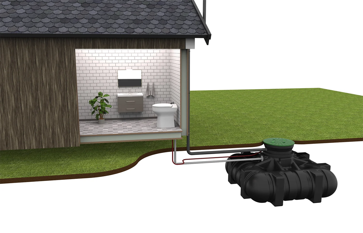
The EcoVac™ is an innovative toilet that flushes with only 0.2–0.6 liters of water per flush, offering up to 95 percent water savings. This highly efficient toilet can be used by septic tank owners, island residents, or in remote areas, with various tanks, containers or bio-containers. It is also suitable for buses, trains and boats. The vacuum-powered flushing system quickly transports waste into the container, saving both water and energy while maintaining the comfort of a flushing toilet. In a year, the EcoVac™ requires only about 5 kWh of energy, and the septic tank only requires approximately one instance of emptying.
Technological maturity: Proven
Contracting type: For sale
Technology level: Medium
Place of origin: Sweden
Availability: Worldwide
Contact: WIPO GREEN Database
Irrigation: driplines for landscaping
Netafim
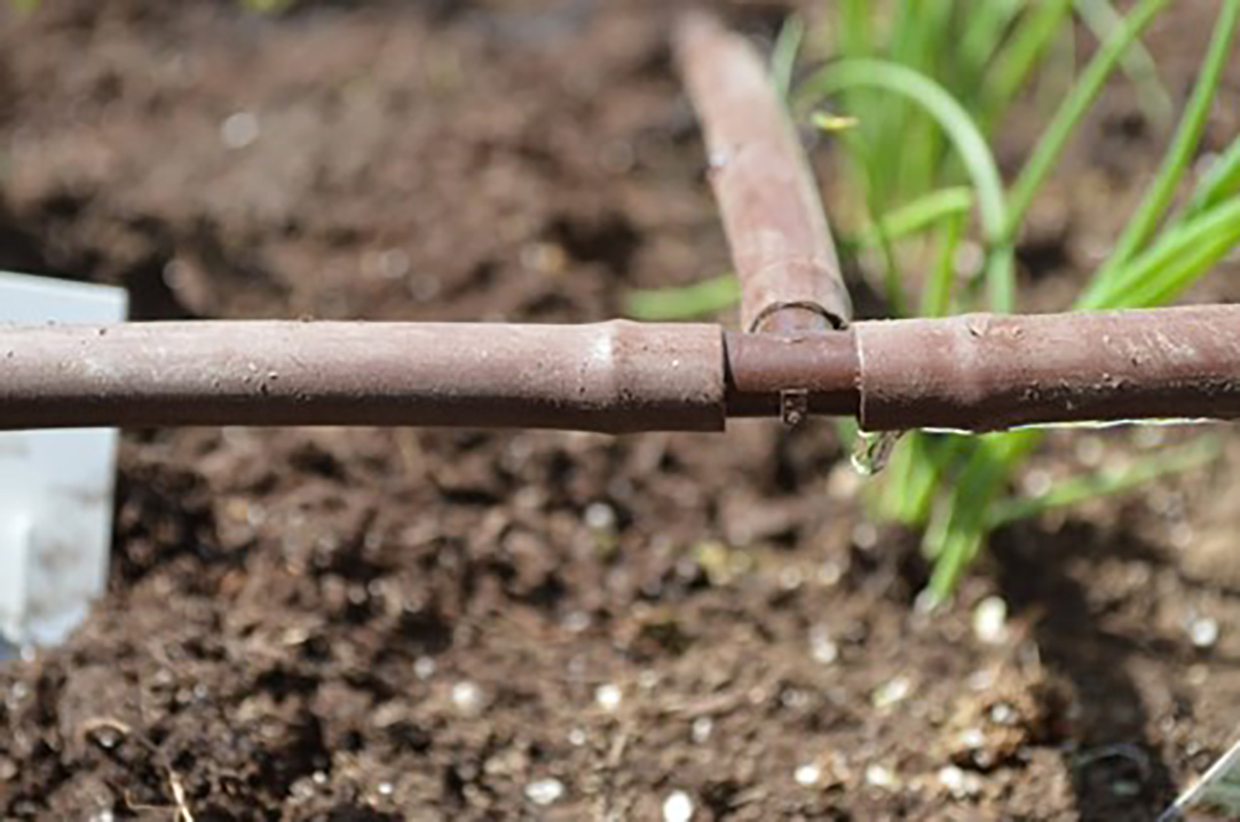
Netafim’s Techline family of driplines provides efficient, water-saving irrigation by delivering water directly to a plant’s root zone. Unlike sprinklers, which can cause overspray, staining and wasted water, these driplines release water slowly and precisely, preventing evaporation and runoff. The system saves 30 percent to 70 percent of water compared to traditional sprinklers. It promotes healthier, fuller plant growth, reduces plant diseases by keeping foliage dry, and prevents stains on surfaces. The system provides the option to lay the tubing on the ground or bury it beneath the soil. Techline’s flexible design adapts to various planting shapes, making it ideal for oddly shaped or hard-to-water areas.
Technological maturity: Proven
Contracting type: For sale
Technology level: Medium
Place of origin: Israel
Availability: Worldwide
Contact: WIPO GREEN Database
Water supply and management: Smart metering solution
Telefónica Tech
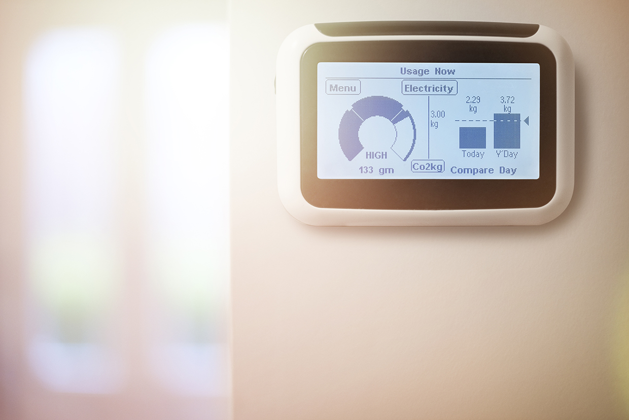
Telefónica Tech’s Smart Water supply and management solution optimizes the entire water cycle from collection to wastewater treatment. By integrating Narrowband-IoT water meters, the solution enables remote monitoring, automatic consumption readings, and a 40 percent reduction in leaks, saving 15–20 percent of total water consumption. Designed for public, private and mixed water companies, the solution detects leaks, controls unauthorized consumption and manages water loss efficiently. Its modular and scalable design allows customization for each customer.
Technological maturity: Proven
Contracting type: For sale
Technology level: Medium
Place of origin: Spain
Availability: Worldwide
Contact: WIPO GREEN Database
Water supply and management: AEM survey system
SkyTEM
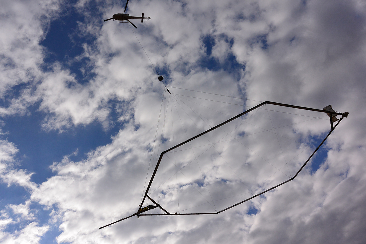
SkyTEM uses airborne geophysics to map the top 600 m of the subsurface in 3D. Its system measures electrical conductivity (or resistivity) and can also include sensors for magnetic susceptibility and natural radioactivity (potassium, uranium, thorium). Variations in these parameters reveal changes in mineralogy, moisture content, stratigraphy, porosity, and salinity—critical factors for groundwater studies. Airborne electromagnetic (AEM) surveys detect conductivity and resistivity variations to locate aquifers, track water quality, and assess salinity. Magnetic surveys map variations in magnetite content, aiding geological interpretation, while radiometric surveys detect natural gamma radiation to identify soil and rock types. Sensors mounted close to the ground beneath the aircraft capture subtle variations with high resolution, enabling water managers to visualize and manage groundwater resources efficiently and sustainably without invasive drilling.
Technological maturity: Proven
Contracting type: For service
Technology level: High
Place of origin: Denmark
Availability: Worldwide
Contact: WIPO GREEN Database
Frontier technology solutions
Hydrogel: non-synthetic formulations for agriculture
AEH Innovative Hydrogel
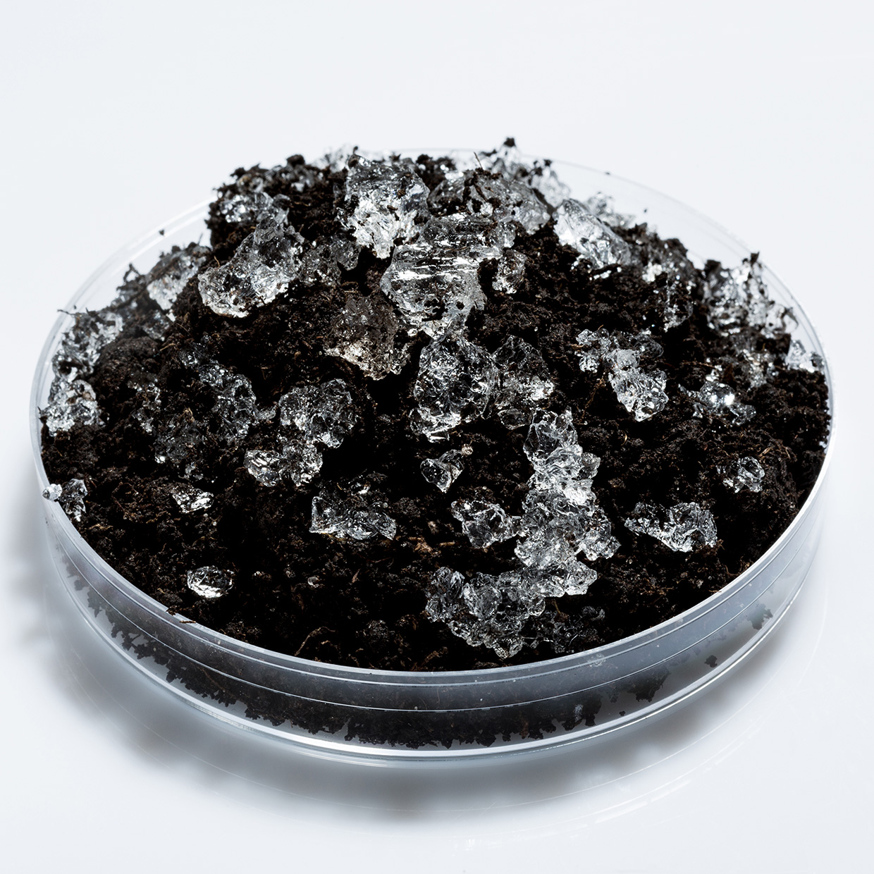
AEH Innovative Hydrogel’s GelPonics technology, developed with support from Innovate UK’s Transforming Food Production challenge, provides biodegradable, hydrogel-based substrates for agriculture. The technology includes soil improver granules, which mix with soil to improve water retention and reduce soil erosion; dry sheets, which are used in propagation trays in controlled environment agriculture, replacing traditional growth substrates such as peat and coir; and plugs, designed for pots and troughs in hydro- and aeroponic systems. The GelPonics products’ high-water holding capacity enhances crop resilience in dry conditions, reducing the need for frequent irrigation, and contributing to boosted yields.
Technological maturity: Frontier
Contracting type: For sale
Technology level: Medium
Place of origin: United Kingdom
Availability: United Kingdom
Contact: WIPO GREEN Database
Water quality: portable microbiological water-testing lab
Roshan Water Solutions
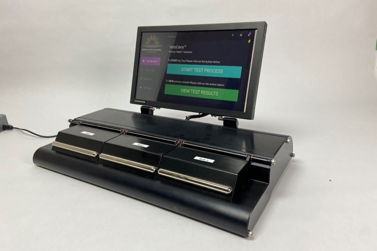
VeloCens™ uses a light-addressable potentiometric sensor (an electrochemical sensor technology that detects changes in voltage caused by the presence of target substances) combined with nanotechnology-sensor-based test cartridges to quickly test water for E. coli and total coliform within one hour. The nanostructures on the cartridges attract targeted species of bacteria and are highly sensitive to their activity, allowing for on-site, on-demand water quality monitoring. This provides real-time decisions about water safety, significantly improving turnaround time by 18 times compared to traditional methods. VeloCens™ follows stringent protocols, ensuring its performance matches that of standard microbiological lab equipment. All sample data is automatically logged into a cloud data center, offering 24/7 access, where results can be mapped by location and time.
Technological maturity: Frontier
Contracting type: For sale
Technology level: Medium
Place of origin: Canada
Availability: Worldwide
Contact: WIPO GREEN Database
Early warning and monitoring: UAVSAR system
NASA

NASA’s UAVSAR is an advanced airborne radar system that uses differential InSAR techniques to detect tiny ground surface movements – often less than a centimeter – caused by subsurface water activity. By capturing repeat radar images with precision GPS-guided flight paths, UAVSAR monitors groundwater recharge and movement. It has been instrumental in mapping areas of aquifer replenishment, such as California’s San Joaquin Valley, and supports groundwater modeling when combined with other data such as AEM readings. Operating across multiple radar bands, UAVSAR provides critical insights into root zone moisture and subsurface changes to support sustainable water management.
Technological maturity: Frontier
Contracting type: Not commercially available/for scientific collaboration and application
Technology level: High
Place of origin: United States
Availability: Worldwide
Contact: WIPO GREEN Database
Water supply and management: Smart water metering system using GSM and sensors
HydroIQ

HydroIQ SmartGrid is the world’s first virtual water network operator, transforming traditional water systems into smart, integrated grids. Using advanced IoT devices, it monitors water consumption, pressure, levels and quality at both the consumer level and throughout the network. This enables predictive maintenance, real-time data analytics and reporting for industrial, utility and smart city projects. HydroIQ’s SmartBilling platform allows property managers to remotely monitor, manage, bill and collect payments. Additionally, HydroIQ Snap uses a mobile app to capture precise meter readings, while HydroIQ Pay ensures 100 percent utility bill collection and reduces operational costs by over 90 percent, guaranteeing no revenue loss and eliminating follow-up.
Technological maturity: Frontier
Contracting type: For sale
Technology level: Medium
Place of origin: Kenya
Availability: Guatemala, Kenya, Nigeria, South Africa, Tanzania
Contact: WIPO GREEN Database
Water supply and management: AI-powered digital platform for industrial water management
Veolia Water Technologies

Hubgrade Water Footprint is Veolia’s AI-powered digital platform designed to help industrial clients reduce their water use, energy consumption and carbon emissions. Unlike traditional water audits, Hubgrade provides real-time insights into water operations by combining in-field data, advanced analytics, and Veolia’s global expertise. It identifies water wastage events as they occur and offers customizable alerts, ensuring immediate action can be taken. The system estimates true water costs, usage ratios and balances, supporting strategic sustainability planning. In addition, Hubgrade integrates seamlessly with existing water management systems, helping clients optimize water reuse and recycling efforts. Hubgrade began expanding globally in 2024, helping companies meet water neutrality goals and regulatory demands.
Technological maturity: Frontier
Contracting type: For sale
Technology level: High
Place of origin: France
Availability: Worldwide
Contact: WIPO GREEN Database
Improved crop breeding: speed breeding system
Nexsel Tech
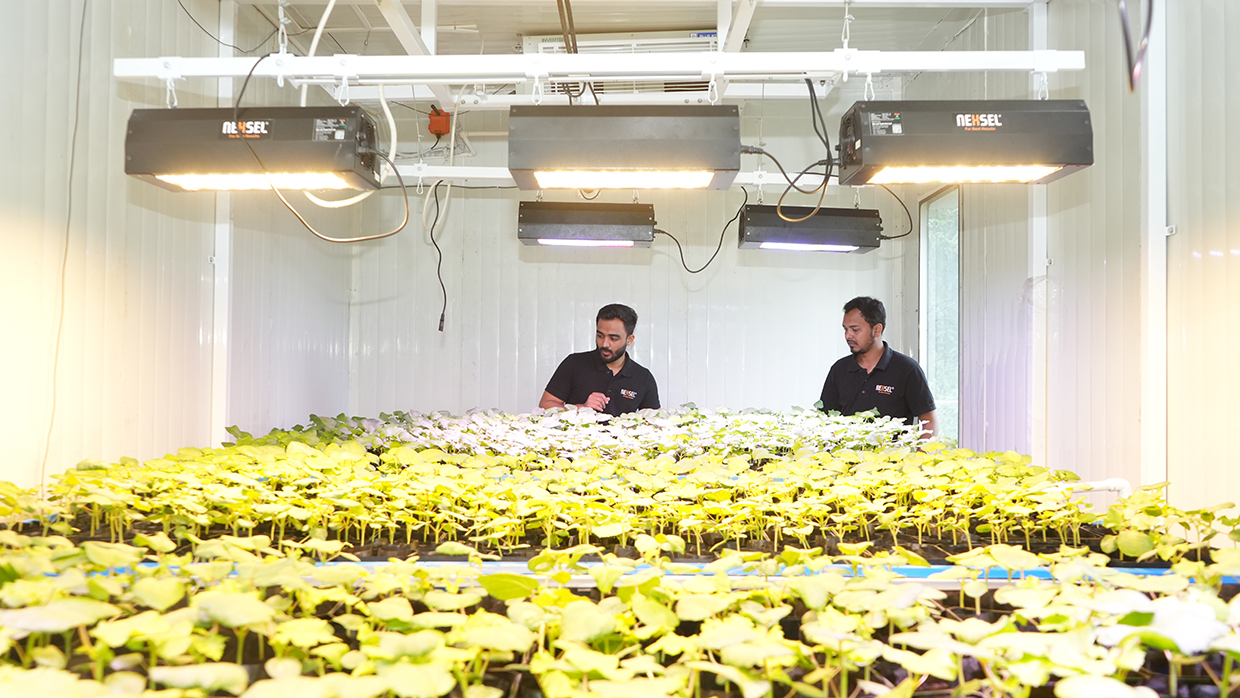
Nexsel has pioneered speed breeding solutions using the 7P control mechanism, which reduces breeding time by up to 60 percent. This advanced technique accelerates plant growth by optimizing seven environmental conditions, shortening breeding cycles for crops such as wheat, rice, cotton and okra. The company offers two types of 7P control speed breeding growth chambers: the portable chamber, designed for developing growing protocols with precise control over environmental parameters, and the walk-in chamber, which provides a comprehensive solution for commercial speed breeding with full control over light, temperature, humidity and CO2 levels.
Technological maturity: Frontier
Contracting type: For sale
Technology level: High
Place of origin: India
Availability: India, United Arab Emirates
Contact: WIPO GREEN Database
Water treatment: UV advanced oxidation process (UV AOP)
Trojan Technologies
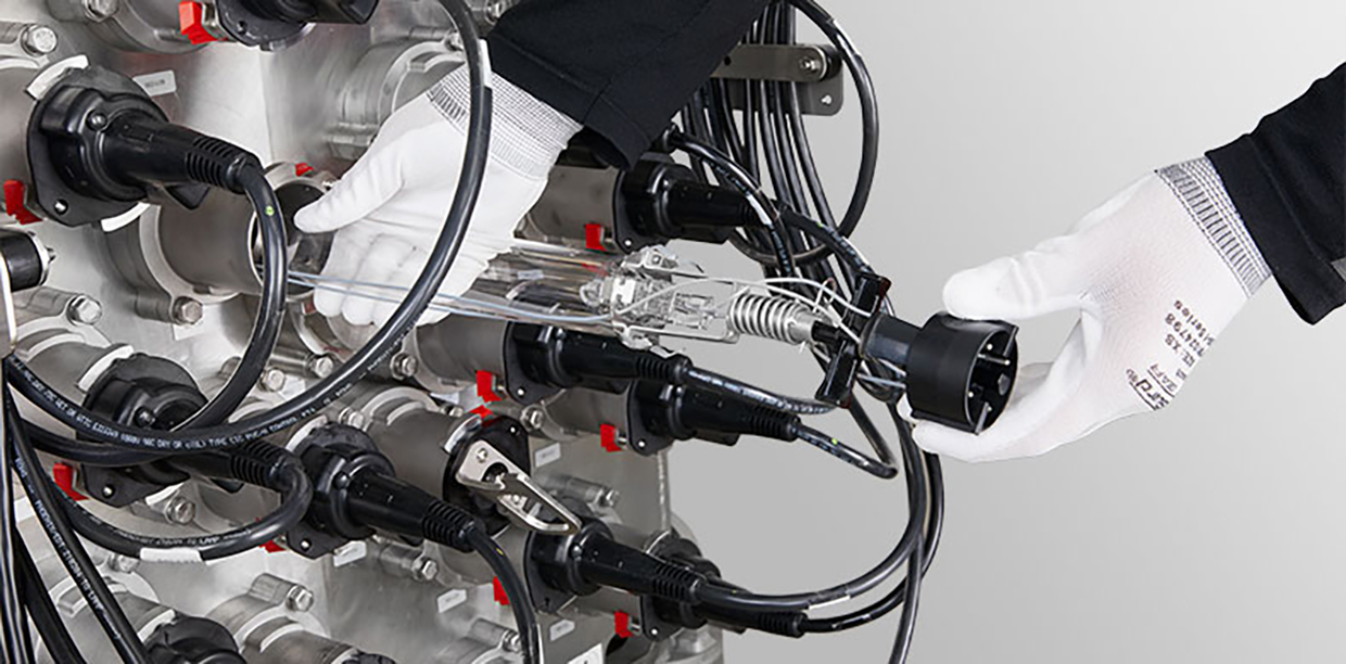
The TrojanUVFlex®AOP is a UV advanced oxidation solution designed to treat a wide range of contaminants in groundwater and surface water. Its cross-flow lamp orientation improves treatment efficiency, meaning that the water flows perpendicular to the path of the UV light to ensure that the water is exposed to the light more effectively. UV AOP works by using UV light (along with an oxidant) to break down chemical bonds in contaminants such as VOCs, pesticides, by-products, algal toxins and hazardous substances, including 1,4-dioxane, trichloroethylene and cyanide. The system’s compact, modular design allows for easy installation and expansion, even in small spaces. Unlike filtration methods such as granulated activated carbon, UV AOP does not physically remove contaminants; instead, it chemically breaks them down, making it highly effective for treating complex pollutants that other methods may miss.
Technological maturity: Frontier
Contracting type: For sale
Technology level: High
Place of origin: Canada
Availability: Worldwide
Contact: WIPO GREEN Database
Wastewater treatment: modular all-in-one system for gray and black water
Big Red
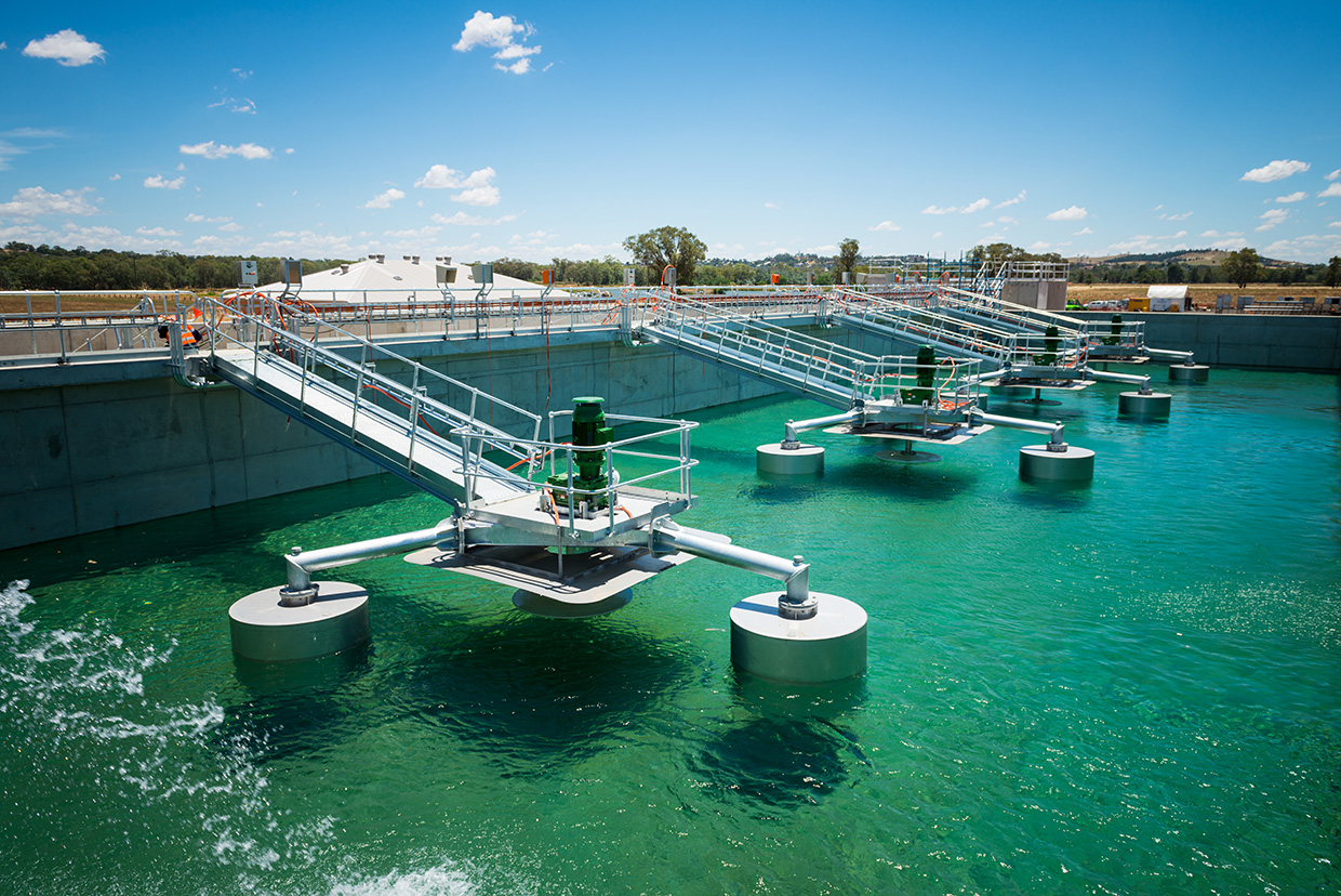
Big Red is an all-in-one wastewater treatment system designed to convert black and gray water into recycled effluent for irrigation. It combines all necessary components of a treatment plant into a modular, scalable “plug-and-play” unit that is available for immediate installation in South Africa. The system processes wastewater through a multi-chambered septic tank for solids breakdown, followed by aerobic digestion in a bioreactor, and disinfection with an inline chlorinator. Made from 100 percent recyclable, durable polyethylene, the system can be installed underground, above ground, or containerized for export. It is solar-compatible, and suitable for various settings, including remote areas, schools, clinics and urban environments. The system can handle flow rates from 1 kliter/day to 500 kliter/day, with options for domestic (4–12 people) or commercial use (up to 2,000 people).
Technological maturity: Frontier
Contracting type: For sale
Technology level: Medium
Place of origin: South Africa
Availability: South Africa
Contact: WIPO GREEN Database
Household appliance: water-saving automatic faucet
TOTO
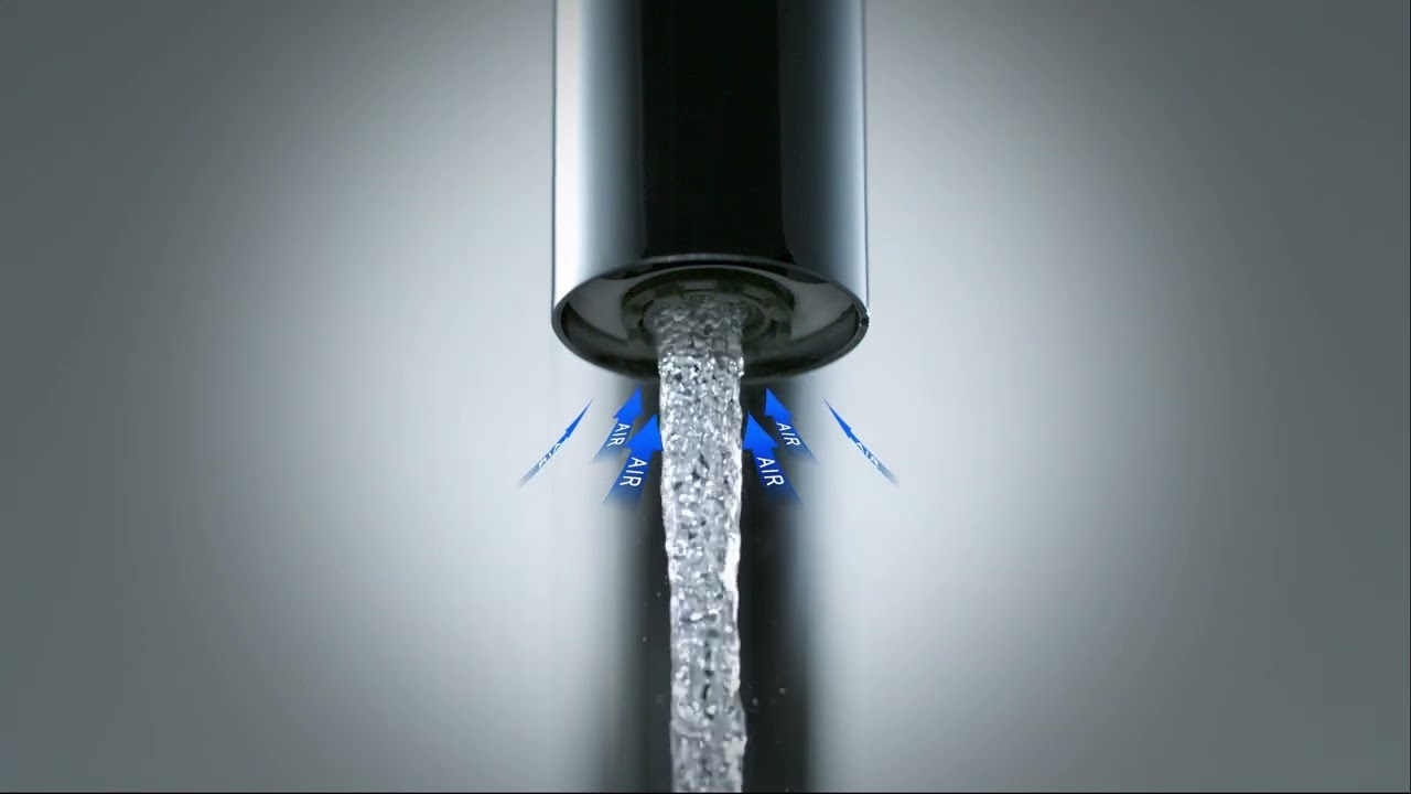
TOTO’s ECO CAP technology reduces water consumption by aerating the water flow. Their latest generation of touchless faucets, introduced in 2022, uses only 2 liters per minute while still providing a voluminous water flow and a comfortable handwashing experience. TOTO’s automatic faucets also feature SELFPOWER technology, which generates energy from the water flow to operate the faucet’s sensor, eliminating the need for external power sources or batteries.
Technological maturity: Frontier
Contracting type: For sale
Technology level: Medium
Place of origin: Japan
Availability: Worldwide
Contact: WIPO GREEN Database
Horizon technology solutions
Improved crop breeding: CRISPR acceleration system
BetterSeeds
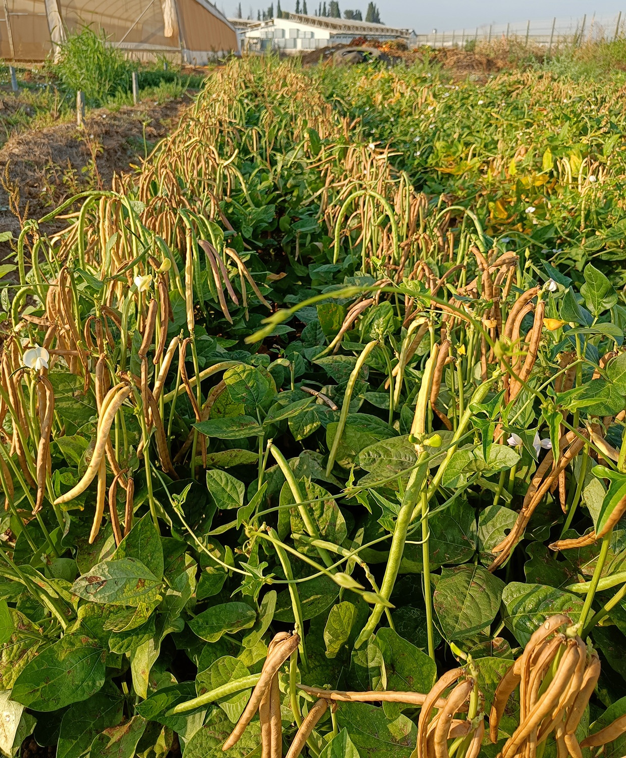
CRISPR gene editing is a powerful tool for improving specific crops, but its use is limited by the time and resources required to develop edits for new crops. BetterSeeds is addressing these challenges with EDGE™ (Efficient Delivery of Gene Editing), a system designed to accelerate the process of introducing CRISPR-based traits across a broader spectrum of crops. With EDGE™, the time it takes to incorporate valuable traits – such as drought and heat tolerance – into crops is dramatically reduced, allowing for more rapid advancements. In addition to improving climate resilience, the EDGE™ system can also facilitate the development of crops with enhanced nutritional profiles, better disease resistance and improved yield.
Technological maturity: Horizon
Contracting type: Under development
Technology level: High
Place of origin: Israel
Availability: N/A
Contact: WIPO GREEN Database
Improved crop breeding: non-GMO hybrid wheat technology
Corteva
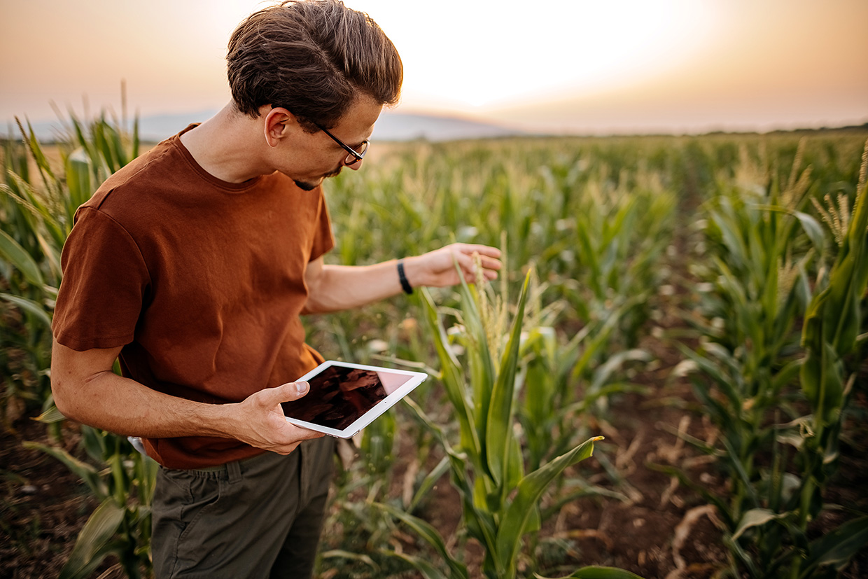
In 2024, Corteva unveiled a proprietary non-GMO hybrid wheat technology. While hybrid technology has boosted yields in other crops, wheat has struggled to achieve the same benefits. Corteva’s hybrid wheat could increase yields by 10 percent with the same resource usage and improve drought resistance, showing a 20 percent higher yield in water-stressed conditions. This technology also accelerates the development of elite germplasm by scaling up parent seed production. Corteva’s hybrid technology is compatible with all wheat germplasm, enabling faster genetic improvements and commercial-scale seed production. The company plans to launch hybrid hard red winter wheat in North America by 2027, offering substantial benefits for farmers and global food security, similar to the impact of hybrid corn.
Technological maturity: Horizon
Contracting type: Under development
Technology level: High
Place of origin: United States
Availability: N/A
Contact: WIPO GREEN Database
Improved crop breeding: salt-tolerant wheat variety/resilient cereals
OlsAro
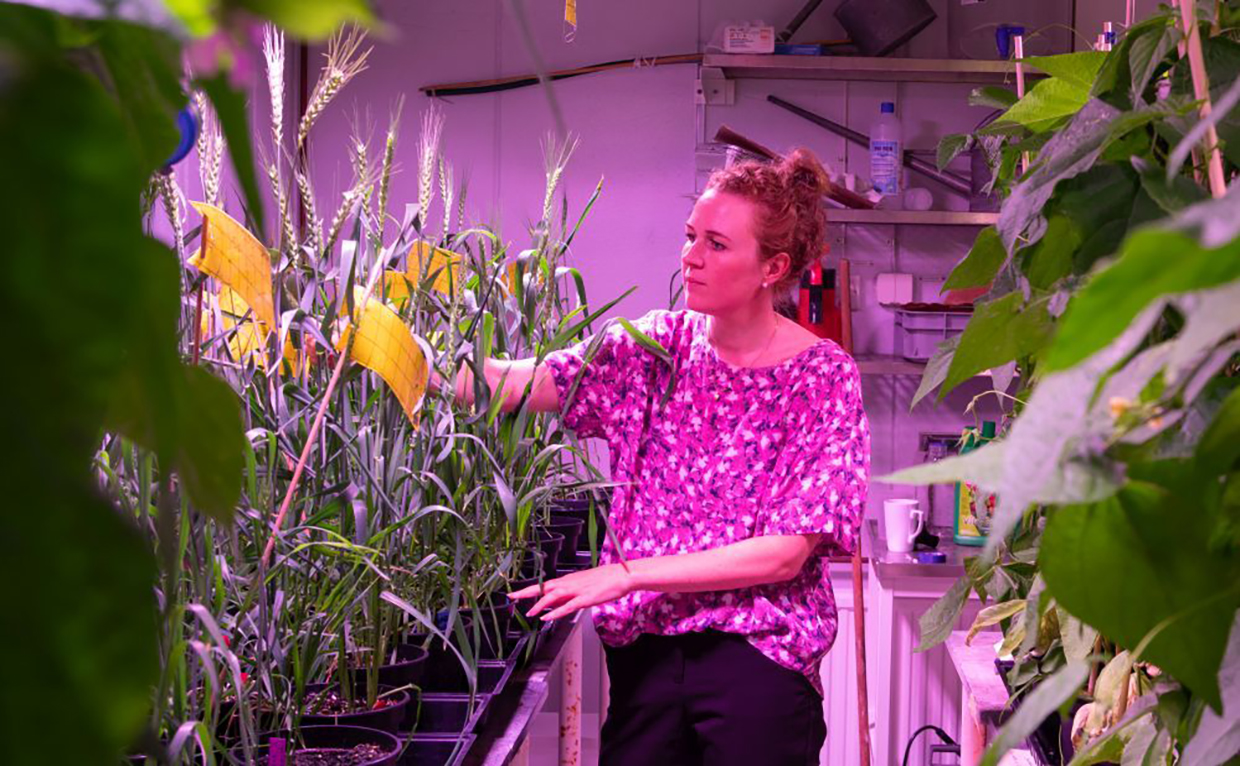
Swedish agtech startup OlsAro has raised €2.5 million in pre-seed funding to advance its development of climate-resilient wheat varieties. Backed by investors such as Future Food Fund, PINC (Paulig), and AgFunder, OlsAro uses an AI-driven breeding platform to accelerate crop development threefold. AI is used to analyze vast data sets and predict the best genetic combinations. Its first product – a salt-tolerant wheat – boosted yields by 52 percent in saline conditions in Bangladesh, enabling farming on degraded land. With over 830 million hectares of land globally affected by salinity, OlsAro’s solution offers farmers new opportunities during dry seasons while supporting local food systems.
Technological maturity: Horizon
Contracting type: Under development
Technology level: High
Place of origin: Sweden
Availability: N/A
Contact: WIPO GREEN Database
Wastewater treatment: high-removal ultrafiltration (UF) membrane
Toray
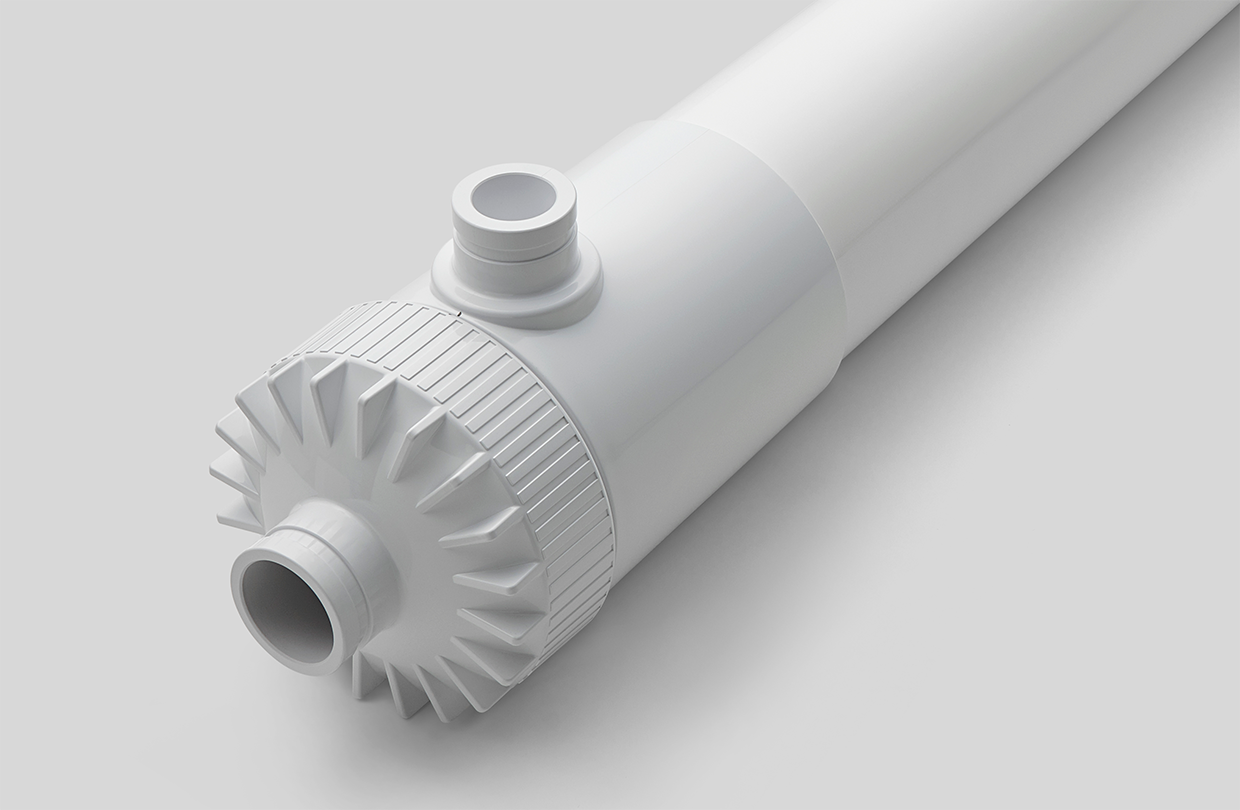
Toray has developed a high-performance UF membrane that improves wastewater reuse by reducing the strain on reverse osmosis (RO) membranes. This innovation ensures consistent production of high-quality water for applications such as semiconductor manufacturing and potable water production. Featuring sub-10 nm nanopores, the new UF membrane effectively blocks biopolymers commonly found in wastewater, reducing RO membrane contamination. This leads to less frequent chemical cleaning, extending RO membrane lifespans, which lowers operational costs and reduces associated CO2 emissions by over 30%. Toray’s tests show the UF membrane can reduce the decline in RO membrane permeability by one-third. The technology is set for mass production and will launch in North America in mid-2025, followed by expansion into other markets.
Technological maturity: Horizon
Contracting type: Under development
Technology level: High
Place of origin: Japan
Availability: N/A
Contact: WIPO GREEN Database
Water harvesting: fog harvesting and treatment system
ETH Zurich/University of California – Berkeley

Researchers have developed a passive system for harvesting and treating fog water, particularly in urban and industrial areas where fog droplets may contain harmful pollutants. The system uses polymer coatings embedded with photocatalytic metal oxide nanoparticles, such as titanium dioxide, to break down pollutants when exposed to sunlight, making the water safe for drinking. Unlike previous systems requiring UV light, this new approach allows the coating to remain active even under cloudy or foggy conditions, functioning similarly to how a battery stores charge. Two types of coatings were tested: hydrophilic (water-attracting) and hydrophobic (water-repelling). The hydrophilic coating proved more efficient at removing contaminants. In real-world tests, the system successfully reduced organic pollutants by over 90 percent, showing effective water collection performance. This method has the potential to be scaled in polluted regions, though challenges remain in adapting it to different types of air pollution.
Technological maturity: Horizon
Contracting type: Under development
Technology level: High
Place of origin: Switzerland
Availability: N/A
Contact: WIPO GREEN Database