-
Table of contentsTable of contents
-
Download
-
Database
-
Home
Climate change is increasing cities’ exposure to heatwaves, floods and extreme weather events. From stormwater management to cool pavements, this section examines some of the ways in which technologies contribute to resilient and green cities. Cities are rising to the climate change challenge using a combination of engineered solutions and blue-green infrastructure.
Innovation examples
-
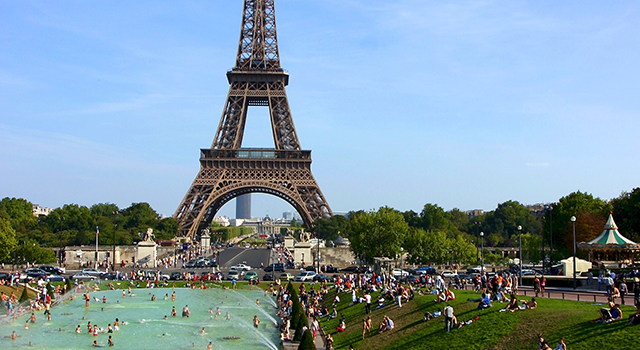
France’s response to the 2003 European heatwave
The 2003 European heatwave caused more than 15,000 casualties in France. It served as a wake-up call for many cities to take action on reducing…
More...
Read more5. Cities / Urban planning / Innovation examplesFrance’s response to the 2003 European heatwave
 Getty Images/© piccaya
The 2003 European heatwave caused more than 15,000 casualties in France. It served as a wake-up call for many cities to take action on reducing climate risks in urban areas. The following year, the country drew up the National Heat Wave Plan built on national forecasting and alert systems. Despite hotter summers since, the death toll has been significantly lowered. In addition to a major effort to issue warning messages in time, the plan includes measures such as cooling rooms at senior centers, replacing tarmac at playgrounds with more heat reflective materials, and mandatory insulation in construction regulation. This reflects a growing awareness of the benefit of an integrated response to risks like heatwaves, compared to stand-alone technologies and projects. Since 2012, French construction standards for new buildings and, to a lesser extent for existing buildings, have included requirements regarding comfort during heatwaves. In Paris, adding parks and green spaces has been another key solution to heatwaves. Urban greening is most effective when green spaces are watered during a heatwave. Doing so increases the cooling effect from evapotranspiration. A simulation was made of the potential effects of some measures introduced in Paris, namely applying new construction standards, behavior change in relation to air-conditioning use, and urban greening. If fully implemented, these measures could potentially reduce night-time temperatures by as much as 4.2°C.[1]
Share this content -
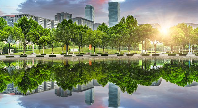
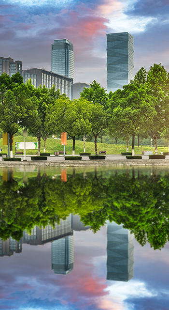
The Qunli stormwater park in China
“Sponge City” is a term for green infrastructure approaches that combine methods. Combinations include methods such as permeable paving,…
More...
Read more5. Cities / Urban planning / Innovation examplesThe Qunli stormwater park in China
 Getty Images /© chinaface
“Sponge City” is a term for green infrastructure approaches that combine methods. Combinations include methods such as permeable paving, bioretention (removing pollutants from stormwater runoff), urban vegetation and rainwater collection. Planned at an urban scale, such nature-based solutions can help mitigate stormwater runoff and flooding, improve water quality and recycle rainwater for on-site use. Many solutions are well suited for low-cost implementation. However, they do require careful coordination, planning and a knowledge of local conditions such as soil status to maximize benefit at the city or community scale. Several cities are experimenting with the “Sponge City” approach. They include San Salvador and a number of cities in China. Notably, the city of Harbin in Northeast China has implemented an integrated urban water management (IUWM) strategy to mitigate serious waterlogging. The strategy included revitalizing a dying wetland in the middle of the city surrounded by roads and large development projects. Ponds and mud flats were created around the wetland. A cost–benefit analysis of the urban construct looked at the likely construction and maintenance fees in relation to air quality improvement, rainwater harvesting and flood-risk reduction. It concluded that, although long-term maintenance of the ponds and mud flats may be costly, the social and environmental impact would be positive due to their flood handling capacity.[1]
Share this content -
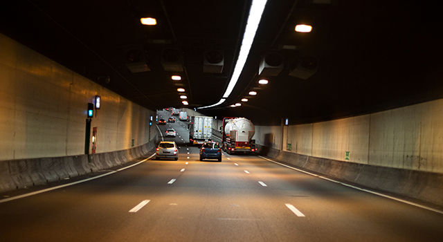
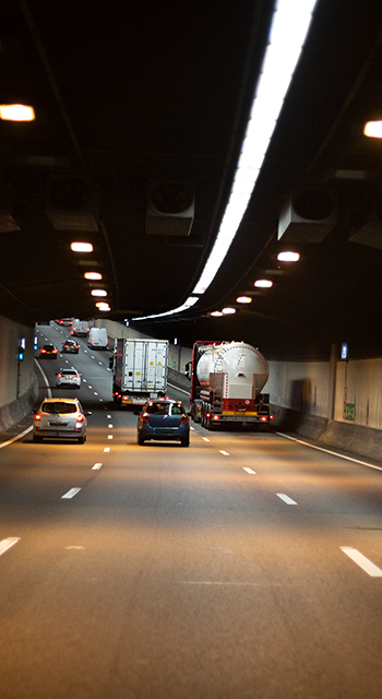
Kuala Lumpur’s Stormwater Management and Road Tunnel (SMART Tunnel)
Malaysia’s SMART Tunnel is a stormwater drainage tunnel built to alleviate flooding in the center of Kuala Lumpur. It stretches for nearly 10 km…
More...
Read more5. Cities / Urban planning / Innovation examplesKuala Lumpur’s Stormwater Management and Road Tunnel (SMART Tunnel)
 Getty Images /© ollo
Malaysia’s SMART Tunnel is a stormwater drainage tunnel built to alleviate flooding in the center of Kuala Lumpur. It stretches for nearly 10 km between two locations where the rivers Klang, Ampang and Gombak meet. This makes it the longest stormwater drainage tunnel in Southeast Asia. The system was built to divert large volumes of water from flood-prone areas via a holding pond, a bypass tunnel and a reservoir to store the water. At the same time, the opportunity was taken to integrate a motorway into the system to relieve traffic congestion at the main city center gateway. To protect drivers, automated flood control gates have been installed at either end of the tunnel, operated by a hydraulic system. Ventilation and escape shafts are also available at 1 km intervals. During the March 3, 2009, Kuala Lumpur flashfloods, the SMART system successfully diverted a total 700,000 m3 of floodwater from the holding pond via the tunnel. This avoided the overflowing of the area around Masjid Jamek LRT station.[1] In 2021, the tunnel claimed a new record by diverting nearly 5 m m3 of floodwater from the Klang River to the reservoir.[2]
Share this content
Proven technologies
-
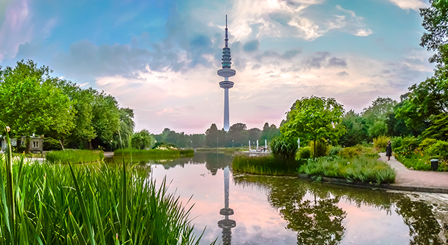
Blue-green urban planning framework
Many cities lack a holistic approach to nature-based solutions to increase resilience. Instead solutions such as providing shade from the sun are…
More...
Read more5. Cities / Urban planning / Proven technologiesBlue-green urban planning framework
Climate-KIC, Imperial College London Getty Images /© bluejayphoto
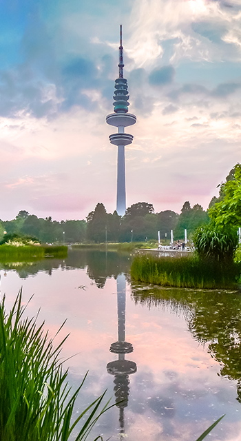
Many cities lack a holistic approach to nature-based solutions to increase resilience. Instead solutions such as providing shade from the sun are applied in a mono-functional way. The Blue Green System project is a methodology and set of tools developed by researchers at Imperial College London, with the support of Climate KIC. The System helps city planners and developers integrate green space, trees and natural flood management into projects. Researchers now provide expertise through services connected to disseminating the blue-green solutions. Thirteen demo sites have been created in different countries to demonstrate solutions such as urban lakes and bioswales, as well as green roofs equipped with sensors for predicting stormwater collection and thermal insulation benefits. The framework is applicable at building, neighborhood and city-scale and suitable both for new and retrofit developments.
- Contracting type: Service
- Technology level: Medium
- Country of origin: United Kingdom
- Availability: Worldwide
Share this content -
Stormwater management software
The EPA’s Storm Water Management Model (SWMM) is an open source public software free for use worldwide. It can be used by local, state and…
More...
Read more5. Cities / Urban planning / Proven technologiesStormwater management software
United States Environmental Protection Agency Getty Images /© Larisa Rudenko
The EPA’s Storm Water Management Model (SWMM) is an open source public software free for use worldwide. It can be used by local, state and national actors for the planning, analysis and design of stormwater and drainage systems. By evaluating gray infrastructure such as pipes and storm drains, this tool can be used to develop stormwater control solutions to reduce urban runoff and discharge. It can also be used to map flood plains and design strategies to avoid sewer overflows. For example, various combinations of green infrastructure (including rain gardens, bioretention cells, green roofs and bioswales) can be modelled to determine their effectiveness in managing runoff.
- Contracting type: Free
- Technology level: Medium
- Country of origin: United States
- Availability: Worldwide
Share this content -
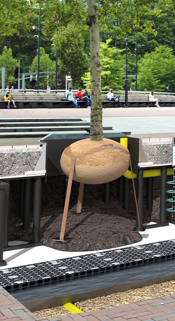
Underground bioretention and water storage
Treebuilders underground bioretention system serves two functions: bioretention and underground water filtration and water storage. The…
More...
Read more5. Cities / Urban planning / Proven technologiesUnderground bioretention and water storage
Treebuilders Photo: © TreeBuilders
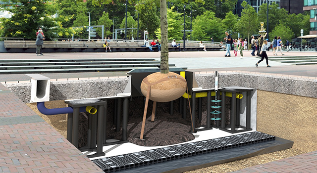
Treebuilders underground bioretention system serves two functions: bioretention and underground water filtration and water storage. The technology is described as a “submerged rain garden”. It exists of soil-containing modular units to support large tree growth combined with on-site stormwater management through absorption, evapotranspiration, interception and filtration. The underground structure avoids taking up extra space in crowded cities. Instead, enough space is provided underground to allow the tree roots to grow, its absence often preventing urban trees from thriving. The modular units simultaneously treat stormwater runoff at source rather than allowing it to enter sewers untreated.
- Contracting type: Service
- Technology level: Medium
- Country of origin: The Netherlands
- Availability: Worldwide
Share this content -
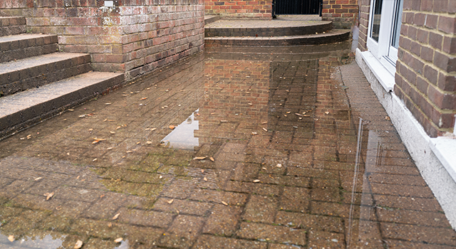
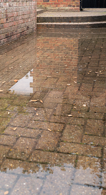
Soakaway crates for stormwater collection
Soakaway is a sub-surface drainage technology that manages surface water and stormwater runoff on site. It is essentially a pit with several…
More...
Read more5. Cities / Urban planning / Proven technologiesSoakaway crates for stormwater collection
ACO Getty Images /© CBCK-Christine
Soakaway is a sub-surface drainage technology that manages surface water and stormwater runoff on site. It is essentially a pit with several holes in the ground that collects rainwater before further dispersing into the earth. Filling the holes in the pit with materials such as stones and rubbles slows the infiltration of water into the ground, instead of discharging it immediately to an offsite location such as a sewer. ACO StormBrixx is an example of a plastic geocellular soakaway system for the attenuation and infiltration of water. The design consisting of brick-bonding and cross-bonding is flexible. It can be used across various construction environments either as a standalone solution or part of an integrated sustainable urban drainage (SuDS) scheme.
- Contracting type: For sale
- Technology level: Medium
- Country of origin: United Kingdom
- Availability: Worldwide
Share this content -
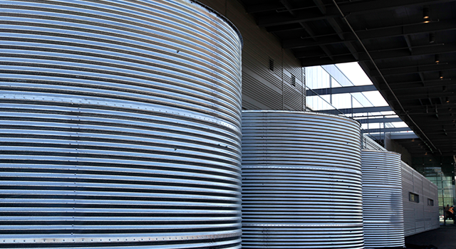
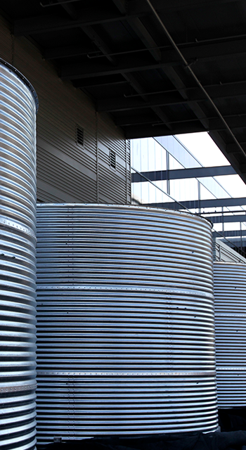
Large-scale rainwater catchment system
Residents of a new housing estate Nye in Aarhus, Denmark, are using treated rainwater for their washing machines and toilets. The project was…
More...
Read more5. Cities / Urban planning / Proven technologiesLarge-scale rainwater catchment system
Aarhus Vand Getty Images /© San Francisco Chronicle/Hearst Newspapers via Getty Images / Contributor
Residents of a new housing estate Nye in Aarhus, Denmark, are using treated rainwater for their washing machines and toilets. The project was carried out by Aarhus Vand, a public utility water company. The technology consists of a system where rainwater collected from roofs is drained into a basin, or artificial lake, together with other rainwater and surface water flows. A water treatment plant located near the basin filters the water to a good standard. From the plant, this water is channeled first into water reservoirs then into homes via a separate piping system for use by washing machines and toilets. By reusing treated rainwater on a larger scale, up to 40 percent of drinking water is saved.
- Contracting type: Service
- Technology level: Medium
- Country of origin: Denmark
- Availability: Denmark
Share this content -

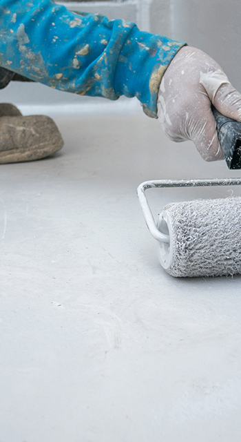
Retrofit cool pavement coating
EnduraBlend is a retrofit solution for “hot” pavements. It is in the form of a reflective coating that decreases solar absorption. Reflective…
More...
Read more5. Cities / Urban planning / Proven technologiesRetrofit cool pavement coating
EnduraBlend Getty Images /© Yung Getty
EnduraBlend is a retrofit solution for “hot” pavements. It is in the form of a reflective coating that decreases solar absorption. Reflective treatments for paved surfaces like Endurablend can help reduce heatwave duration and severity. The company’s Pavement Surface Coatings contain special infrared solar reflective pigments that reduce asphalt pavement temperature. The result is a lower heat index, lower energy costs (for cooling in nearby buildings) and better air quality. In addition, Endurablend extends pavement life-time by protecting the asphalt surface from petroleum, salt and de-icing materials, as well as UV degradation. Endurablend has an expected lifespan of 10 years in heavy traffic and extreme weather conditions.
- Contracting type: For sale
- Technology level: Low
- Country of origin: United States
- Availability: Worldwide
Share this content
Frontier technologies
-
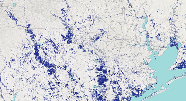
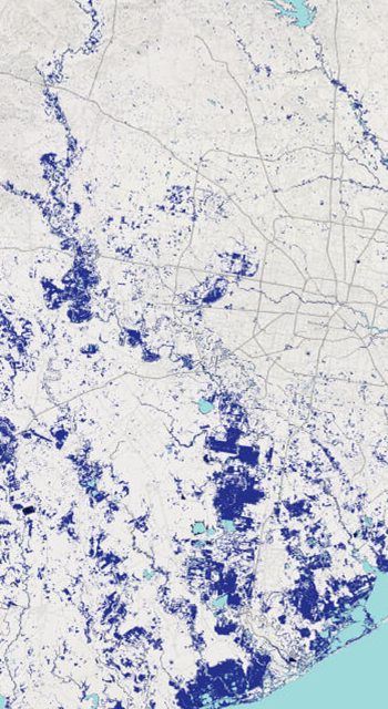
Open source flood tracking
Cloud to Street’s free Global Flood Database offers an overview of flood exposure around the world. The database is the world’s largest…
More...
Read more5. Cities / Urban planning / Frontier technologiesOpen source flood tracking
Cloud to Street Photo: © CloudtoStreet
Cloud to Street’s free Global Flood Database offers an overview of flood exposure around the world. The database is the world’s largest collection of flood maps. It combines 15 years of data on 913 floods with human settlement maps across 169 countries to help scientists, governments and financial institutions prepare better and protect against flood-risk. Through the use of satellites and artificial intelligence, floods can be tracked in near real-time anywhere in the world to insure risk and save lives. Maps can be downloaded from 15 public and private satellites, down to 250 m resolution. The company also offers paid services and claims to have provided support to 28 governments worldwide, including to the Republic of Congo, where floods could quickly be identified to relocate at-risk refugees, secure emergency aid and provide targeted relief.
- Contracting type: Service
- Technology level: High
- Country of origin: United States
- Availability: Worldwide
Share this content -
Cool pavements
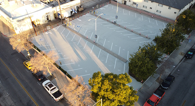
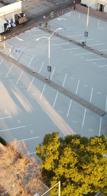
Dark pavements absorb from 80 to 95 percent of heat. They add to global warming by radiating heat into the atmosphere where it is trapped by the…
More...
Read more5. Cities / Urban planning / Frontier technologiesCool pavements
ePAVE Photo: © ePAVE LCC
Dark pavements absorb from 80 to 95 percent of heat. They add to global warming by radiating heat into the atmosphere where it is trapped by the greenhouse effect. Cool paving materials reduce urban temperature and make cities more comfortable during hot weather. ePAVE is a cool pavement product with a patented formula. It is engineered to provide asphalt and concrete surfaces with a layer of protection that also has climate adaptation benefits. The technology consists of a two-component polymer cement composite. The first component is a dry ingredient powder, the second a liquid polymer emulsion resin. The reflective coating is said to mitigate the urban heat island effect by reflecting solar radiation. This lowers surface and ambient air temperatures, while improving air quality.
- Contracting type: For sale
- Technology level: Medium
- Country of origin: United States
- Availability: United States
Share this content
Horizon technologies
-
AI-driven satellite solution for green space
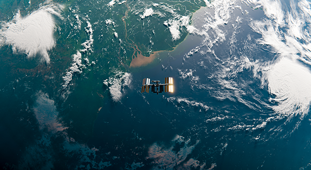
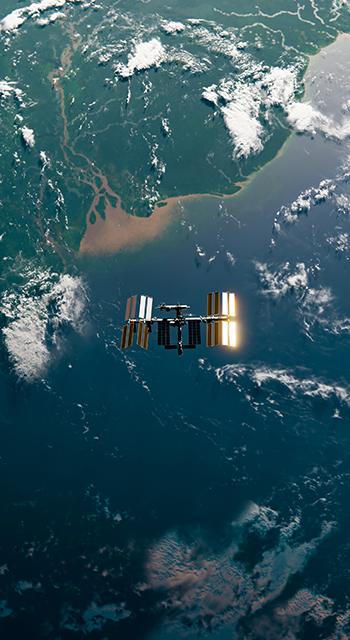
Husqvarna Urban Green Space Index (HUGSI) is an AI-driven satellite solution focusing on urban green space. The tool measures and analyzes urban…
More...
Read more5. Cities / Urban planning / Horizon technologiesAI-driven satellite solution for green space
Husqvarna Getty Images /© Darryl Fonseka
Husqvarna Urban Green Space Index (HUGSI) is an AI-driven satellite solution focusing on urban green space. The tool measures and analyzes urban green space in selected cities worldwide. It does so by applying computer vision and deep learning techniques to satellite imagery. The aim is to provide objective and continuous quantifications of urban green space and allow cities to track their development and benchmark against global standards. To date, over 250 cities in 60 countries have been ranked according to indicators such as health of urban vegetation, tree coverage and urban green space distribution.
- Contracting type: Service
- Technology level: High
- Country of origin: Sweden
- Availability: Worldwide
Share this content -
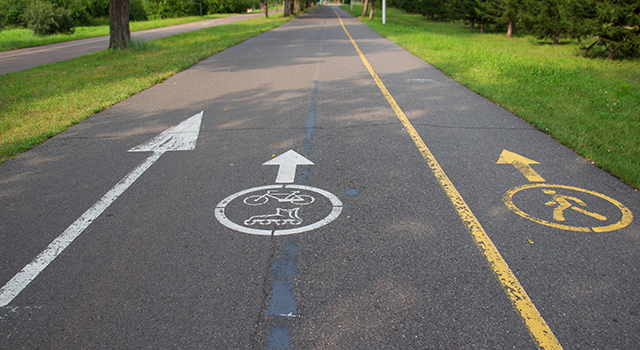
Pedestrian navigation tool for cool streets
Summers in Barcelona are becoming increasingly hot due to climate change. Cool Walks is an app developed by a public agency in Barcelona that…
More...
Read more5. Cities / Urban planning / Horizon technologiesPedestrian navigation tool for cool streets
Barcelona Regional Urban Development Agency Getty Images /© Vera Tikhonova
Summers in Barcelona are becoming increasingly hot due to climate change. Cool Walks is an app developed by a public agency in Barcelona that allows pedestrians to choose the shadiest path to where they want to go. By picking the starting point and destination for your walk, as well as the time of day, recommended routes are provided. Using LIDAR, high-resolution models of ground elevation (including trees and buildings) were created. Combined with manually-gathered data, this allows the app to model direct sunlight and shade, and guide pedestrians toward shady sidewalks, drinking fountains or places to shelter. Similar digital tools for helping citizens navigate cities through various climate impacts could become commonplace in the future.
- Contracting type: Free
- Technology level: Medium
- Country of origin: Spain
- Availability: Barcelona
Share this content
Cities exposed to floods, as temperatures rise
Flooding and drought are expected to increase in cities. This impacts freshwater availability, regional food security and industrial outputs, but human health and comfort also.[16] Of 530 cities…
Read more
Cities exposed to floods, as temperatures rise
Flooding and drought are expected to increase in cities. This impacts freshwater availability, regional food security and industrial outputs, but human health and comfort also.[16] Of 530 cities worldwide that reported their climate hazards in 2018, 71 percent said floods were their top concern, followed by extreme heat.[17] In some large cities, for example Jakarta and Semarang in Indonesia, climate change-related flooding risk is exacerbated by the rapid sinking of land (subsidence) due to groundwater over-extraction.[18] Regionally, urban areas in Africa and Asia are considered most at risk. In East and West Africa, urban land in flood zones and drylands exposed to high-frequency floods is expected to increase by as much as 2,600 percent by 2030.[19] Meanwhile, car fumes, dark rooftops and tall concrete buildings in close proximity are all factors trapping heat and creating the so-called urban heat island effect.[20] [21] Many cities and settlements are in desperate need of climate-resilient urban planning to better manage these hazards and risks, and reduce vulnerability.
Read less
Managing water through gray, green and blue infrastructure
In responding to extreme weather events and flood, densely populated urban areas often turn to engineered solutions. They include pumping stations, reservoirs and expanding sewer capacity (if there is one). However, greater attention is paid to…
Read more
Managing water through gray, green and blue infrastructure
In responding to extreme weather events and flood, densely populated urban areas often turn to engineered solutions. They include pumping stations, reservoirs and expanding sewer capacity (if there is one). However, greater attention is paid to green and blue infrastructure in city planning. The IPCC[22] has highlighted the importance of such nature-based solutions. Starting in peri-urban areas, measures such as hill-slope and coastal zone reforestation can help reduce flood hazard in cities. City planners are also recognizing the ability of green spaces such as parks to temporarily hold excess water by turning into lakes during flood events. Similarly, green roads can be designed to detain and hold back water in smaller side streets.[23] Large-scale installation of rainwater harvesting systems and city-wide green roofs could reduce total discharge by up to 15 percent, depending on the city.[24] Blue infrastructure on the other hand includes lakes, wetlands and bioswales, which are shallow channels covered in vegetation that capture and infiltrate stormwater runoff. In Europe, many urban innovations have been pilot tested. But their up-scaling remains challenging. In Central and South America, the adoption of nature-based solutions and green-gray infrastructure is still emerging[25] While integrated and hybrid approaches are increasingly called for, there is still a strong bias toward gray infrastructure in most parts of the world. Flood protection in coastal cities for example often takes the form of sea walls and levees (see chapter on Water and coastal regions).
IMAGE
Read less
Green cities absorb and cool
Parks, green spaces and urban planning choices such as street orientation and building density all help decrease outside air temperature. Trees and vegetation areas lower temperatures by providing shade, as well as cooling from…
Read more
Green cities absorb and cool
Parks, green spaces and urban planning choices such as street orientation and building density all help decrease outside air temperature. Trees and vegetation areas lower temperatures by providing shade, as well as cooling from evapotranspiration.[26] Increasingly, cool pavements (containing for example solar radiation-reflecting additives) are being recognized for their significant temperature reduction potential in an urban environment,[27] while permeable roads contribute to managing storm water runoff. NASA has estimated that a white roof could be 23°C (42°F) cooler than a black roof on the hottest day of a New York summer.[28] Meanwhile, some cities are offering cooling centers for vulnerable populations who may not have access to air conditioning, or cannot afford the electricity bills during peak temperatures.
Read less
Sufri, S., F. Dwirahmadi, D. Phung and S. Rutherford (2020). A systematic review of community engagement (CE) in disaster early warning systems (EWS). Progress in Disaster Science, 5, 100058.
IPCC (2022). Working Group II Sixth Assessment Report. Impacts, adaptation and vulnerability. Summary for policymakers. Geneva: Intergovernmental Panel on Climate Change. available: https://www.ipcc.ch/working-group/wg2/
IEA (2018). The future of cooling: opportunities for energy-efficient air conditioning. International Energy Agency (IEA). Available at: https://iea.blob.core.windows.net/assets/0bb45525-277f-4c9c-8d0c-9c0cb5e7d525/The_Future_of_Cooling.pdf
Climate-ADAPT (2016). Urban. The European Climate Adaptation Platform Climate-ADAPT. Available at: https://climate-adapt.eea.europa.eu/en/eu-adaptation-policy/sector-policies/urban [accessed October 2022].
Leflaive, X., B. Krieble and H. Smythe (2020). Trends in water-related technological innovation: Insights from patent data, OECD Environment Working Papers 161. OECD Publishing. Available at: https://www.oecd-ilibrary.org/content/paper/821c01f2-en.
Kunz, D., H. Müller, and C. Soltmann (2012). Patent landscape report on solar cooling technologies. Geneva: World Intellectual Property Organization (WIPO). Available at: https://www.wipo.int/edocs/pubdocs/en/patents/948/wipo_pub_948_3.pdf.
Renaldi, R., N.D. Miranda, R. Khosla and M.D. McCulloch (2021). Patent landscape of not-in-kind active cooling technologies between 1998 and 2017. Journal of Cleaner Production, 296, 126507.
CDP (2022). Climate Change. Carbon Disclosure Project. Available at: https://www.cdp.net/en/climate [accessed October 2022].
CPI (2021). Global landscape of climate finance 2021. Climate Policy Initiative (CPI). Available at: https://www.climatepolicyinitiative.org/publication/global-landscape-of-climate-finance-2021/.
Richmond, M. and N. Upadhyaya (2021). An analysis of urban climate adaptation finance. Climate Policy Initiative (CPI). Available at: https://www.climatepolicyinitiative.org/publication/an-analysis-of-urban-climate-adaptation-finance/.
UNEP (2021). Adaptation Gap Report 2021: The gathering storm. Nairobi: United Nationals Environment Programme. available: https://www.unep.org/resources/adaptation-gap-report-2021
Smith, B., D. Brown, and D. Dodman (2014). Reconfiguring urban adaptation finance. London: International Institute for Environment and Development (IIED). Available at: https://iied.org/10651iied.
CDP (2018). Cities at risk: dealing with the pressures of climate change. Carbon Disclosure Project. Available at: https://www.cdp.net/en/research/global-reports/cities-at-risk [accessed October 2022].
Bott, L.-M., T. Schöne, J. Illigner, M. Haghshenas Haghighi, K. Gisevius and B. Braun (2021). Land subsidence in Jakarta and Semarang Bay – The relationship between physical processes, risk perception, and household adaptation. Ocean & Coastal Management, 211, 105775.
Takebayashi, H. and M. Moriyama (2020). Chapter 1 – Background and purpose. In Takebayashi, H. and M. Moriyama, eds., Adaptation measures for urban heat islands. Cambridge, MA: Academic Press, 1–8.
EEA (2018). 10 case studies: how Europe is adapting to climate change. Luxembourg: European Environment Agency (EEA). Available at: https://climate-adapt.eea.europa.eu/en/about/climate-adapt-10-case-studies-online.pdf.
Cristiano, E., S. Farris, R. Deidda and F. Viola (2021). Comparison of blue-green solutions for urban flood mitigation: A multi-city large-scale analysis. PloS ONE, 16(1), e0246429.
Kappou, S., M. Souliotis, S. Papaefthimiou, G. Panaras, J. A. Paravantis, E. Michalena, J.M. Hills, A.P. Vouros, A. Ntymenou and G. Mihalakakou (2022). Cool pavements: State of the art and new technologies. Sustainability, 14(9). Available at: www.mdpi.com/2071-1050/14/9/5159 [accessed October 2022].
NASA (2012). Bright is the new black: New Yorks roofs go cool. Available at: https://www.nasa.gov/topics/earth/features/ny-roofs.html [accessed October 2022].
Viguié, V., A. Lemonsu, S. Hallegatte, A.-L. Beaulant, C. Marchadier, V. Masson, G. Pigeon and J.-L. Salagnac (2020). Early adaptation to heat waves and future reduction of air-conditioning energy use in Paris. Environmental Research Letters, 15(7), 075006.
Fan, X. and T. Matsumoto (2019). Gis-based social cost–benefit analysis on integrated urban water management in china: A case study of sponge city in Harbin. Sustainability, 11(19). Available at: www.mdpi.com/2071-1050/11/19/5527.
Government of Malaysia (2022). Stormwater Management and Road Tunnel (SMART). Available at: https://smarttunnel.com.my/about-us [accessed October 2022].
Smarttunnel (2021). 0924HRS Info terkini, @Smarttunnel. Twitter. available: https://twitter.com/Smarttunnel/status/1472739766407819266
